To go directly to the visita page: HERE
To see the missions from oldest to newest: HERE
New in 2026, Mission Albums for more historic to recent photos, plus the chapter of each, from my book, is included: https://vivabaja.com/mission-albums/
The first two mission sites (below) are considered extensions of Mission San Miguel by some historians. They were founded after the Spanish period had ended (1822).
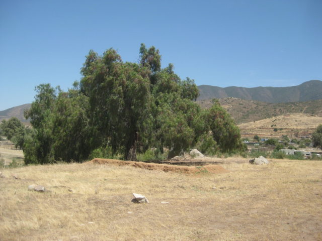
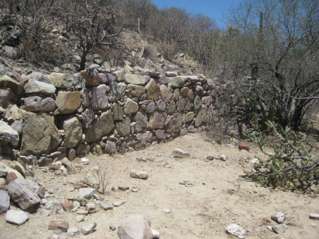
El Descanso (1830-1834)
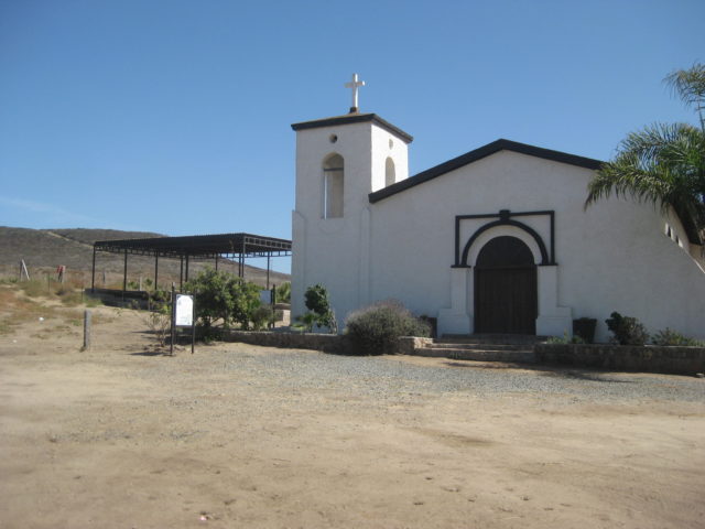
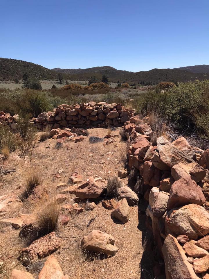
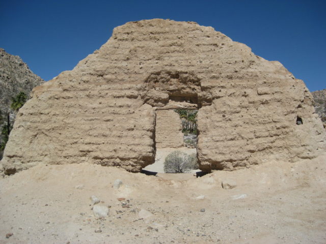
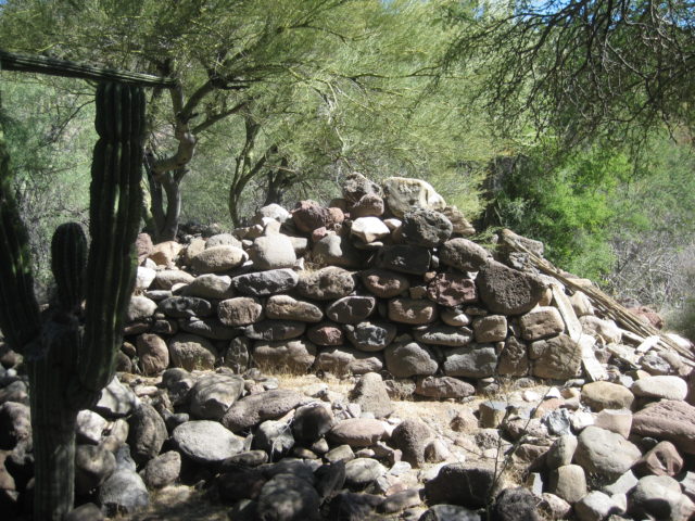
Foundations located behind the modern church date to 1830 and are partially protected by this steel awning.
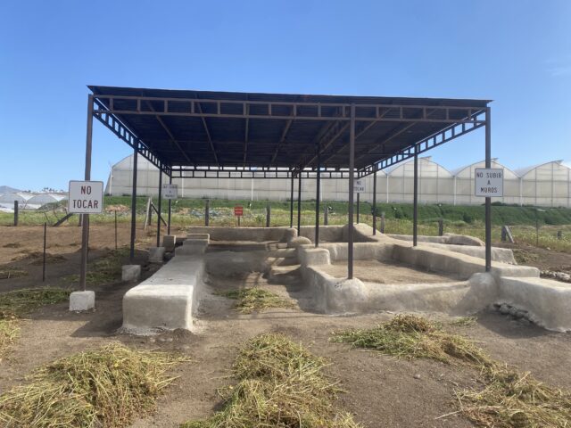
Full name: El Descanso
Founding date: 1830 (near the 1810 relocated San Miguel mission site) Mission #26
Catholic Order: Dominican
Founded by: Padre Felix Caballero (well after Mexico’s independence from Spain)
Condition: Floor and footings exposed and protected, next to the modern church.
Closing date: Abandoned in 1834
GPS: 32.205433, -116.905558
Access: Mex. #1, Km. 49, south of Tijuana, 1/2 mile east.
Read more: HERE
Mission El Descanso photo and info page
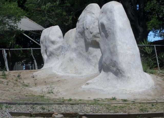
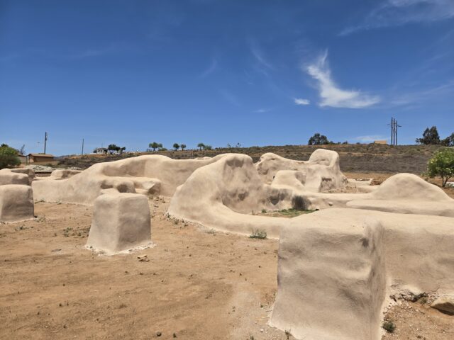
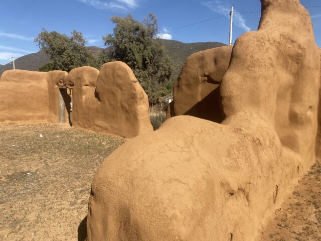
Guadalupe (1834-1840)
Full name: Nuestra Señora de Guadalupe
Founding date: July 25, 1834 Mission #27
Catholic Order: Dominican
Founded by: Padre Felix Caballero (after Mexico’s independence from Spain)
Condition: No remains. Footings added at site in 1998 to simulate mission.
Closing date: Abandoned in 1840.
GPS: 32.091944, -116.574250
Access: Mex. #3, Km. 77, south of Tecate, 1 mile south through town.
Read more: HERE
Mission Guadalupe del Norte photo and info page
Almost half of the missions relocated during their operational years. Usually for a better supply of water, farmlands, or for the Native population. Ruins remain today at some of these other locations. Missions often were called by the location name after a move. The idea of one mission with two names (and two locations) was confusing to some.
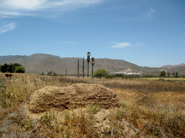
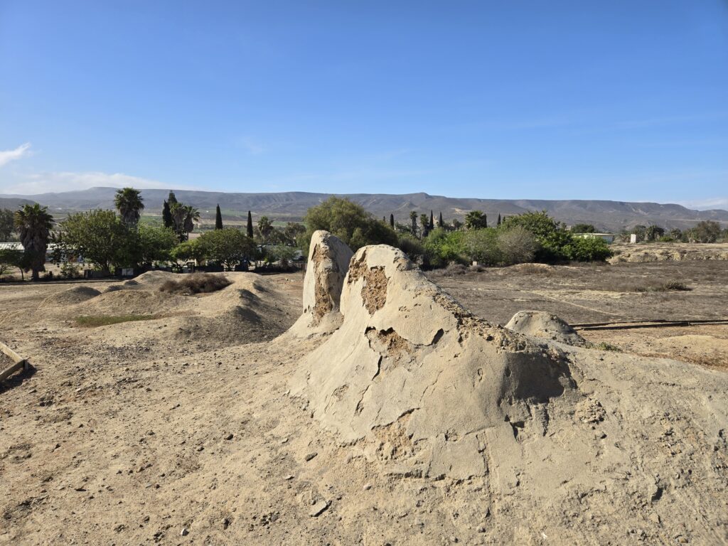
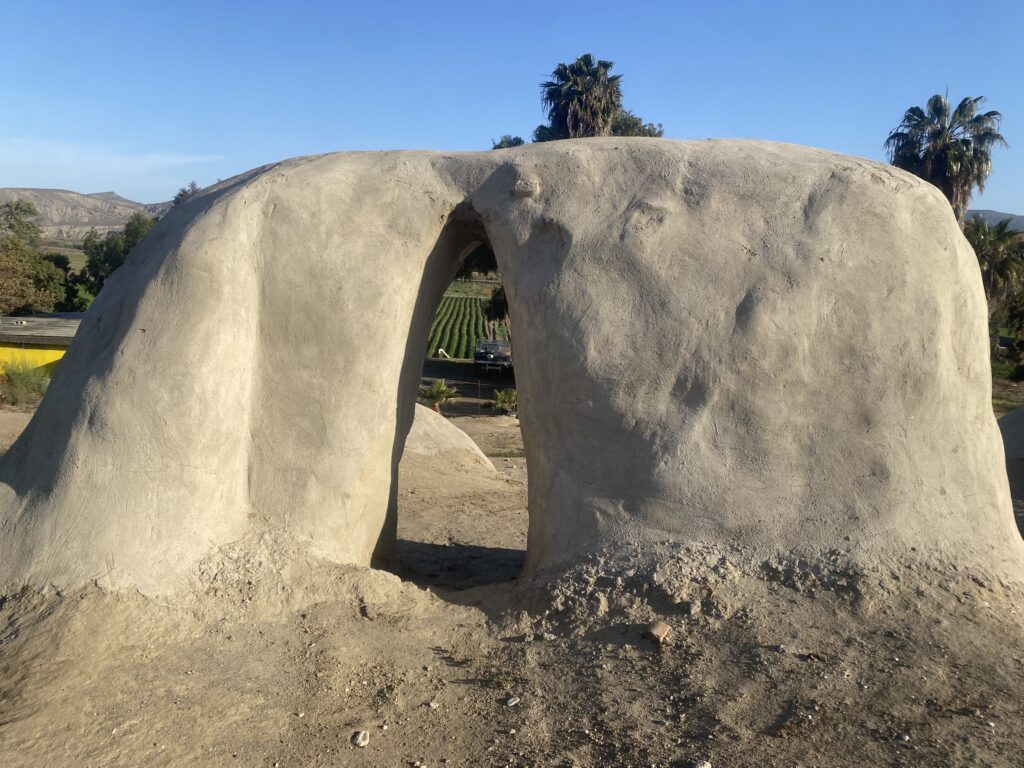
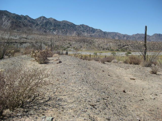
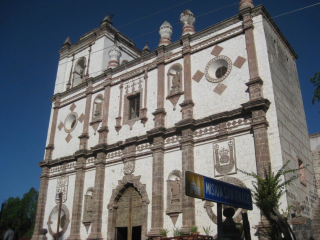
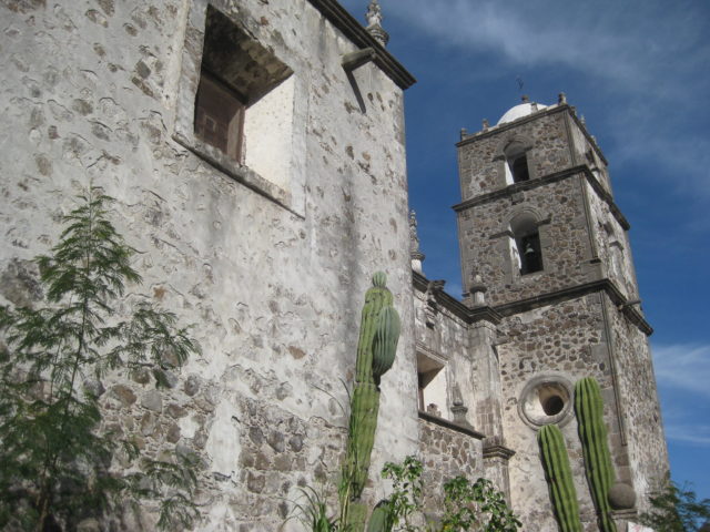
San Miguel (1787-1834)
Full name: San Miguel Arcángel
Founding date: March 28, 1787 (moved 7 miles west in 1788, then north 8 miles in 1810, then back circa 1814) Mission #22
Catholic Order: Dominican
Founded by: Padre Luis Sales
Condition: Adobe ruins at the second site.
Closing date: Abandoned in 1834
GPS: 32.094279, -116.854331
Access: Mex. #1, Km. 65.5, south of Tijuana, next to school in La Misión.
Additional photos: https://vivabaja.com/san-miguel/
Read more: HERE
Mission San Miguel photo and info page
Santa Catalina (1797-1839)

Full name: Santa Catalina Virgen y Mártir
Founding date: November 12, 1797 (last Spanish mission founded in Baja California) Mission #25
Catholic Order: Dominican
Founded by: Padre José Loriénte, Padre Tomás Valdellón
Condition: Footing stones, room outlines
Closing date: Abandoned in 1839
GPS: 31.660583, -115.821111
Access: Mex. #3, Km. 91, southeast of Ensenada, east 5.4 miles (90% paved).
Read more: HERE
Mission Santa Catalina photo and info page
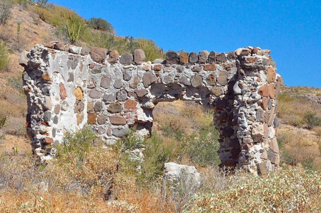
Santo Tomás (1791-1849)
Full name: Santo Tomás de Aquino
Founding date: April 24, 1791 (moved 1 mile east in 1794 and 3 more miles east in 1799) Mission #23
Catholic Order: Dominican
Founded by: Padre José Loriénte
Condition: Adobe ruins at final site, nearly vanished.
Closing date: Abandoned in 1849 (was the last California mission to be operating)
GPS: 31.558333, -116.413583
Access: Mex. #1, Km. 50, south of Ensenada, just north of El Palomar RV Park.
Additional photos: https://vivabaja.com/santo-tomas/
Read more: HERE
Mission Santo Tomás photo and info page
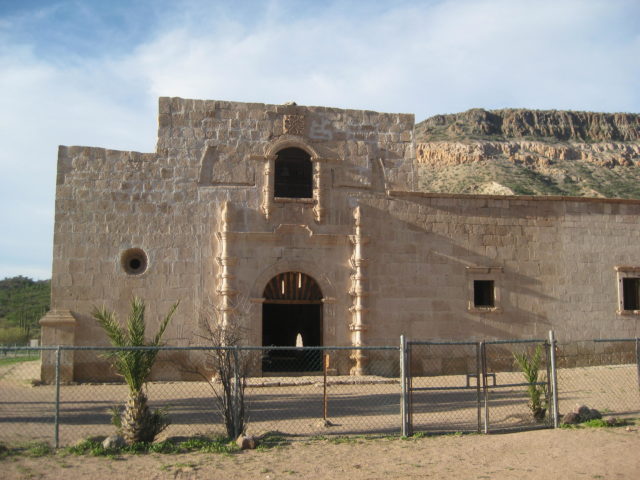
San Vicente (1780-1829)
Full name: San Vicente Ferrer
Founding date: August 27, 1780 Mission #21
Catholic Order: Dominican
Founded by: Padre Miguel Hidalgo, Padre Joaquín Valero
Condition: Adobe ruins, stabilized in a park setting.
Closing date: Closed in 1829.
GPS: 31.329972, -116.259167
Access: Mex. #1, south of Ensenada, Km. 88.5, 1 km. west.
Read more: HERE
Mission San Vicente photo and info page
San Pedro Mártir (1794-1811)
Full name: San Pedro Mártir de Verona
Founding date: April 27, 1794 (relocated 7 miles south after just 3 months) Mission #24
Catholic Order: Dominican
Founded by: Padre Caietano Pallás, Padre Pablo Grijálva, Padre José Loriénte
Condition: Stone footings at first site. Stone walls at second site.
Closing date: Abandoned in 1811
GPS: 30.790069, -115.472458
Access: 2 days backpacking or horseback ride, one way.
Read more: HERE
Mission San Pedro Mártir photo and info page
Santo Domingo (1775-1822)
Full name: Santo Domingo
Founding date: August 30, 1775 (relocated 2.5 miles east in 1798) Mission #20
Catholic Order: Dominican
Founded by: Padre Miguel Hidalgo, Padre Manuel Garcia
Condition: Adobe ruins at second site.
Closing date: Closed in 1822
GPS: 30.770889, -115.937222
Access: Mex. #1, Km. 169, south of Ensenada, 5 miles east.
Additional photos: https://vivabaja.com/santo-domingo-in-photos/
Mission Santo Domingo photo and info page
El Rosario (1774-1822, two sites)
Full name: Nuestra Señora del Rosario de Viñadaco
Founding date: July 24, 1774 (relocated 2 miles west in 1802) Mission #19
Catholic Order: Dominican
Founded by: Padre Francisco Galistéo
Condition: Adobe ruins at both sites
Closing date: Closed in 1822
GPS/ Access: 30.066944, -115.718889 (first site) Mex. #1, Km. 58.5, south of San Quintín, just uphill.
GPS/ Access: 30.041389, -115.739111 (second site) Mex. #1, Km. 57.5, south of San Quintín, 2 miles west.
Read more: HERE
Mission El Rosario de Arriba photo and info page
Mission El Rosario de Abajo photo and info page
San Fernando (1769-1822)

Full name: San Fernando de Velicatá
Founding date: May 14, 1769 Mission #18
Catholic Order: Franciscan
Founded by: Padre Junípero Serra
Condition: Adobe ruins remaining date to the 1790s
Closing date: Closed in 1822
GPS: 29.971109, -115.236434
Access: Mex. #1, Km. 121, south of San Quintín, 2.3 miles southwest, gate at 1 mile.
Read more: HERE
Mission San Fernando photo and info page
Santa María de los Angeles (1766-1775, two sites)
Full name: Nuestra Señora de Columna/ Santa María de los Angeles
Founding date: October 16, 1766 (relocated 30 miles northwest and renamed on May 26, 1767) Mission #17
Catholic Order: Jesuit
Founded by: Padre Victoriano Arnés, Padre Juan Diez
Condition: Adobe outlines at 1766 site. Adobe buildings at second site, from 1768-1769.
Closing date: Abandoned in 1774 or 1775.
GPS/ Access: 29.421194, -114.195100 (first site/ Calamajué), Mex. #5, Km. 179.5, east & south 17 miles or Mex. #1, Km. 251, east & north 15 miles.
GPS/ Access: 29.731742, -114.547379 (second site/ Santa María), Mex. #1, Km. 181 (Santa Ynez), east 15 miles.
Read more:
Mission Santa María photo and info page
Calamajué mission site photo and info page
San Borja (1762-1818)
Full name: San Francisco de Borja Adac
Founding date: September 1, 1762 Mission #16
Catholic Order: Jesuit
Founded by: Padre Wenceslaus Linck
Condition: Adobe ruins from 1759-1773. Stone church from 1801.
Closing date: Closed in 1818
GPS: 28.744547, -113.753997
Access: Mex. #1 Km. 52 (south of Punta Prieta at Nuevo Rosarito), east 22 miles or Mex. #12 Km. 45 (L.A. Bay highway), south 21 miles.
Read more: HERE
Mission San Borja photo and info page
Santa Gertrudis (1752-1822)
Full name: Santa Gertrudis
Founding date: July 15, 1752 Mission #15
Catholic Order: Jesuit
Founded by: Padre Georg Retz
Condition: Stone church construction completed in 1796
Closing date: Closed in 1822
GPS: 28.051117, -113.085325
Access: Mex. #1 Km. 189 (north of Santa Rosalia), east 47 miles.
Read more: HERE
Mission Santa Gertrudis photo and info page
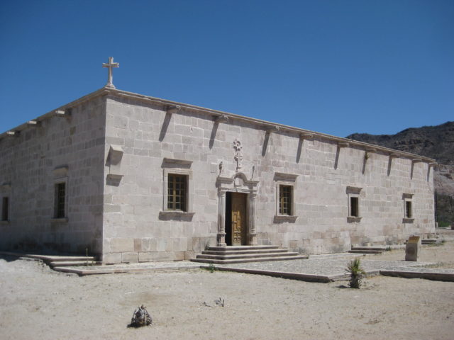
San Ignacio (1728-1840)
Full name: San Ignacio de Kadakaamán
Founding date: January 20, 1728 Mission #11
Catholic Order: Jesuit
Founded by: Padre Juan Luyando
Condition: Stone church construction from 1761 to 1767 and again from 1779 to 1786.
Closing date: Closed in 1840.
GPS: 27.283939, -112.898922
Access: Mex. #1 Km. 73 (San Ignacio entrance), south 1.6 miles (paved).
Read more: HERE
Mission San Ignacio photo and info page
Guadalupe de Huasinapí (1720-1795)
Full name: Nuestra Señora de Guadalupe de Huasinapí
Founding date: December 12, 1720 Mission #8
Catholic Order: Jesuit
Founded by: Padre Everarado Helen
Condition: Ruins from the 1750s.
Closing date: Closed in 1795.
GPS: 26.918403, -112.405787
Access: Mex. #1 Km. 131.5 (Mulegé) east & north 41 miles.
Read more: HERE
Mission Guadalupe (del Sur) photo and info page
Santa Rosalía de Mulegé (1705-1828)
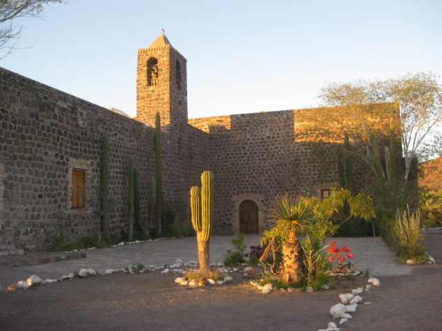
Full name: Santa Rosalía de Mulegé
Founding date: November 1705 Mission#4
Catholic Order: Jesuit
Founded by: Padre Juan Basaldúa
Condition: Stone church constructed 1757 to 1766.
Closing date: Closed in 1828.
GPS: 26.885339, -111.985979
Access: Mex. #1 Km. 134 west 1 km.
Read more: HERE
Mission Santa Rosalía de Mulegé photo and info page
La Purísima (1720-1826)
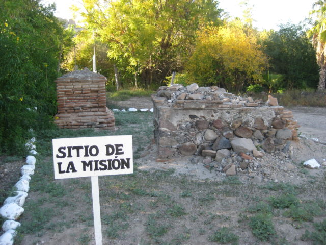
Full name: La Purísima Concepción de Cadegomó
Founding date: January 1, 1720 Mission #6
Catholic Order: Jesuit
Founded by: Padre Nicolás Tamaral
Condition: No church ruins, two crypts remain to mark the mission.
Closing date: Closed in 1826.
GPS: 26.190444, -112.072944
Access: One block north of paved BCS #53, 72 miles north of Ciudad Insurgentes.
Read more: HERE
Mission La Purísima photo and info page
San José de Comondú (1708-1827, two sites)
Full name: San José de Comondú
Founding date: 1708 (relocated 22 miles south in 1736) Mission #5
Catholic Order: Jesuit
Founded by: Padre Julián de Mayorga
Condition: Stone church constructed 1751 to 1761, demolished in 1936. A side chapel was preserved.
Closing date: Closed in 1827.
GPS: 26.274278, -111.719028 (first site), 26.059726, -111.822168 (final site)
Access: Paved road from the south (BCS#53, km. 64.5) or unpaved roads, east from km. 27.5, near San Javier or northwest from San Isidro/ La Purísima.
Read more: HERE
Mission San José de Comondú photo and info page
Loreto (1697-1829)
Full name: Nuestra Señora de Loreto Conchó
Founding date: October 25, 1697 Mission #1 of 27
Catholic Order: Jesuit
Founded by: Padre Juan María de Salvatierra
Condition: Stone church constructed from 1740 to about 1750. New roof and bell tower added in 1955.
Closing date: Closed in 1829.
GPS: 26.010278, -111.343278
Access: Mex. #1 Km. 0 (Loreto) east 2 kms.
Read more: HERE
Mission Loreto photo and info page
San Javier (1699-1817)
Full name: San Francisco Javier de Biaundo
Founding date: November 1, 1699 (relocated 5 miles south circa 1710-1720) Mission #2
Catholic Order: Jesuit
Founded by: Padre Francisco Píccolo
Condition: Stone church constructed from 1744 to 1758.
Closing date: Closed in 1817.
GPS: 25.860727, -111.543585
Access: Mex. #1 Km. 117 (Loreto) east & south 21 miles (paved).
Read more: HERE
Mission San Javier photo and info page
Ligüí (1705-1721)
Full name: San Juan Bautista de Ligüí (de Malibat)
Founding date: November 1705 Mission #3
Catholic Order: Jesuit
Founded by: Padre Pedro de Ugarte
Condition: No ruins since 2001.
Closing date: Abandoned in 1721.
GPS: 25.739500, -111.264167
Access: Mex. #1 Km. 84 (south of Loreto) east 1/2 mile.
Read more: HERE
Mission Ligüí photo and info page
Los Dolores (1721-1768, three sites)
Full name: Nuestra Señora de los Dolores
Founding date: August 2, 1721 (relocated 15 miles southwest in 1741 to La Pasión) Mission #9
Catholic Order: Jesuit
Founded by: Padre Clemente Guillén
Condition: Ruins at two sites, with only rubble and foundation stones at final site.
Closing date: Closed in 1768 by the Spanish government.
GPS: 25.055543, -110.884425 (second site, Apaté) 17 miles east from Chillá; 24.887709, -111.031002 (final site, Chillá)
Access (final site): 30 miles from Mission San Luis Gonzaga at Rancho La Capilla/ Cabañas La Pasión.
Read more: HERE
Mission Los Dolores (both sites) photo and info page
San Luis Gonzaga (1737-1768)
Full name: San Luis Gonzaga Chiriyaqui
Founding date: July 14, 1737 Mission #14
Catholic Order: Jesuit
Founded by: Padre Lambert Hostell
Condition: Stone church constructed from 1753 to 1758
Closing date: Closed on August 20, 1768 by the Spanish government.
GPS: 24.908056, -111.290903
Access: Mex. #1 Km. 195 (north of La Paz) east 22 miles.
Read more: HERE
Mission San Luis Gonzaga photos and info page
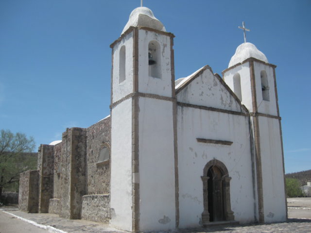
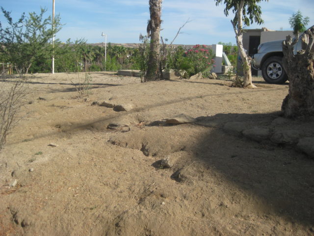
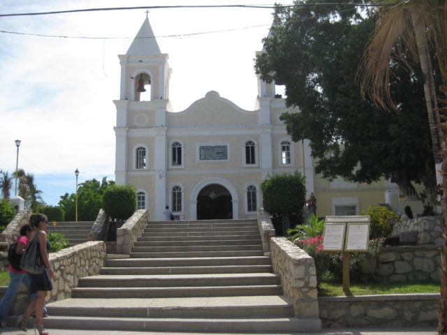
Pilar de la Paz (1720-1840, three sites)
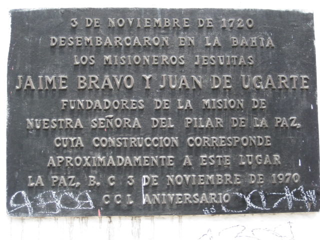

Full name: Nuestra Señora del Pilar de la Paz
Founding date: November 3, 1720 (relocated 50 miles south to Todos Santos in 1748, then 1 mile south in 1825) Mission #7
Catholic Order: Jesuit
Founded by: Padre Jaime Bravo, Padre Juan de Ugarte
Condition: No ruins remain at La Paz or the second site. Reconstructed, enlarged church at the third site.
Closing date: Closed in 1840.
GPS: 24.160000, -110.316500 (first site plaque, 1720); 23.460316, -110.219140 (second site, 1748) Mex. #19 Km. 49.5; 23.449767, -110.225450 (final site, 1825)
Access: Mex. #19 Km. 51.
Read more: HERE
Mission La Paz/ Todos Santos photos and info page
Santa Rosa (1733-1748)

Full name: Santa Rosa de las Palmas
Founding date: August 1733 Mission #13
Catholic Order: Jesuit
Founded by: Padre Sigusmundo Taraval
Condition: No ruins remain. Modern church and playground on the site, along Highway 19.
Closing date: Mission Santa Rosa was terminated in 1748 when the older mission at La Paz relocated to here.
GPS: 23.460316, -110.219140
Access: Mex. #19 Km. 49.5 (north edge of Todos Santos)
Mission Santa Rosa photo and info page
Santiago el Apóstol (1724-1795)

Full name: Santiago el Apóstol Aiñiní
Founding date: 1724 (relocated 2 miles south in 1736) Mission #10
Catholic Order: Jesuit
Founded by: Padre Ignacio Nápoli
Condition: Modern church on second site.
Closing date: Closed in 1795.
GPS: 23.475694, -109.717333
Access: Mex. #1 Km. 84.5 (south of La Paz), west 1.9 miles (paved).
Read more: HERE
Mission Santiago photo and info page
San José del Cabo (1730-1748 & 1768-1840)
Full name: San José del Cabo Añuití
Founding date: April 8, 1730 (relocated 3 times) Mission #12
Catholic Order: Jesuit
Founded by: Padre Nicolás Tamaral, Padre José de Echeverría
Condition: Modern church on final site.
Closing date: Closed from 1748 to 1768 and finally in 1840.
GPS: 23.062139, -109.695639
Access: Mex. #1 Km. 32 (south of La Paz) east & south 1 km.
Read more: HERE
Mission San José de Cabo photo and info page
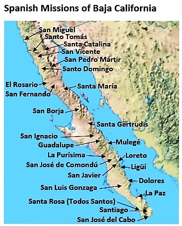
These are the mission sites on the peninsula of Baja California, north to south. In addition to the mission locations, are many visita sites. A visita was a satellite chapel of the head mission, located at other water sources and Native settlements. Some missions had several visitas attached to them. Some visitas became missions themselves. Photos at visitas are on the next page…
All my photographs at the mission sites, over multiple years: https://vivabaja.com/mission-albums/
To discuss or share about missions in Baja California: On Facebook ‘bajamissions’
Before the mission program began in 1697, the Jesuit Padre Eusebio Kino and a Spanish force made two attempts to colonize California, in 1683. Three months at La Paz and two years at San Bruno, where until recently the ruins were visible: https://vivabaja.com/san-bruno-1683-1685/
Finding El Camino Real, the mission road
To have the most complete and up-to-date history and details, order a copy of Baja California Land of Missions from Amazon Books: HERE (or from your local book dealer). Missions are listed in the book in the order they were founded, #1-#27.