Full name: San Miguel Arcángel
Founding date: March 28, 1787 (moved 7 miles west in 1788, then north 8 miles in 1810, then back circa 1814) Mission #22
Catholic Order: Dominican
Founded by: Padre Luis Sales
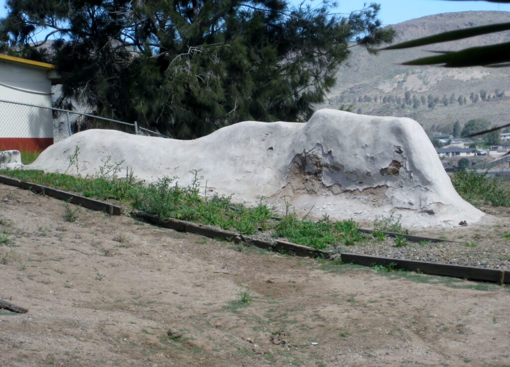
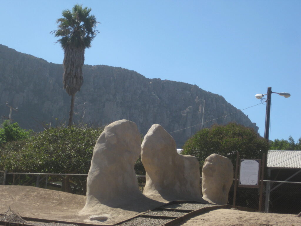
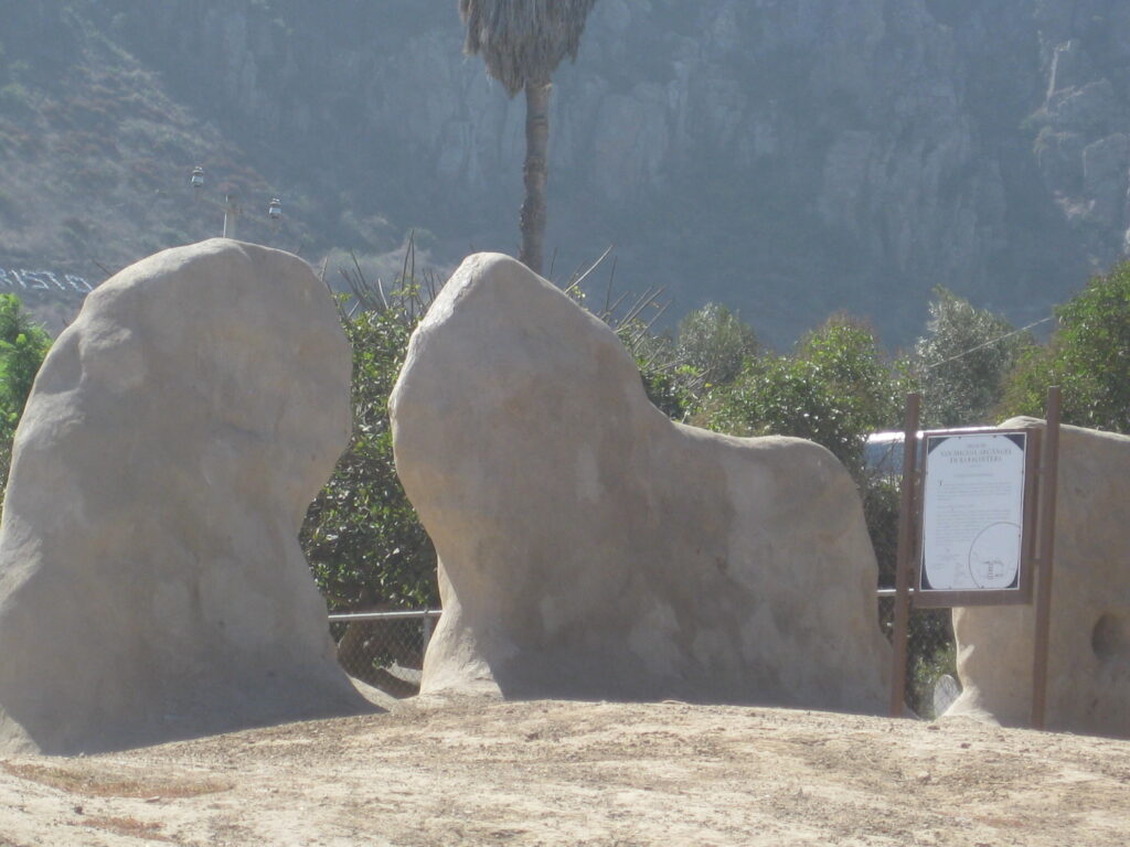
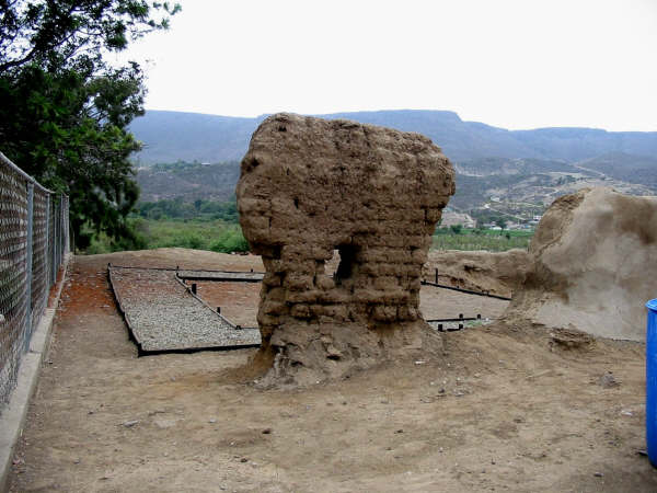
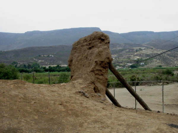
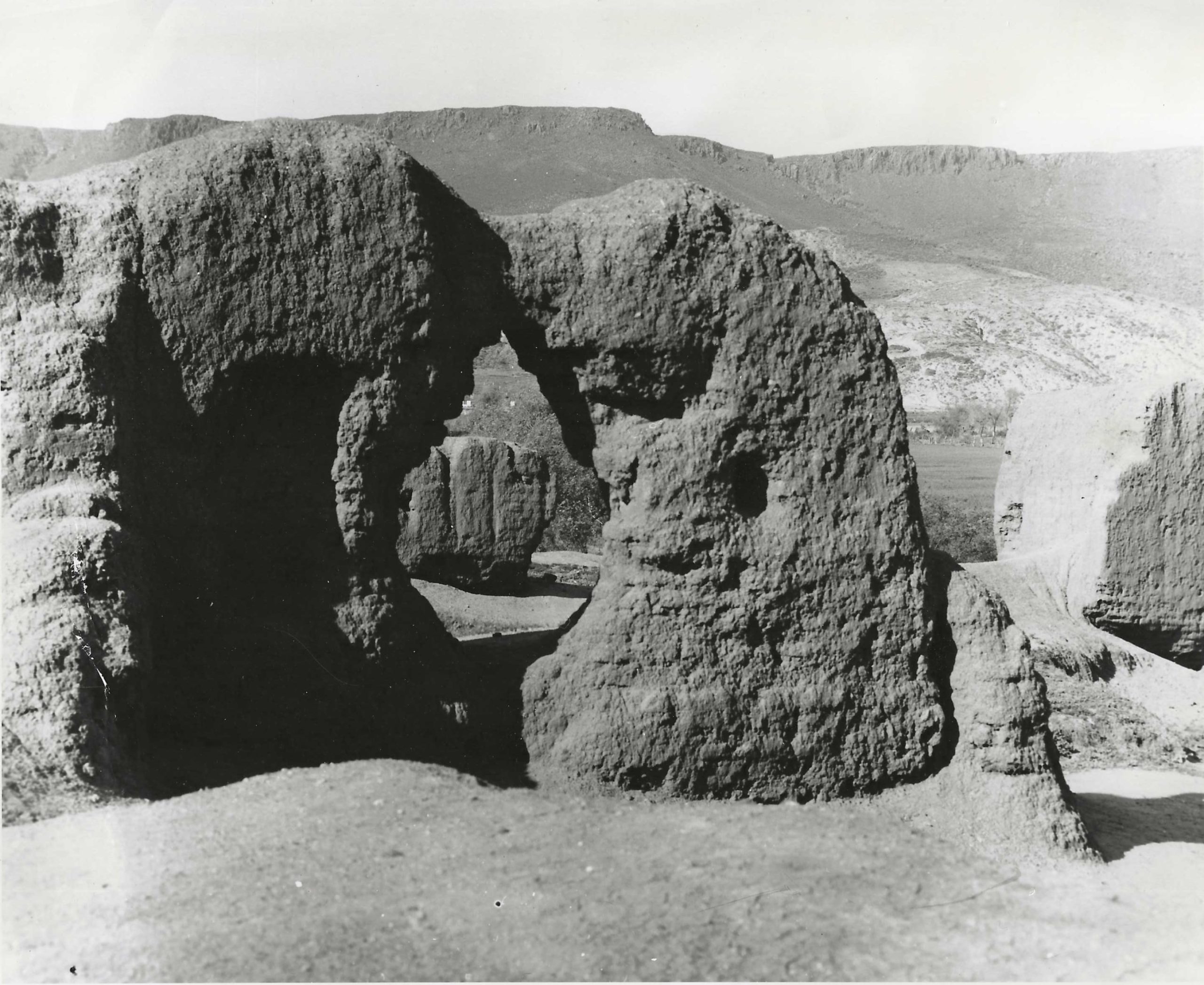
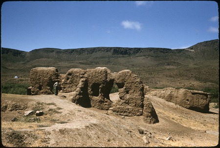
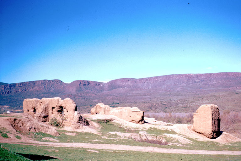
Condition: Adobe ruins at the second site.
Closing date: Abandoned in 1834
GPS: 32.094279, -116.854331
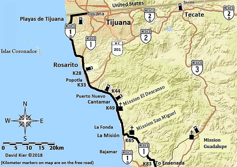
Access: Mex. #1, Km. 65.5, south of Tijuana, next to school in La Misión.
Read more: CLICK HERE
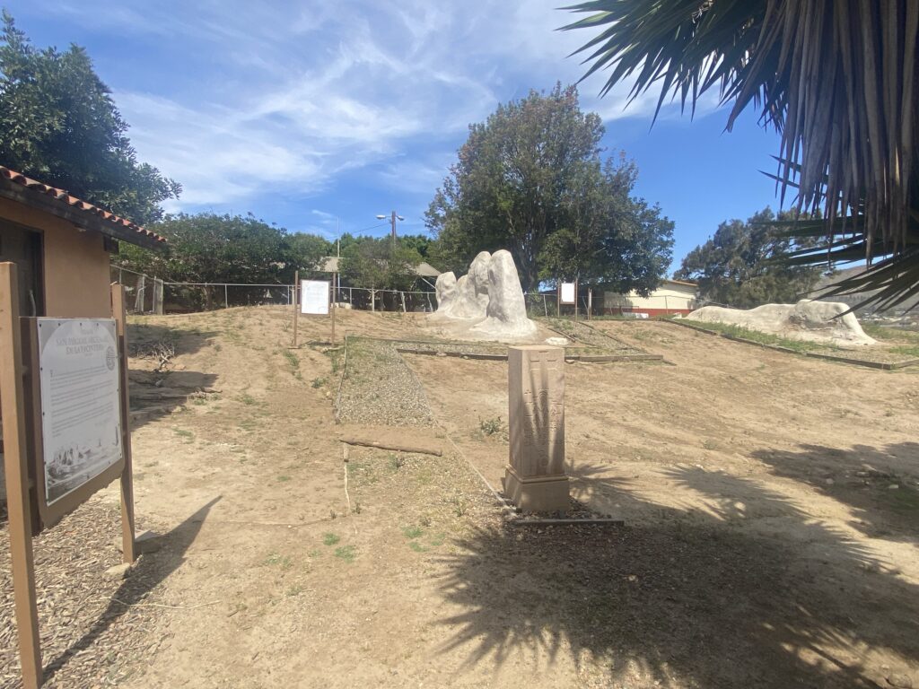
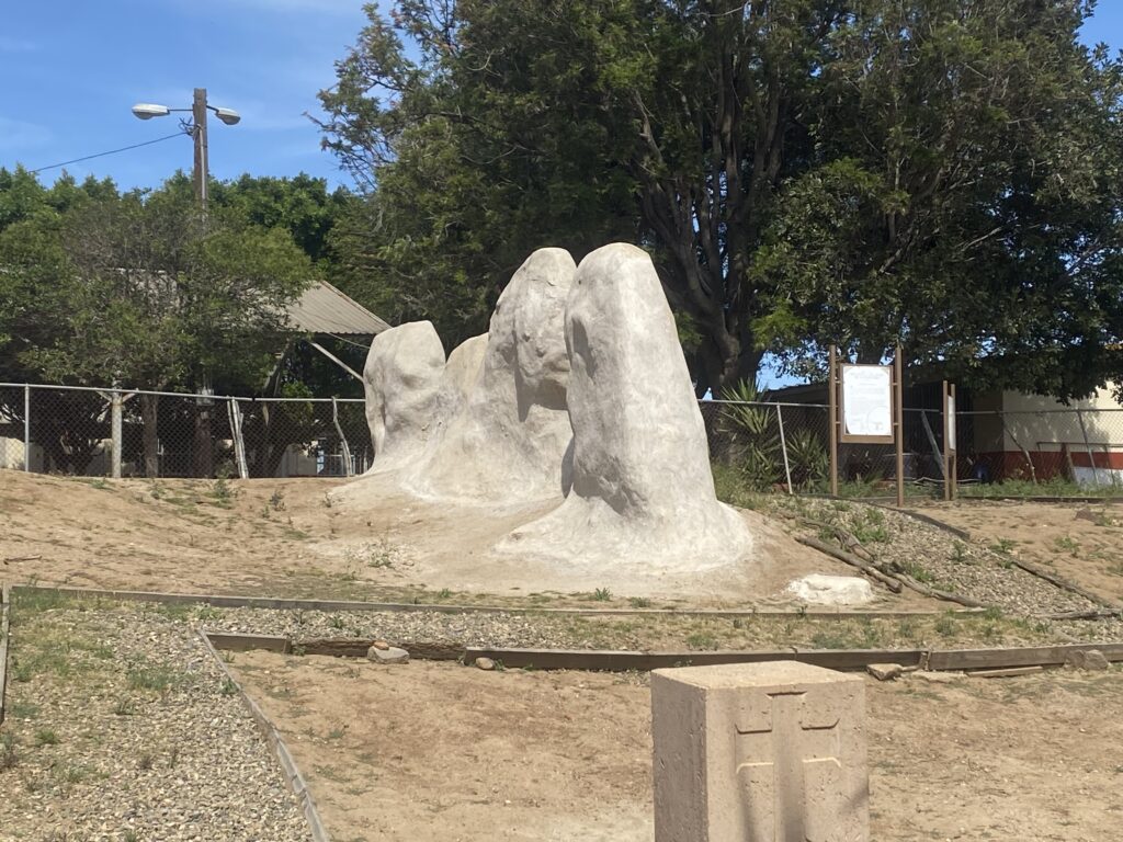
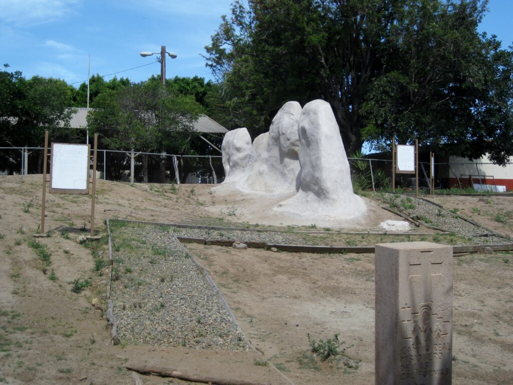
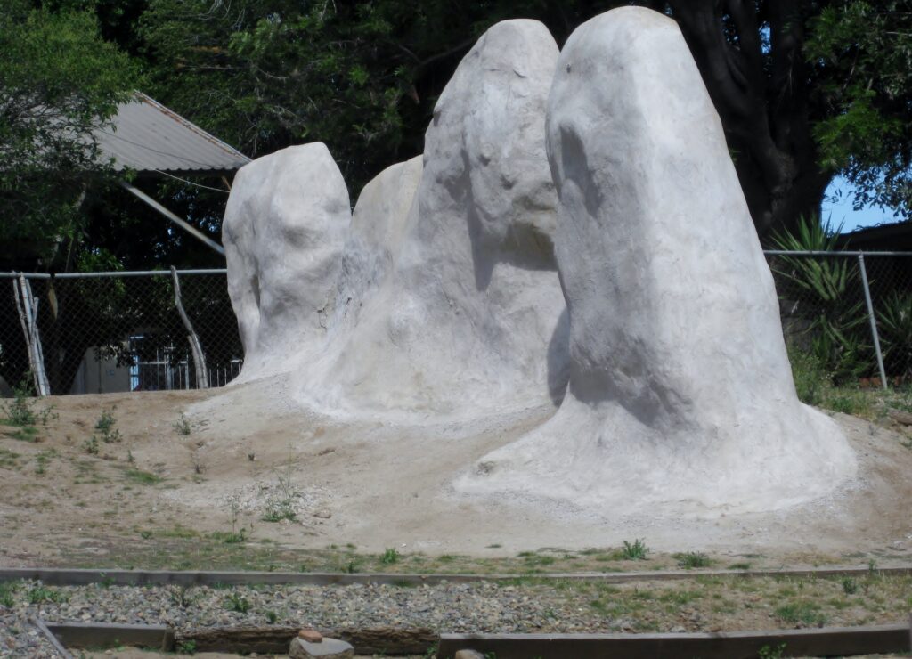
May 2025 (Photos by Dave W. & David Kier)
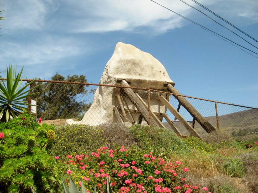
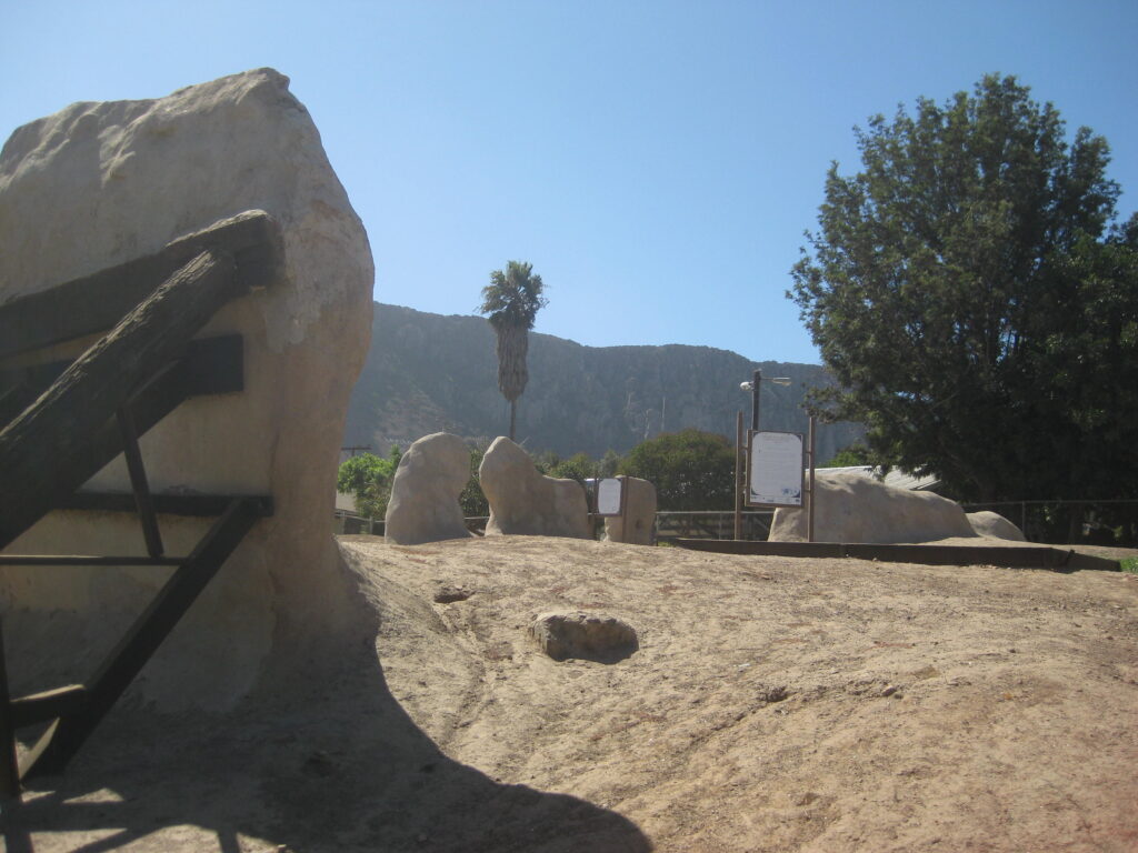
October 2017 photos by David Kier
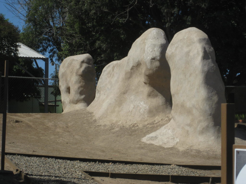

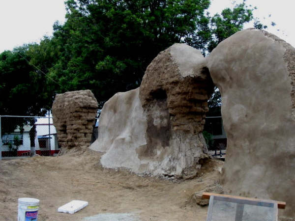
2003 photos by Jack Swords©

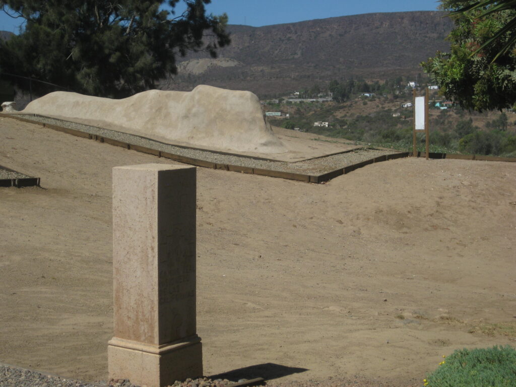
2003 photo by David Kier

1966 photos by Choral Pepper

1956 photo by Howard Gulick
1949 photo by Marquis McDonald
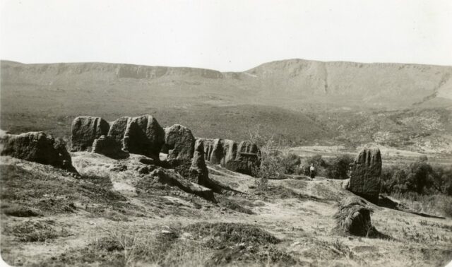
1936 photo by Peveril Meigs
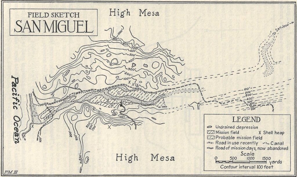
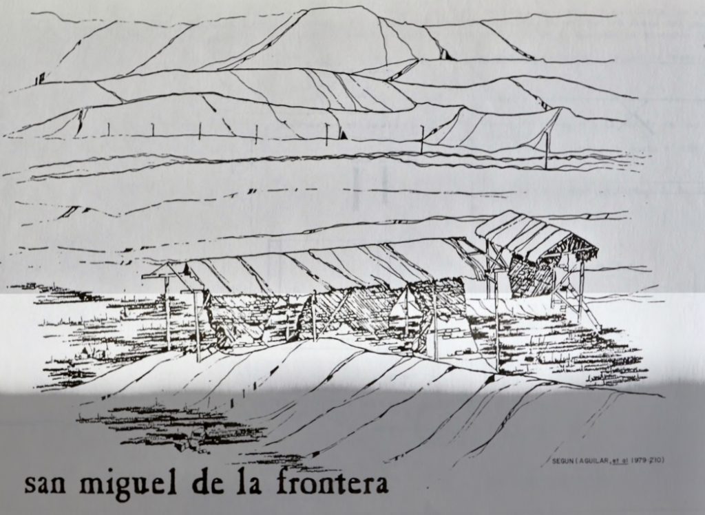
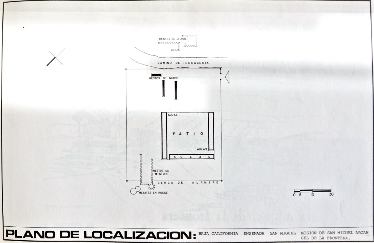
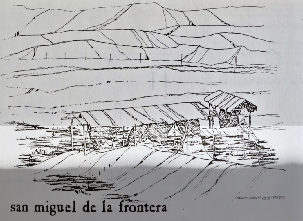
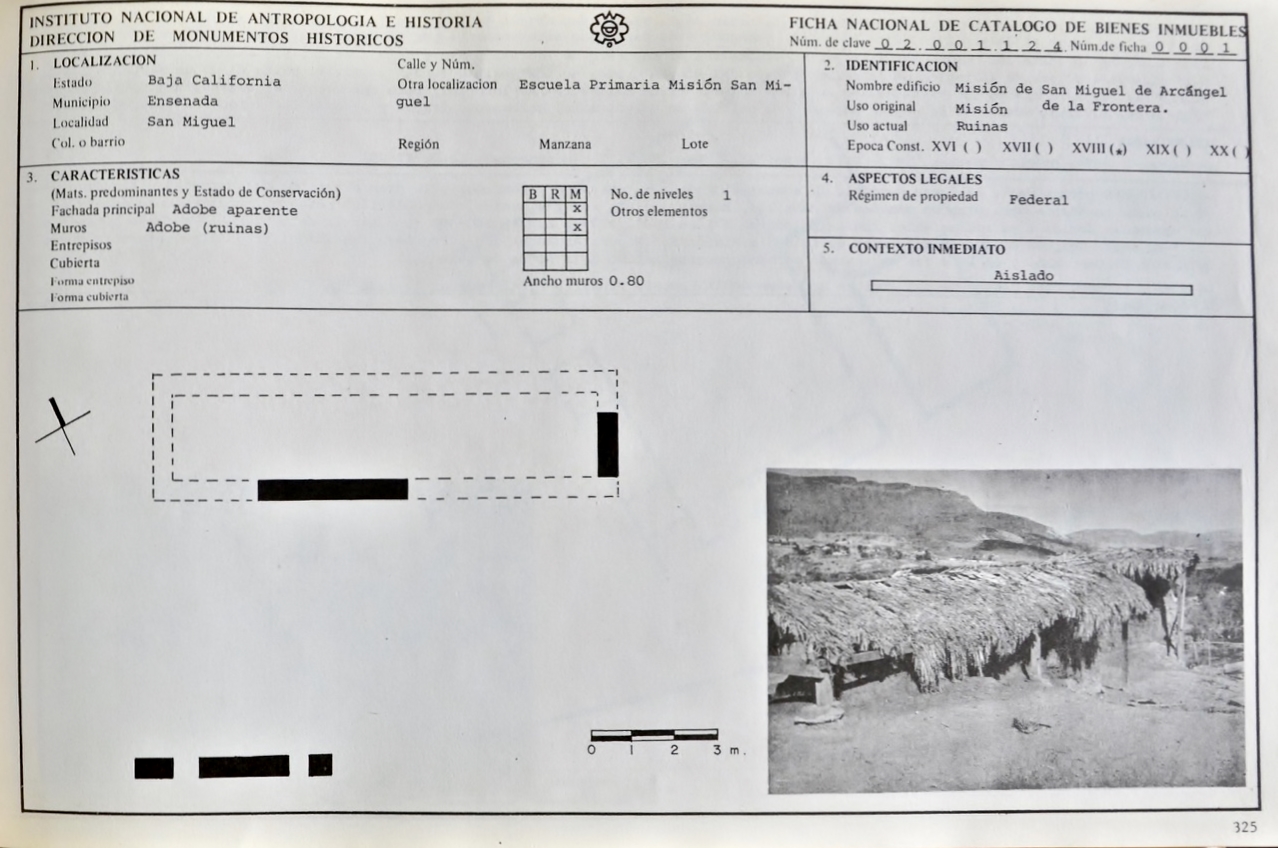
1920s mission plan (first map has south at the top)

Site Plans from Peveril Meigs mid-1920s
From INAH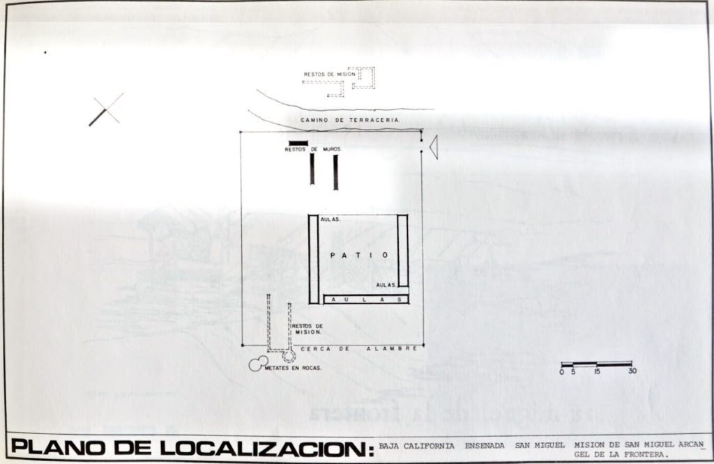
I hope this was interesting or informative for you! Please be welcome to join our Baja California Land of Missions Book Group, on Facebook: HERE
- All the missions, quick look and history, north to south: HERE
- Other mission photo pages plus more Baja California history: HERE
- VivaBaja.com home page
![]()
![]()
The following chapter is from my book, Baja California Land of Missions
Order your own copy from Amazon Books: HERE
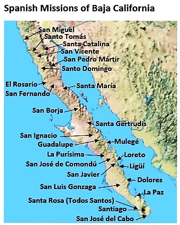
#22 San Miguel Arcángel (1787-1834)
The Dominicans were anxious to complete their original task to establish five missions in the void between San Fernando de Velicatá and San Diego de Alcalá. The Dominicans named this region La Frontera, and after thirteen years, they only established three missions. Indians hostile to the Dominican presence at San Vicente, along with the 1781 massacre at Yuma, caused a multi-year delay in beginning their fourth mission. Padre Luis Sáles of San Vicente finally explored for new sites and found one he felt suitable for the future Mission San Miguel at an arroyo named El Encino.
On March 28, 1787, Mission San Miguel Arcángel was founded midway between San Vicente and San Diego on the Camino Real. This mission site was referred to as “San Miguel Encino” or “San Miguel de la Frontera.” The native population at San Miguel began with 123 baptisms the first six months and there were 137 neophytes by the end of 1787. Peveril Meigs (in 1928) reported that this first mission location at El Encino was apparently on the site of a Russian ranch named La Misión. It was located above an encina (oak filled canyon). Meigs was unable to locate any original mission ruins on the ranch.
Rooms and a chapel were being constructed, and crops were planted at the mission, then the spring dried up. From the writings of Padre Sáles: “While we were in this predicament there came an unbaptized Indian all swollen up from the bite of a viper and at the point of death. He was the captain (chief) of a place named San Juan Bautista. I had the good fortune to cure him perfectly with common oil [a remedy which the missionaries use regularly on such wounds]. The grateful Indian told us that in his land there were all the facilities we were seeking to found a settlement. Instantly I set out, explored the site, and found that what the Indian had said to me was true. Consequently, we abandoned this place and moved all the train to the new site …”
This new site (San Juan Bautista) was just over seven miles west of El Encino (the first mission site) and one-and-a-half miles from the coast. An estuary and the beach near there provided abundant seafood. The area was also well populated with Indians. The San Miguel mission was moved to San Juan Bautista in 1788. The Indian name for the area was Ja-kwatl-jap, (ja=water; kwatl=a family name; jap=hot) for some warm springs in the valley. A source for salt was nearby at La Salina, along the coast, adding even more value to an area that seemed like a perfect location for growing crops and raising livestock.
That same year, Padre Sáles incorporated into San Miguel a ranchería of Indians located in Franciscan territory, midway between the two missions of San Miguel and San Diego. The Governor approved Sáles’ request to moving the boundary line with the Franciscan jurisdiction fourteen miles north from the Médano Valley to Rosarito Creek (Arroyo del Rosarito). It remained the division between Baja and Alta California until the end of the Mexican War, when it was moved north again to the Tijuana River Valley.
In 1793 the adobe church measured nineteen feet by seventy-two feet and was roofed with tiles. Inside were two altars. The missionaries also had an adobe dwelling. In 1794 the population numbers were up to 206. An irrigation canal was built along the steep slope, next to the mission. The canal ran from over a kilometer away. In 1798, three rooms and two granaries were built. In 1800, a new house for the missionaries and their servants was built. That same year 224 Indians were converted at San Miguel. However, a few years later, in an 1808 report, Dominican Presidente Ramón López said this: “Conditions at San Miguel are not very good. While outwardly prosperous, its minister can barely provide the Presidente with twenty-five or thirty pesos annually. I know quite well that the priest there can hardly meet his own needs.”
Normal instructions and orders from Spain, as well as supplies from the Mexican mainland, were interrupted and the missionaries and Spanish soldiers had to fend for themselves for some eleven years of isolation during the war for Mexico’s independence, beginning in 1810. The Dominicans appealed to their Franciscan brothers in Alta California for assistance in 1815. The Alta California missions were doing far better and were able to respond with cattle, grain, and clothing. Large fields had been cultivated at San Miguel, but flash floods carried off most of the soil by 1810.
The damage from these floods was so severe that in 1810 Padre Tomás de Ahumada had moved the mission about eight miles north to a place named El Descanso. The new site was known also as “San Miguel la Nueva” (New San Miguel). Padre Ahumada traveled between the two sites while based at Descanso but seems to have eventually returned mission functions to the old site. In 1824, the estimated population was 350-400. However, in 1830 the population was only seventy-eight.
Following the 1821 independence of Mexico from Spain, the original purpose of the missions to convert the Indians into civilized Spanish subjects was over. The padres, however, continued to serve the native Indians. In 1830, Padre Félix Caballero had new adobe buildings erected at El Descanso, reviving activities there. While El Descanso is not technically a separate mission from San Miguel, it is considered such by Mexico’s National Institute of Anthropology and History (INAH) and most history writings. See page 171.
No mission activities are recorded beyond 1834 at ether San Miguel or El Descanso. On December 29, 1840, the Dominican President, Padre Gabriel González, asked Padre Tomás Mansilla of Mission Santo Tomás to include the missions of San Miguel and Guadalupe in his jurisdiction. This indicates that the Dominican leadership either did not know of or ignored the abandonment of those two missions.
The new Mexican government secularized mission property throughout Mexico in 1833, but the remoteness of California (Baja and Alta) and the number of Indians who were not yet “civilized” or transformed into “European style” living caused an exception in the law to be added in 1835. A California mission could continue to operate until the current missionary died or until he abandoned it.
The 1788 San Miguel mission site is located next to Highway One (the Ensenada “Free Road”) in the modern town of La Misión, Km. 65.5, twenty-seven miles north of Ensenada.
Dominican Missionaries recorded at San Miguel:
Luis Sáles (to 1789) March 28, 1787
Caietano Pallás 1790-1791
Juan Salgado 1792-1793
Mariano Yóldi 1793-1804
Mariano Apolinário 1794-1796
Raymundo Escolá 1797-1800
Miguel Abád 1799
Tomás de Ahumada 1809-1815
Félix Caballero 1815-1834
José Martínez 1819-1822 (last resident missionary)
Domingo Luna 1829 and 1833
See the other mission pages: https://vivabaja.com/baja-mission-albums/