May 2025 Baja California Tour (5/25)

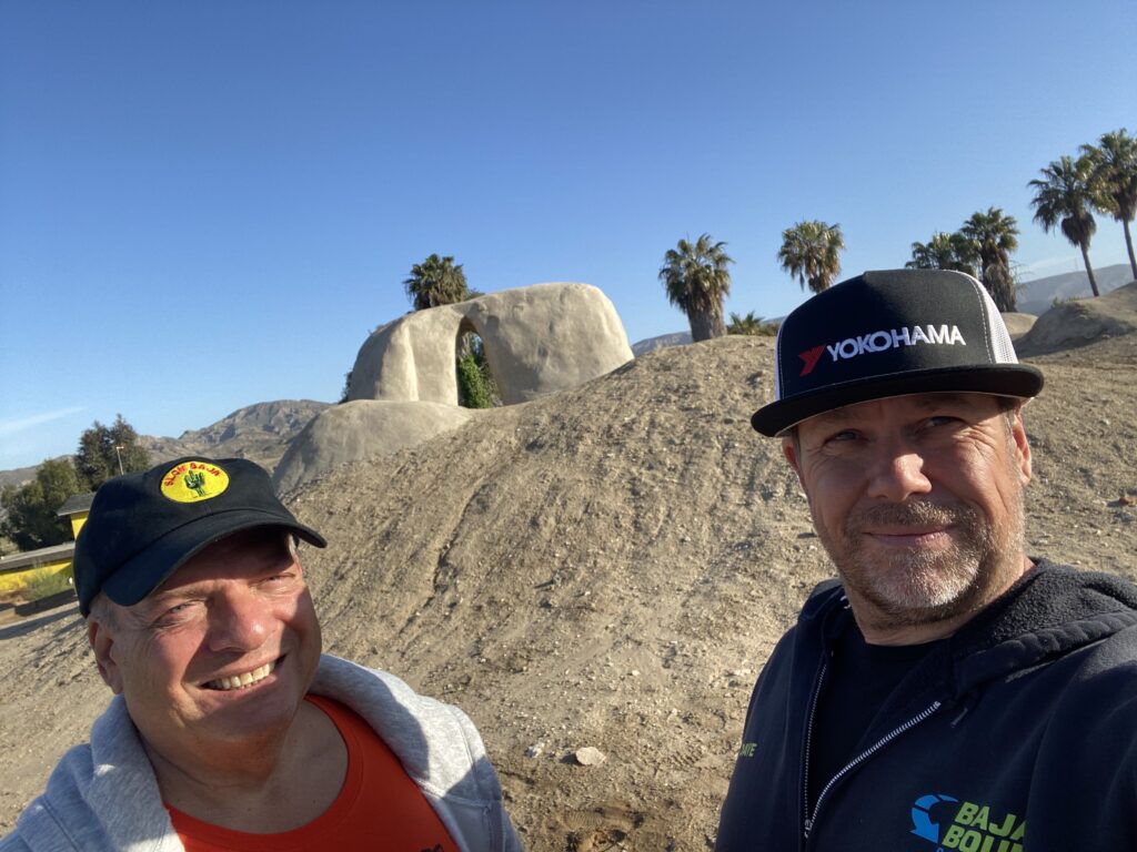
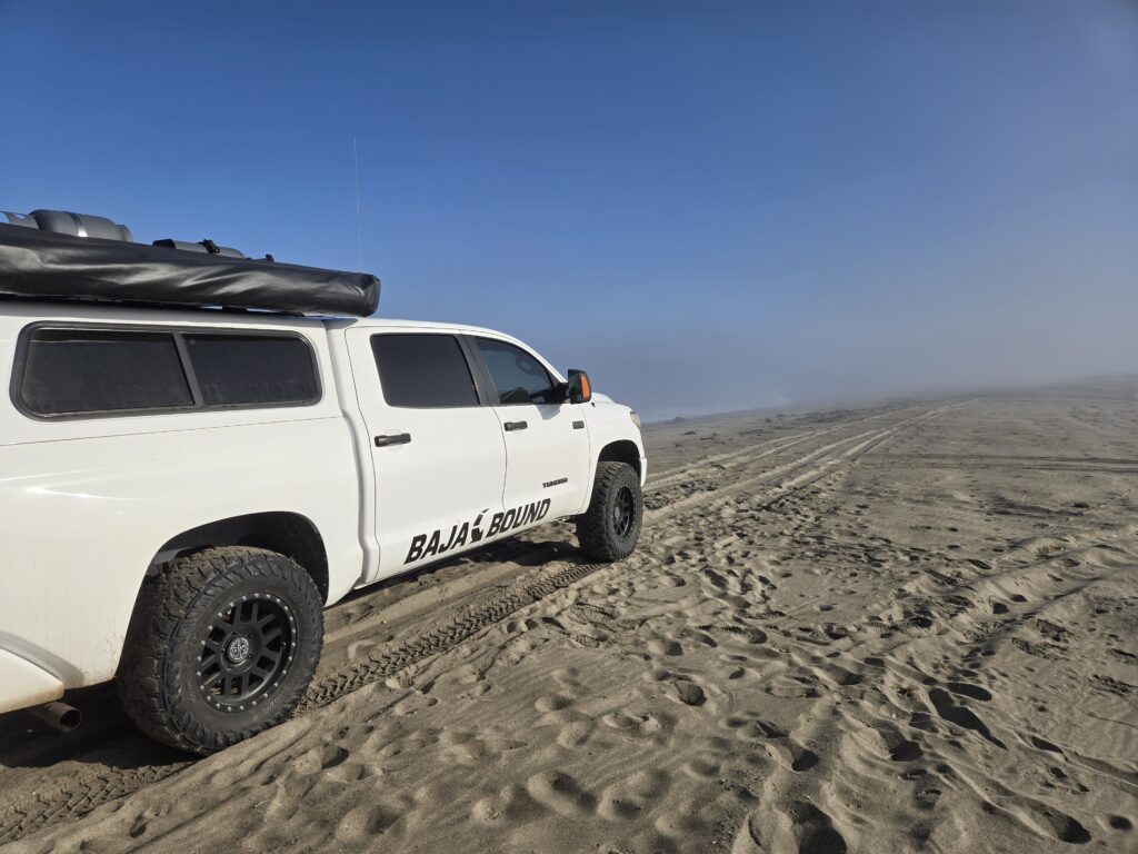
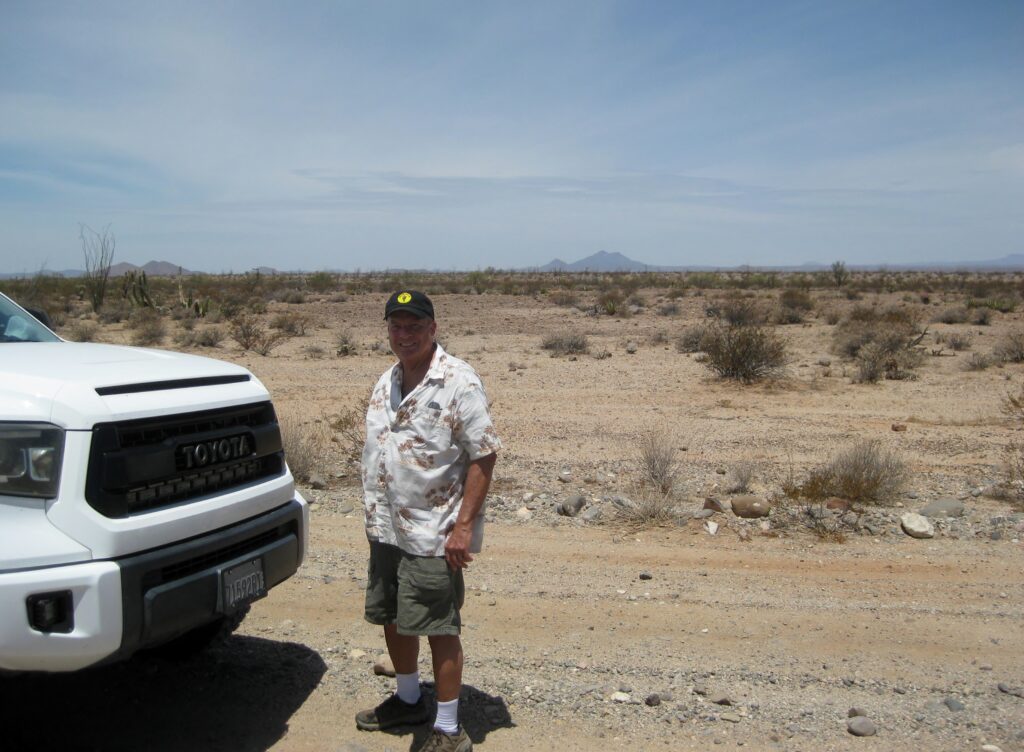
One of my friends, who I met through association with Baja Bound Insurance, is Dave W. Dave created the ‘Toyotas in Baja’ Facebook group, he owns a Tundra and 4Runner. Dave likes the kind of places I also like to visit (history and geology sites). On the weekend of May 10-12, 2025, we did a whirlwind tour around northern Baja California in order to see some interesting places. For me it would be a revisit to many sites I have not seen since 2017, plus a couple of new ones. For Dave, it would be the first time he would see most of these places. His passion for Baja had been surfing and off-road racing. Dave was very involved with the Mag 7 Pit Team.
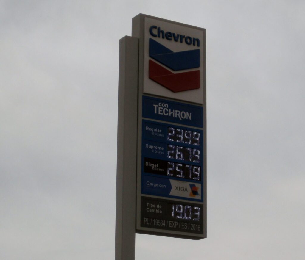
We reached the border just before 8 am, Saturday. The U.S. has officers stationed on each southbound lane and there was a backup, but we moved quickly. Things inside Mexico were different than my last trip (in 2022), with a new building and lane changes. Be sure to be in the right-hand lane to get your FMM (tourist permit). There still was an exit to go over to the building by the giant flagpole, prior to the electronic gates, Dave had a quicker route to immigration parking. First, we passed the gates, then we got waved over for an inspection (Dave’s Tundra has a shell and it looks loaded with camping gear, etc.). The inspection was quick, and we were ‘released’. Just a few feet from that inspection stop, we pull off to the right, where new lanes (used just for parking) merge with the existing ones. There, we turn northward to park.
We walk through construction to the side of the building and quickly find the INM (immigration) kiosk, present passports and get the free FMM (good for 7 days or less). The text on the forms is small so bring reading glasses, if you need them. We were done and back in the Tundra in just twelve minutes.
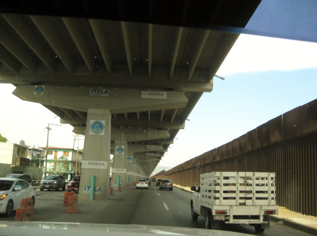
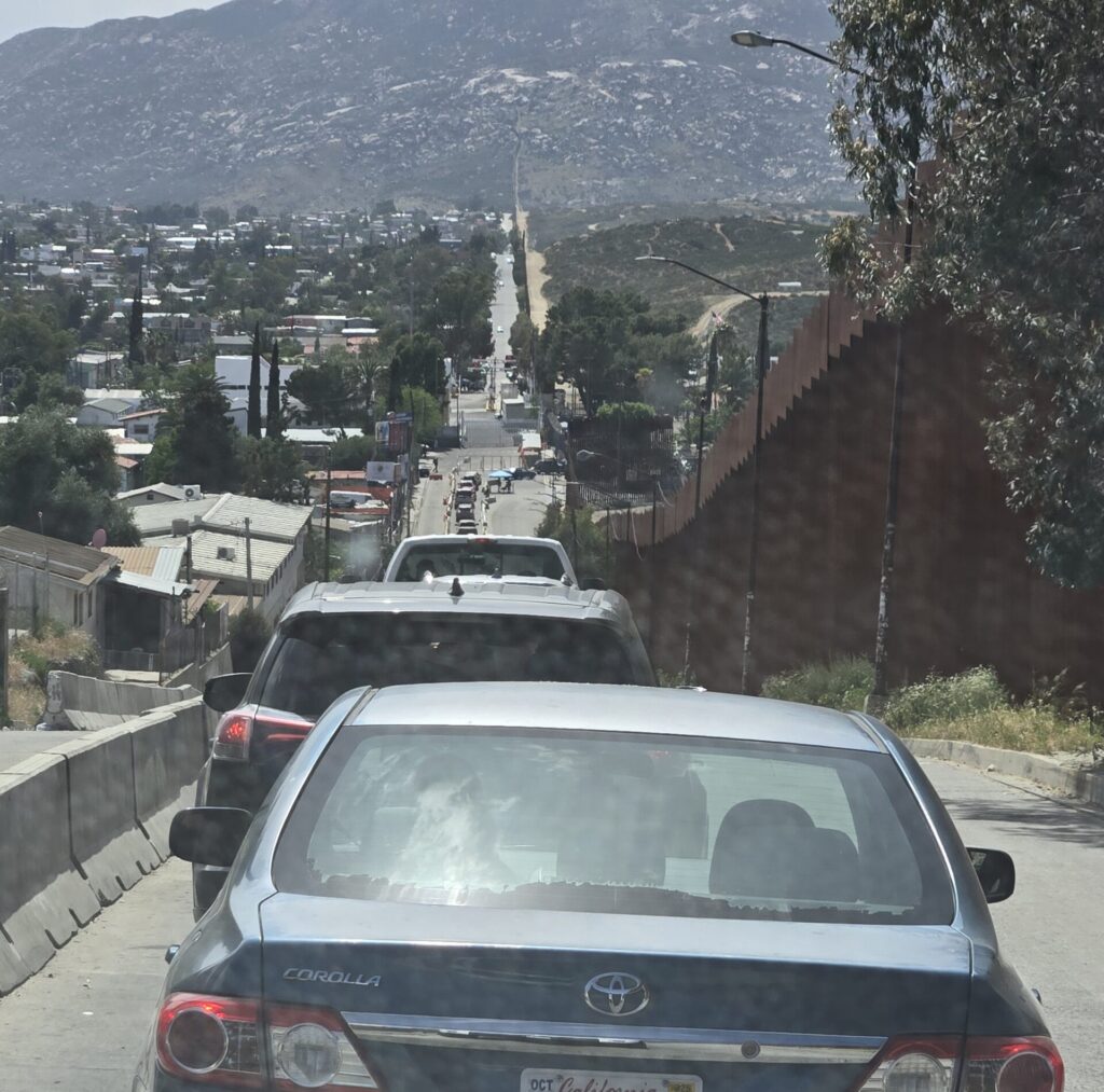
Leaving the border crossing and getting to the street (for the Ensenada toll highway) along the border fence was easy. The new thing about the route is they are building a double deck or raised roadway above the original (photo below). Where this road joins in with the Highway #1-D going west, from downtown Tijuana, is quite an elaborate project. This was in in the canyon where the road was washed out and traffic had been squeezed into two lanes. No more! We flew freely into the other roadway then out towards Playas de Tijuana and the first toll booth.
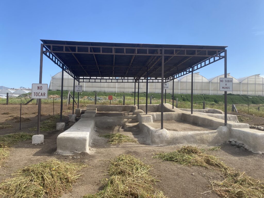
MISSION EL DESCANSO (1830-1834)
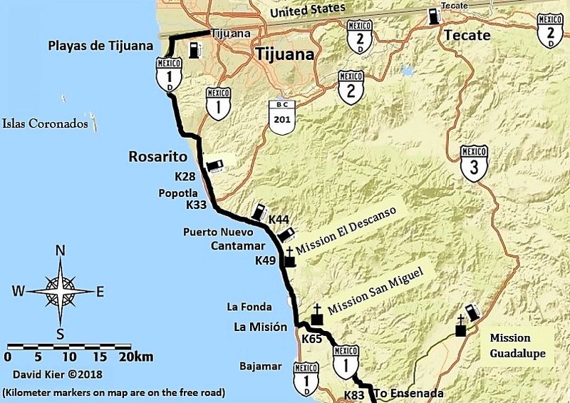
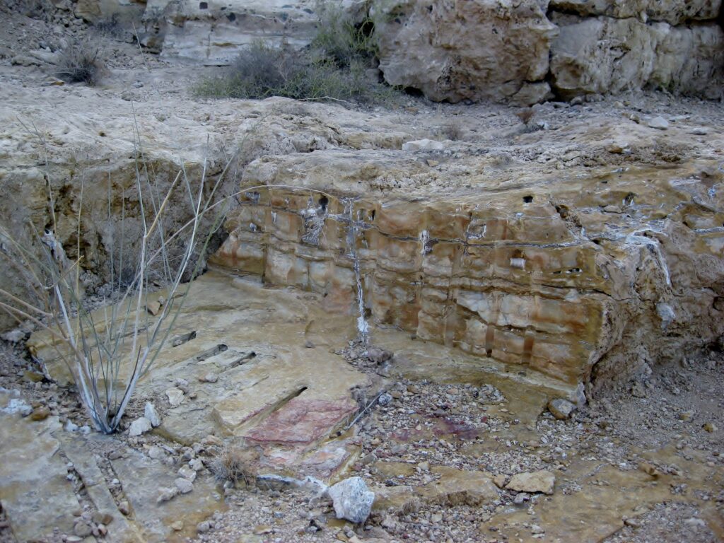
Mission El Descanso was the first site we visited. It is accessed off the free road at Km. 49, then you drive under the toll road on a dirt street for 1/2 mile. Park by the modern church and walk behind it, to where the awning-covered mission foundations are located.
Descanso has a confusing story to tell: A mission in this area was originally established about 1810 as a new location for Mission San Miguel (the mission that today is in the town of La Misión, a few miles south). This move was after floods destroyed the croplands there. In about 4 years, Padre Tomás Ahumada returned to the previous mission site. His Descanso mission location was called ‘San Miguel la Nueva’ (New San Miguel) and it was on the south rim of the Descanso valley, where a cemetery is today.
The site with the awning overhead was a newer mission, founded by Padre Felix Caballero in 1830. Mexico won their independence nine years earlier, thus Descanso was not even a ‘Spanish mission’, just one created by a lone Dominican priest, with help from the Native tribe. Padre Caballero was one of a few Dominicans who were allowed (by the new Mexican government) to remain in Baja California to continue service for the Indians.
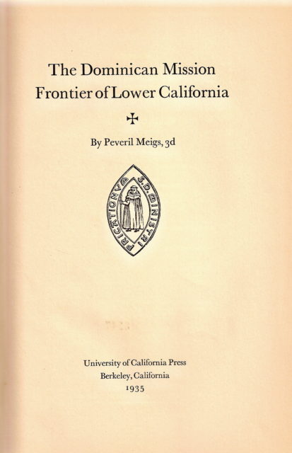
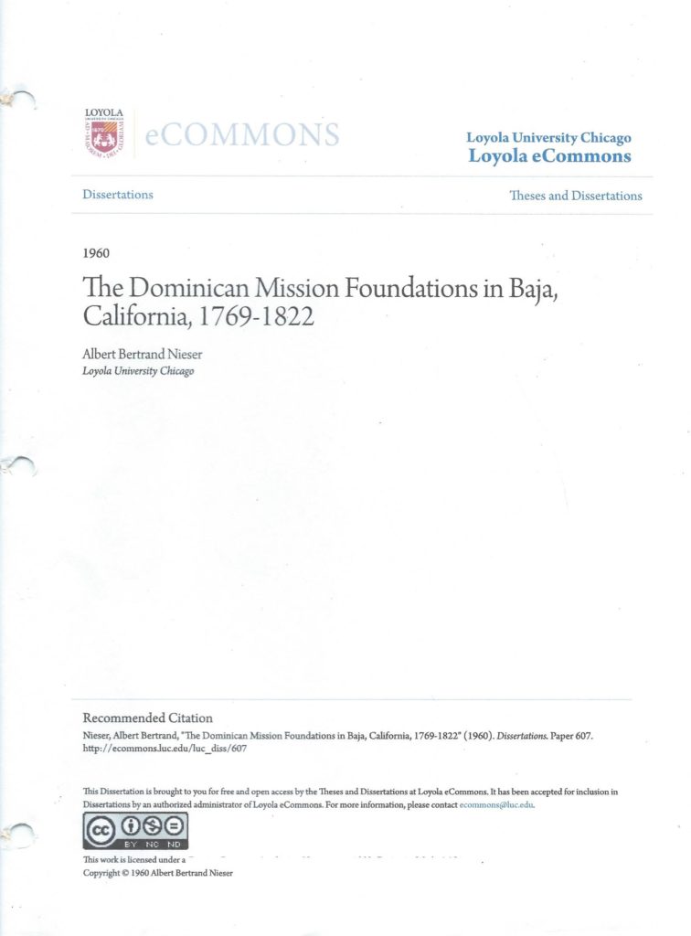
More confusion comes with the year of the first Descanso valley mission (San Miguel la Nueva): That year was still unknown when Peveril Meigs wrote his great book on the Dominican missions, in 1935. Meigs estimated that Descanso was established in 1817. Information signs and many books written after Meigs continued the 1817 guess-date, rather than the 1810 date, which was published in 1960. That, plus the fact that we are seeing two different projects in this valley is cause for confusion. Meigs thought the adobe remains, up on the rim of the valley, was a fort and not Ahumada’s moved San Miguel mission.


We went to the popular restaurant Splash for breakfast. I had never been there, and it was pretty amazing located on a sea-cliff above the rocks. Splash was a great name! We both had the machaca and eggs with OJ. It was excellent!
MISSION SAN MIGUEL (1787-1834)
On south, using the free road, we next went to the growing community of La Misión to see Mission San Miguel. It is next to the school, on the left as you enter the main town (Km. 65.5). It was a Saturday, so there was no school activity. The mission is fenced-off, with a locked gate. We took photos through the fence.
More San Miguel photos: https://vivabaja.com/san-miguel/
The free road on south to Ensenada was a very nice, scenic drive and it wasn’t long before we were in Ensenada, passing through town with ease. The bad traffic began at Maneadero, just after the La Bufadora junction. The road narrows from 4 to 2 lanes.

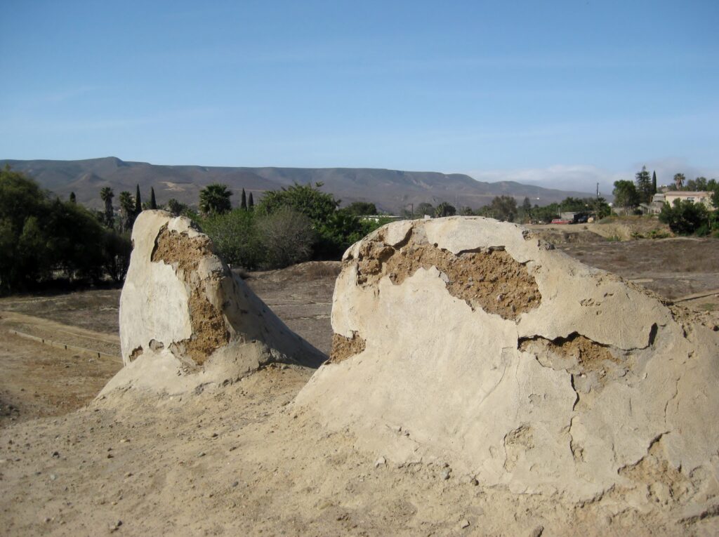
MISSION SANTO TOMÁS (1791-1849)
At Santo Tomás, the big shock was the El Palomar campground, gas station, and curio store were all closed. That was a beautiful campground (Km. 50). I stayed there in 1975, 1976, and 2000 (maybe more). In 2017, I drove to the mission site through the campground. Can’t get there that way, anymore!
We parked along Mex 1 by a home, close to the mission (see the tall palms as you enter Santo Tomás) and asked permission to pass through the home’s front yard. My wife and I did this back in 2005. You step over the mission’s water canal as you leave the home’s yard and enter the big field, with the palms. The mission today is just a bit of adobe wall, still there from the 1799-1849 mission location. It was the third site for the mission, as the previous two sites (1791 & 1794) were unfit or not too successful.
More Santo Tomás photos: https://vivabaja.com/missions2/

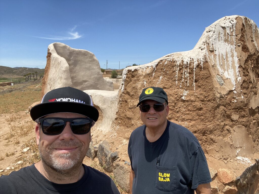
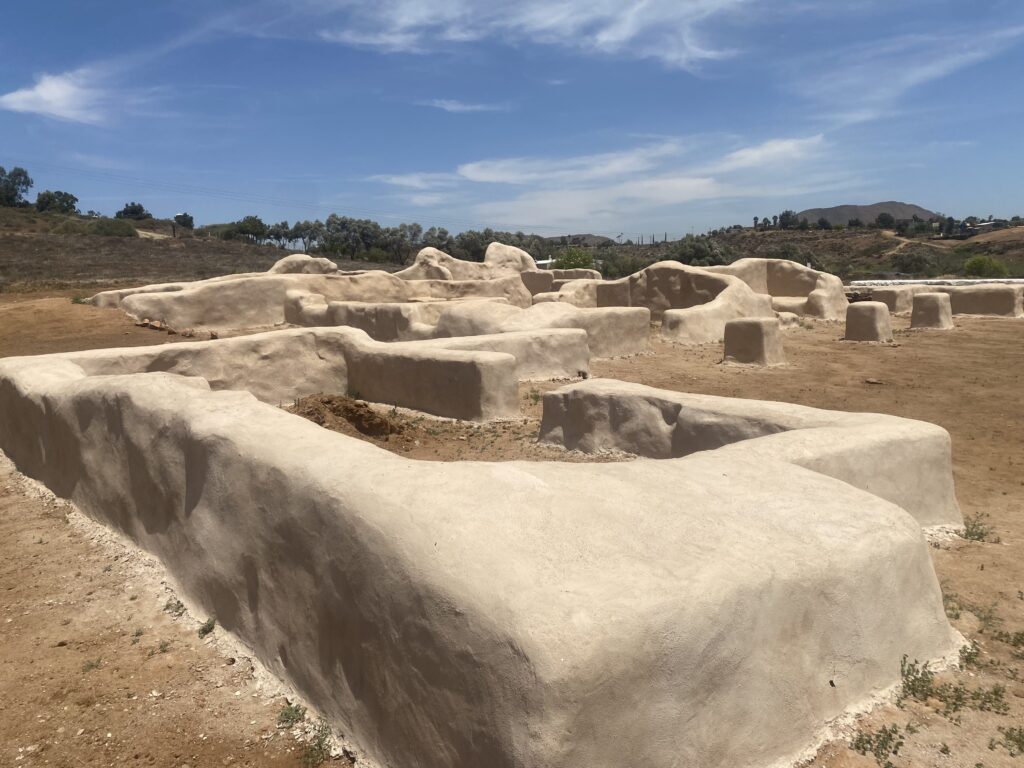
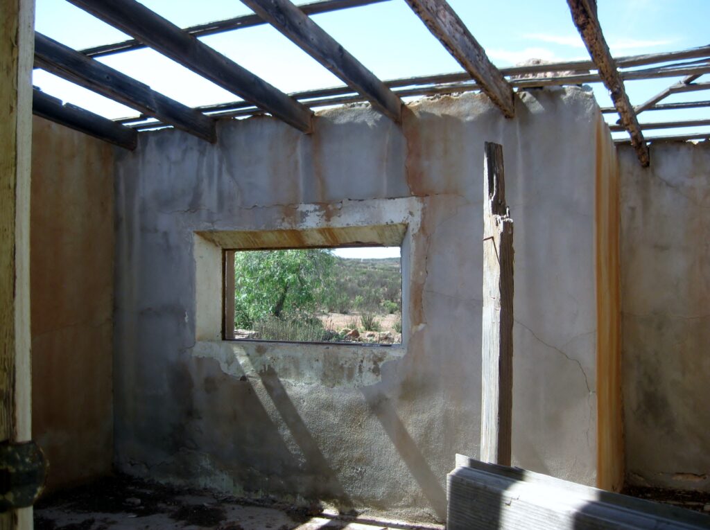
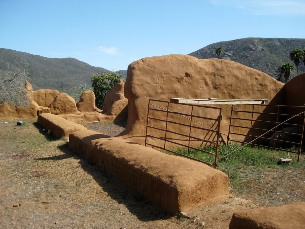
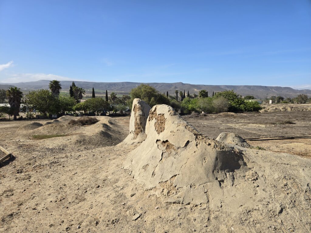
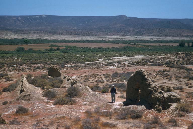
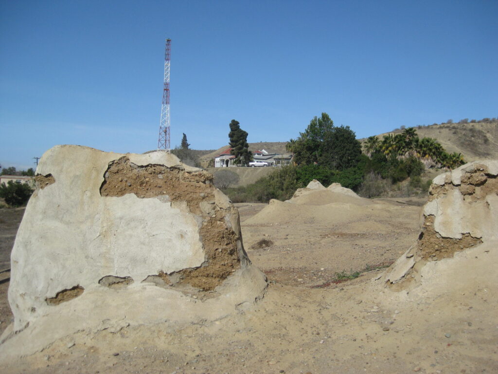
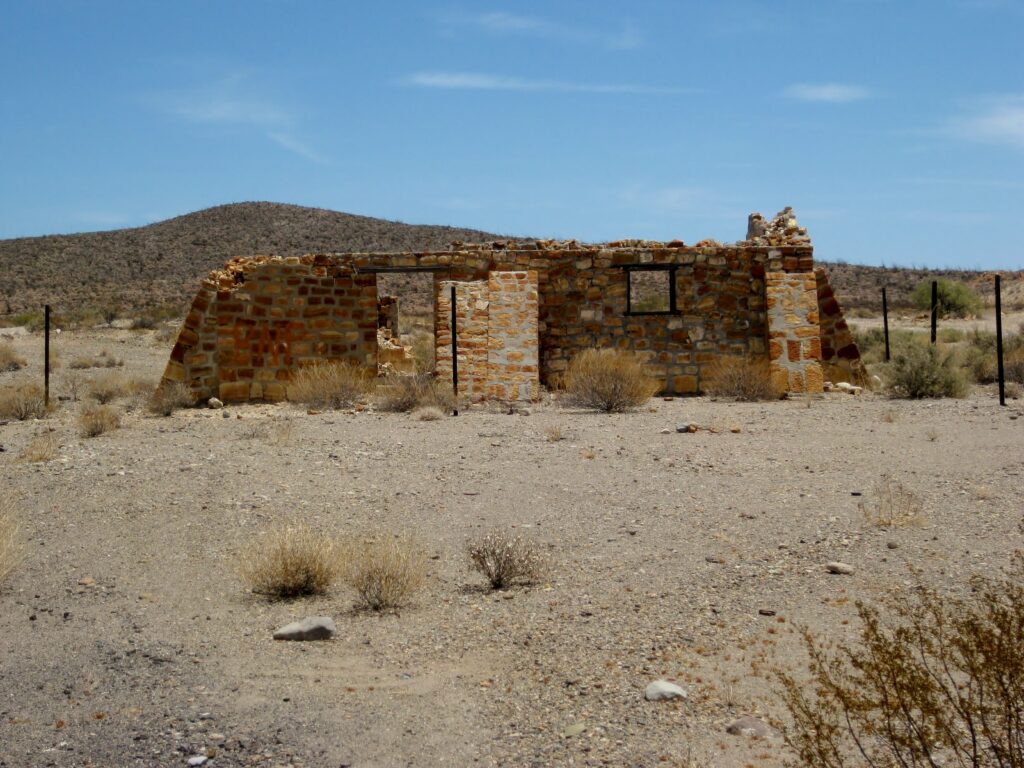
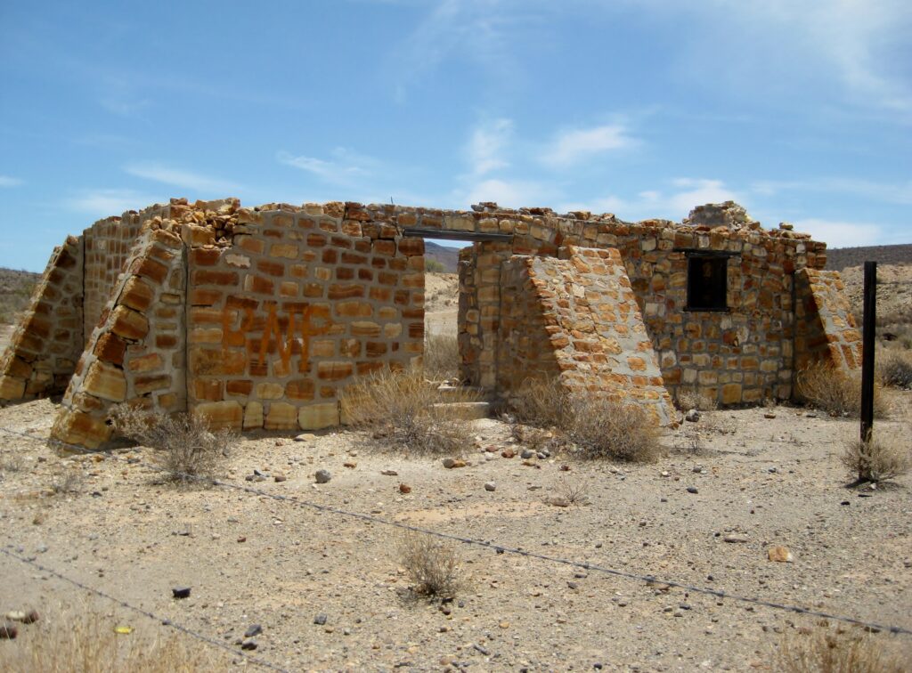
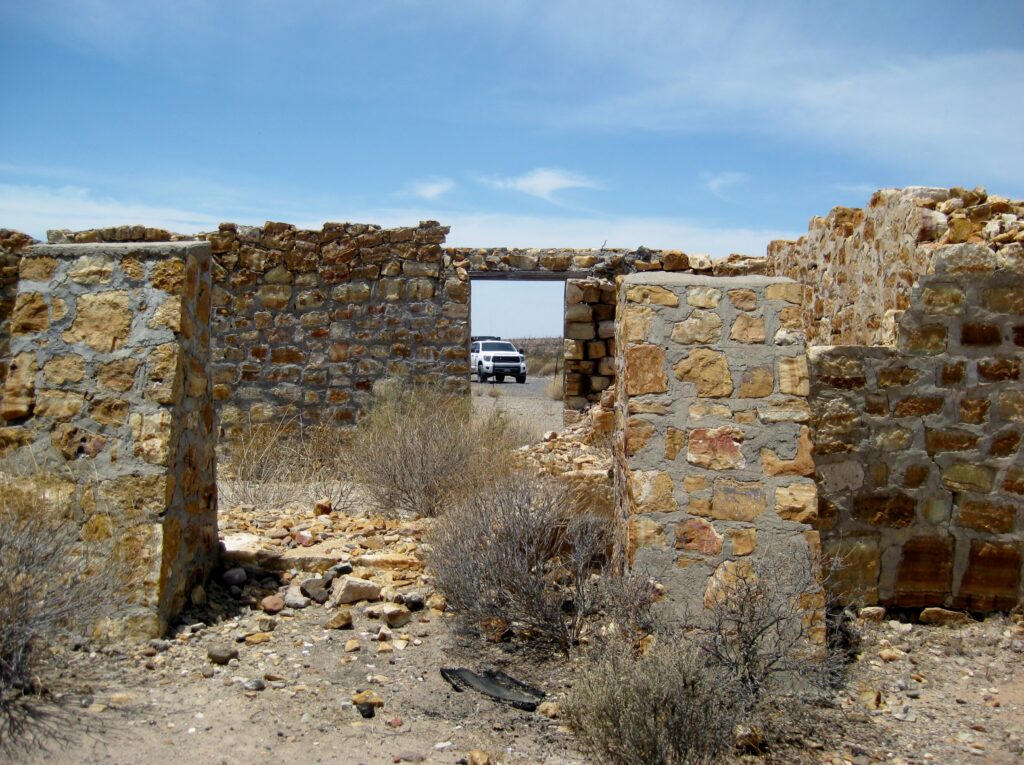
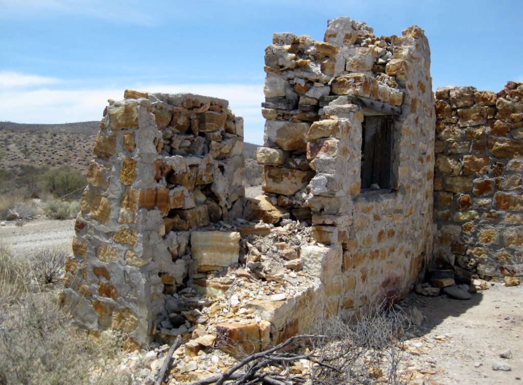
MISSION SAN VICENTE FERRER (1785-1829)
Our next stop heading south on El Camino Real (Mexico #1 is over or parallel to) was Mission San Vicente Ferrer, founded in 1785 as the third Dominican California mission. The road to the mission is about a kilometer long, going west from Km. 88.5, next to the Mi Ranchita restaurant. The mission overlooks the San Vicente river valley.
Unlike Santo Tomás, this mission has more extensive ruins that have been preserved, with plaster coating the adobe, and made into an historic park with informative signs and gravel paths. A graveyard is on the hill, overlooking the complex. No caretaker was around today, but the gate was open.
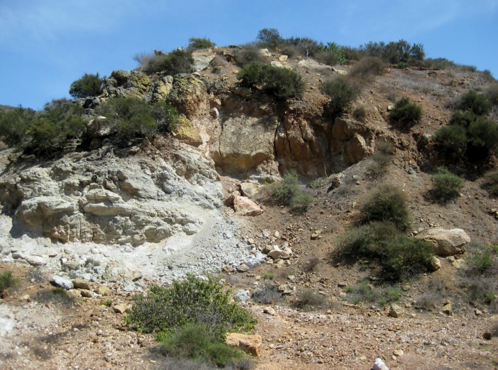
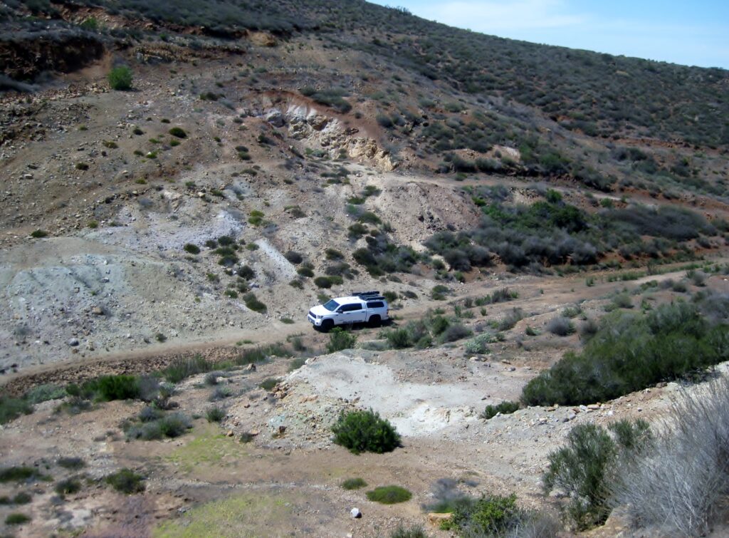
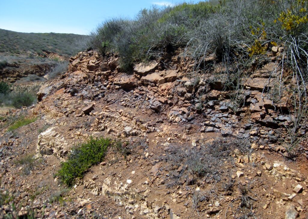
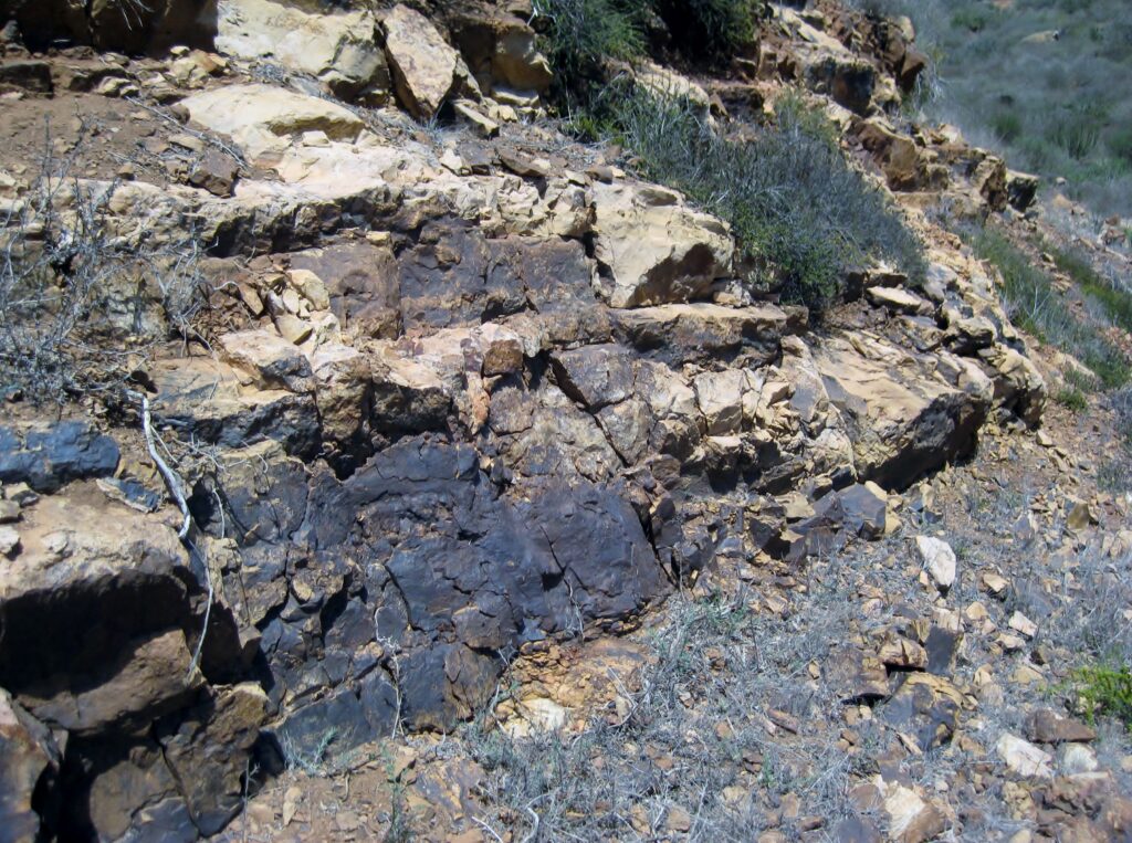
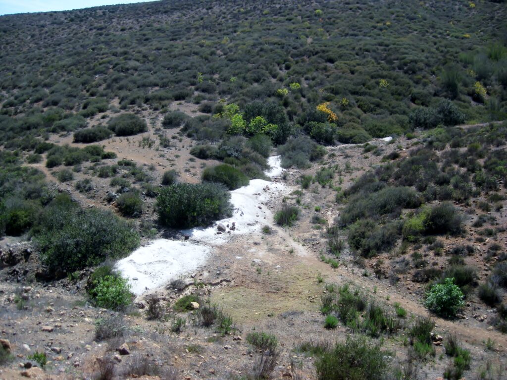
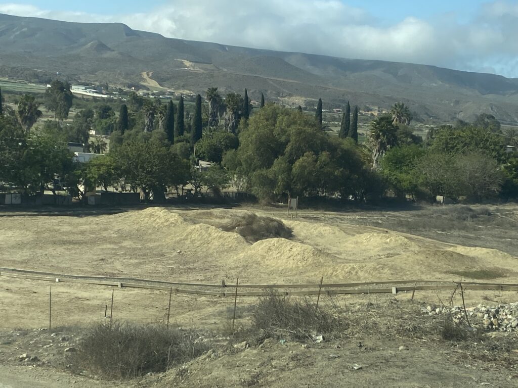
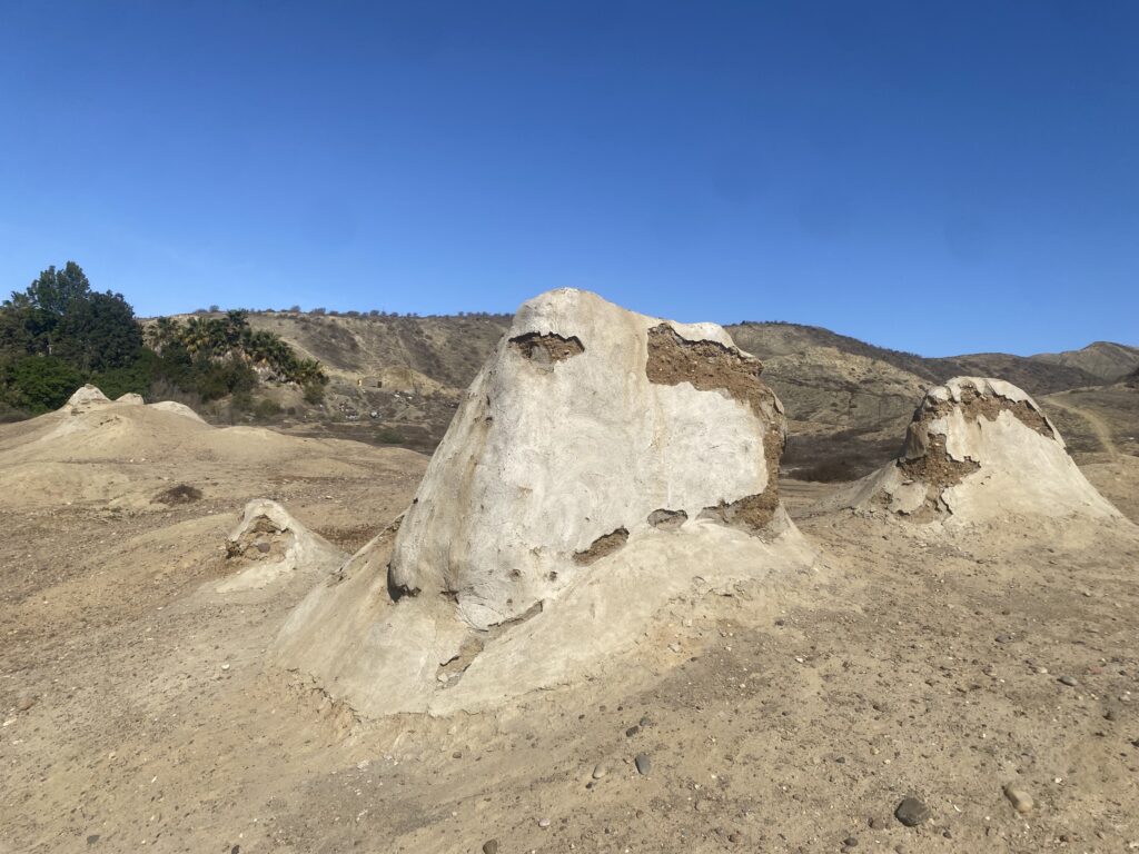
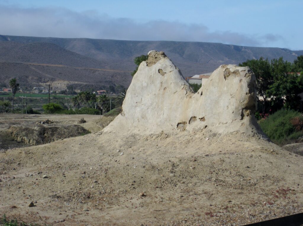
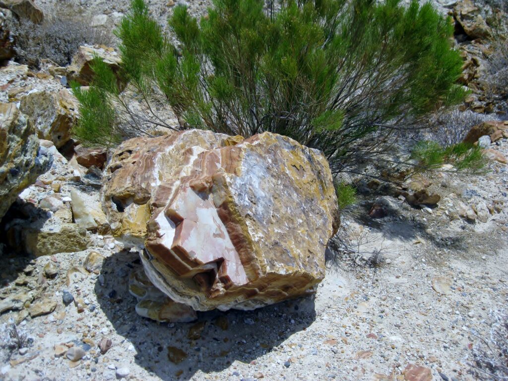
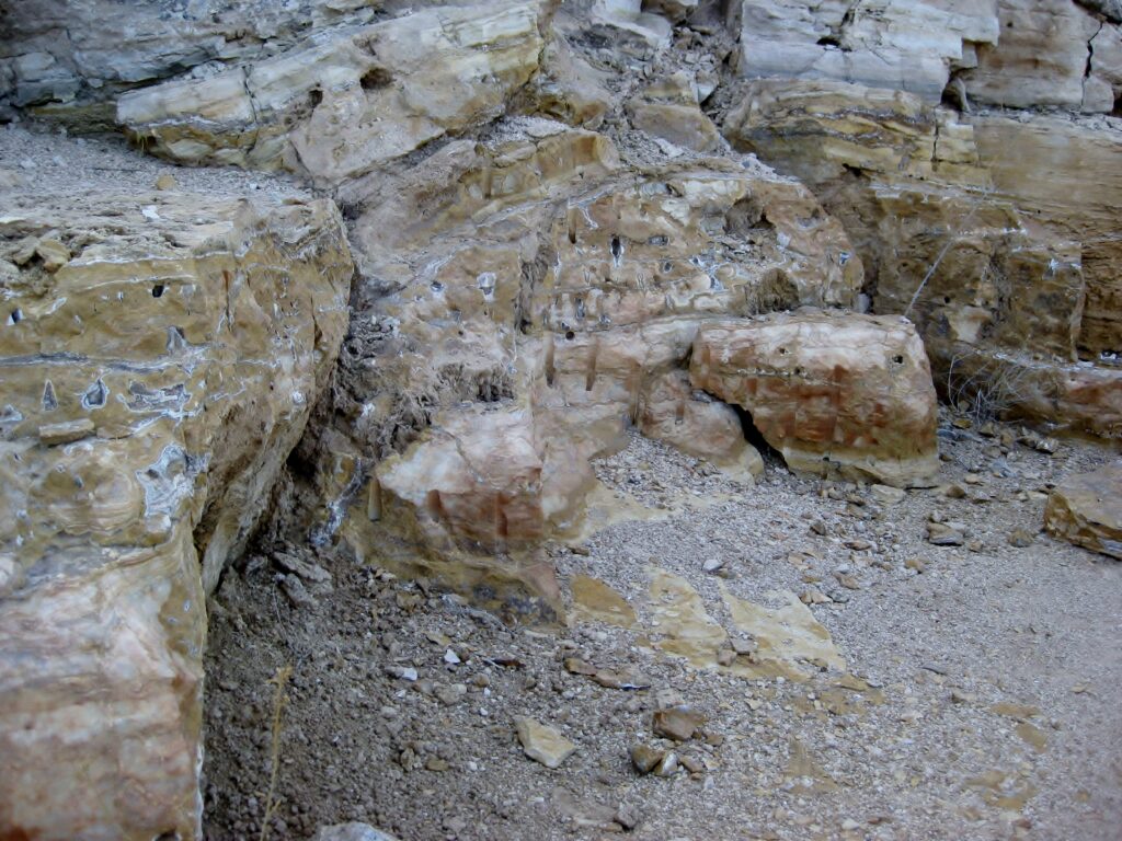
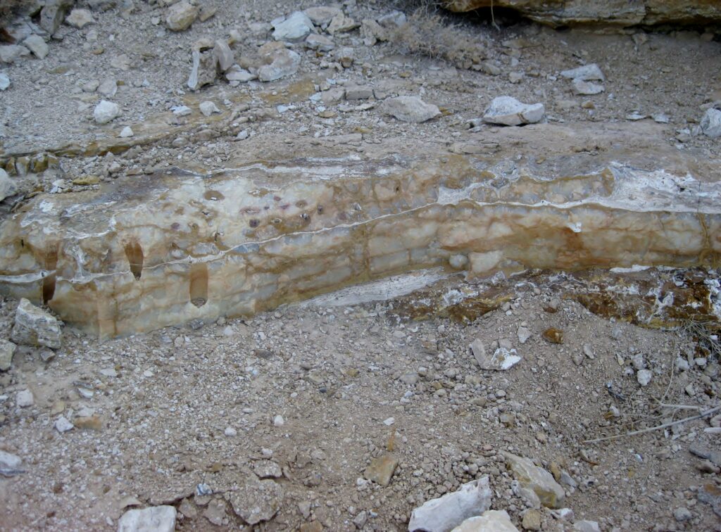
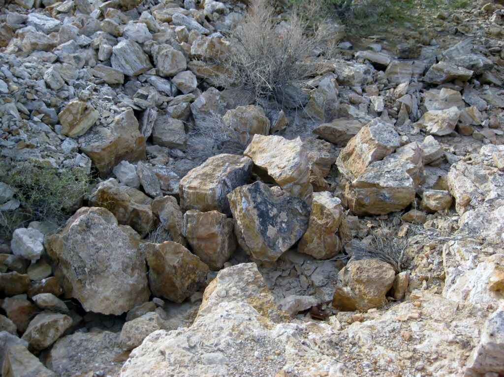
THE ALBERTINO MINE (barite)
Next, we try to find the Albertino Barite Mine, a site the Auto Club had included in their maps and guidebooks of the 1950s and 60s. It seemed so fascinating that, even before I went there, I wrote about it: CLICK HERE
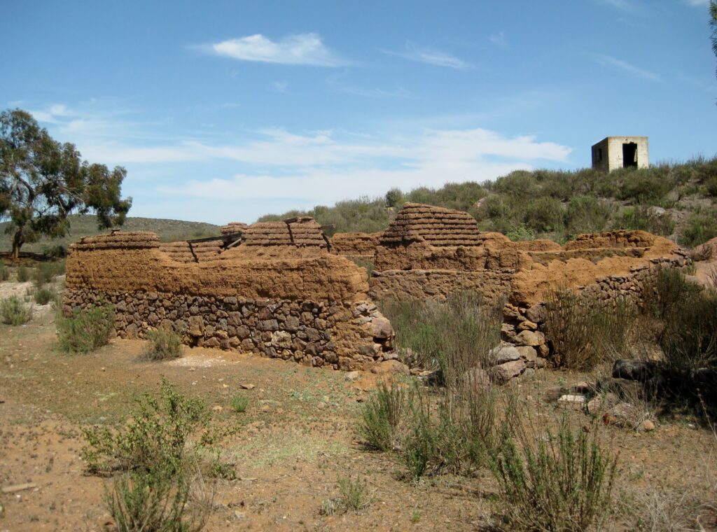
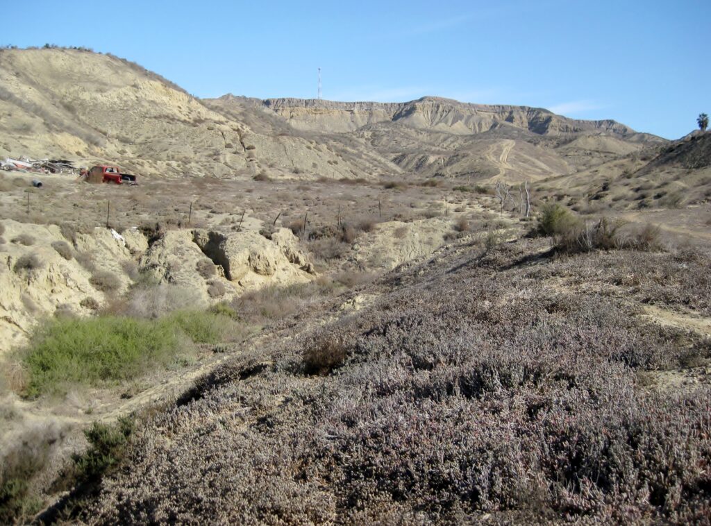
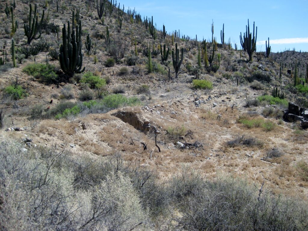
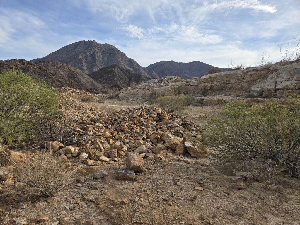
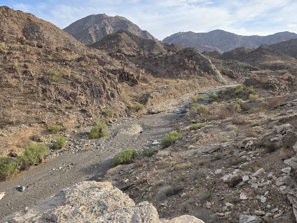
It is located just 3.7 miles east of Km. 149.8. The road is opposite of the Punta San Jacinto Shipwreck road sign. It goes straight east then curves to climb the hill into a valley beyond. Soon, it curves south, then goes west, right through the abandoned Las Minitas ranch. Just over the rise, the road descends and arrives at the mine. The Las Minitas ranch ruins were interesting, too.
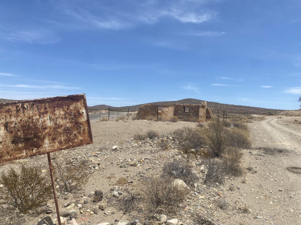
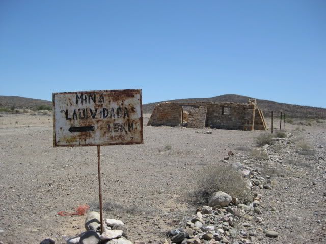
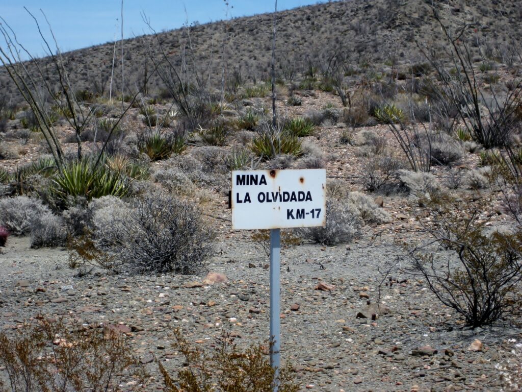
Dave and I wondered about the mine, but not being geologists, we did not know what barite looks like. The very dark veins of rock and the long pile of whitish dirt were photographed, as that was unusual. The mine was first mentioned 74 years ago and vanished from Auto Club books and maps about 60 years ago. Maybe all the barite was removed? Another barite mine is located past El Mármol (and past El Volcán): called ‘La Olvidada’ which is worked sporadically.

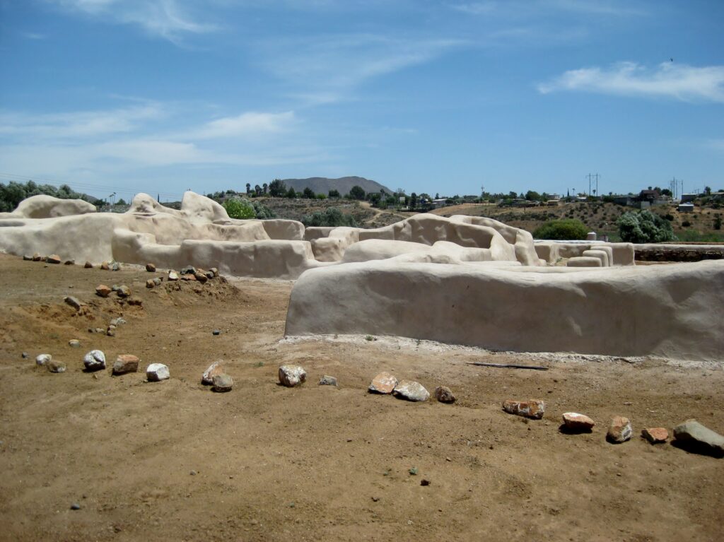
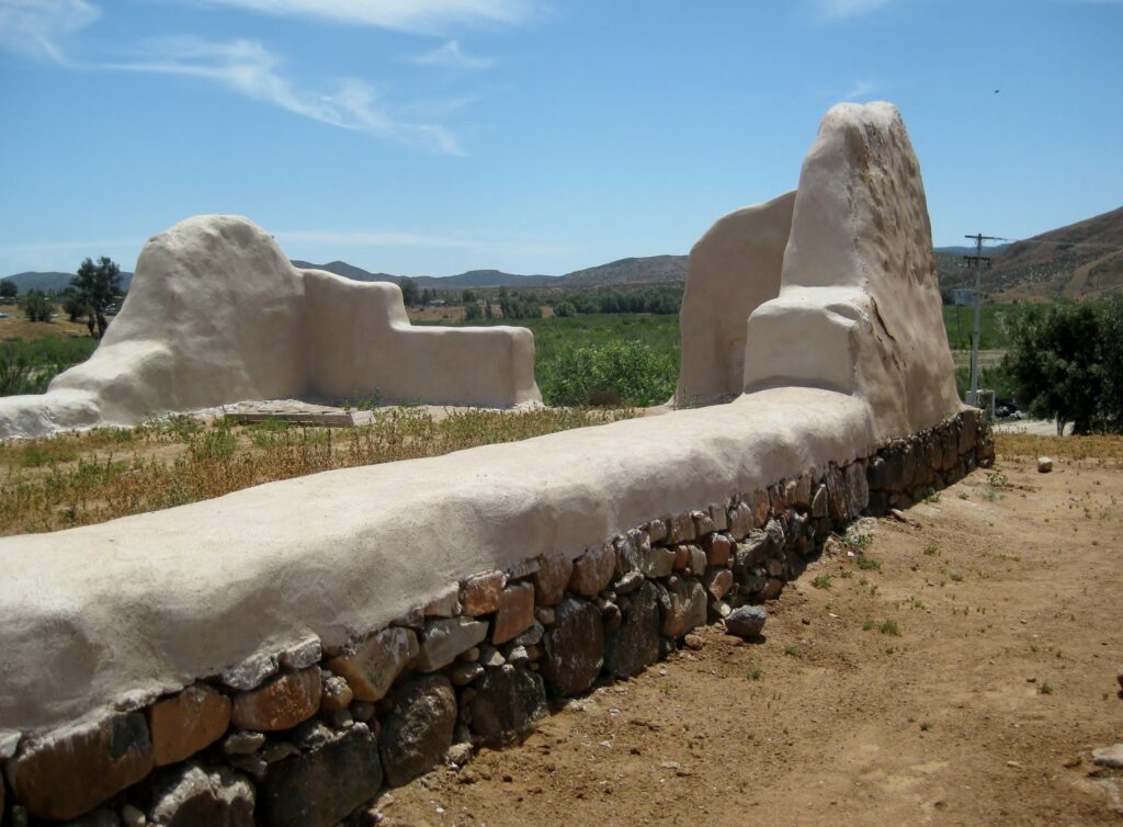
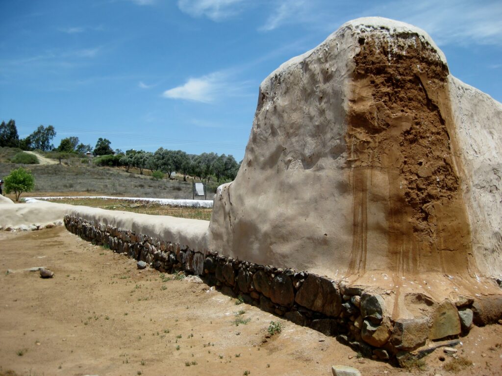
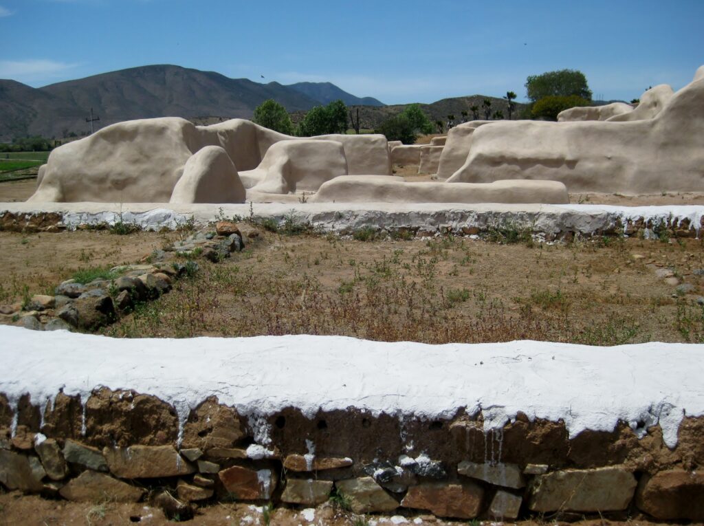
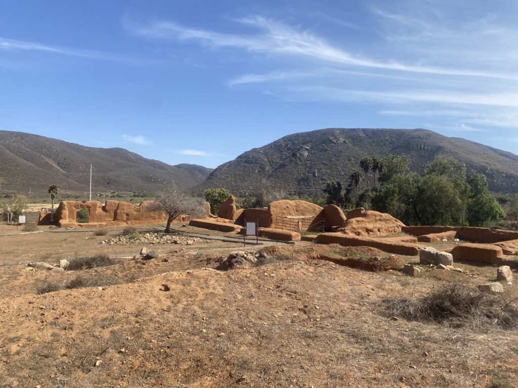
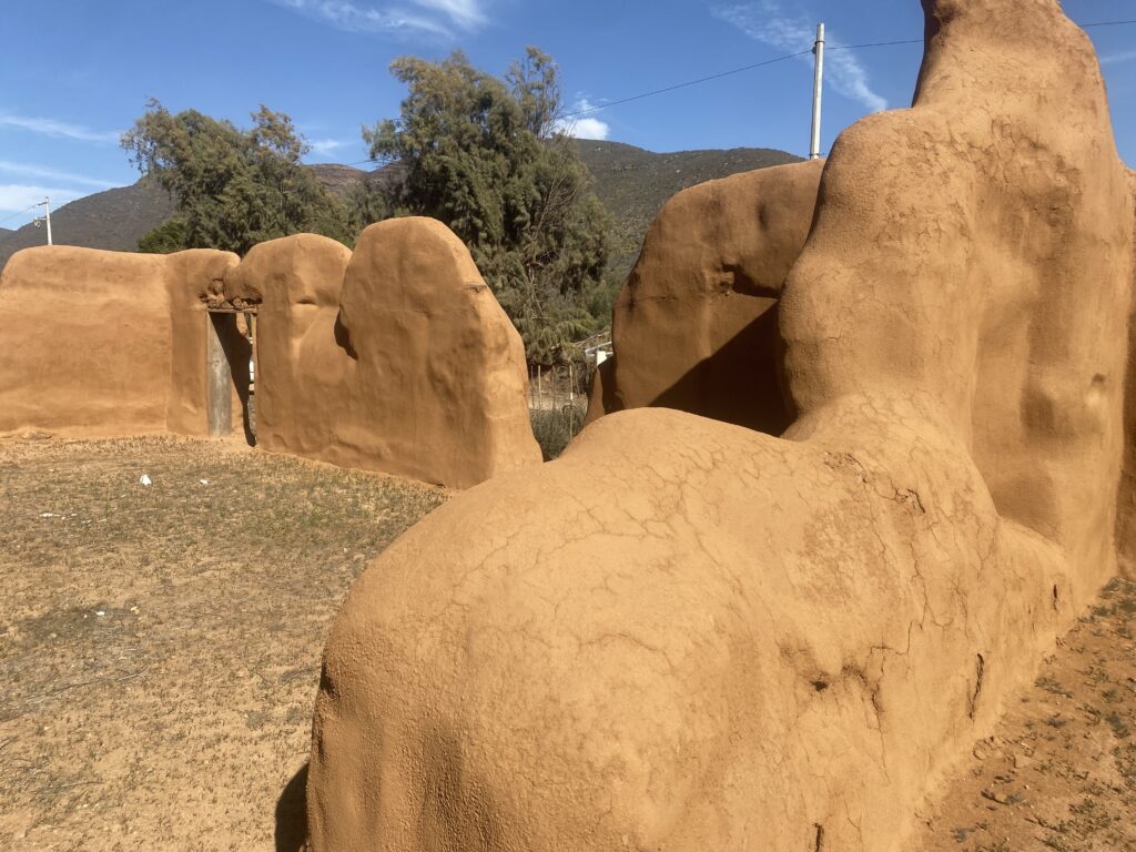
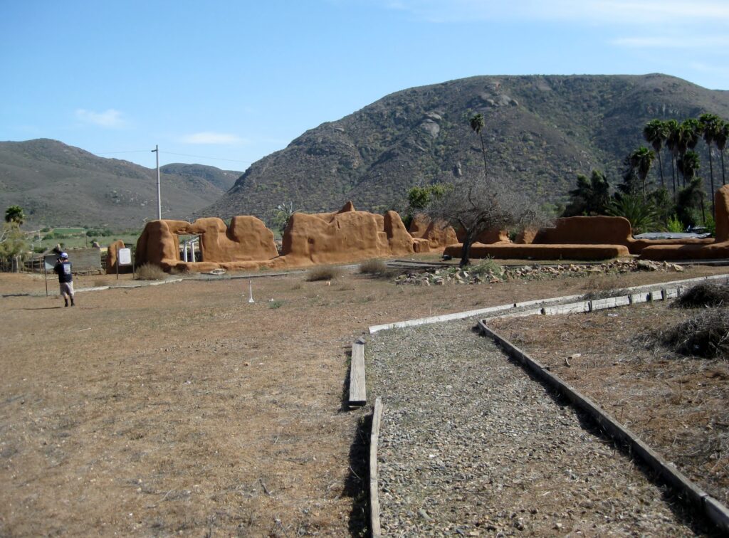
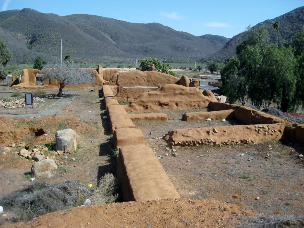
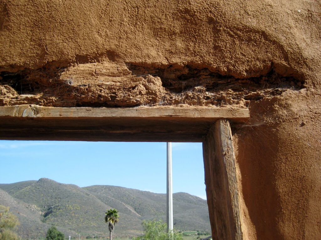
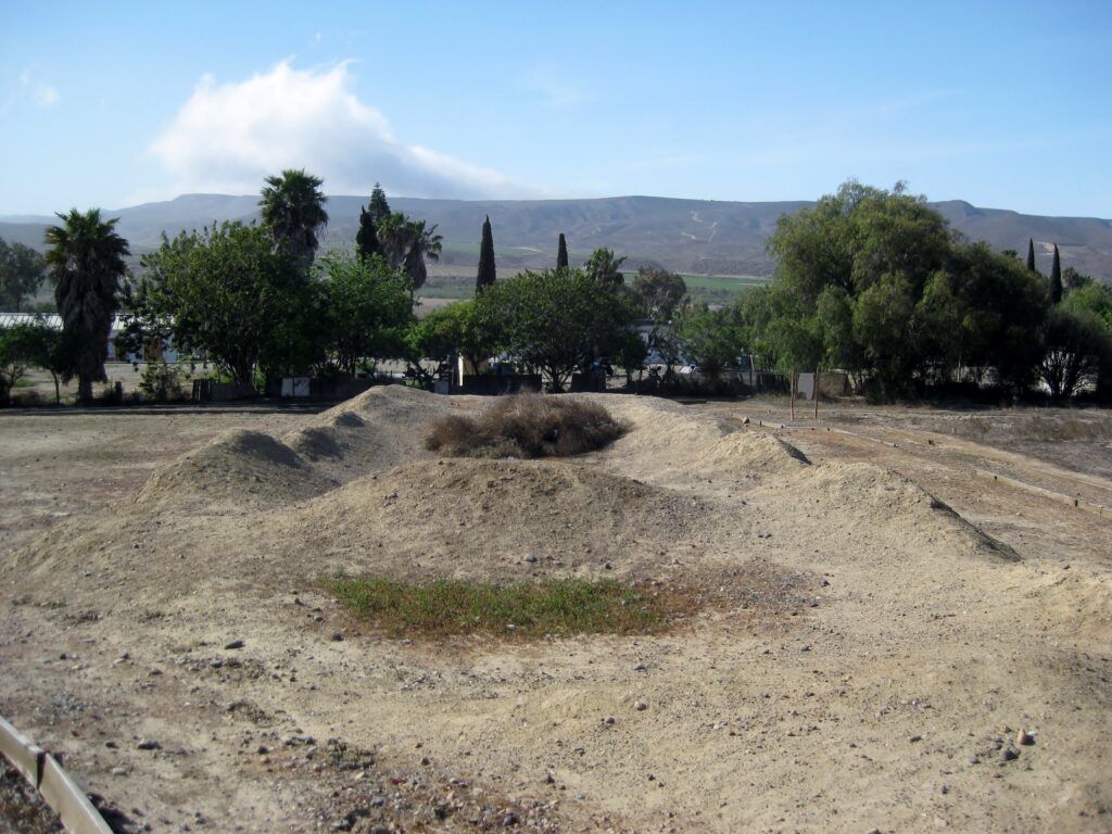
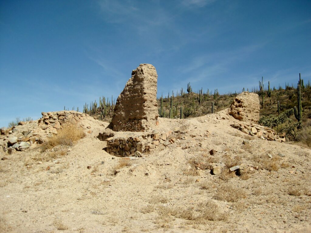
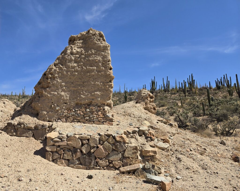
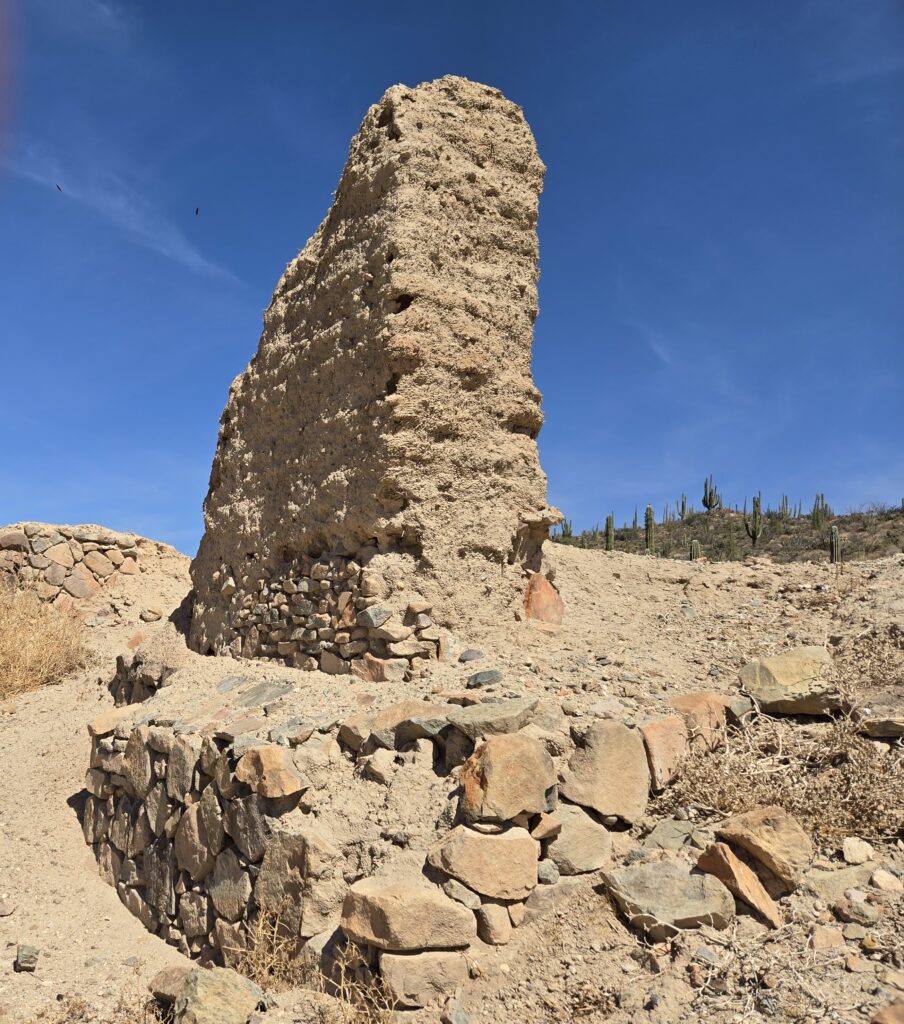
MISSION SANTO DOMINGO (1775-1822)
This is another mission complex that has been preserved and made into a park-like setting. Again, no caretaker was present, but the gate was open. I have been to this mission in 2005, 2014, and 2017. There has been additional plastering work since my last visit and some scaffolding is in one room. The graded dirt road is 5 miles from Km. 169 (just north of the Colonia Vicente Guerrero town and long bridge over the Santo Domingo river).
 At the entrance to the mission valley, 2 1/2 miles from where Santo Domingo is now located, the mission was first established here, known as ‘Red Rock’. Services were performed in a cave.
See more of Santo Domingo: https://vivabaja.com/santo-domingo-in-photos/
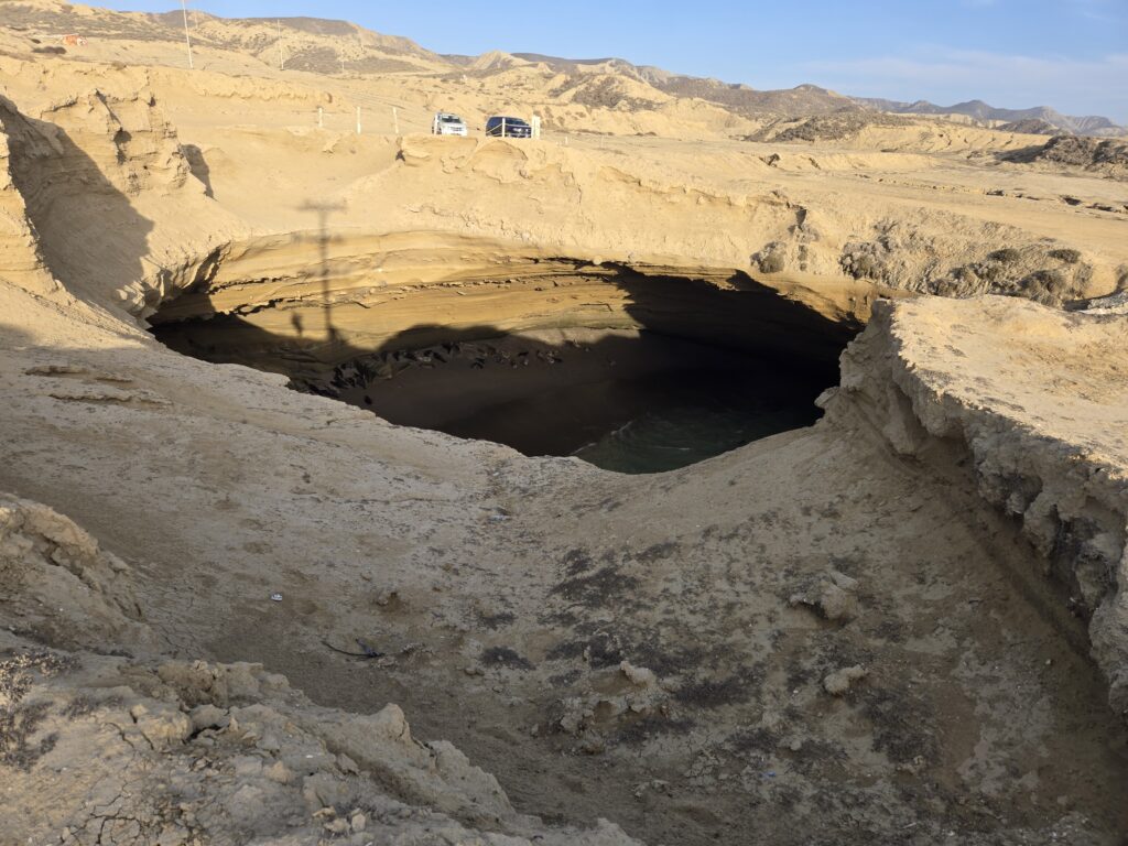
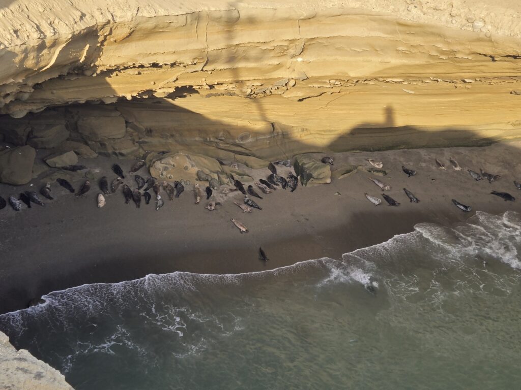
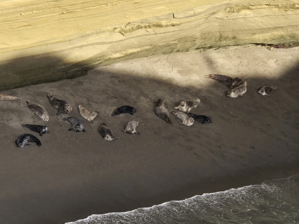
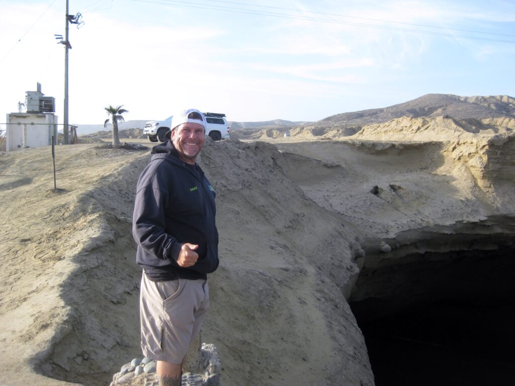
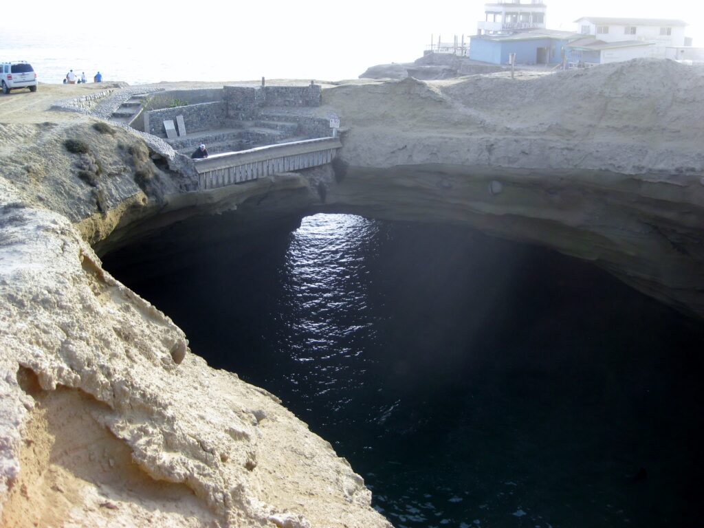
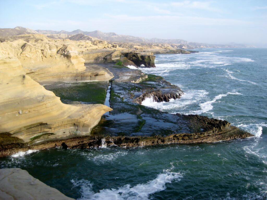
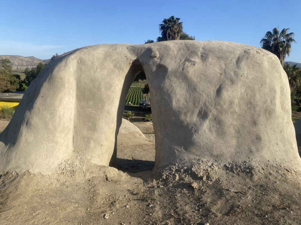
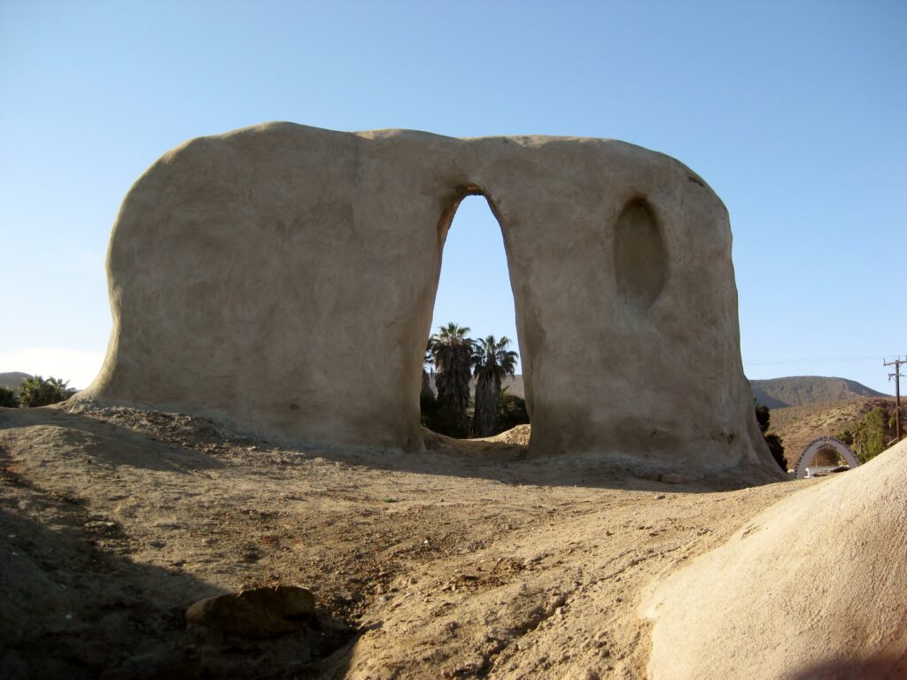
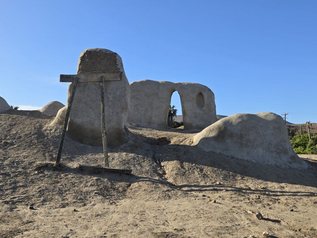
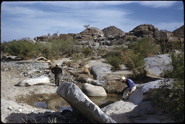
LA LOBERA
The last time I drove the three miles from Mex #1 (Km. 47.5) to the Sea Lion Crater (La Lobera) was in 2016. I had already been there several times since the first, in 2005. Each time it is interesting to look down on the marine mammals and a thrill, with that dramatic coastline. I recall that someone had posted there are a species of seal down there, as well.
In 2016, the arroyo crossing was pretty steep, 4WD was used, and a detour going a bit west was best. This last weekend, the original crossing was fine, but overall, I don’t recommend any passenger cars attempt the rough drive. It is maybe the longest three miles to drive in Baja!
There were a few people at La Lobera. An American couple, who were walking back to their car that they parked at the arroyo crossing. I saw more sea lions/ seals inside the crater this time than ever before. Some fellow, living inside the building, was asking for money to use the bathroom.
See more of La Lobera: https://vivabaja.com/la-lobera/
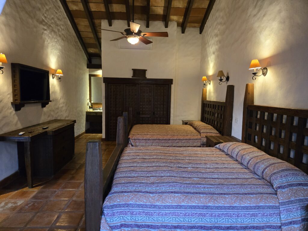
On to El Rosario and our room at Baja Cactus Motel (Km. 57, next to the gas station).
Tacos Misión, for dinner!
The town seemed pretty dead for a Saturday night. We drove the length, past Ed Lusk’s Baja’s Best B&B and the Turista Motel/ restaurant, both were pretty dark or closed. Hugo Lopez’ Taco’s Misión was brightly lit with cars in front, so that was a given as a place to eat.
Hugo was very happy to see me as it had been several years! Baja Angel (Elizabeth, my wife) and I own two of his paintings. He has a few still on display…
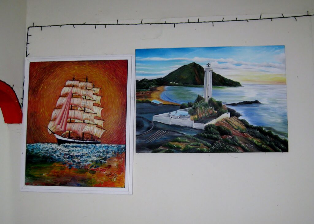
Hugo said he wasn’t painting (much) anymore… which he said to me back in 2017, too. He sure cooks some great loaded potato bowls (Papas Rellenos) and burritos. I had the Papas Misión and Dave had a quesataco, both were enjoyed. I couldn’t eat all of mine, it was so filling.
Hugo’s art on Baja Nomad forums (2004-2025)
The next morning we would visit both mission sites (El Rosario has two sets of mission ruins, 2+ miles apart) and went to La Bocana, El Rosario’s beach.
Sunday May 11, 2025
We talked about having breakfast, but neither of us were that hungry (for food), but we were hungry for adventure!
Just south of Baja Cactus Motel, turning right where Mex 1 makes the sharp left, is how you get to the sister village of Rosario de Abajo (Lower Rosario) and the second Rosario mission location. The first location is just off Mex 1. We will go there when we head south a bit later this morning. This road to ‘Abajo’ is paved for a distance through ‘Arriba’ (Upper Rosario) and passes one road (to the left) that can be used to cross the riverbed (we came back on it). In short order, our road begins curving left to cross the riverbed, near the seafood processing plant.
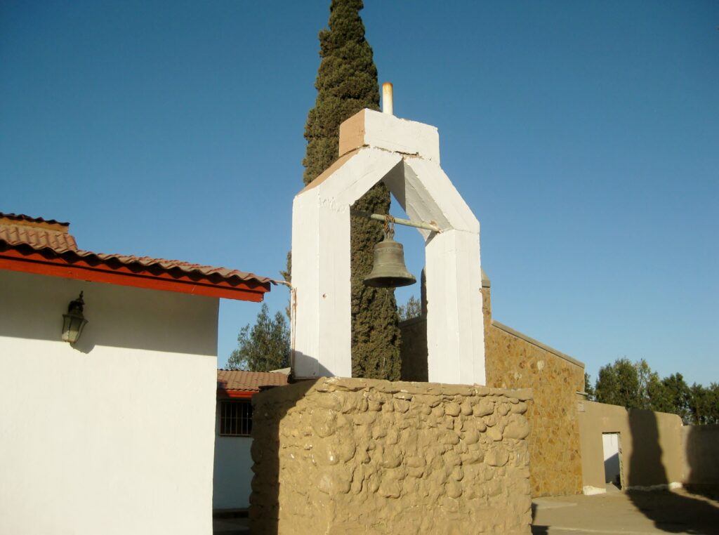
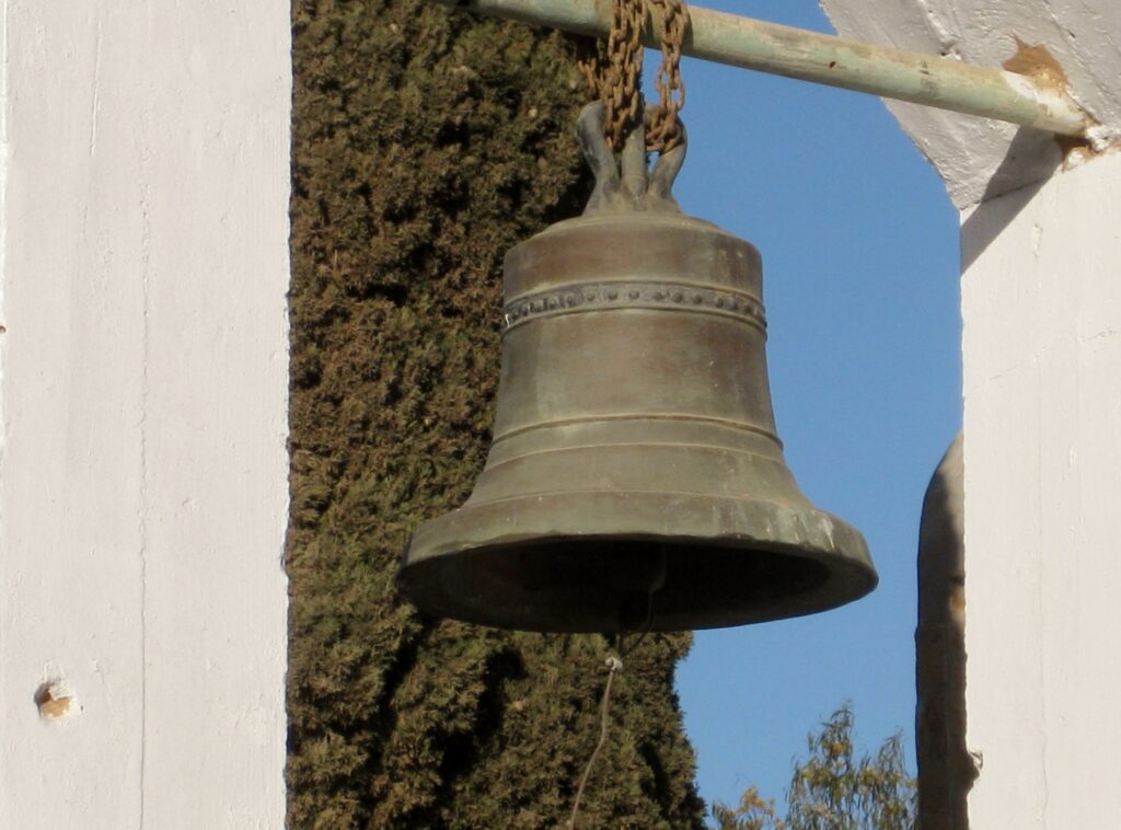
The river was dry this trip but has had water flowing in the past. On the south bank, this road turns west and passes through El Rosario de Abajo. A church, that is on the right, has one of the two surviving mission bells (or a facsimile bell). The other original one was reportedly sold in the 1960s, when the town needed money. Where it is now remains a mystery, but one report puts it at a San Ysidro, CA church.
MISSION EL ROSARIO (de Abajo), the second site of the Rosario mission. Moved to here in 1802 when the water source at the first site failed. This location is close to the river and planting fields.
Back in time…

See more of Rosario de Abajo: https://vivabaja.com/rosario-de-abajo-in-photos
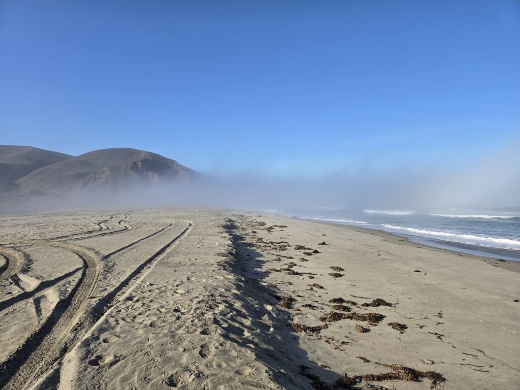
LA BOCANA (El Rosario’s Beach)
Driving back, we were stopped by a ‘Guardia Nacional’ truck full of armed officers… what used to be done by the army, performing a search of our truck. It was all friendly, and we were soon back in El Rosario and topped the gas tank at Antonio’s (Baja Cactus) Pemex.
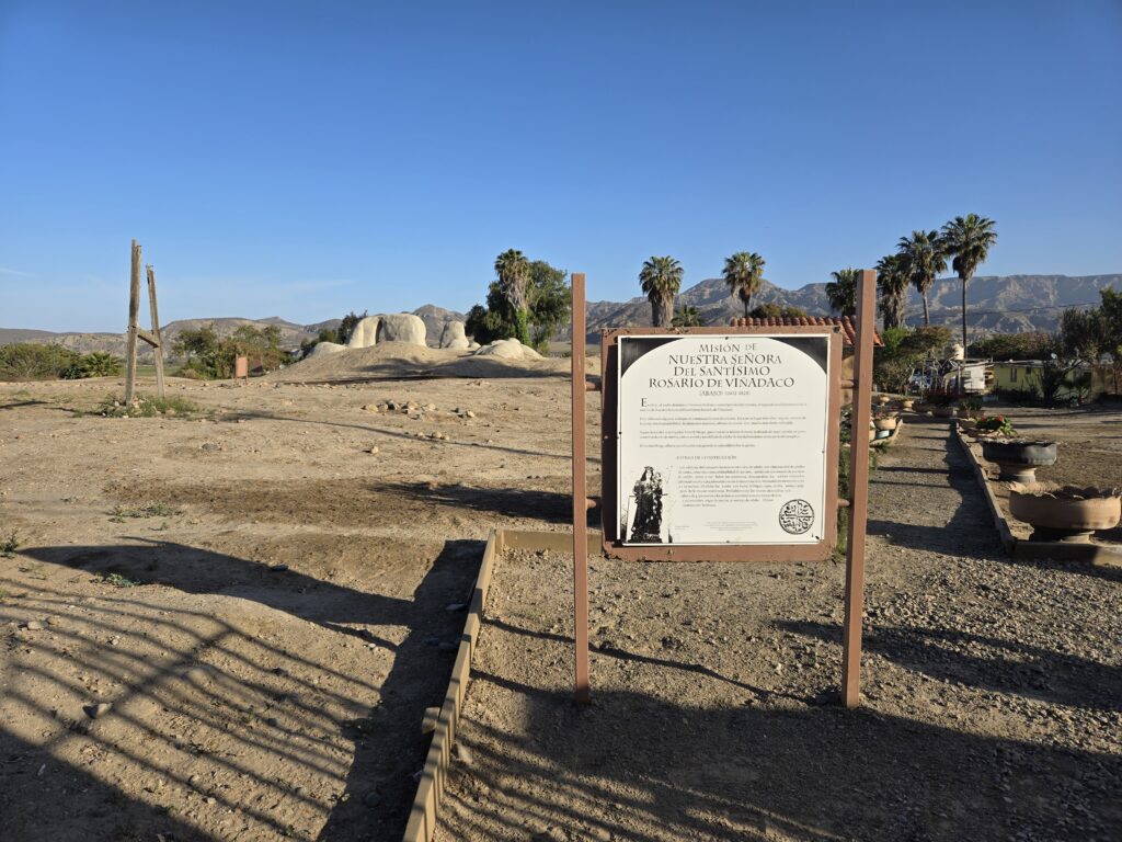
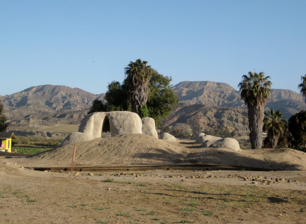
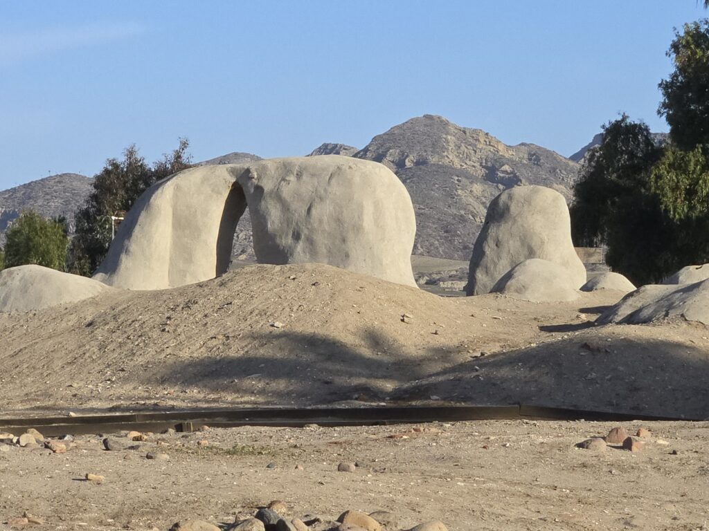
MISSION NUESTRA SEÑORA DEL ROSARIO VIÑADACO (1774-1822)
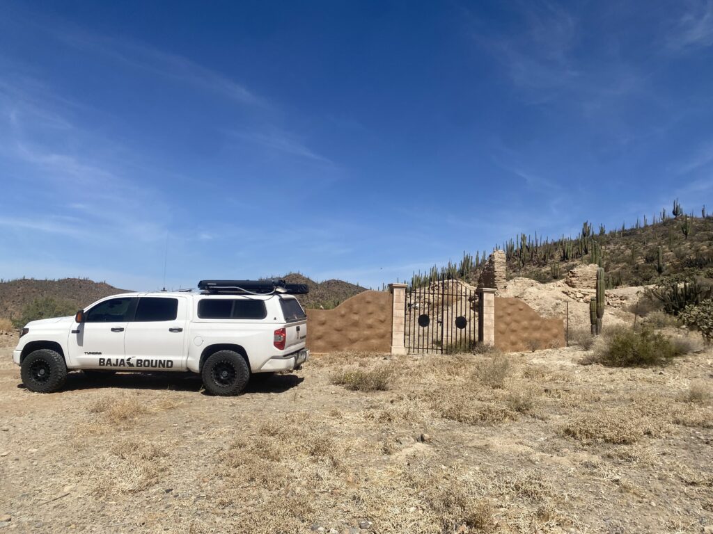
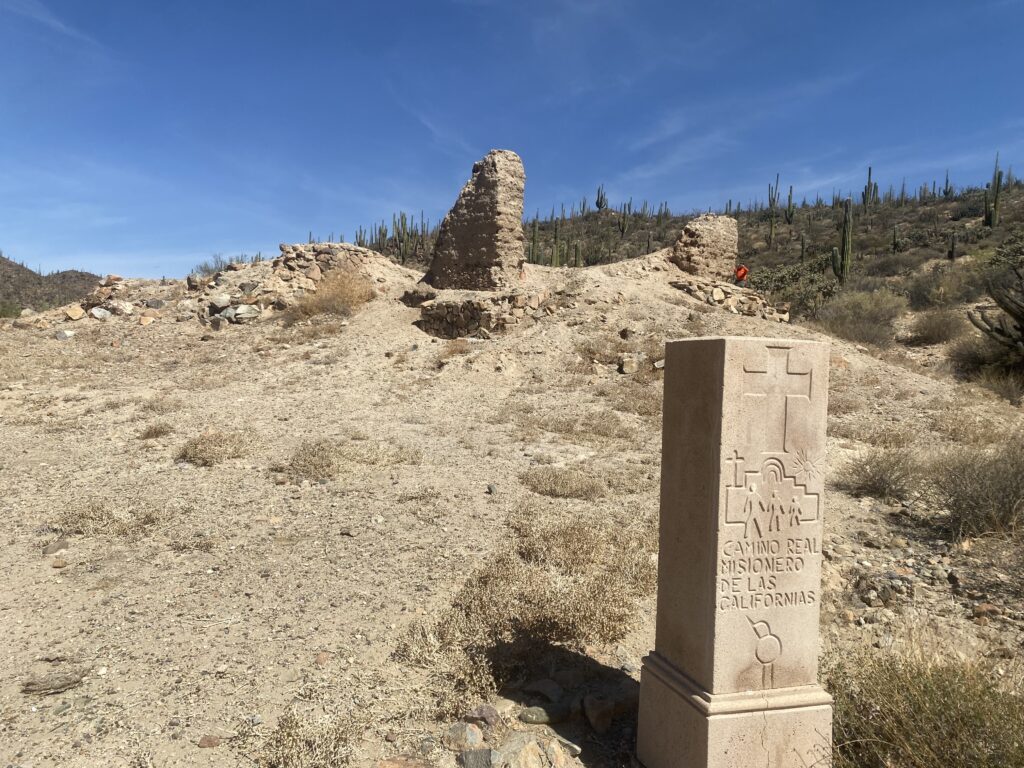
In El Rosario, just uphill of Mex 1, is the first California Dominican mission site, Nuestra Señora del Rosario de Viñadaco. It was officially founded on July 24, 1774, making El Rosario older than the United States!
No sign currently points out which street to take off of the highway. It is a concrete street just past the tire shop ‘San Borja’ (on the left). The mission is only a few hundred feet up the street, on the left. It is a larger complex than than the second location (‘Abajo’) we had just come from. Built more like a fort outpost, as the Spanish were not confident the Natives would be receptive.
The location was chosen when, on a previous expedition (seeking mission sites), the Dominican leading the way dug test wells and found the water table. The water began flowing in good quantity. The Dominicans had a dam built to store the water. In 1802, that water source failed, so they moved the mission closer to the river and a bit over two miles west. The first site became known as Rosario de Arriba (upper) and the new site was Rosario de Abajo (lower).
See more of Rosario de Arriba: https://vivabaja.com/rosario-de-arriba/
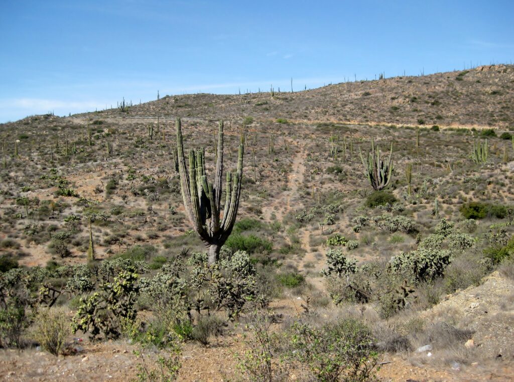
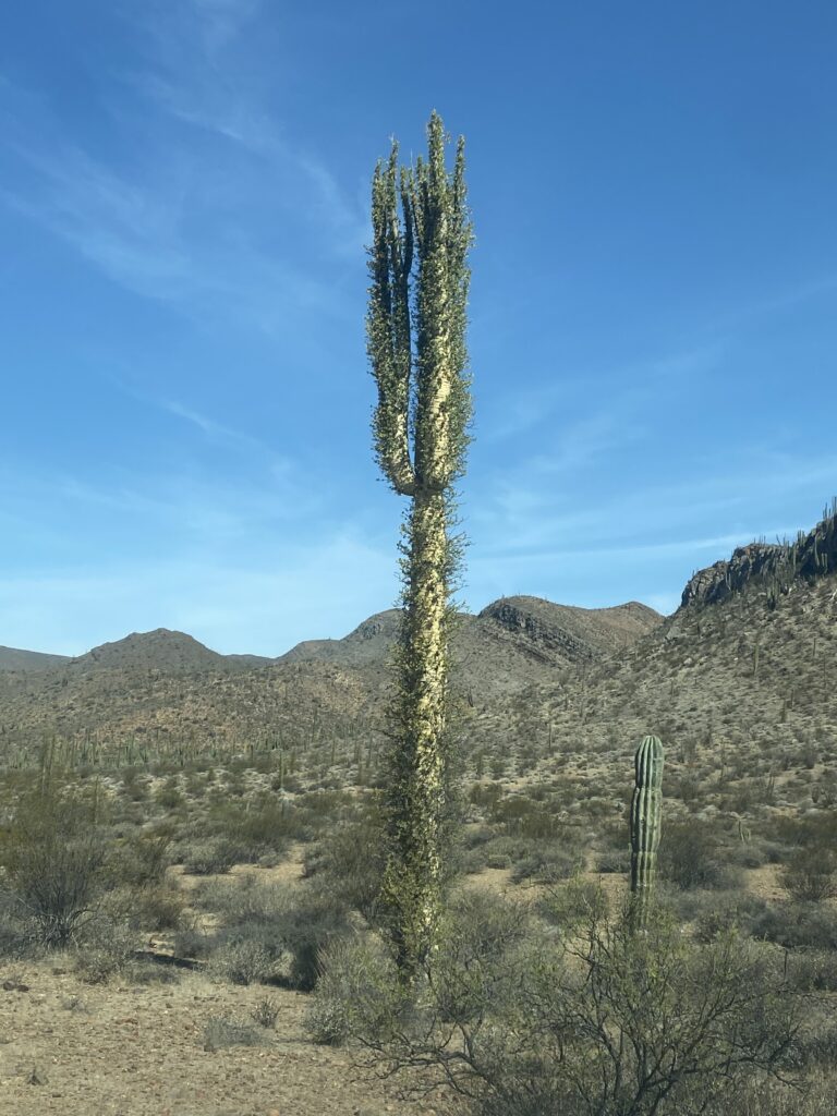
We leave El Rosario, and soon cross over hills covered with boojum (cirio) trees and giant cardón cactus.
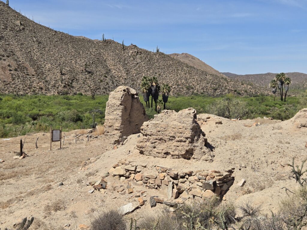
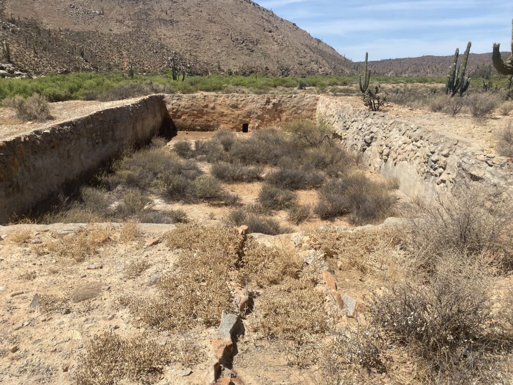
MISSION SAN FERNANDO (1769-1822)
We take the road to Mission San Fernando at the abandoned ruins of El Progreso restaurant (Km. 121). The farm, worked a few years ago, was also abandoned. The gate about a mile in, was open… all was good!
Now let’s go back 23 years >>>

Ever further back, 50 years (from 2025) >>>

99 years ago >>>

Let’s return to 2025:
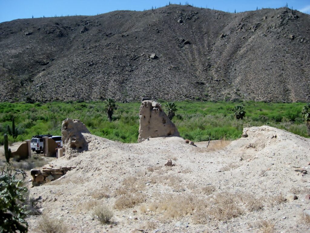
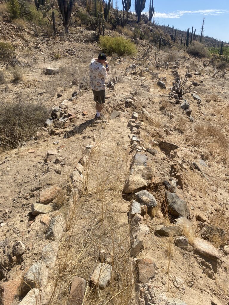
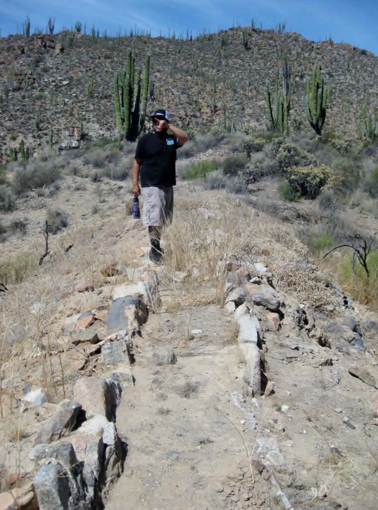
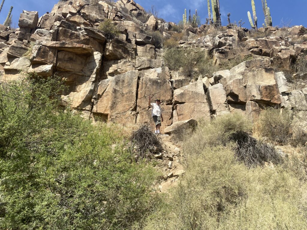
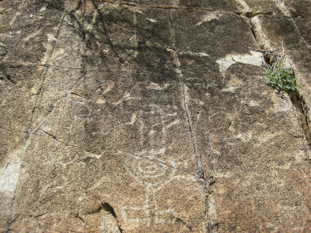
Next, we drive past the mission to see the petroglyph panel on the east-facing cliff, just a kilometer west.
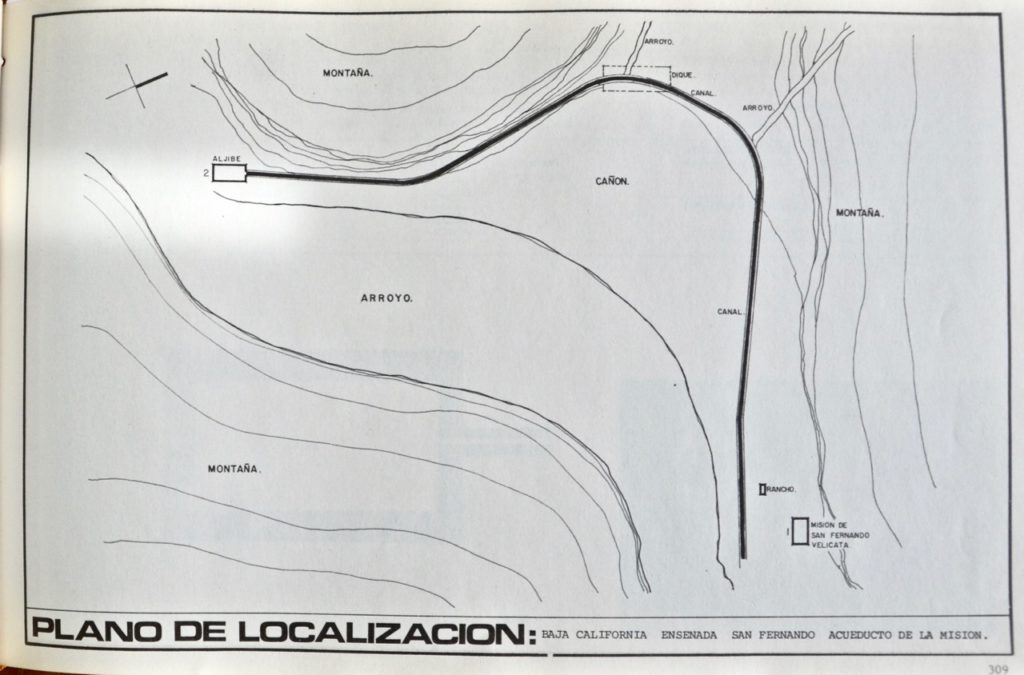
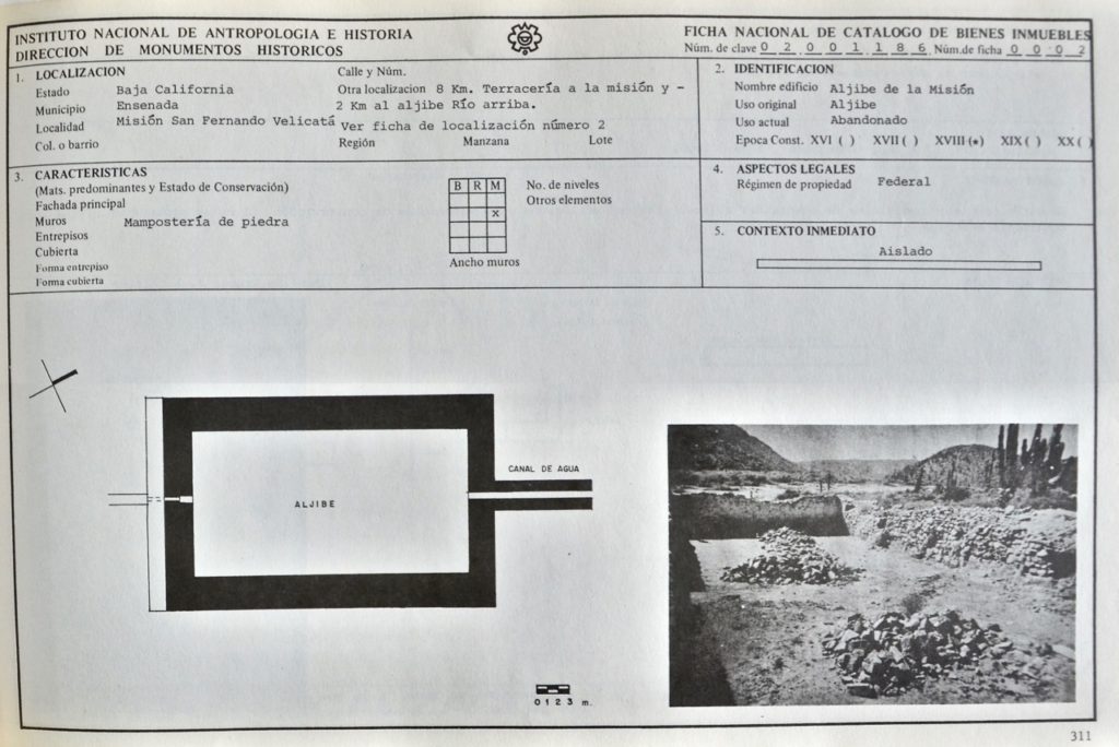
We drive about half the distance when the thorny trees overgrew too much into the road. Not wishing the scratch the truck any further, we get out and walk. Along the way, we investigate the mission’s aqueduct that once brought water nearly a mile from the river to a large reservoir (pila). A plan was made by INAH (Spanish for National Institute of Anthropology and History). It shows the aqueduct route…
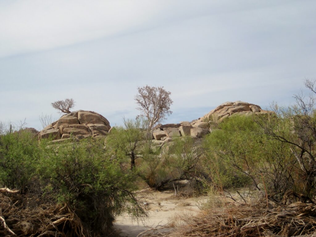
The petroglyph cliff of San Fernando
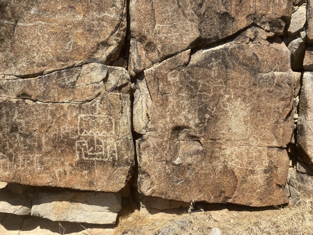
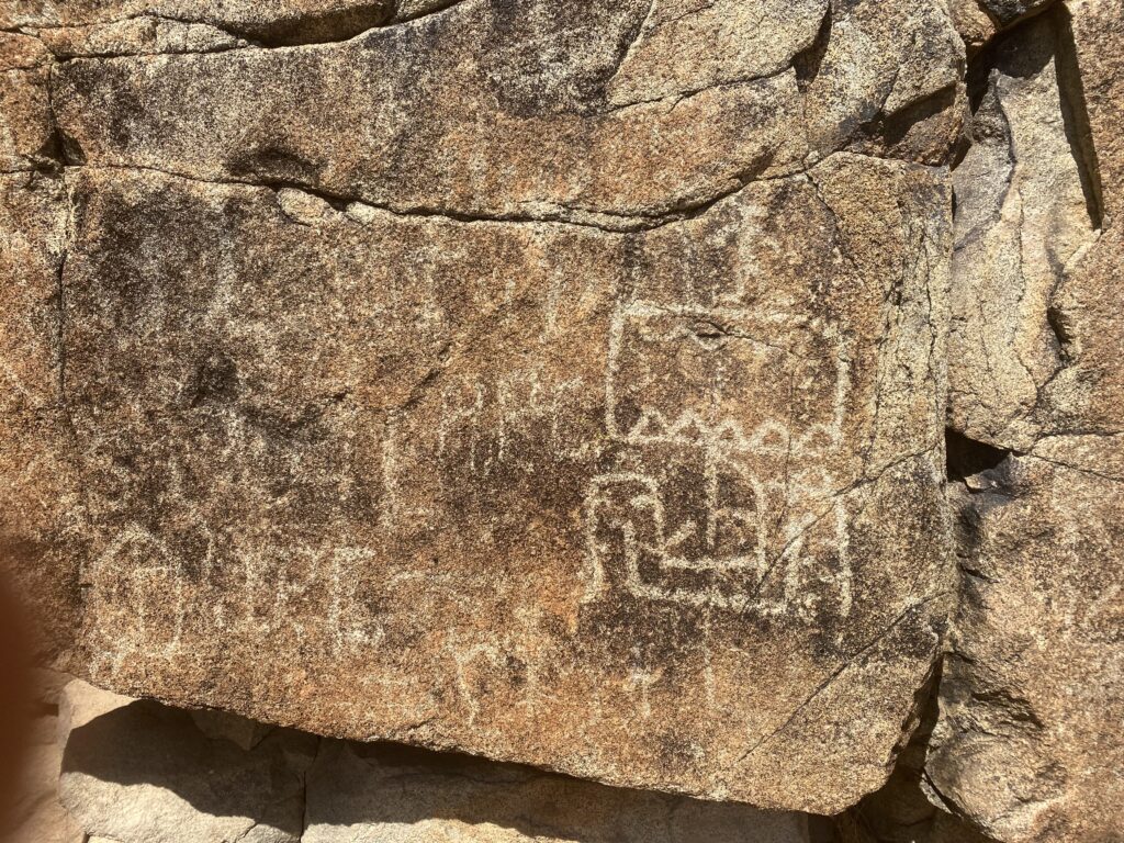
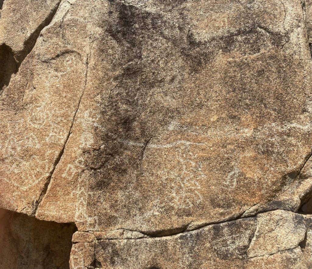
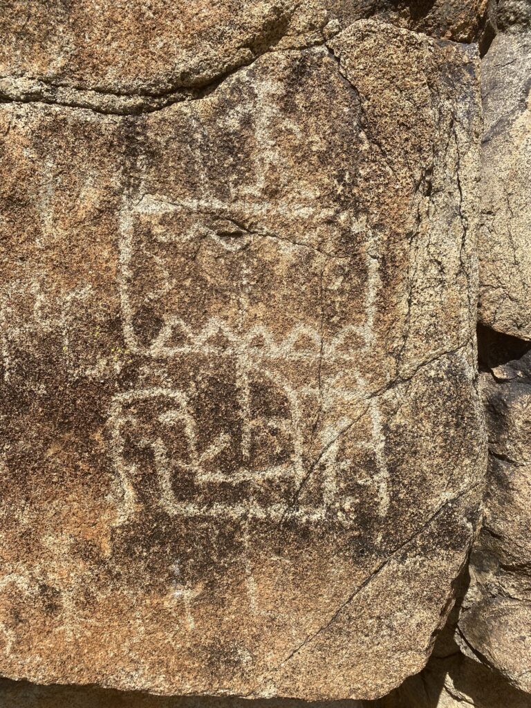
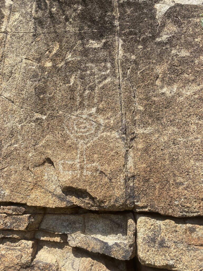
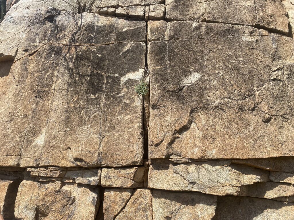
In the morning sunlight, the markings are less noticeable. They look better in the afternoon. I have been here many times since the first, in 1974.
See more of San Fernando de Velicatá: https://vivabaja.com/san-fernando/
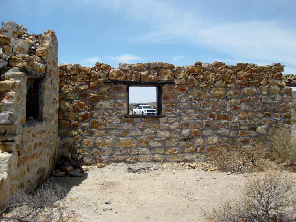
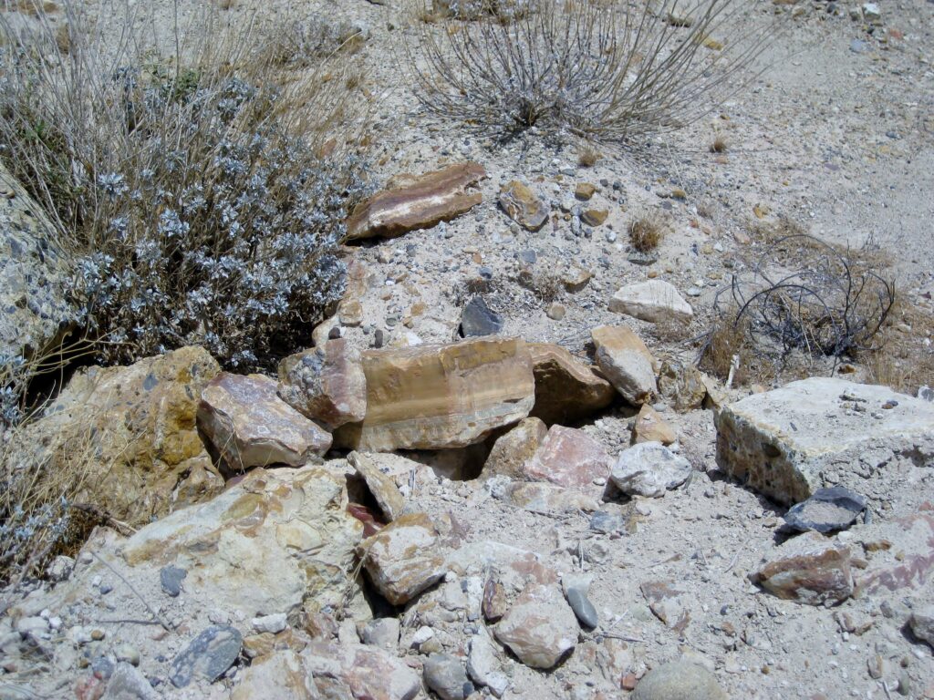
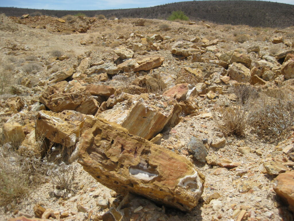
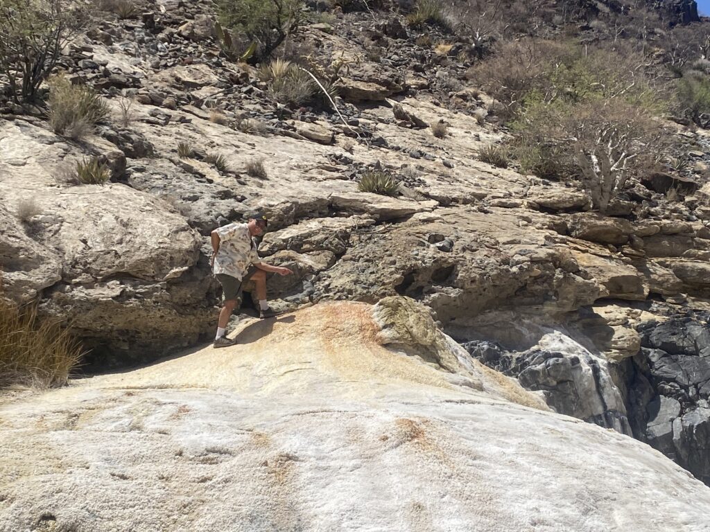
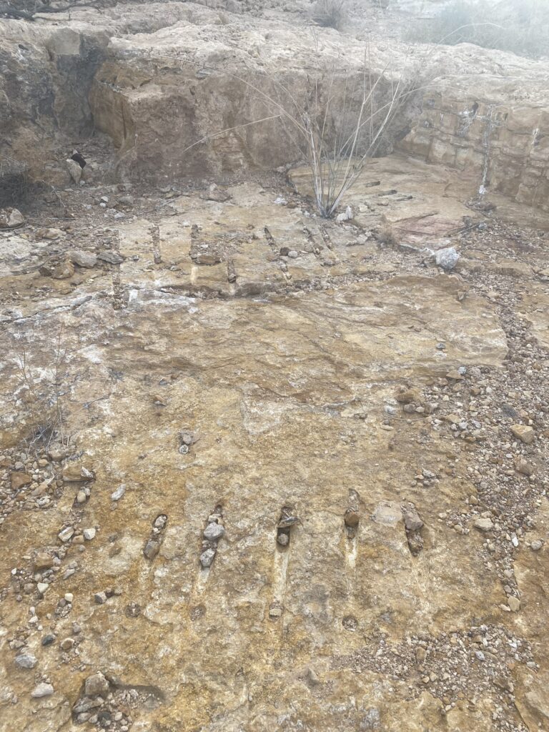
The next destination for us was the onyx quarry of El Mármol with its ‘world-famous’ onyx built schoolhouse (50% was demolished for the precious stone, unfortunately). Along the 15 km./ 9.3 mile road from Mex 1 (Km. 149), we stop for a photo about where I did during Spring Break, fifty years ago, in 1975.
EL MÁRMOL (Km. 149 + 15 kms./ 9.3 miles in):
The following two photos are from 1952, by Mike McMahan and his friends:


The onyx works was shut down in 1958 with lack of demand of the elegant rock. All the people left, except for a caretaker. When I first visited, in 1974, nobody remained. Enjoy my history article on this place: CLICK HERE
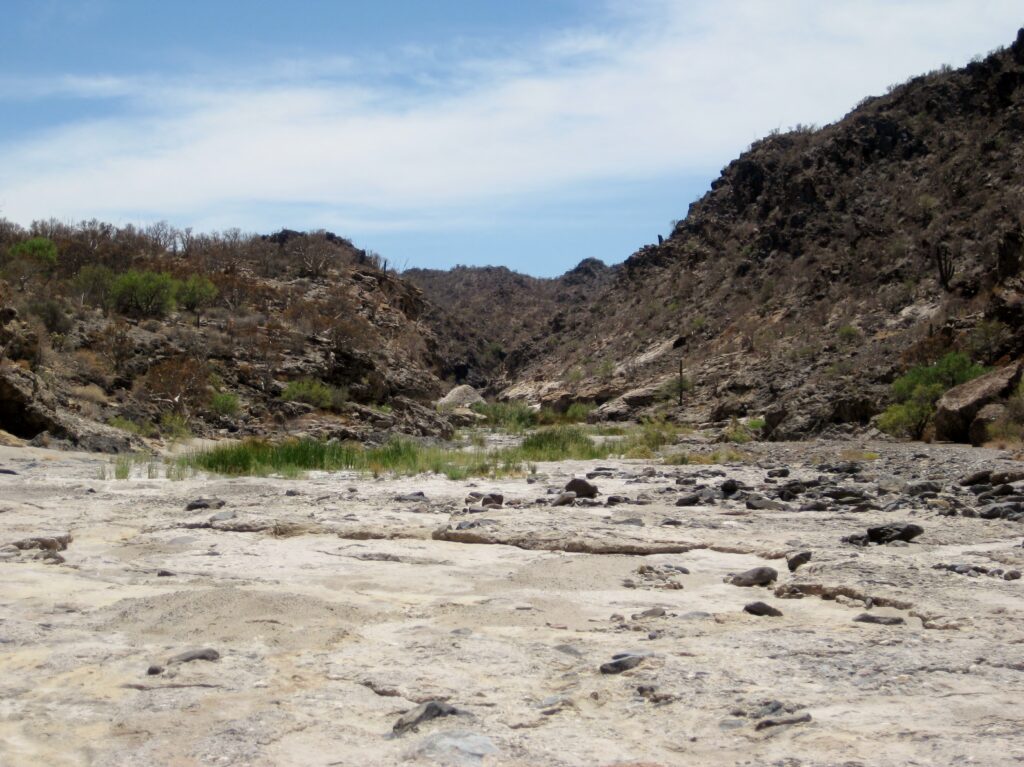
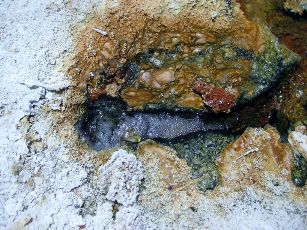
Next, we drive the four miles to Arroyo el Volcán, in hopes of seeing the monthly eruption of Baja’s cold-water geyser! El Volcán is where one can see how onyx is made, a few inches every hundred (or maybe thousand) years. Go the four miles to the arroyo of El Volcán (some maps misnamed it ‘Zamora’) and turn right in the arroyo. Park and walk the 1/4 mile to the geyser dome and soda springs.
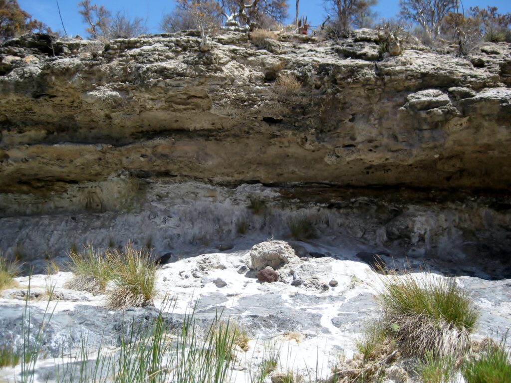
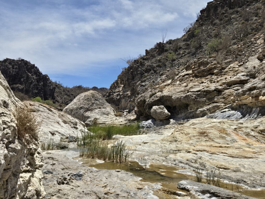
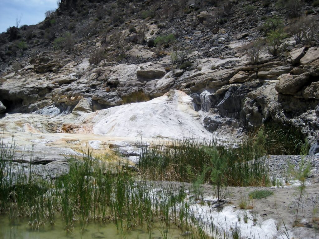
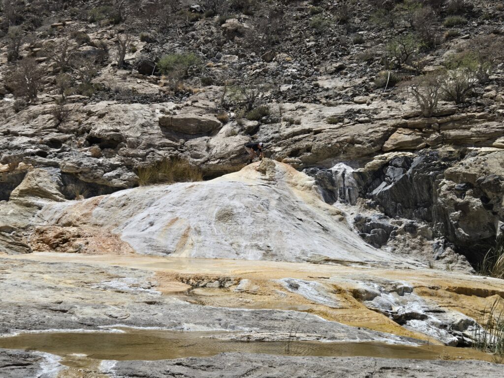
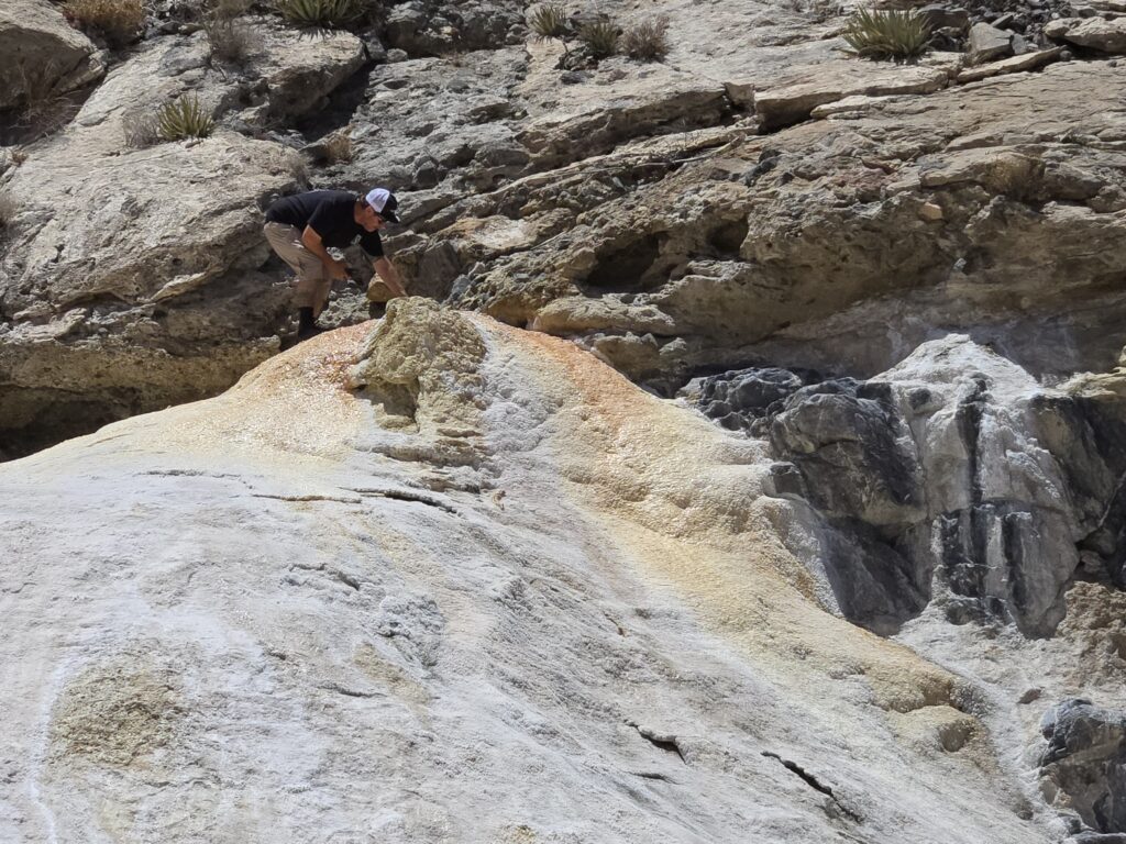
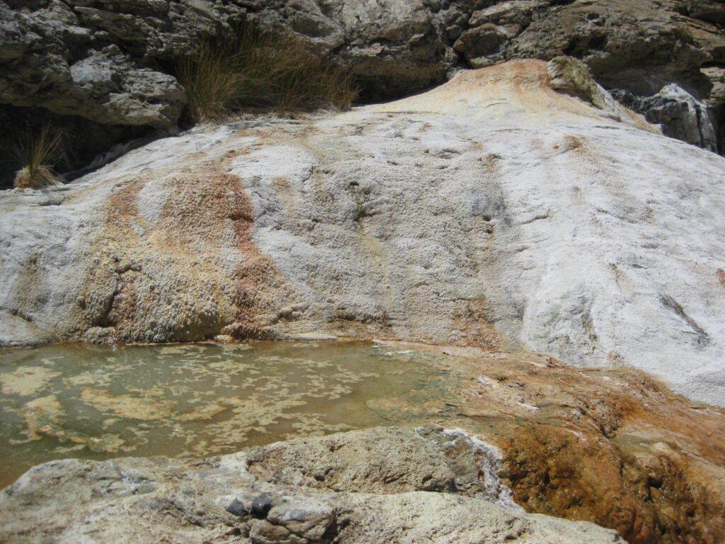
THE TOP OF EL VOLCÁN
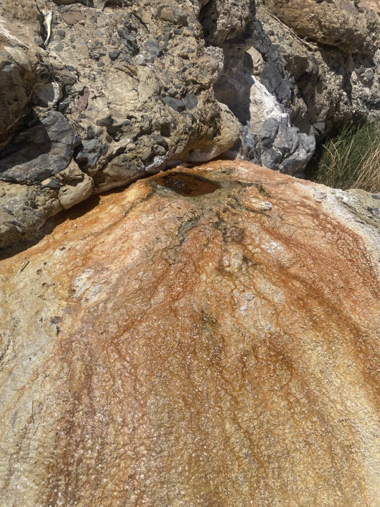
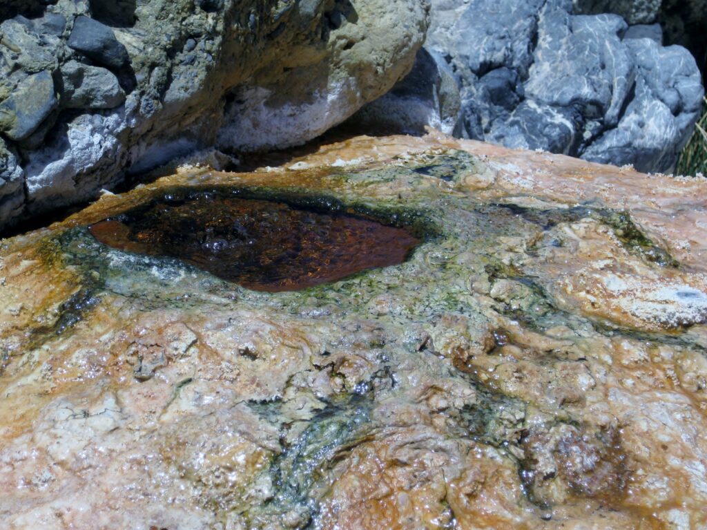
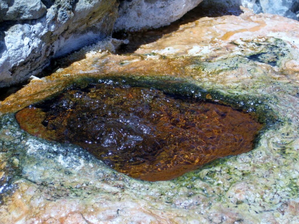
Another soda spring is near the bottom of the geyser dome.
Video clip of it, with sound:
I have a final close look. My previous times here were in 2003, 2006, & 2011 (click year to see).
Time to head back to the truck. Here is a last look around…

See El Mármol and El Volcán in 2006: https://vivabaja.com/marmol/ and in 2011 (with La Olvidada): https://vivabaja.com/p411/
We have an easy drive from El Mármol back to Mex 1 and turn south towards Cataviña and Laguna Chapala, making a small detour to Rancho Santa Ynez.
We pull off the highway at Km. 176 and see if it is possible to park at the foot of the boulder hill with the painted cave at the top. It was fenced off, and we just weren’t ready to do any hiking, not yet! Photos in the painted cave: https://vivabaja.com/p703/
The area is all very desolate, with no traffic, and a bit sad more people aren’t experiencing this land. Nothing new to report at Cataviña (Km. 179), and still no open Pemex station, other than the couple of independent vendors that sell gas from cans (filled in El Rosario). At Santa Ynez (~Km. 180.7), the gate to pass through for Mission Santa María was closed. If needed, an alternative is to simply drive in the arroyo to where the road from that gate joins in.
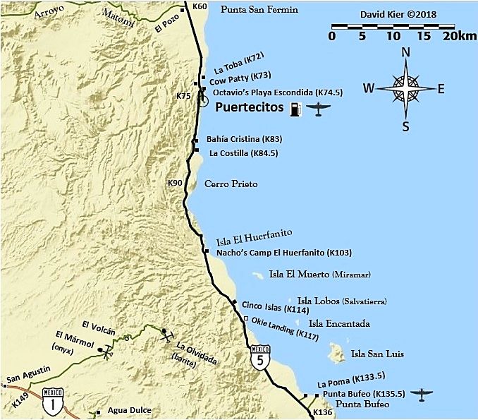
Dave and I were pretty worn out from all the hiking at San Fernando, El Mármol, and El Volcán. Still, we just wanted to press on, see more stuff, but get to Dave’s beach house (closer to San Felipe). We turn onto Mexico Highway #5 for the northbound leg of the trip.

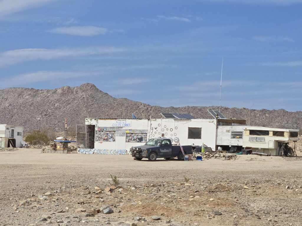
It is 22 kms (~14 mi) to (the new) Coco’s Corner, which is at historic Las Arrastras (gold grinding mills, in the arroyo just south of Coco’s). Coco passed away in 2022, just over a year after moving his home & business to this spot. His assistant continues the business, selling beer and sodas. Read more about Las Arrastras, CLICK HERE
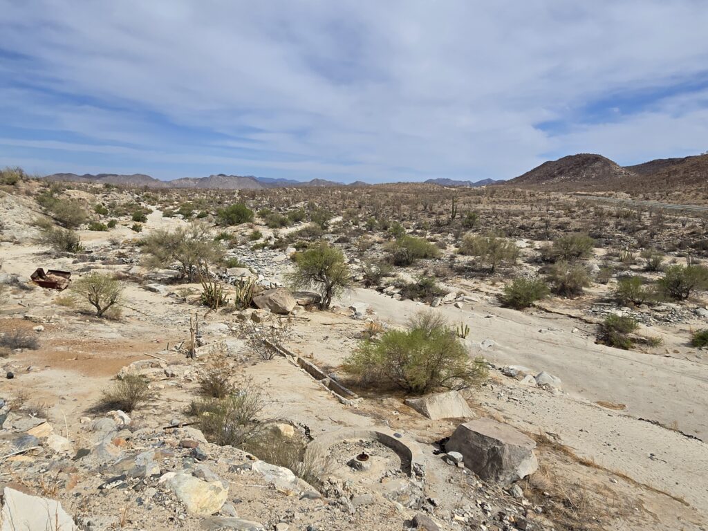
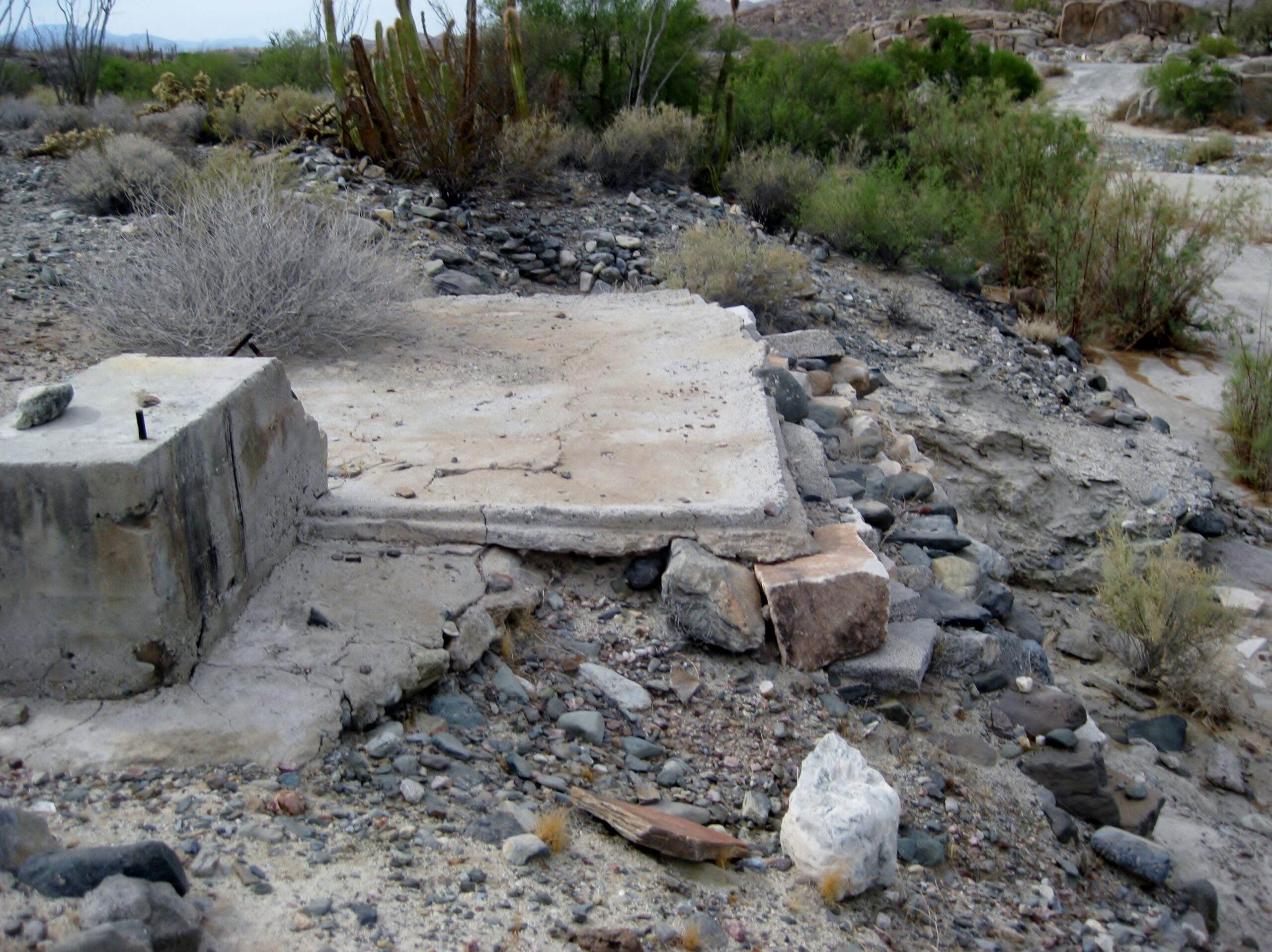
Las Arrastras ore mill at bottom of photo, east of the highway bridge and south of Coco’s Corner, Km. 179.5.
POZO de SAN FRANCISQUITO, west of the Km. 179 marker
On May 4, 1769, Padre Junípero Serra said mass at the deserted church at Calamajué, sent letters that required his attention back to Mission San Borja, and traveled to San Francisco*. Serra said the mail ‘went a little after midday’ (meaning he traveled that afternoon) to his next camp.
On May 5, he left [San Francisco] early and traveled the ‘most tortuous road’ to Mission Santa María, arriving at half-past eight. Considering the distance and terrain, he must have left well before sunrise!
The entire Serra diary (English and Spanish): CLICK HERE (the above lines are on page 57 of the first volume)
*Over time, the name of this spring was modified to San Francisquito, as we can see on old maps, dating back to the 1880s. https://vivabaja.com/maps/
Howard Gulick (Lower California Guidebook author) included it on his maps, and placed it just north of Las Arrastras. This waterhole was so important, the name was also applied to the arroyo (modern topo maps call it ‘Arroyo Las Arrastras’); the bay it empties into (typically called today ‘Gonzaga Bay’); Molino de Lacy (which was originally Molino San Francisquito); the Pioneer Mine (Mina San Francisquito); and the landing at today’s Punta Final Resort (orig. Puerto de San Francisquito). San Francisquito was so major, but in modern times, it is all but forgotten.
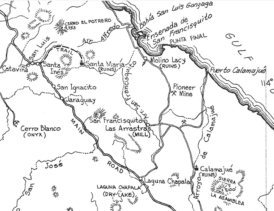
Howard Gulick’s map from the 1958 Lower California Guidebook.
Now, where the water surfaces moves about over the years. This is due to flash floods that move the sand, and more recently by the construction of Mexico Highway 5, which exposed the water table by a nearby bridge (~Km. 178). The https://CaminoRealBaja.com team even included a photo of that pool as being the ‘semi-destroyed spring’. Fortunately, Howard Gulick took photos during a 1959 trip with his associates at the natural pool that was Pozo de San Francisquito (at least where it was in 1959).
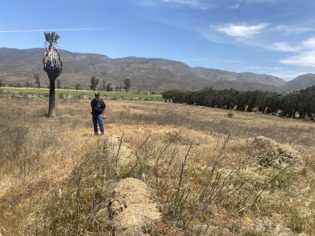
Dave and I pulled off the highway just south of that bridge and walked down into the arroyo, armed with the Gulick photos to try and match where they were taken. We saw the distant hills in the photos and knew we were near, and I finally found a water hole.
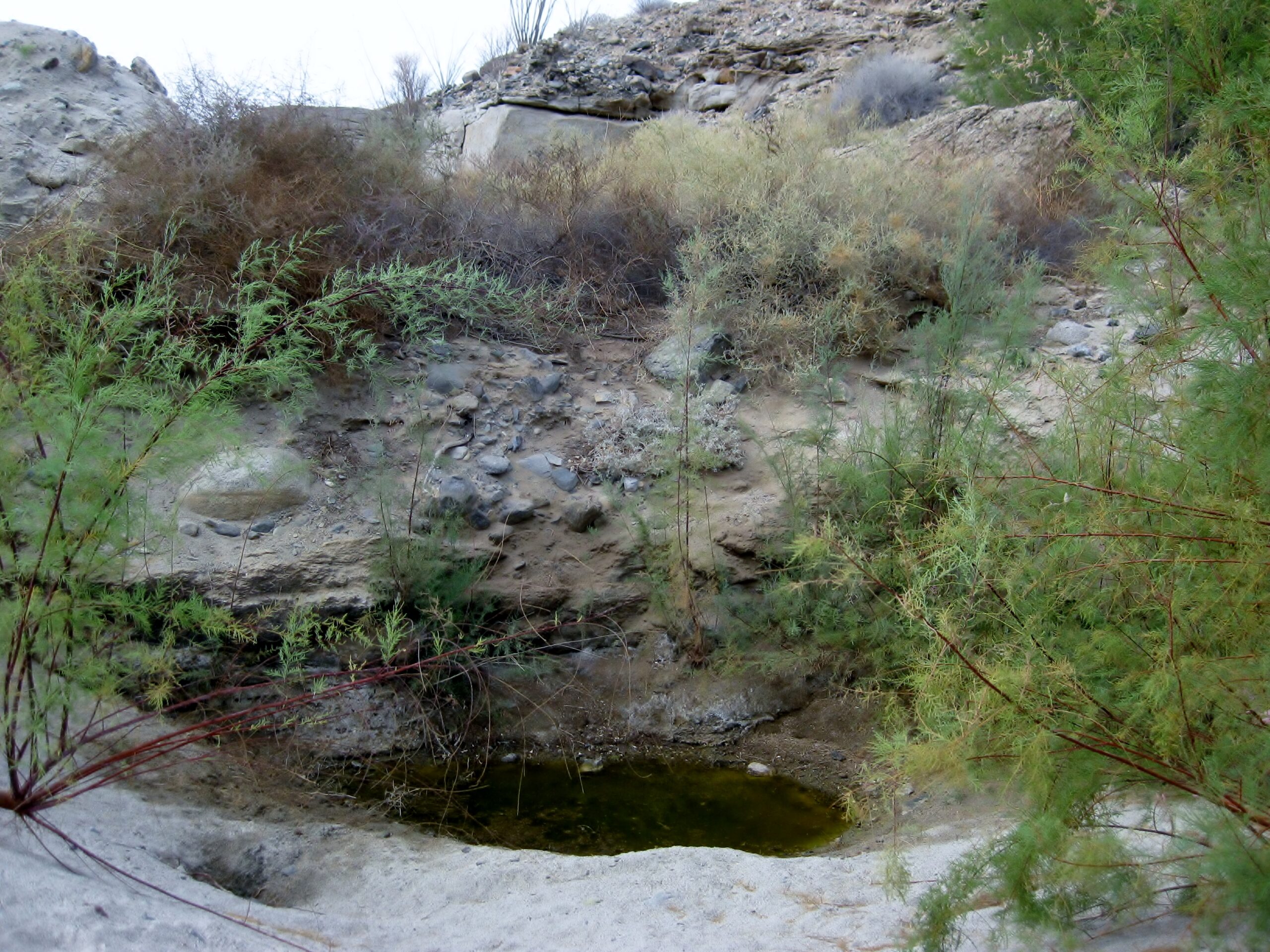
29° 33.135’N, 114° 20.643’W Pozo de San Francisquito, in 2025
It was a bit south of where the old photos showed, but I was happy! However, Dave was determined to find the same rocks as seen in the 66 year old photos. Being that I was so worn out, I sat and let Dave explore… and he found it, EUREKA! 29° 33.154’N, 114° 20.680’W
New trees and brush made recreating the exact photo spot impossible but there was no mistake, Dave found where Howard Gulick took the photos, where the pool of water was in 1959.
Two more Gulick photos, at another San Francisquito water pond:


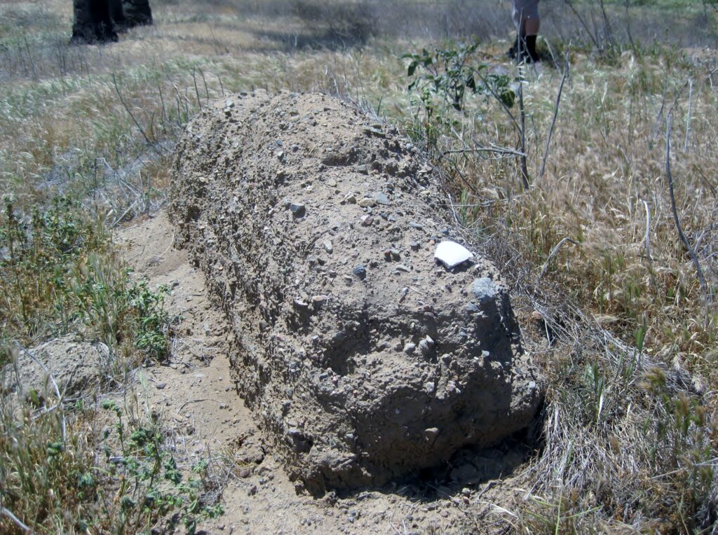
Gulick also wrote about gold mill artifacts here, and I found this on the west bank of the arroyo:


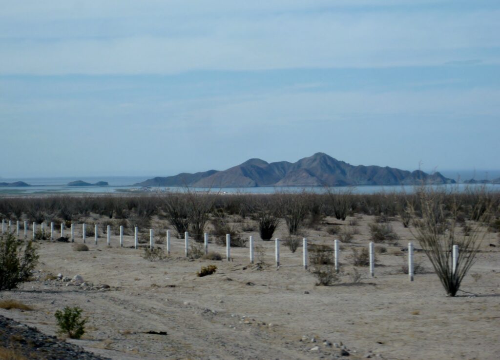
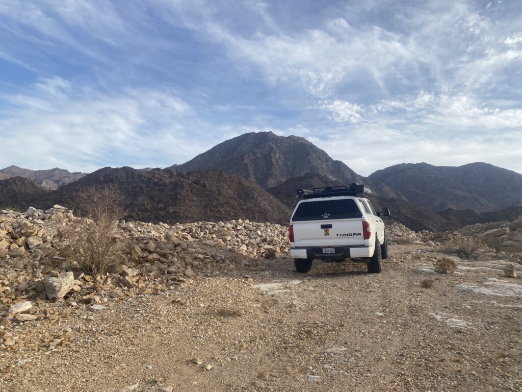
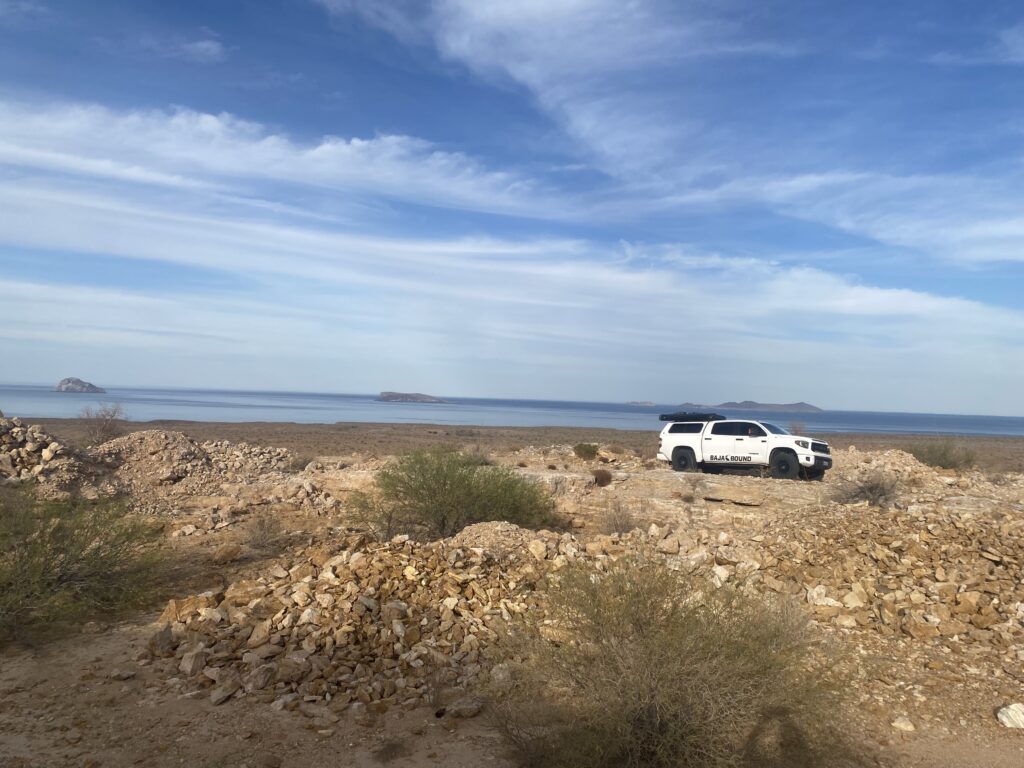
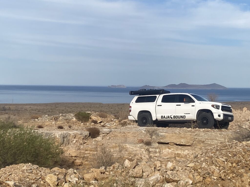
Gonzaga Bay, here we come!
Dave was as happy as I to have found the location of the 1959 photograph, with that uplifted flat rock. Now, we headed north, still uncertain of where that night would be. We grabbed a bag of ice and a soda at the Rancho Grande market (Km. 147) and drove into Papa Fernandez’ (Km. 143) in hopes of getting a meal. The doorway into the little restaurant was blocked, even though the ladies were inside cooking. A gringo was sitting outside of the kitchen door and said they were cooking… but we were not comfortable walking into their kitchen to get a seat. If they wanted business, then they would take the barricade away from the main door. I was hoping to show Dave the photo of Papa with John Wayne. We were hungry for a hot meal, so we elected to push north to Colonia Delicias and hopefully find one of the little cafe’s open there.
We did make time to check one of the sites on my list of places to see, the San Judas onyx mine. Just south of that road, we looked for another road that goes into the arroyo containing Agua del Mezquitito. Alas, we didn’t spot it.
San Judas was worked in the late 1960s and after. However, an onyx mine or discovery appears on maps of 1919 and 1930. More recently, see it on Cliff Cross’s Baja map of 1970. Topographic maps of the 70s (and after) show ‘San Judas’ and a landing strip for planes. The road is approx. at Km. 118.5, where there is a gap between the end of a guardrail and a white culvert. This is just south of the site of Okie Landing. The mine road parallels the highway for a bit, then there is a fork to the west, uphill. The airstrip was ditched sometime ago by the military to prevent use by drug runners. Park at the mine area, about one mile from leaving the highway. On Google Earth, you can see the airstrip and it’s concrete runup pad. The onyx dig is just west of there.
GPS: 29° 59.637’N, 114° 34.550’W
Photos of San Judas (Onyx) :
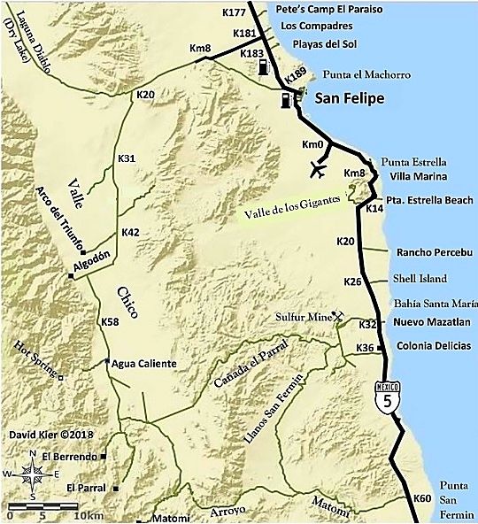
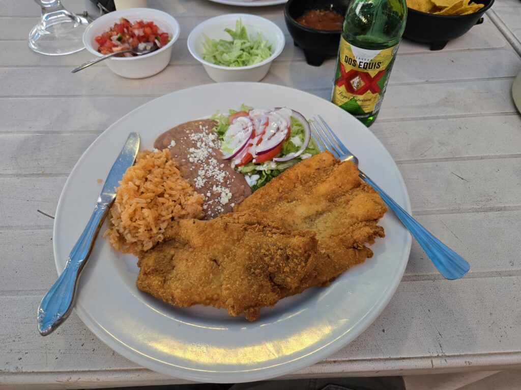
We continue the drive north to Colonia Delicias, and find Aniceto’s restaurant open (Km. 35.5). I had the breaded fish plate and ice-cold Dos Equis Lager. We visited with a couple of loco gringos there, as well.
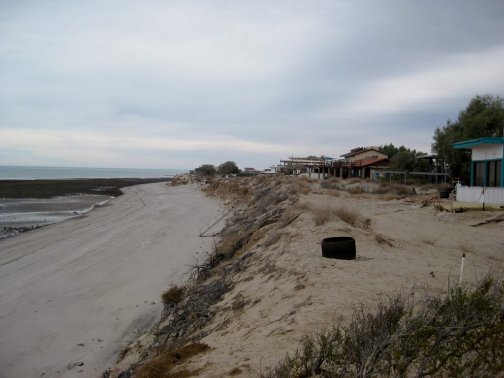
The evening was great and I slept on a cot, under the stars, with the lapping Sea of Cortez as a lull-a-bye. The weather was perfect on the beach, no wind, and not cold.
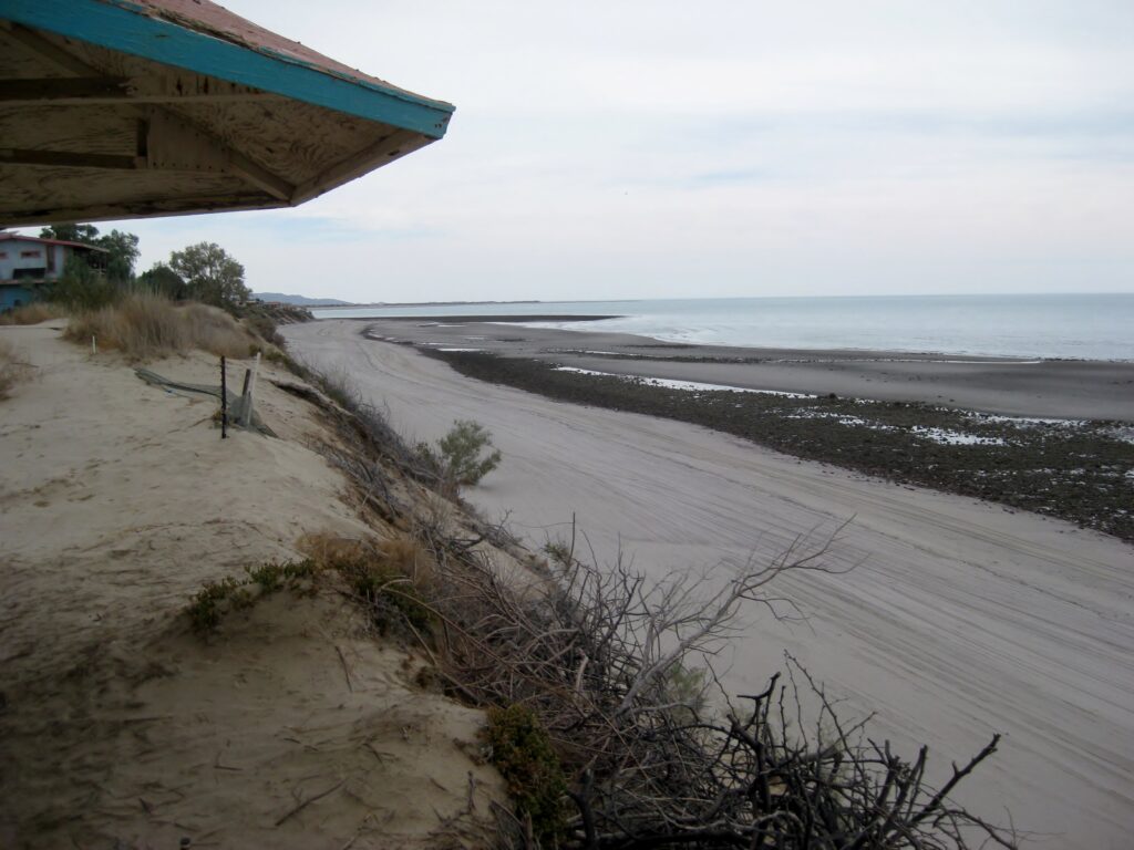
The next morning (Monday May 12, 2025) was ideal… high clouds made a beautiful sunrise and kept the sun from cooking us too early. I will guess it was around 80°. We packed up and drove into San Felipe for a really good breakfast, at the far north end of the Malecon. I ordered us a pitcher of (fresh squeezed) OJ to go with our chorizo or machaca and eggs. It was more juice than the two of us could drink, but I was celebrating and didn’t mind paying the 350 pesos. I just love fresh squeezed juice, so common in Mexico!
We headed for Tecate, via 2-D, west from Mexicali. The military inspection at the Mex 3 junction waved us through, but we were pulled over at the base of the Rumorosa Grade on Mex 2-D. It still went pretty quickly.

At the Tecate border line around 3:30 pm and it was 42 minutes until we got to the booth, showed our passports, and were waved on into the USA.
What a rush, in the past couple of days, we went to eight mission sites, Albertino Mine, La Lobera, Antonio’s luxurious Baja Cactus Motel, Hugo’s Tacos Misión (and art studio), El Rosario’s La Bocana beach, El Mármol and El Volcán, the spring were Serra and others on El Camino Real rested, and the San Judas onyx mine!
Overall, a super, jam-packed trip (or expedition). Dave and I were very happy to see as much as we could. A future trip will be back to Dave’s beach house and have some excursions: to see again for me, fist time for Dave, sites around Gonzaga Bay: missionaries’ warehouse site, the soda/onyx springs behind Rancho Grande, Molino de Lacy, and maybe the water of Las Palmitas oasis and La Turquesa Canyon.
***In May 2026, we will be going back for a second survey of Baja’s great points of interest between Puertecitos and Bahía de los Angeles, plus Mission San Borja!
https://VivaBaja.com Resource for Baja California travel planning, peninsula history, and my years of travel and sharing ‘Baja love’ and fascination (photos, TV, film, YouTube).
Facebook group ‘VivaBaja’ for Baja California back country travel, camping, off-roading discussion.