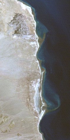
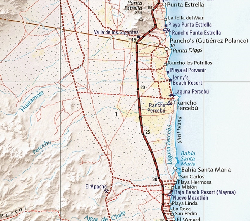
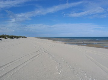
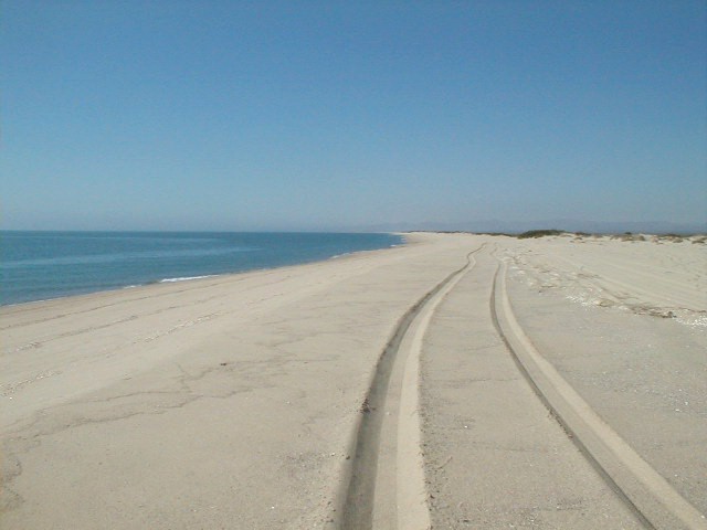
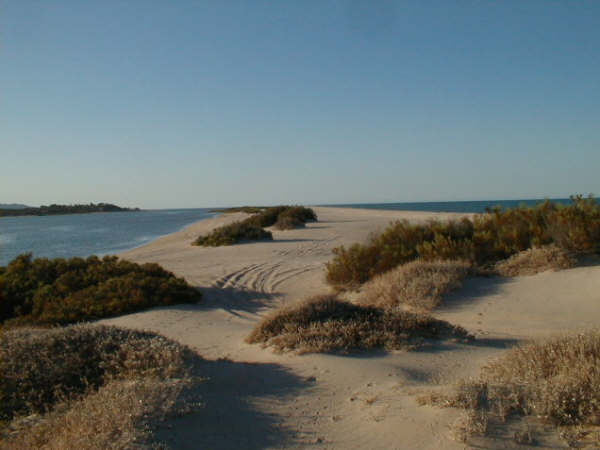
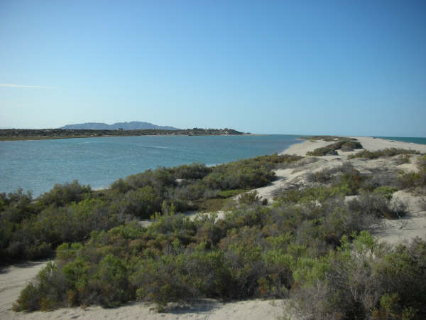
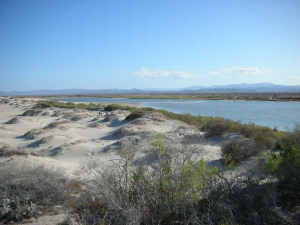
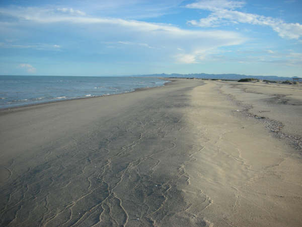
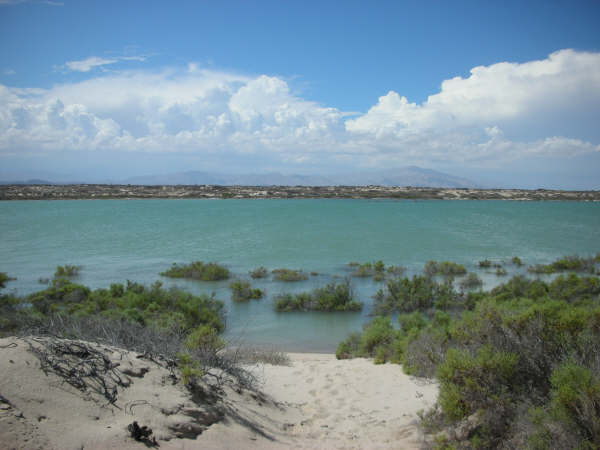
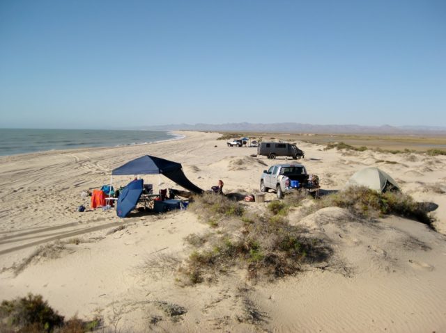
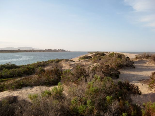
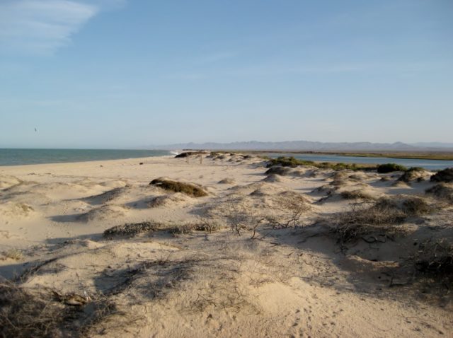
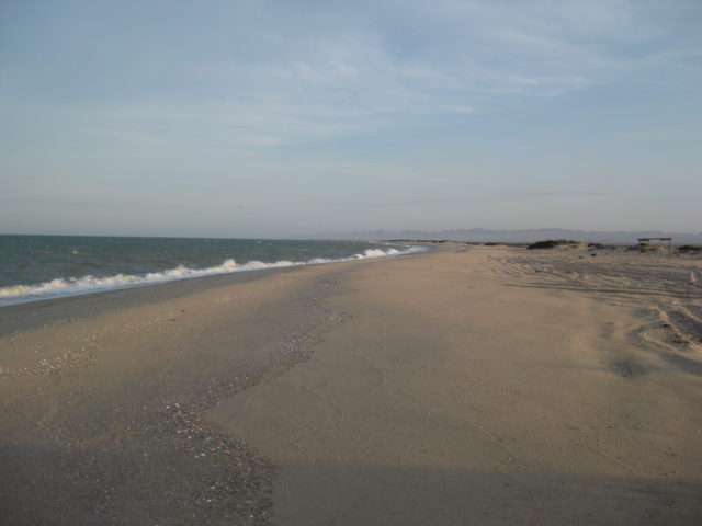
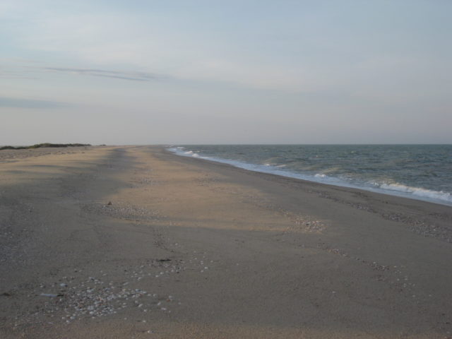
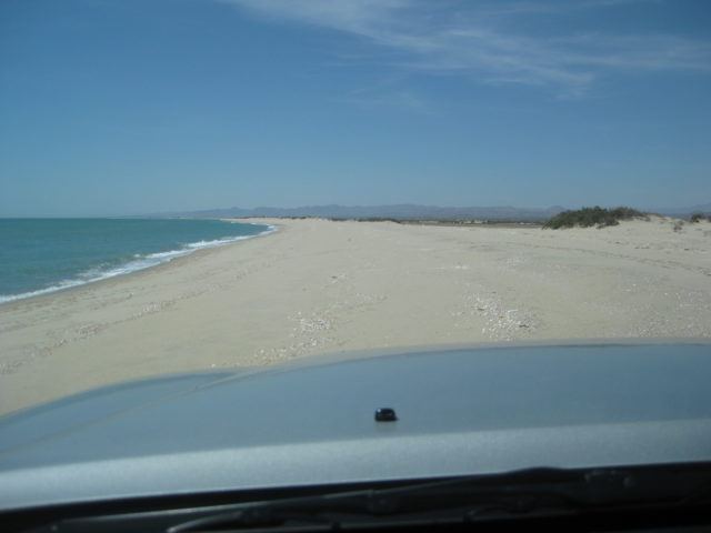
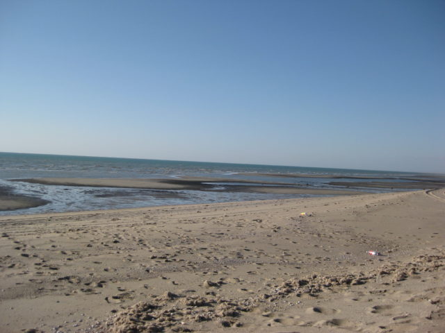
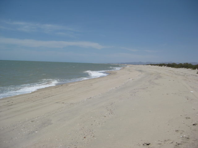
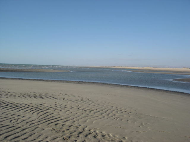
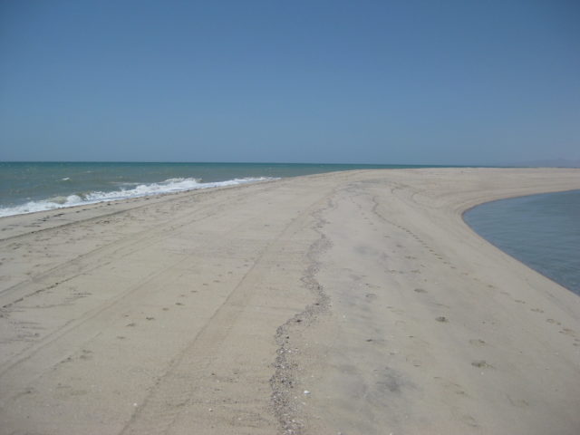
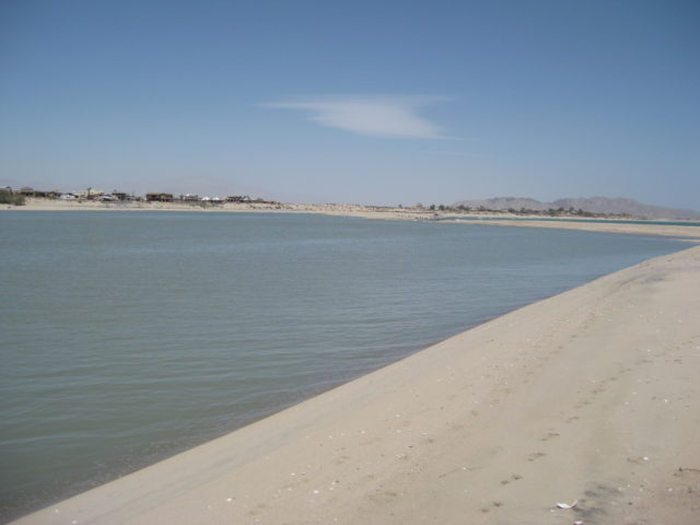
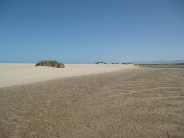
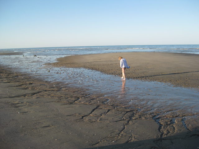
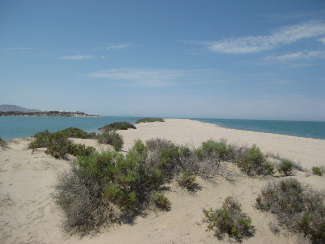
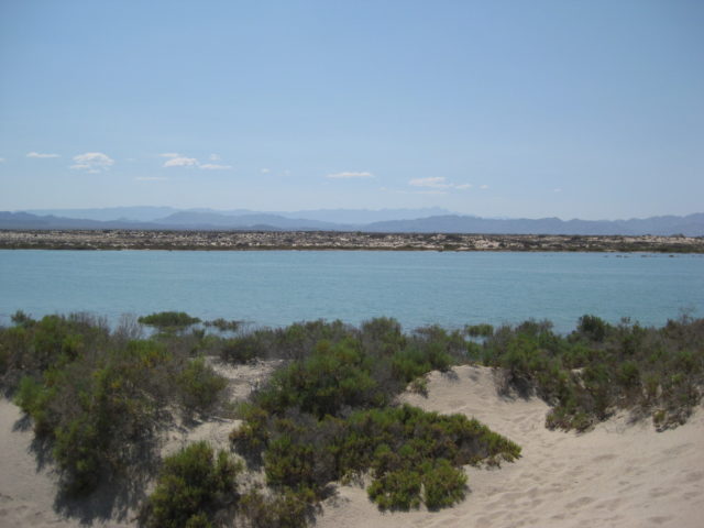
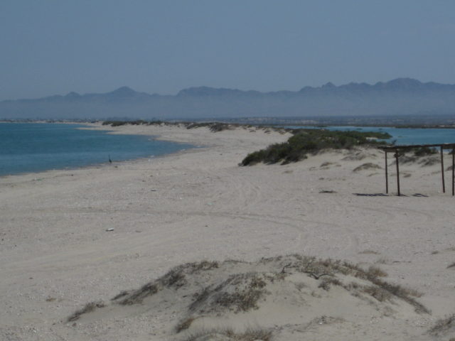
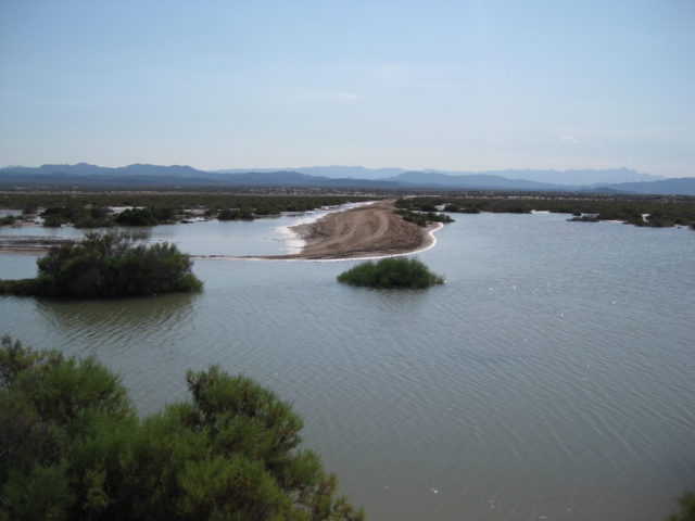
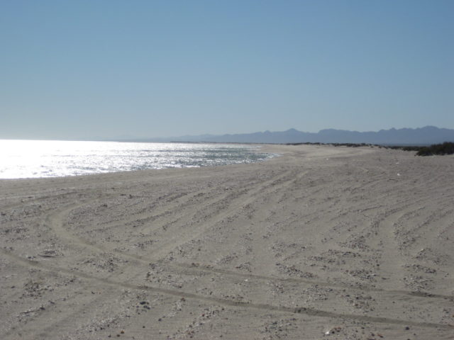
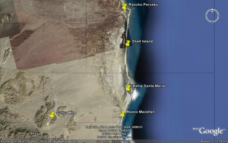
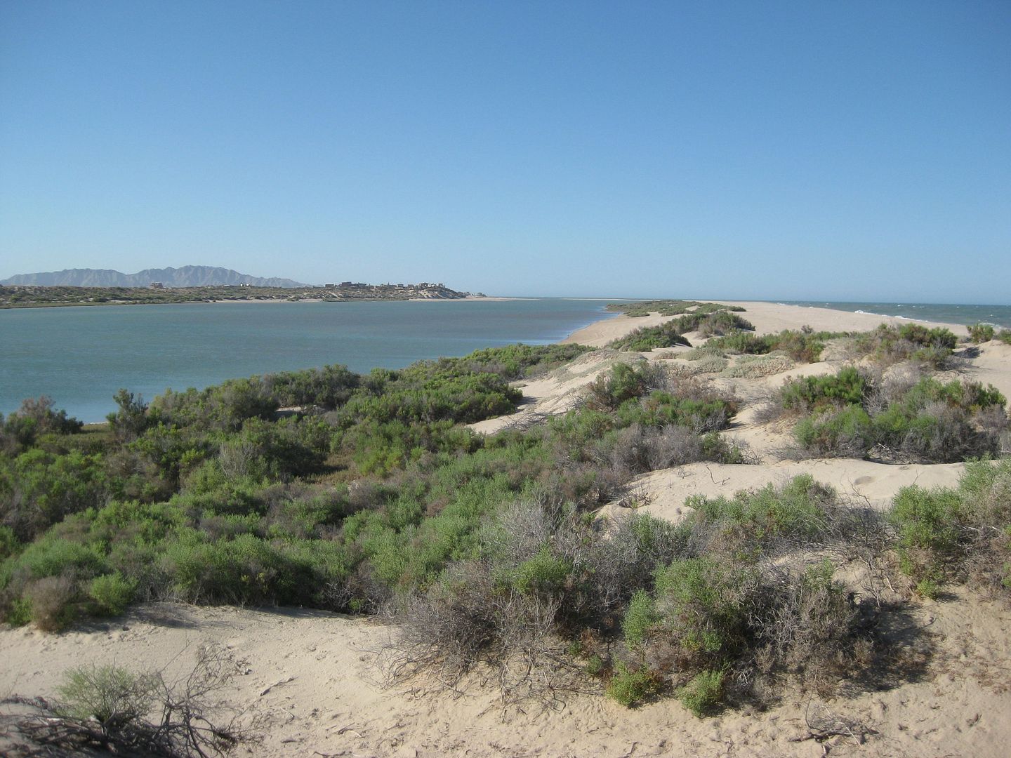
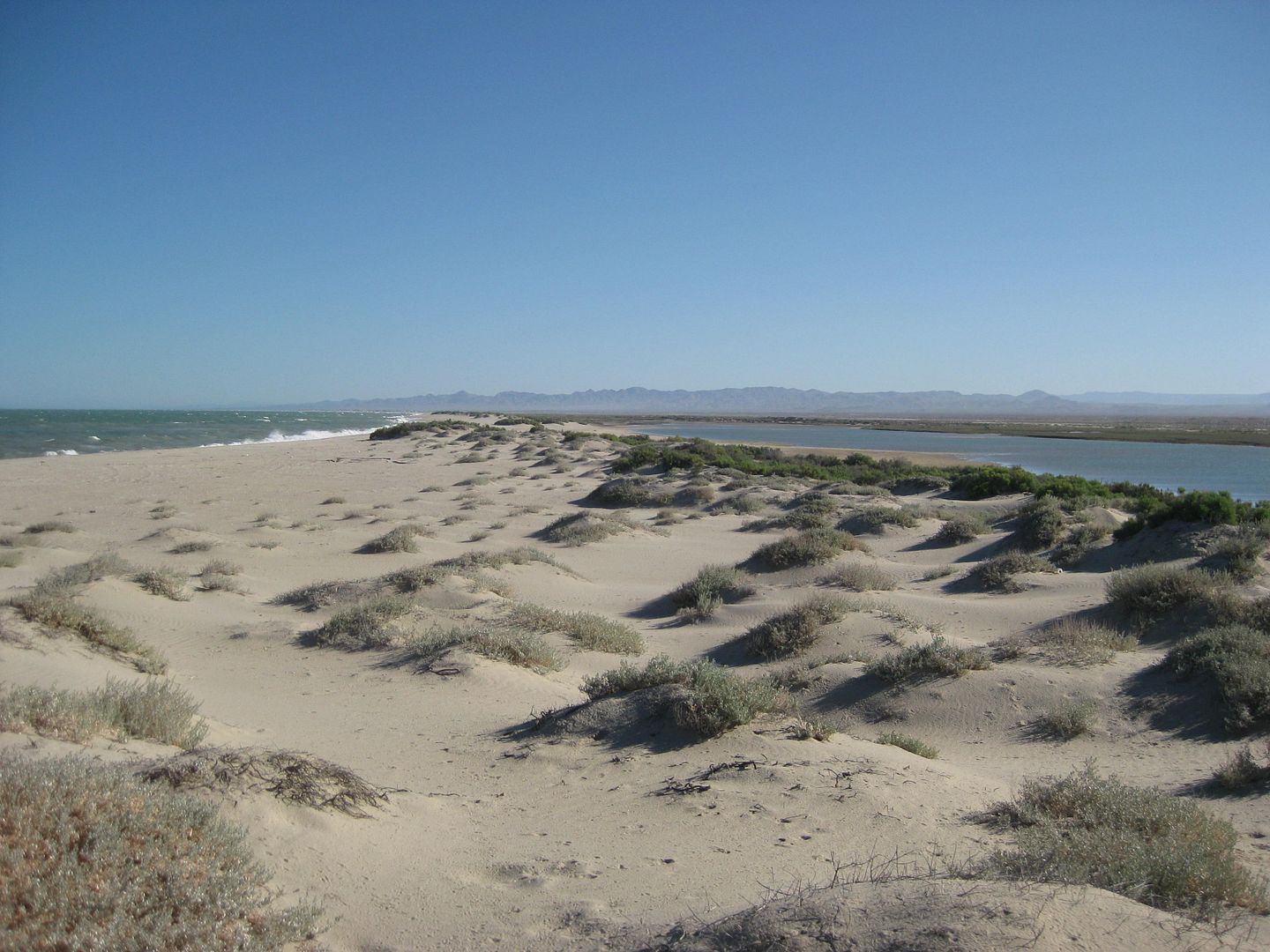
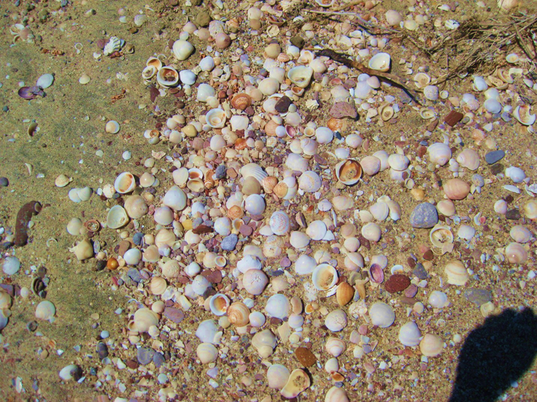
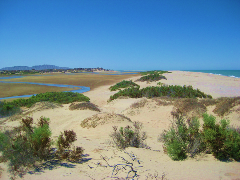
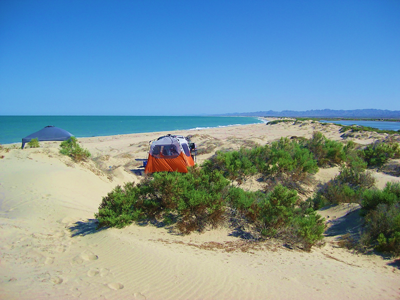
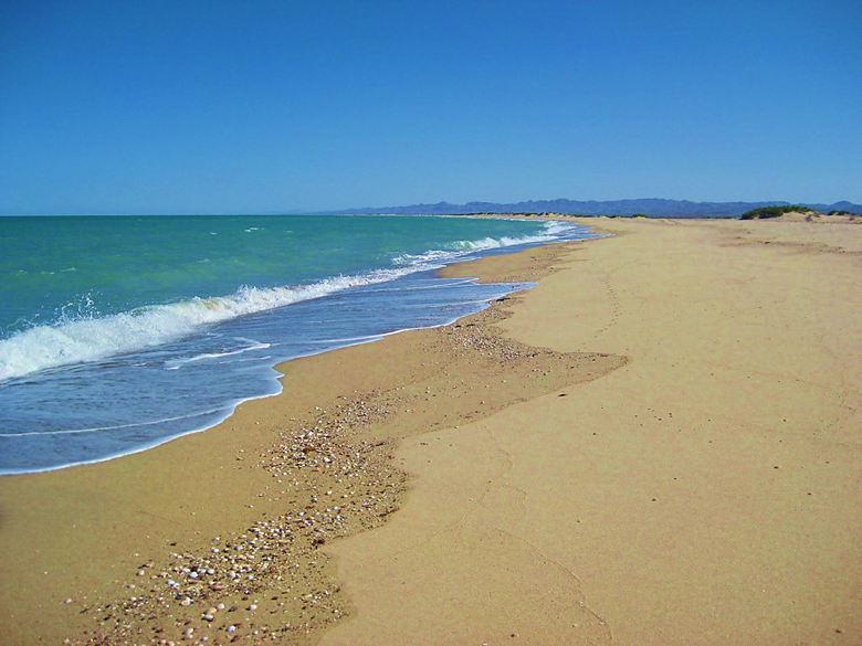
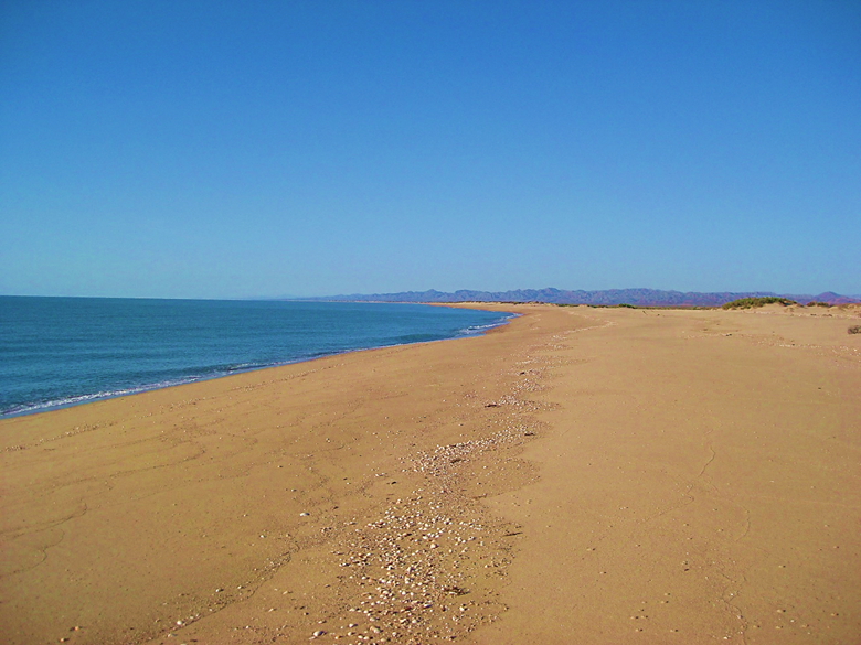
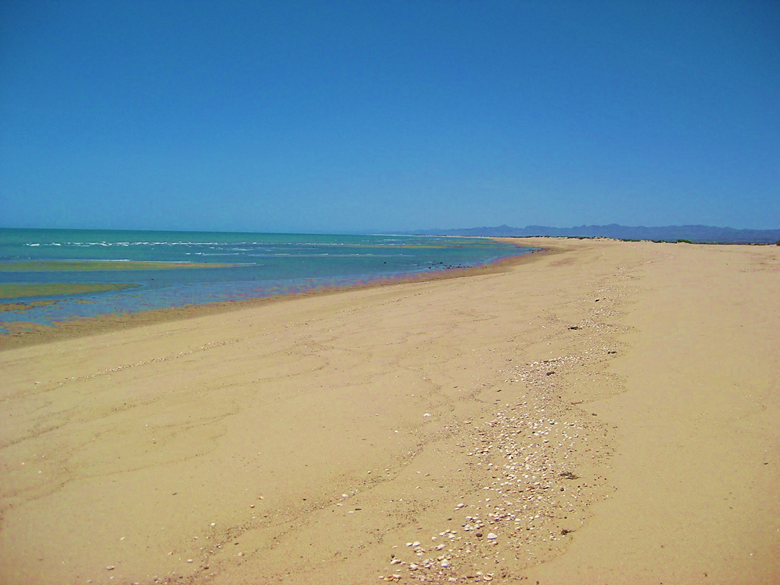
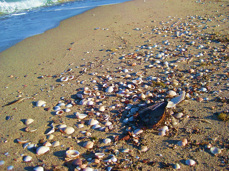
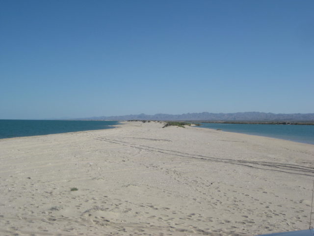
The long, narrow barrier island beach, between Percebu and Bahía Santa María, is backed by lagoons on the north and the south, that fill at high tide. During lunar high tides, these two lagoons connect and this narrow beach is surrounded by water. This is why I named it Shell Island (in 1978) instead of calling it ‘Shell Beach’ as others have. A place called ‘Shell Beach’ is already on the Baja peninsula, next to Punta Chivato. Before discovering a way to drive onto the island, I would park on the north side of Bahía Santa María and walk across the lagoon entrance at low tide, to go shell collecting or exploring on the island (1974-1977).
The following are not showing all of my trips there. I still have old photos to scan from the the 1970s, 80s, 90s, and 2000s. The following are photos that were scanned or were digital, and are from my trip albums here on VivaBaja.com. I just lifted them out of the albums and placed them on this new page so they would all be together. My overall goal with doing location photo pages is for the Viva Baja viewer to go to one place to see photos of a location, instead of searching through the years of albums on my site.
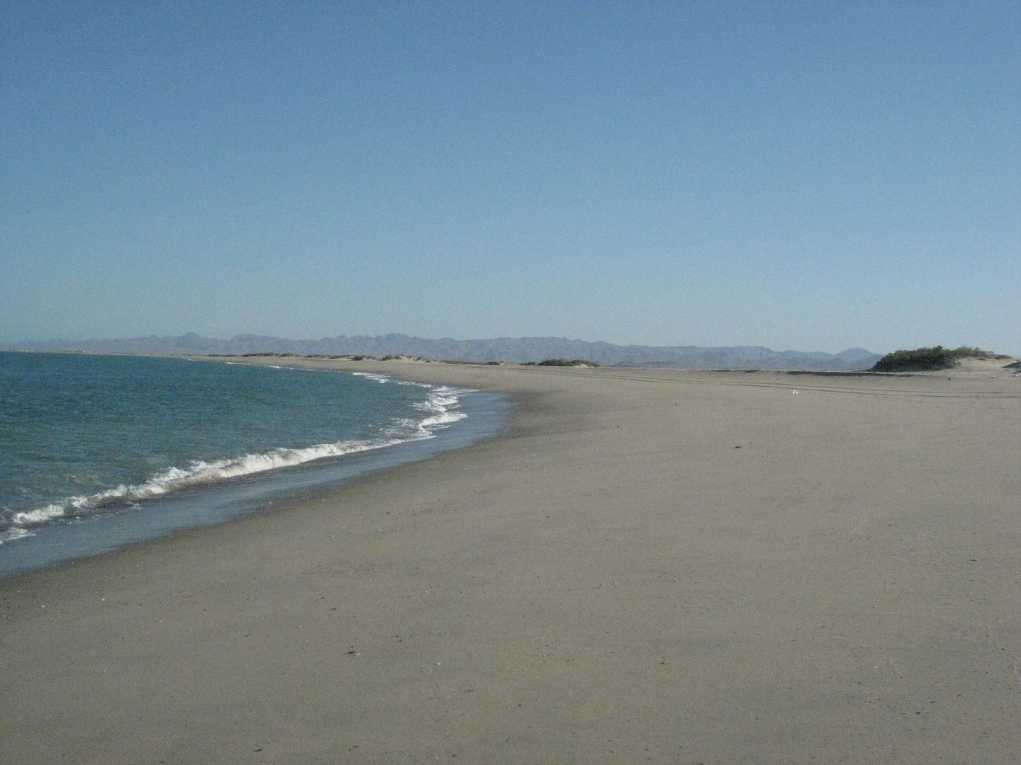
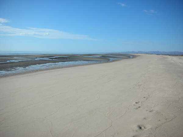
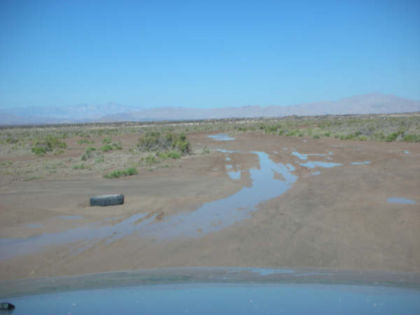
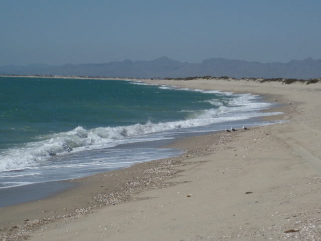
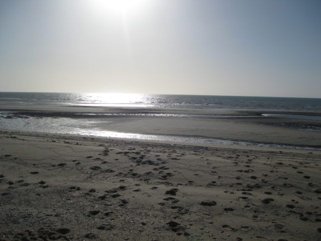
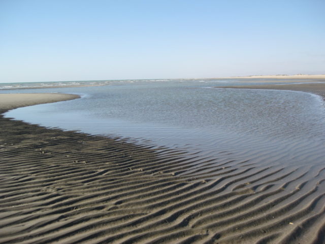
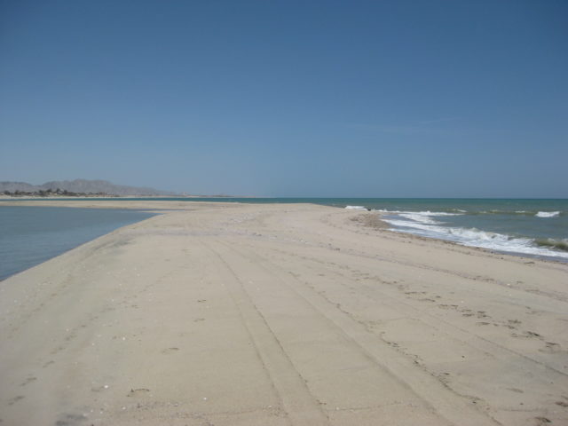
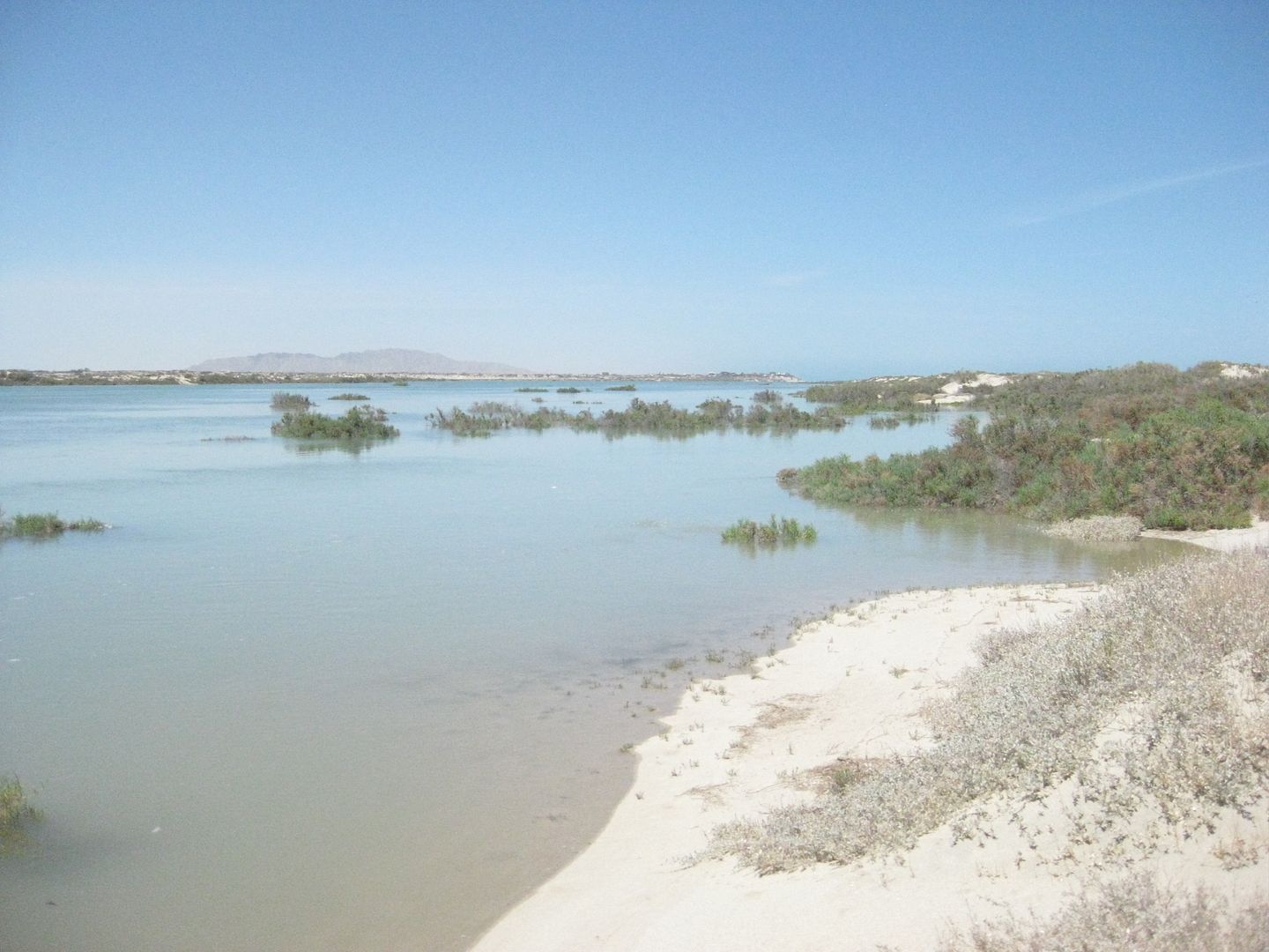
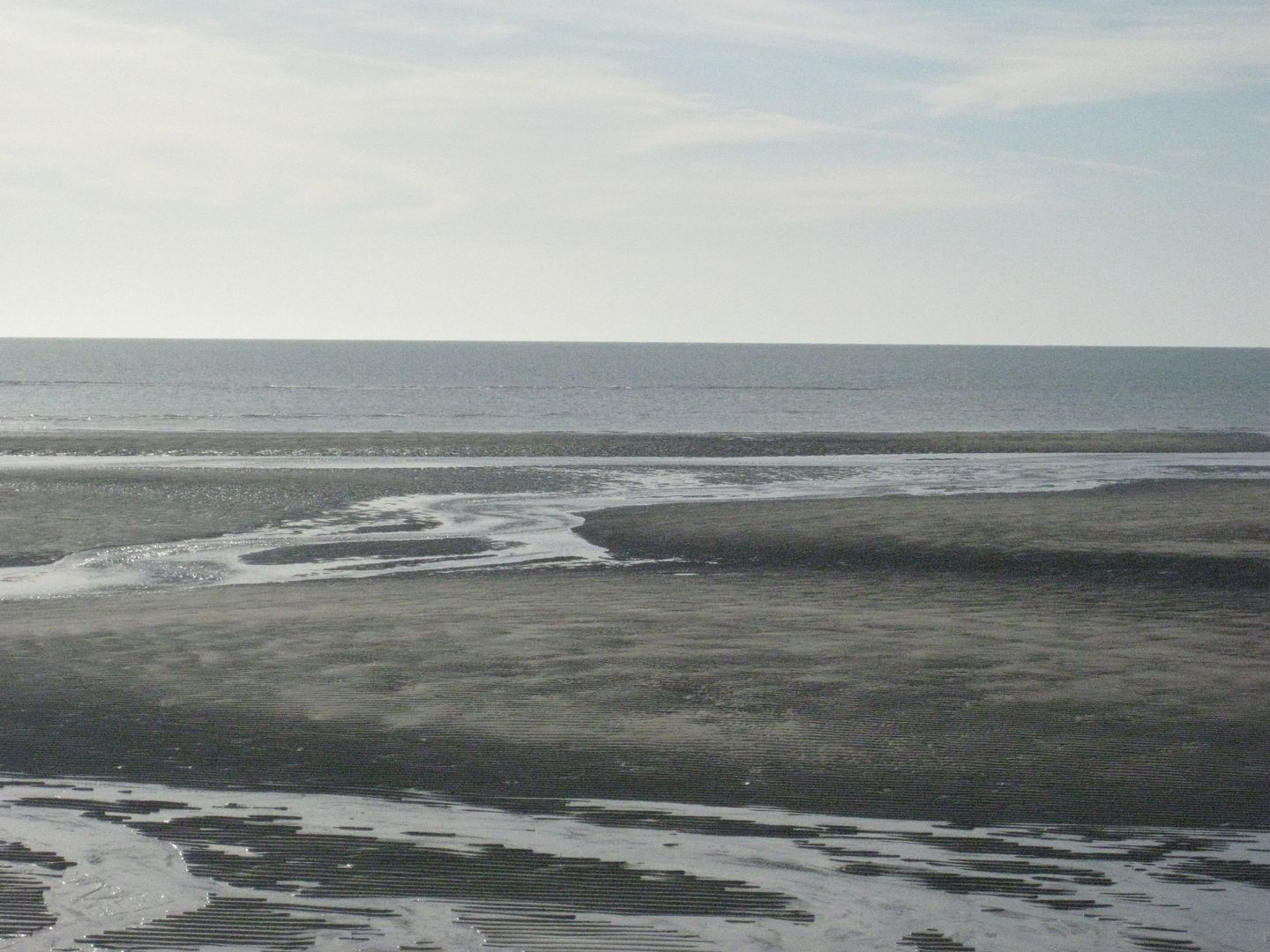
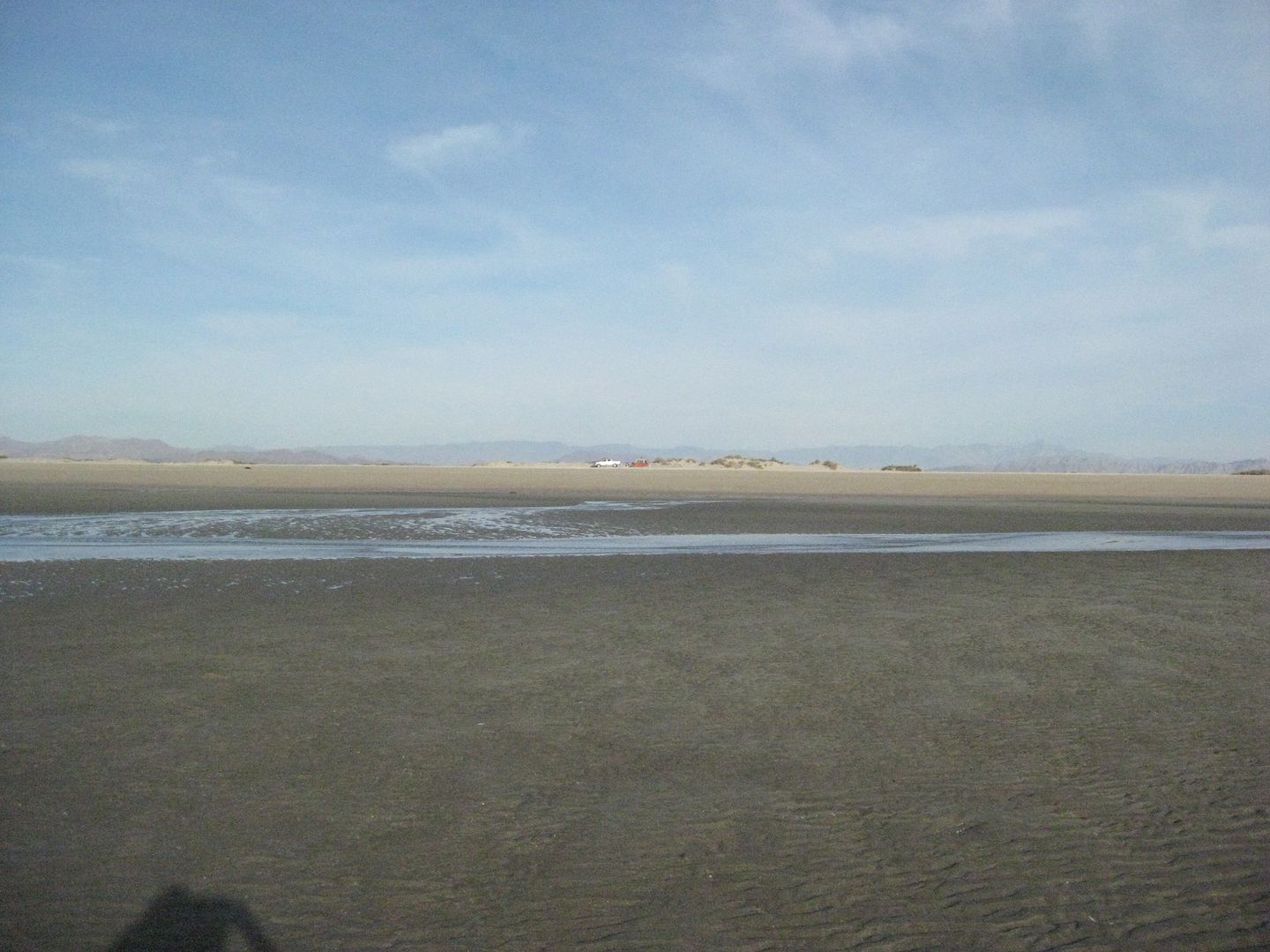
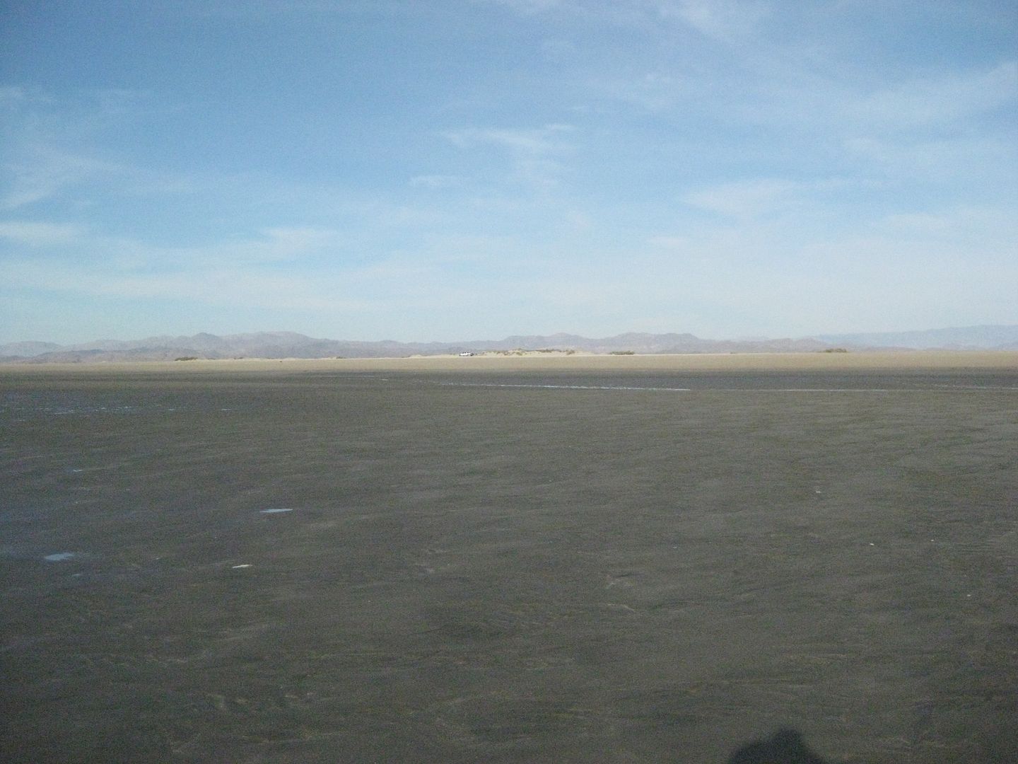
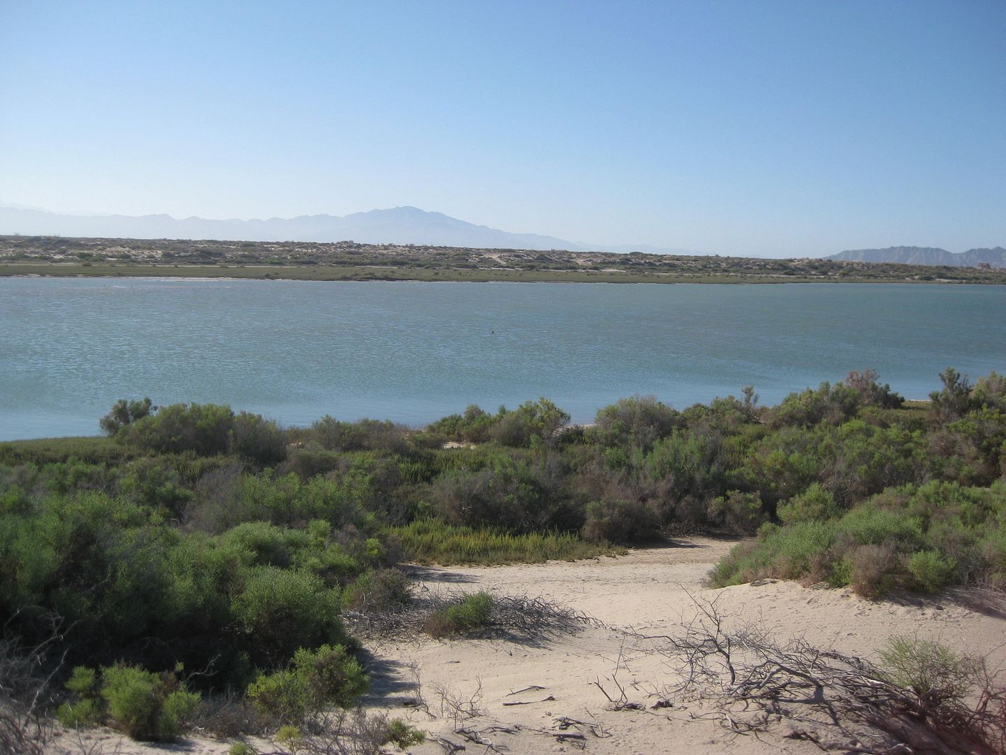
Because it is an island, it has two coasts: Gulf, on the east side, and Lagoon on the west side. The lagoon only fills fully at high tide during full and new moon phases. Other times it is just wet or damp sand covering mud (do not drive across at low tide, use the access road, three miles south of the north end).

Included in these photos are:
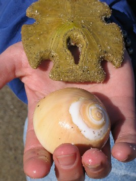
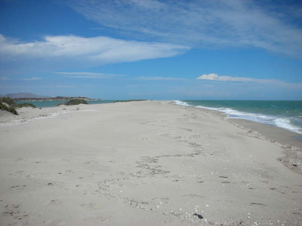
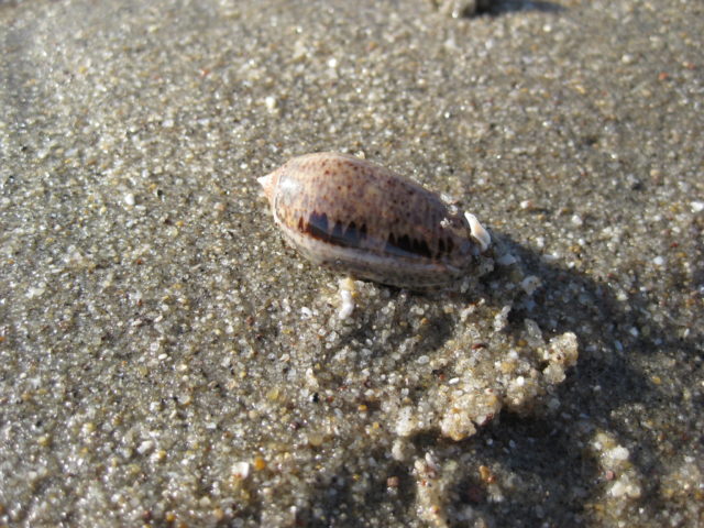
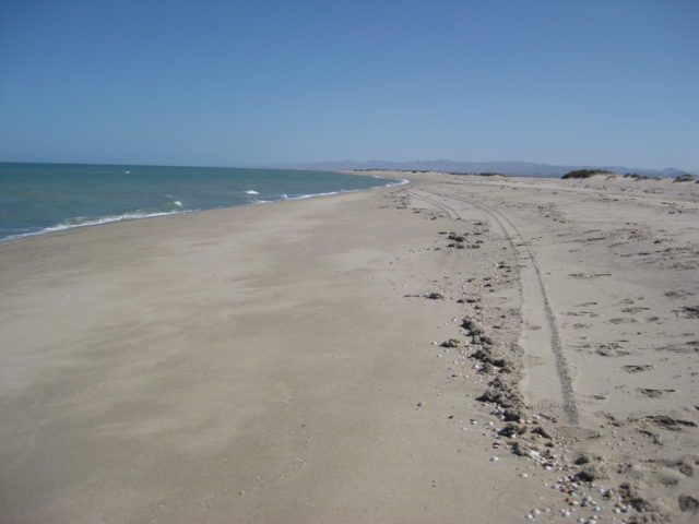
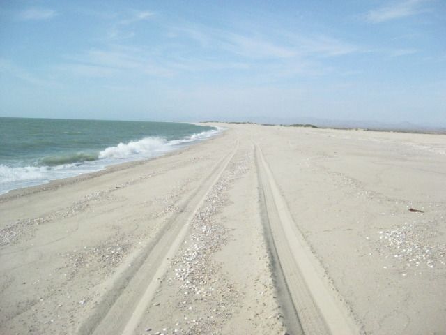
- The Giant Sand Beach
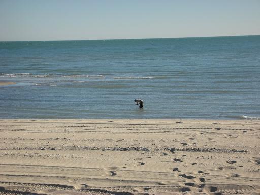
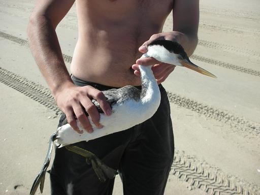
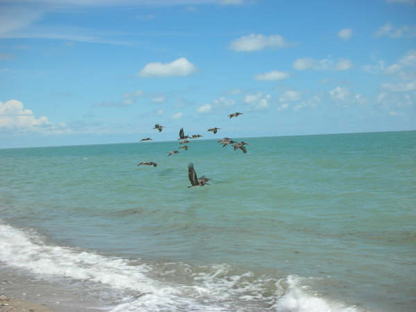
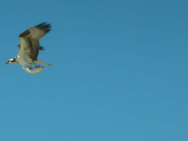
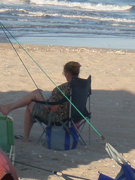
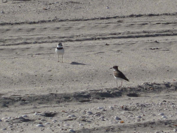
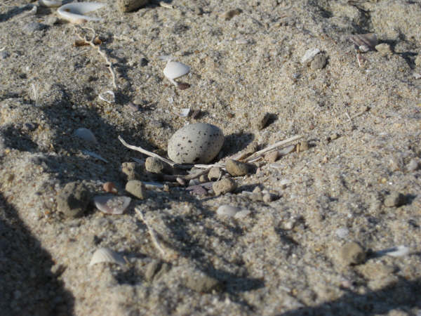
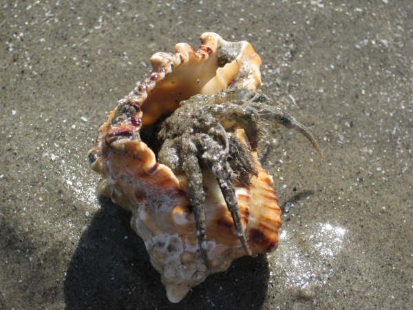
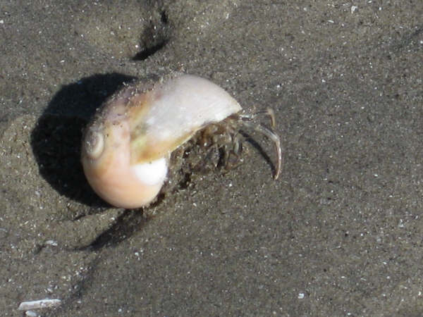
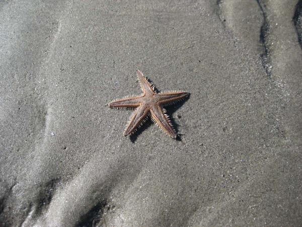
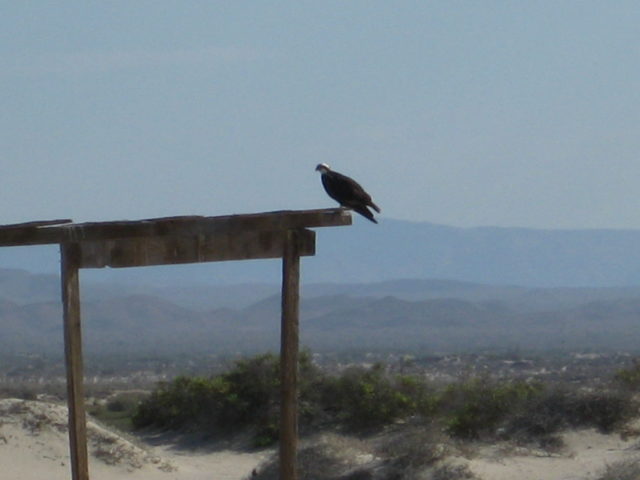
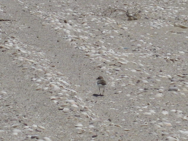
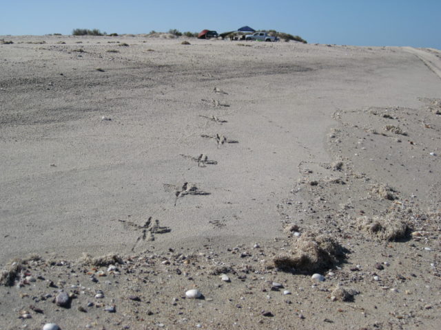
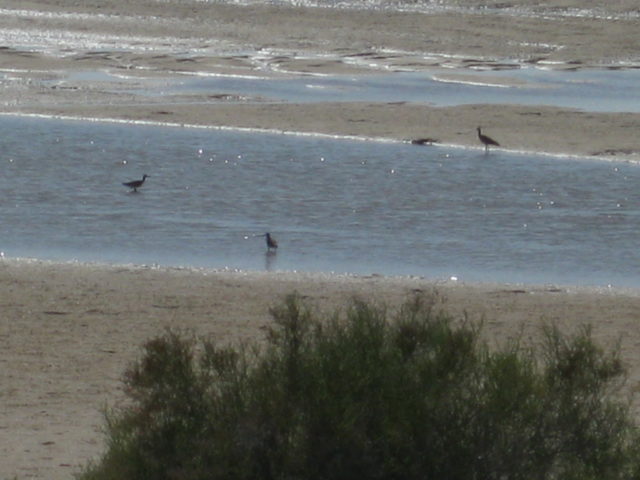
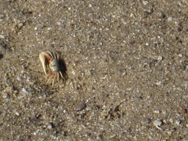
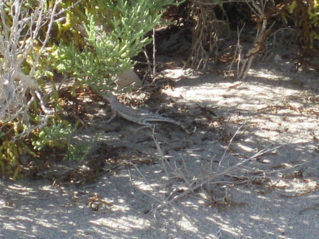
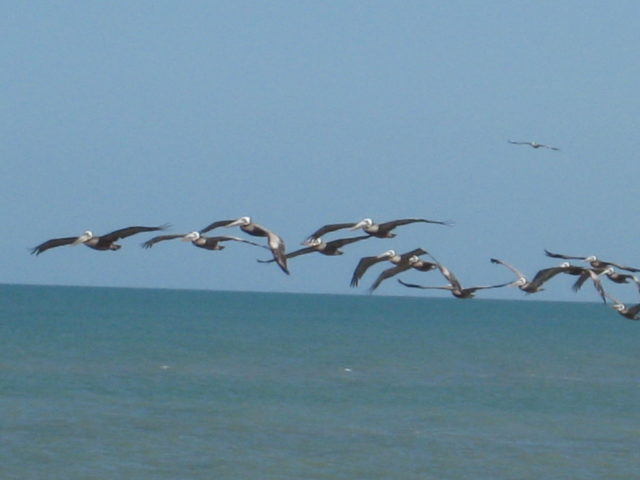
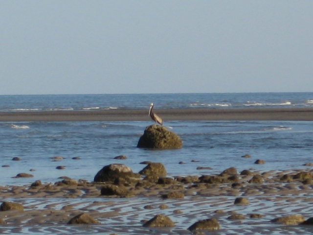
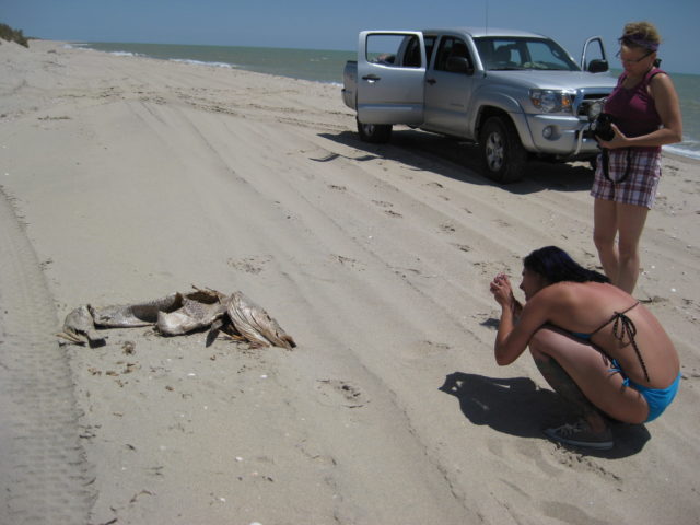
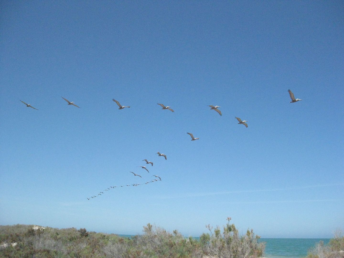
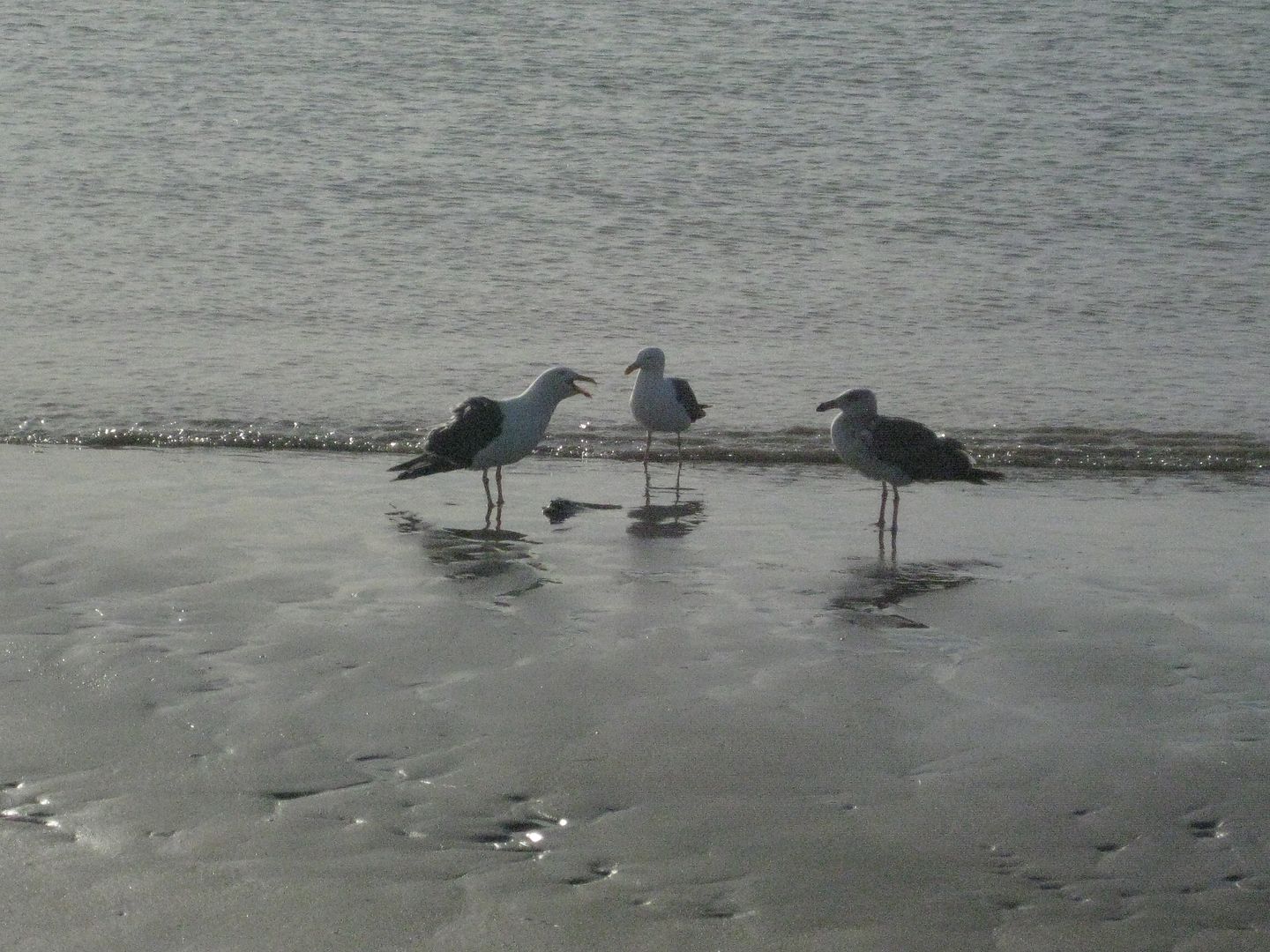
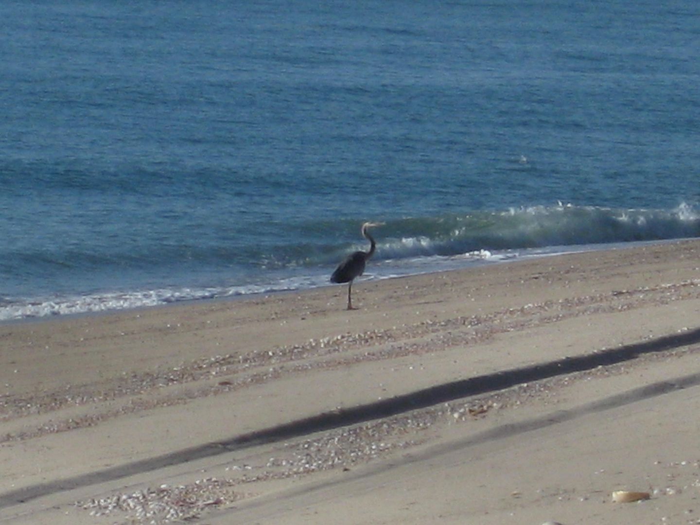
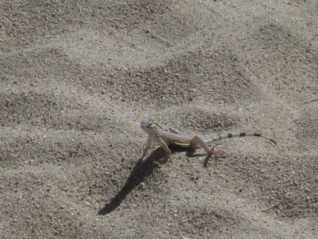
- Animals, including birds
- Dead animals and bones
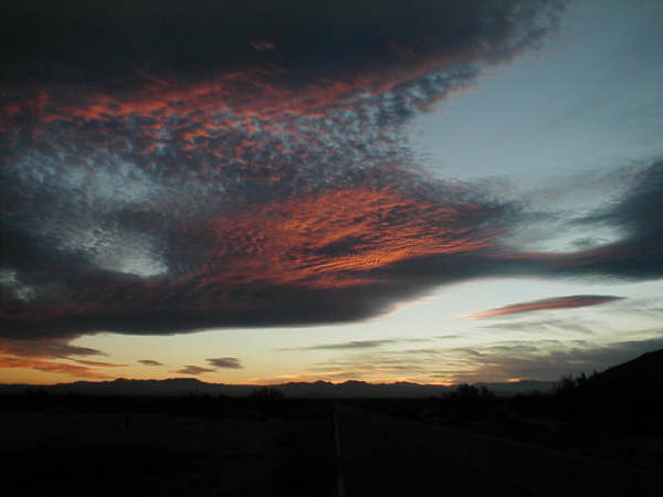
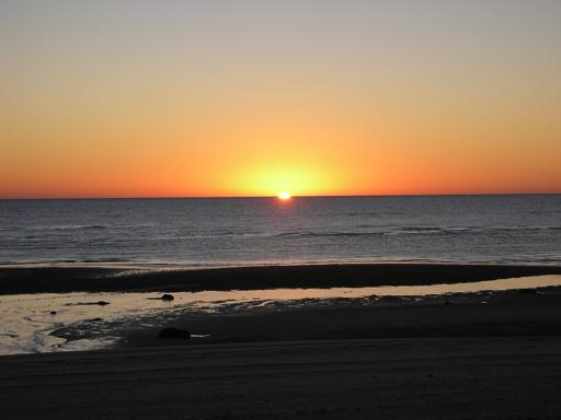
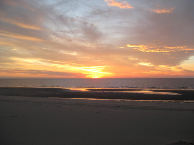
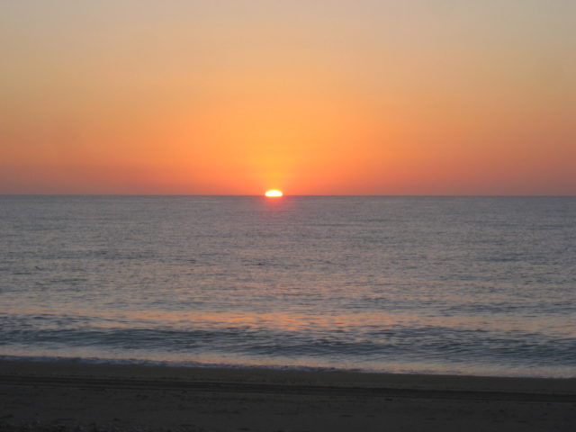
- Sunrises and sunsets
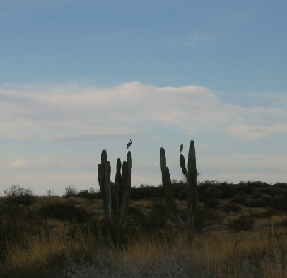
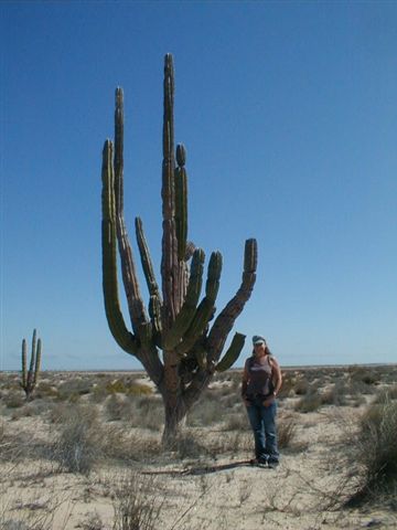
- Cardón cactus
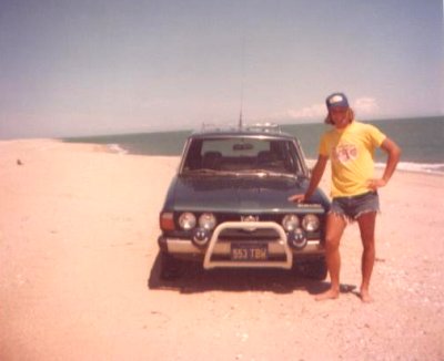
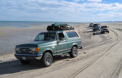
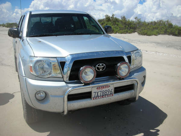
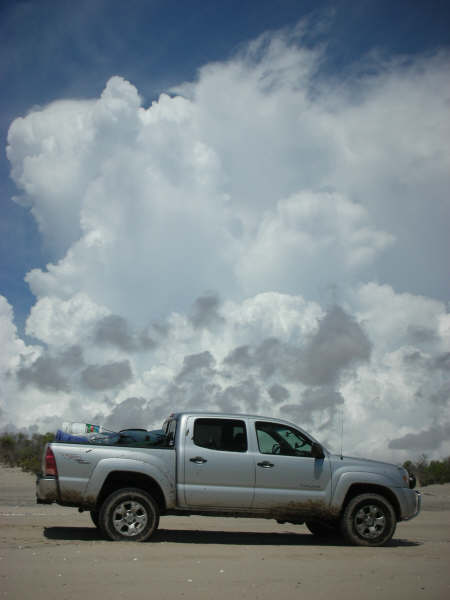
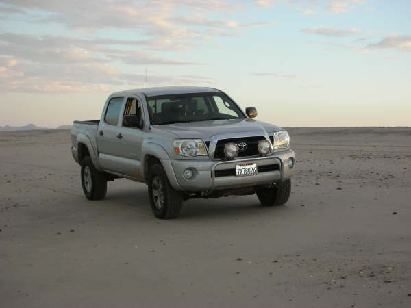
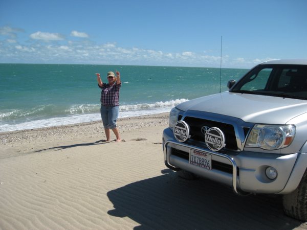
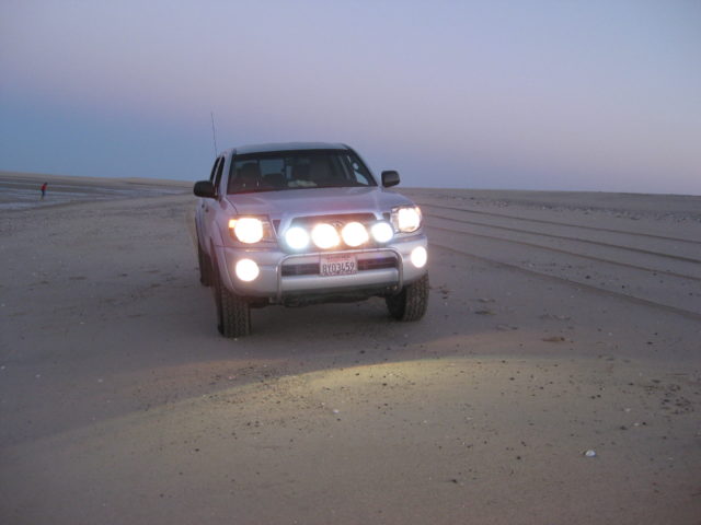
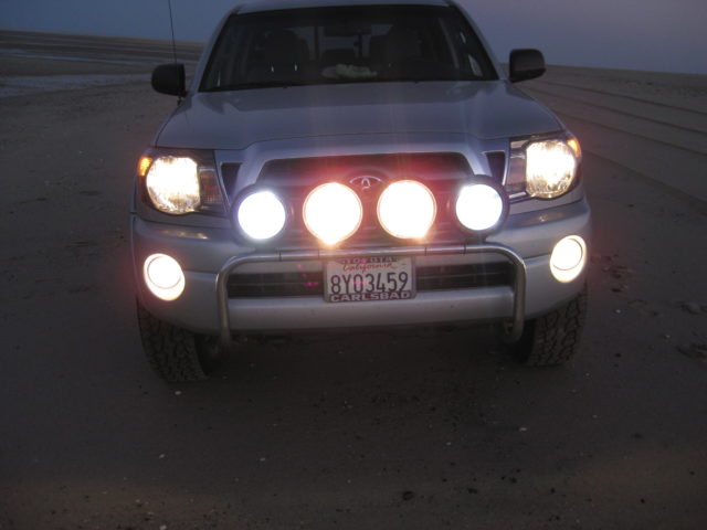
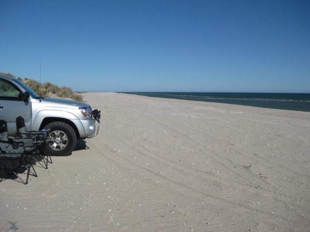
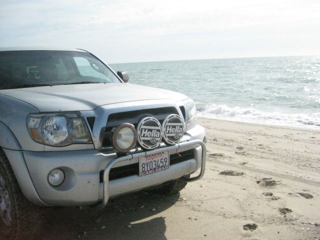
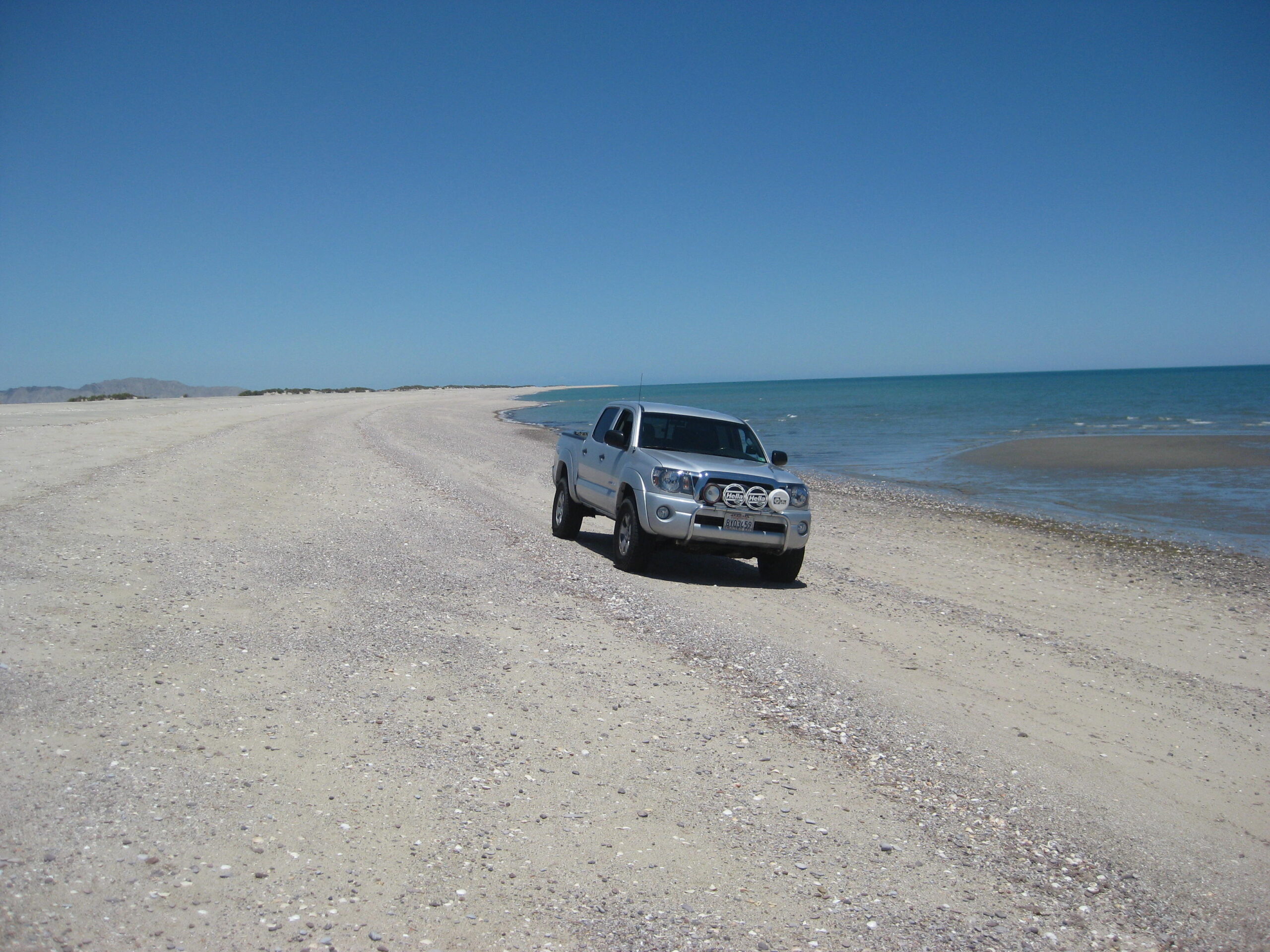
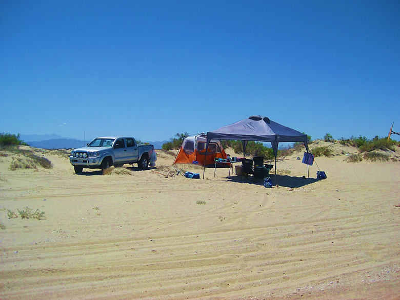
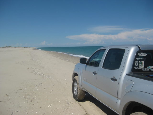
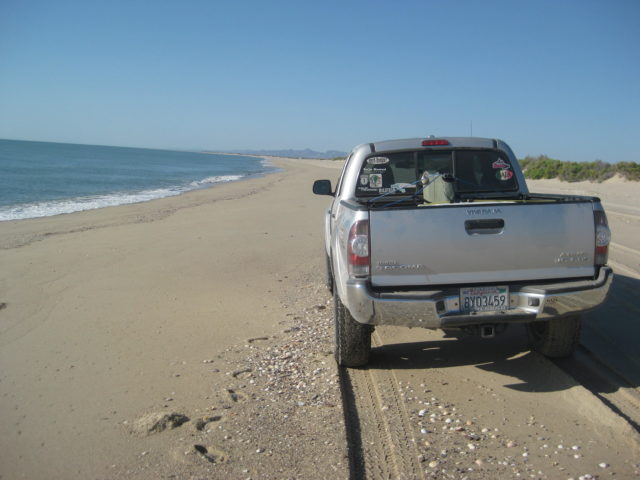
- My Toyota Tacomas (’01, ’05, & ’10)
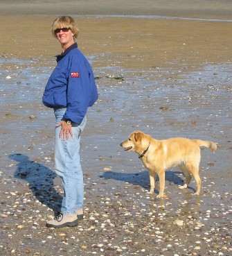
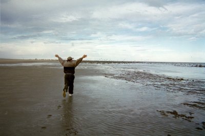
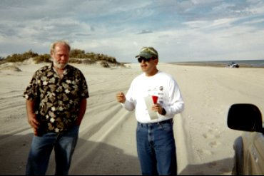
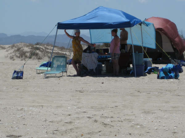
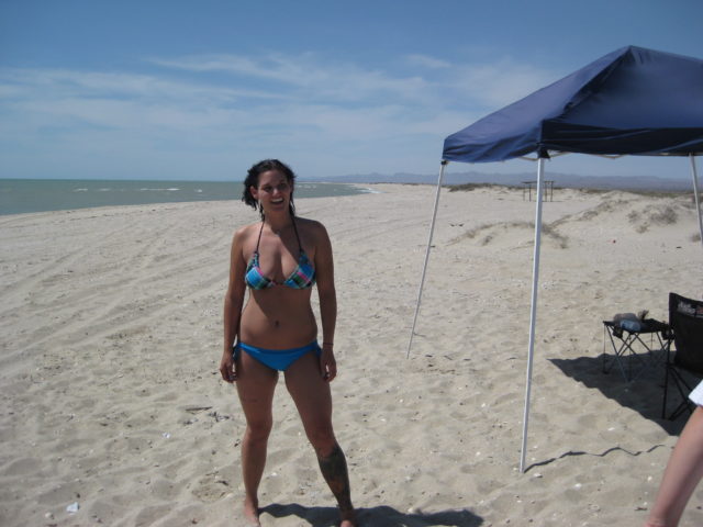
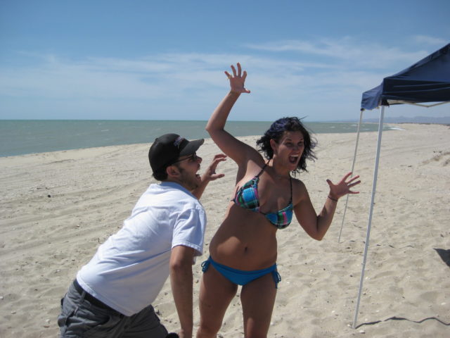
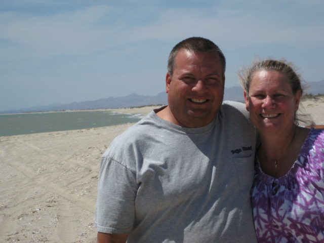
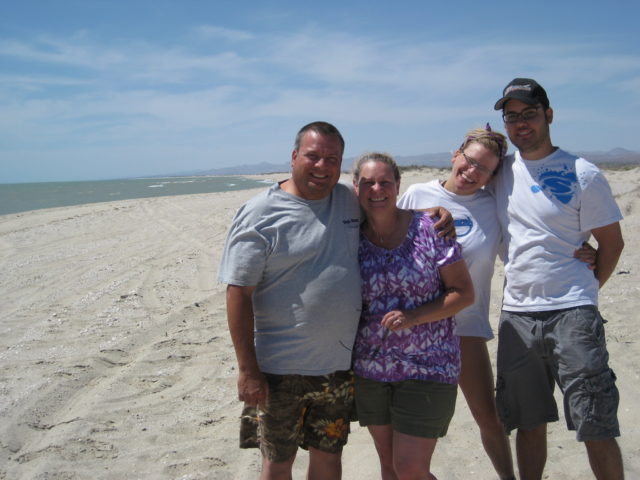
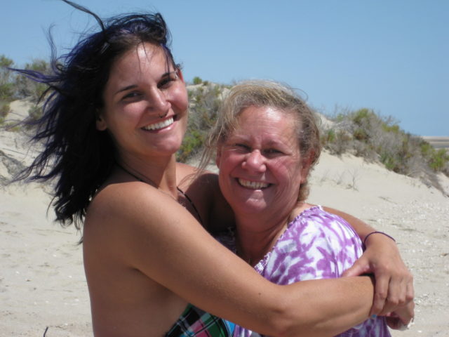
- Happy People
Thank you and enjoy!
David
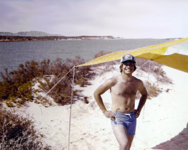
1978
1980
1984

2001
January (New Years Day):

See the other photos of this trip: https://vivabaja.com/baja-2001/
Where is Shell Island and why is it called an ‘island’?
From a plane:

From a satellite:
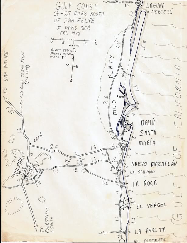
One of my many hand-drawn maps (1967-2007). The others are HERE
“Shell Island” labeled on the 2021 Benchmark Map (no, I didn’t request this):
February 2001 (President’s Day weekend):


See the other photos of this group trip/tour: https://vivabaja.com/shell/
2003
May (Memorial Day weekend):


See the other photos from this trip: https://vivabaja.com/p503/
2004
February:


See the other photos from this group trip/tour: https://vivabaja.com/p204/
2005
February:

See the other photos of this trip: https://vivabaja.com/p205/
July:


See the other photos of this trip: https://vivabaja.com/p705/
September (My ’01 2-door Tacoma was traded in for a new ’05 4-door Tacoma, still a 4×4 Off Road ):


See the other photos of this trip: https://vivabaja.com/p905/
2006
January:

June:


November:


2007
February:


June:


2008
May:


September:


This trip photo album continues with Puertecitos, El Almacén, Alfonsina’s, Gonzaga Bay, and El Rosario: https://vivabaja.com/p908/ In Sept. 2008, the pavement ended 2 miles south of the Puertecitos junction. It would be 12 more years to be completed to Highway 1 at Laguna Chapala. That was a tough 80-mile job!
2009
May:

July:


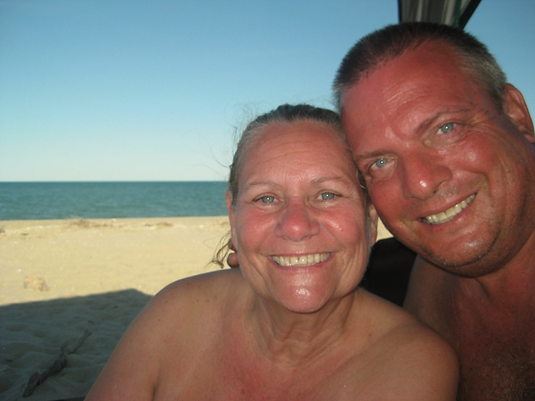
There was one other ‘couple’ on Shell Island!


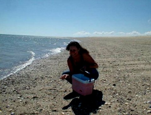
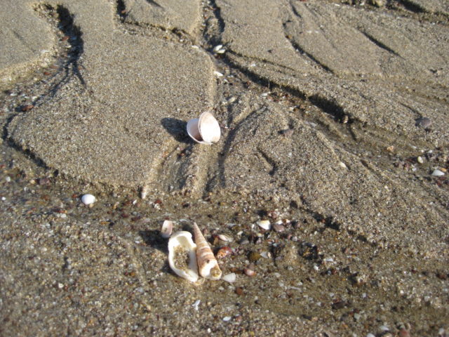
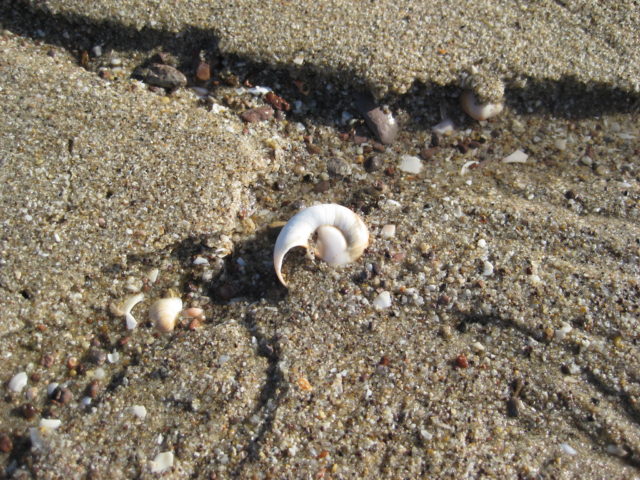
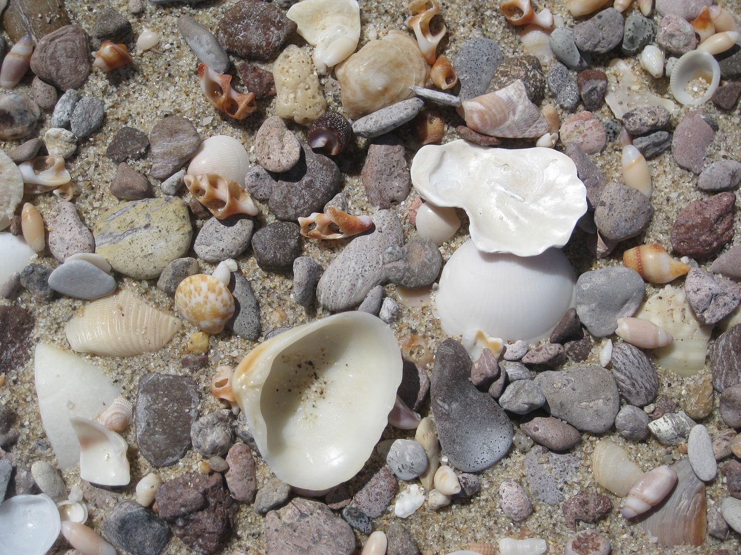
… and shells!


October:


2010
July 4
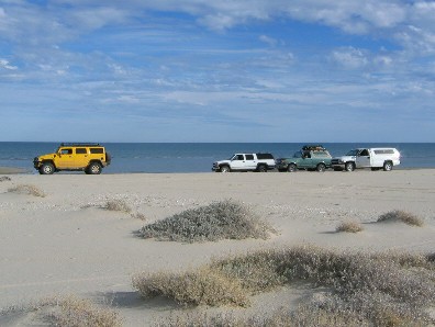
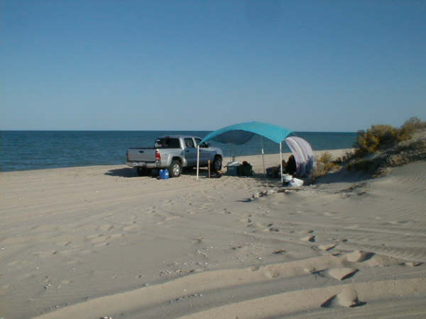
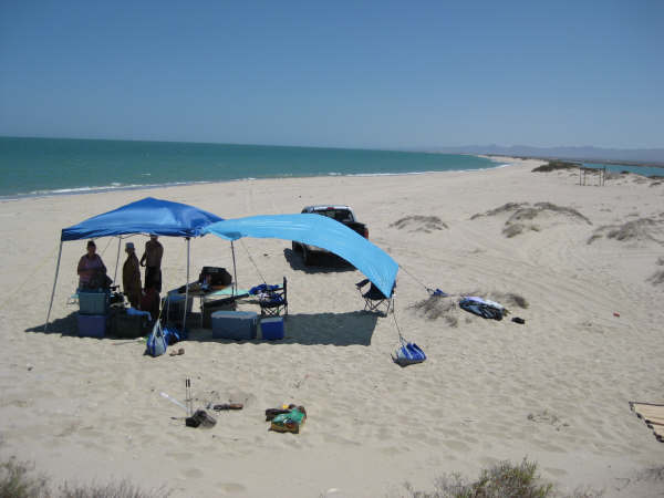
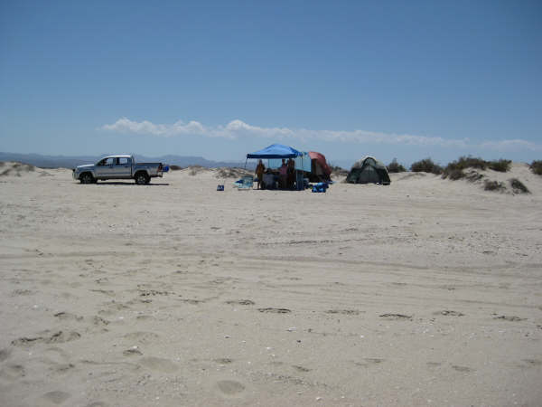
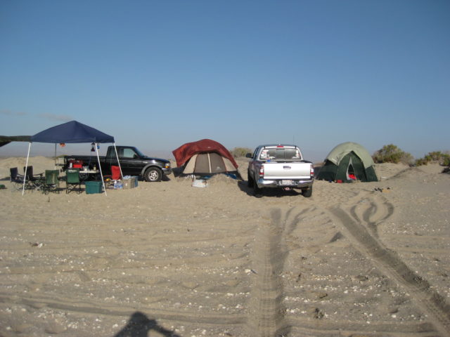
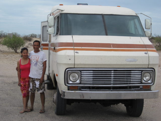
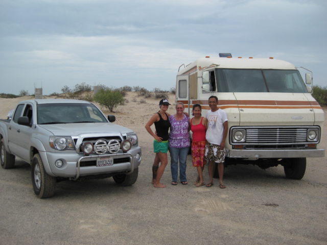
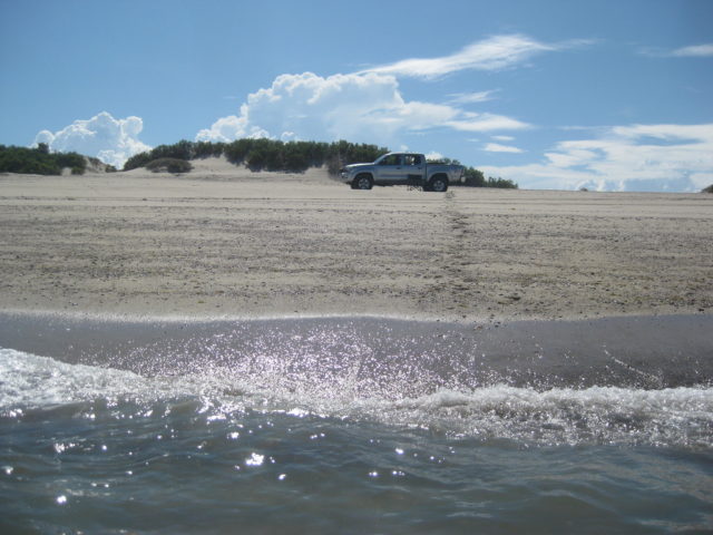
July 4 weekend 2010: Shell Island with friends: ‘Baja Ken’ + Leidys, in a Jeep Rubicon & ‘edm1’ (Art), in his custom 4×4 motorhome/van.


July 18:
The Beach, Birds and Bumps in Baja: July 17-20, 2010
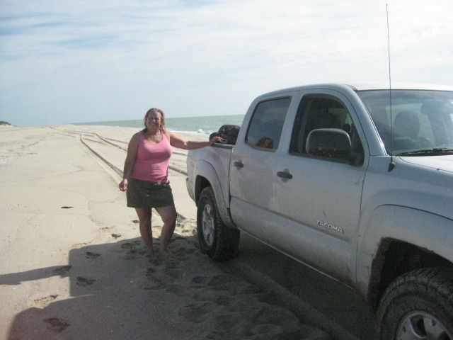
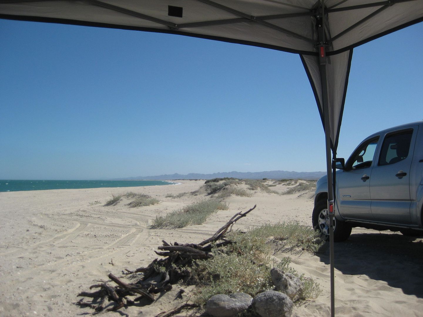
It was our second wedding anniversary on the 18th, and our favorite place to be just to ourselves is Shell Island, about 20 miles south of San Felipe where the Sea of Cortez is on one side and the Percebu lagoon is on the other.
We started our weekend with breakfast at Sunrise Café, in Vista, CA and were on the road south at 7:30 am. Because of the traffic southbound at Calexico, last trip (2 weeks earlier) we decided to cross at Tecate this time. We crossed the border about 8:45 and headed towards Mexicali, getting on the fast toll highway (Mexico #2-D) a few miles to the east.
Three tolls are paid heading east to the San Felipe highway (Mexico #5). El Hongo was $4.30 (55 pesos), La Rumorosa was $1.50 (16 pesos), and Mexicali (at the Hwy. 5 junction) was 55 pesos (no dollar amount sign posted, we paid in pesos here). It was 10:30 when we got to Hwy. 5.
There was about 6 miles of dirt detour between La Puerta and Rio Hardy where there was earthquake damage and they may be widening the highway to four lanes. Another, but shorter section of dirt detour is near the Hwy. 3 junction, and military checkpoint. New, wider highway begins south of the Hwy. 3 junction and turns into four lanes closer to San Felipe. We got gasoline and a pack of Tecate beer at the El Dorado Pemex and market, and then went into San Felipe for a lunch of fish tacos and carne asada tacos before heading south.


On July 19, 2010 the pavement south of the Puertecitos junction ended in 19.5 miles. The detour off the new road was at 18.5 miles.
2011
May:
Memorial Day Weekend 2011 was a hit!
In a nutshell, a great weekend on Shell Island for Memorial Day 2011!
It would be the first trip there with Baja Angel’s daughter Kristi… Her son Josh and his girlfriend Jonna would also caravan with us.
Jonna and Josh were last on the island this past Labor Day (Sept. 2010) and the four wheel drive wouldn’t engage so they were stuck were the road reaches the beach, then.
This trip, the Ford transfer case engaged and they were able to keep up with my Tacoma for the trek up to our favorite camping spot, a couple miles away.
We left the San Diego area Friday evening around 7:30 (after dinner) and headed east on I-8 to Hwy. 111 to Calexico/Mexicali, which is the fastest route to San Felipe. Coming home, we prefer the Tecate border (and it was a doozy last night with almost a 3 hour wait.. and we heard the other borders were almost a 6 hour wait).
There were several dusty miles of detours in the Rio Hardy/ El Mayor area and again at Laguna Salada by the old canal location… On the way home, I recorded about 7 miles of dirt detours. Our vehicles were searched at the military checkpoint southbound (but not northbound, 3 days later).
We arrived in San Felipe about 1:30 am, topped off the gas tanks at the station in El Dorado Ranch and headed right for Shell Island. We were concerned for the Ford Ranger and expected to maybe need to pull it if air pressure alone couldn’t help if the four wheel drive again failed. There was no need to worry, as the Ford did fine!
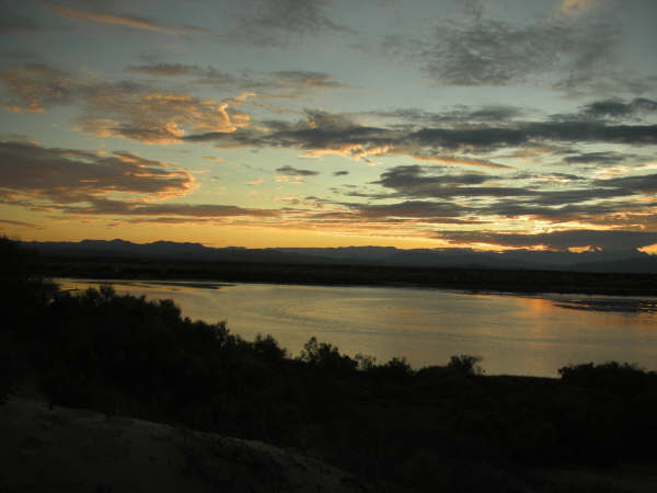
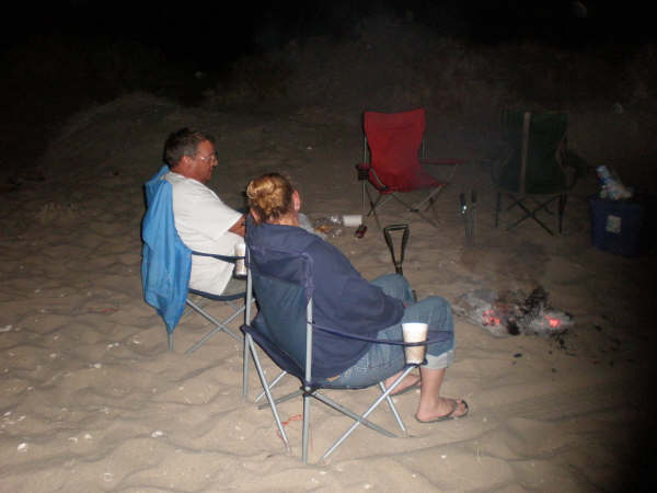
We got camp set up, and a fire started to kick back… enjoy the Tecate Lights we bought in Mexicali… and realized that the glow in the sky was the approaching sunrise! Man, was I sleepy! I think I got (maybe) 3 hours of sleep before the warming sun got me up… The day was beautiful, the water was smooth, and we were in paradise!
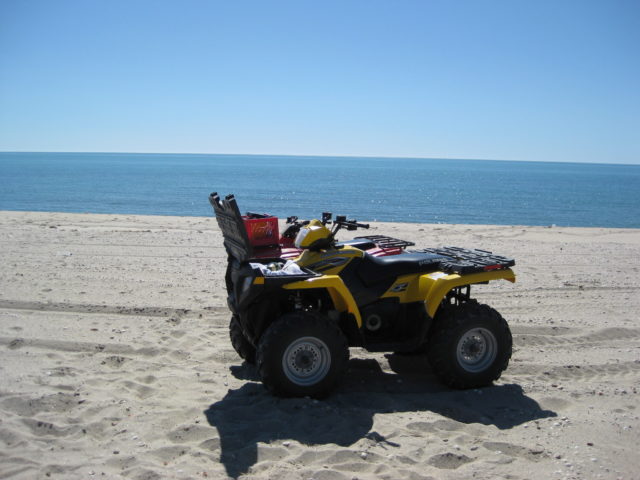
I hear the rumble of ATVs approaching…
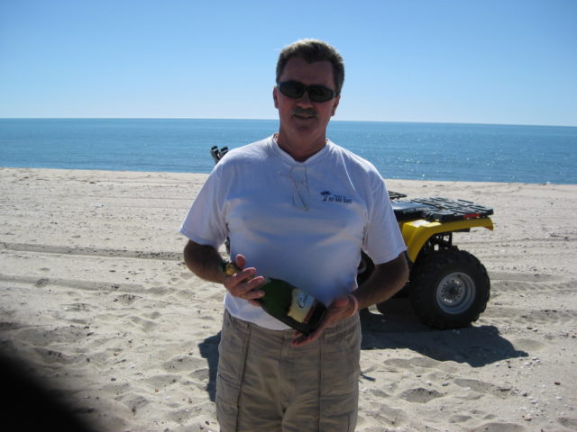
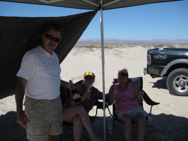
Champagne Time!
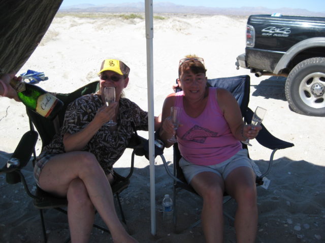
High tide was at midday and then the water goes back out again to expose new treasures to photograph…
Saturday, was a pretty mellow day with a nap or two. We did drive to Bahia Santa Maria to show off Rob and Connie’s house to Kristi. We then drove down the beach to El Vergel to look for ‘El Vergel’ (Vern)… found his Jeep, but not him… left my card on his windshield wiper. We then went to Delicias for lunch at Aniceto’s and it was very good. A return to Shell Island for a relaxing afternoon.
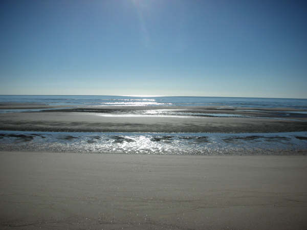
Low tide Sunday Morning…
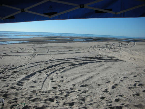
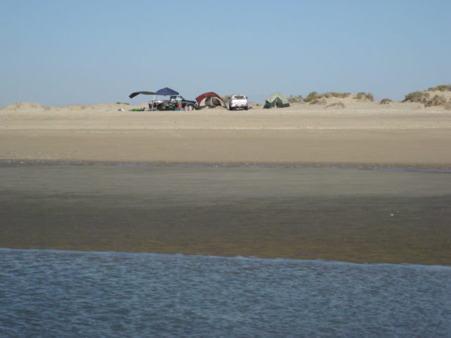
The next six photos are a 270°panorama from the north end of the island, across from Rancho Percebu: East to south to west to north.


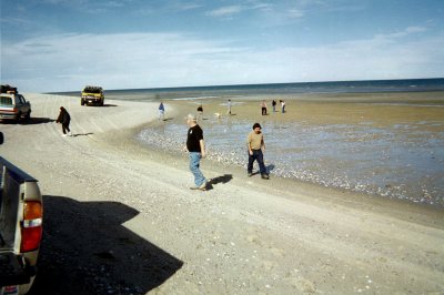
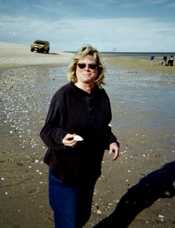
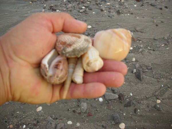
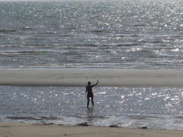
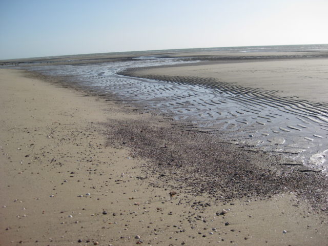
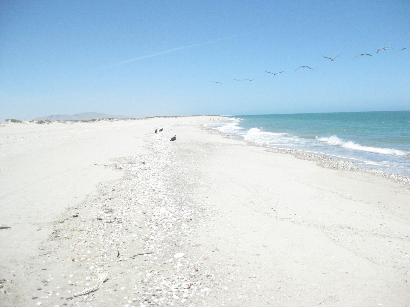
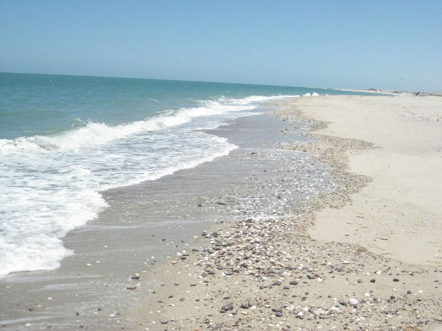
Sunday Afternoon at low tide, I took the kids to the far south end of the island (which is the north point of Bahia Santa Maria) for some goodie searching (shell collecting, photos, discovery)…
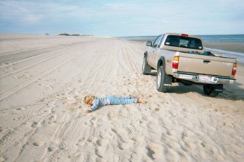
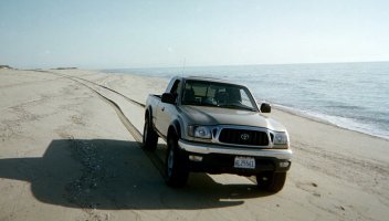
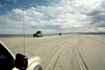
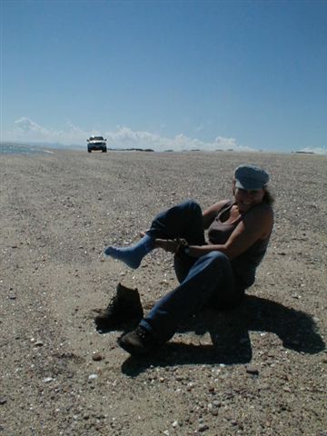
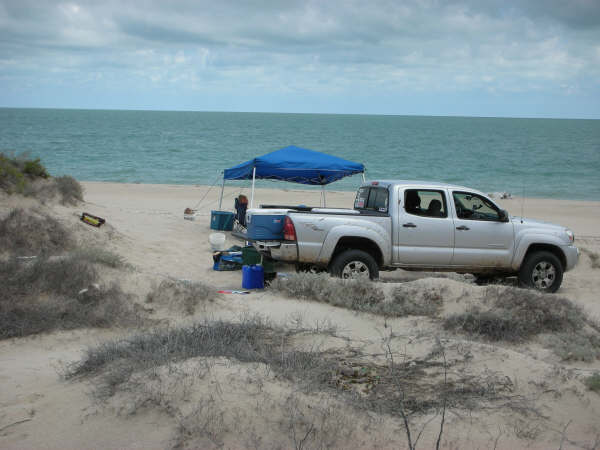
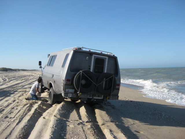
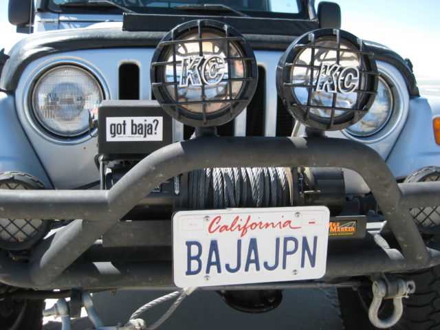
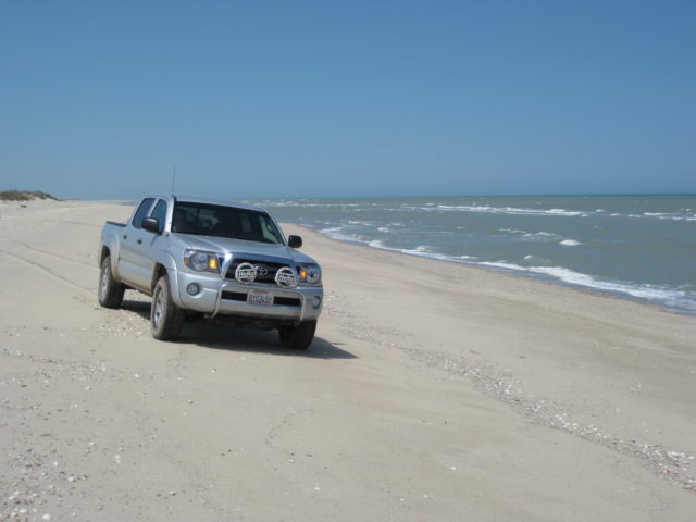
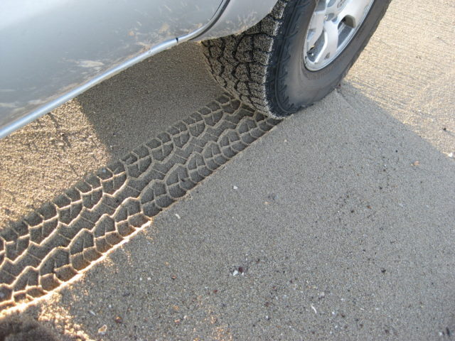
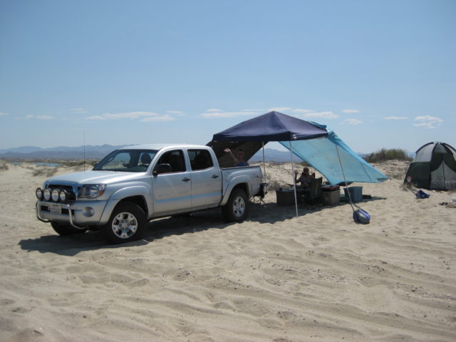
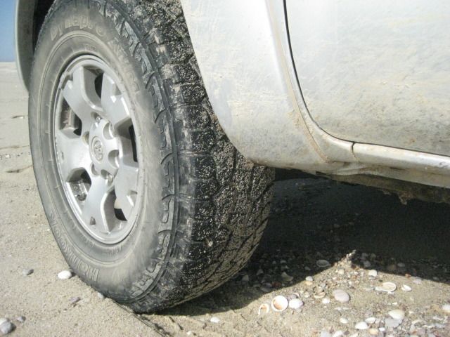
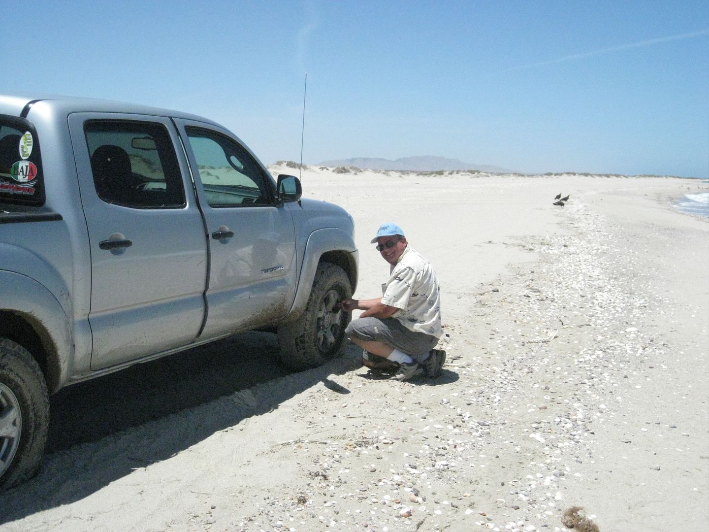
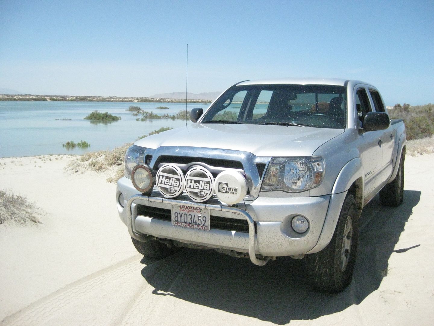
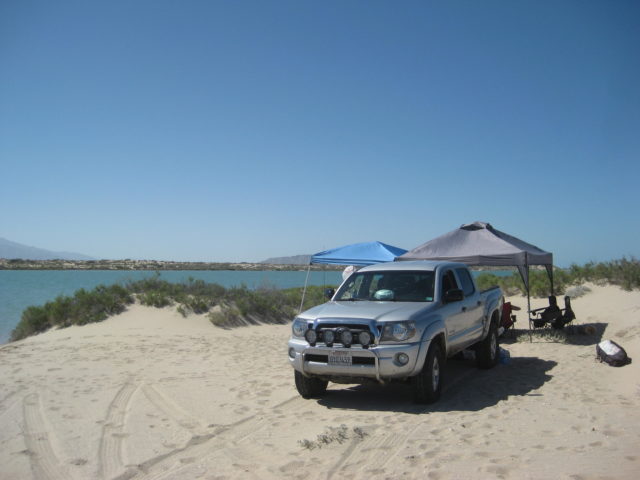
Of course I love my Tacoma and any chance to drive it in four wheel drive is a thrill. Last February, the stock BFG tires (265/70-16) that came with the new truck got replaced with Hankook Dynapro ATM tires… also 1″ taller (265/75-16) as that increases my ground clearance 1/2″… all without needing any lift or changes. The Dynapros were very quiet on the highway, amazing in snow and mud, as well as desert sand at Ocotillo Wells. This was the first test on Baja’s bottomless beach sand… which is the most difficult of all sands to drive on. Probably due to the high percent of crushed shells and slightly coarser grain…
When we arrived on the beach 2 am Saturday morning, I dropped them to 14 psi all around and had no issues getting to our camp. With the truck unloaded, I dropped the rear tires to 12 psi. What you want is a wider ‘foot’ in order to ‘float’ on top of the sand and not dig in. Once over the dry sand and onto the wet sand between the high and low tide lines of the day, it is possible to drive in 2WD even… but getting to the wet sand requires crossing the dry, deep stuff where most people will have trouble without 4WD and without deflating their tires. On future trips, I would discover that 18 psi was the point I got floatation with this tire model. VERY GOOD!
Time to pack up… do I got to go?
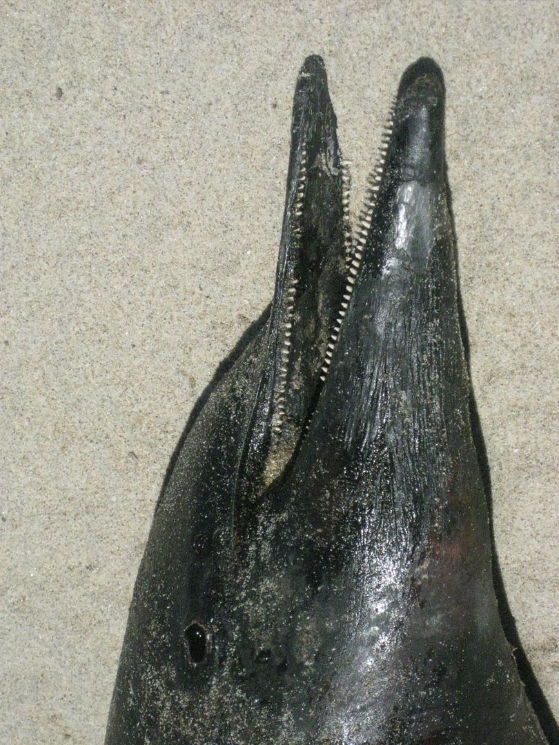
Marine biology students! Yes, that is a totuava.
We are off the island and tires re-inflated before noon. The drive into San Felipe was easy. We filled our tanks… it was just under 9 pesos per liter in San Felipe and just over 9 pesos in Tecate. The exchange rate was 11.50 pesos per dollar making the cost of 87 octane gas just under $3 a gallon south of the border zone and just over $3 in the Pemex special border zone… a dollar or more cheaper than in California!
We enjoyed fish, shrimp and carne asada tacos in San Felipe, we bought some tourist stuff (t shirt, silver jewelry, friendship bracelets) and were northbound before 3 pm. San Felipe looked almost dead for Memorial Day (compared to past years… well I mean 5 or more years ago).
July:
FREAKY FOURTH: SATURDAY 7-2-11
Who would have guessed that such a textbook perfect July day in Baja could become so ugly in just a few hours?
Baja Angel, Kristi and I made the drive from San Diego Friday night… crossing at Tecate (to avoid Friday PM Calexico traffic into Mexico) for a quick drive to San Felipe… not getting dark until we were well south of Mexicali.
There is still 6 miles of dirt detour in the Rio Hardy area and a few detours in the Laguna Salada canal area, up and down from the road as they change the conduits or bridges.
The military checkpoint at the Hwy. 3 jcn. is checking both north and south bound vehicles equally (it used to be just northbound)… 31 more miles to San Felipe.
I made a log of some mileages south from San Felipe, all the way to Hwy. 1 at Laguna Chapala… Including where the new pavement ends now and extent of new roadbed work. Look for that in the Baja Road Conditions Forum, soon…
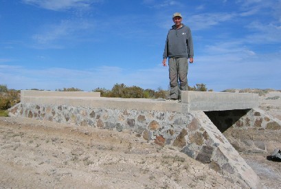
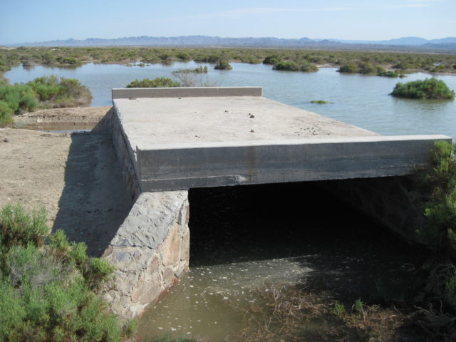
We arrived onto the island about 11:15 pm, well short of the next high tide… There was some sea water to cross by the concrete bridge, from the 18.0 foot high tide that afternoon… no problem…
Once onto the lower beach, I lowered the air pressure to 18 psi and that worked well on my Hankook Dynapro ATm tires. Camp got set up…. and then, off to sleep!
SATURDAY MORNING… was awesome… all blue skies, gentle breeze… the 2:29am high tide was still going out to the lowest point (8:41 am) so Kristi began walking the sand bars looking for goodies.
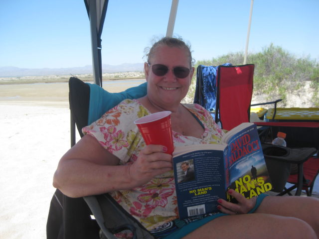
I was game for a swim that morning, but it required a half mile walk (or more) to reach the sea at low tide! Baja Angel was happy to just stay under the shade and relax.
We knew that Art and Nora (edm-1) were coming in the new, bigger 4WD motorhome… I took a couple of drives out to the bridge before high tide hoping to greet them or help them in… I drove back and joined Baja Angel and Kristi swimming and floating in front of our camp (now just a couple hundred feet from camp). That was great… water felt perfect… not as warm as in the past, very comfortable. (story continues below the photos)
After the tide started going back out (about 3:30pm), I drove back to the bridge and took photos of the flooded area with just a slightly higher tide (18.2 feet) causing so much change in looks and making sure people can see it is an ISLAND!
No Art… back to camp for a siesta! zzzzzzzzzzzzzzzzzz
The sound of an engine struggling had me jump up and run to the sand dune by our tent with the binoculars… there was Art! He was across the lagoon on the salt flat road that runs between Laguna Percebu and Bahia Santa Maria. He was in a mud pit… He got out, and motored to a point across the lagoon from our camp on the island. The tide was still high enough to have the lagoon full of water, but at about 3 feet deep, I waded across to greet Art and Nora.
The amount of water at the bridge (on the access road onto the island) was a concern for him and he wisely elected not to cross it.
Knowing Art’s mechanical skills at driving 4WD motorhomes (as in our adventure to Mision Santa Maria and onto Shell Island last year), I asked if he wanted to try it with me being a ride along harbor-pilot to guide him over the route my Tacoma took 17 hours earlier? Art was game, so we returned to the bridge and I walked in the water over my track from last night to show Art the depth and direction to charge across.
Sadly, the mud was just too slippery for the motorhome’s weight and street tires, and even with front and rear lockers (and all tires spinning equally) the motorhome got only 20 feet into the water crossing. Backing up only slid the giant rig sideways and soon we had no forward or backward movement… But also we were not going down deeper in the mud. The ground below was firm… It was the 6″ of wet, slimy mud the stopped the coach.
Naturally, I felt mostly to blame for this mess… So, I had to be able to get Art and his 12,000 pound 4WD home out of there! Did I say the sun was close to setting and it was really going to take some Baja Magic to fix this??!!
A panga fishing camp is on Shell Island just a 1/4 mile south of the bridge and Art and I walked there with high hopes for help. (My Tacoma was 2 miles away, but it may not have been able to move such a huge thing if it was the only truck on the island.)
One fisherman was in camp, Esteban (Steven) who smiled and had us hop into his Ford 4X4 with fat rope onboard (used to pull the pangas way up on the beach). We motored out to Art’s motorhome (I nicknamed the Titanic)… and with such ease, Esteban pulled Art’s coach out of the wet and down the causeway to the dry salt flat. YEA!
Art drove the Titanic back to the area across from our camp… We were going to eat dinner together, but a sidewinder encounter (as they began heading towards the lagoon to cross it), had them decide to postpone our get-together until the following morning!!
I walked back over to our camp to find Kristi and Baja Angel just awakening from their siesta!!! It was getting pretty dark… I lit the lights and campfire… and figured Art and Nora were too exhausted to come over (we learned about the rattlesnake the next morning). We had some food and relaxed a short while… too short… 
We watched the lightning show across the gulf (typical in summer… it stays over there in Sonora). However, this evening it was moving closer to us! The the wind picked up… Then things started flying! Kristi’s nice sleeping bad blew into the fire… I grabbed it but there was damage, sadly. The sun canopy collapsed as we were taking it down… the legs buckled and broke!
Our dome tent was almost flattened from the hurricane-like wind and blowing sand… It would rip open allowing sand to jet into our tent. A miserable mostly sleepless night…
Well, it was quite a night with the hurricane blowing over Shell Island and our camp in a bit of a shamble… The pop up sun canopy was destroyed and our tent was ripped… Without a sunshade, we would need to leave and head for another location… We had planned to show Kristi Gonzaga Bay and El Rosario, we would just do it a day sooner, now!
Art and Nora walked across the empty lagoon with pots of food in hand… Lumpias and Ox Tail Soup… what a treat! We had a nice visit and Art and Nora walked out onto the sand bars looking for goodies… while we packed up to exit the island and head south.
2012
January:
From Jan. 5, 2012:
Baja Angel and I headed south Saturday morning, crossed the border at Mexicali about 12:30 and loaded our ice chests with all the beer they could hold (Dos Equis, Carta Blanca Light) from a distributor at Km. 5.5 who added free ice above what we had. Very nice man runs the place who moved back to Mexico when business in the US soured.
The highway to San Felipe was in super condition with just a very short detour about 50 miles south, near the sand dunes. However, that was finished yesterday… so no detours at all now.
Gasoline in San Felipe was 9.42 pesos/ liter for Magna and 10.20 for Premium. The station at El Dorado Ranch was giving an exchange rate of 13.65 pesos per dollar. Making the cost of Magna US$2.61/ gallon… a dollar a gallon less than in California.
The time was 3:30 and we headed directly to the Malecon (beach front street) for some tacos and beer. The town seemed nearly deserted from tourists (Mexican or American) and it was a sad scene. The taco stand plaza has morphed into just two restaurants from the original dozen fish taco vendors of up to 10 years before.
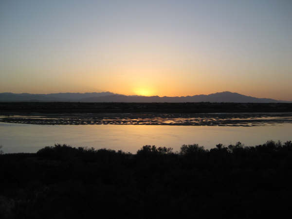
We were invited to stay at BajaRob and Connie’s (Bahía Santa María) which is 24 miles south, and we arrived about 4:30 pm and enjoyed the sky changing color and the Sea of Cortez. Rob and Connie arrived about an hour later from an event put on by the South Campos Community, called a White Elephant… Rob can describe that to you guys!
The night was wonderful and we were asleep before New Years (well, unless you go by a different time zone).
The next morning (Sunday, Jan. 1), was an awesome sunny day… Good omen… I helped Rob and his neighbor Jim bring up fresh sea water for the clams for a final purge. Rob ordered 100 dozen clams and has the ‘clam thing’ down to a science… There were up to 100 people at the New Years Day party (1-4 pm) and the clams were perfect in both quantity and flavor. It is a pot luck, so many dishes and salads and Rob’s black eyed peas add to the bowl of clams and butter everyone enjoyed.
Before the party, Baja Angel and I drove to Shell Island and enjoyed some quiet time before the party.


This New Years 2012 trip continues here: https://vivabaja.com/new-years-2012-fossils-friends
July:
Fifteen Fabulous Days to the Tip of Baja and Back, 2012
Saturday, July 14: Crossed the border at Tecate 11:14am. When entering Mexico there is a red light/ green light signal to tell you to continue on in or to pull over for inspection. Being a pickup truck full of stuff, we got a red light. Since Tecate is a very quiet border going into Mexico, it took just a few seconds for the officer to glance at my truck and tell me to continue on into their country. They are looking for items that may be resold in Mexico such as appliances, electronics, etc. Camping and personal gear is no problem.
Signs point the way towards Mexicali making the little bit of city street use very simple. Just east of town on Highway #2, we stop at a Pemex station and topped the gas tank. Price of 87 octane ‘Magna’ from the green/ ‘verde’ pump was $3.02/ gallon (slightly higher price along the border). Got on the toll highway (Highway #2-D) towards Mexicali for a quick 80-mile trip east to Highway #5 for San Felipe. Toll at El Hongo was 57 pesos (or posted US$4.30), toll at La Rumorosa was 20 pesos ($1.55), and final toll near the junction with Highway #5, was 60 pesos ($4.65).
Highway #5 has been torn up for widening in sections for the past few years and during this trip, there was a total of 20 miles of unpaved detours along the new road work. This is in the area 47 miles south of the Highway 2-D junction (at the sand dunes) to El Chinero mountain (between the active gold mine and Highway 3 junction). The detours were mostly smooth and watered down for dust control.
At the Highway 3 (Ensenada) junction, 160 miles from Tecate is the first major military inspection where soldiers may ask you to step out of your car so they can look for illegal drugs, guns or ammo. They are always polite, friendly and very quick (at least to us). Most of the time they will ask you where are you coming from and where are you going. In a couple locations they recorded my name and asked what year model my Toyota Tacoma was (2010). Showing them your driver’s license makes their writing of your name easier. They never asked to see passports or tourist cards, and never have on any of my trips… as it is not in their duty of looking for guns and drugs.
At El Dorado Ranch, we stopped to top our gas tank. This is 7 miles north of San Felipe, just past the big ‘Rockodile’ sign (a crocodile). The price here is the same as at all other Baja stations for this trip with one exception and the border zone price. Magna (Regular 87 octane) is 10.05 pesos per liter or $2.95 per gallon. If you are using dollars, this station was giving an exchange rate of 13.00 pesos per dollar. I took on 10.5 gallons for the 183-mile drive from Tecate. The convenience store at the El Dorado Pemex had 8 packs of Tecate Light Beer for 84 pesos ($6.46 for 8 cans).
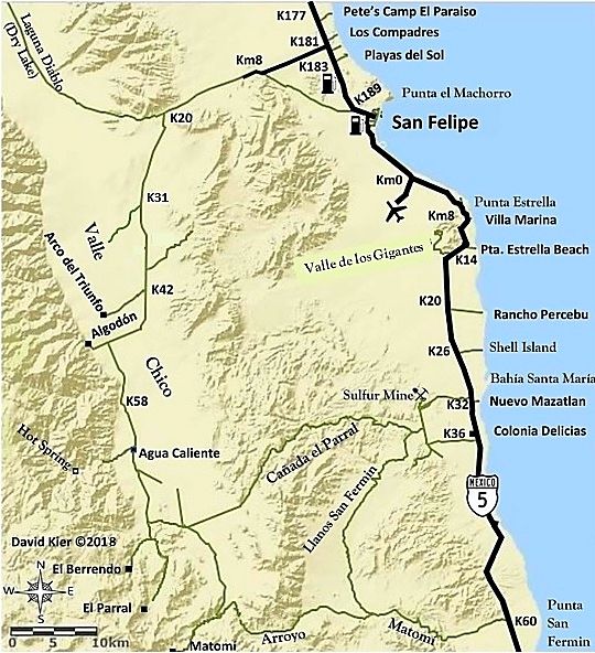
We left the station at 3:30pm, drove the 7 miles to San Felipe, turning south at the traffic circle. In 6 miles, a left turn is made (ahead goes to the airport) and this point is also Kilometer 0 for Highway #5 south. Several vacation home and camp areas are passed as we head for a very special beach I have been camping on for the past 34 years, before most of the region’s development and before paved roads ventured south of San Felipe. It is a barrier island that during the highest tides is surrounded by water and impossible to access or leave. Being difficult to get to is one reason it remains as beautiful today as it was the first time I camped here, on the beach I call ‘Shell Island’. The access road to the island is near Km. 26, almost 22 miles from San Felipe. We arrived at our campsite at 4:40 pm. Our vacation had begun!


The trip continues south, see https://vivabaja.com/p712/ to view it all. Thirteen days later, we come back to Shell Island on our drive north… A great night, and now the drive home:
2013
May:
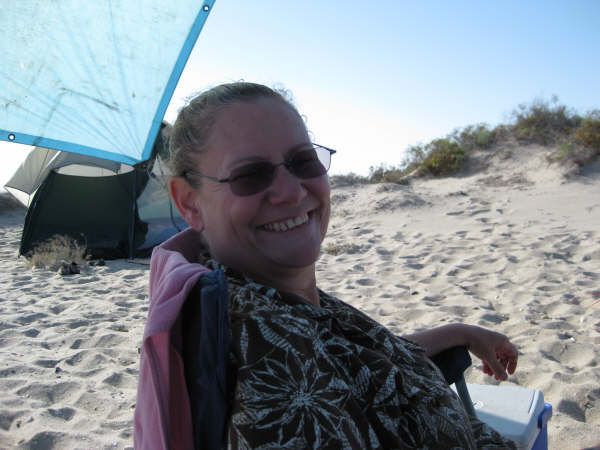
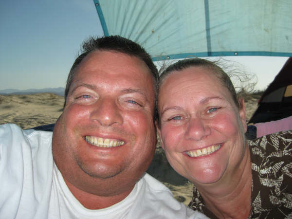
With only a couple exceptions, we typically go to Shell Island over Memorial Day weekend. The weather is great, the sea water is not as warm as we like best, but okay for short swims, and we mostly need to get away from civilization by the time late May rolls around. We had not planned to go until Friday noon when Baja Angel (my wife and best friend) said she needs a Baja beach fix!
We left home at 5:30am Saturday, stopped for breakfast along the way and arrived in San Felipe a little after 11 am… topped the gas tank, bought a case of Tecate Light and a few sodas and headed first for our friend Baja Rob’s in Bahia Santa Maria. A lot of activities were happening and despite his strongest efforts to have us stay in his great guest room (which we have many times) and join in the fiestas, we had to decline as peace and quiet is what Baja Angel really needed, and camping on Shell Island nearly always provides that tranquility.
The highest tide of the month was that day (Saturday, May 25) at 2:40pm and a whopping 19.7 feet… Anything over 18.5 feet surrounds Shell Island with sea water (why I call it an ‘Island’ and not just a ‘Beach’… as shown on many maps, too):

So, after visiting with Rob for a while, we headed back north to the access road to the island… and as we neared the beach, the tide already had flooded the access… This is where 4WD, good tires, and Toyota’s Active Traction Control makes getting to tough places less stressful than otherwise!
One patch of gooey mud and the Tacoma goes sideways briefly, but counter-steering put us back on course and soon we were out of the mud and onto the sand. I got as far as the water’s edge before I had to deflate the tires for floatation. Even super traction 4WD is no match for the bottomless sand/shell mix of this beach. Dropping the pressure to 18 psi is enough for the brand of tires I have on the truck (Hankook Dynapro ATM) … some other brands require lower pressure to keep from digging into the sand. While I let the air out, Baja Angel takes some photos…


2014
August-September (Labor Day):
Labor Day 2014: Baja Beach Get-a-way!
Now, one would think that Labor Day, the last big weekend of summer, would mean every beach is going to be crowded, yes?
Not true!
On Labor Day 2013, a tropical storm was dumping rain on San Felipe, so our customary 3-day beach get-a-way didn’t happen. We had gone down on Memorial Day 2013, but the water temperature is still a bit chilly for our liking. July-Sept. the Gulf of California near San Felipe is like a warm bath, still cooler than the air, but so nice and relaxing that it is therapy to us. Over a year since our last visit to Shell Island really had me stressed, as I am so connected to that beautiful beach, nearly 20 miles from San Felipe.
Saturday Aug. 30, 2014
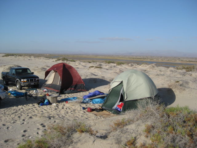
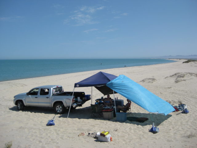
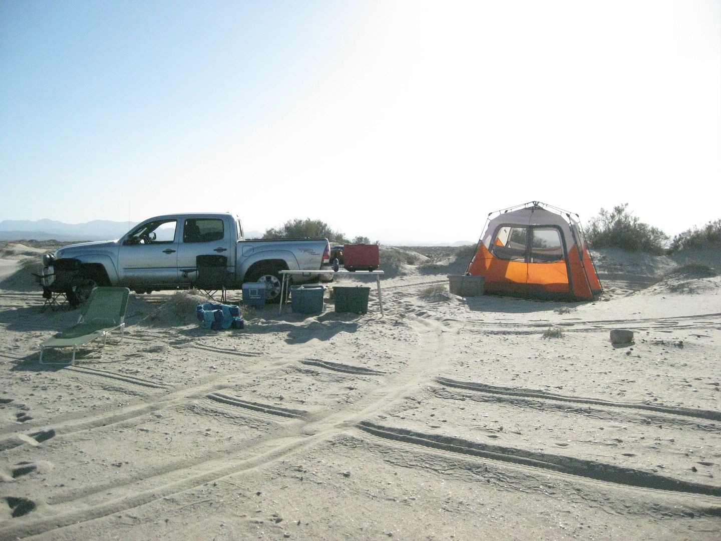
I loaded up the Tacoma with the essentials for a beach weekend in Baja: Sun canopy (Coleman Easy-up), Tent (Coleman Instant Tent), chairs (yup, Coleman), table, stove (guess what brand!), two X-treme ice chests (one for food using block ice and one for beer and water and some mango-ritas using crushed ice). We have an air mattress with an electric pump that I plug into the 110v outlet that Toyota puts in the bed of the TRD Tacomas.
Another reason for Shell Island as our destination is that my wife Elizabeth (‘Baja Angel’ on Baja Nomad) loves Shell Island and it is her birthday around Labor Day… works for me!
We were on the road at 8:09 am, stopped for gas in El Cajon at 8:54 am, topped tank at El Centro at 10:40 am and crossed into Mexico at 11:00 am.
The drive from Mexicali to San Felipe was fast and easy. There are no more detours along the way as all highway widening is now complete.
We stopped for gas at the El Dorado Pemex station (1:05 pm), which is just past the giant Rockadile sign. The station was fully open, as was the convenience store there. Magna Sin (Regular unleaded) gasoline was 12.95 pesos per liter. 500 pesos topped my tank (38.6 liters). The exchange rate offered was 12.80 pesos per dollar. I paid $39.00 for the gas and a dollar tip to the attendant (who did not wash the windows) but was otherwise friendly and wanted to speak to me in English.
As there was some interest in the gas station situation in San Felipe, I noted the other stations…
There was a second Pemex station open, a few more miles south, before entering town. Just past the arches (town entrance) is the third Pemex station on the right. A few stop signs, a couple of new super markets, and the Clam Man building is passed before reaching the traffic circle where we turn south (right) to leave town. At the traffic circle are two Pemex stations. Just south, about 3/4 mile from the traffic circle, the final town Pemex was closed and the pumps had their hoses removed.
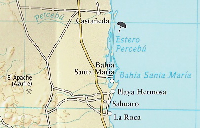
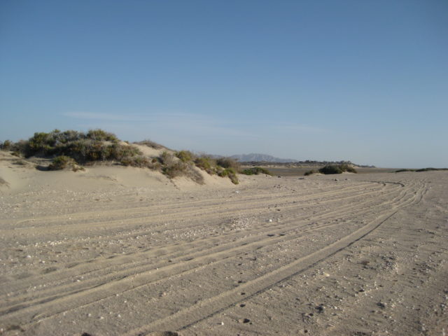
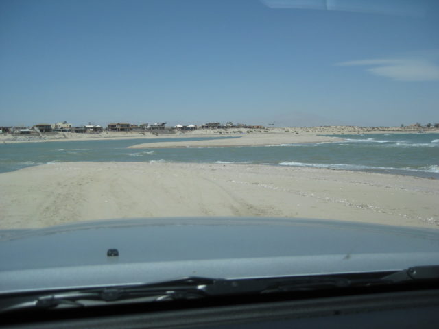
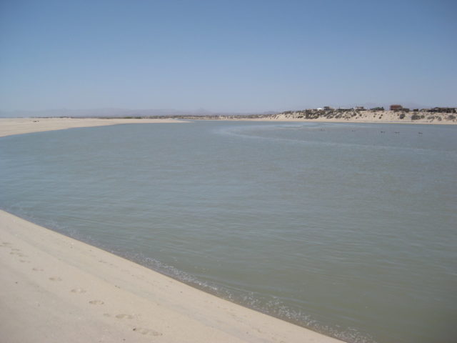
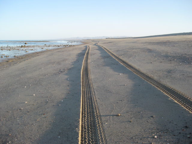
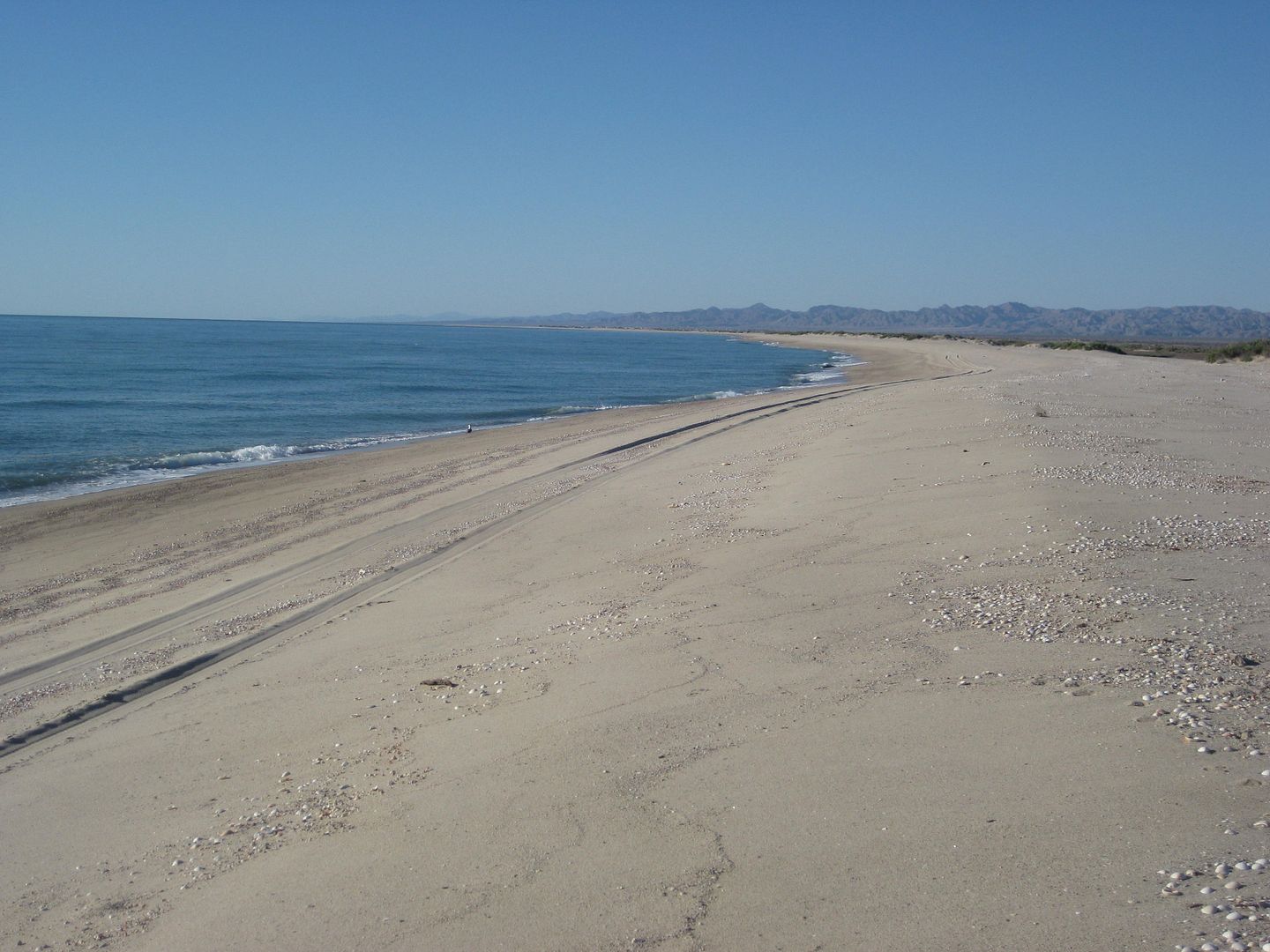
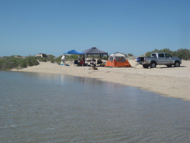
The drive south was easy and almost no other traffic on this U.S. holiday weekend. Near Km. 20 the road to Rancho Percebu is passed (this is not a ranch, but a beach camp for tourists along with private homes). Some years ago, many of the campos became ‘ranchos’, perhaps for tax reasons the name change was made. Before, it was called Laguna Percebu. It is the lagoon that begins here which creates the barrier island I call Shell Island which runs all the way to Bahía Santa María, 5 miles from Rancho Percebu.
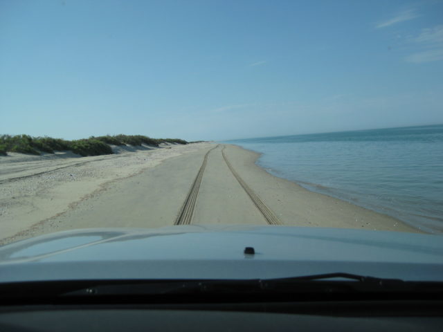
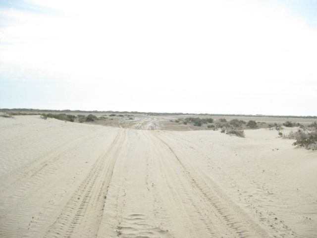
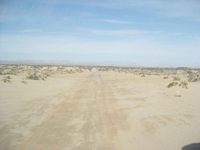
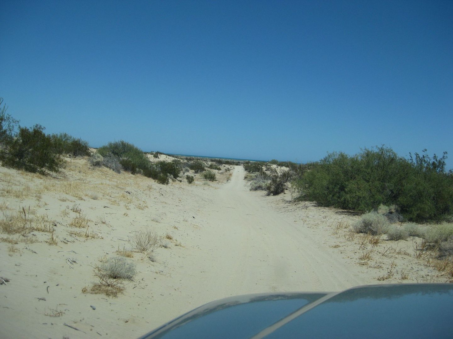
The access road to Shell Island is by the Km. 26 marker and some cinder block columns. It is less than two miles to the beach. During high lunar tides, the road is under water the final half mile… it really does become an island!
Some photos on the access road east from Hwy. 5, and on the beach…

Instead of heading towards the old concrete bridge along the once elevated causeway onto the island, we took the more traveled and original access road that veers to the right towards the fish camp site/ shack. If you find this area underwater (full or new moon), the best bet is to stay on what appears to be the heaviest used track, as that will be the most compact… and often the most water as it is lower by a couple of inches. This trip, the moon was closer to a quarter phase, and the high tides were about 14 feet. When they are over 18 feet is when Shell Island becomes surrounded by water.


There was NOBODY else on the entire beach, even the fisherman camp was abandoned… Where else can you go on a Labor Day weekend, 6 hours from Southern California cities and have an entire island/ beach to yourself?

Answering a question about tire pressure for sand driving, and our meals on Shell Island:
As this was the first time on Shell Island for this tire on this model truck, I drive as far as I am able to see how well it does… and I was amazed that with my heavy load in the bed (2 ice chests, etc.) that I drove onto the beach and down to the surf line and even continued about 1/4 mile before the truck struggled. The tires (Destiny Dakota AT) were at 35 psi and I was in 4WD-HI with traction control (limited slip) on.
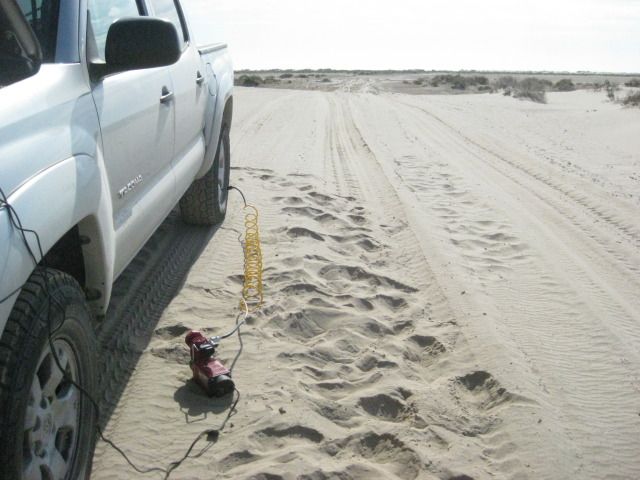
I stopped and Baja Angel began shell searching while I deflated the tires. I simply use a tool on my car keys that is like a small screwdriver to depress the air stem valve. It takes like 2 minutes and 15 seconds (I am counting as the air is released) to remove 15 pounds. Since the tires did so well at 35 psi, I only dropped to 20 psi… and sure enough, they did great the rest of the time driving to our camp spot and back to the road-head. We camp 2 miles down the beach from the road-head.
After I switched from a cigarette lighter connected compressor to the Harbor Freight battery connected compressor, the fill time was 3 times quicker (2 psi per minute to 6 psi per minute). However, I had issues with the Harbor Freight compressor fuse holder melting, and fuses melting. I was later given a Tsunami MV-50 red compressor… it is less bulky, has a smaller carry case than the Harbor Freight one, and does not melt the fuse folder or fuse when used. It is a little slower at 5 psi per minute, but that is the one I use.
We did not leave the island for meals or anything. In the past we gone to or have joined with Baja Rob and Connie, and eaten at the places in Colonia Delicias (5 miles south on the highway) sometimes. This is rare compared to eating simply while we are on the island.
Since these beach trips are a get-a-way from the usual for us, and I usually cook at home, there is not much to our eating… and we want to lose weight anyway!
Breakfast is cereal (oatmeal or raisin bran was brought), we had some bananas also. Baja Angel likes coffee. We have orange juice, too.
Lunch is sandwiches, and Baja Angel makes great ones. We have tomatoes and sweet onion, use sandwich buns. Chips and beer (Tecate Light) with lime juice complete that meal. Snacks are cheese and crackers or chips and salsa.
Dinner can be sandwiches, snacks, or a hot freeze dried meal in a bag (just add a pint of boiling water) and plenty for two. We had beef stew Sunday night. Our favorite is the beef stroganoff and I also like the chicken and rice.
We drink lots of water, beer, ice tea, mango-ritas. We enjoy a camp fire, and in the summer, we just don’t need to sit close to it! We bring a couple of those 4-hour instant logs and a bundle of store firewood. This last weekend, some fisherman had camped at our spot and left a pile of local wood there (see it in the photo above).
The whole idea is to unwind and not work anymore than what is needed to set up and tear down camp. We haul out any trash that doesn’t burn along with the mess the fishermen left when they went away (cans, tequila bottle). We are fine with simple camp life and the only use for the stove is to heat water for coffee and the camp meals in a bag. When we were younger and took our kids camping, we cooked up scrambled eggs, burgers, etc. Now that it is just us, we don’t need to do that, so we don’t!
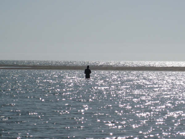
I was a fisherman and may be again still… I just didn’t fish much after my dad died… it was his thing and reason for going to Baja. My reason to go to Baja is to explore, relax, photograph, write travel stories. I love to eat fish, but am just fine if they are caught by someone else. I did mention to Baja Angel as we were floating in the Sea of Cortez and had fish jumping out of the water all around us, that I would like to bring a pole down and maybe fish off the beach again, as I had with my dad in the same area from 1966-1983.


The day was beautiful, but about 11 am the wind picked up and stayed with us until about 5 pm. In the past, the wind in September was none existent. That keeps it hot, but the sea is flat and nice for swimming/ floating. With the wind created waves, swimming at high tide was not easy. High tide was about 4 pm. We did go to the lagoon at high tide where it is as calm as a lake and floated in there to almost sundown… NICE!
Monday
Since we wanted an early start, we collapsed the sun canopy and packed it in its case the night before… We had our breakfast of orange juice and crunchy raisin bran, burned all paper trash and cleaned up the cans and bottles left by the previous camp site guests. There was a surf board and a glove box along with some plywood that was a wind break, I didn’t have room to haul away.


Off the deep sand and on the hard-dry mud flats, I stopped to refill the tires back to 35 psi from 20. We were once again driving at 9:53. The distance from the beach to Hwy. 5 (Km. 26) is 1.9 miles and just under 1/2 mile is on the mud flats. During a high tide of over 18 feet, the sea floods the flats as the lagoon from Percebu and the back bay of Bahia Santa Maria connect and make Shell Island surrounded by water, as the map shows…
It’s about 22 miles back to the San Felipe traffic circle, where it is 10:30 am and 95º. No need to buy more gas, as I am still above the 3/4 full line. We head north on Hwy. 5.
The military check point at the Hwy. 3 junction was the fastest ever. This was the first time we were not asked to get out of the Tacoma for a search, northbound!
To read the rest of the trip report and more photos: https://vivabaja.com/p914/
2015
July:


Wednesday, July 22: Perfect day, again… but the day you leave is typically the best weather day, so we were not surprised! We leave our beach camp at 8:00 am, and once we are off the beach we have the tires aired-up at 8:30. Deflating tire pressure is needed in such deep sand with a heavy load in the truck to prevent spinning the tires and getting stuck. An electric tire pump is used to refill them and takes about 15 minutes for the four tires to go from 15 psi (back) or 20 psi (front) to the normal street 34 psi.


To read and see the rest of this trip report: https://vivabaja.com/july-2015/
2016
July:
JULY 2016: Shell Island and Mission San Fernando DAY 1 (Thursday, July 7, 2016) We had some vacation time and love camping on the beach when the weather (and water) is warm! June or July is never too hot for us on the gulf coast of Baja! Our favorite beach that is only a day’s drive away (6 hours) is Shell Island, about 20 miles south of San Felipe. It is a barrier island with sand dunes that is surrounded by water at the highest monthly tides. Getting to it other times may require slogging through slimy sea mud! This helps preserve the beach as a rare, undeveloped and natural camping area. That is just what we like… peaceful, remote camping. We bring everything we need… and we do not need much!
We pack up the truck and get out of town by 8:30 Thursday morning (in this case, Escondido north of San Diego). Heading to El Centro was easy, then south through Calexico and into Baja at Mexicali (west/downtown). With a lot of discussion that there is a need for all trips into northern Baja for the “Tourist Card” (FMM), a type of visa for Americans to get, no matter where or how long a trip lasts, we pull over just across the border (on the left) at the INM office. There is a FREE tourist card for up to 7 days in Mexico and a PAY one (about $25 US) for up to 180 days.
The officer speaks perfect English and explains that the FREE FMM must be returned to their office when you leave Mexico (to prove you did not stay longer). However, the PAY one does NOT need to be returned (as you can keep it for any trips south for the next 180 days). Now, to get back to the INM office in Mexicali or Tijuana may be quite an ordeal because of city traffic and finding your way from there to the end of the line, to drive into the U.S. We planned to return through Tecate, a much smaller border town with easy access to the INM office, which is on the ‘entrance to Mexico’ street. Not sure how long before we can get back to Baja, we get the FREE ones and see how that works out.
The INM officer scanned and stamped our passports, had us fill out the two-piece FMM, and gave us one part and he kept the other. We were on our way in about 10 minutes. Not one other person stopped to get the FMM while we were there. Nowhere in the next 5 days did anyone ask to see the FMM on our trip. However, we were good to go if it was requested!
Driving south, the road to San Felipe is well signed, but be careful of the lane one sign points to as you approach a bridge… you need to go up the bridge, which is the next lane to the left!
We arrive at the El Dorado Pemex station, about 13 miles north of San Felipe and fill up. The price is 12.90 pesos per liter and the exchange rate is 17.30 pesos per dollar. I suspect this pump reads high, but that is typical in many stations, some believe. Next time, I will go to the newer Pemex a few more miles down the highway. It is 1:30 pm (5 hrs. from Escondido) and we are right on schedule.
The road south from San Felipe to Puertecitos is in pretty bad shape with several holes now, and still a few steep dips… Max speed 50 mph. Our beach access is by Km. 26 and we go into 4WD… the beach is only 1.5 miles away, but there is still some water and mud from the higher New Moon tides of a couple days ago… We slime through it with not too much mess and arrive on the beach about 2 pm. Our camping spot is a couple miles down the beach and requires deflating the tires (as the Tacoma is heavy with two full ice chests and camping gear). Dropping from 34 psi to 20 psi does the trick (sometimes 15 or even 10 psi is required, depending on conditions and tire type). I am running Hankook DynaPro ATM tires and they are excellent in sand.
We are at our camping spot and setting up at 2:30pm.
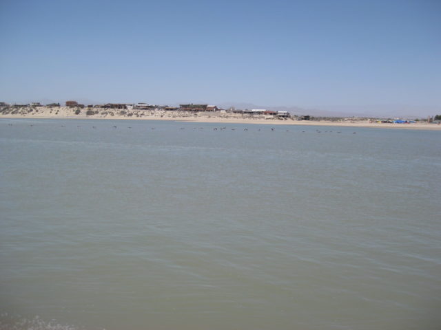
The temperature was 100° crossing the desert, but only 95° on the beach. There is a strong south breeze and it makes getting into the water for a swim tough with short, slapping waves at high tide. We walk across Shell Island and take a swim in the calm lagoon on the other side… this is often called Laguna Percebu or Estero Percebu.
The next two days, the midday high temp was only 88° and a much calmer breeze… PERFECT!
Here are some photos on Shell Island:

We did a lot of relaxing and swimming/ floating when the tide was halfway in or higher. As it was, that would be in the morning to around 9 and then again after noon. At low tide, the 14-18 foot average tide height takes the sea so far away and you can walk a mile and only be ankle deep! Twice a day the tide is high and twice it is low… A lot of gravity is at work in the upper Gulf of California!

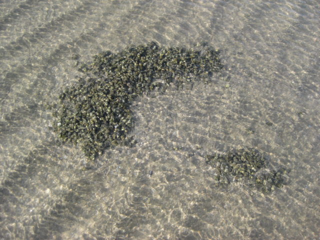
The next day, at high tide we see something new!
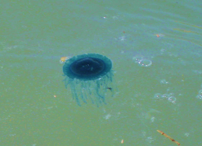
I had never seen any jellyfish on Shell Island in nearly 40 years of camping there. As I would find out (this morning), these were not true jellyfish but floating marine organisms… Here is the answer from Dr. Hans Bertsch (author of Sea of Cortez Marine Invertebrates and a new book mentioned in his reply):
Dear David,
Thanks for the photos of Porpita porpita (Linnaeus, 1758); Phylum Cnidaria, Class Hydrozoa, Family Porpitidae. Although it is in the same family as the infamous man-of-war Physalia, it is not really dangerous to humans. Both are pelagic, frequently washing ashore when the winds are right. It is obviously in my new, in galleys, book, Invertebrados Marinos del Noroeste de México…. Porpita is called “Blue Button,” or “Botón Azul.” The shrimpers probably had nothing to do with the beaching of Porpita; winds. You just have to be at the right place at the right time.
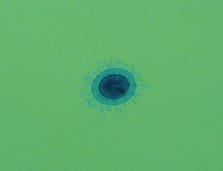
From Wiki:
Porpita porpita From Wikipedia, the free encyclopedia:
Blue Button Scientific Classification Kingdom: Animalia Subkingdom: Eumetazoa Phylum: Cnidaria Class: Hydrozoa Order: Anthomedusae Suborder: Capitata Family: Porpitidae Genus: Porpita Species: P. porpita
Binomial name Porpita porpita (Linnaeus, 1758)
Although it is superficially similar to a jellyfish, each apparent individual is actually a colony of hydrozoan polyps. The blue button is a Chondrophore, which is a group of cnidarians that also includes Velella and Porpema. The chondrophores are similar to the better-known siphonophores, which includes the Portuguese Man o’ War.
The blue button lives on the surface of the sea and consists of two main parts: the float and the hydroid colony. The hard golden-brown float is round, almost flat, and about one inch wide. The hydroid colony, which can range from bright blue turquoise to yellow, resembles tentacles like those of the jellyfish.[5] Each strand has numerous branchlets, each of which ends in knobs of stinging cells called nematocysts.
The blue button sting is not powerful but may cause irritation to human skin. The blue button itself is a passive drifter and is part of the neustonic food web. It is preyed on by the sea slug Glaucus atlanticus (sea swallow or blue glaucus) and violet sea-snails of the genus Janthina. It competes with other drifters for food and mainly feeds on copepods and crustacean larvae.
The blue button has a single mouth located beneath the float, which is used for both the intake of prey and the expulsion of wastes.
Sunday, July 10, 2016…
We get camp taken down, and loaded up by 9:10 am…

10:00 am , we are off the beach, refill the tires to 34 psi, head to the Ejido Delicias stores (Km. 35-36) and get a half block of ice and a bag of cubes to add to our ice chest (we condensed the two to one this morning).
They are both Coleman Extreme 5 Day chests. One was for beer and water bottles (One 10lb. block and two 10 lb. bags of crushed) + 30 cans of beer (Tecate Light) and lots of water bottles… The other was for meat & cheese, milk, OJ, more water bottles (pre-frozen) and had 2 blocks and one bag of ice. I drained the melted water out of the food box except for a few inches at the bottom. The beer chest with only 1 block, I let the melted water remain inside. This was a test… I was sure the drained box would have more ice (2 blocks vs. 1, opened less often, etc.). The beer chest was new, but still 5- day rated… the temps were near 90° each day and we left them in the truck bed only covered by folded tarps. The beer chest, with undrained water, had twice the size of block ice (1 block) as did the food chest (2 blocks) had after 3.5 days of un-ideal conditions! It was a good lesson. I had heard pros and cons of both drain and leave the water in there. Obviously, with food, you may need to drain when driving so the sloshing liquid does not make a mess of your food. We use snap lid containers or double zip lock bags to keep out the water.
See the rest of the trip report and photos: https://vivabaja.com/july-2016/
September:
The Baja Extreme 2016 (September 9-19), a casual tour designed by me with one excursion (far side of Concepción Bay) requested by Jesse Hansen.
Eight people in four off-road-ready Toyotas made exploring Baja California their goal. We traveled to as many sites as I could fit into the time we had on the peninsula. We saw six Spanish mission sites, a giant painted cave, beautiful beaches, petroglyphs, and fossils. Have a look at some of the best adventure that can found in Baja California: For ten days, four well-prepared Toyota 4X4s traveled and explored some of the best that Baja California has to see and do in 10 days of travel and fun. Only one night was spent on Shell Island:

See the rest of the tour: https://vivabaja.com/p916/
2017
May:
Memorial Day 2017: A Baja Beach Family Camp Trip
Hello Amigos,
Our 3-year-old grandson was ready for his first Baja trip and camping weekend. His parents have been to Shell Island multiple times before his birth and were ready for him to experience the beauty and wonder that this barrier island beach has to offer.
Because they no longer had a 4WD truck, it was necessary to make it all work in my Tacoma. Now, there was no room for any gear inside the cab, so everything had to go in the 5 ft. bed of my 4 door 2010 Tacoma TRD Off Road 4×4. Costco has some neat, stackable storage tubs, so I got some and they worked great for both family’s gear and food… along with two ice chests, a table and chairs, and a 6-gallon water bottle.
We spent the night (Thursday) at their La Mesa home, as it is halfway to the border from ours and we had to repack and then load up in the morning.
We were on the road before 5:30 Friday morning and the 3-year-old was wonderful the entire trip, and border wait, too. We crossed at Tecate, mostly to avoid the construction delays at Calexico, where I normally cross for San Felipe or further south trips. We got the red light at Tecate, as we were loaded up real high in the truck. The inspector just asked if we had certain items, and that included beer, lol! I told him that Tecate was where the best beer was made and we would be silly not to buy only Mexican beer.
The drive was uneventful and we made a few stops, including the typical break near the sand dunes, halfway to San Felipe from Mexicali.
When we got to the Pemex just north of town, we discovered one of the boxes had dropped off the truck!!! OMG… we thought it was the food box (bread, cereal, etc.). The only thought as to where was hitting some bumps at the stop, 60 miles back north… so from 10:30-12:30 was a 120-mile round-trip only to NOT find the box.
We simply went to the supermarket in San Felipe and duplicated as best we could what was in the ‘food’ box (pots, pans, plates, silverware included).
We got to the salt flat that surrounds Shell Island and it had water on it from the big, new moon high tide… we had wanted to beat to get to our spot. Some squishy mud four wheeling got us to the beach and then the two-mile drive to our favorite camping spot was a race to pass the place where the high tide touched the sand dunes and blocks passage.
We got through, just barely! The box that fell off was NOT the food box, it was one with our floating chairs and beach stuff… So we had extra food now!
The next days all had near perfect weather and no wind above a nice breeze.
Our grandson had a great experience and it was great fun.
On a very sour note, his father was hit by a stingray while crossing the water between sand bars, far out during low tide Sunday morning. His wife ran the half mile to where Baja Angel and I were, in camp relaxing. I drove my Tacoma way out on the sand bars to ambulance him back to camp, as walking was impossible.
There may be no pain as severe as a stingray’s, and it cut deep with lots of blood. I applied tea tree oil first to kill any bad bacteria and then began the hot water applications as he laid in agony, for several hours.
By Sunday evening, the hot water soaking had greatly relieved the pain enough for him to move about. The wound was bandaged with Neosporin and taped well. The next day (Monday) he was well enough to help take down camp and help me load the truck.
We got into San Felipe about 11 am Monday and got the truck washed (U.S. border does not want loads of dirt on your vehicle). We had fruit cups and French fries while waiting for the wash. After the wash, we went to the Malecon for fish tacos.
The drive north began about 1 pm. There was about a 15-minute wait at the military checkpoint, 30 miles north.
The border wait at Tecate began for us at 5:21 pm yesterday and it was 2 hours and 45 minutes to reach the border crossing. Nice lady inspector, no secondary.
Tuesday 11 am update: The doctor said he needs no stitches, and prescribed an antibiotic and said to keep wound unwrapped and let it dry out. All is well!
Some Shell Island photos….


August:
DAY 1 (Tue Aug 1, 2017)
On the road at 8:05 am, heading east for Calexico/Mexicali via I-8.
Exchanged dollars for pesos at 17.35 pesos: 1 dollar. Making 100 pesos = US$5.76
The border crossing was simple, I got the green light [red light means you get inspected, it’s either random or someone decides?]. As I already had a validated FMM (Tourist Card), no need to stop at the INM (immigration) office, once inside Mexico.
At 12:20, I stopped to have lunch just south of Mexicali, at the restaurant ‘Yocojihua’ (Km. 12) having been reading good reviews for it on Baja Nomad. I had 4 tacos dorados (2 beef & 2 chicken) with rice & beans and a Jamaica drink for 115 pesos + tip (25 pesos). It was a very good lunch and start for Baja food!
Gasoline at Km. 184 ‘ejido’ Pemex, near San Felipe, was 15.86 pesos per liter (=US$3.46/ gallon) for Magna (87 octane). The Oxxo market had a deal for Tecate Light beer, 9 cans for 101 pesos (65 cents each). That deal improved the further south I got (10 cans for 95 pesos or 55 cents each). The time was 2:17 pm.
Cans to avoid broken glass in the ice chest. However, later on… all the rough dirt roads did a number on 2 cans, causing them to leak! If I am not on the road for a day, then an ice cold bottle or two of Pacifico is perhaps my favorite drink in Baja?
I arrive on Shell Island (access is 22 miles south of San Felipe) and go about a mile up the beach to camp. The truck not being as heavily loaded as other times was able to do the drive on the deep sand without deflating (thus saving me the work of putting air back in, in the morning).
It is 4:30 pm and my simple camp is set up… a folding chair, a cot, and the stars above. Only a sheet is needed as the summer nights are warm.
I enjoy a couple swims before the sun sets behind the Sierra San Pedro Mártir, just south of Diablo Mountain.
Total miles today: 298
On the return north leg:


DAY 14 (Mon Aug. 14, 2017) The trip home:
I had a great evening under the stars.
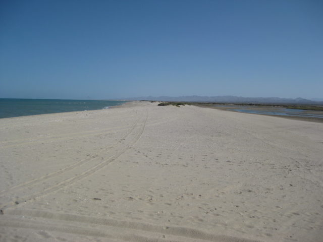
Unless there is wind, Shell Island is an ideal beach camp and relaxing location. It is a 4WD only kind of place either for the deep sand on the beach or the possible mud beds that surround it. It is an island and during the highest lunar tides, sea water surrounds this barrier island beach. The access is at Km. 26 (another road cuts across from Km. 25). It is 1.3 miles to the mudflats and another 0.5 to the dry sand of the beach. The island is about one mile to the south end (Bahia Santa Maria bay) and three miles to the north point (opposite Rancho Percebu campground). Camp where ever you like or as much deep sand driving you can do.
See all of the 14 day trip to the tip photos: https://vivabaja.com/p817/
2018
August:
At San Felipe, I get gas at the “ejido” Pemex (Km. 184) after hearing good things about it from PaulW. Indeed, it seems like honest pumps and good persons working there. Magna was 19.35/liter and the exchange was 18.35:1 dollar. My truck took on 37.2 liters (9.8 gal.) for 185 miles giving me a great 18.9 MPG! I love ethanol-free gasoline!
It is 4:40 pm and I head south to see if the tides will allow me to get across the marsh/muddy salt flats to Shell Island. It is just after a new moon and it was really high.
Well, there was water in low spots but the flats were not underwater (I have crossed these when I could not see the ground, just the shrubs, more than once).
About halfway across the flats, I sink in… oh balls!
I put it reverse and try to back out… I am in low range and my A-TRAC is always on in low range. However, my tires can do nothing more than spin in the goo and A-TRAC hates spinning tires (as it is useless to spin, typically)…
One last resort that the Tacoma has, a rear locking differential (“for emergency only”, says Toyota). When the rear is locked, A-TRAC is disabled under 3 mph and only works on the front tires in that situation. This forces the tires to spin (in back) and I get out. Good thing, as I am alone, and nobody is in Baja in August, except the most sincere Baja lovers!
I back out of the goo, and since my truck is now got mud splattered, I take a different tack and that worked!


I go for a swim, make dinner, and sleep well. I see some meteors when I wake briefly before sunrise while it is still dark and a moonless sky.
Wednesday, August 15, 2018
See all of this trip photos and report: https://vivabaja.com/p818/
Summary: Total visits to the island on this web page: 34
See more Baja California Location Photos and read of more places to discover: https://vivabaja.com/locations/