Southernmost Baja (14 days/ 3,000 miles)
DAYS:
1) San Diego North County to Shell Island (south of San Felipe), 298 miles (via Mexicali).
2) Shell Island to El Datil south, 396 miles.
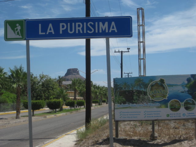
3) El Dátil south to Lopez Mateos, 229 miles (via La Purisima & Comondú).
4) López Mateos to Dolores Overview, 201 miles (via Puerto San Carlos, Mission San Luis Gonzaga, La Pasión).
5) Dolores Overview to La Paz, 181 miles (via La Soledad, San Evaristo, tire slow leak).
6) La Paz (Tire repair, a rest day otherwise)
7) La Paz to Todos Santos, Los Cabos, La Ribera, and back, 272 miles.
8) La Paz to Tecolote, La Ventana/El Sargento, Punta Arena, San Antonio, and back, 177 miles.
9) La Paz to Punta Conejo and La Aguja, 88 miles (Days 9 & 10).
10) La Aguja to Punta Marquez, Conquista, and back.
11) La Aguja to Constitución (dead battery), Agua Verde Overview, Bahia Concepción, 285 miles.
12) Bahia Concepción to Mission Guadalupe to Punta Chivato, 135 miles.
13) Punta Chivato to Shell Island, 392 miles.
14) Shell Island (south of San Felipe) to North San Diego County, via Tecate, 292 miles.
DAY 1 (Tue Aug 1, 2017)
On the road at 8:05 am, heading east for Calexico/Mexicali via I-8.
Exchanged dollars for pesos at 17.35 pesos: 1 dollar. Making 100 pesos = US$5.76
The border crossing was simple, I got the green light [red light means you get inspected, it’s either random or someone decides?]. As I already had a validated FMM (Tourist Card), no need to stop at the INM (immigration) office, once inside Mexico.
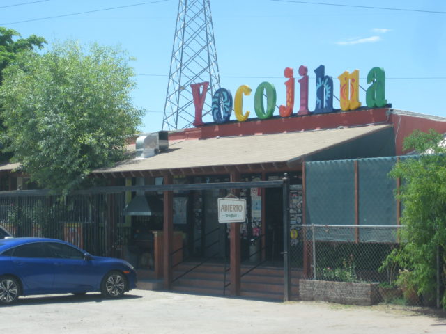
At 12:20, I stopped to have lunch just south of Mexicali, at the restaurant ‘Yocojihua’ (Km. 12) having been reading good reviews for it on Baja Nomad. I had 4 tacos dorados (2 beef & 2 chicken) with rice & beans and a Jamaica drink for 115 pesos + tip (25 pesos). It was a very good lunch and start for Baja food!
Gasoline at Km. 184 ‘ejido’ Pemex, near San Felipe, was 15.86 pesos per liter (=US$3.46/ gallon) for Magna (87 octane). The Oxxo market had a deal for Tecate Light beer, 9 cans for 101 pesos (65 cents each). That deal improved the further south I got (10 cans for 95 pesos or 55 cents each). The time was 2:17 pm.
Cans to avoid broken glass in the ice chest. However, later on… all the rough dirt roads did a number on 2 cans, causing them to leak! If I am not on the road for a day, then an ice cold bottle or two of Pacifico is perhaps my favorite drink in Baja?
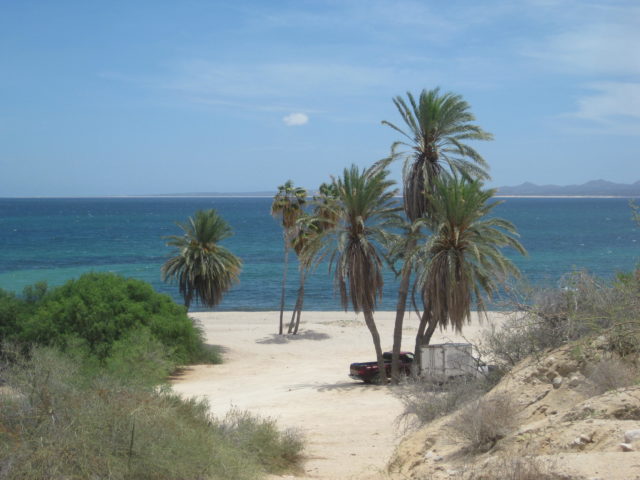
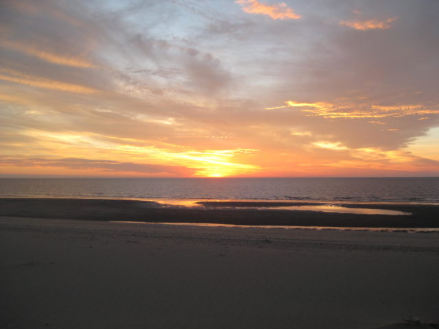
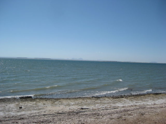
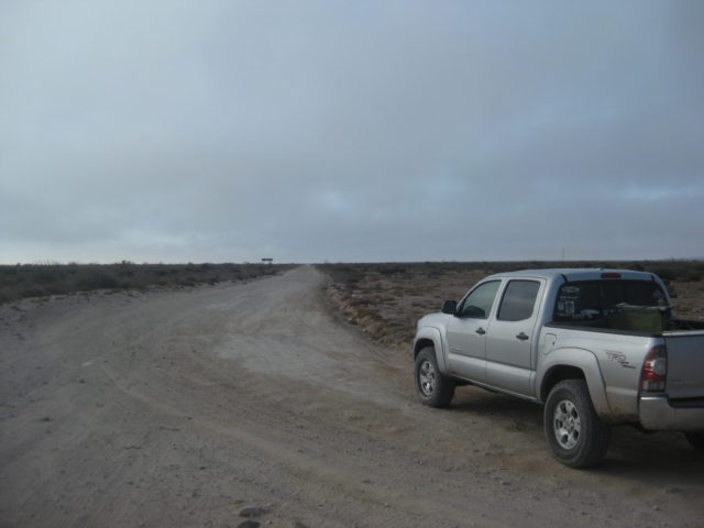
I arrive on Shell Island (access is 22 miles south of San Felipe) and go about a mile up the beach to camp. The truck not being as heavily loaded as other times was able to do the drive on the deep sand without deflating (thus saving me the work of putting air back in, in the morning).
It is 4:30 pm and my simple camp is set up… a folding chair, a cot, and the stars above. Only a sheet is needed as the summer nights are warm.
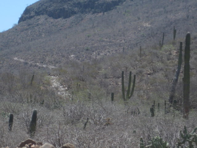
DAY 1 PHOTOS:
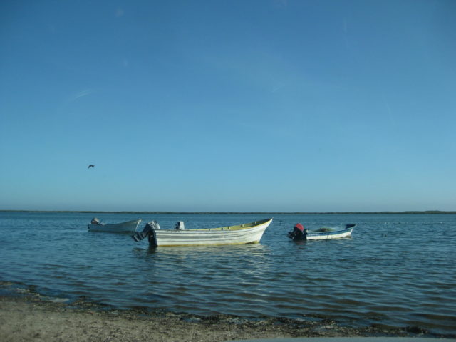
I enjoy a couple swims before the sun sets behind the Sierra San Pedro Mártir, just south of Diablo Mountain.
Total miles today: 298
DAY 2 (WED AUG 2)
Being in a place where the sun rises over the sea instead of a mountain range means it gets light sooner. I was actually packed and left camp at 6:12 am!
I arrived at Bahía San Luis Gonzaga Pemex Station (Km. 147+) at 8:00 am. I topped the tank (108 miles from the last topping) so I could drive worry free to San Ignacio. Magna (regular, 87 octane) here was 16.36/liter ($3.57/gallon) and pumped in 25 liters (6.6 gallons). For those who are wondering, dollars are accepted everywhere in Baja. It is often easier to have pesos for trip expenses and takes away any confusion on money. Mostly that you will get pesos in change if you don’t have the exact amount in U.S. money. This remote Pemex was offering a good rate of 17.00 pesos per dollar. Further south, that rate dropped to as low as 16.00 per dollar.
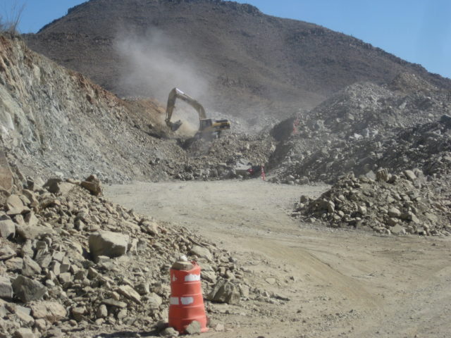
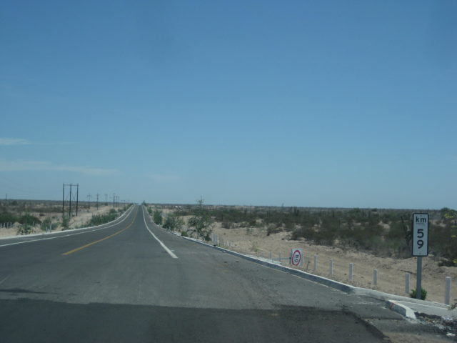
The end of pavement was unchanged from 2014, 12.5 miles south of the Gonzaga Pemex, just beyond the Km. 167 post. [In February, 2020, the highway was completed]
A side note: There was a Km. 170 sign here for a couple years, even though it was 1 km. south of the Km. 166 post. THAT has been fixed to read Km. 167! [A funny thing happened with the completion of the highway: the next kilometer sign (should be 168) was instead Km. 171. Adding three ‘magic’ kilometers to the distance from San Felipe!]
I pass Coco’s Corner, Mile 22.6 from Gonzaga/ 10.1 from the end of pavement, at 8:50 am. I reach Highway 1 (Laguna Chapala) at 9:28 am. Mile 35.7 from Gonzaga, (23.2 unpaved miles). [In April 2021, Coco moved his corner to be next to the highway at Km. 179.5]
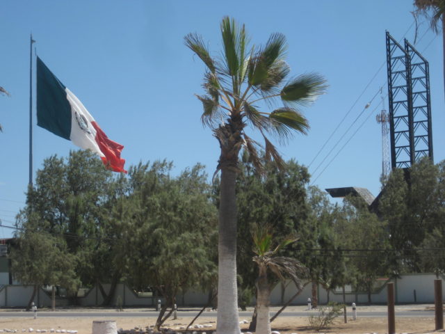
At the Eagle Monument, near Guerrero Negro, is the state border between Baja California and Baja California Sur. The only ‘big’ deal here is being charged 20 pesos to drive over an insect spray strip and losing an hour on the clock going into Mountain Time Zone. 11:30 am becomes 12:30 pm!
I arrive in San Ignacio at 2:09 pm Mountain Time. Pemex station to fill the gas tank for the long drive ahead…
16.27 pesos/liter here. My highway mileage is about 17 mpg… providing the gasoline pump amounts are correct… and sadly, many stations are known to not be. That is just the nature of things… Baja is still so worth it.
Across from the Pemex station are some small eating places. The burrito/taco one is really good. I tried the sea food one today, Mariscos San Ignacio. I had some great shrimp tacos and ceviche of mixed seafood. Totally great.
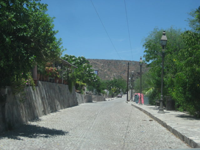
It is 1.6 paved miles from the highway into the town plaza at the giant, stone mission (founded in 1728). This mission of San Ignacio appears on the cover of my book…
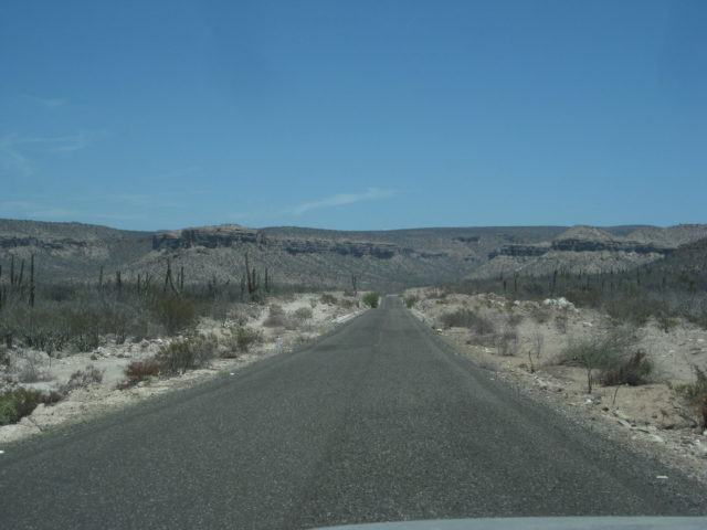
DAY 2 PHOTOS
South from San Ignacio on the road to Laguna San Ignacio and San Juanico (Scorpion Bay).
Gas tank full, my stomach full, on south I go!
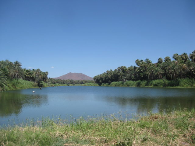
Setting the odometer to zero in front of the mission, I head for Laguna San Ignacio, a popular whale watching location, in season. Closed-up to tourism off season.
The road has been paved to about 5 miles from the lagoon shoreline.
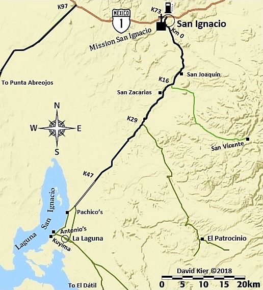
ROAD LOG
The mission and town plaza is 1.6 miles from Highway 1. Continue straight, passing in front of the mission church, passing the market and hotel La Huerta, the paved street curves left, passing the Hotel Posada. Pavement ends briefly.
- Km. 0 This marker sign is 0.6 mi (1 km.) from the mission/plaza. Pavement begins in 500 feet.
- Km. 9 Rancho El Batequi
- Km. 12.5+ Rancho San Joaquín
- Km. 16.5 Road left, signed to San Vicente.
- Km. 19.5 San Zacarias
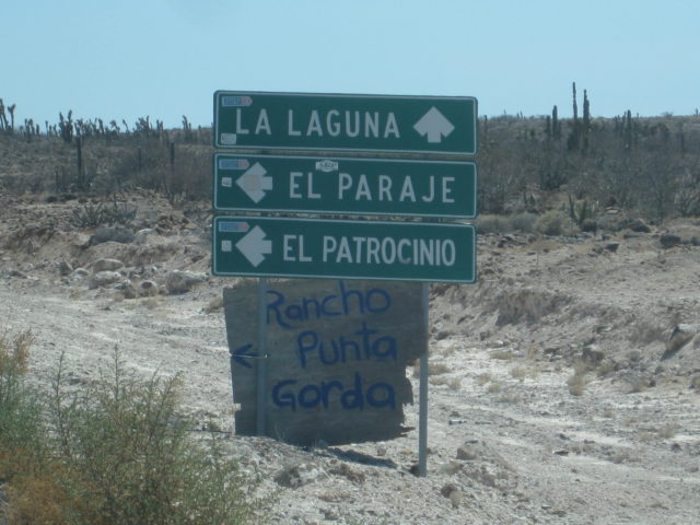
- Km. 29.5 Road left to El Patrocinio (35 kms.)
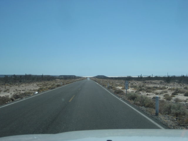
- Km. 47.5+ End of Pavement (30.1 miles from the mission/plaza). The road ahead is an elevated roadbed, over the salt pan. No more kilometer markers.
The following are mileages from the mission/plaza in San Ignacio:
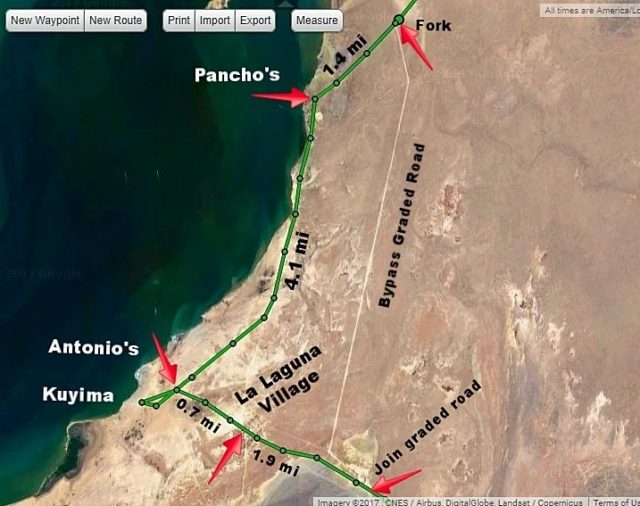
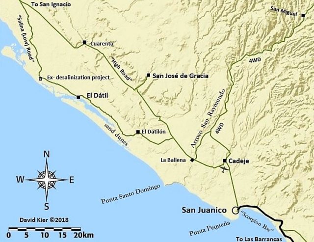
34.7 Bypass road south, avoids whale camps and village. Signed San José de Garcia. Log goes on right branch, to the lagoon. [see first satellite map]
36.1 Pachico’s whale camp entrance, on right. (Pancho’s on the map, in error)
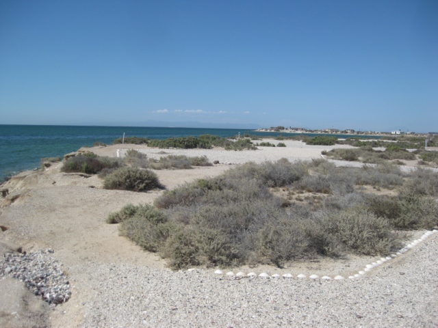
36.2 Lagoon shore.
38.8 Fork, keep right. Left goes into village.
40.2 Crossroad. Antonio’s Camp is to the right, Kuyima Camp is 0.4 mi ahead. Turn left (east) to continue south. Operations open during whale watching season. Typically, that is December-April.
40.9 La Laguna village, pass through to far side. Several optional roads come back together.
42.8 Join graded bypass road from Mile 34.7, above.
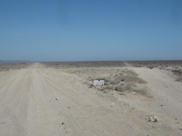
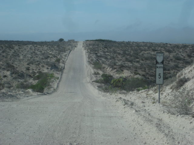
46.7/ 0.0 Major Fork. Small sign “Salina” here. The left branch is the high road via Rancho Cuarenta and the access to San José de Gracia. The low road returns to the high road after 39 miles. This road log uses the more popular low road, longer but smoother driving, if dry. Reset odometer to zero. [see second satellite map]. In 2018, it was reported that the high road had been repaired and was the preferred route.
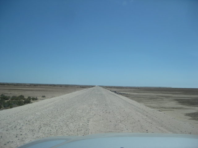
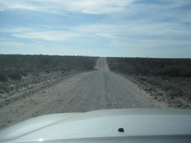
The washboard surface begins very bad, but soon improves. Deflating tires by ~30% improves the ride and traction off the pavement.
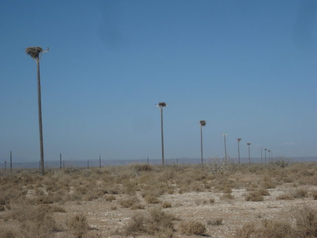
14.7 Abandoned building and many high poles now serving as osprey nests mark a former desalinization project. The road soon reaches the salt flats. It is advised to avoid any shortcuts across the flats and stay on the route that follows the desert’s edge.
22.2 El Dátil fishing village. Limited supplies. [see third satellite map]
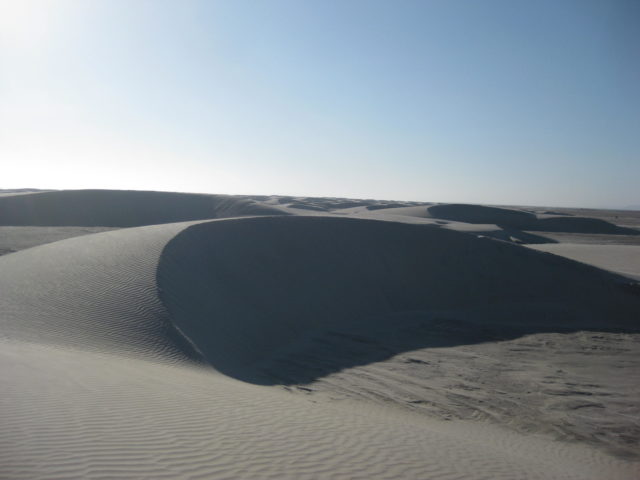
32.0 Sand dunes near the south end of salt flats. The road begins to turn inland.
35.1 Rancho El Datilón. The road soon turns south and crosses an arroyo.
41.7 Junction with high road coming approx. 39 miles from the fork at Mile 0.0, above. Turn south for San Juanico and on to La Paz.
46.7 Rancho La Ballena at Arroyo San Raymundo. The mountain road from Mulegé came in here, but recent storms may have altered the route.
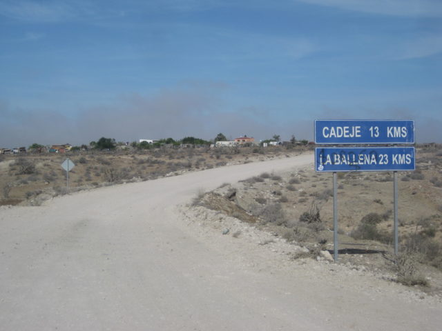
52.8 Cadeje an oasis village with an airstrip.
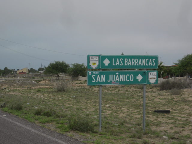
61.0 San Juanico town entrance. Motels, restaurants, supplies. Popularly known as Scorpion Bay by surfers. Paved road south to Las Barrancas and on to Ciudad Insurgentes and Highway 1 to La Paz or Loreto.
Here are my GPS Tracks on satellite maps with my road notes added:


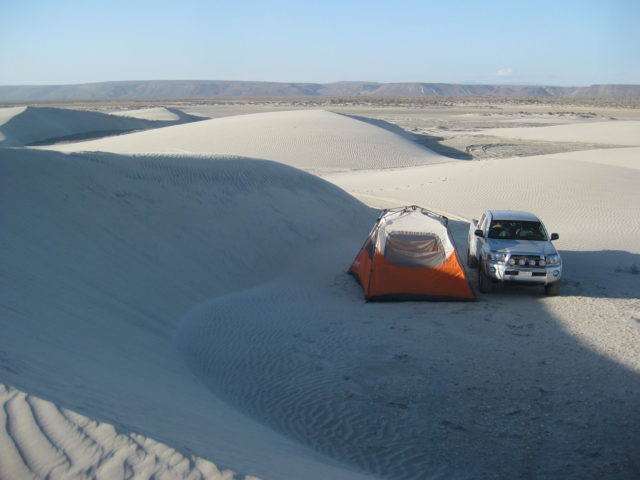
10 miles south of El Dátil, are sand dunes to the west and the end of the salt flat driving. I make camp in the sand dunes at 6:48 pm.

DAY 3:
The evening on the sand dunes was great. I could hear the sounds of the Pacific far in the distance. I saw only one vehicle heading north to El Dátil on the Salina (salt flat) road before it got dark. I was about a half mile from the road and partially hidden by the dunes.
Thursday morning, I was packed up and on the road at 8:30. My body was telling me it was still on Pacific time, as it seemed like 7:30!
I passed a ranch, there was no sign with a name, but the map has El Datilón where it was. The road curves from east to south and crosses an arroyo just past the ranch. The map shows a road fork before the arroyo crossing, but it was not very noticeable. The road was graded and maybe obscured the fork.
The map shows another ranch called El Batequi de San Juan on the south side of the arroyo, but there was none. This map (Baja California Almanac) is the best there is of Baja dirt roads, but it does have a few errors, as most maps do.
Eventually, the road from El Dátil joins the high road used to reach San José de Gracia from San Juanico and was the road that forked at Mile 46.7.
The ranch of La Ballena is passed and the village of Cadeje is driven through. It has an abandoned army camp and an airstrip (with tires across the runway to prevent it from being used, just any old time).
I came to a paved highway at the entrance to the town of San Juanico, also known as “Scorpion Bay” by surfers.
Let me add some road log details to continue from yesterday:
0.0 El Dátil
10.0 (approx.) Leave salt flats and head inland, eastward.
13.3 Pass by a ranch (on left) and soon head across arroyo to the south.
20.1 T Junction with the high road. Turn right (south) for San Juanico.
25.6 Rancho La Ballena. The cross-mountain road from Mulegé had come in here, but a different route to Cadeje may be the best way after recent hurricane damage?
31.9 Cadeje, a small village.
40.4 San Juanico, “Scorpion Bay”. Large town.
Paved road goes south to Las Barrancas, 30.2 miles.
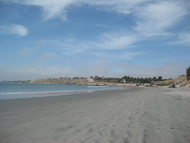

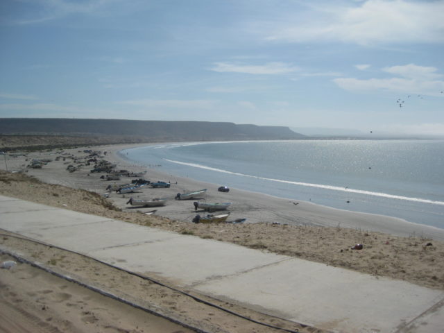
I drive around San Juanico once and noted a couple restaurants. While I did see signs for a motel, I was not seeing much of anyplace that looked like one on my quick drive by. Maybe rooms in people’s homes are rented? Like other surfer locations, maybe secrecy is strictly enforced to keep away newbies? LOL The surfers on the Internet have a strict code of silence! So as to not create “waves” I don’t spend a lot of time at surfer locations and move on.
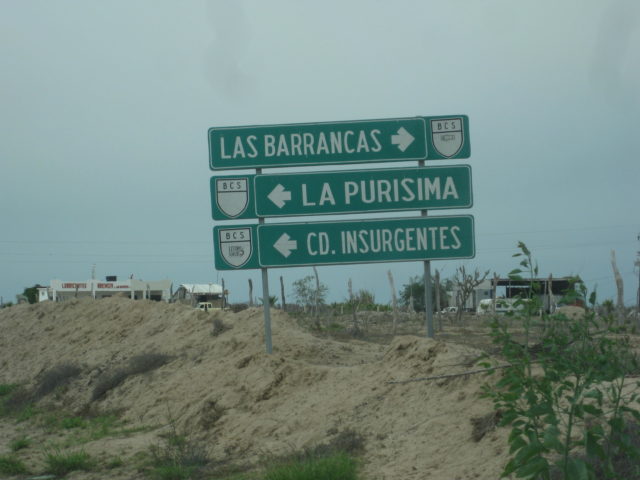
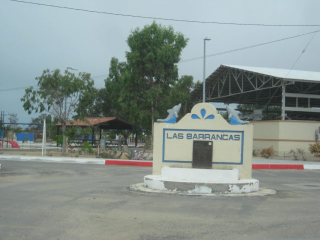
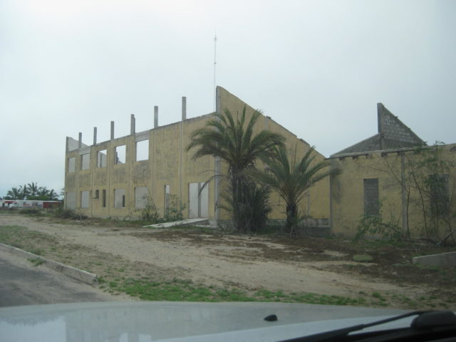
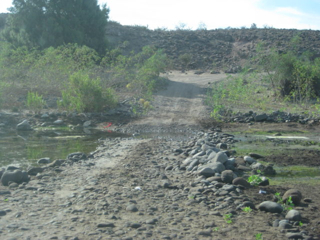
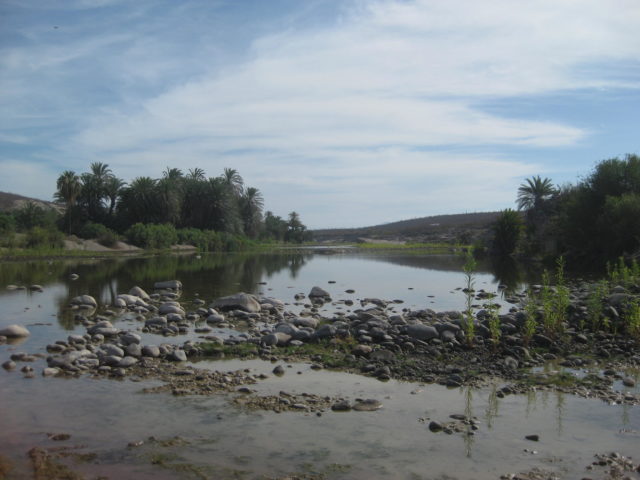
Las Barrancas was the location of a German/Mexican solar energy facility many years ago, long abandoned. Called Project Sonntlan, read the interesting story: http://dj7wl.darc.de/Sontlan.html
The newish paved road to San Juanico from the south was in good condition to Las Barrancas. The 4.5-mile paved road from Las Barrancas to the Insurgentes-La Purísima road had some pot holes to dodge.
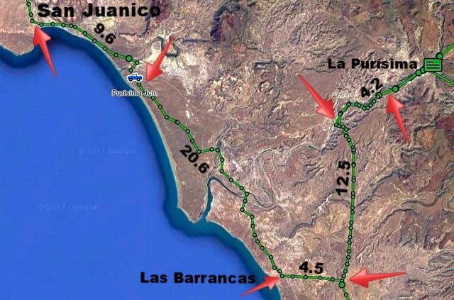
It is 4.5 miles from Las Barrancas (the San Juanico highway junction) to the La Purísima/Insurgentes highway.
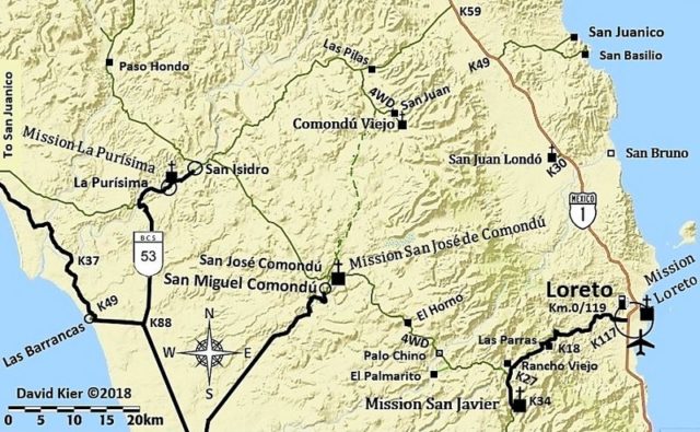
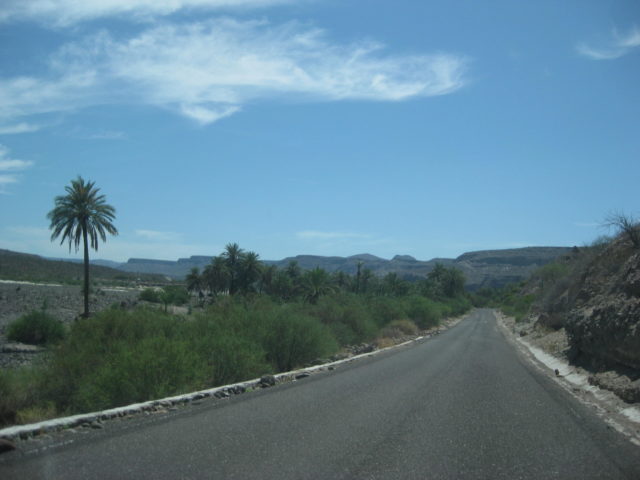
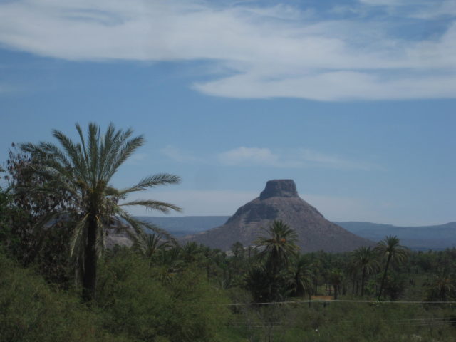
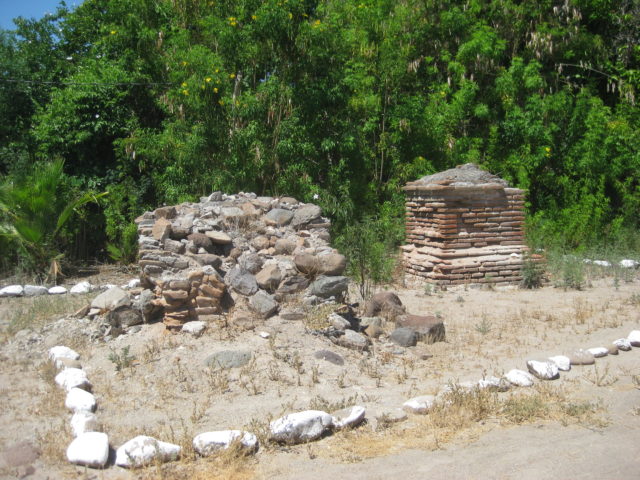
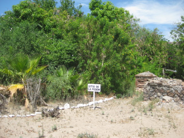
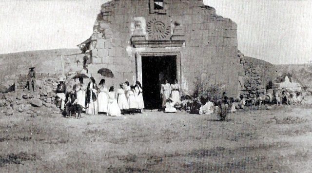
I drive north to La Purísima to cover that highway. I had driven into La Purísima from Comondú (and La Purísima out to Hwy. 1 near Bahía Concepción) already this year (TRIP #2, Feb.). I wanted to cover the paved road into town, for the guide.
From the Las Barrancas road to the old, dirt San Juanico road, on the La Purísima highway, it is 12.5 miles. It is 4.2 miles more into La Purísima and to the restaurant Otho and motel Posada del Angel. The mission site is just a block beyond Otho and a block north.
I have lunch at Otho from 12:10-12:50 and head south on the highway. lunch was fish dinner plate and a Jamaica drink for 150 pesos, with tip.
16.7 miles back down the highway is the Las Barrancas road and 14.4 additional miles is Francisco Villa and the paved highway north to San Miguel Comondú. Like La Purísima, I previously went into Comondú from the north and east and wanted to cover the south, paved road, also.
It is 22.6 miles to the entrance of San Miguel Comondú, where the blacktop becomes cobblestone. 0.2 mi further is the street to the right, passing the boutique motel Don Mario and continues on to San José Comondú, where the mission was from 1736 to 1827. The mission was founded in 1708, but 22 miles to the north and now called Comondú Viejo (see my TRIP #2 report).
Just past the street corner, ahead if you don’t turn right, on the left, was where gasoline from 20-liter containers can be purchased. The Baja California Sur state government cracked down on independent gasoline sales, so no longer are signs posted where you can buy gas in towns without a Pemex station. You just need to ask! 20 liters was 380 pesos. Very fair if you consider how far it must be brought in from.
Back south I go to Francisco Villa and continue southward on the highway to Ciudad Insurgentes. There are no pot holes or not many on the La Purísima or Comondú highways, but from Francisco Villa south, there are some! In 3 miles, however, a brand new, very wide paved highway begins, and lasts for 19.5 miles! There are 4 miles of older highway, then again a wider highway starts.
Nearing Ciudad Insurgentes, I take the paved road west to López Mateos, a fishing town and whale watching center on Magdalena Bay. It is 20 miles to town. I drive around and go to the Hotel Refugio, recommended by ‘Mula’ on Baja Nomad forums, who has a home there. The hotel owner (Róman) was very nice and the room was air conditioned, very small, but comfortable at 350 pesos (=US$20.17). The WiFi only works in the dining room area, which was not serving food in the summer… because whales are not there then! I made a couple posts and checked email. I slept well… but the mosquitos got me when I was in the dining room area and outside.
End of Day 3.
229 miles traveled.
PHOTOS:
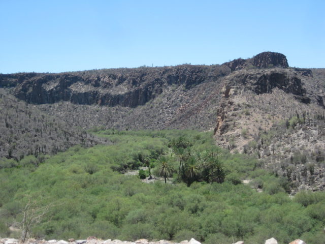
Continues on next page…