JULY 2016: Shell Island and Mission San Fernando DAY 1 (Thursday, July 7, 2016) We had some vacation time and love camping on the beach when the weather (and water) is warm! June or July is never too hot for us on the gulf coast of Baja! Our favorite beach that is only a day’s drive away (6 hours) is Shell Island, about 20 miles south of San Felipe. It is a barrier island with sand dunes that is surrounded by water at the highest monthly tides. Getting to it other times may require slogging through slimy sea mud! This helps preserve the beach as a rare, undeveloped and natural camping area. That is just what we like… peaceful, remote camping. We bring everything we need… and we do not need much!
We pack up the truck and get out of town by 8:30 Thursday morning (in this case, Escondido north of San Diego). Heading to El Centro was easy, then south through Calexico and into Baja at Mexicali (west/downtown). With a lot of discussion that there is a need for all trips into northern Baja for the “Tourist Card” (FMM), a type of visa for Americans to get, no matter where or how long a trip lasts, we pull over just across the border (on the left) at the INM office. There is a FREE tourist card for up to 7 days in Mexico and a PAY one (about $25 US) for up to 180 days.
The officer speaks perfect English and explains that the FREE FMM must be returned to their office when you leave Mexico (to prove you did not stay longer). However, the PAY one does NOT need to be returned (as you can keep it for any trips south for the next 180 days). Now, to get back to the INM office in Mexicali or Tijuana may be quite an ordeal because of city traffic and finding your way from there to the end of the line, to drive into the U.S. We planned to return through Tecate, a much smaller border town with easy access to the INM office, which is on the ‘entrance to Mexico’ street. Not sure how long before we can get back to Baja, we get the FREE ones and see how that works out.
The INM officer scanned and stamped our passports, had us fill out the two-piece FMM, and gave us one part and he kept the other. We were on our way in about 10 minutes. Not one other person stopped to get the FMM while we were there. Nowhere in the next 5 days did anyone ask to see the FMM on our trip. However, we were good to go if it was requested!
Driving south, the road to San Felipe is well signed, but be careful of the lane one sign points to as you approach a bridge… you need to go up the bridge, which is the next lane to the left!
We arrive at the El Dorado Pemex station, about 13 miles north of San Felipe and fill up. The price is 12.90 pesos per liter and the exchange rate is 17.30 pesos per dollar. I suspect this pump reads high, but that is typical in many stations, some believe. Next time, I will go to the newer Pemex a few more miles down the highway. It is 1:30 pm (5 hrs. from Escondido) and we are right on schedule.
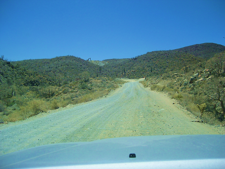
The road south from San Felipe to Puertecitos is in pretty bad shape with several holes now, and still a few steep dips… Max speed 50 mph. Our beach access is by Km. 26 and we go into 4WD… the beach is only 1.5 miles away, but there is still some water and mud from the higher New Moon tides of a couple days ago… We slime through it with not too much mess and arrive on the beach about 2 pm. Our camping spot is a couple miles down the beach and requires deflating the tires (as the Tacoma is heavy with two full ice chests and camping gear). Dropping from 34 psi to 20 psi does the trick (sometimes 15 or even 10 psi is required, depending on conditions and tire type). I am running Hankook DynaPro ATM tires and they are excellent in sand.
We are at our camping spot and setting up at 2:30pm.
The temperature was 100° crossing the desert, but only 95° on the beach. There is a strong south breeze and it makes getting into the water for a swim tough with short, slapping waves at high tide. We walk across Shell Island and take a swim in the calm lagoon on the other side… this is often called Laguna Percebu or Estero Percebu.
The next two days, the midday high temp was only 88° and a much calmer breeze… PERFECT!
Here are some photos on Shell Island:
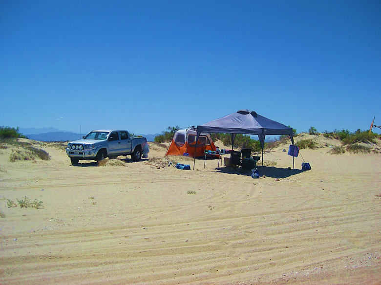
Camp set up
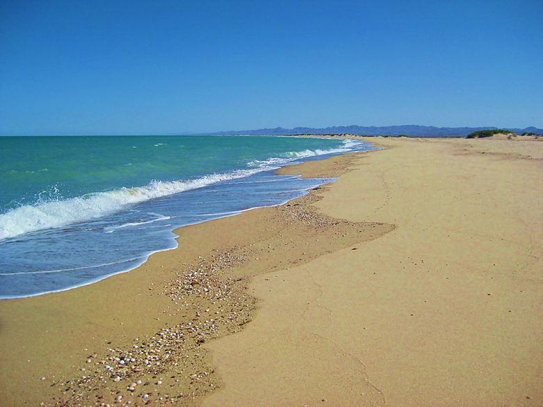
The beach seems endless!
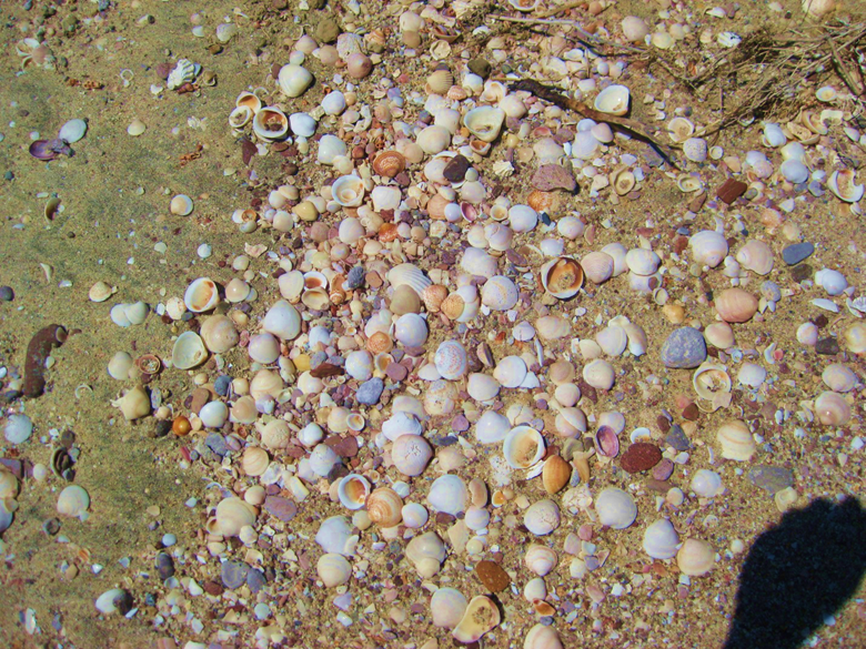
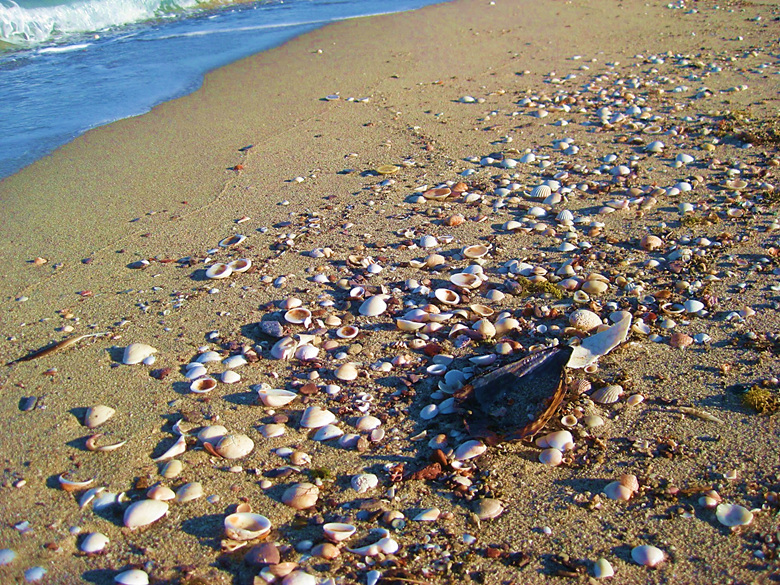
Shells, shells, shells!

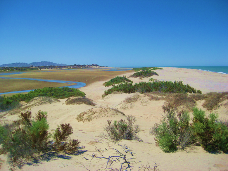
View north form the island at high tide.
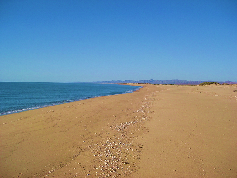
The same view at lower tide.
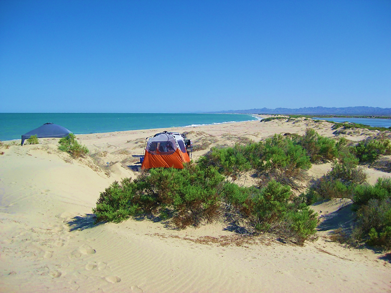
View south showing our tent and sunshade.
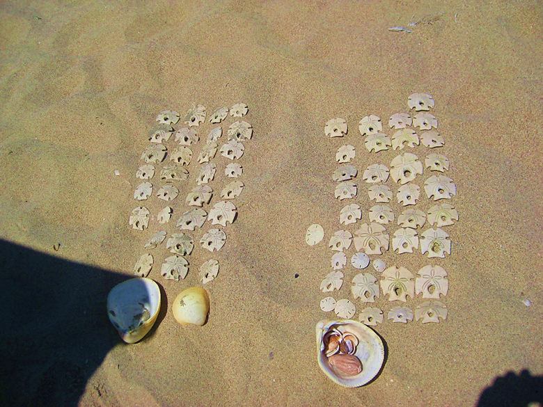
Organizing and comparing what we each collected at one low tide! Sand dollars are plentiful.
The weather was great, 88° and a light breeze out of the north, then east.
We did a lot of relaxing and swimming/ floating when the tide was halfway in or higher. As it was, that would be in the morning to around 9 and then again after noon. At low tide, the 14-18 foot average tide height takes the sea so far away and you can walk a mile and only be ankle deep! Twice a day the tide is high and twice it is low… A lot of gravity is at work in the upper Gulf of California!

A local resident.
Tide is going out
Tide is halfway out.
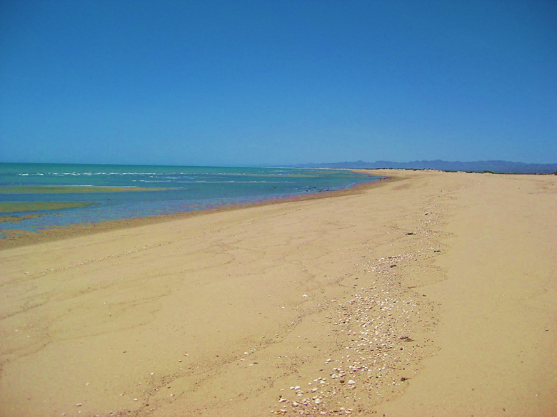
Low tide (and it goes out more).
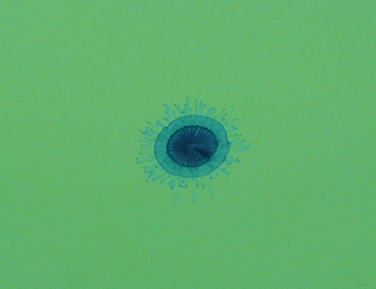
The next day, at high tide we see something new!
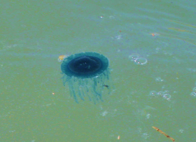
I had never seen any jellyfish on Shell Island in nearly 40 years of camping there. As I would find out (this morning), these were not true jellyfish but floating marine organisms… Here is the answer from Dr. Hans Bertsch (author of Sea of Cortez Marine Invertebrates and a new book mentioned in his reply):
Dear David,
Thanks for the photos of Porpita porpita (Linnaeus, 1758); Phylum Cnidaria, Class Hydrozoa, Family Porpitidae. Although it is in the same family as the infamous man-of-war Physalia, it is not really dangerous to humans. Both are pelagic, frequently washing ashore when the winds are right. It is obviously in my new, in galleys, book, Invertebrados Marinos del Noroeste de México…. Porpita is called “Blue Button,” or “Botón Azul.” The shrimpers probably had nothing to do with the beaching of Porpita; winds. You just have to be at the right place at the right time.
From Wiki:
Porpita porpita From Wikipedia, the free encyclopedia:
Blue Button Scientific Classification Kingdom: Animalia Subkingdom: Eumetazoa Phylum: Cnidaria Class: Hydrozoa Order: Anthomedusae Suborder: Capitata Family: Porpitidae Genus: Porpita Species: P. porpita
Binomial name Porpita porpita (Linnaeus, 1758)
Although it is superficially similar to a jellyfish, each apparent individual is actually a colony of hydrozoan polyps. The blue button is a Chondrophore, which is a group of cnidarians that also includes Velella and Porpema. The chondrophores are similar to the better-known siphonophores, which includes the Portuguese Man o’ War.
The blue button lives on the surface of the sea and consists of two main parts: the float and the hydroid colony. The hard golden-brown float is round, almost flat, and about one inch wide. The hydroid colony, which can range from bright blue turquoise to yellow, resembles tentacles like those of the jellyfish.[5] Each strand has numerous branchlets, each of which ends in knobs of stinging cells called nematocysts.
The blue button sting is not powerful but may cause irritation to human skin. The blue button itself is a passive drifter and is part of the neustonic food web. It is preyed on by the sea slug Glaucus atlanticus (sea swallow or blue glaucus) and violet sea-snails of the genus Janthina. It competes with other drifters for food and mainly feeds on copepods and crustacean larvae.
The blue button has a single mouth located beneath the float, which is used for both the intake of prey and the expulsion of wastes.
Tide going out, again.
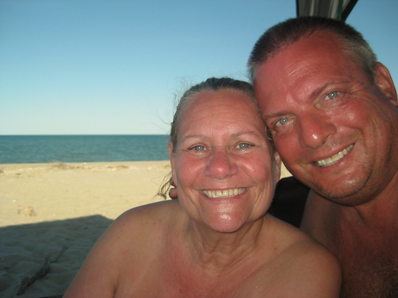
Elizabeth and I are incredibly happy to return here, year after year. My first time camping on the Shell Island was in 1978. I first brought Elizabeth here in 2005, just a couple months after we met!
Sunday, July 10, 2016…
We get camp taken down, and loaded up by 9:10 am…

Driving south… hate to leave… but we got enough sun and our friend BajaCactus/ Antonio may be in El Rosario and we would like to visit with him.
10:00 am , we are off the beach, refill the tires to 34 psi, head to the Ejido Delicias stores (Km. 35-36) and get a half block of ice and a bag of cubes to add to our ice chest (we condensed the two to one this morning).
They are both Coleman Extreme 5 Day chests. One was for beer and water bottles (One 10lb. block and two 10 lb. bags of crushed) + 30 cans of beer (Tecate Light) and lots of water bottles… The other was for meat & cheese, milk, OJ, more water bottles (pre-frozen) and had 2 blocks and one bag of ice. I drained the melted water out of the food box except for a few inches at the bottom. The beer chest with only 1 block, I let the melted water remain inside. This was a test… I was sure the drained box would have more ice (2 blocks vs. 1, opened less often, etc.). The beer chest was new, but still 5- day rated… the temps were near 90° each day and we left them in the truck bed only covered by folded tarps. The beer chest, with undrained water, had twice the size of block ice (1 block) as did the food chest (2 blocks) had after 3.5 days of un-ideal conditions! It was a good lesson. I had heard pros and cons of both drain and leave the water in there. Obviously, with food, you may need to drain when driving so the sloshing liquid does not make a mess of your food. We use snap lid containers or double zip lock bags to keep out the water.
The road to Puertecitos is pretty rough for pavement, but not as bad as it was in 2006-7 before they recoated it.
Km. 60 is Arroyo Matomí road (34 miles west to the waterfall).
Km. 74.5 Puertecitos Junction 9:30 am
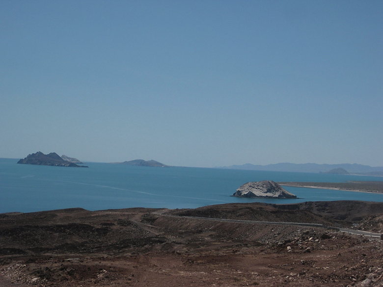
Km. 99 is the view pullout for the Enchanted Islands. We leave at 11:07 after having sandwiches.
Km. 147 is the Pemex and across the way, the Rancho Grande store. 11:38 am.
The Campo Beluga road is 1.2 miles south (Km. 149). A news note, Alfonsina’s son (Roman) no longer owns that Pemex, it was sold to a group that runs several Pemex stations in Baja.
Km. 159 (7.2 mi from Pemex) Las Palmitas road and it has some activity on it. This was the access to the El Camino Real trail to Mission Santa María and the oasis of Las Palmitas.
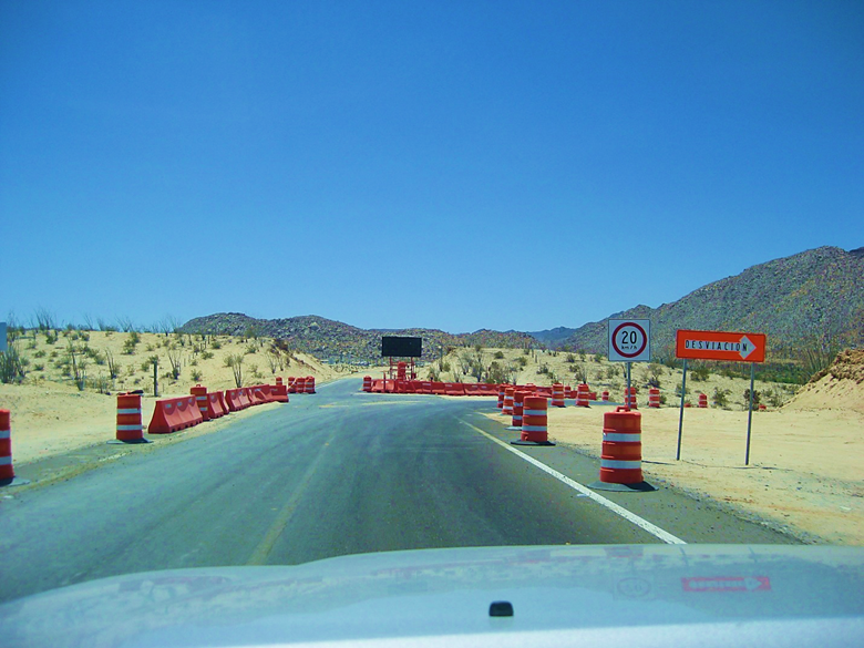
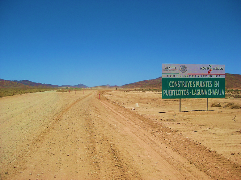
END OF PAVEMENT 7-10-16 (same as it was in Jan. 2015). Km. 167.5, 12.4 miles south of the Pemex. It is 11:50 am.
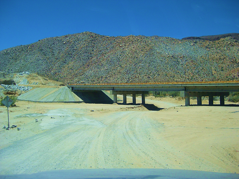
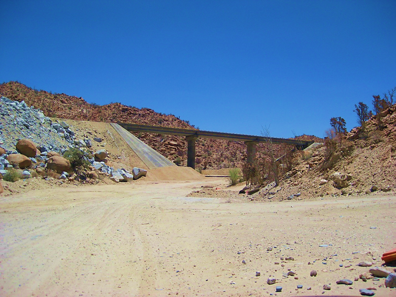
We see about three completed bridges… and many just started bridges and little else change in the canyon in the past 12 months.
18.5 miles from Gonzaga Pemex is the Las Arrastras historic site (see my July 2015 trip report), currently a road construction camp. 12:07 pm. The new highway heads straight south from here (or will when open) while the old road curves to the left and heads for Coco’s Corner.
Mile 22.5 from Pemex is Coco’s Corner. 12:17 pm. See my 2015 report for photos of Coco and his corner.
Mile 27.2 come along new road construction in the canyon. The past 4.7 miles from Coco’s are the roughest of all the miles.
No work was in progress except for a water truck we saw driving on the new roadbed, across the Chapala Valley, where it is a bit south of the old road.
HWY. 1 Laguna Chapala 35.4 miles from Gonzaga Pemex. 23.0 unpaved miles. 1:03 pm
These are odometer corrected mileages (if they appear a little different than earlier mileage figures). I am seriously into accuracy!
The drive north of Highway One was pretty typical. There are some potholes and rough areas near Laguna Chapala and near Cataviña (about 30 miles north of the Hwy. 5 junction).
We stopped to have a look at the Hotel Misión Cataviña (formerly Desert Inn, La Pinta, El Presidente) to see what is new… It was impressive considering the location.
I made a few road notes:
- San Ignacito café (south of Santa Ynez) was back in business and there looked to be a new monument marker where the highway construction crews from the north and the south met (1973), across from the restaurant. A plaque was vandalized some time ago here.
- Km. 179 Cataviña
- Km. 176 Rock Art access (see: http://vivabaja.com/703/page5.html)
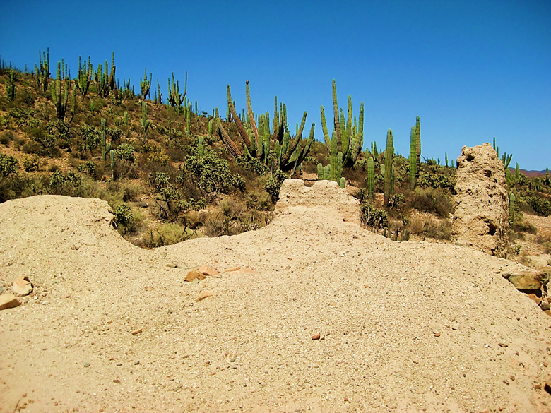
- Km. 121 Mission San Fernando access/ Rancho El Progresso (café is now abandoned).
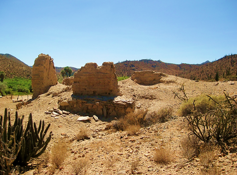
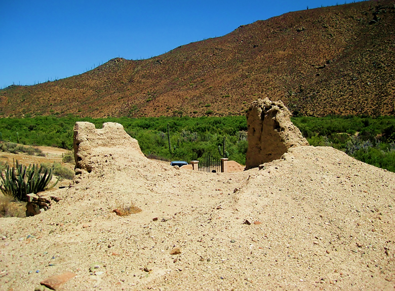
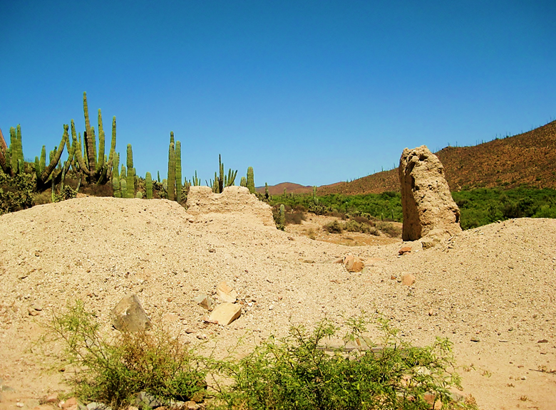
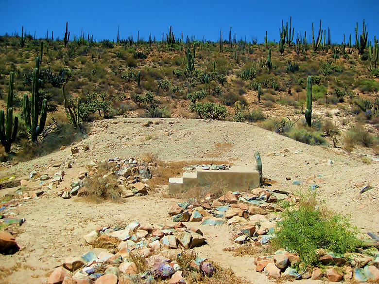
- It is only 2.3 miles from here to the 1769 mission site…
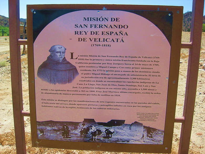
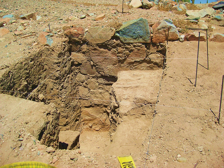
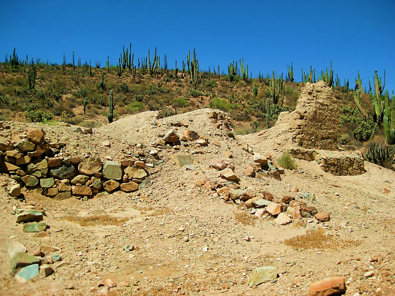
New signs and some archeological digging have exposed the stone side wall of the mission or terrace the mission was built upon. Nobody is there when we arrived. I was last on site in 2005 but flew over it in a helicopter for photos in 2014 during the Trail of Mission TV show trip I was on. [I returned again two months later with my tour group. In 2017, I Camped here. In 2019, I brought the TV show America Unearthed here to see the nearby petroglyphs]
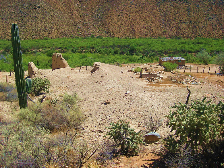
Mission San Fernando de Velicatá was the first mission in California founded by Junípero Serra of the Franciscan Order. Here is a full array of photos at the mission site, as it was in 2016.
Here is what was seen, in 1926:

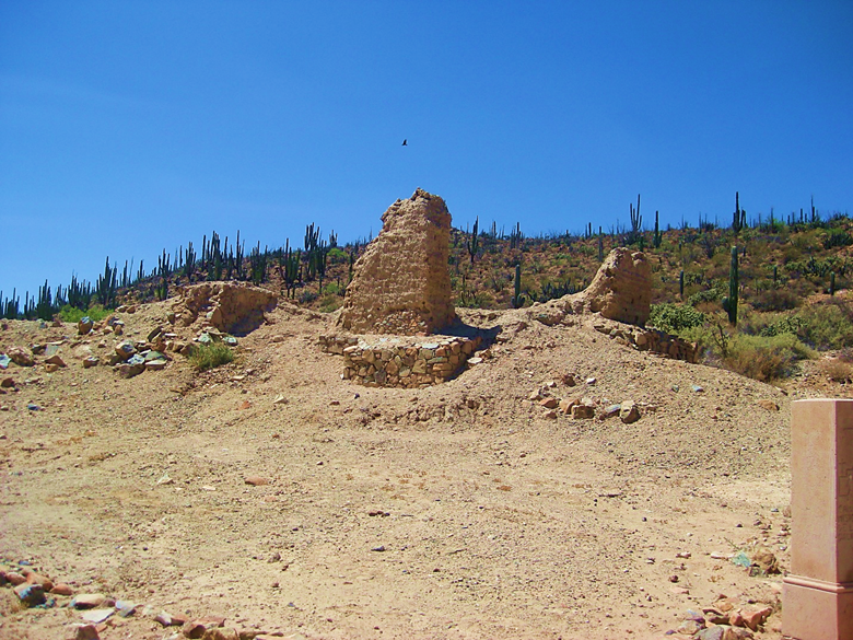
In 2016
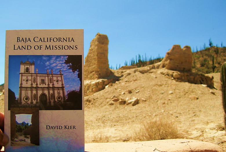
My book on the missions, published this February (2016).
We leave the mission and return to Hwy. 1 on the original access road just a bit (1.6 mi.) northbound from El Progreso. Part of this road is the original Baja main road before 1973. In fact, where the highway is reached was where the pavement ended in July 1973, and there was a large worker camp here back then.
It is 2.9 miles from the mission to Hwy. 1 using the north access. It is rougher and less used than the southern or El Progreso access (which was 2.3 miles long).
On the pavement, we soon pass Hector’s monument (Km. 116.5): See photos of it from 2005: http://vivabaja.com/1005/
El Descanso Café is doing well, and we see the café at the Sauzalito/ Los Mártires/ San Juan de Dios junction (near Km. 103) has a new name: El Sacrificio.
We arrive in El Rosario at 3:45 pm and check into Baja Cactus, our home in El Rosario!
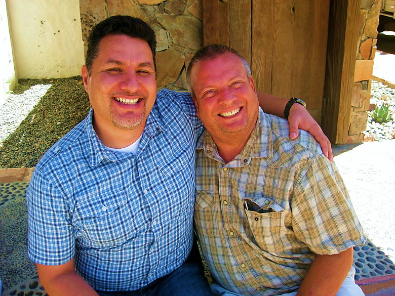
Antonio soon arrives at the motel to visit with us. He owns the Pemex station, next door, and was there when we arrived. I made friends with Antonio through Baja Nomad and we met in July 2004 at jrbaja’s home near Rosarito (La Barca) for an informal get-together.
http://vivabaja.com/bajacactus/
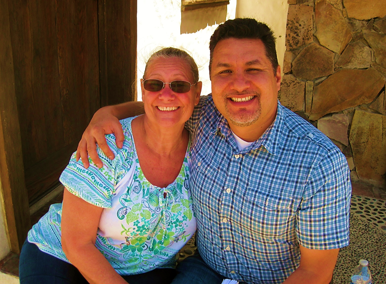
Baja Angel (Elizabeth) and BajaCactus (Antonio). It was Antonio who came up with the handle “Baja Angel” for Elizabeth back in 2005, when she joined Baja Nomad.
We hear of the changes in El Rosario and other happenings. We had not spent time there in a few years, using Hwy. 5 to travel south/north on. I saw Antonio briefly on the Trail of Missions TV special I was part of in 2014 and when he came up to San Diego County for supplies once, last year. I donate several copies of my books for Antonio to use as fund-raisers for his Desert Hawks Rescue Service: https://www.facebook.com/HalconesdelDesierto/
Antonio has a meeting with a government rep that evening, and Elizabeth and I go to Ed’s Baja’s Best B & B restaurant for dinner. We had the shrimp stuffed chile rellenos.
Monday morning, we have breakfast with Antonio and Itzela (who manages the Desert Hawks donations) at Mama Espinoza’s. Then, we have to say goodbye, but hope it will not be too long before we return!
Gasoline in El Rosario was 13.40 pesos per liter (Magna) and 14.37 for Premium. The peso per dollar exchange was 17.00: 1. We left at 12:30pm.
Military Checkpoint on the mesa above Rosario was the only one on the drive home, and we were waved through. At Maneadero we stop for tacos at the place on the east side as you enter town. They were great! We departed there at 3:47 pm.
At Tecate, we needed to turn in the FREE FMM and drove up to the border (entrance into Mexico street) and to the right, one-way street is street parking. We walk to the border and get instructions on what to do. You go through the turnstiles on the east side of the street, follow arrows north, then across the street to the INM office. Walk in, find the desk and our passports are stamped and scanned, all clear to go! It was not too much trouble.
Back to the Tacoma, we drive east to the U.S. entrance access road and get in line at 6:10 pm. We are in the U.S. at 6:28! No secondary inspection.
Thank you… and hope to see some of you at my lecture in San Diego! [It was Thursday night July 14 and a full house]