These are photographs from my many trip web pages showing Bahía Concepción locations. If I find any more, especially from my trips here of 1966, 1973 and 1974, they will be added.
1976
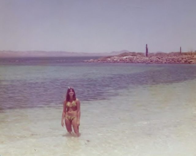
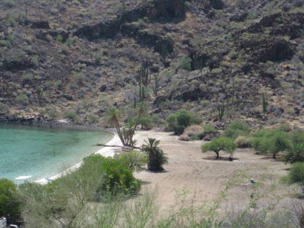
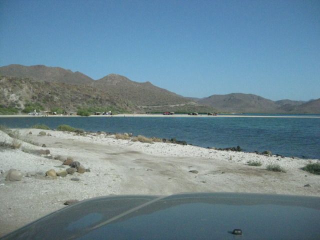
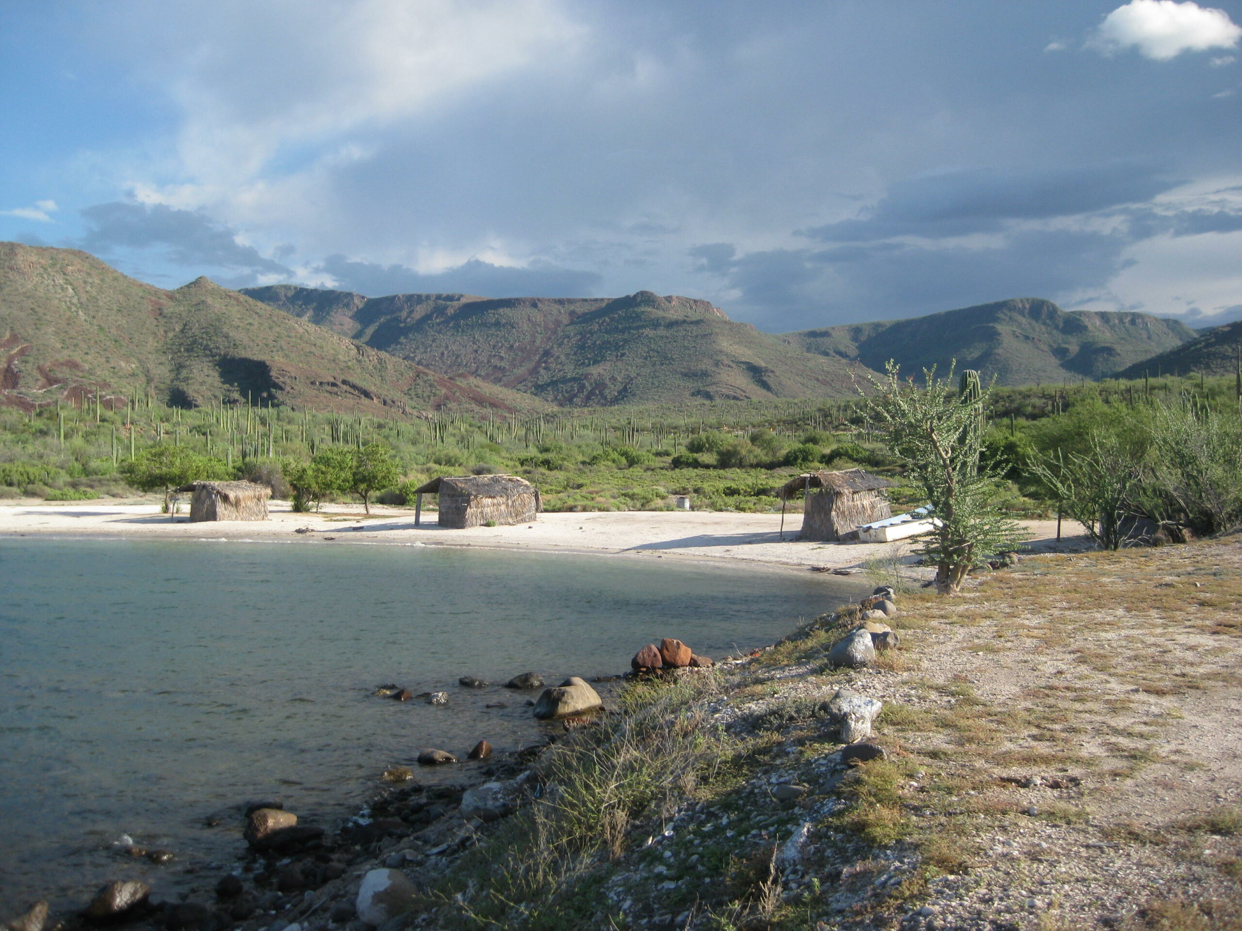
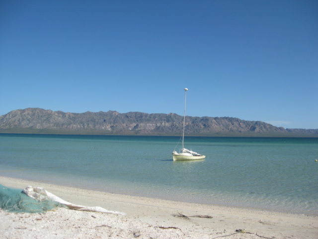
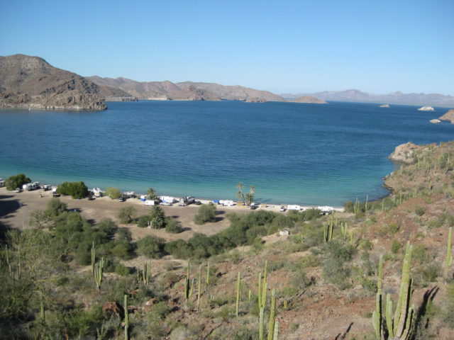
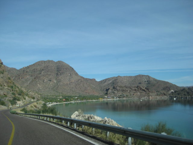
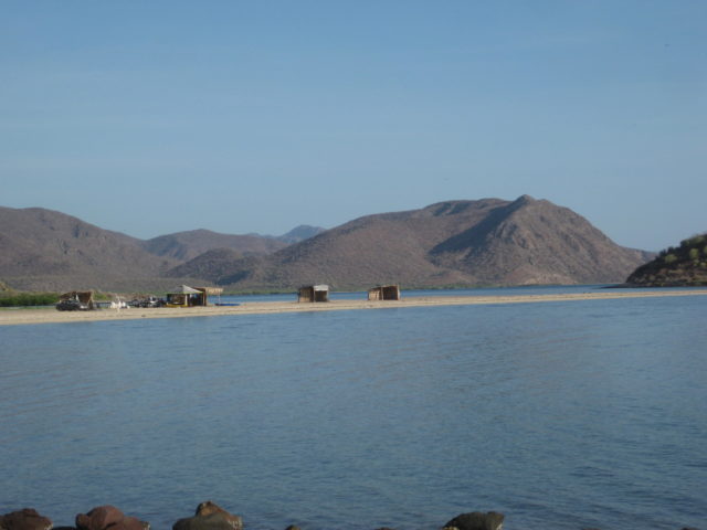
After my high school graduation, with my girlfriend Lynne, I drove my Jeep Cherokee Chief to Loreto, San Javier, and other locations. We camped at El Requesón, with my parents who followed along. This is the ‘secret beach’ just north of El Requesón on the old road.
1985
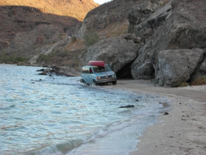
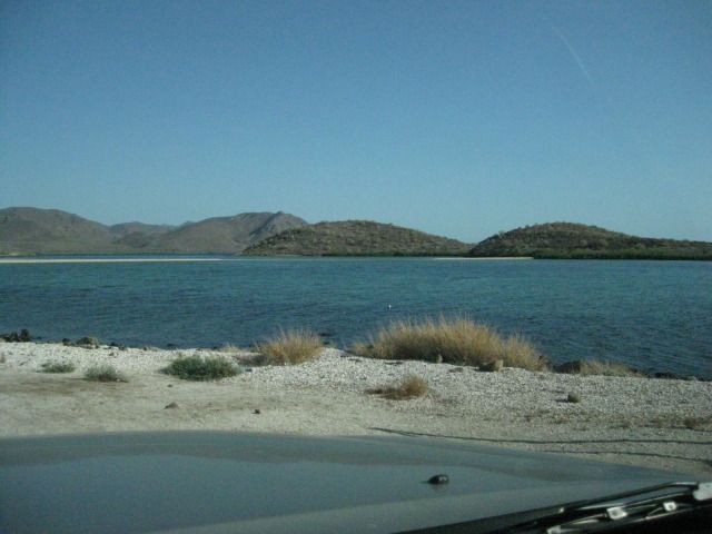
El Requesón in July 1985. I had camped here other times before, including 1976 and 1966. We stopped here as well in 1973 & 1974 but not overnight.High tide. My first bride and I honeymooned in Baja. We rowed around Isla el Requesón in that inflatable raft. A pod of dolphins played with us on the other side of the island!
2001
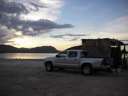
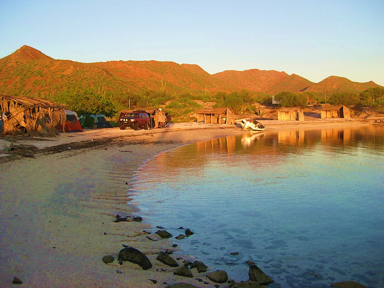
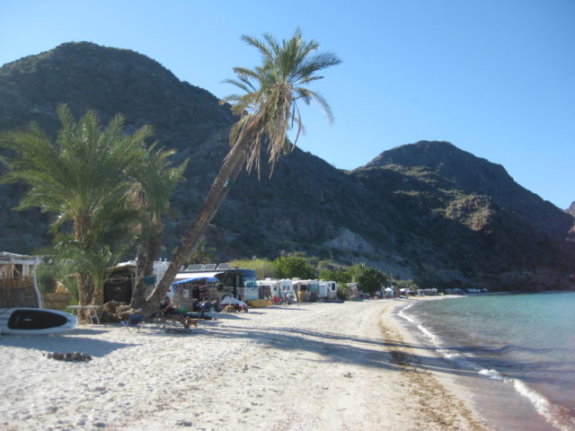
In December 2001, my new girlfriend Mindy and I camped with Capt. Mike and his wife at Playa Santispac.
Captain Mike’s plane was at the Motel Serenidad airstrip in nearby Mulegé. He took us up for a flight over Bahía Concepción and Punta Chivato.Playa Santispac. Full trip webpage: https://vivabaja.com/baja15/
2007
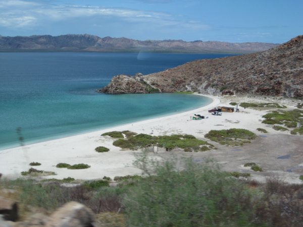
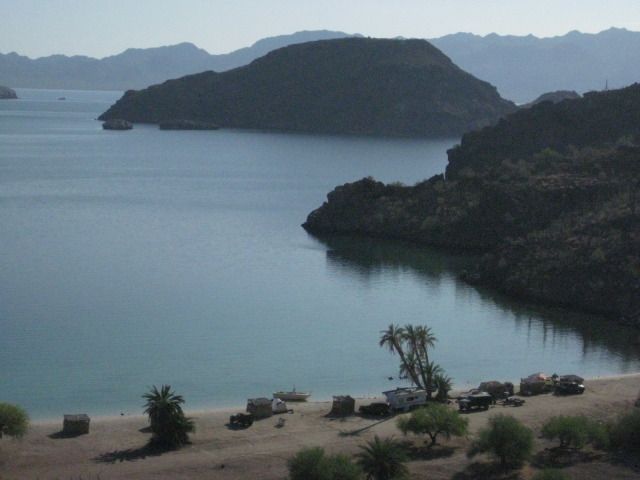
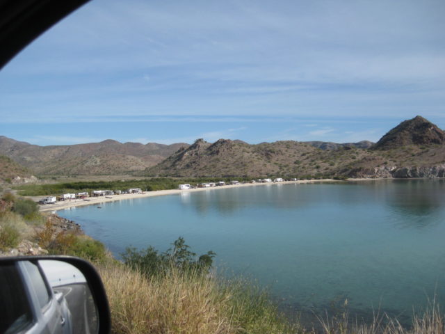
My future wife, Elizabeth and I had a perfect time at El Requesón in July 2007.One of Baja California’s “two-sided” beaches!
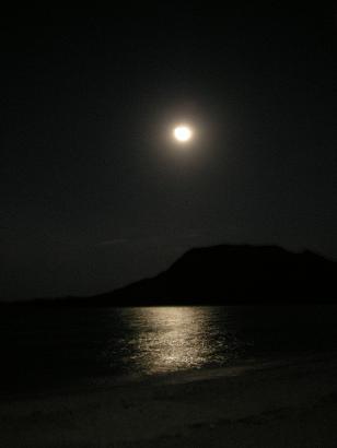
This is the old main road to La Paz, prior to 1971 when the new highway roadbed was built and soon paved, higher up the slope. No global sea level crisis, it is just high tide and has been this way since the 1930s when the first auto road was scratched out of the desert.View to El Requesón from the highway. That is our palapa and tent, next to it. We drove into Mulegé for dinner at El Patrón, on the beach.SunsetEl Requesón full moon. Full trip webpage: https://vivabaja.com/p707/
2009
What a treat! Bob & Susan Frambes invite us to spend two nights at the luxurious Lighthouse Resort, Km. 118+.It is our first anniversary as husband & wife!Freshwater swimming pool, all concrete deck.A lighthouse (one of the rooms) with great lookout.The two-bedroom casitas surround the pool.Furniture was imported from Bali.The casitas are air-conditioned in the summer and are very reasonable, especially if you split one with another couple. Go to www.mulege.org for more information.Playa El Burro (Km. 108.5)Playa El Coyote (Km. 107)
Playa Buenaventura (Km. 93+)
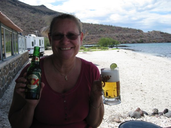
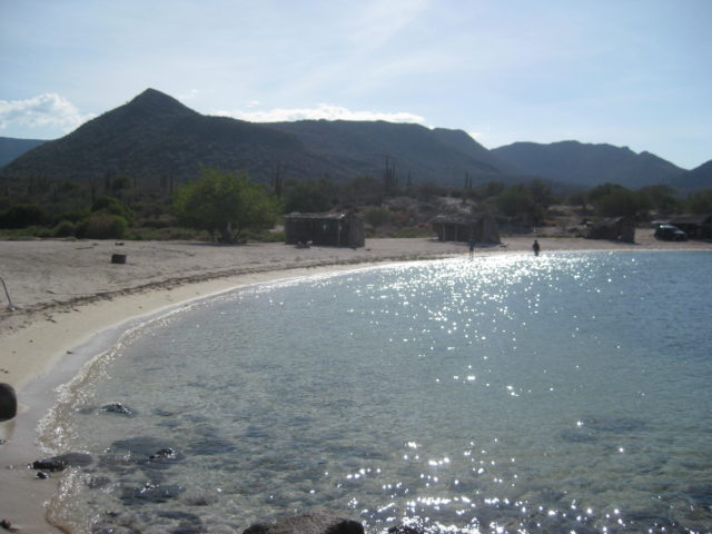
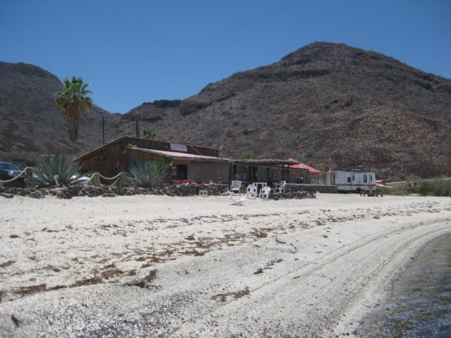
Happy Elizabeth, my ‘Baja Angel’ with a cold beer on a Baja beach!Cantina operator Mark Burbey (with hat) and I.Playa El Requesón, Km. 92
Playa La Perla (Km. 91 & 92 access roads)
Playa Armenta (Km. 89 & 90 access. Large or 2WD rigs use Km 90 only). Full trip webpage: https://vivabaja.com/p709/
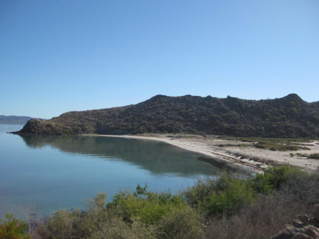
2012 Playa La Perla (Km. 91 & 92 access roads)
Our new easy up tent is great… windows all around that can be closed and it is tall enough to stand in.
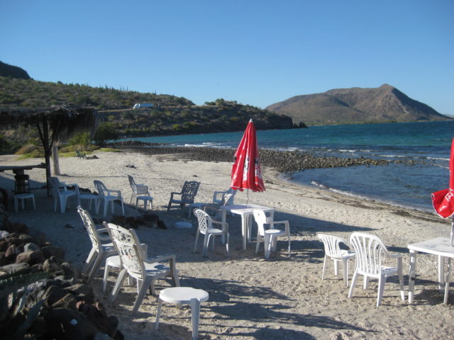
The palapa is open on the inland side, a bit backwards unless it was to block wind off the bay?We have these floating chairs, which are perfect in the Sea of Cortez.Is there any better way to enjoy a cold cerveza?Playa Buenaventura Cantina at Km. 93Cheeseburger in paradiseLeaving La Perla to go on to La Paz was not easy!
After a wonderful time in La Paz and the cape region with friends, we are returning to Bahía Concepción! View north from Hwy. 1, around Km. 71-72.There’s the old main peninsula road as seen around Km. 89. It was replaced by the new road between 1970-71.Back ‘home’ at La Perla!
Happy wife… happy life!
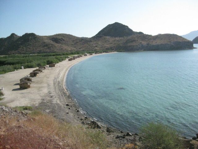
Looking north to El Requesón on the beach road. Access at Km. 92Looking north to El Requesón on the beach road (the original road from La Paz).View down to Playa El Coyote, access at Km. 107.Playa Los Cocos (Km. 110.5). Full trip webpage: https://vivabaja.com/p712/
2015
The road to El Requesón (Km. 92) now has a large paved ramp off the highway and any vehicle can get to that beach. Even an 18 wheeler was down there! Too crowded, no vacant palapas, so we go ‘next door’ to La Perla and camp at the same place we did in 2009 and twice in 2012. It was 2:21 pm, and other than a day-use family, nobody else was there. Awesome!We set up the tent first, throw in it our close bags and pillows, and then jump in the beautiful bay water. It was warm but cooler than last time, actually it was perfect! The daytime temperature was in the mid90s and felt great. While floating in the water, we see the typical thunder clouds building up to the southwest, then suddenly we see a downpour out in the bay and can actually hear the rain hitting the sea with great force! All seems to be moving to either side of us, so no panic… yet. When some big drops begin dropping around us in the water and the wind picks up, I get out and add lines to secure the tent. Knowing these afternoon showers are generally brief, I was not too concerned that it would not be much of a problem.Elizabeth got out of the water as it began really raining steady. We both took advantage of the natural shower and rinsed off before sitting down inside the palapa to wait out the rain. It got harder and harder, the wind got stronger, a large waterfall was pouring off the mesa a couple miles west, the rain began to blow in sideways, hitting us in the face, as we huddle well under the palapa. The tent is really being pushed on by the strong, tornado-like wind and we can see that the clothing bags are pressed into the sides and may be getting wet. Nothing we can do than wait it out. We estimate the rain event lasted about an hour, and it and the wind moved on. We survived the cloudburst, but inside the tent, our clothes and pillows were soaked! We had a fire and hoped for a better day tomorrow. A car drove up in the dark and a little old lady named Rosa walked up to collect the camping fee (100 pesos). It was buggy as we were on the beach and even saw millions of crawling bugs come out of the sand around the fire. It reminded Elizabeth of an Indiana Jones movie! Elizabeth made the best of it for the time, but she was not going to sleep outside that night and had a comfortable night in the Tacoma. She tried to get me to join her, but I was sure I needed to lay down, so I set up my cot in the palapa, with citronella candles and Deet applied (yes, many mosquitos). I actually slept well; unaware the mosquitos were not annoyed by my preventative measures. Friday, July 24: I wake up early and notice that my lips are feeling weird and there is a puffiness under one of my eyes. The Deet and candles were not 100% effective and I am guessing I look like the Elephant Man somewhat? I go to the Tacoma passenger window; Elizabeth is awake, and I do my best Quasimodo impersonation. Other than the mosquitos, I slept fine, and Elizabeth was very happy she slept in the truck! The day is beautiful and sunny. I string up some clotheslines and we basically spend the day drying everything that got wet, with some time swimming in the bay also.
Several years ago, an ‘artist’ outlined the lava on this mountainside. Most of his white paint has faded. It looks like he was seeing coral or seaweed and a whale swimming up? In 1997: https://programagbc.blogspot.com/2009/05/en-1995-disene-el-programa-gbc.htmlWe decide this would be our last night camping here and will pack it up in the morning (Saturday). Saturday, July 25: We pack up the camp and pull out of La Perla at 11:49 am and take the short drive north to visit with Mark & Olivia at Playa Buenaventura Bar & Restaurant. We see that the hotel next door is deserted/ closed, but Mark and Olivia’s place is open and inviting. They are both there and Mark shares their great news regarding the battle with Muñoz (an out-of-state developer and owner of the hotel next door who has harassed these two for several years with false accusations and physical harm to try and force them off their land, so he could take it over). The long nightmare is apparently over. From what I gathered in our brief talk; a judge has awarded them the hotel (for compensation for the years of hell). Mark said that Muñoz had the rooms trashed and pulled the copper wire out of the buildings before being forced away. If they reopen the hotel, it may only be a couple of the rooms or they may sell it? We take some photos along Bahía Concepción driving north:North Bahía el Coyote, Km. 107.Playa El Burro, Km. 108.5Playa Los Cocos (Km. 110.5). Full trip webpage: https://vivabaja.com/july-2015/
2016 (My ‘Baja Extreme’ 4×4 Tour)
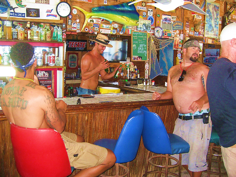
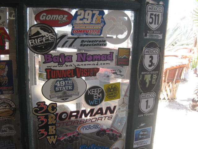
Nathan Burbey at Playa Buenaventura Cantina. In 2023, the cantina has changed hands. Olivia and Mark Burbey can relax now after many years serving guests here. Nathan now operates https://casaconcepcionbaja.com/In November 2024, the local ejido demolished the cantina. Great memories and fun times!
My guests want to do some serious off-roading and asked me to include going up the peninsula on the other side of the bay, to a manganese mine from World War II. A tropical storm was just through here a week before and sure enough, the road for us was gone. We would discover that after several miles and hours driving at night!
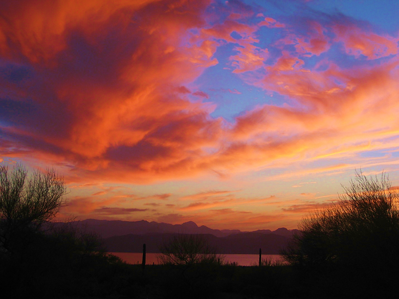
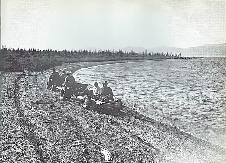
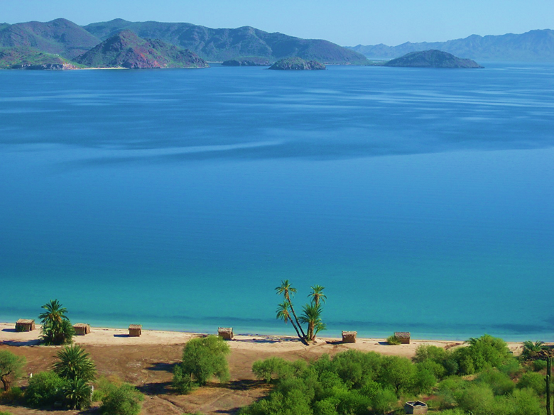
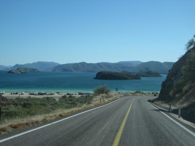
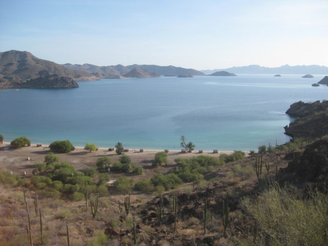
Sundown from the other side of the bay.The next morning was gorgeous. I would later discover that Erle Stanley Gardner took a photo at this spot when he explored over here on the peninsula in 1966.Erle Stanley Gardner, using funds from his TV series Perry Mason, loved to explore Baja using custom made ATVs. This photo is in his 1967 book, Off the Beaten Track in Baja. Very little change in the fifty years between 1966 and 2016.We did drive up a canyon in this lovely stream. At the end, the water flowed out of solid rock!We go back to the ‘popular side’ of the bay and camp at La Perla for Night 6. Morning shot here.Bahía el Coyote and one of the most popular photo locations in Baja California, as seen on many book covers. See the bottom of this page for book covers.Playa el Coyote is reached from Km. 117. At high tide, the water covers a bit of the road. These palms on the beach have been photographed for nearly 90 years, and the seawater is no closer to them today! The full trip webpage: https://vivabaja.com/p916/
2017
In late January to February, I made a mapping and road guide research trip to Baja California Sur. The previous month, I had researched from San Felipe to Punta San Francisquito, my first of eight such trips to cover as many roads to interesting places as I could.
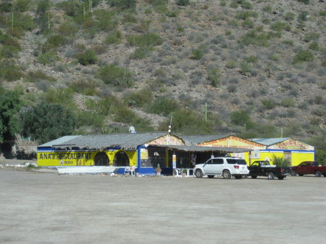
I made this map following my 2017 travels.Playa Brisas del Mar Km. 118+ & 1.8 miles in.Playa Frambes Lighthouse Resort (Bob & Susan) Km. 118+ & 1.7 miles in. https://mulege.orgLos Narranjos bungalows for rent (300 pesos) Km. 118+ & 1.9 miles.Playa Los NarranjosPlaya Punta Arena Km. 118+ & 1.9 miles in.Playa Santispac Km. 114Ana’s Restaurant at Playa Santispac.Playa Santispac, and most the other places, was wall-to-wall ‘snowbirds’ (estimate 90% are Canadian, based on the flags) this February.
Leaving Santispac. The mangrove below is where the hot springs of Santispac are… in the mud.Playa La Escondida (Km. 111+ & 0.5 mile in)Playa Los Cocos (Km. 110.5)Playa El Burro homesBetha’s Restaurant/Playa El Burro (Km. 108.5)El Burro campingEl Burro campingPLAYA EL COYOTE, Km. 107 (Famous sea level palms):
Playa El Coyote as seen from high above on the old road.PLAYA BUENAVENTURA, Km. 93+ (Mark & Olivia’s to 2023, Matt’s briefly then in Nov. 2024 the cantina was demolished by the ejido)
EL REQUESÓN (Km. 92, and to the left):
LA PERLA (Km. 92, to the right):
Playa Armenta (Km. 90+ and 89+)After going to Loreto, San Javier, and the three Comondú’s, Bahía Concepción was a welcoming sight driving north!Back at La Perla for one night on my journey back north.
My next mapping trip to Baja California Sur was in August 2017. On my drive north from La Paz, I stayed at La Perla, once again.
Looking at El Requesón from the road to La Perla. A two-sided beach doubles the enjoyment but can bring in many campers.One final look at El Coyote Bay from the old road where it reaches the top of the ridge.Full trip webpage: https://vivabaja.com/p817/ All 8 Road Guide Trips: https://vivabaja.com/tacoma-travels/
2019
Cameron Steele (Off-road racer, TV host, tour organizer) asked if I would join with his friends to do a recon trip for his next Trail of Missions TV tour. As the ‘mission expert,’ I had ideas of new sites we might check out for his big tour the following month. I was most rewarded to finally get to see the San Bruno 1683 colony ruins, the Visita de San Pablo, and the San Borjitas cave. The full trip is here: https://vivabaja.com/p519/ Below, were our stops on Bahía Concepción:
Mark & Olivia’s Playa Buenaventura Cantina (Km. 93)
Mark chatting with Curt LeDuc.Playa Frambes Lighthouse Resort (Freshwater pool) at Km. 118+Bob Frambes and David (note camera crew is in the lighthouse). Full trip webpage: https://vivabaja.com/p519/
The following year, Covid broke-out around the world and that changed so many lives over the next two years. Many did not or could not travel to their favorite places.
When you can’t go exploring into Baja California, then use VivaBaja.com to see hundreds of travel stories, maps, books, thousands of photos, and more!
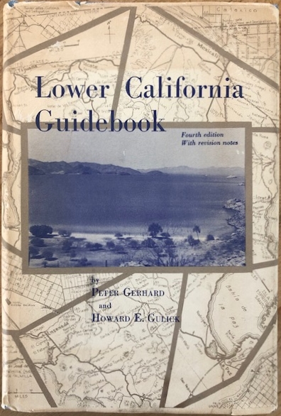
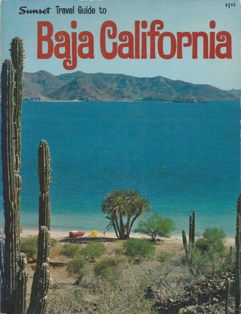
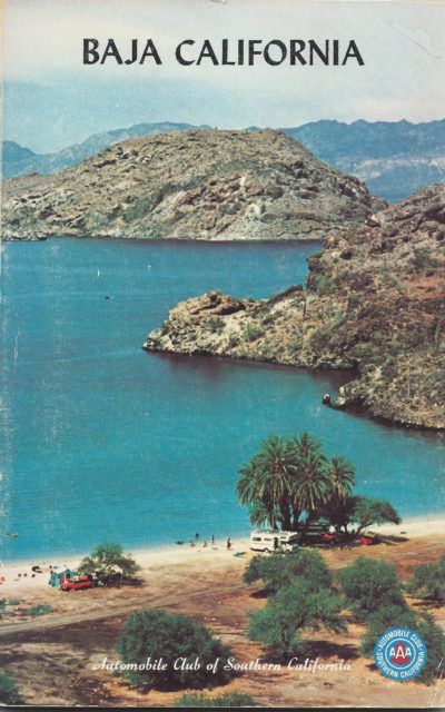
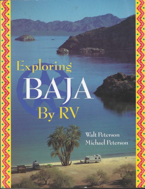
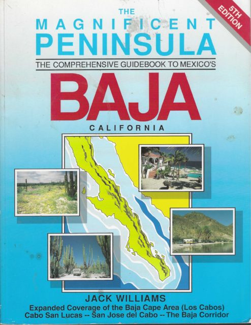
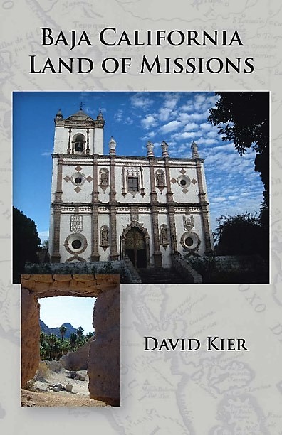
BOOKS with Bahía Concepción on the cover:
1962-1970 editions and printings19671970-1974 editions1971197419751979-1985 editions199619961998
19982014
Would you like to know more about the missions in Baja California? Twenty-seven were founded there from 1697 to 1834. Nearly half relocated one or more times to better locations during their time, giving us close to forty mission sites as well as visitas (mission satellite chapels). Here is a quick look at them: https://vivabaja.com/mission-site-photos/
To get much more of the missions’ history, even the ‘lost missions’ please get my book, now in its 14th printing (2024), last revised in 2021:www.oldmissions.com Thank you all, David Kier