An incredible trip of ten days that included great weather (a bit cold at night), great Baja Nomads (Internet amigos), some I met for the first time, and great but rough dirt roads. I went to many missions and visita sites. Here is a list of them: San Ignacio, Mulegé, San Juan Londó, Loreto, Ligüí, San Javier, El Horno, San José de Comondú (1736 site), San Miguel (Comondú), La Purísima, Comondú Viejo (1708 site), and San Borja.
I traveled most of the known roads to the beaches between Santa Rosalía and Ensenada Blanca (below Loreto) and the rough roads between San Javier and Comondú, on to La Purísima and back east to Hwy. 1. I also drove both roads into/ out of San Borja and checked out an abandoned gold mine with many open, deep shafts that I could not see the bottom of.
I took photos and notes at each site, recorded kilometer markers and mileages on the dirt roads all as part of a project to gather new data on Baja travel that we may all have access to.
DAY ONE (Jan. 30, 2017):
I leave my North San Diego County home at 6:53 am. My vehicle is a 2010 Toyota Tacoma OFF ROAD TRD, 4WD, 4 door pickup with 265/75-16 Hankook Dynapro ATM tires. Almost stock, except for Bilstein 5100 shocks, all around and adjustable Ride Rite air springs on the back. A light bar in front with four CREE LED 7″ lamps (2 spot beams and 2 driving beams).
First stop is in Calexico to buy pesos (20.20 per dollar). Next is to Cross into Mexico, at 10:12 am. I get the green light but am flagged (flash lighted) to pull over (typical with a loaded pickup truck). After a short look-over, she sends me on south (never asked about FMM needs, but I had one already).
At San Felipe (12:24 pm), I top the tank and buy an extra 7 gallons to put into my empty 5 and 2-gallon cans, for insurance, should there be a gasoline issue. My truck has a 21-gallon tank and has just over a 300-mile range under these driving conditions. As it turned out, I did not need the extra gas cans as no stations were closed and I never dropped below 8 gallons still in my tank.
Military Checkpoints southbound (at the Hwy. 3 junction and Gonzaga Bay) did not stop me, or it was just a quick question of where I was coming from and where I was going.
At Gonzaga Bay at 2:06 pm and hoped to have a fish taco or two. The restaurant next to the Rancho Grande market was closed. The taco shack in front of the market was out of fish so she was making potato tacos!!?? Out-of-fish in Baja is a crime! I went into the market and bought some crackers, cookies, and a Milky Way bar… as I did not want to take the time to go to the Alfonsina’s or Papa Fernandez’ restaurants.
The pavement ends 20 kms. south of Gonzaga and is followed by almost 23 miles of fair, graded road, used also as construction access as they are building the final section of a paved Highway 5. [This road was all paved, three years later, in 2020.]
I reached Hwy. 1 (Laguna Chapala) at 3:15 pm. The construction detours were not bad, and the older road still used was only bad for about 2 miles past Coco’s [original] Corner.
Reached the L.A. Bay junction at 3:41 pm. The El Tomatal military checkpoint at 4:22 pm, soldiers not even looked my way. Villa Jesus Maria seems to have been renamed VALLE JESUS MARIA (unless the government sign maker goofed, and that happens a lot). I stopped for gasoline and had quesatacos (no fish here either) for dinner at Kassandra’s, next to the Pemex station. I was on the road again at 5:07 pm and soon saw the sun set.
At the Eagle Monument (it is in need of paint), which is the state border. Here you change to Mountain Standard Time, and go from 5:30 pm to 6:30 pm. The cost for driving over the Baja California Sur state insect spray strip is 20 pesos. No INM officer or request to see FMM here as in years past (or at any time during the trip). The FMM is your tourist paperwork, required for every U.S. or Canadian visitor in Mexico.
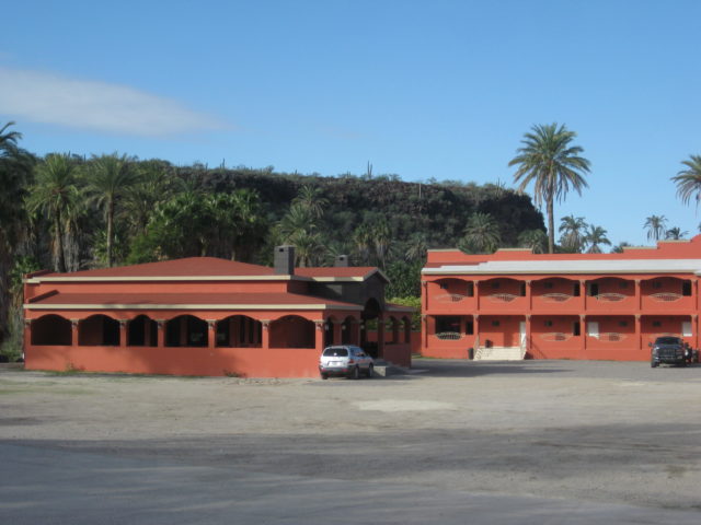
Arrived at San Ignacio at 8 pm (MST) and stayed at the La Huerta Hotel (650 pesos or about $32) for a great night sleep!
PHOTOS:


DAY TWO:
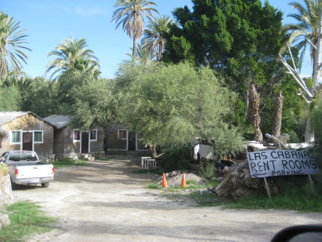
Some photos I took in San Ignacio on Tue. Jan. 31, 9 am+, before I went to see La Muralla and the Tres Virgenes Volcano hotel.
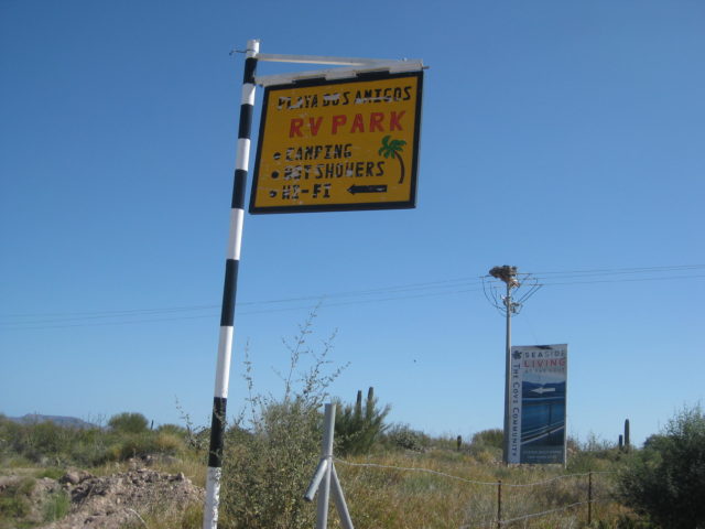
For this report (and potential guidebook), I am mainly trying to show places to camp or motels for travelers, along with points of interest.


Leaving San Ignacio…
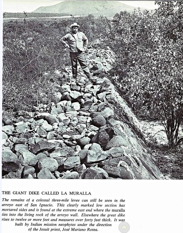
This page from Harry Crosby’s 1974 history adventure book The King’s Highway in Baja California had me wanting to see this magnificent structure, being such a grand site from 1700s Baja California.
Just 1/2 kilometer east of the paved entrance road to old San Ignacio and the Km. 73 marker, turn right into the large dirt lot and go to the far end. The Baja Oasis Motel is just past this lot. Park and walk to the Muralla.


The most recently active volcano on the peninsula is passed between San Ignacio and Santa Rosalia. Las Tres Virgenes is the complex of three volcanoes…


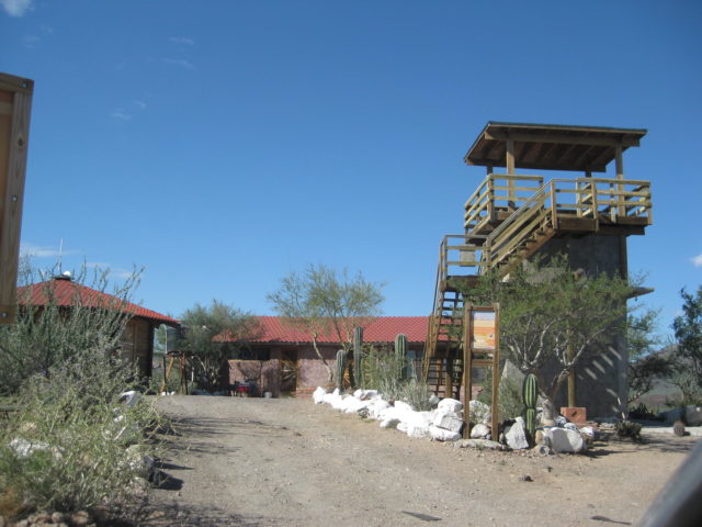
Hotel Volcán Tres Virgenes:

Km. 31.5 Paved road north to an eco-lodge, Volcán Trés Vírgenes (1.8 mi. in). 5 ؙcabins have 10 rooms with shower and toilet, 350 pesos. Food served in the lodge. The paved road beyond the resort (gated) goes to a geothermal electric plant.

Francisco (likes to be called ‘Borrego’) manages the lodge and he showed me around… I will be back!


SANTA ROSALIA, and south, Jan. 31, 2017

More on the Eiffel church and history of Santa Rosalía (click here).


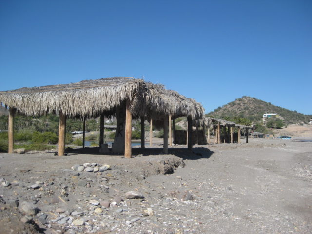
SAN LUCAS COVE:


SAN BRUNO:
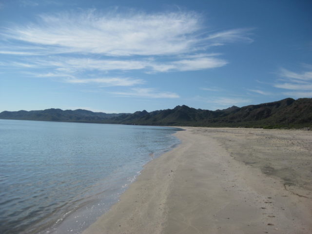
SHELL BEACH/ PUNTA CHIVATO:


Hotel Punta Chivato (originally called Hotel Borrego de Oro) built in the mid 1960s:
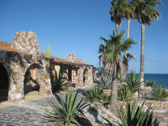

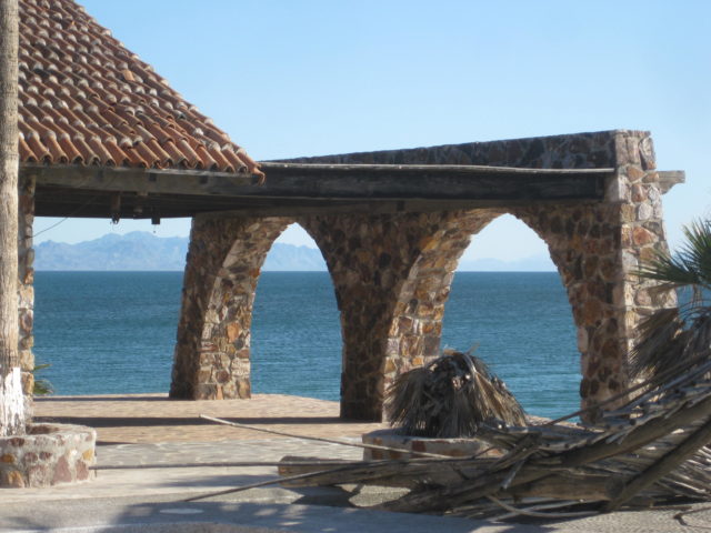
To the north of the long Punta Chivato runway, is this isolated beach. Can get windy here!

END OF DAY 2 (Tue. Jan. 31, 2017)
DAY 3: It is Wednesday morning, Feb. 1, 2017, and it was a quiet, wind-free night, at Punta Chivato (Shell Beach). Thanks again to Russ for the hospitality and ATV ride around the area, yesterday. I was up at sunrise to take a photo, as Russ does here, but there were no clouds for the big ball of fire to illuminate, so no photo.
I got on the road at 8:45 am (MST) and drove the approx. 8 miles back to the highway at Palo Verde to begin the next section of note and photo taking…
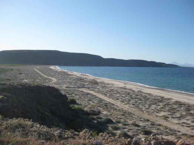
SANTA INES (Km. 155.5)
2.8 miles in there is an unsigned fork. To the left, in 0.2 mi. is a fishermen’s home or camp and what appears to be an area for camping. But, you cannot see the water (low sand dunes) from there. Going back to the fork, and taking the right branch went 1/2 mile to a parking area next to a beautiful beach… 3.3 miles from the highway.


On to Mulegé:


El Patrón restaurant (end of the north road) was closed (sign said open at 11), but just west, was Casa de Pancho Villa restaurant. WHAT A GREAT PLACE! Willy Airstream (Richard) had recommended it. I had a shrimp omelet with fries, fresh squeezed OJ and coffee, all for just 95 pesos… =US$4.75. They had wifi so I could check emails and Baja Nomad while waiting. Met a traveler there who, later came to Loreto in two days and attended my book signing.

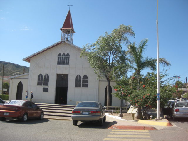
The 4th California Mission, Santa Rosalía de Mulegé, founded in 1705.

The stone church was built from 1757 to 1766, just before all the Jesuits were removed from the New World.
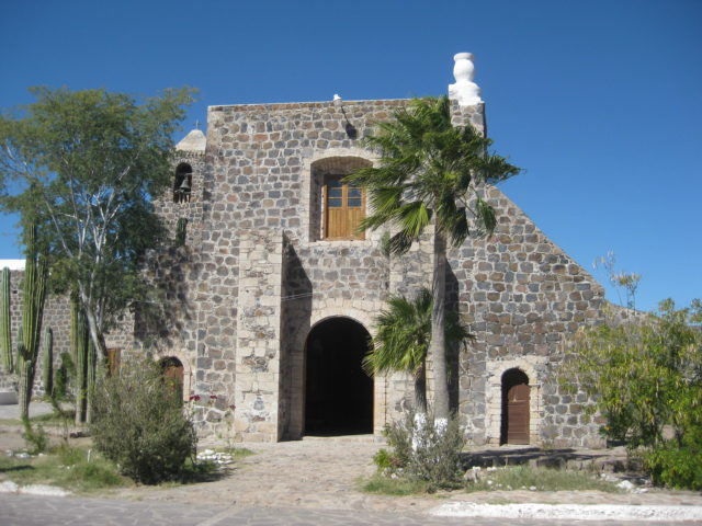

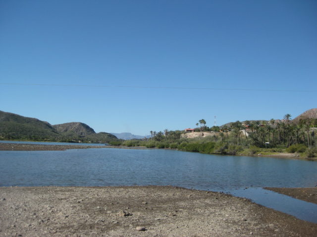
The mission site is reached from the south side of the bridge over the river at Km. 134, and a paved road turns left and goes under the bridge to the mission.
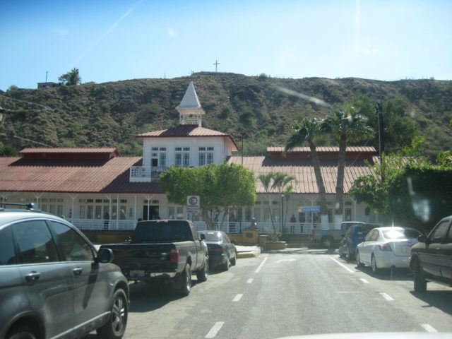
More Mulegé from along the south side of the river…


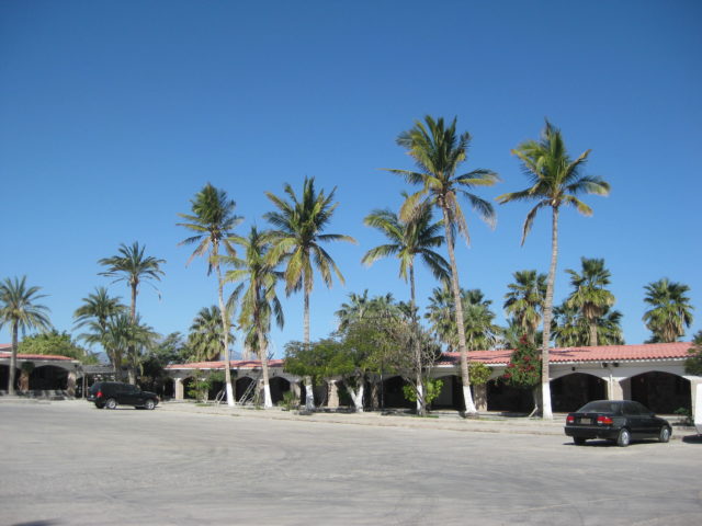
The Hotel Serenidad (Km. 131+) was pretty quiet looking. Such a big place, and almost no clients in sight. The airstrip looked okay, a bit wet still maybe (it rained a week earlier).
The Pemex station is at Km. 130, and I am pretty sure the pumps here are rigged to short the amount pumped by about 15%. I didn’t need a lot today, but in a few days, it was more evident when I returned.
Bahía Concepción is next, page 2…