These historic maps are for educational purposes only. All have a click-zoom-in feature for detailed viewing. Click on map image to zoom in for maximum detail. Scroll down to see something new!
*Missing some Auto Club Maps, can you help?: IF they exist, I would love to have (or get your scans of): 1970, 1976, 1977, 1981, 1986, 1993, 1999. Plus, any editions from 1935 to 1954; Also, a better 1972 map than I have, would be nice. Feel free to private message or email me (info@vivabaja.com) if you have any of these maps and would be willing to loan them so I can scan and return, you scan them, or send them to me (maybe for an exchange or discount on one of my Baja books at www.old missions.com?). Thank you!
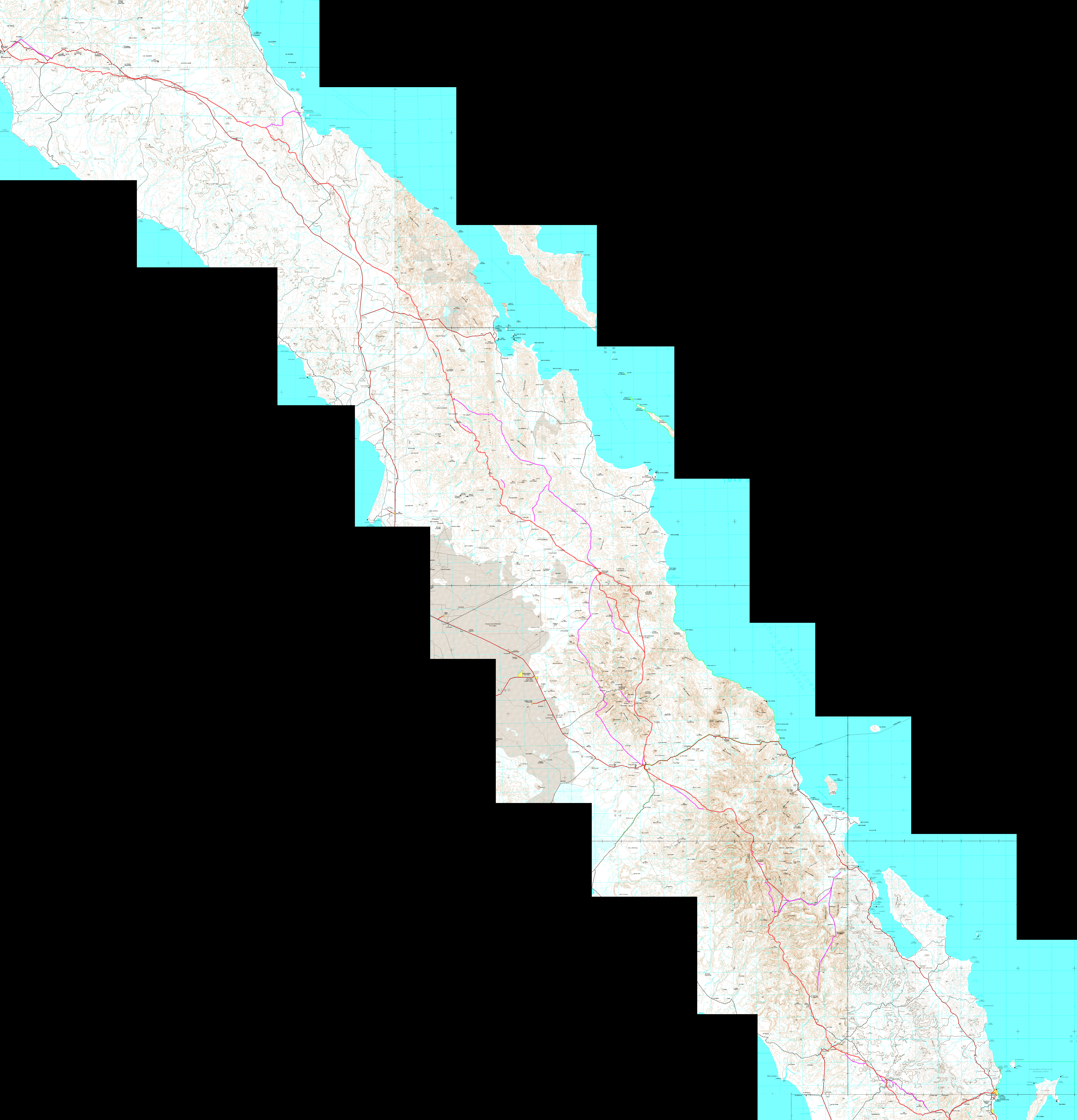
Baja California Peninsula Physical Map (from KarlMuellerMaps)
Baja California Peninsula Physical Map (Larger scale)
- CalTopo: Baja California, Mexico (switch between Topographic & Satellite Maps)
- Mexican Topographic Maps from INEGI (choose scale, area, and click PDF or GeoPDF where available)
- Selected topographic maps of popular locations
- Up-to-date Satellite Road Map
- Ejidos of Mexico Map (for ejido details click: i)
- Native Baja Californian Place Names
- Interactive Map of Photos on the peninsula (zoom in close to see all photos)
- Interactive Map of David’s Travel & History Articles, and Photos (click on the dots)
- Interactive Map from Baja Bound (several categories), created from my travels
- El Camino Real Maps
- Map of the Spanish Missions
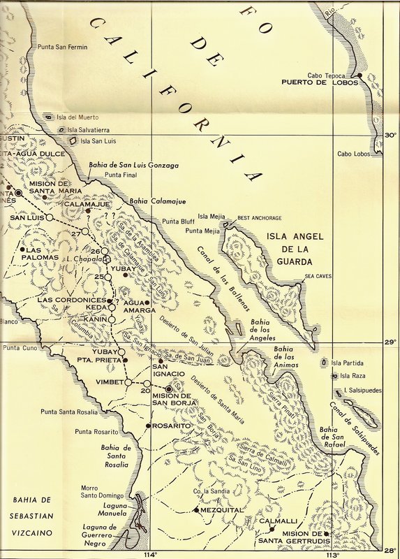
- Maps of the San Pedro Mártir/ Valle Chico Canyons
- Maps from the Auto Club (1927-2010) [also listed below]
- Auto Club maps of San Felipe South area (1930-2010)
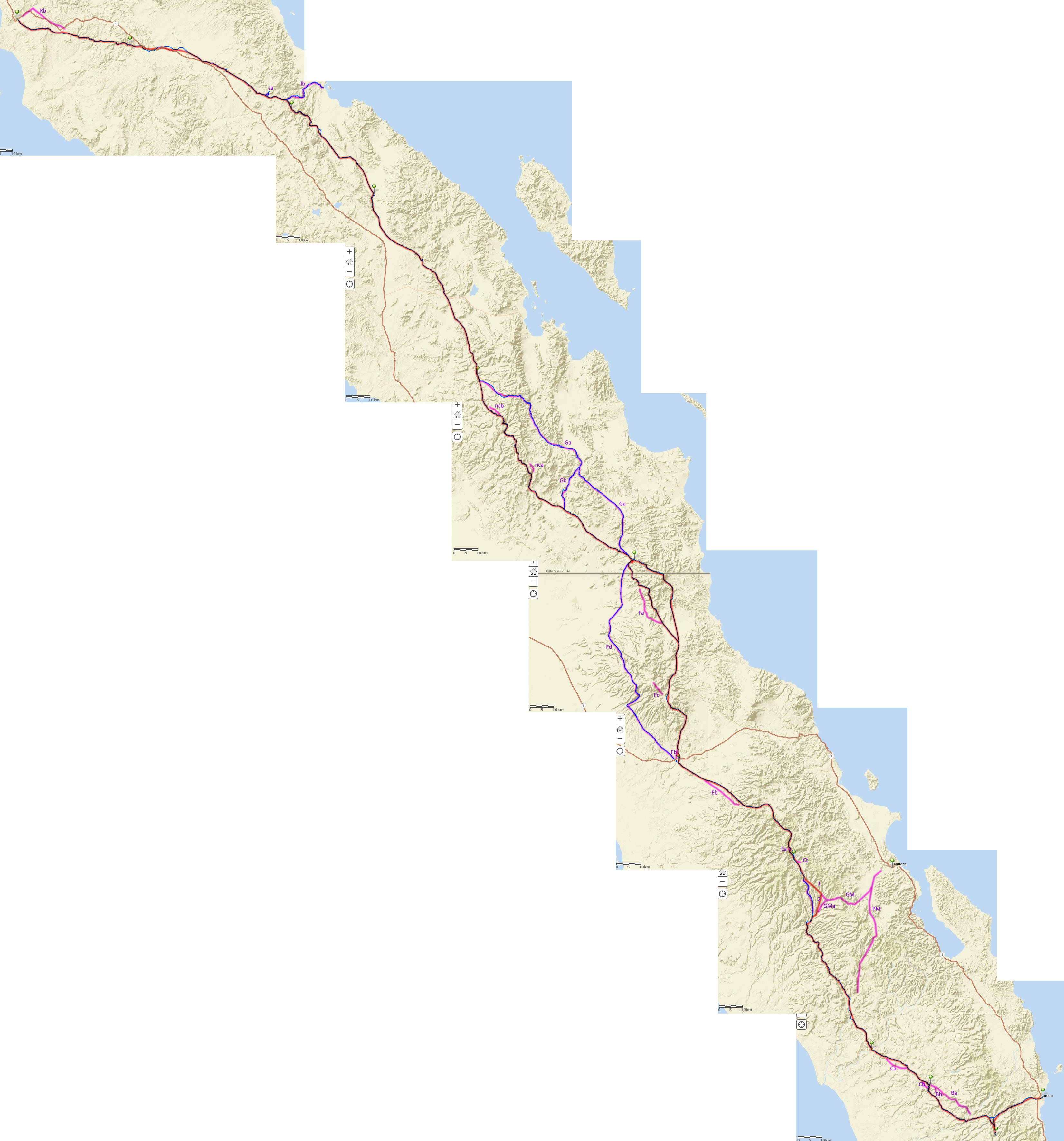
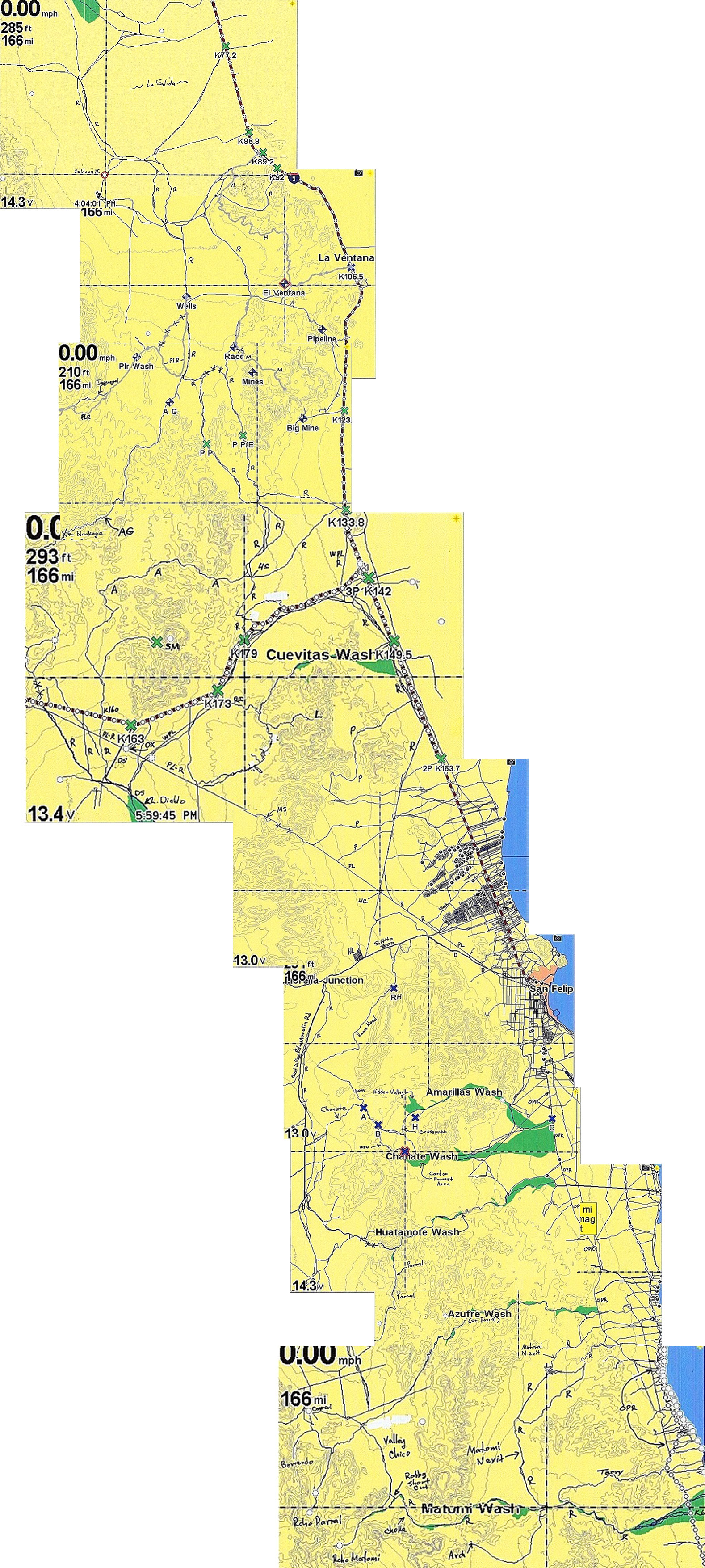
- Baja Race Maps 1972-2025
- 2015-2024 Baja Race Maps on Google Earth
- Okie Landing on maps
- 2018-2021 Baja Road Guide Maps by David Kier
- 1597 Map of California and Western Mexico
- 1598 Map, improved version of 1597 map
- 1683 Map by Padre Kino with the two colonies (La Paz & San Bruno)
- 1684 Atondo-Kino Expedition Route (detailed)
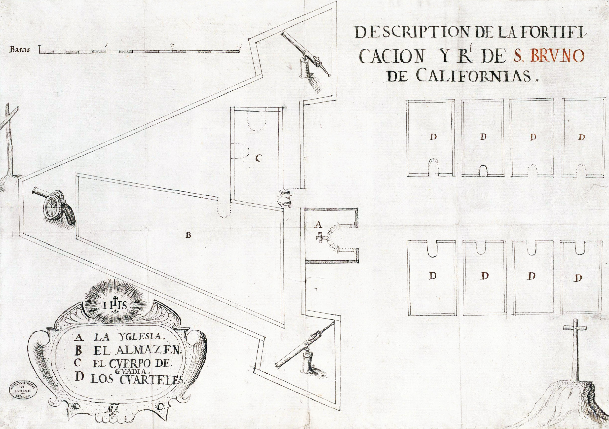
- 1685 Real de San Bruno Map (oldest ruin in the Californias)
- 1701 Padre Eusebio Kino Map
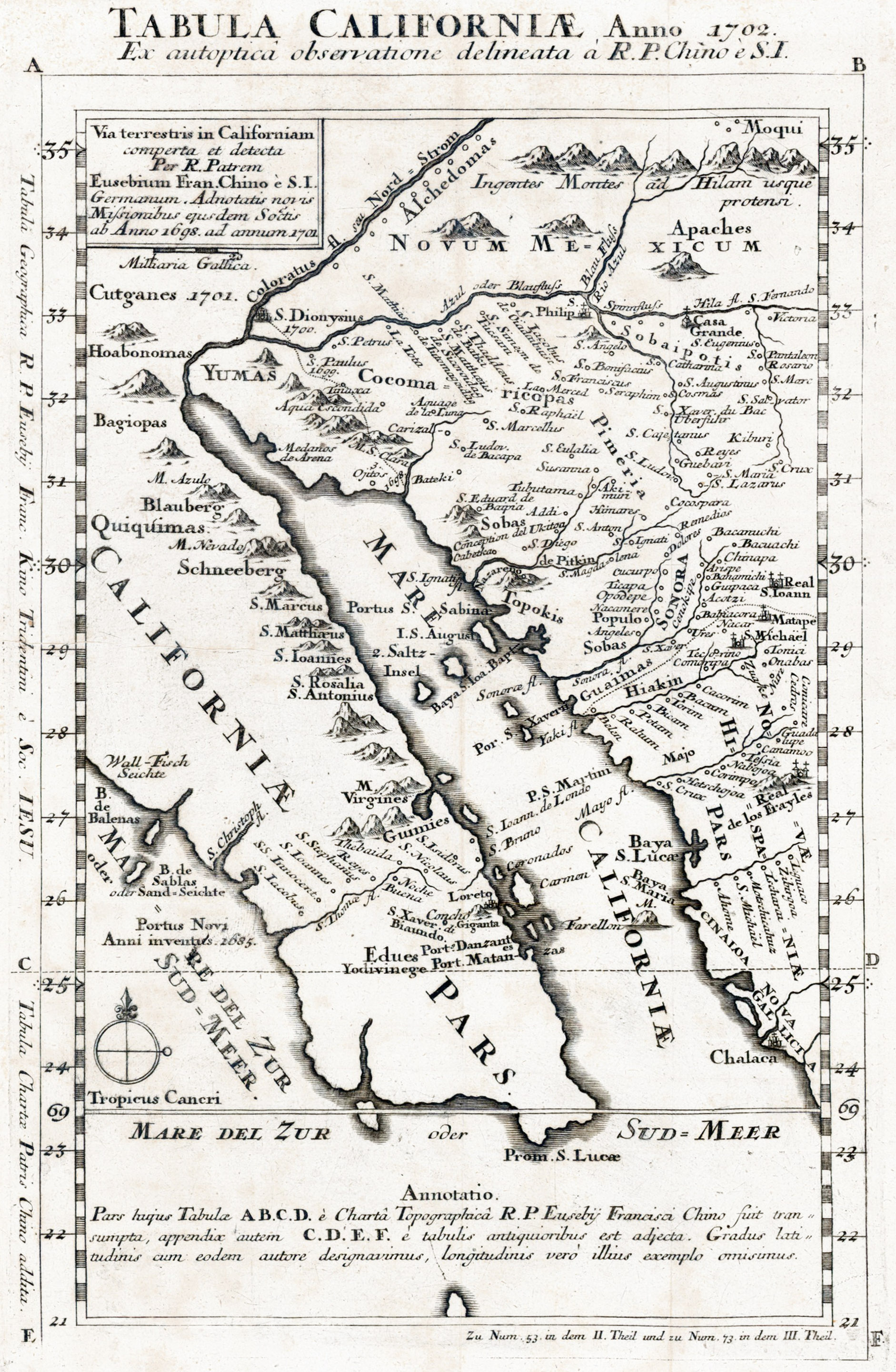
- 1702 Padre Kino Map of California (and NW Mexico)
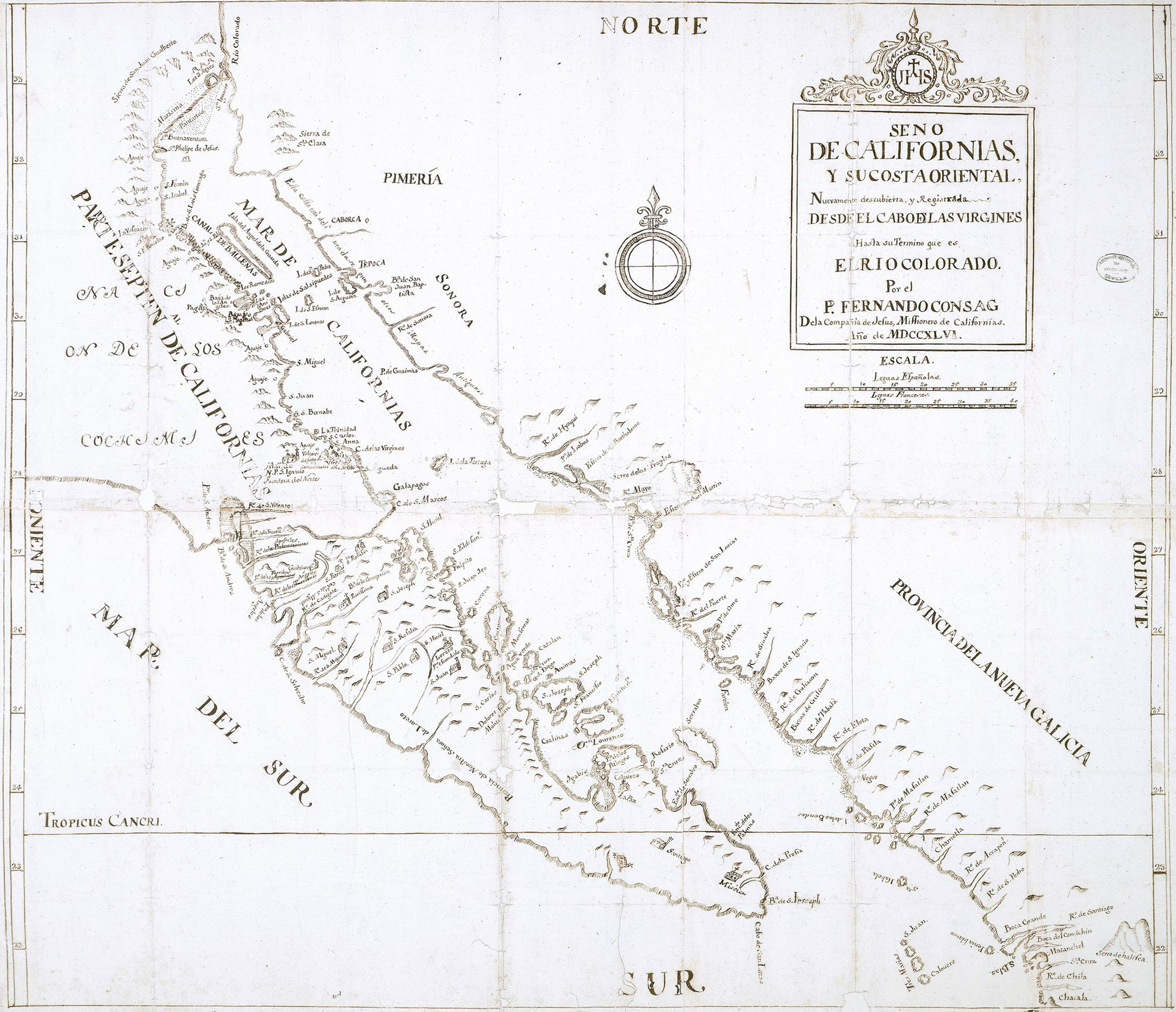
- 1746 Padre Fernando Consag Peninsula Map, with missions
- 1747 Padre Fernando Consag Northern Peninsula Map
- 1757 Jesuit Mission Map (data from ~1747)
- 1765 Isaak Tirion (Dutch) Map of California
- 1766 Padre Linck’s Expedition Map (north)
- 1766 Padre Linck’s Expedition Map (south)
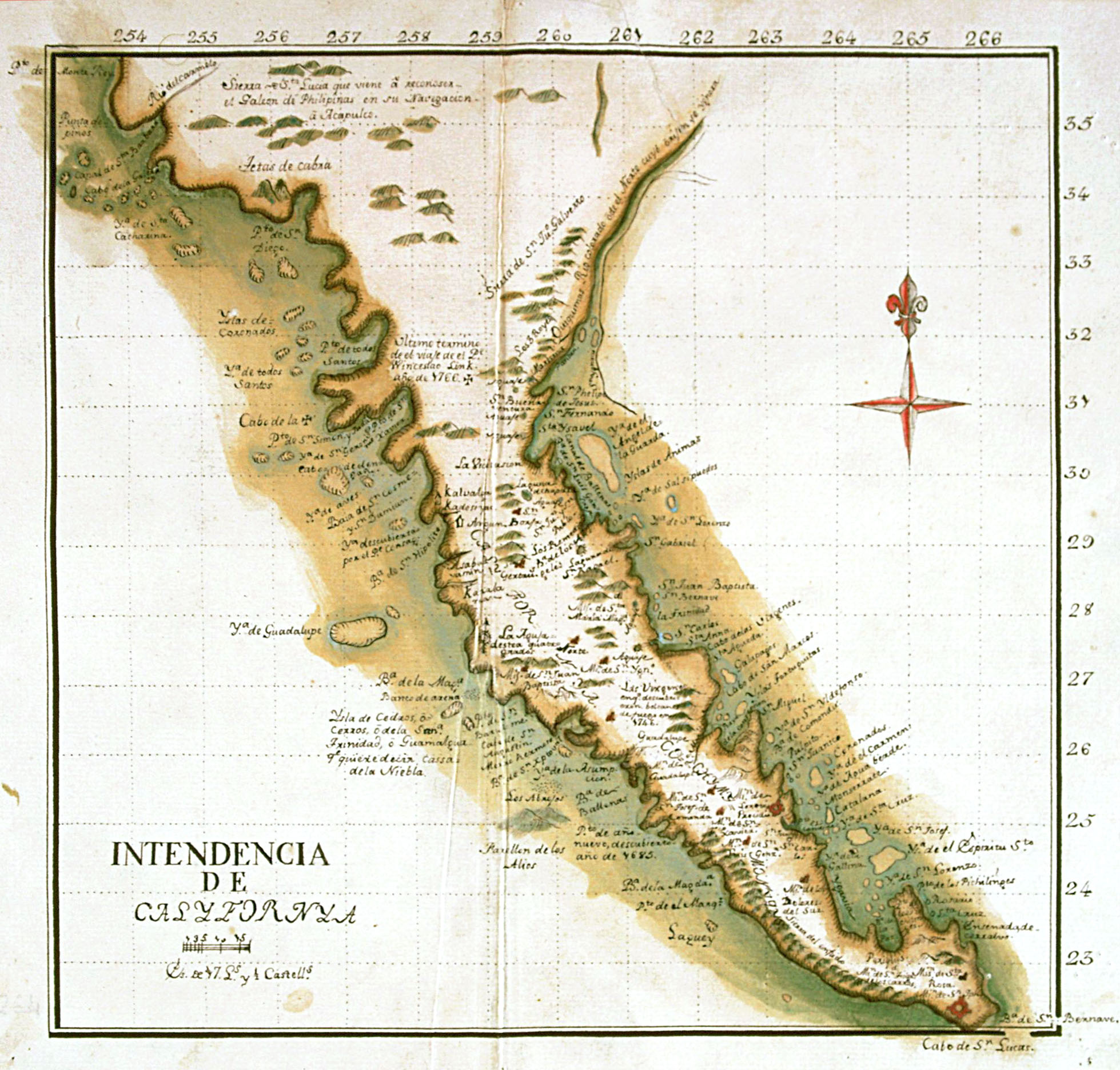
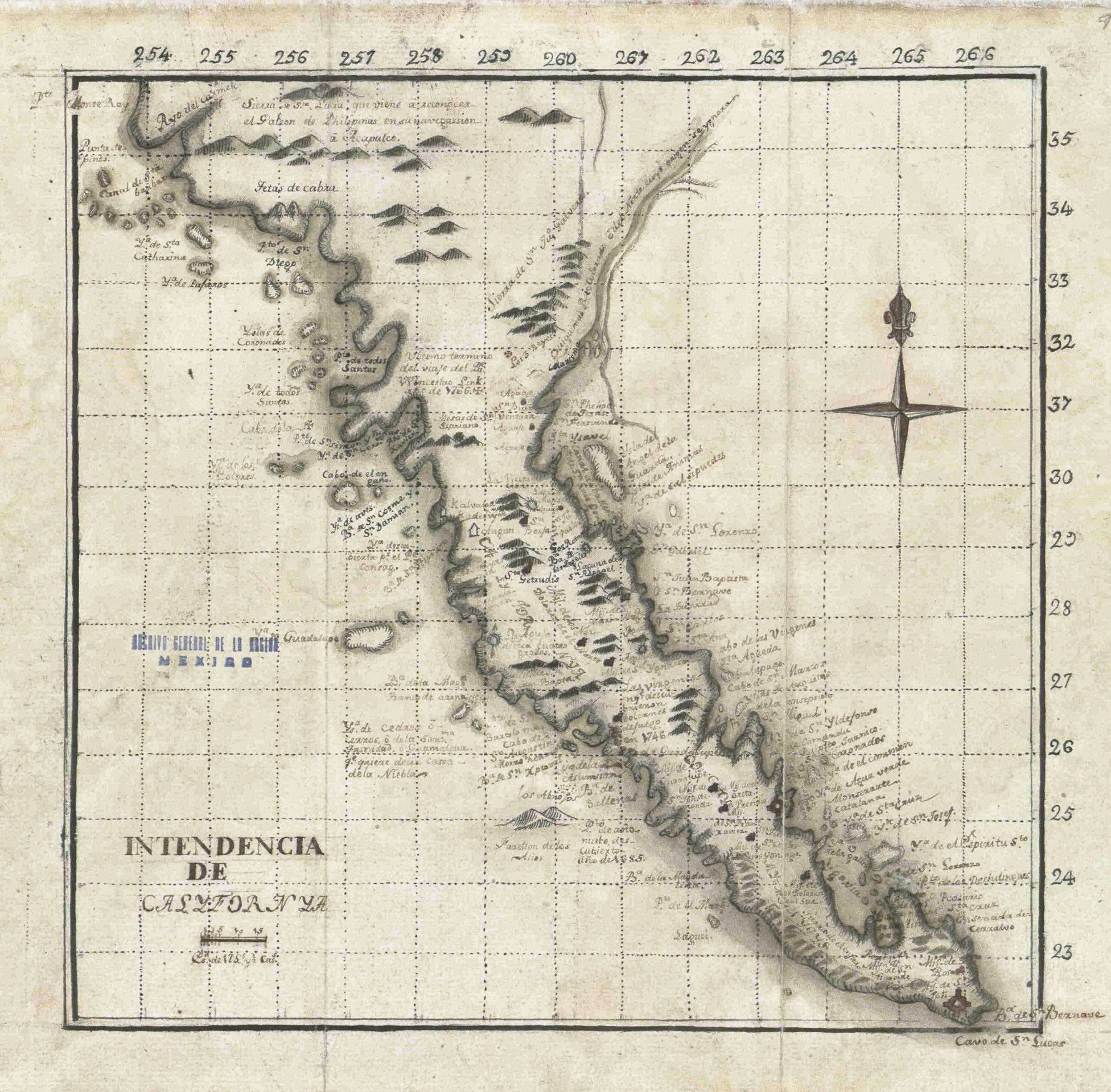
- 1767 (?) Intendencia de California Map
- 1768 Baja California and Mexico Map
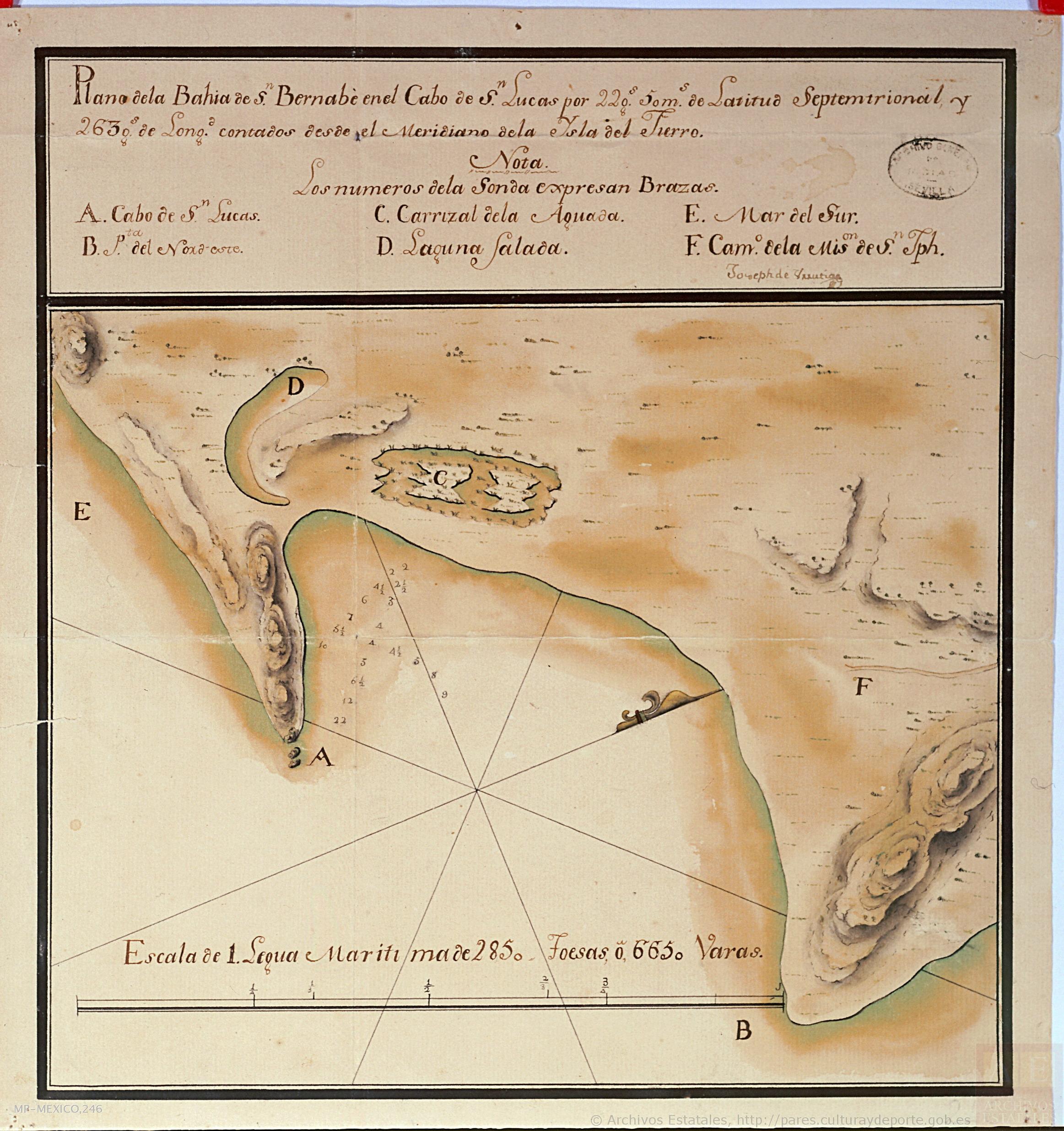
- 1768 Cabo San Lucas Map
- 1770 Real de Santa Ana plan (modern map)
- 1772 Padre Jacob Baegert Map of Baja California
- 1774 (?) Intendencia de California Map
- 1779 Baja California and surroundings Map
- 1787 Antigua & Nueva California Map of Missions & El Camino Real
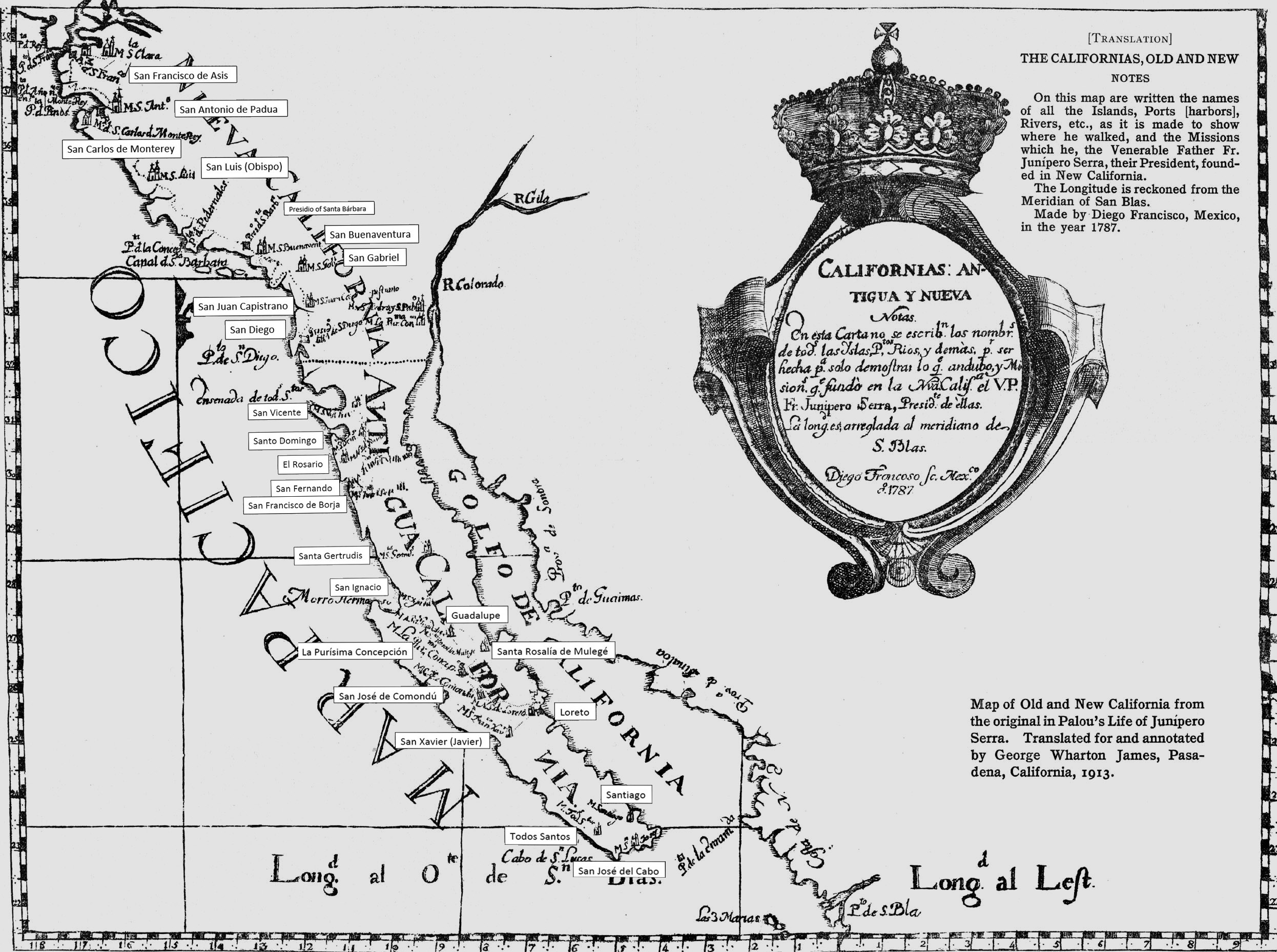
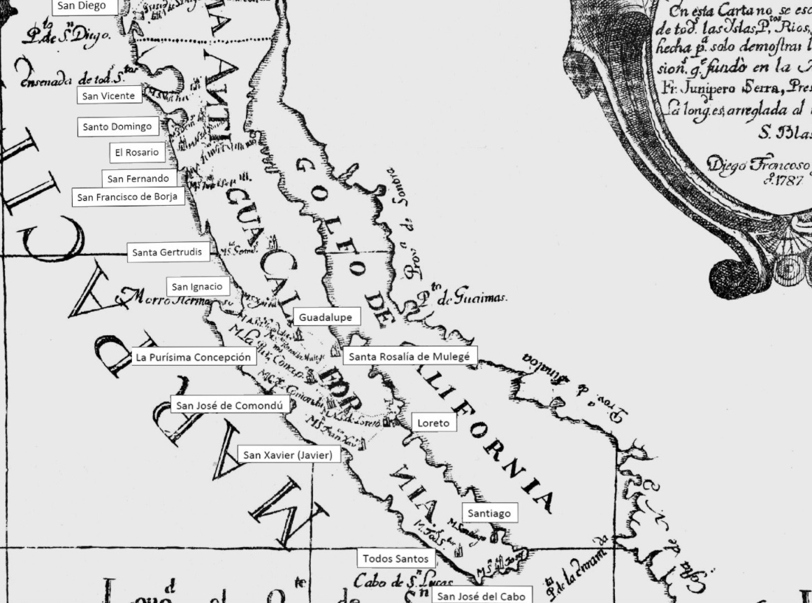
- 1787 Antigua & Nueva California Map, with translation and mission labels
- 1787 Antigua (Baja) California Map of Missions, with labels
- 1788 Map of Baja California & NW Mexico
- 1803 Pacific Coast Map (San Diego to Punta Abreojos)
- 1823 Baja & Alta California Map
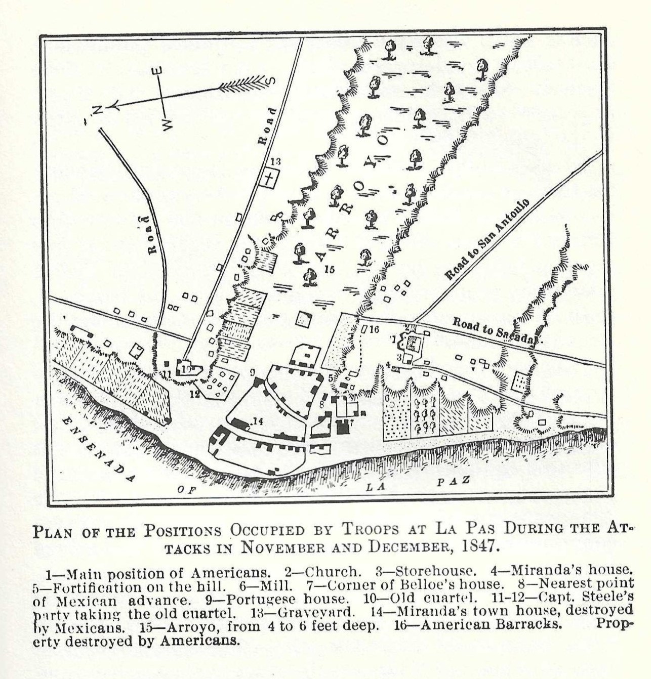
- 1847 Map of La Paz during the U.S. occupation
- 1858 Map of the Californias & New Mexico by Theodore Ettling
- 1860s (?) Map of Baja California
- 1870 Map of Baja California
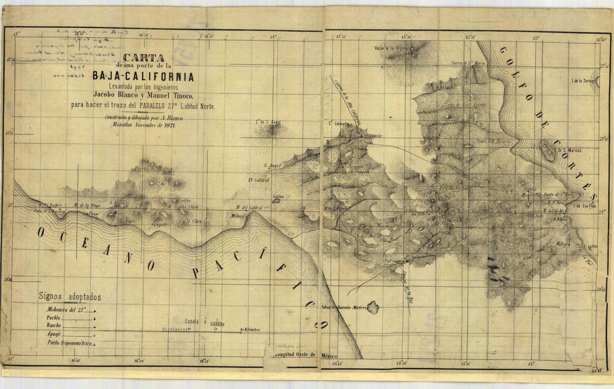
- 1871 Map of Latitude 27° across the peninsula
- 1871 Map of Latitude 27° across the peninsula, enhanced
- 1884 Baja California Map
- 1886 Baja California Map
- 1888 Baja California Maps by Charles Nordhoff, stitched together
- 1889 San Quintín Bay Map
- 1899 (circa) Baja California Map
- 1900 Map of trails and roads from San Borja to Cabo San Lucas
- 1904 Baja California Postal Route Map
- 1905 Mines and Roads Map of Northern Baja California, Standard Zoom
- 1905 Mines and Roads Map of Northern Baja California, Large Zoom
- 1912 Mexicali & Imperial Valley Map (Salton Sea to the Gulf)
- 1914 David Goldbaum Baja California Norte Map
- 1914 David Golbaum Baja California Norte Map Map (large scale)
- 1915 Harris & Cromwell Map of Baja California & the Gulf
- 1918 David Goldbaum Baja California Norte Map (printed in 1925)
- 1919 National Academy of Sciences Baja California Map
- 1921 Baja California Norte Districts (large)
- 1921 Baja California Norte Districts (medium)
- 1922 Baja California Map
- 1922 Baja California Geology Map
- 1923 & 1928 Baja California Geographical Maps
- 1925 Rand McNally Baja California Peninsula
- 1926 Railroad Map (San Diego to Tijuana to Tecate to Mexicali to Yuma)
- 1927 Auto Club Maps (San Diego to the San Quintín area)
- 1927-1928 Road map, California to Mulegé (super zoom)
- 1930 Edward Knight (detailed) Baja California Map
- 1930 Auto Club of Southern California Baja California Map
- 1934 Auto Club of Southern California Baja California Map
- 1936? Auto Club of Southern Cal. Baja California Map (with missions)
- 1939 Rand McNally Baja California Road Map
- 1940 Auto Club Log
- 1941 Baja California Roads & Minerals Map, with mileage log
- 1946 Baja California Map
- 1947 Auto Club Member’s Trip Report
- 1948 Geology Map of Baja California
- 1949 Orozco Northern Baja California Map
- 1949 Orozco Baja California Peninsula Map
- 1950 Auto Club Baja California Map
- 1951 Union 76 Map of Baja California (with imaginary roads)
- 1954 Howard Gulick’s El Camino Real location maps and notes
- 1954 El Camino Real location maps by Howard Gulick, stitched together
- 1955 Renie Map Service Baja California (large scale)
- 1955 Auto Club Baja California Map
- 1956 Government Peninsula Map
- 1956 Howard Gulick (Lower California Guidebook) Maps, stitched
- 1958 Howard Gulick (Lower California Guidebook) Maps, stitched
- 1958 (April) Desert Magazine Map
- 1958 (April) Desert Magazine (large scale) Map
- 1958 Shell Oil Map of Baja California
- 1959 Auto Club Map of Baja California
- 1961 Hovering Over Baja Book Map
- 1962 Howard Gulick (Lower California Guidebook) Maps
- 1962-1967 Howard Gulick Maps ‘stitched’ together
- 1962 Auto Club Map of Baja California
- 1962 Bud Bernhard’s Valle de San Felipe/ Valle Chico Canyons Map
- 1963 Bud Bernhard’s San Pedro Mártir Plateau Map
- 1966 Ray Cannon’s Sea of Cortez Book Map
- 1967 Mike McMahan (black & white) wall map
- 1967 McMahan Color wall map
- 1967 Auto Club Map of Northern Baja California
- 1967 Auto Club Map of Central and Southern Baja California
- 1967-1968 Edition Airports of Baja California Map
- 1967 Airports Map Cover and Communications List
- 1968 Auto Club Map of Northern Baja California
- 1968 Auto Club Map of Central and Southern Baja California
- 1968 Auto Club Guidebook Map of Gonzaga Bay
- 1969 Auto Club Map of Northern Baja California
- 1969 Auto Club Map of Central and Southern Baja California
- 1970 & 1972 Cliff Cross ‘birds-eye-view’ (and all his) Baja Guide Maps
- 1971 Sunset Travel Guide Maps
- 1971 Auto Club Map of Northern Baja California
- 1971 Auto Club Map of Central and Southern Baja California
- 1971 Reconnaissance Geologic Map of Baja Norte (3 parts):
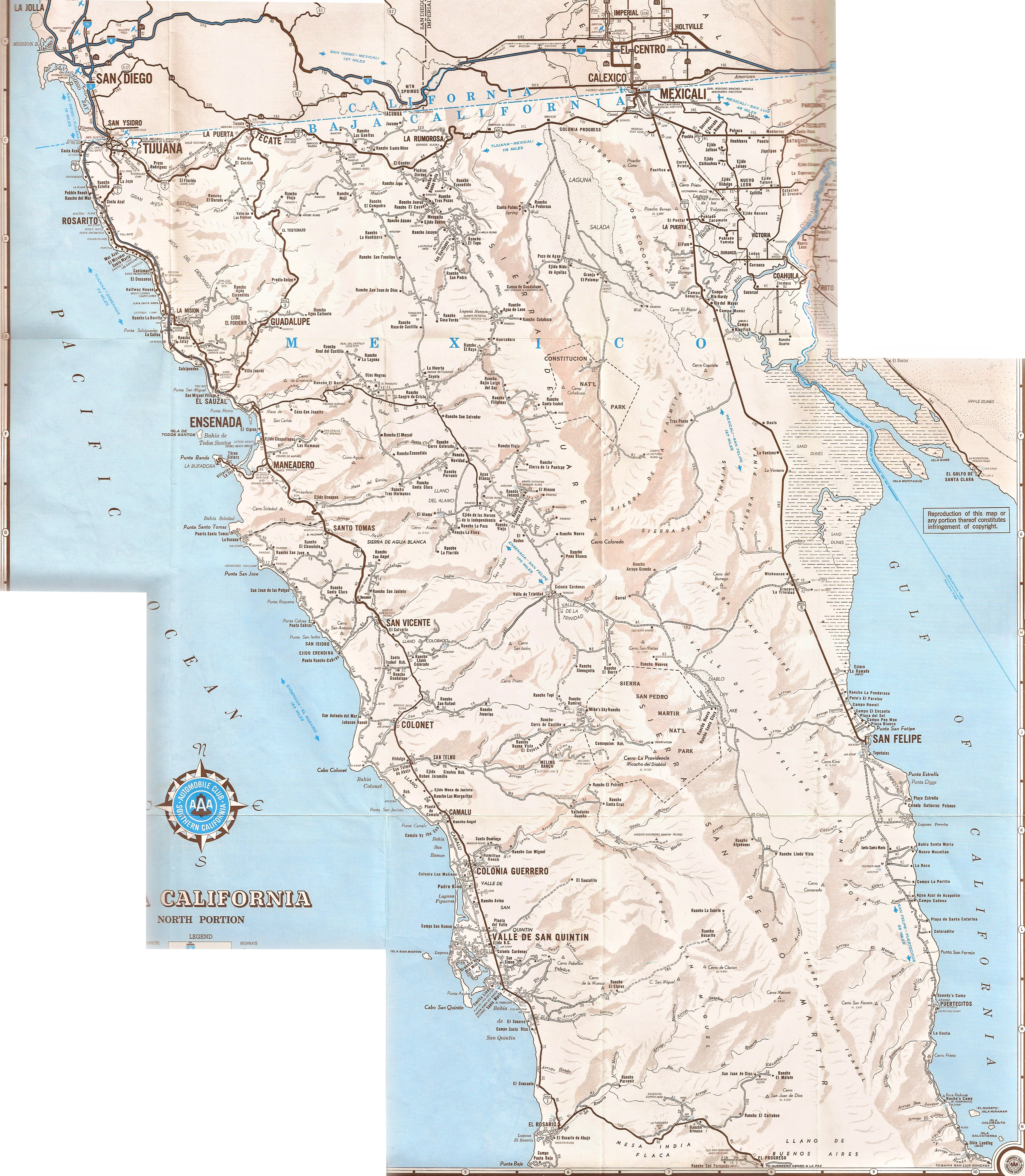
- 1972 Auto Club Map of Northern Baja California
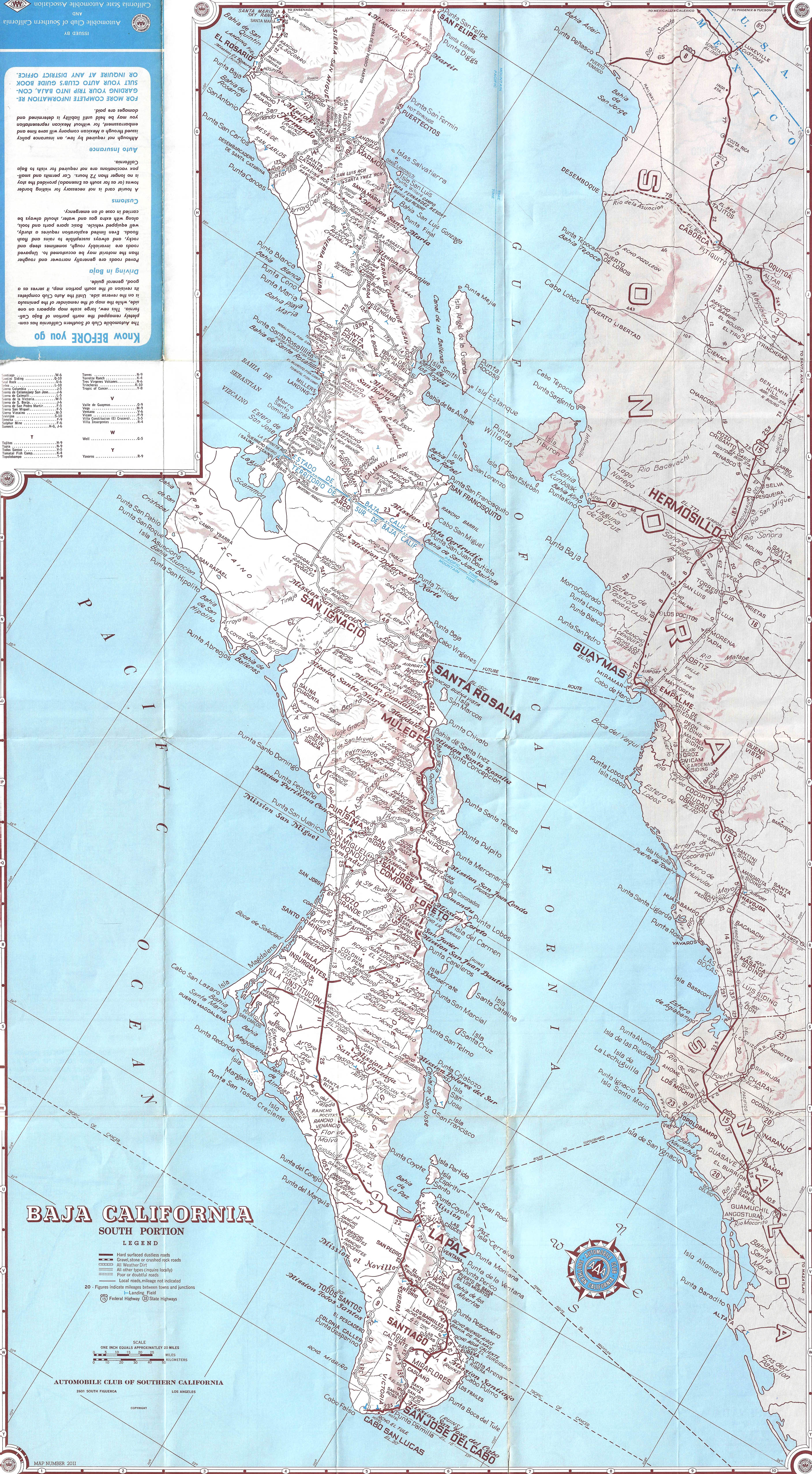
- 1972 Auto Club Map of Central and Southern Baja California
- 1972 Mike McMahan 3rd edition wall map (sample image)
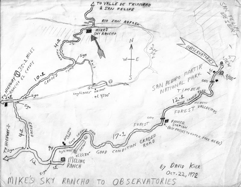
- 1972 David Kier Mike’s Sky Rancho to Observatories
- 1973 Homer Aschmann Highway Route History Map
- 1973 Homer Aschmann History of the Highway Notes
- 1973 Auto Club Map of Northern Baja California
- 1973 Auto Club Map of Central and Southern Baja California
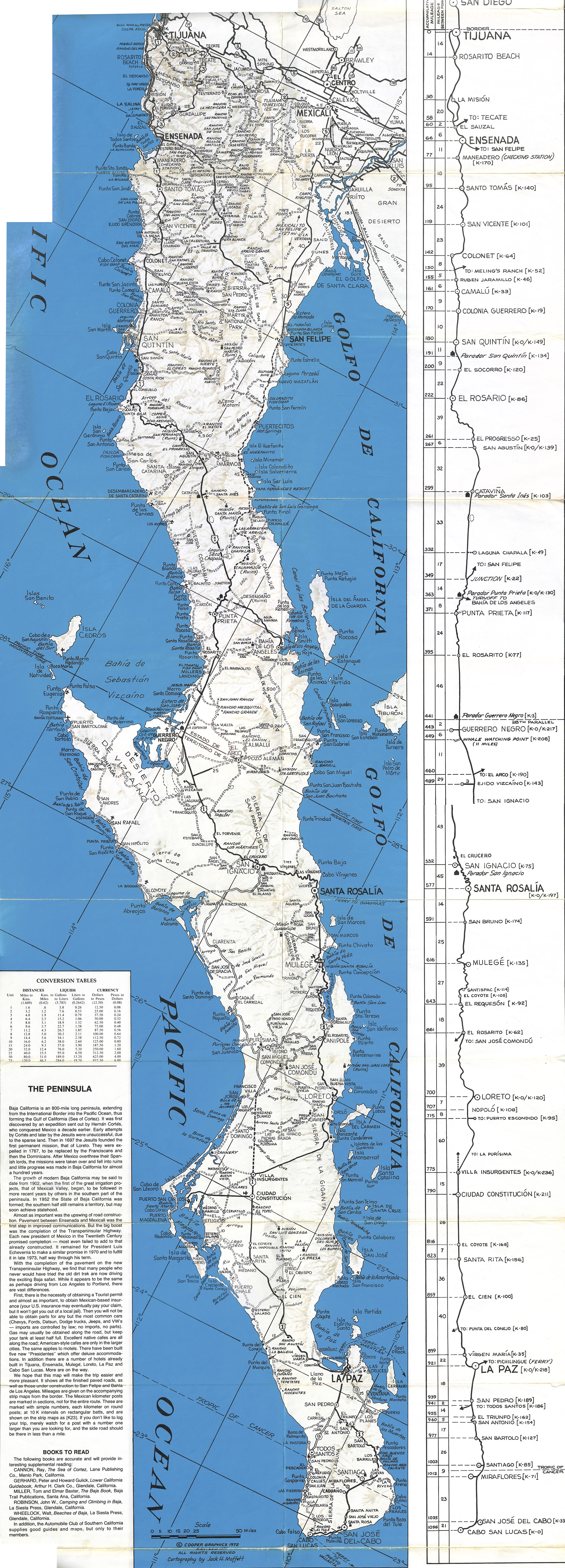
- 1974 Cooper Graphics Baja Road Map (revised from 1972)
- 1974 Auto Club Map of Northern Baja California
- 1974 Auto Club Map of Central and Southern Baja California
- 1974 Harry Crosby El Camino Real Maps stitched together
- 1974 SCORE Baja Internacional Race Map
- 1975 Auto Club Map of Baja California
- 1975 Baja California Guidebook Maps (stitched)
- 1975 Airports of Baja California Map
- 1975 Harry Crosby Painted Caves Maps
- 1977 Harry Crosby El Camino Real Maps
- 1977 Harry Crosby El Camino Real Maps stitched together
- 1978 Auto Club Map of Baja California
- 1979 Auto Club Map of Baja California
- 1980 Auto Club Map of Baja California
- 1982 Auto Club Map of Baja California
- 1983 Auto Club Map of Baja California
- 1984 Auto Club Map of Baja California
- 1984 Tourism Department Peninsula Map
- 1985 Auto Club Map of Baja California
- 1987 Auto Club Map of Baja California
- 1987 Pronto Mapa: Peninsula Baja California
- 1988 Jerry Schad Observatories to Diablo Mountain Map
- 1988 Jerry Schad San Pedro Mártir Map
- 1988 Auto Club Map of Baja California
- 1989 Auto Club Map of Baja California
- 1990 Auto Club Map of Baja California
- 1991 Auto Club Map of Baja California
- 1992 Auto Club Map of Baja California
- 1992 Kevin Healey ‘Traveller’s Reference Map’ of Baja California
- 1994 Auto Club Map of Baja California
- 1995 Auto Club Map of Baja California
- 1996 Auto Club Map of Baja California
- 1997 Auto Club Map of Baja California
- 1998 Auto Club Map of Baja California
- 2000 Auto Club Map of Baja California
- 2001 Auto Club Map of Baja California
- 2002 The Spanish Missions of Baja California
- 2003 Auto Club Map of Baja California
- 2003 Baja California Almanac
- 2003 Baja California Almanac Folding Map
- 2004 Auto Club Map of Baja California
- 2004 Mapa Turístico Baja California Road & Recreation Map
- 2004 Peninsula Map from Baja Almanac & Discover Baja
- 2005 EIGAS State of Baja California Map
- 2007 Auto Club Map of Baja California
- 2009 Baja California Almanac Book + Maps
- 2010 Auto Club Map of Baja California (the final edition)
- 2015 Baja California Almanac (unpublished)
- 2018 El Camino Real trails topo map. Tracks from CaminoRealBaja.com
- El Camino Real on a terrain map. Tracks from CaminoRealBaja.com
- 2018-2021 Road Guide Maps by David Kier
- 2021 San Felipe Region Trails by Paul W
- Maps of the San Pedro Mártir/ Valle Chico Canyons
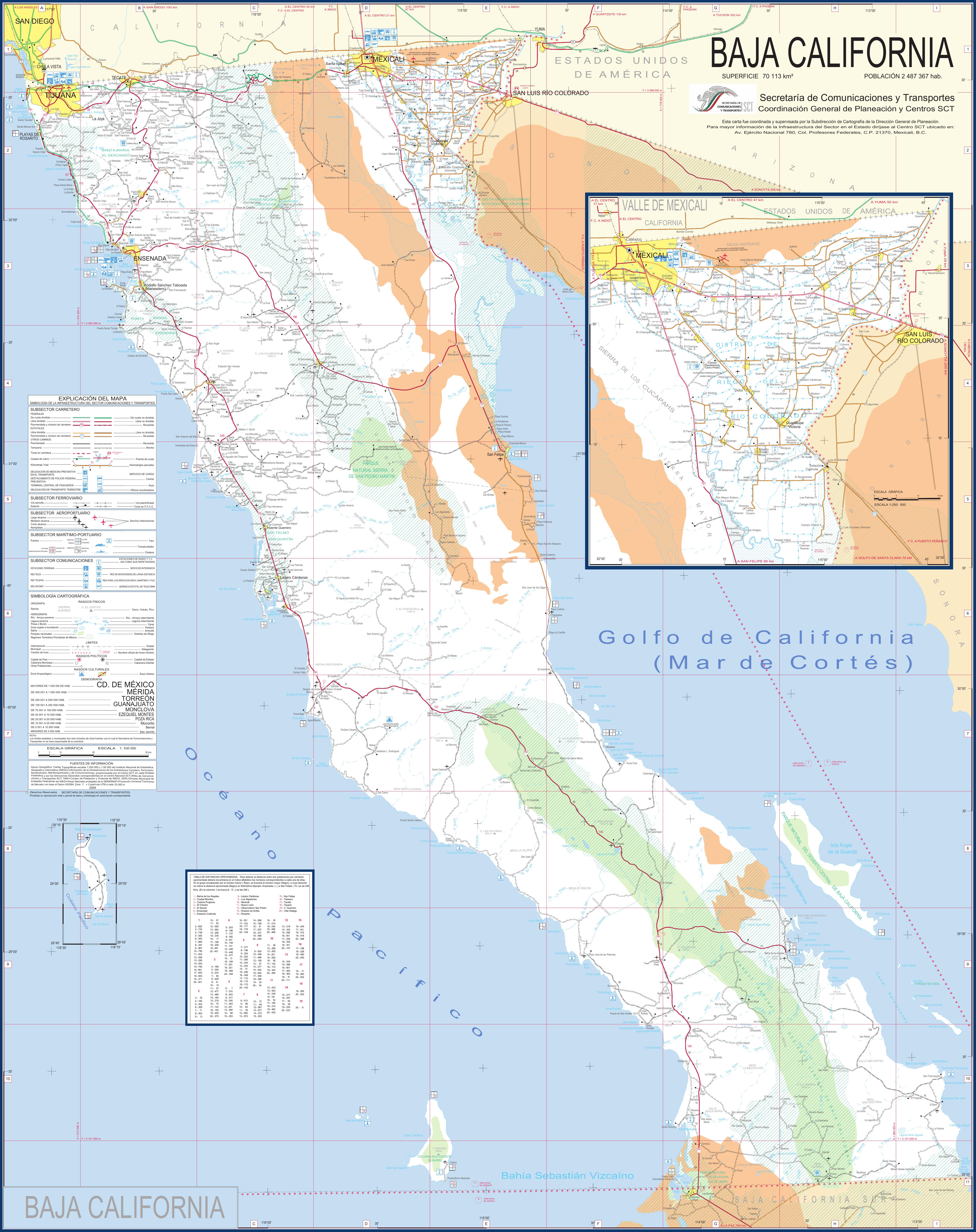
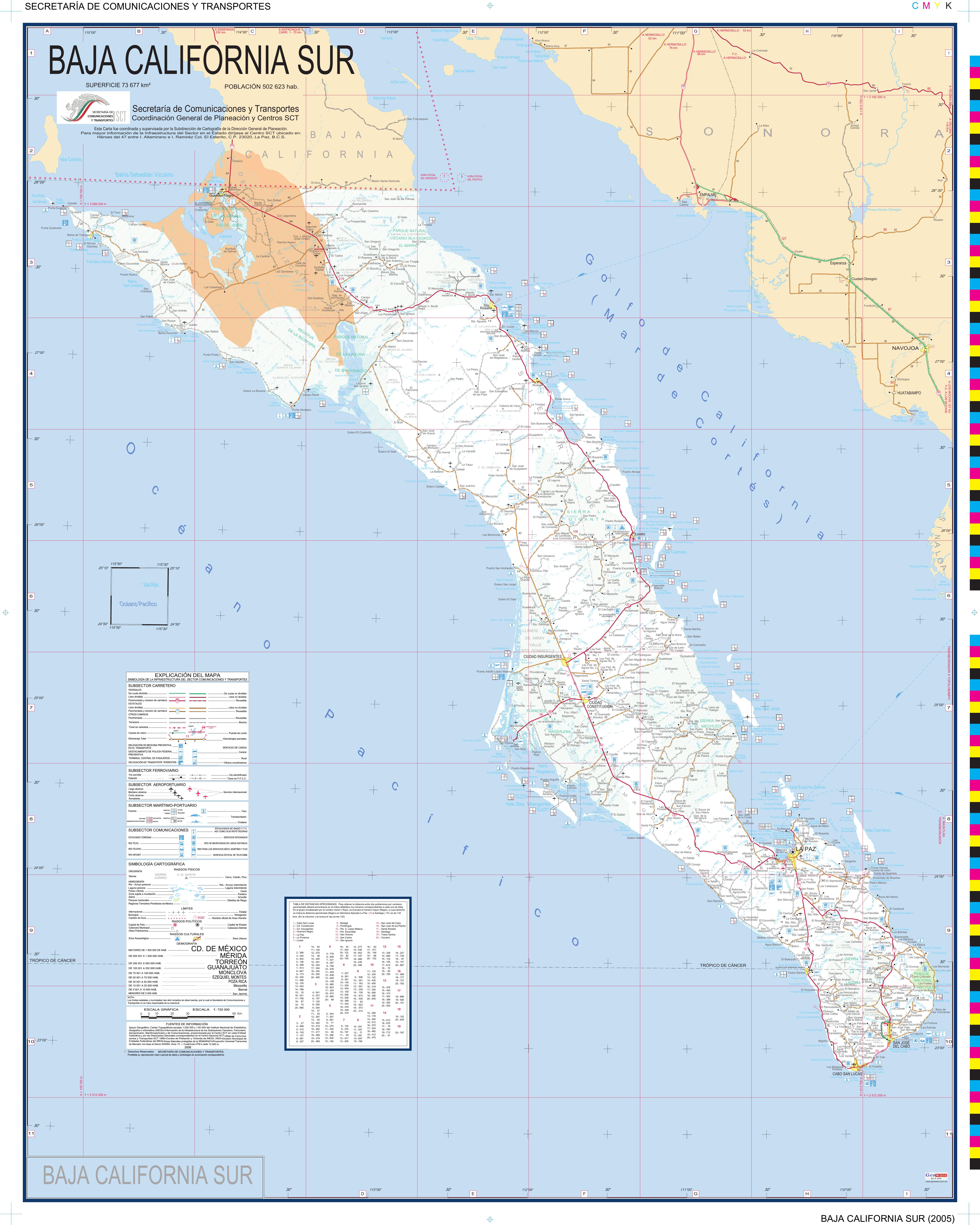
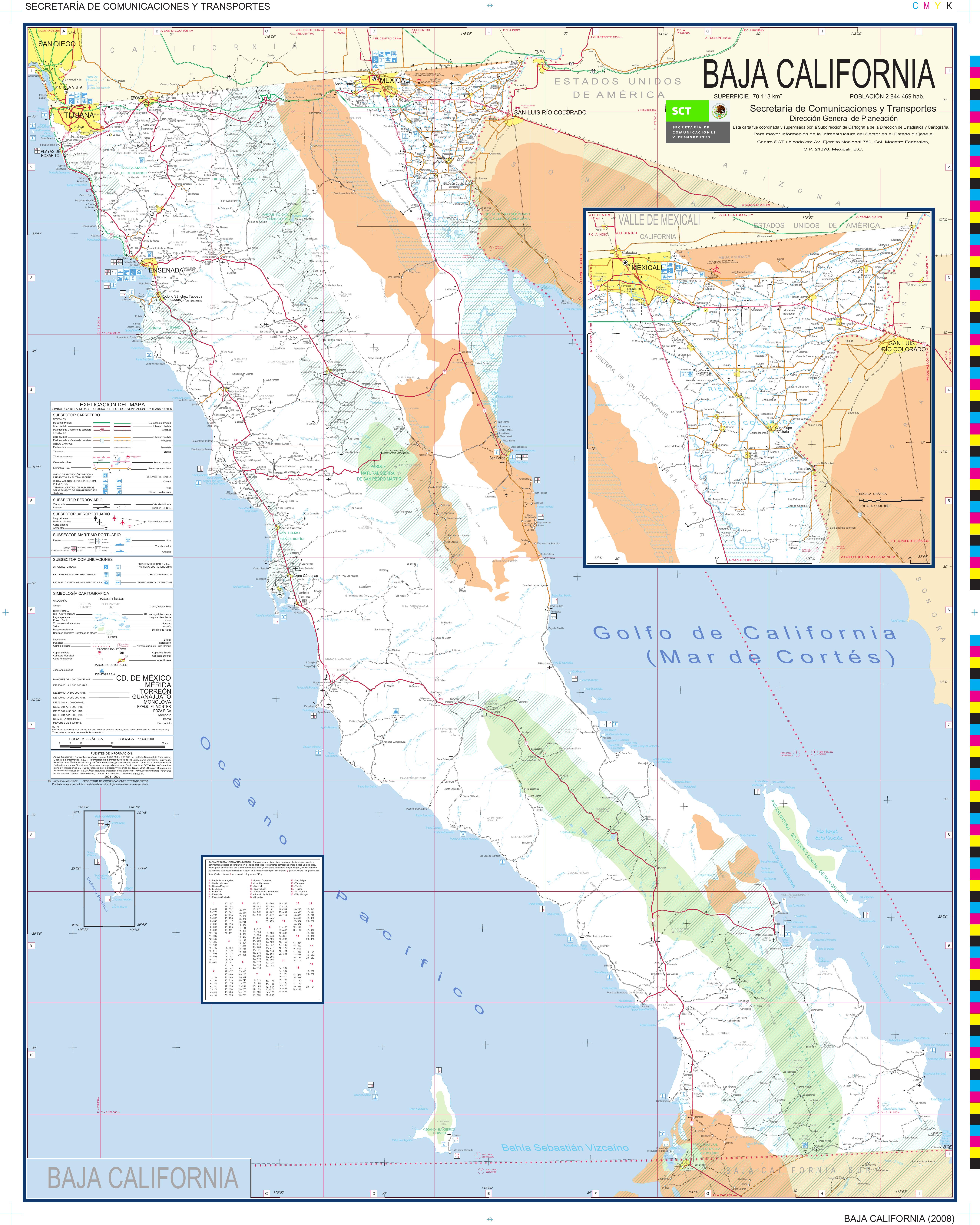
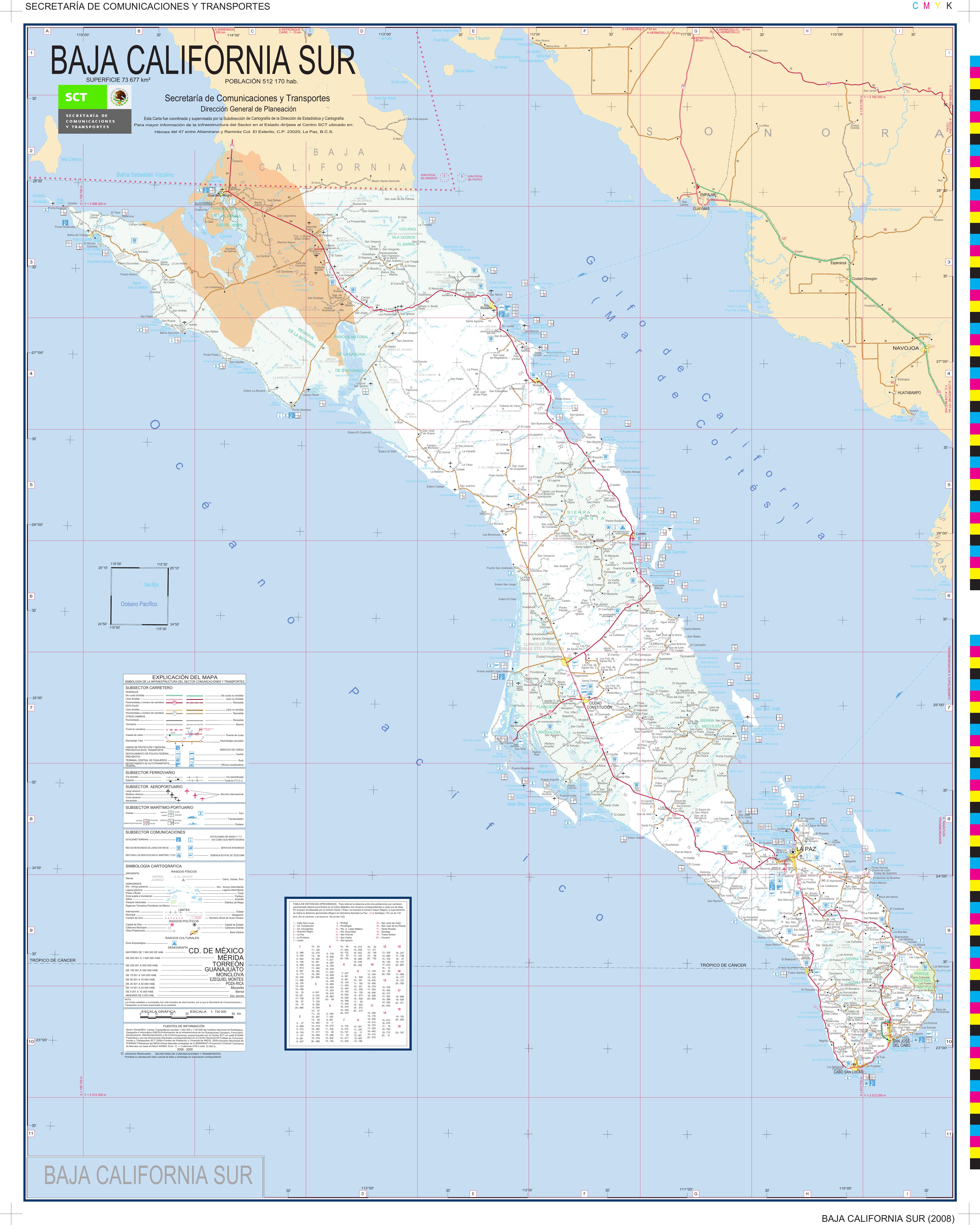
Government SCT Road Maps of North and South Baja California (2004-2016):
- 2004–Baja-California–Norte–Map–SCT.jpg
- 2004–Baja-California–Sur–Map–SCT.jpg
- 2006–Baja-California–Norte–Map–SCT.jpg
- 2006–Baja-California–Sur–Map–SCT.jpg
- 2009–Baja-California–Norte–Map–SCT.jpg
- 2009–Baja-California–Sur–Map–SCT.jpg
- 2012–Baja-California–Norte–Map–SCT.jpg
- 2012–Baja-California–Sur–Map–SCT.jpg
- 2014–Baja-California–Norte–Map–SCT.jpg
- 2014–Baja-California–Sur–Map–SCT.jpg
- 2016–Baja-California–Norte–Map–SCT.jpg
- 2016–Baja-California–Sur–Map–SCT.jpg
- For sale:
- 2023 Benchmark Baja California Atlas web page
- YouTube video shows the Atlas pages
- Benchmark Maps Baja California Road & Recreation Atlas, discount price!
- 2023 Benchmark Digital Map from Avenza web page
- List of 2023 edition changes.
- 2025 VivaBaja 6 ft. wall map from Carlos Cañez, at bottom of this link.
- For free:
- 2018-2021 Baja Road Guide Maps by David Kier
- Interactive Map: Baja Bound Travel Articles: Locations & Links
- Interactive Map of Photos on the peninsula (zoom in close to see all photos)
- Finding El Camino Real in Baja with maps from Howard Gulick, Harry Crosby, and more.
- Exciting New El Camino Real Website and Google Earth Map from CaminoRealBaja.com
-
David’s hand drawn maps of the San Felipe South area (1967-2004)
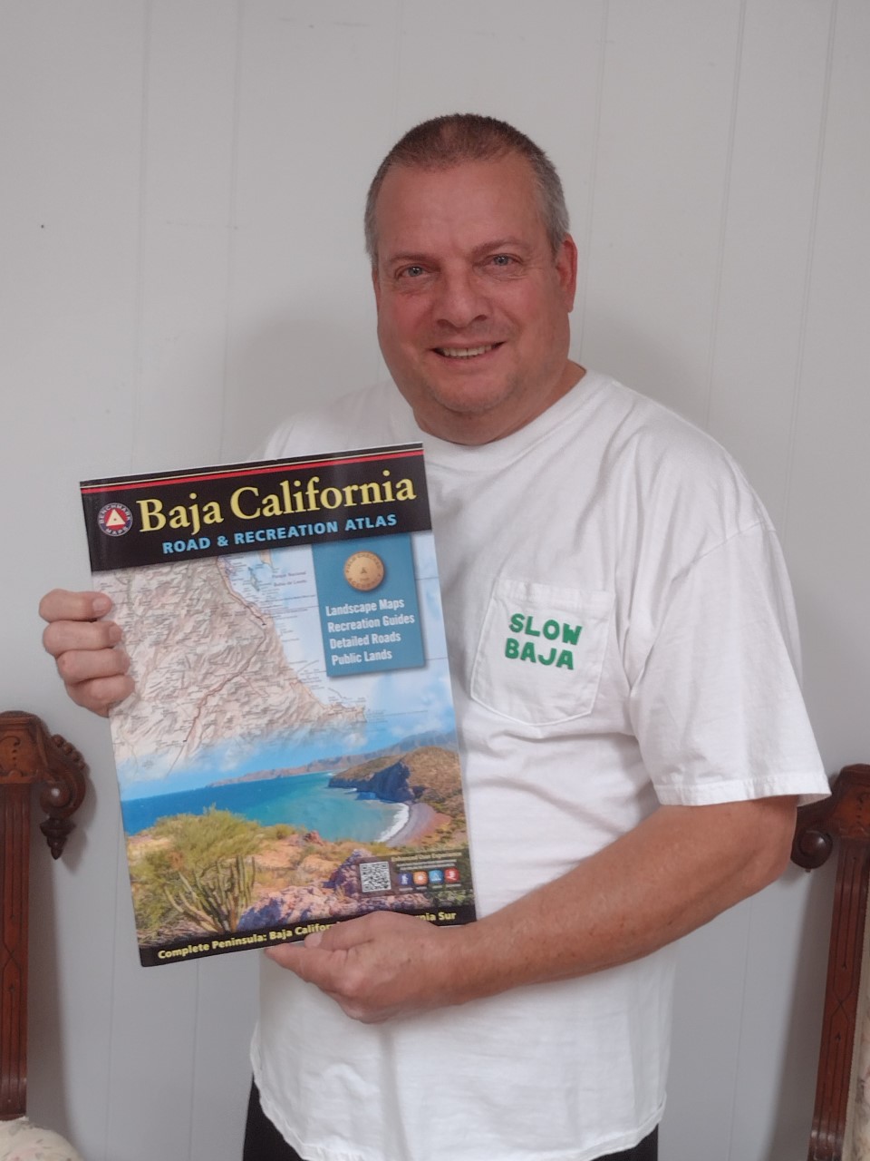
*Benchmark Maps extends a special thank you to David Kier for his invaluable editorial assistance. Kier’s seminal book Baja California Land of Missions is an essential resource for anyone wanting to learn and explore the history of Baja California’s Spanish Missions. Learn more at www.vivabaja.com.
Learn more about Benchmark’s Baja California Atlas project in this episode of the Slow Baja podcast.
NEW! The 2023, Second Edition Baja California Atlas is here!