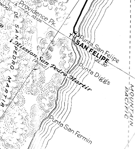
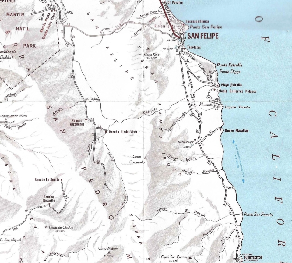
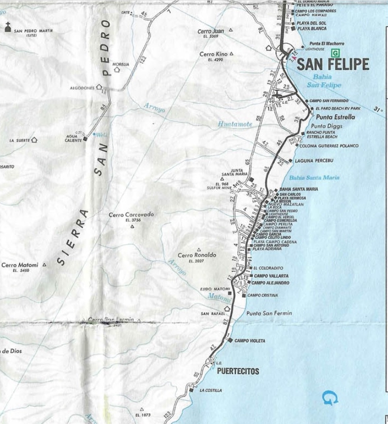
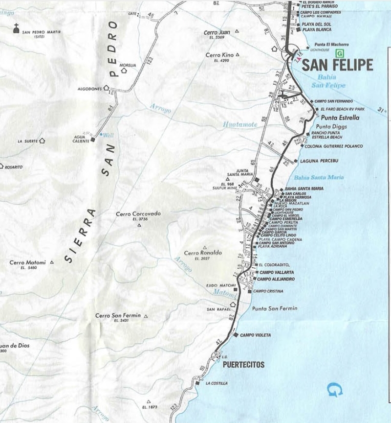
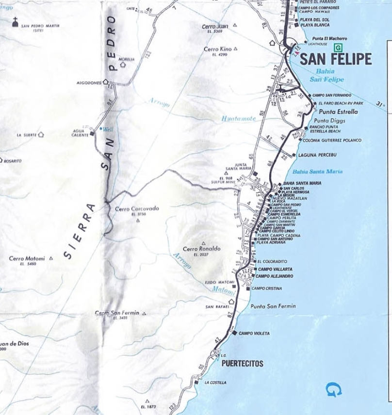
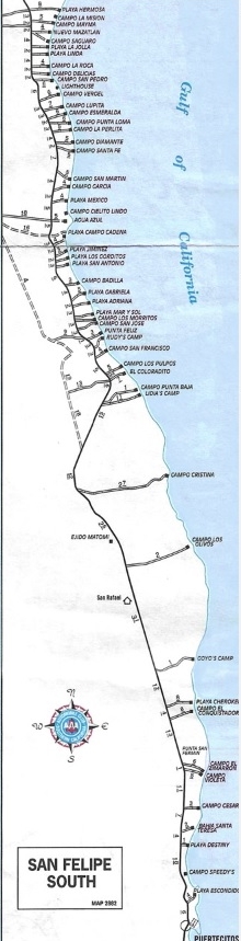
Auto Club maps of San Felipe South area (1930-2010)
Not all years included, see message at bottom. Maps shown for historical education.
1930:
Dirt road to San Felipe from Mexicali.
1934:
No change
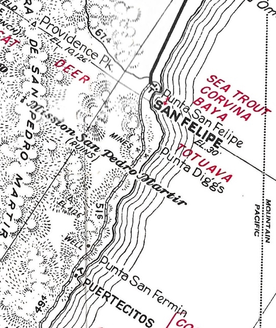
1955:
A paved highway reaches San Felipe and a dirt road continues about 22 miles south to a sulfur mine. The mine is 5 miles inland. The road is incorrectly shown, as it runs direct to the mine and not along the coast.
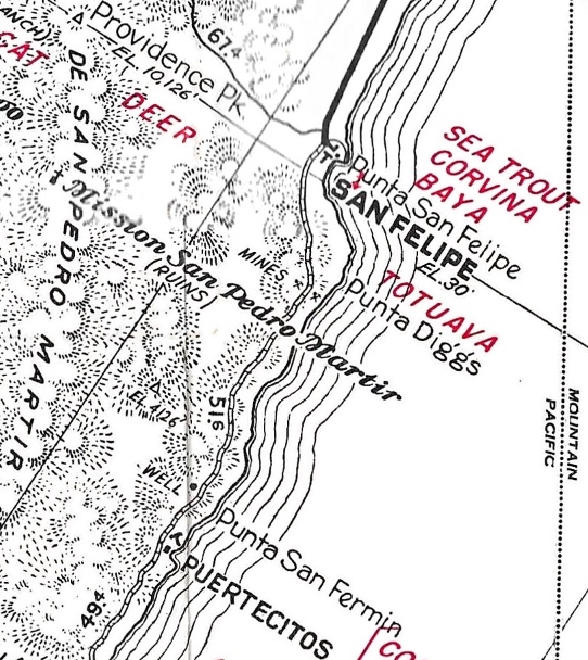
1959:
The road from Ensenada is now included, as is the sulfur mine. The road south is now shown as graded. The new camp, Puertecitos is included, as is the well in Arroyo Matomí ten miles north. However, the placement of the road leaving San Felipe, and the mine, remains incorrect.
1962:
No changes from the 1959 edition.
1967:
A totally new map that is very accurate and detailed. Both the old 1951-59 road south and a newer one just west of it are shown. No change in the next three editions.
1971:
1973:
1974:
1975:
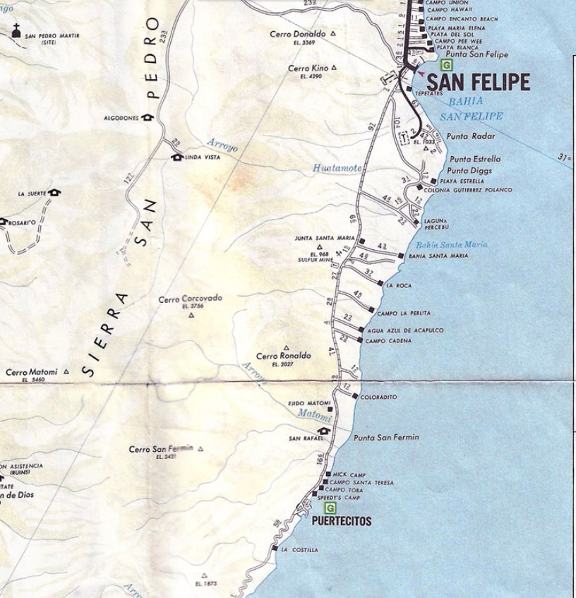
A totally new format over the 1967-1974 editions. These are less detailed, with a smaller scale, but that allowed the entire half of the peninsula to be on each side. More campos shown along the coast. The road to La Roca is incorrect, as it partly uses the Nuevo Mazatlan road. Arroyo el Matomí is incorrectly labeled as Arroyo Caliente.
1978:
Ejido Matomí is added, but only a sign was placed there, no building. Rancho San Rafael is added along Arroyo Matomí. Nuevo Mazatlan name removed, oddly.
1979:
A new airport is shown, along with the paved road to it from San Felipe. Punta Radar is added and a road to it from the airport road. Nuevo Mazatlan was removed for some unknown reason. It was and is still there, to this day.
1980:
The road to Punta Radar now continues on to join the road to Playa Estrella. This will eventually be the route of a paved highway south to Puertecitos. Nuevo Mazatlan is placed back on the map and the road to La Roca is corrected. Playa Hermosa and other campo names are added.
1982:
Junta Santa María (a café near the sulfur mine, at the junction to the coast) name is moved. The café (for a time, two: Tony’s and Lupe’s) was there throughout the 1970s. By the mid-1980s, traffic was using the newer road built along the coast, which ended business for them.
1983:
New highway (unpaved) roadbed now usable. It rejoins the older route just south of El Coloradito.
1984:
1985:
Road from Puertecitos south to La Costilla is changed to poor.
1987:
Paving south advances past Punta Estrella. Road south of Puertecitos to La Costilla no longer poor.
1988:
Paving south is incorrectly shown to Laguna Percebu and not on the new roadbed. Road south of Puertecitos now shown as graded.
1989:
1990:
Paving to Laguna Percebu road is now corrected. Some of the paving by Punta Estrella is deteriorated. Road on to Puertecitos is shown as gravel, ready for paving.
1991:
1992:
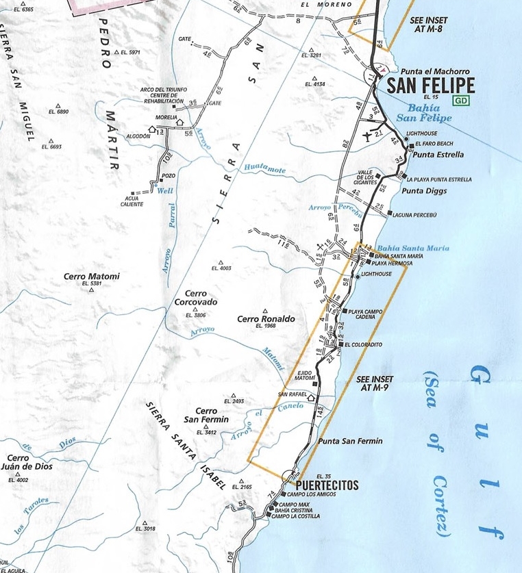
Pavement is shown reaching Puertecitos.
1994:
1995:
1996:
1997:
1998:
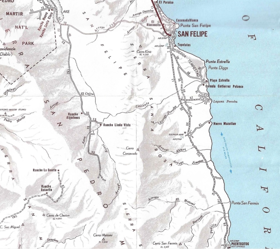
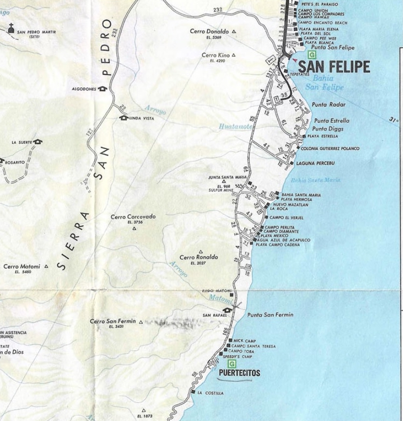
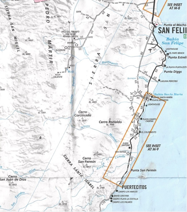
So many campos have been added that the map had to place their names remotely.
2000:
Ensenada road shown as poor. Pavement was so thin, it had badly disintegrated. Here the final ten miles to Puertecitos are shown as unpaved. 10.9 miles of Cañada el Parral (Azufre Wash) road shown. It actually could be driven to Matomí Ranch or Agua Caliente since 1978 when I piloted the path over an abandoned road route.So many campos to show, the Auto Club made insert maps for them.
2001:
Pavement breaking up, as it was too thin. Azufre Wash road distance added 0.7 mile. Junta Santa María removed. Arco de Triunfo added.
2003:
2004:
2007:
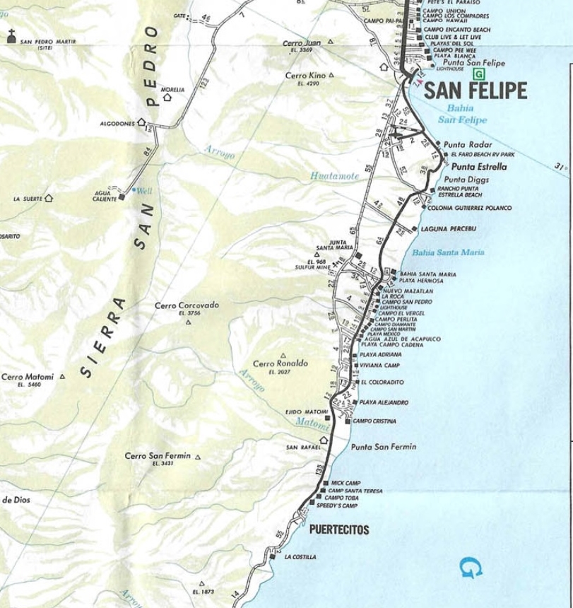
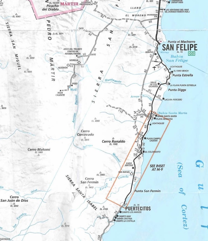
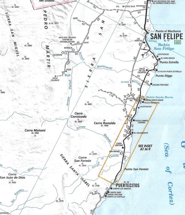
The entire Puertecitos highway was repaved.
2010:
Missing some Auto Club Maps, can you help?: IF they exist, I would love to have (or get your scans of): 1970, 1976, 1977, 1981, 1986, 1993, 1999. Plus, any editions from 1935 to 1954; Also, a better 1972 map than I have, would be nice. Feel free to private message or email me (info@vivabaja.com) if you have any of these maps and would be willing to loan them so I can scan and return, you scan them, or send them to me (maybe for an exchange or discount on one of my Baja books at www.old missions.com?). Thank you!