These interesting maps, shown here for educational purposes, come from the Anthropology of Baja California web site of Don Laylander (www.sandiegoarchaeology.org):
Native language groups:
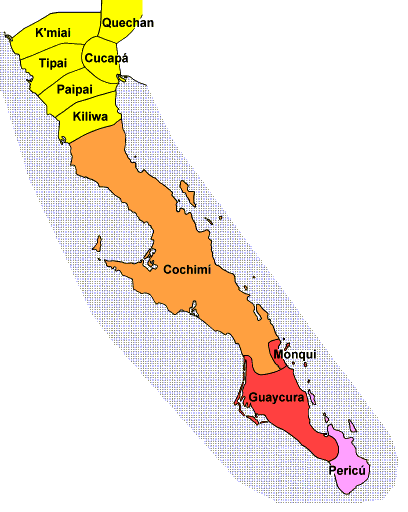
Maps from South to North:


DavidK's Baja Adventures
These interesting maps, shown here for educational purposes, come from the Anthropology of Baja California web site of Don Laylander (www.sandiegoarchaeology.org):
Native language groups:
Maps from South to North: