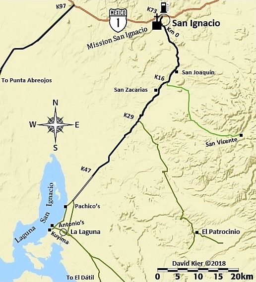
These maps were created from my many research trips in 2017 & 2018 to complement a road guide, that is not published in print. An online edition was made so Baja California travelers might benefit from hours and hours, no days of preparation! https://vivabaja.com/baja-bound-road-guide/ Updates for changes after 2018 to 2021 have been made. Each map was drawn to fit a region of Baja California to help visualize the roads traveled or mentioned in the guide. The maps are not all drawn to the same scale. So, when they all were attached to create a peninsula map (last map on this page), the text is not uniform.
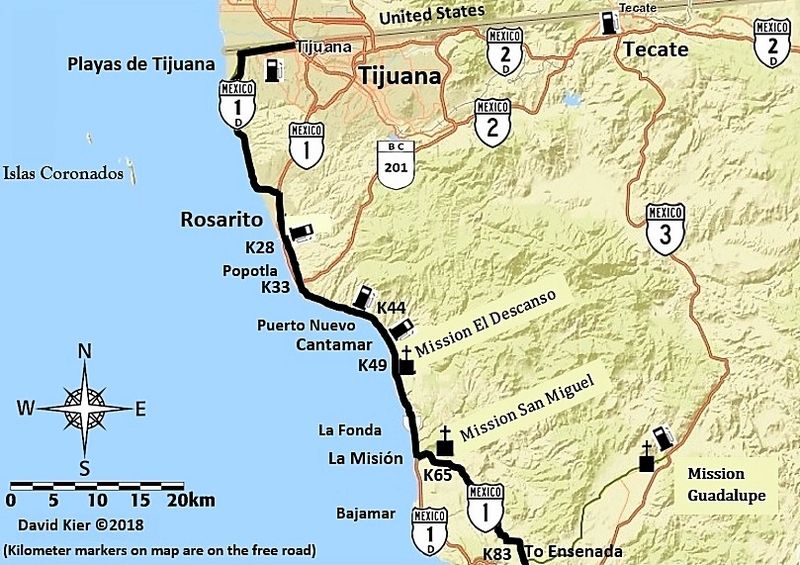
MAP 1
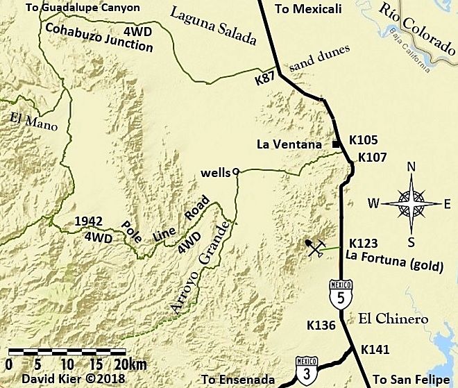
MAP 2

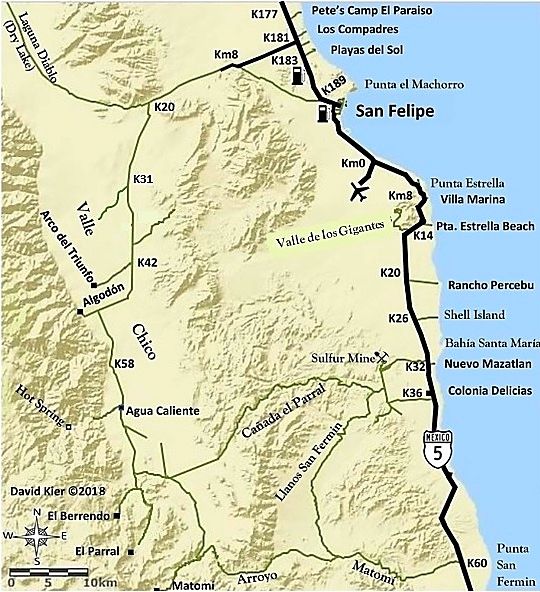
MAP 3

MAP 4

MAP 5
MAP 6

MAP 7

MAP 8
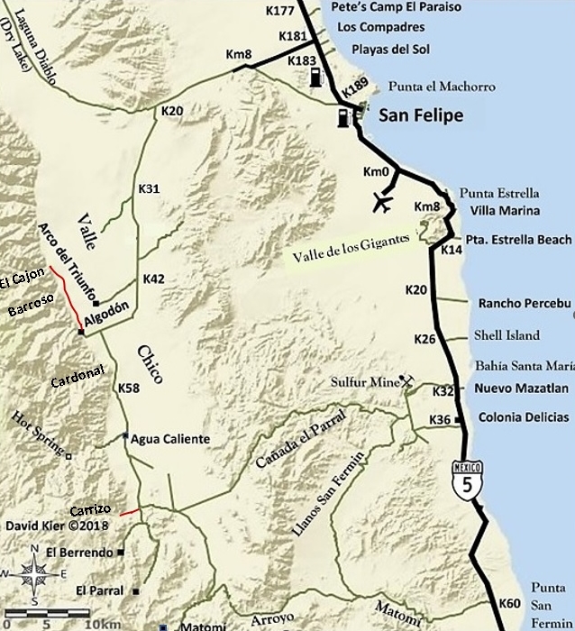
Canyons of Valle Chico
MAP 9
MAP 10
MAP 11

MAP 12

MAP 13

MAP 14
MAP 15

MAP 16

MAP 17

MAP 18

MAP 19

MAP 20
MAP 21
MAP 22

MAP 23

MAP 24

MAP 25

MAP 26

MAP 27

MAP 28

MAP 29

MAP 30

MAP 31

The 31 maps stitched together:

‘Zoom-in’ version of this peninsula map
A 6 ft. tall vinyl wall map was created by Carlos Cañez, from the peninsula map, details below…
 :
:
See the Road Guide, online edition: https://vivabaja.com/baja-bound-road-guide/
New and used Baja California and Mexico BOOKS FOR SALE, thank you for your support!