DAY 4 (FRI Aug. 4, 2017)
I am on the road at 7:43 am and heading away from López Mateos.
I don’t want to say too much about López Mateos because I was not there very long and didn’t have any Nomads to show me the highlights. My son lived there for a couple months in 2012 working for Mag Bay Outfitters (their son and my son were best friends from 4th grade on and we used to take him camping with us to Baja and the desert). It is off season, humid, mosquitos, and most restaurants were closed… again no whales or tourists in the summer. There is a huge building that looked like a museum for whale watchers out at the dock where they must get on boats to see the beasties up close. Closed now, naturally.
Back east to the Insurgentes-La Purísima highway where I turn south.
1.1 miles south is a Pemex station and I fill up. 15.71 pesos/liter. Someone asked about the cost of diesel, and there, it was 16.48/liter.
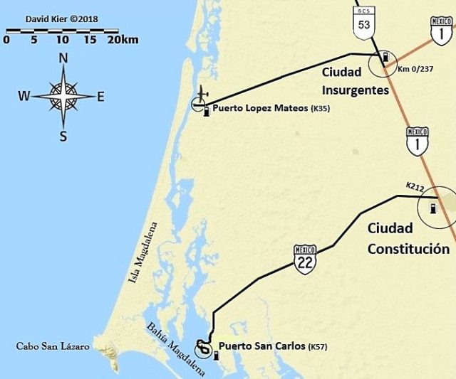
The junction with Mexico Highway 1 is 0.3 mi south of the Pemex (1.4 mi south of the López Mateos highway). I continue south on the now, 4-lane highway. Kilometer markers are not as consistent on some Baja Sur sections of highway and a lot of that is because of new highway widening and not getting around to replacing the markers. The corner of Hwy. 1 where the way to Loreto and to La Paz meet is Km. 0 going to Loreto and should be Km. 237 from La Paz (but I didn’t see a marker until Km. 235 just over 1.2 miles south).
The Puerto San Carlos highway (Mexico #22) was 15.9 miles south of Insurgentes, or about Km. 211.5. In fact, the Km. 212 marker was 0.4 mi north… so the estimating of missing kilometer marker locations works.
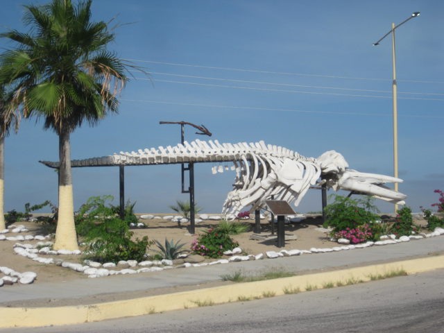
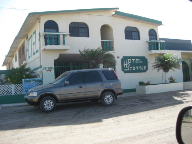
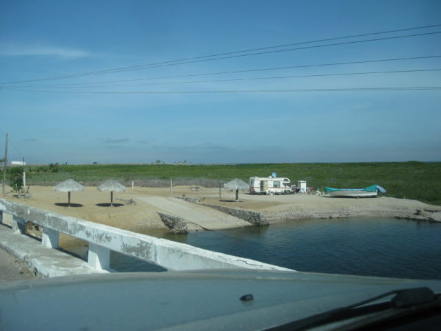
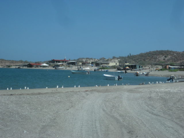
I drive out the 35 miles (57 kilometers) to San Carlos and was quite pleased with the nice town appearance, the beach palapas just before town, and just a better feel for what was available there to serve visitors. I saw three hotels (motels): Mar Y Arena (at the entrance to town), Alcatraz, and the Brennon (with an Irish theme).
At a market in the middle of town, I bought three bags of ice for my chest (60 pesos) as my ice from home was finally in need of supplementing. I also knew it would be awhile before I was able to get more. I only needed the ice for milk (cereal), Costco chicken/mozzarella/artichoke brats, and to cool the beer and drinking water.
Back out to Ciudad Constitución I go and turn south on Mex 1. I top my gas tank as I am going off grid for a couple days. 19 liters (5 gallons) for the 94 miles since I filled at Insurgentes means I got 18.8 m.p.g. for the easy, paved driving.. and the station’s pump was accurate! The station was at Km. 210.5, 1/2 mile south of the San Carlos junction, west side of the highway.
For many years, many have reported the local police being extra alert for tourists who do not stop fully at the many stop signs… even pulling some over who did stop fully. I have never had that experience in this town and usually don’t even see any cops. Maybe because I travel in the hot summer? However, this day there were trucks with machine gun mounts and labeled as Municipal Police (not military) cruising up and down the main street. Didn’t affect me at all, but it was pretty extreme to see.
The south end of town is at Km. 208, the 4 lane highway returns to two lanes, and an R.V. park and motel is at Km. 206.
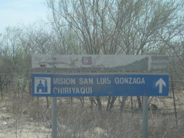
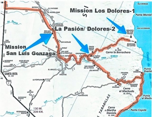
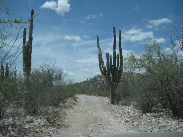
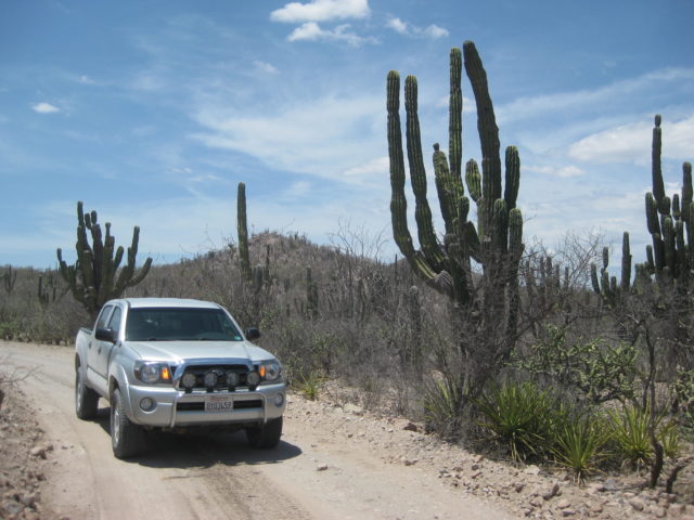
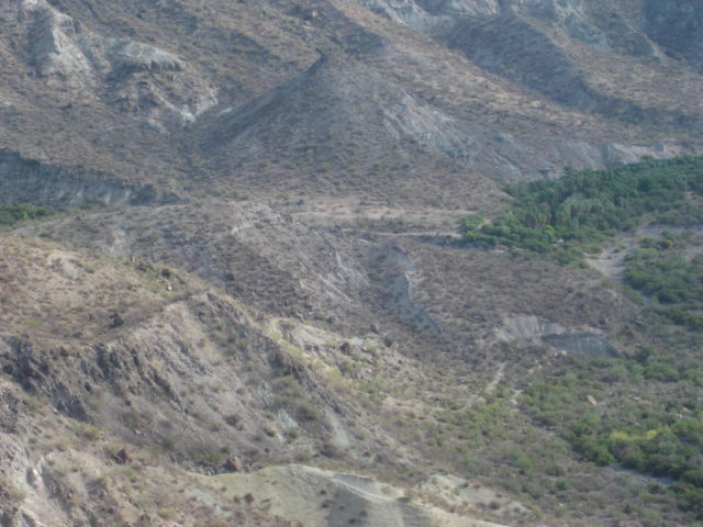
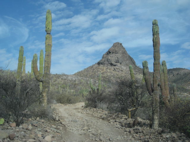
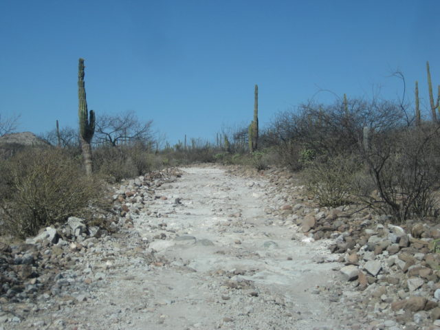
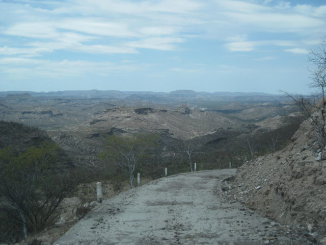
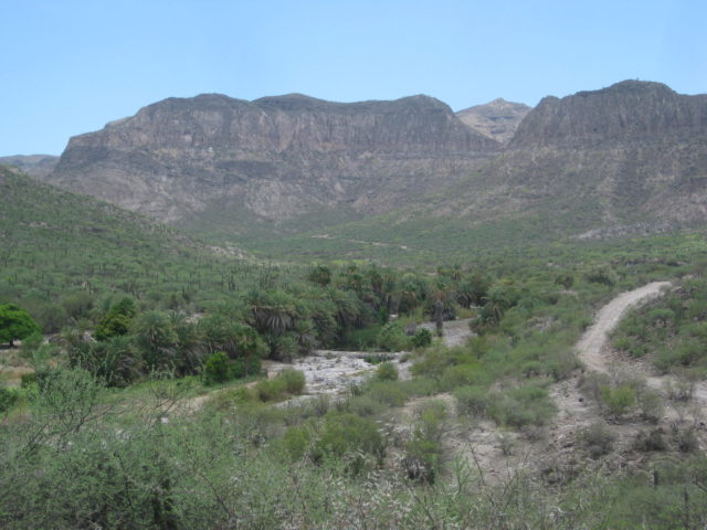
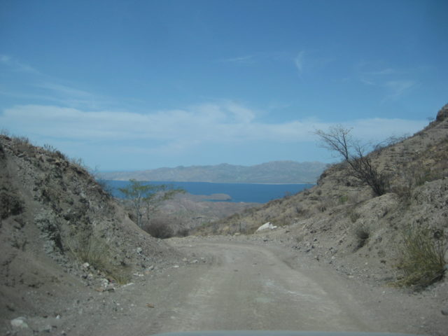
At Km. 195 is the road east to Mission San Luis Gonzaga, and beyond. Finally, back into the dirt! I drop my tires to 25 psi to soften the ride on this washboard, graded road. The road is quite good and I am cruising at 50 mph until some cement vados (dips) pop up after many miles and have me hitting the brakes! The dips are at mile 8.0, 9.4, 9.6 and 10.2.
The only fork or turn in the road is at mile 12.3, and you go right. Ahead leads to a dam project (El Ihuagil).
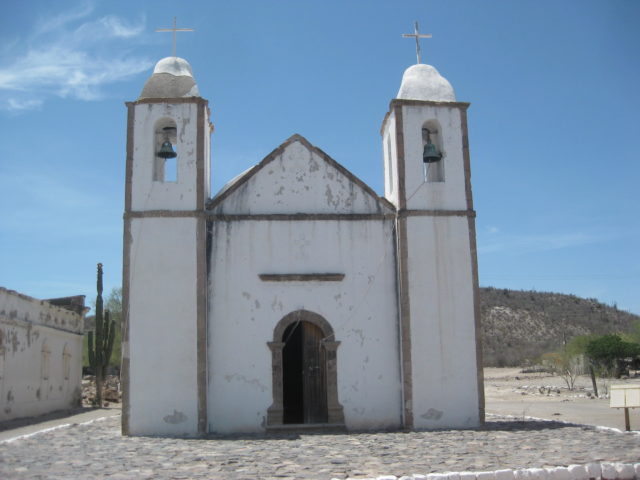
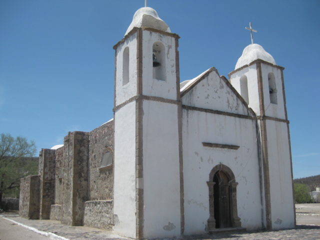
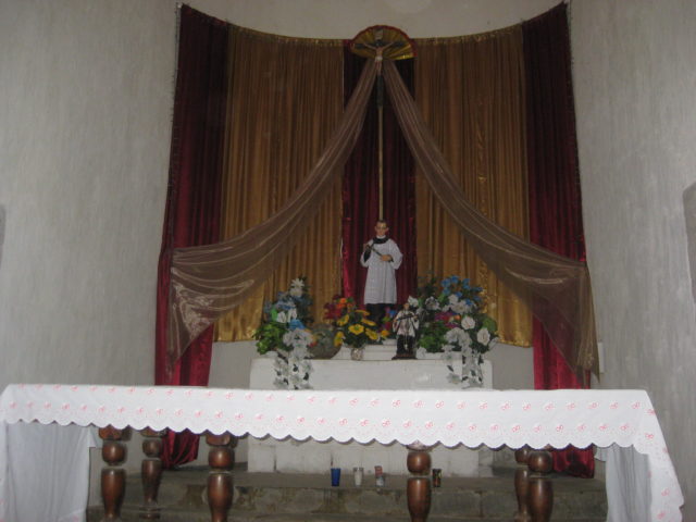
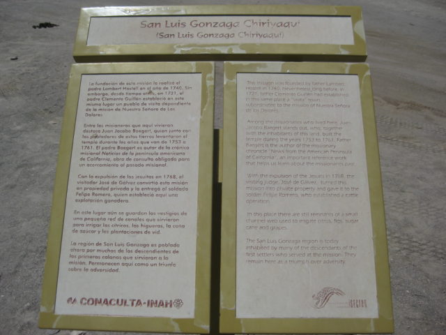
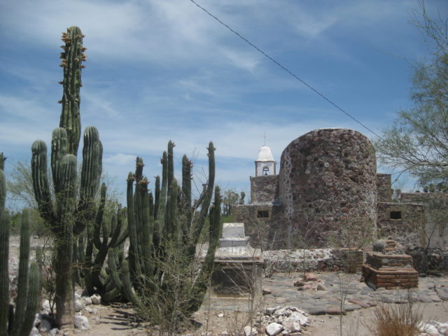
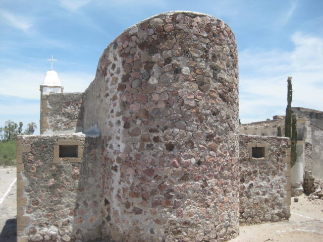
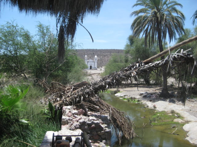
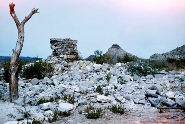
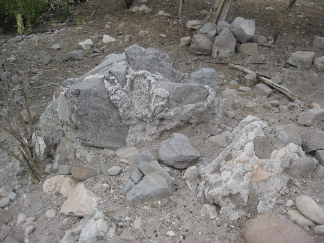
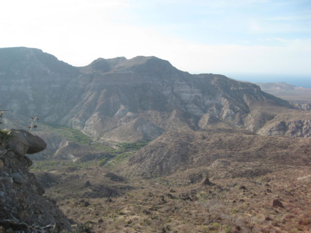
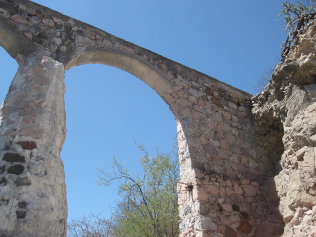
Arrive at the 1737 founded mission (stone church built 1753-1758) at mile 22.3 from Hwy. 1. There is much interest in this mission that is based on the writings of one of the long-term resident Jesuits who was stationed here, Johann Jakob Baegert, S.J. from 1751 to 1768. His 1772 book, ‘Observations in Lower California’, (translated and re-published in 1952) are full of details of the life of the Native Californians and the geography of California (what is called Baja California today). The church is one of the few intact Jesuit California missions to survive to modern times.
Resting in the shade of the building next to the church were a man and woman on fat tire mountain bikes. It is Mike and Rebecca from Canada and they are riding the length of Baja, following the advice of this web page: https://bajadivide.com/ .
After I got home, three days ago, I got an email from Mike with a link to his blog page with photos, posted from La Paz. He mentions how we met… and how I bumped into them again, two days later… Here is their story: http://www.zerotocruising.com/kenny-chesney-visit and what Mike wrote about our meeting:
Our plan, whenever possible, is to find shade between noon and 3:30 (or later) and simply hide from the sun, and we took advantage of the walls of the building adjacent to the mision to do exactly that. As we sat enjoying our lunch, a lone gringo drove up in a pickup and began taking pics. We struck up a conversation with him and learned that David was not only a life-long fan of Baja California, but that he had written and published a book on the old missions of the region. And unlike us, he was actually working that day, researching material for his upcoming book, a new travel guide for Baja. After sharing contact details, we said farewell, and he continued on his way while we resumed hiding from the sun.
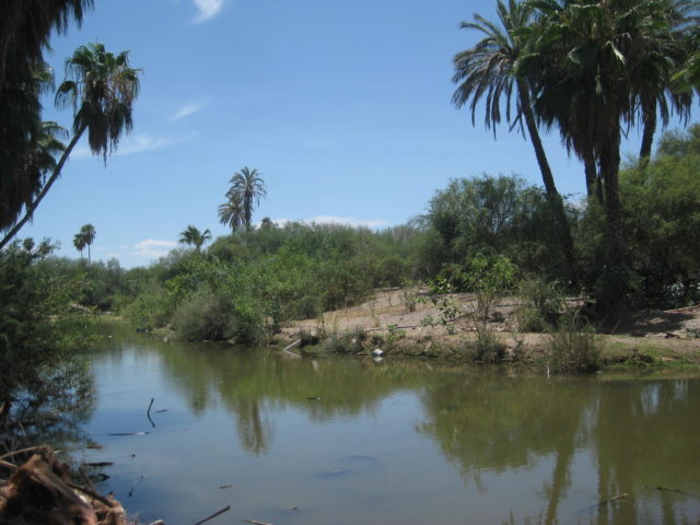
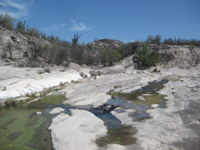
I walk over to the mission dam and small lake it creates, take photos all around and after spending about an hour there, leave at 1:24 pm.


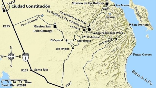
My next goal is to see the mission site, typically called La Pasión. It was the final location (1741-1768) for the mission of Los Dolores, founded along the gulf coast in 1721. San Luis Gonzaga was a visita (satellite mission station) of Dolores before becoming a separate mission, with its own priest.
The missions are a link to our past, our culture, and some of the oldest structures in California (Upper or Lower). I strongly urge anyone with interest into seeing the past of California, Mexico, or Spain to see the missions or just go to their locations, even if the original mission building is gone or in ruins. While I would appreciate if you purchased my book www.oldmissions.com, at least enjoy the data and photos on my web page at Vivabaja.com devoted to the 27 missions of Baja: http://www.vivabaja.com/bajamissions/
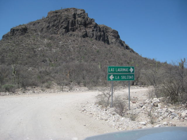
From Mission San Luis Gonzaga, my next goal was La Pasión, the final location of Mission Los Dolores. It would be less obvious to find being that any walls have long ago fallen, and a goat ranch, La Capilla, was operating on the site.
The road headed south from San Luis Gonzaga and there are many forks and no signs to give a hint. I did have live tracking both on my inReach device and on my smartphone with the Earthmate app (pretty good Baja maps, considering).
There was a junction I had pre-marked, but instead of right (which was in the wrong direction but the better road to use, I think), I took a left going towards my goal. I did get there okay, but it went a little more north before returning to the watershed I was intending to follow to La Presa and La Pasión.
I will do a little road log and compare to satellite and maps, then try to show my route on maps… This is fun for me and if you don’t go to unexpected places then you might not see unexpected and cool things!
Total (Partial) Miles
0.0 (0.0) Mission San Luis Gonzaga (1:24 pm)
5.3 (5.3) Curve right, ranch on left.
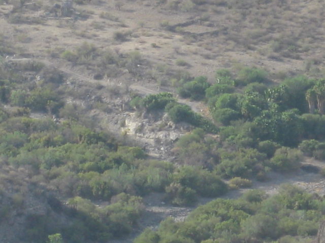
7.4 (2.1) Ranch house (El Plátano?), concrete creek crossing, oasis.
8.1 (0.7) Fork, main travel goes left.
8.9 (0.6) San José de la Palmita (?)
10.2 (1.3) Ranch, process building, road junction.
12.2 (2.0) Ranch
15.5 (3.3) T intersection. Rancho Merecuaco is 0.4 mi right (south). Go left.
19.4 (3.9) Weather Station, ranch houses.
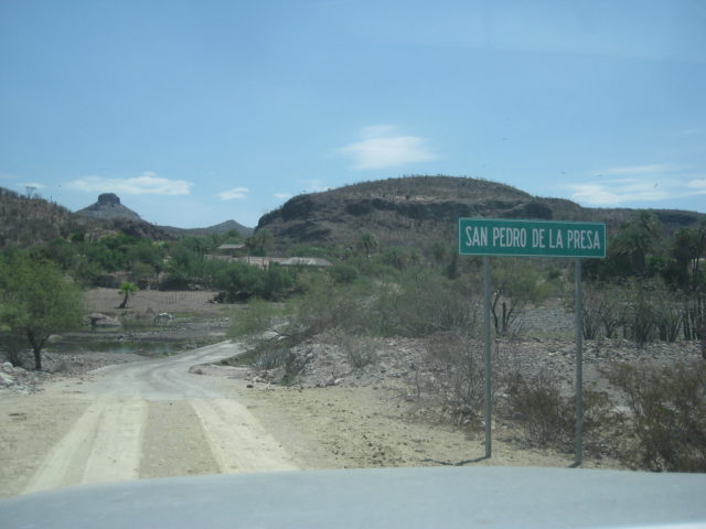
20.0 (0.6) Big arroyo crossing (Arroyo San Pedro on AAA map, Arroyo La Presa on Baja Almanac).
21.6 (1.6) Major Graded Road (3:22 pm)
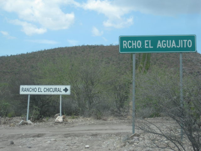
22.5 (0.9) Road right signed to El Chicural & Aguajito.
24.9 (2.4) Rancho Cantarana
26.8 (1.9) Rancho La Presa (closed to visitors)
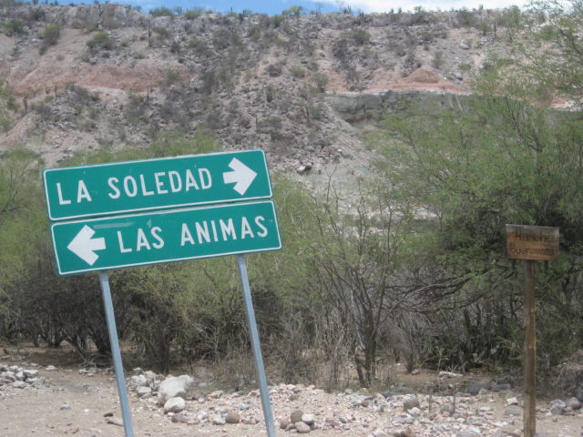
27.3 (0.5) Junction. Ahead to El Solano & San Evaristo. Left to La Pasión, Santa María de la Toris, Los Burros. Turn left.
29.1 (1.8) Ranch on left and a road to the right crosses arroyo to the mission site. Turn right, cross arroyo. If ranch gate is closed, turn left just past and drive along the fence to get to the other side of the ranch house.
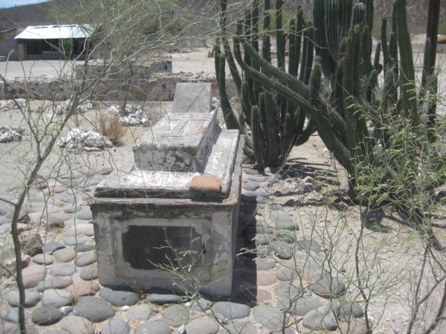
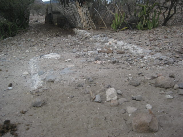
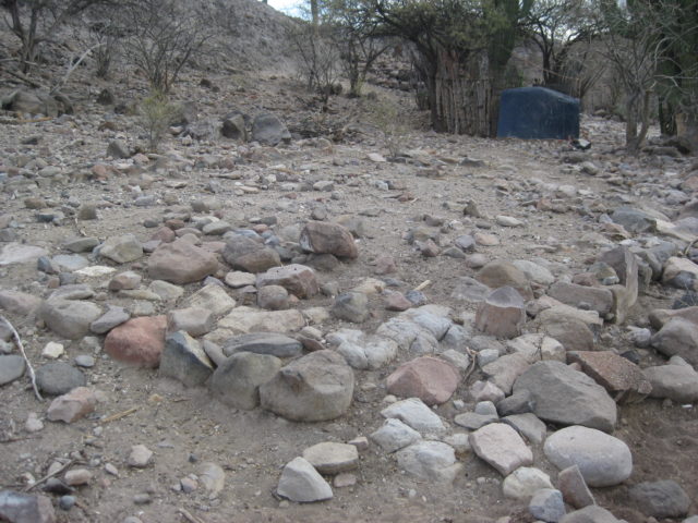
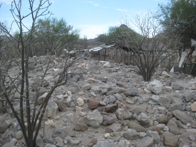
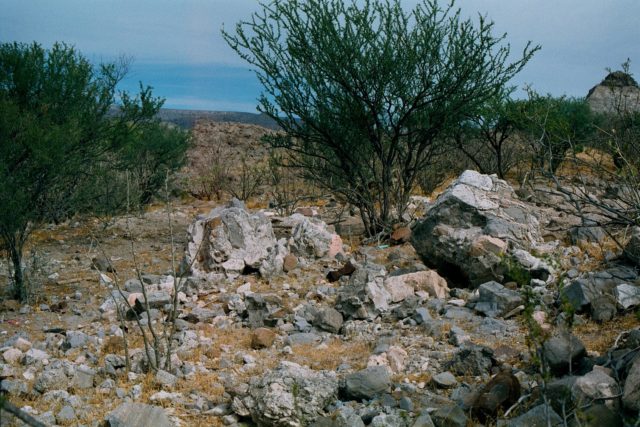
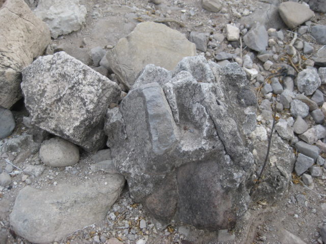
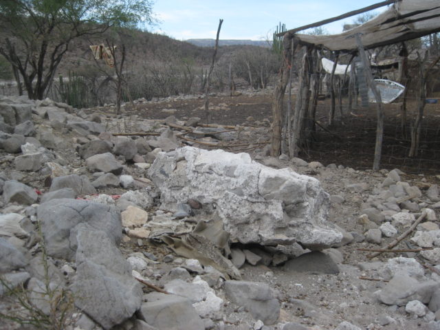
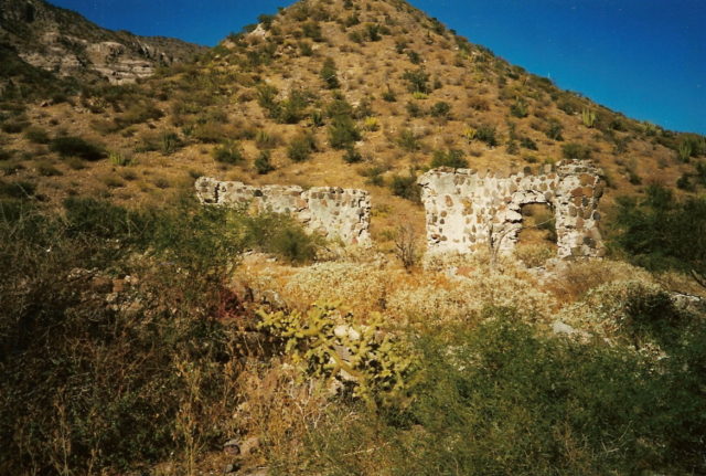
29.3 (0.2) Rancho La Capilla and Mission Los Dolores Chillá (La Pasión) ruins. The ranch owner, ‘Modesto’ tells me visitors are welcome!


La Pasión was the visita location name. When Mission Los Dolores relocated to La Pasión, the missionaries generally referred to it by the location name, not the official mission name (Nuestra Señora de los Dolores Chillá, and sometimes as Dolores del Sur as there was a visita named Dolores, near Loreto).
The same thing occurred at Todos Santos, which was the visita name. When it was elevated to a mission, the official name was Santa Rosa de las Palmas, but the location name ‘Todos Santos” was used more often. When the La Paz mission moved to there, it replaced Santa Rosa, but it was more often called Todos Santos, still!
Clearing up these mission names was one of my book’s goals.
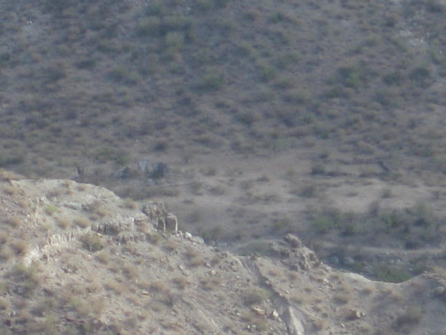
Having my fill of the old stones and foundation outlines from this long ago Spanish California mission, I moved on east (well northeast) to see how close I could get to the Dolores overlook.
Mission Nuestra Señora de los Dolores Apaté was the 9th California mission, founded in 1721. It was the result of the failure at the Ligüí/Malibat mission location (1705-1721). The benefactor for that mission (the third in California) suffered bankruptcy and his funds dried up. The Jesuits kept the mission going but it was in a bad location and was raided often by hostile Pericú Indians.
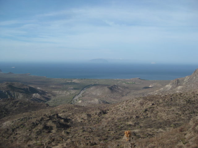
When new funding was found, the mission also began anew, far to the south of Ligüí and with a new name. First established close to the beach, where shallow wells provided fresh water (probably where Rancho Dolores is today), within two years, the mission was moved into the canyon just east of the beach about 2 miles away.
Ruins with standing walls have survived at Dolores Apaté along with other walls, a man-made storage cave, irrigation canals, etc. No road goes to Dolores, so one must get there from the sea or hike down a very steep Camino Real trail from above. This isolated location did not serve the Guaycura Natives who lived beyond the canyon, so Padre Clemente Guillén had long desired to move the mission, and he did in 1741, to La Pasión. That site was known to the Indians as Chillá or Tañuetía (The Place of Ducks).
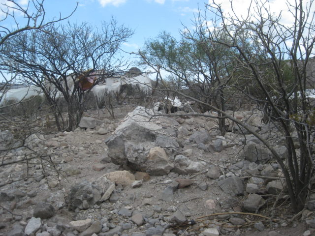
My time limits and energy availability prohibited me from making the 1,000 foot drop and return from the location down there. I would have to try and find a point on the ridge that the road to Los Burros comes close to and see if I could get a photo from above, as others had done.
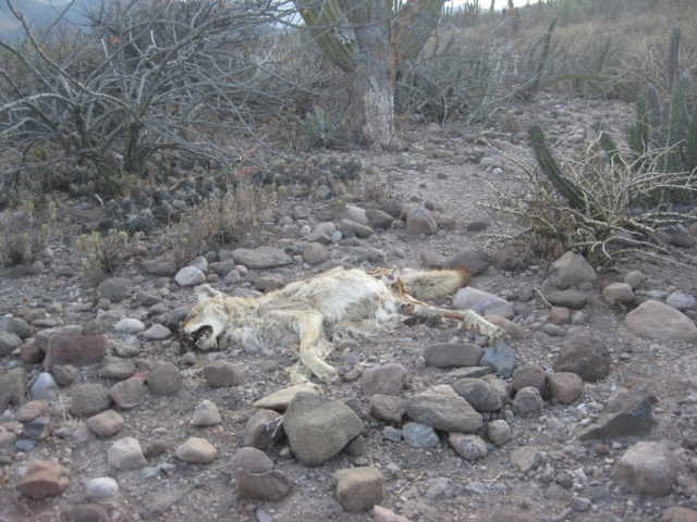
The hike was short to the first place I could see the site, but it wasn’t ideal. I tried to find another vantage point and came across a dead coyote. Reaching for my camera, in my pocket, it wasn’t there!!! PANIC!!!
It was late, the sun was nearing the horizon and I was bush whacking near the cliff edge for a photo op. How did it get out of my pocket!!??
Well circling back between the thorny plants I finally found it. A young ocotillo-like plant grabbed the camera leash, that was dangling out of my pocket. I saw my camera hanging on the small plant, above the ground. Wow, relief!
I took more photos of what I thought were the ruins, my eyes are not so good anymore, but when I looked at the zoom image on my camera, it seemed I got it.
I got my truck turned around on the very rocky road. I originally had hoped to go down to Los Burros (Ensenada Cortez) but the one steep grade to this point was really bad and I was no longer feeling like another steep drop to go down, then back up the next morning. I drove back westward and found a bit of a sandy arroyo to put up my tent. The tent was to protect me from bugs if there were any. Mosquitos love me and all the B vitamins in the world don’t deter them. The sun was going down, I made my dinner of brats from Costco, and all was good.
The next morning, after seeing on the GPS/map I am very near another possible view point of the mission, I drive just 1/4 mile back east, see the path to the north and it is drivable for about 500 feet. I hike the remaining distance to the cliff edge and take more photos. I have not (until now) examined those photo… So we are all seeing what I got today, for the first time! Cross your fingers…
I need to find a better spot along the cliff… I lose my camera… find it… and take a photo of the coyote, which probably saved me from losing my camera forever!
The new spot was not better, so I return to my truck and go find a camp spot. Here is the photos from Saturday morning after hiking to the edge of the giant cliff…
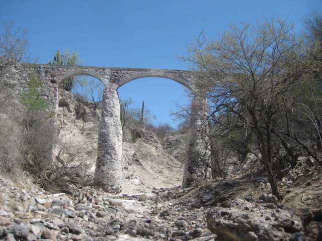
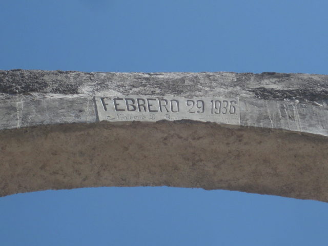
Well, I was satisfied after all those bumpy miles and hiking to see the 1721-1741 Dolores mission. Back to my truck and return to the road past La Pasión. On the north bank of the arroyo, before Rancho La Presa, is an aqueduct used to bring water to the old ranch from the water source at La Pasión. The ranch was the property of one of Baja’s first Mexican governors during the transition period in the 1820s, Fernando de la Toba. He is buried there. Jack Swords managed to see the grave as well as the impressive aqueduct.

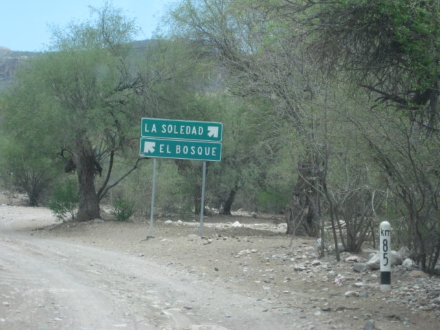

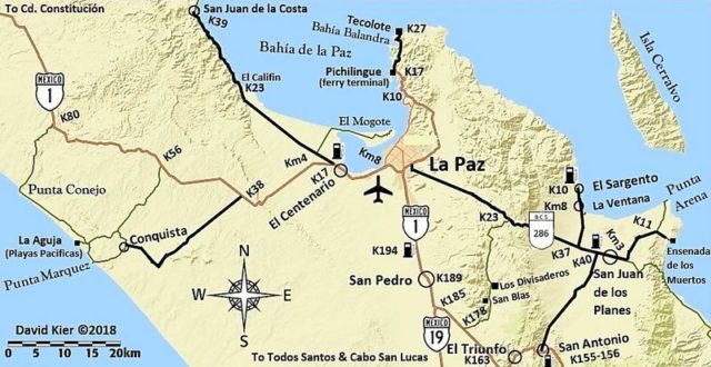
I turn around and go back to the school area and take the road signed El Bosque (for the way to San Evaristo and La Paz). Set odometer to 0.0 here.
0.0 Km.85, schools, near La Soledad on map
1.8 Rancho Las Paredes, gasoline for sale per signs.
2.3 La Vibora Blanca & La Purificación signs.
4.3 El Primer Bosque road north.
4.8 El Bosque road south.
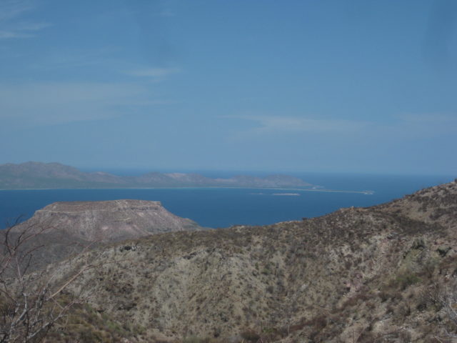
7.5 Top of big grade. View of gulf. elev. 1,680′.
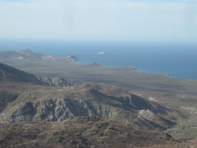
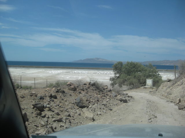
11.5 Bottom of grade, coast road (but not in sight of coast). San Evaristo is 1.6 miles to the left and the road ends in 2.4 miles at a ranch facing some salt mine works. One business for visitors on the beach, otherwise a fishing camp.
Reset odometer to 0.0 for the run to La Paz.
42.1 miles: Pier for San Juan de la Costa. A paved road, used for mine vehicles is separated from the non-workers dirt road, next to the beach. However, without signs, you must figure how to get to that road, as it is the only way south. The beach road was washed out ahead and is a lagoon now.
43.5 Beach Cabins on the left, here you must fork to the right, leaving the beach road. Beach route dead ends in 0.9 mi.
44.3 T Junction, turn left.
44.5 Meet paved road, turn left (south). Just ahead (south) is a sign directing northbound traffic to turn off the highway, this leads them to the other side of the lagoon/ washed-out-road. Km. 38.5
Reset odometer to 0.0: San Juan de la Costa
8.3 miles El Califin beach.
9.5 miles Km. 23 Beach.
21.3 miles Km. 4 El Mogote road.
23.6 Pemex/ market at the junction with Mexico Highway 1. Km. 17 west of La Paz.
Continues on next page…