Skip to content
DAY 11: to La Bocana and Bahía Asunción
Tuesday, July 24, 2012 (Day 11)
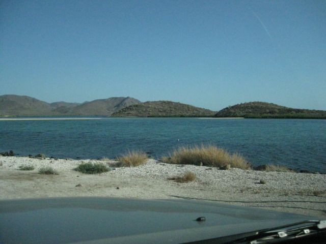
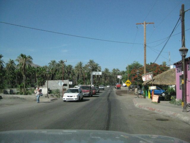
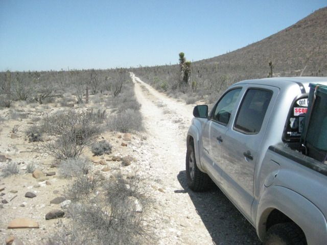
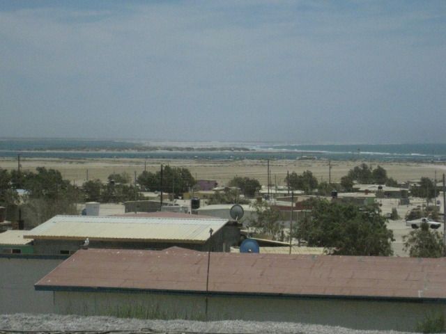
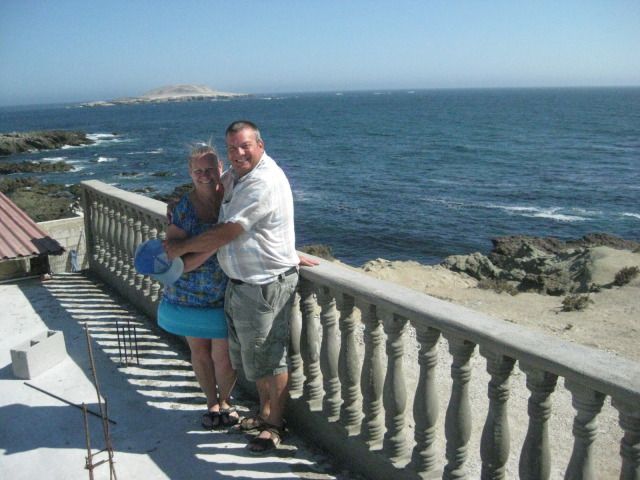
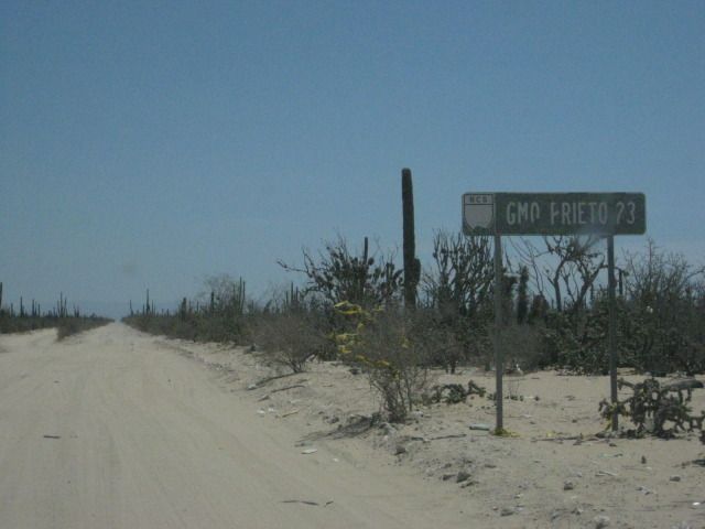
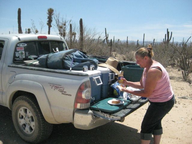
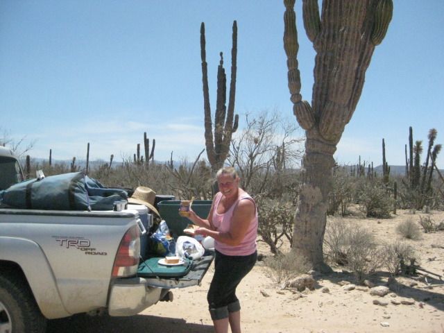
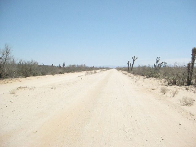
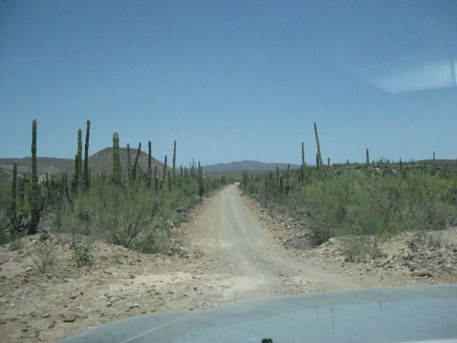
Our camp is pretty easy to pack onto the Tacoma, and this new easy-up tent is great. We leave La Perla at 9am and drive out on the El Requeson road, since we are northbound. We take photos of some views of Bahia Concepcion and of a highway crew painting new stripes on fresh pavement. Next we pass through Mulegé, without stopping and the same for Santa Rosalía. We have a long drive to get out to La Bocana and Bahia Asuncion, on the Vizcaino Peninsula. That is the big point or ‘hook’ of land that sticks out into the Pacific, halfway down the peninsula of Baja California.
Both La Bocana and Bahia Asuncion have bed and breakfast establishments operated by members of the Baja Nomad forums on the Internet. We have stayed at Bahia Asuncion once before (in 2007), and were looking forward to seeing the additions made there, since. The town of Bahia Asuncion has become very popular with Americans and Canadians who heard about it on Baja Nomad, and came for the fantastic fishing or just a quiet get-away, in a small Mexican town.
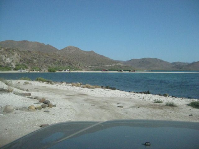
Leaving Playa La Perla and there is the sand isthmus of El Requeson.
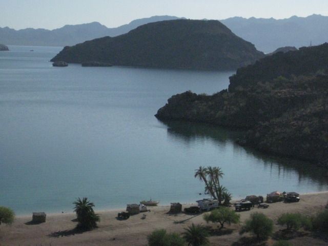
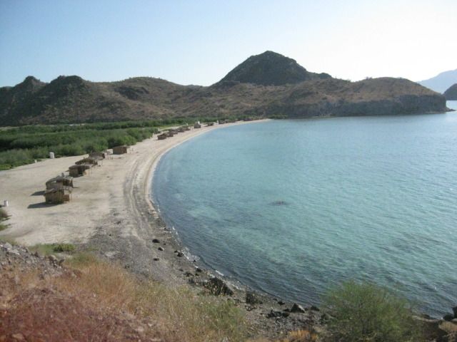
One of the most photographed beaches on Bahia Concepcion is El Coyote.
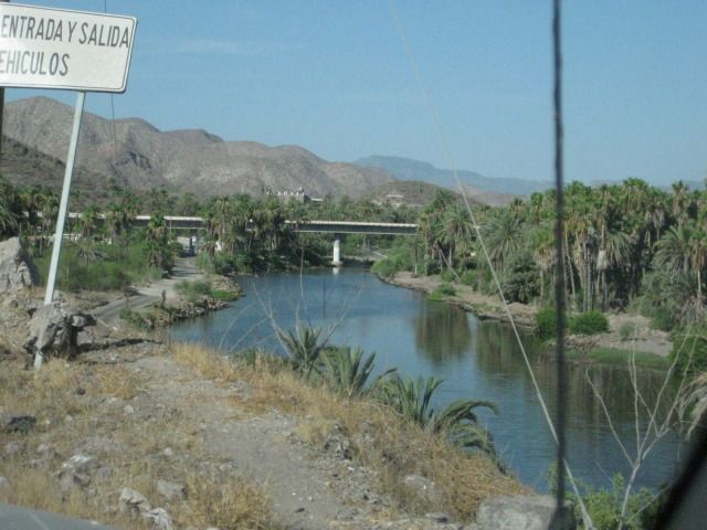
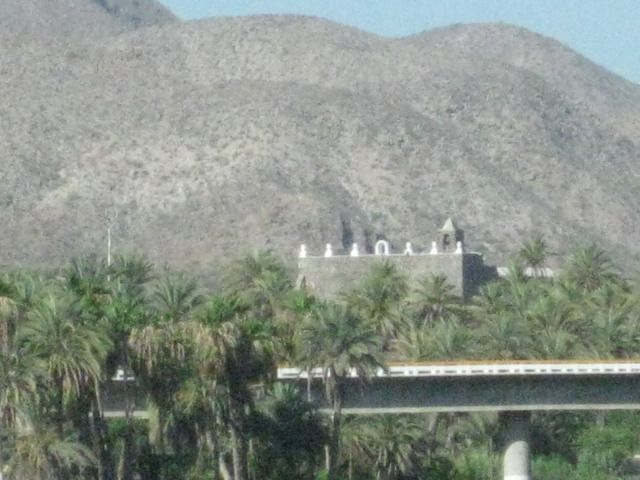
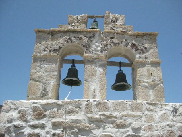
There is the Mulegé mission in the distance, past the highway bridge, over the river. The mission was named Santa Rosalía de Mulegé and was the 4th Spanish California mission, founded in 1705. The stone church we see today was constructed from 1757 to 1766.
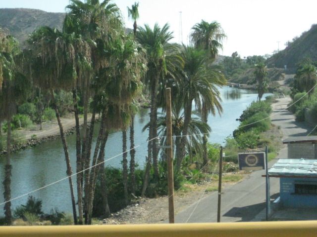
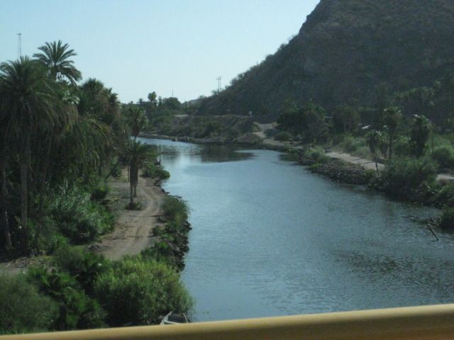
Mulegé is often known as the ‘Hawaii of Baja’.
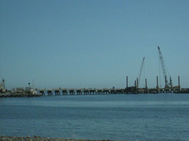
As we pass north of Santa Rosalía, and we get a photo of the new pier being built for the new mines opening up there for copper and manganese. New discoveries and a rising copper price will pump life into this former French copper mining town, on Mexico’s Baja coast.
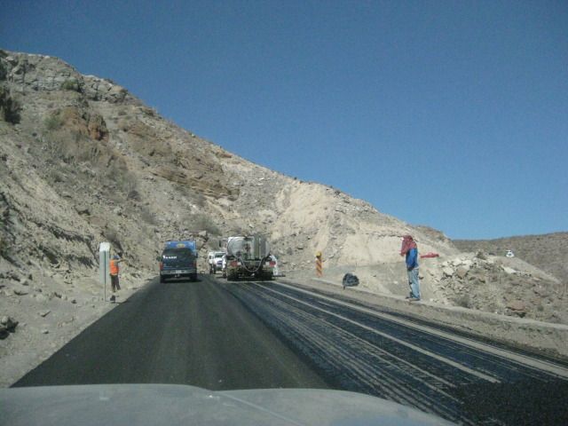
The steep grade ‘Cuesta del Infierno’ was being widened and repaved and we were one of the first to drive on the new pavement heading up the grade on this day. The narrow, shoulder-less Baja Highway, finished in 1973, is slowly being modernized to a wider highway with shoulders having enough room to allow bikes or pedestrians safe space from the trucks, busses, and cars the highway was built for. It also allows for broken down vehicles to not totally block a lane of traffic.
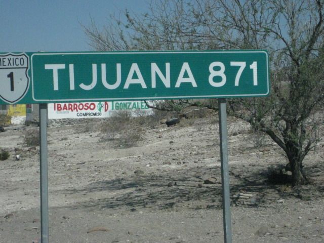
The distance from San Ignacio (540 miles) which is just 10 miles south of the halfway point between Tijuana and Cabo San Lucas (1,059 miles) on Highway #1.
We arrive in San Ignacio at 11:14 am and fill up the gas tank for the long drive from here. It is 163 miles since I filled up in Loreto, so I need a half a tank to top it off (40.3 liters/10.6 gallons), cost is 405 pesos ($31.40).
Just south of Highway #1, on the Punta Abreojos highway, the old main road is crossed… so naturally, I turn onto it for a photo! This was the main road to La Paz from Tijuana before 1973. I traveled on this road with my parents in our Jeep in 1966… When driving in Baja was a REAL adventure!
The highway to Punta Abreojos joins Highway #1, 14.5 miles west of San Ignacio at Km. 97 ½ and the road is paved all the way to Abreojos now, 65.5 miles. In 2007, the pavement ended about 10 miles from town.
Arriving in Abreojos, a new Pemex gas station is not yet open, up ahead.
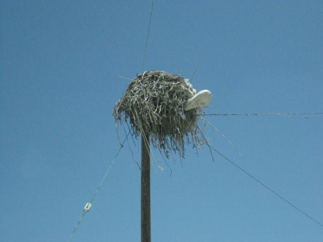
Ospreys make their nests on any high object.
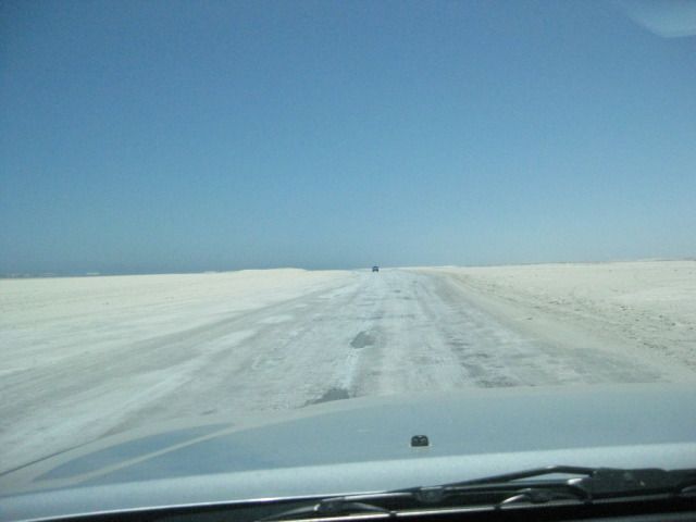
The fast road to La Bocana… If the sea level ever does rise, then this would not be an option!
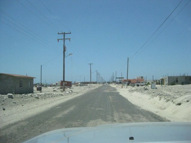
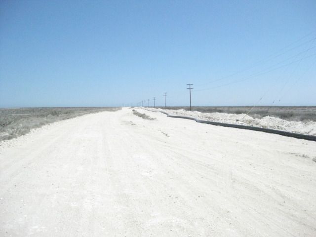
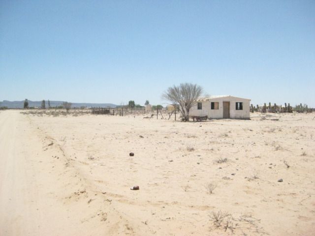
We arrive in Punta Abreojos and miss seeing the road on to La Bocana, so we turn around at the end of town (built on a point) and spot the north road that drops down onto the salt flat… which is smoother than the graded dirt road, we missed at the entrance to town. Of course, after a real big high tide, you don’t want to use the salt flat! We leave Abreojos at 12:45pm and have an easy drive for 12.6 miles to the La Bocana Bed & Breakfast run by Blanca and Les, located on the west side of town with a clear view of the Pacific, beyond the expanse of low dunes.
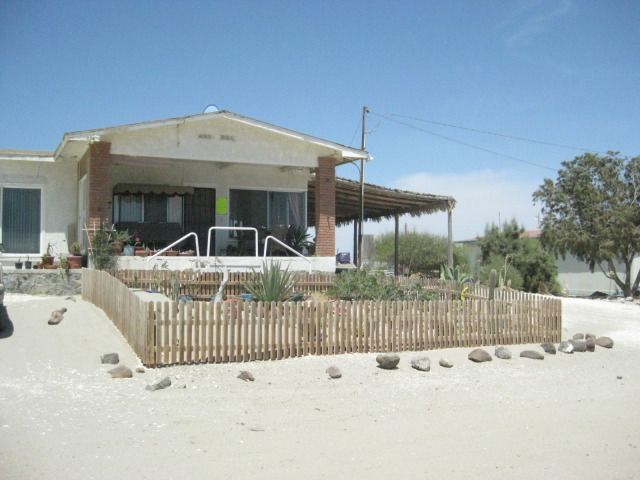
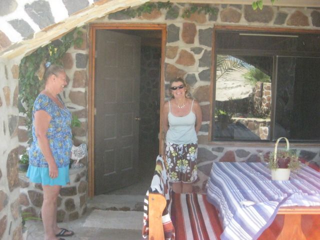
The front of Blanca and Les’ bed and breakfast in La Bocana.
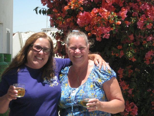
Blanca and Elizabeth (Baja Angel).
We are invited to see their rooms and then asked if we would like some chicken stroganoff… Why yes, thank you! Their newest and biggest room is quite the accommodation. I called it the ‘Deluxe room’ and took several pictures. We had lunch and there was even some chocolate/lemon cake for dessert. When I offered to pay for the great meal, she declined, but I said, “for the children” … (Blanca has been helping the village children get and do things that can make a difference in their fishing village lives).
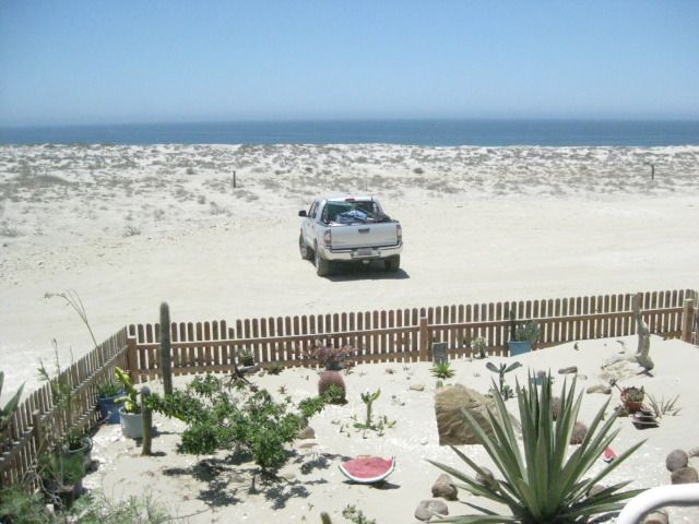
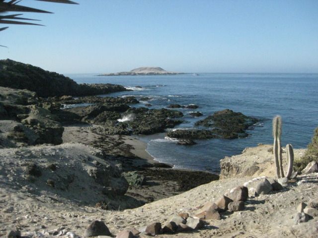
View of La Bocana.
We left La Bocana at 3:12pm and after missing the correct street out of town, found it (maybe the only 4 way stop sign intersection in La Bocana) with a small sign for Asuncion. The road now is a graded dirt road and had recently been graded, so the drive was pretty fast. A new water pipeline is being placed in a trench along the road nearly the entire distance to Asuncion.
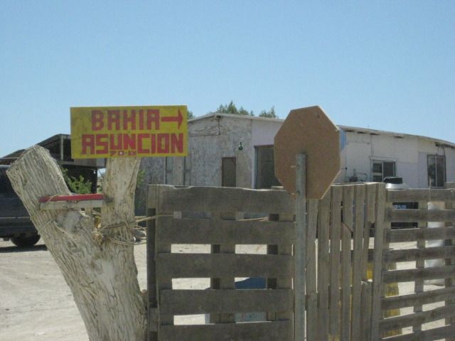
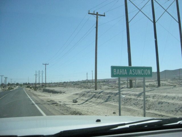
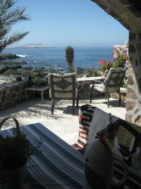
We reach the paved highway to Bahia Asuncion (at Km. 34), just 3 miles from town, and 44.7 miles from La Bocana, at 4:35pm. Juan & Shari’s Bed & Breakfast is on the far side of town, on the point with a clear view of Asuncion Island. Take the left fork at the Fisherman Monument where the entrance road splits, then work your way over the rise to the other side of the point. To go any further past their B&B, you would be in the ocean!
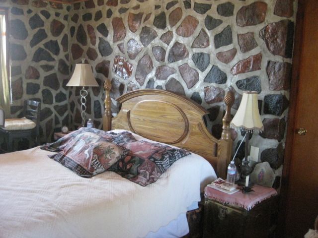
Shari was there when we drove up and showed us the new ‘Rock room’ added since our last visit. It is actually two rooms, available together or separately, so it is great for a family with children. Another new room was nearly finished on the other side of Shari’s house, the ‘Dolphin room’ with great views. Upstairs will be another addition, in the near future. For dinner, Shari makes us abalone burgers! Food from the sea is her specialty and you would be hard pressed to find a more pleasant and accommodating host.
Shari came to Baja from Canada to study the whales and marine life, over 20 years ago. She has made Baja her home, speaks Spanish like a native, and married to a local fisherman from the famous Arce family that date back to the time of Spanish soldiers who guarded the missions. Shari’s daughter (born in Baja) and son-in-law help operate their campground in Bahia Asuncion, and are raising Shari’s grandson, now about 2 years old!
During the whale breeding season (Feb.-Apr.), Shari offers guided tours and whale watching from boats on the lagoon ‘Ojo de Liebre’ (Scammon’s Lagoon). The gray whales swim right past her home, as well as they migrate to and from the Bering Sea, off Alaska.
Shari shows us the new Rock Room, and we get to stay there for two nights!
The future upstairs room.
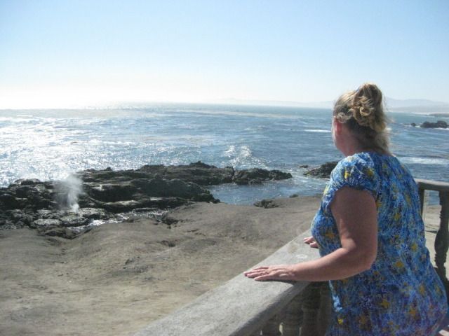
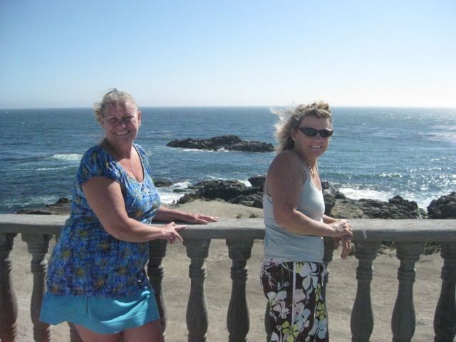
The Blowhole.
Tomorrow, we go hunting for fossils, including shark’s teeth from the dinosaur age!
Part 10
DAY 12: Relaxing and Fossil Hunting
Wednesday, July 25, 2012 (Day 12)
We had a fantastic, restful sleep in the Rock room… great mattress and the sound of waves and sea lions were great ‘white noise’ affects! Shari serves us lobster omelets for breakfast and it is a super relaxing day with no rushing and no long driving. Ever since our first time at Asuncion, we have wanted to return to do some fossil hunting. Megalodon teeth http://www.the-shark-side-of-life.com/megalodon-shark.html
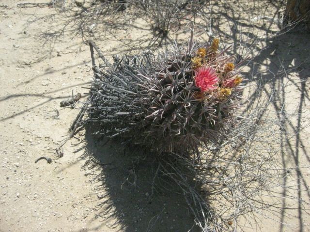
have been found in the hills near Bahia Asuncion and we were anxious to have a look in the badlands a few miles away. In fact, it was a request from Elizabeth to go so we could have a look, so think of this side trip to Asuncion as her anniversary present! Yah, I am willing to do things my wife likes… like a good husband! Okay honey, if that’s what you really want to do, I will go four wheeling for you and look for fossils. LOL
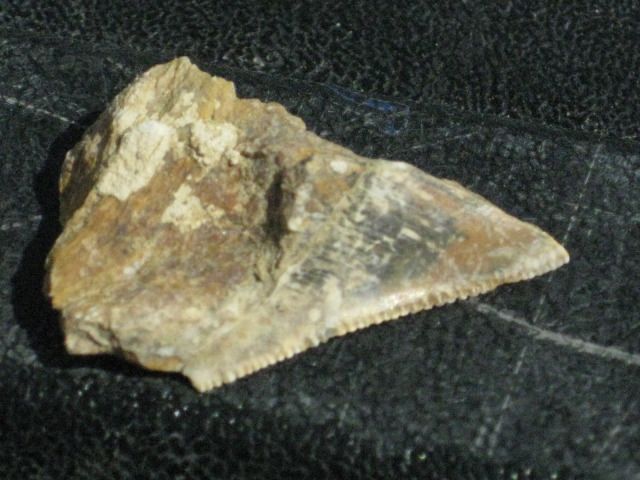
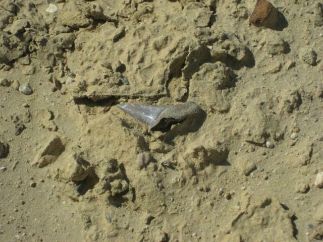
What was a surprise is that not long after picking one place to start looking, Elizabeth found a tooth! Way to go Baja Angel! We just enjoyed looking at the hills and scanning the ground, and at another location, she found another… and I found one. It wasn’t as nice as hers, and was broken, but still it was fun. There also were lots of tube shaped pieces that looked light rusty ½ inch galvanized pipe. Shari would tell us later that they were coral fossils.
We spent all afternoon out there and it was fun, just Elizabeth and I wondering about and comparing discoveries. I placed them on my tailgate to photograph before leaving them and the badlands behind as we returned to Shari’s home and our ‘Rock room’. We met Baja Nomads ‘Nan & D’ (Nancy and David) who live at Asuncion full time now. They came over to check out the new dolphin room. Nancy is an artist who has paintings, coffee mugs and other creative works on display at Juan and Shari‘s. For dinner we were fed lobster burritos and had a second great sleep.
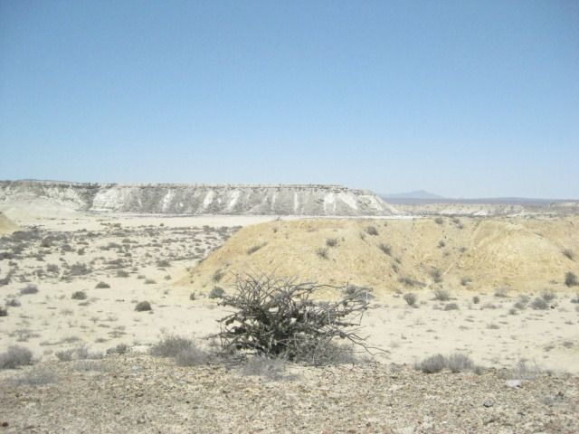
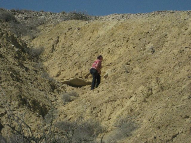
The Asunción Badlands.
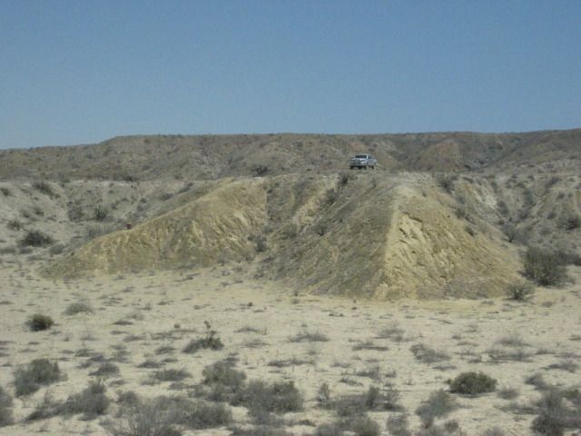
The first tooth was just to the left of my truck and about halfway down the slope. Look for shiny ‘stones’ that stand out from the rest.
Elizabeth is a far better hunter than I. She tells me, not so fast… look slowly.
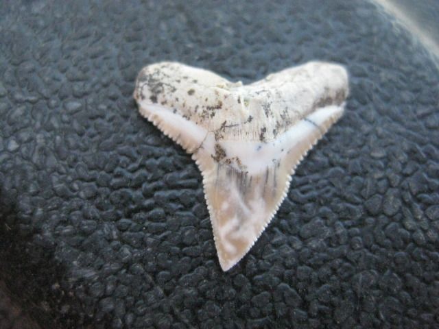
Sitting right on the ledge in front of her, a beauty.
So, don’t be in a hurry when hunting for petrified sharks’ teeth. We were out in the badlands for about 4-5 hours, having a great time… but we only found about 4-5 teeth and a couple of them were not whole, and none were the big megalodon teeth.
DAY 13: To Misión Santa Gertrudis
Thursday, July 26, 2012 (Day 13-a)
Today we awake after another great sleep, and we even asked for a wakeup call so we wouldn’t sleep in too long. Not long after we are up and dressed did Shari deliver waffles with real Canadian maple syrup and fruit. It was great…!
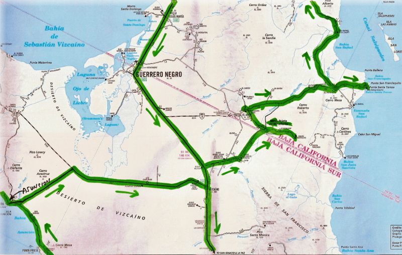
The goal today is to go from the Pacific side of Baja over to the gulf side, and this being the widest part of the peninsula and over half on dirt roads, we had some ground to cover. However, this is a site seeing vacation and we hope to see the 1752 Spanish mission of Santa Gertrudis, the ghost town of Pozo Alemán, the giant cave art site as shown in the book we saw yesterday, and to camp at Punta San Francisquito.
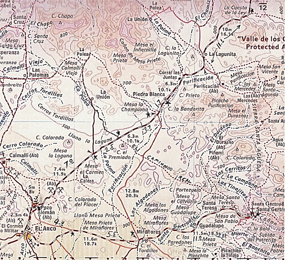
Take a look at the route map, and we are going from the far left side, across to the right side of Baja:
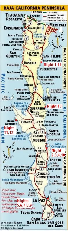
For those not familiar with the central part of Baja California, here is the peninsula map with the places we over-night’ed shown:
I made a road log, starting at Shari and Juan’s Bed & Breakfast on the west side of the point at Bahia Asuncion:
00.0 Juan& Shari’s 10:36am
00.9 Fork at fisherman monument, in town.
01.1 Miramar Market, Gas Pump
01.2 Police Station, Curvina Street (road to San Roque)
01.4 Divided street, Campo Sirena access.
01.7 End divided street, town entrance.
04.7 (Km.34) Road to Punta Prieta, La Bocana, Punta Abreojos
25.2 (Km.0) Junction with Vizcaino-Bahia Tortugas highway 11:05am. Turn east.
70.0 Vizcaino at Highway #1 12:00pm. Gas station is 0.3 mile to the north.
The highway to Vizcaino is 90% good pavement, but the 10% of big pot holes can really ruin the whole road, if you let it. There is also some drift sand that covers one lane in a few places. Just lower your speed, and all will be fine.
00.0 Vizcaino at Bahia Tortugas Junction. Turn north.
06.5 Turn onto dirt road, signed to Guillermo Prieto 23 km., but I measured it at 20 km. 12:22pm. We stop for a break a ways ahead and make sandwiches (PB&J).
18.4 Misión Santa Gertrudis sign, pointing a left turn.
19.0 Center of Guillermo Prieto (‘Dark William’), seems to be abandoned. Continue straight north.
30.1 The state border between Baja California and Baja California Sur. Also a change from Mountain Time to Pacific Time. A fence is parallel to the border, about 80 feet north, per my GPS.
32.6 Intersection: Left to El Arco; Ahead to Punta San Francisquito; Right (signed) to Santa Gertrudis. 12:50pm/ Pacific Time. Reset odometer.
00.0 Intersection
00.6 Rancho Miraflores (made famous in Graham Mackintosh’s second book, ‘Journey with a Baja Burro’, thanks to Graham’s burro, ‘Misión’)
11.0 Mission Santa Gertrudis (1752), on a level bench above a palm filled oasis. 1:14pm.
Lunch ‘on the road’, PBJs.
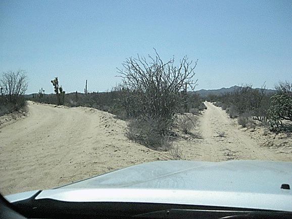
It is a great, fast dirt road to Guillermo Prieto, and on to the border, too.

Guillermo Prieto. 11 years ago it was full of people and kids were playing.
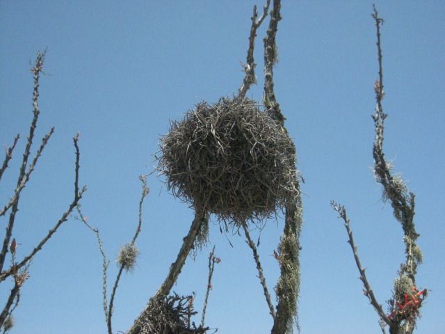
Ball-Moss (Gallito) attaches to many shrubs and cactus in central Baja.
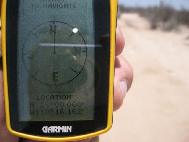
On the 28º parallel of latitude, the state border between Baja California and Baja California Sur, also a time zone change.
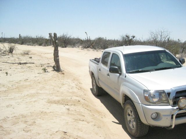
My truck at the fence line, just 80 feet inside Baja ‘Norte’.

2.5 miles north of the border is the intersection with signs pointing to the mission.
All the roads I am on today are good and only 2WD is used.

The oasis below the mission.


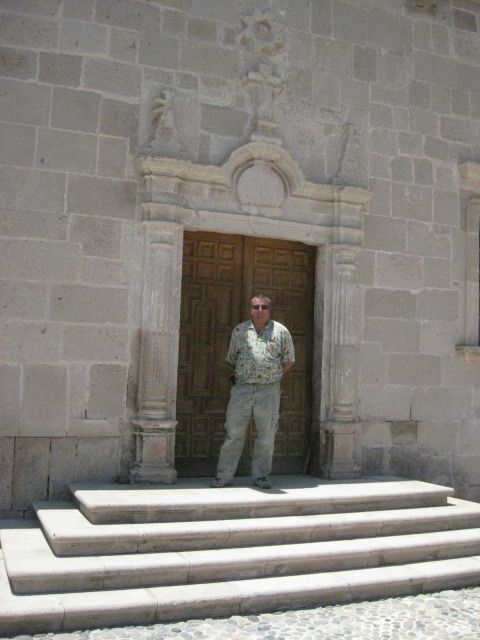


The mission church was locked and there seemed to be nobody in the village. A Mexican family with their SUV was parked at the oasis having lunch as we drove by. I guessed them to be visitors, as well. I took lots of photos of the stone church, and its unique separate bell tower. The present church was completed by the Dominicans in 1796. The Franciscans were here 5 years, before moving on to Alta California in 1773. The mission founding Jesuits were here until 1768, when the king of Spain ordered them all removed from New Spain. This mission was planned as far back as 1745 to be called Dolores del Norte, but when funds were available in 1748 with the closing of Mission San Jose del Cabo, the name was changed to honor the benefactor’s wife. Construction of the first adobe buildings started in 1751, a year before a priest was available to man the new mission. The mission was abandoned in 1822, but some families continued to live here.
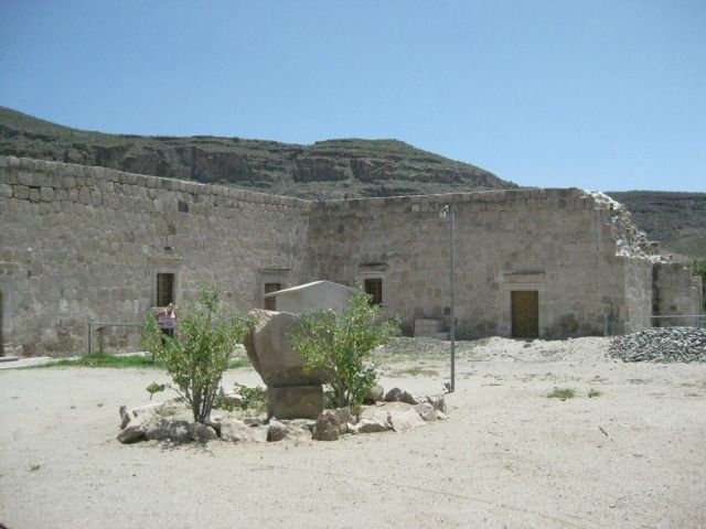
In 1997, the mission was greatly renovated, and some of its historic charm was lost, on the interior changes. Today there are displays and exhibits on the area history, including a mine cart, perhaps from Pozo Alemán, where we go to next!
To Pozo Alemán (German Well)
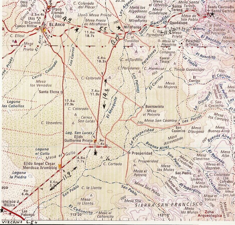
We left Mission Santa Gertrudis and came back out the 11 miles to the 4-way intersection. The left road goes back to Highway #1 (26 miles), and was the way we came in. The right hand road continues northward for 12.3 miles to the Punta San Francisquito and Bahia de los Angeles road. We go straight across on the road west to El Arco.
In 5.5 miles, the graded El Arco road bends to the left slightly where the older, Pozo Alemán road continues straight. It is 2:04pm, so we have plenty of summer daylight still ahead. In a few miles we come to some interesting geology and several other roads going to mine claims, perhaps. I expect this road to go right to Pozo Aleman, as the map shows, but instead it meets the El Arco-San Francisquito road just to the east of Pozo Aleman. It has been 4.4 miles from the El Arco/Santa Gertrudis road.
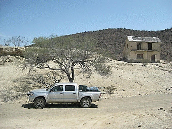
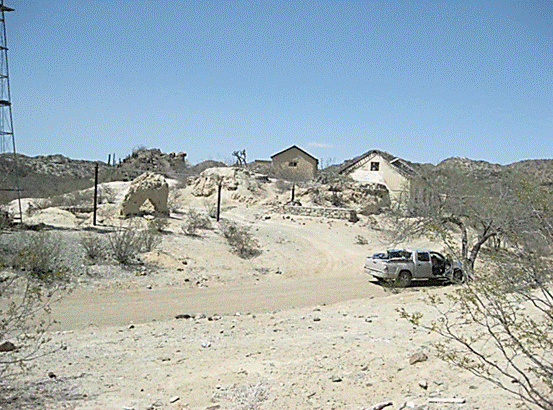
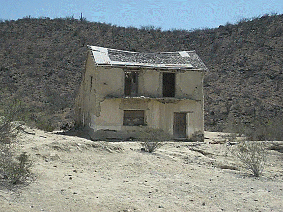
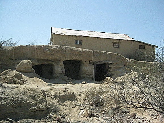
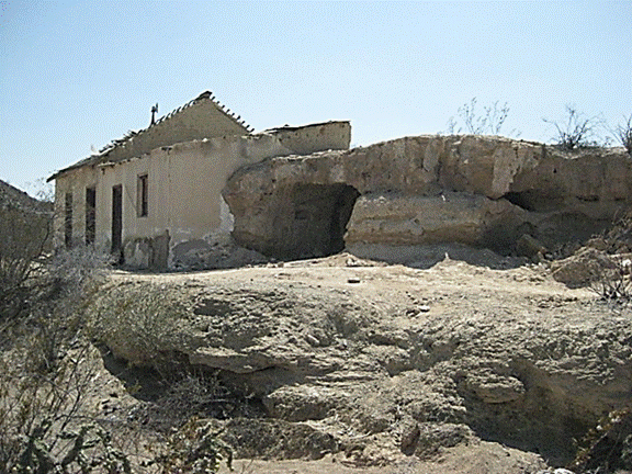
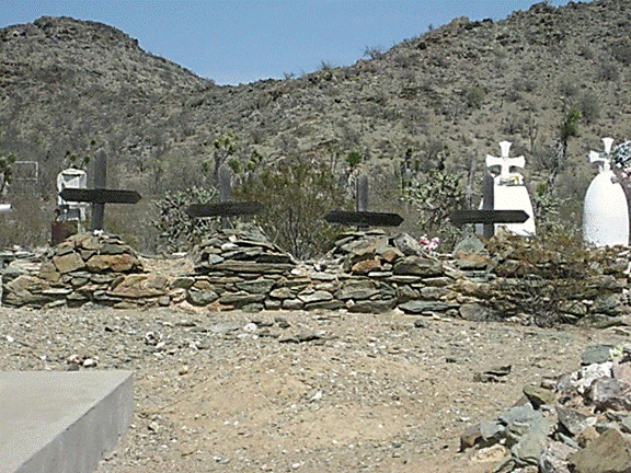
In just 0.4 mile going west, we are at the ‘driveway’ into Pozo Alemán that passes the cemetery. It is 0.7 mile to Pozo Alemán from the graded road. There are several abandoned ruins of adobe and wood homes, as well as the underground homes seen in a 1910 photograph here. There is one rather large home across the gully from the others, and it looks to be occupied, but we see nobody.
There is plenty to look at here and then at the cemetery before we continue our drive east. We leave Pozo Alemán at 3:05pm and are hopeful we can find the big painted cave we saw in the book at Shari’s (I also have seen photos of it on Baja Nomad from at least two other people). To not cause any grief, I will not publish the mileages or GPS of the road to the painted cave. See it in the next part of the trip report.
Map of the area, and mileages on the roads we used, between stars. The 4.4-mile road actually ended 0.4 mile east of Pozo Aleman (not shown on map).
Fork, 16.5 miles from Santa Gertrudis: El Arco left/ Pozo Aleman right.
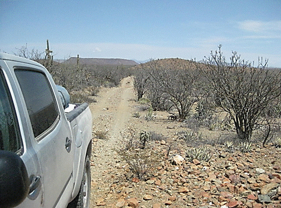
This is the kind of road I like to drive in Baja!
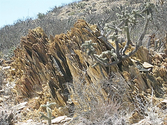
Great geology!
Pozo Alemán:
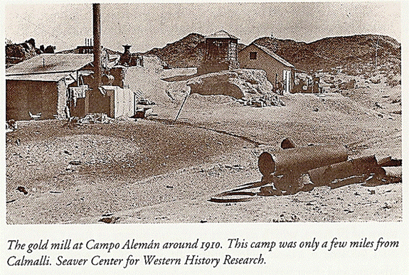
1910 vs. 2012
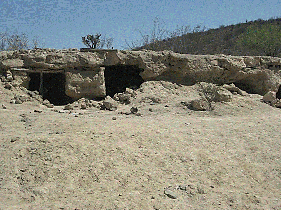
Miners lived underground to escape the heat.
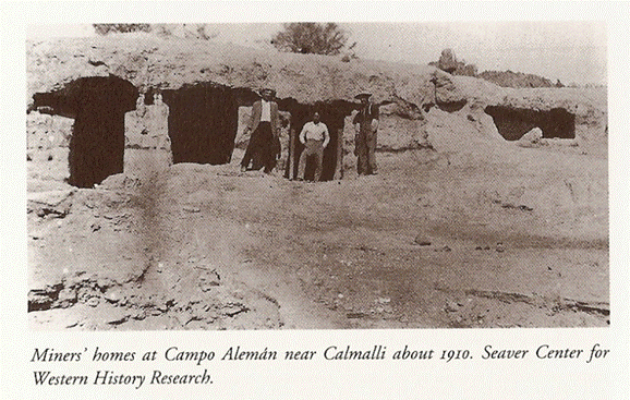
1910 vs. 2012
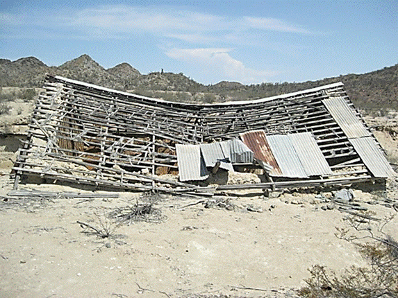
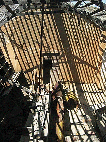
This building is half in the hillside, I walk over to the roof to look down inside.
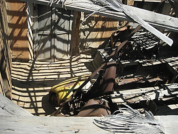
Looks like parts of an old truck in there.
Next we try and find the Cave of El Arco
Pages: 1 2 3 4 5 6 7