Day 3 of Trail of Missions begins with a hill climb exercise.Did I say I was having fun with this group?Cardón and Boojum trees, ahead!Casey Currie tell the TV audience how he lost the tip of his finger while surfing the day before. He would ride in the helicopter, with me, back to the United States to have a hospital check it out.The injury didn’t stop Casey from driving his new Jeep that day. The Raptor I was riding in got a flat tire so Cameron had me get in with Casey until we both got into the helicopter for the ride north. Casey’s regular co-driver took over until Casey rejoined the group further down the peninsula.
Mesa San Carlos:
The first of a panorama series to the west.
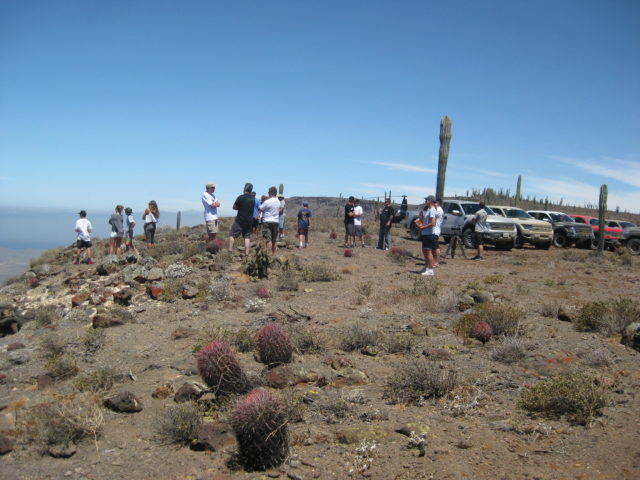
The foot trail up the mesa from Punta San Carlos.Punta San Carlos fishing village. Solosports Resort is to the right, in the distance.Cameron tells us how he rode his motorcycle up the trail in the past.Enjoying the viewEveryone should have one of these along!Cameron makes a commercial for Fox Shocks.Close up shots, for effect!Jim McCoy can land almost anywhere in Baja.The cardón is the king of all cactus in the world.The cirio or ‘boojum tree’ is the most fun cactus in the world!It’s like being in a Dr. Seuss book!With the vehicles behind schedule, Cameron tells Casey and I to get into the copter and we will only fly over Mission San Fernando, as it was dropped from being a scheduled stop (and where I was to give my final lecture). The helicopter’s fuel truck is parked a mile east of the mission where we say our goodbyes to Cameron, and the rest of the caravan heads to Cataviña for lunch.
The cliff on the left is where the San Fernando Petroglyphs are, a half mile west of the mission. I would come back here with the America Unearthed TV crew to film the Vikings in the Desert episode, in 2019. Yes, one petroglyph looks like a Viking ship. The mission aqueduct can be seen along the cliff, as well. See 4 minutes from that show: https://youtu.be/p7qPoqHSPXE
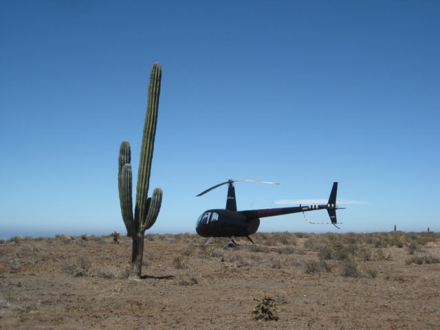
Mission San Fernando de Velicatá ruins are on the left side of the road, past the abandoned ranch house, below. Highway 1 in just over two miles east.The mission ruins and newer entrance gate.Passing over and looking back west. The abandoned ranch and another house is on the left side of then road now and the mission and its entrance gate are on the right. See more photos of this mission at: https://vivabaja.com/missions2/Looking further west, down the valley and seeing the petroglyph cliff at the upper left edge.All fueled and ready to fly to Ensenada and on across the border. We see some incredible sites! See them on the next page >>>