Three mission sites with ruins were visible before 2012. Very little adobe ruin remains at the third site, in 2025.
Full name: Santo Tomás de Aquino
Founding date: April 24, 1791 (moved 1 mile east in 1794 and 3 more miles east in 1799) Mission #23
Catholic Order: Dominican
Founded by: Padre José Loriénte
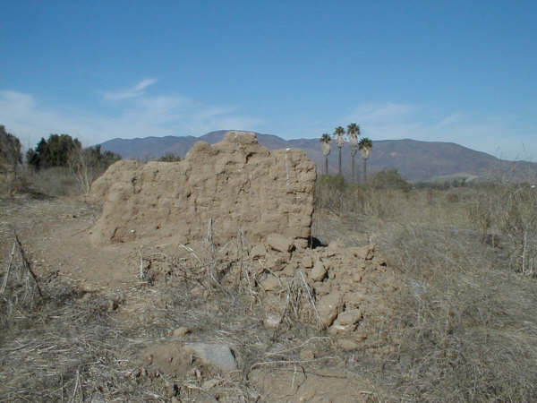
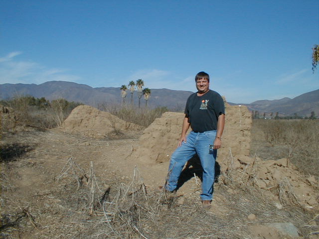
Condition: Adobe ruins at final site, nearly vanished.
Closing date: Abandoned in 1849 (was the last California mission to be operating)
GPS: Site 3 (1799-1849) 31.558333, -116.413583; Site 2 (1794-1799) 31.573417, -116.466306; Site 1 (1791-1794) 31.569722, -116.480556
Access:
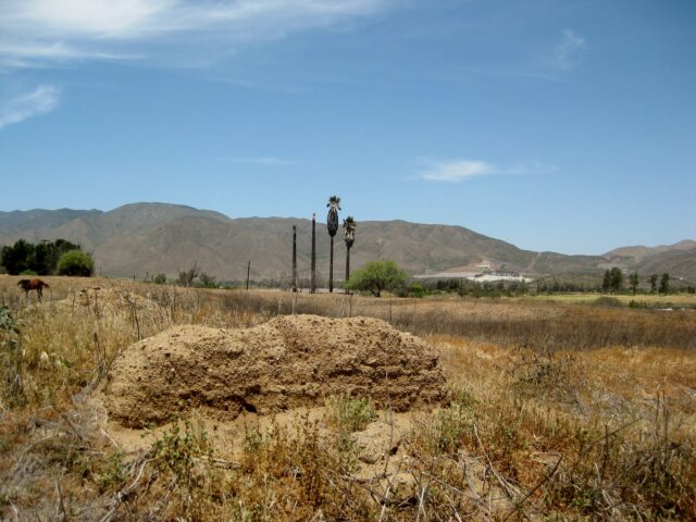
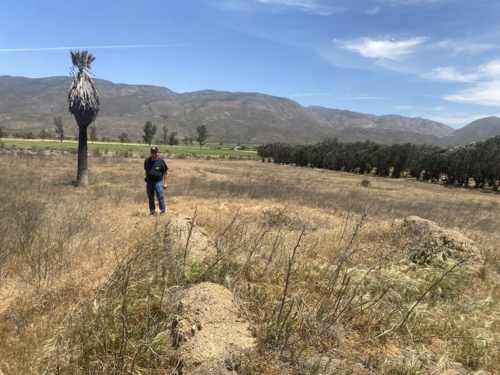
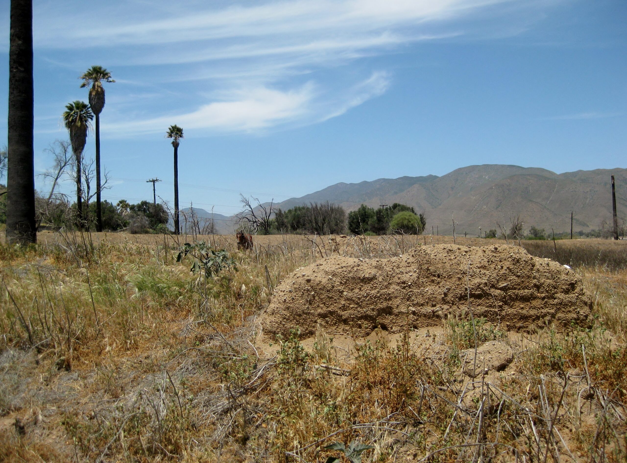
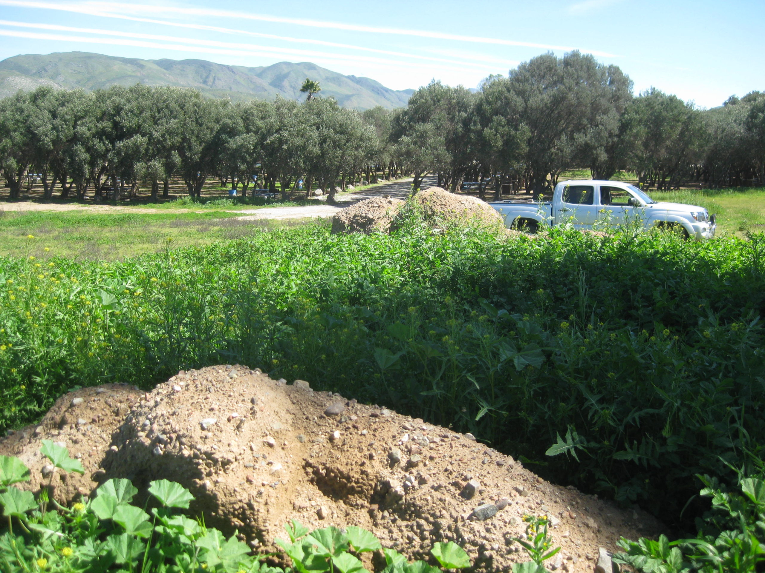
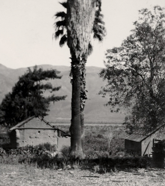
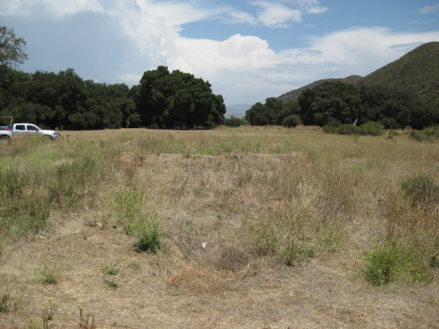
Site 3 Is in the field east side of Mex. #1, about Km. 49.5 (just north of Km. 50, El Palomar RV Park). The RV park was closed in 2025. Note the tall palm trees close to the ruins.
Site 2 The second Santo Tomás mission site was in a plowed field on the north side of the road, 2.8 miles from Highway 1 at Km. 47 (the road to La Bocana and Puerto Santo Tomás). It was obliterated by farming after 2009 .
Site 1 was in a camping area, 3.9 miles from Km. 47 (a miles west of site 2) on the south side of the arroyo (access road 3.6 miles from highway). The area was closed in 2017.
Read more: HERE
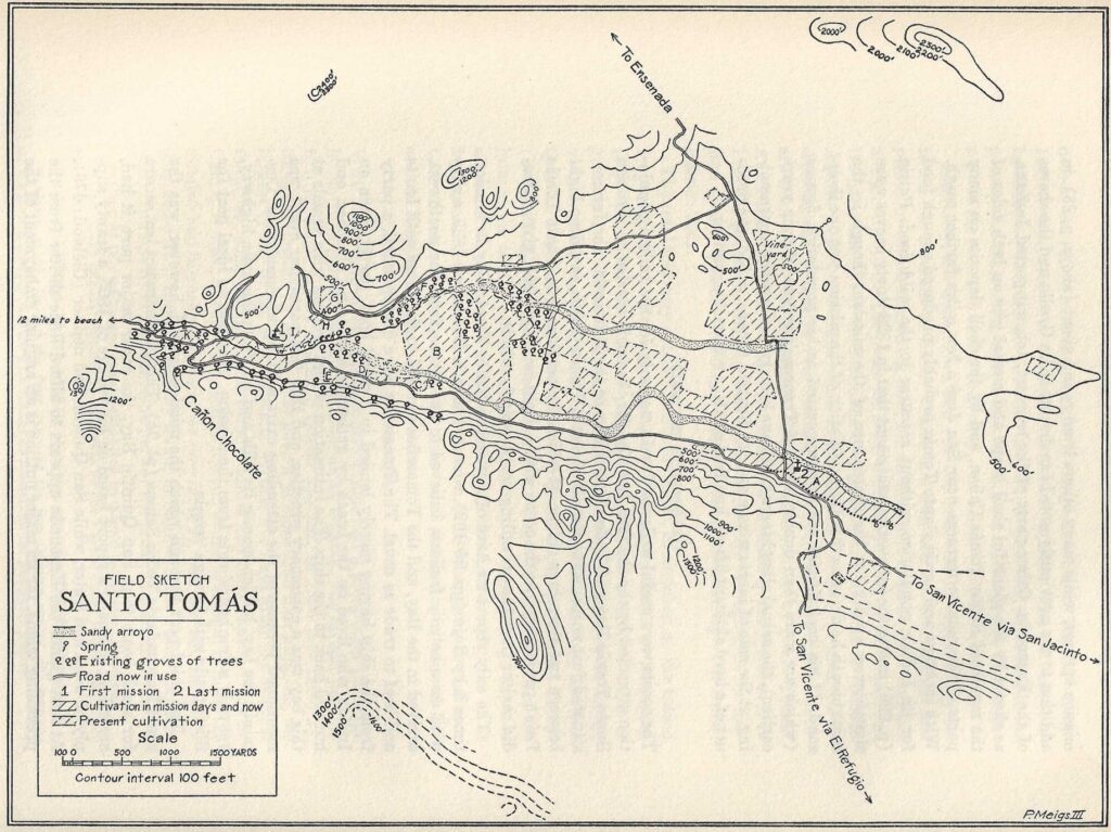
The Santo Tomás mission was first located some 2 1/2 miles west of the town of Santo Tomás. Two sets of ruins (1 mile apart) have been photographed and both called the first mission location (site #1 and site #2):
Peveril Meigs, in 1926 only documented site #2 and site #3. Meigs called site #2 the ‘first site’. Peter Gerhard (in 1956) and Michael Mathes (in 1977) do not mention site #2, only site #1 as the first site and a move in 1794 to site #3.
Zephyrin Engelhardt (1929) gives the year 1794 for a move “higher up” (p 575). Engelhardt (p 625) then provides the founding date of April 24, 1791, the first move in June, 1794, and a second move “on account of the lack of pastures” that was requested “8 years since the founding” (1799).
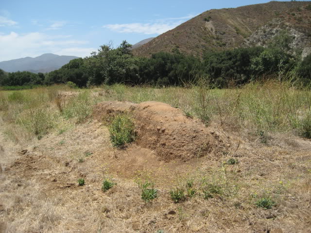
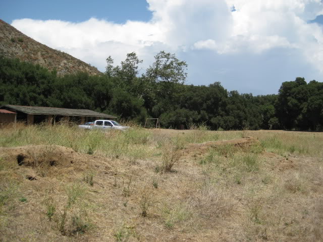
Site #1 is on the south side of the oak tree lined stream, on the valley floor. It should be considered the first location because mosquitos and flooding were reasons for a move “higher up”, made in 1794. The mountain blocking direct sunlight was also a concern, wrote one padre.
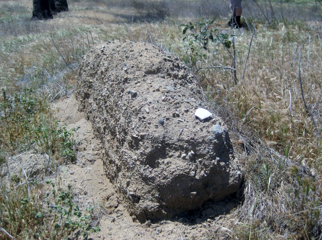
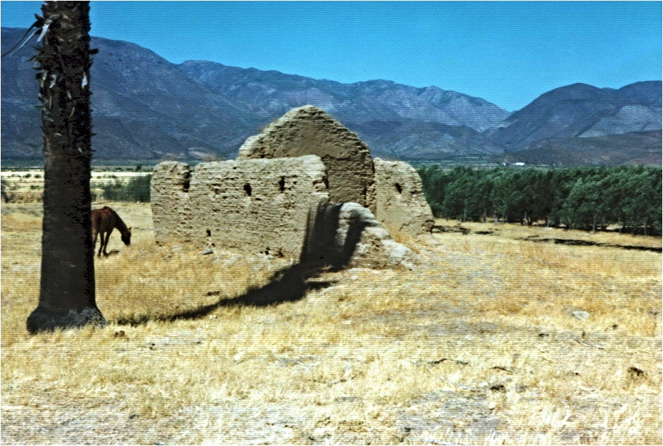
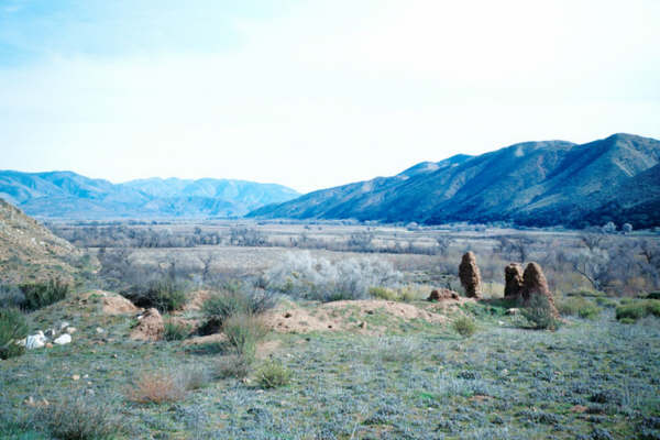
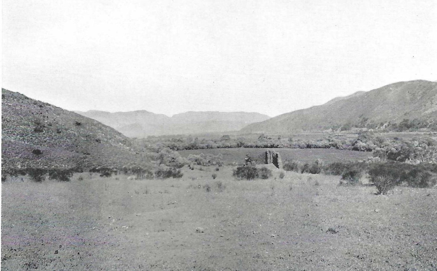
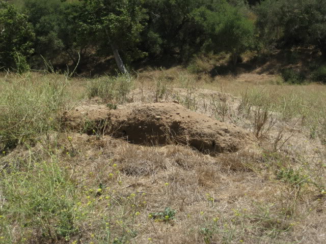
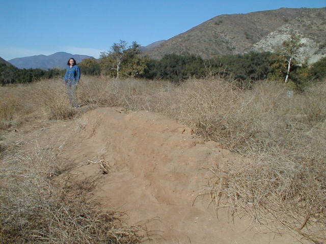
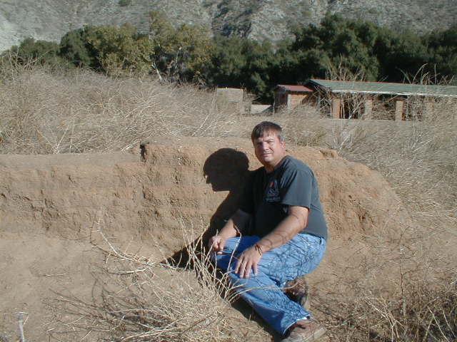
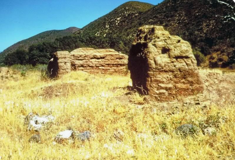
The move from site #2 (because of the “lack of pastures”) to the final site (#3) was made in 1799. Many adobe buildings were constructed there, yet almost nothing remains.
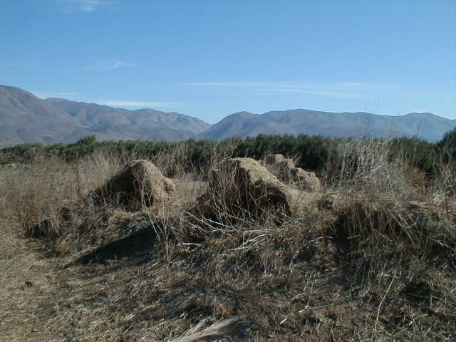
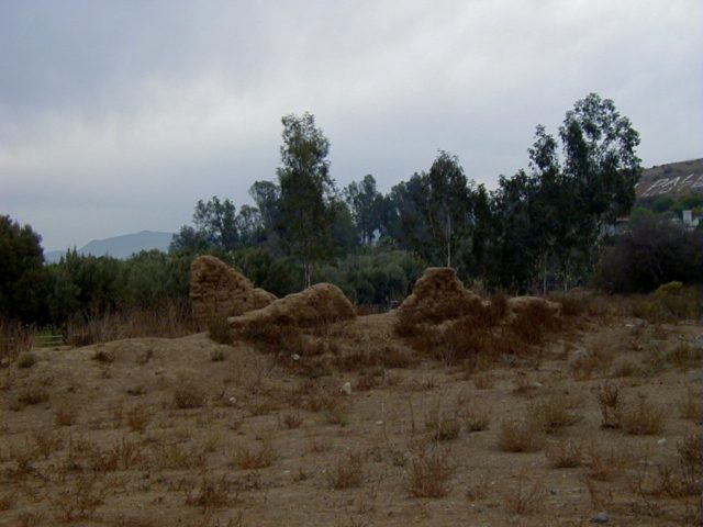
PHOTOS of the 3rd (1799-1849) Site
2025 Photos by David Kier & Dave W:
2017 by David Kier:

2005 by David Kier
2003 by Jack Swords


1975 by Robert Jackson
1961 by Howard Gulick

1956 by Howard Gulick

1949 by Marquis McDonald

1930 Photo by Margaret Bancroft
1926 Photo by G.W. Hendry

1919

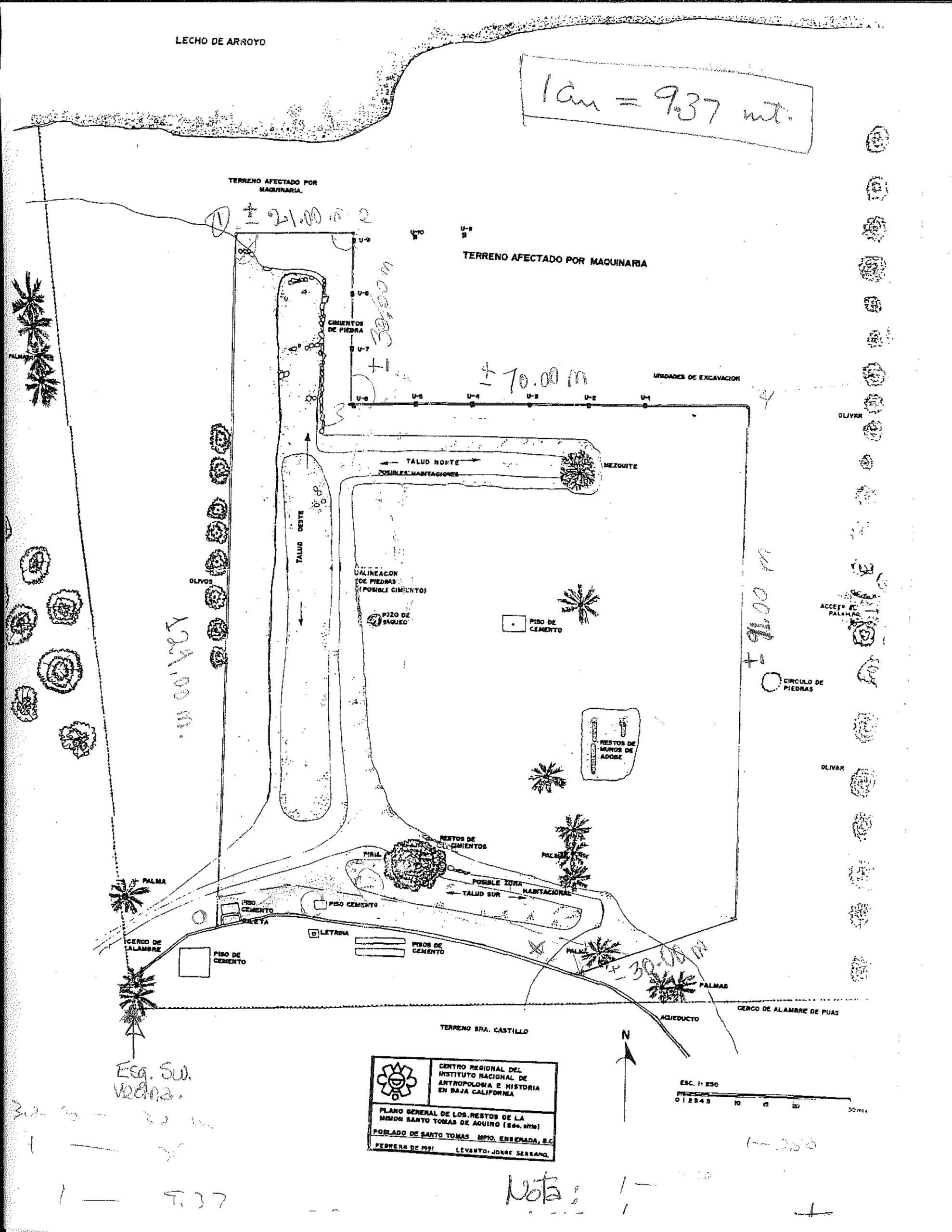
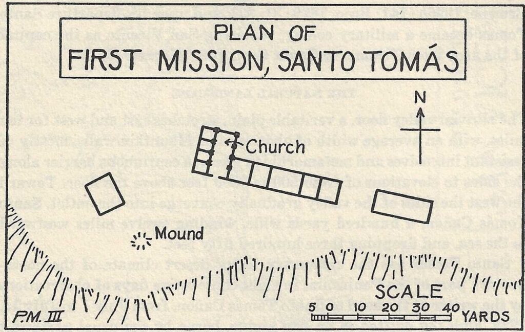
INAH plan drawn by Jorge Serrano González from 1991: Click to enlarge
PHOTOS of the 2nd (1794-1799) Site


Peveril Meigs Mission Site Plans from his explorations in the mid-1920s:
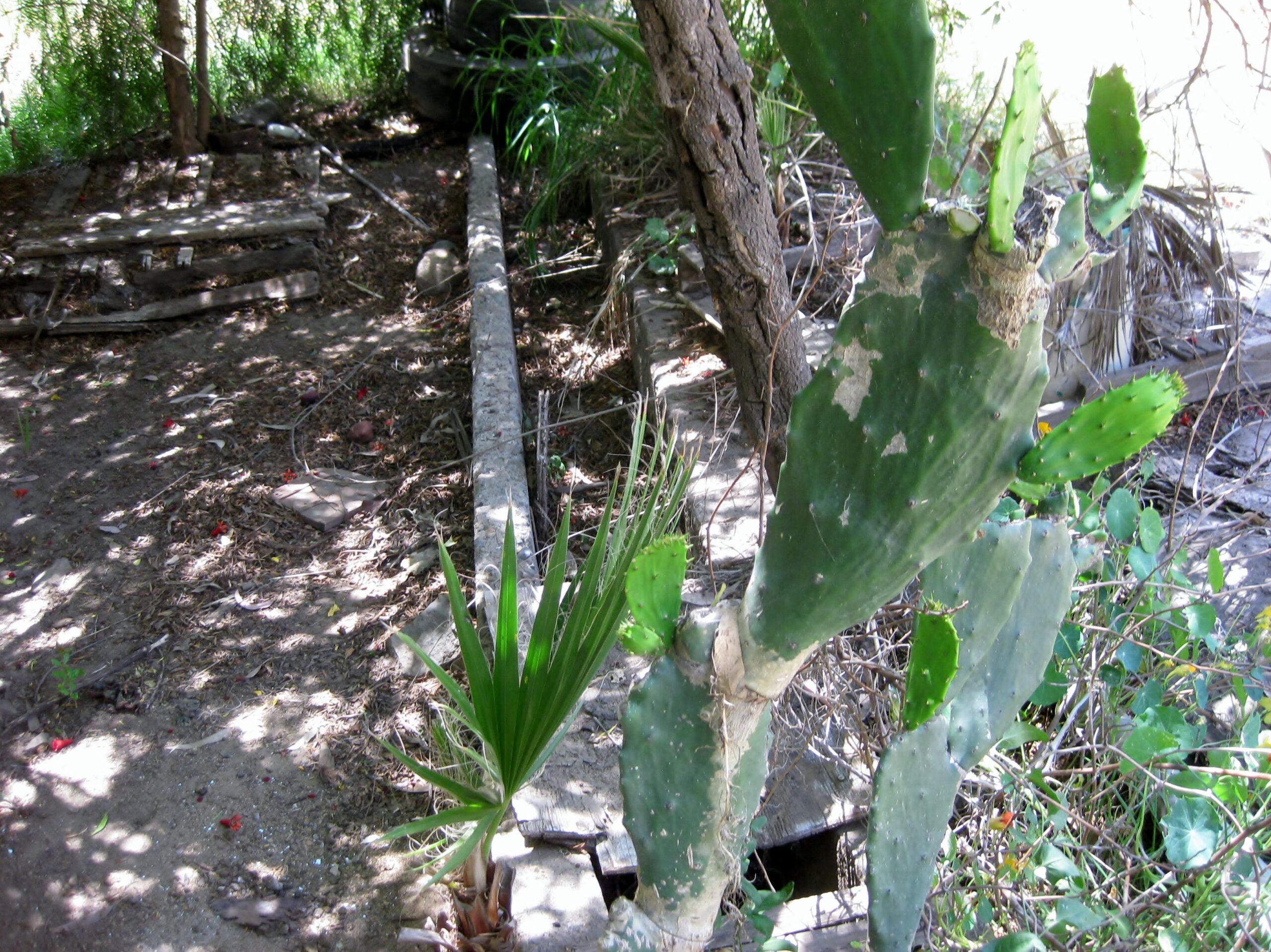
PHOTOS of the 1st (1791-1794) Site
First 4 photos by David Kier in July 2011
Next 3 photos are from November 2005

2003 photos by Jack Swords


1977 photo by Michael Mathes

1975 by Robert Jackson
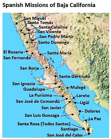
MAP with three sites shown

I hope this was interesting or informative for you! Please be welcome to join our Baja California Land of Missions Book Group, on Facebook: HERE
- All the missions, quick look and history, north to south: HERE
- Other mission photo pages plus more Baja California history: HERE
- VivaBaja.com home page
![]()
![]()
The following chapter is from my book, Baja California Land of Missions Order your own copy from Amazon Books: HERE
#23 Santo Tomás de Aquino (1791-1849)
The location for the twenty-third Baja California mission was discovered in 1769 and named San Francisco Solano by Franciscan Padre Juan Crespí. In April 1785, “San Solano” was visited by Dominican Padre Luis Sáles and a party of soldiers from the mission of San Vicente while searching for potential mission sites. On one of the Padre Sáles expeditions to San Solano, he was attacked by the native Indians, wounded, and thrown from his horse. Sáles, “half-dead,” hid while the Indians chased the soldiers, who returned later to rescue the Dominican priest.
Mission Santo Tomás de Aquino was founded by Padre José Loriénte on April 24, 1791, in the San Solano Valley. This was at a place called by the natives Copaitl Coajocuc (crooked sycamore). With this mission established, the Dominicans fulfilled their mandate to occupy the frontier territory between Mission San Fernando de Velicatá and San Diego. The wide gap along El Camino Real between San Vicente and San Miguel was bridged. The Indian neophyte population in the first year at Santo Tomás was ninety-six.
A 1793 report described the mission church as a small adobe structure fourteen feet by thirty-four feet with a roof of poles and mats. A dwelling for the missionaries was also constructed of the same materials. This first location chosen for the mission had been questioned by Governor Fages because it could be swept away by floods being in the narrow part of the canyon. Also, sunlight would be blocked a third of the day by the height of the hills.
According to a missionary’s letter, sickness developed the second year at Santo Tomás, and he attributed the problem to the marsh: “The heathen did not live where the mission is, but further up the plain, where the air is pure and there are no mosquitoes or gnats because the land is clearer.”
As the result of continual problems of mosquito infested swamps and general unhealthy conditions at the first site, on May 31, 1794, the mission was moved a mile east and higher up the valley. This placed it on the north side of the arroyo, with full sunlight. A new church building was made of adobe with a roof of poles and tules (reeds). Another building of the same materials was made for the priests.
Horses, mules, cattle, sheep, and goats were all raised at the mission. Grain was planted and yields increased, yet in 1798 Padre Miguel López wrote to the governor asking that the mission be moved one more time further east, where more land could be put under cultivation.
In 1799, the mission did relocate again. The final move made was just over three miles to the east, where four buildings were constructed. In 1800, work continued on the church and other buildings. The neophyte population reached the highest at 262. The church was eighty-five feet long and eighteen feet wide with a flat, earth-covered roof. A sacristy was constructed twenty feet by fifteen feet in size. Several other buildings were erected before 1801, including storerooms and living quarters for single girls.
Raising crops and livestock all were successful at the third site for the mission. Trading with foreign sea captains at the bay of Ensenada (Ensenada de Todos Santos) twenty miles to the north was reported. This exchange was an important source of revenue during years of isolation while Mexico was fighting Spain for independence from 1810 to 1821.
In the same year, two Dominican priests while serving at Santo Tomás were murdered by mission Indians. Miguel López was killed on January 13, 1803, at the hands of an Indian by the name of Mariano Carillo. Eudaldo Surroca was killed on May 17, 1803. Surroca was found dead in his bed, the body was full of bruises and bone fractures. At least three Indian domestics were involved, one confessed immediately to the crime. Of the three, one was a woman named Barbara Gandiága who instigated the killing of not only Surroca but of López, four months earlier.
The year was 1849 and while Padre Tomás Mansilla was visiting Mission San Diego de Alcalá he left his brother, Agustín Mansilla y Gamboa, in charge at Santo Tomás. On June 10, 1849, Agustín wrote to his brother Tomás that people traveling north for the gold fields were stealing from locals and from the church. An Indian was reported to have stolen altar valuables and sold them to the “Forty-niners” passing through. That seemed to be the final straw. Tomás Mansilla returned from San Diego, abandoned his mission, and traveled south to join Padre Gabriel González in the southernmost region of Baja California. Mission Santo Tomás de Aquino was the last operating California mission, closing in 1849.
None of the three sites for this mission have any kind of preservation. They are all on private property and INAH has not performed any kind of protection as of this writing. The photos illustrate the inevitable vanishing of these unprotected adobe buildings.
The first (1791) site is nearly gone, with just a small section of wall remaining next to an oak tree picnic area, along a running stream. From Highway One on the north side of the Santo Tomás Valley, take the graded dirt road west (signed for La Bocana and Puerto Santo Tomás). Go 3.4 mi and take a road to the left and go a half mile more to the clearing next to the picnic area. In 2017, this former picnic area was closed.
The second (1794) mission site had only a small area of melted adobe and rocks and was in a planted field when visited in 2009. It was a few hundred feet north of the same La Bocana road, about a mile closer to Highway One than the first site. The distance from Highway One to the second site is 2.8 mi. In 2012, satellite imaging showed the adobe area of the mission having been removed and planted over. Confirmed in 2017. Another mission site gone!
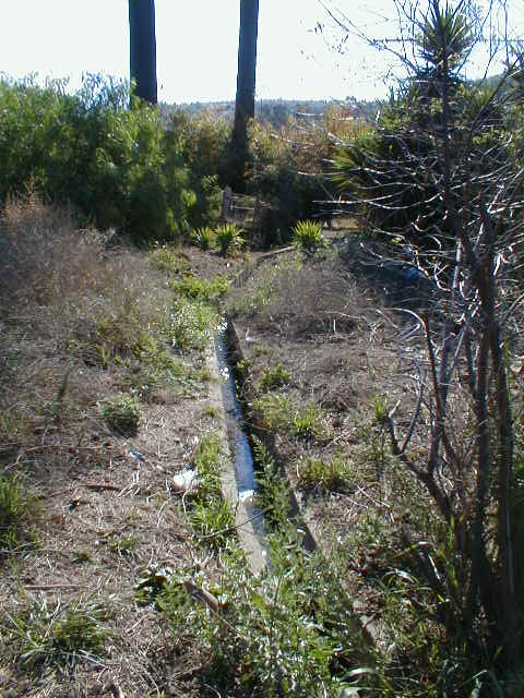
The 1799 third and final site is on the east side of Highway One at the town of Santo Tomás. As you enter Santo Tomás from the north, look near the tall palm trees just north of the El Palomar campground. The mission aqueduct is near the site and still carries water from the spring.
Some books mentioned only two sites for Santo Tomás. Some books have called the second site “the first,” never mentioning the extensive adobe complex once seen at the true first site. Some books have not mentioned the second site, mentioning only the first and final site. Some have reported that road construction destroyed one site. I have found adobe remains at all three sites that match locations photographed in the past ninety years and identified as mission sites.
Photographs show how the unprotected adobe brick walls are susceptible to weathering. In a 1916 letter, about his 1887 expedition to save Dominican artifacts, Fr. James Newall, O.P., made the following very poignant remark:
“But let us say at once, we found very little to describe. Since Mexico’s achievement of independence from Spain, and the expulsion of the Spanish Friars from the Peninsula — that is, for a period of seventy years — those missions had been utterly abandoned, and, what is worse, adventurers and interlopers from Sonora — who constitute the present owners of the Mission lands — after driving and killing off the Indians, dismantled the churches and monasteries, seized on and sold the valuable church furniture and works of art, and even tore the tiles from the Mission roofs for their own huts, thus exposing the walls to the dissolving action of the rains, so that there is hardly a Mission in that country of which it might not be said, Etiam ruinae perierunt! Even the ruins have perished.”
Dominican Missionaries recorded at Santo Tomás:
José Loriénte (to 1798) April 24, 1791
Miguel López 1793-1803
Segismundo Fontcubierta 1798
Eudaldo Surroca 1802-1803
Juan Ríbas 1806
José Miguel de Pineda 1812-1826
Tomás Mansilla 1826-1849
Photos of the next mission south (San Vicente): https://vivabaja.com/san-vicente/
See the other mission pages: https://vivabaja.com/baja-mission-albums/