2017 Baja Expeditions: Project Outline
To bring everyone up-to-speed:
In 2017, I have begun to retravel roads from my past and travel roads I have not yet been on. Here are the regions of info gathering done to date:
Trip 1, New Years 2017: San Felipe to Punta San Francisquito
Trip 2, Feb. 2017: San Ignacio to Loreto area + San Javier, Comondú, La Purísima, San Borja.
Trip 3, March 2017: Mexicali to San Felipe, San Pedro Mártir canyons, and Laguna Chapala north to San Quintin.
All this to document the conditions and report on places Baja travelers may enjoy seeing or staying at. The data (which includes location GPS, photos, observed conditions, history, etc.) will be available online via a “living map” as well as printable versions that would be a road log. That is all yet to be determined based on the requests we get.
The 2009 Baja Almanac was the best all-road map, at the time of this trip [In 2021, the new Baja California Road & Recreation Atlas from Benchmark was produced]. The final Auto Club (AAA) map was printed in 2010 and most data in it was gathered from the three maps of 2003, 2004, and 2007. See many of the AAA maps, preserved here: https://vivabaja.com/maps/
Traveling to and throughout Baja California is what we like. But, so many of us find a spot…. and then keep going to that same spot! Guidebooks and maps give us a hint of what’s over that hill or across that salt flat and can open up new areas of fun and potentially provide economic growth to locals. I have many Baja traveling friends and one thing we all share is an interest in exploring. We know a road on a map is just a line, or a photo is just a hint, and words can never fully describe how each of us will react to any one location. Guidebooks and maps do not spoil the thrill or take away the personal discovery one has. If you just don’t want any clue about where a road goes, simple… don’t read my trip report or get the map-guide!
To travel that line on a map and experience that road is as much fun for some as where the road ends up going. Baja is a land of many roads… and they all go somewhere! Most of the time, they go somewhere interesting and fun.
Trip reports here are the greatest, and often a most important feature for Baja travelers. However, searching for a trip report to the area you want to read about is not easy for many.
Hank and Geoff of Baja Bound Insurance (as well as their staff) have agreed with me about a need for an updated map/guide. Hank and I talked about the idea over 20 years ago. Now, with the technology and Internet expertise available we are creating a map that will have hundreds of waypoints that can be clicked on, and that will open up info about that place. It may include photos and comments. Being online, this “living map” can be updated as conditions change or data needs correcting. All of you can contribute to keeping the information fresh and accurate.
A road log is being created that utilized kilometer markers (where possible) to easily find a turnoff, taco stand, or motel. This way, the doing math with your odometer to find a point is reduced, as well as the issue of odometers not all reading the same, especially when we put on oversize tires!
Before your trip, just print the part of the road log you need or the map area. The possibility of publishing (printing) these, is always an option. Let’s see how things progress. I look forward to your positive feedback and constructive criticism to make this a more beneficial project for both travelers who are “Baja Bound” and for the people who live and work in Baja California.
This next report will be of trip #3 for this project. This year (2017), so far, I have travel 4,000 miles for information gathering for the Baja Bound Map-Guide. It won’t cover all roads in Baja or all the great places, there are just too many! I do hope to travel all the roads that go to places that sound or are known to be interesting or special.
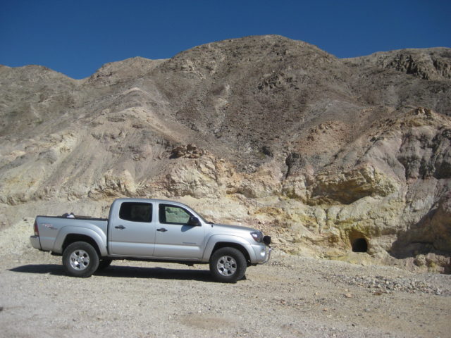
A few roads will require four-wheel drive, off-road driving skill, or deflating tires for improved traction. They will be listed as 4WD only or 4WD recommended. Naturally, some of us can get into places with 2WD that others wouldn’t attempt or don’t mind spinning tires or some rock damage. My job is to report and you can decide to go or not. As most of you know, I use a 4-door Tacoma 4WD truck that is almost stock. Just a small lift and 1″ taller than stock tires. I travel alone, so I won’t take a road that could require a buddy along to spot my tire placement or pull free from a rock high center (hopefully).
A few places included will be for hikers, but not far if you have 4WD. Now, a message for the special group here who like to surf: I personally won’t be listing anybody’s surf location recommendations or directing people to the surfing breaks. There are already maps and surfing guidebooks that do that.
OKAY AMIGOS?
FOLLOW ME TO BAJA!
Thursday March 2, 2017
Bought pesos for the trip at the money exchange in Calexico in the Auto Zone parking lot. The exchange today was 18.80 pesos per dollar. It was 20.20 last month and 20.00 the month before.
Crossed into Mexico at the downtown Mexicali border. Purchased a new 180-day FMM tourist card for 500 pesos. Confirmed with the INM officer that it was good for multiple trips and that it did not need to be returned to INM when leaving Mexico.
Noted mileages and kilometer markers on Hwy. 5 to San Felipe. GPS spotted Pemex stations (outside of the city), campgrounds, and points of interest.
The following are just my notes and are not embellished or how they will appear in the final publication.
Km. 0 is at the San Luis Rio Colorado (Hwy. 2) split from Hwy. 5, 4.9 miles from the border. This is where you cross the railroad tracks a final time.
Km. 8 is the Toll Road (2-D) to Tecate exit.
Km. 23 the highway is west from the volcano, Cerro Prieto.
Km. 38 is the Hwy. 4 junction (access to El Golfo de Santa Clara).
Km. 48.5 is the north access to Campo Mosqueda on the Rio Hardy river (3.3 miles)
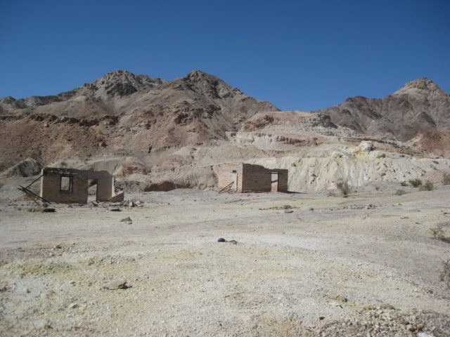
Km. 49 is a graded, but rough road west over the mountain to Laguna Salada and an abandoned Sulfur Mine (7 mi., take right fork at mi. 3.7).
Km. 53.5 is south access to Campo Mosqueda (1.3 mi.). It passes two other campos going in.
Km. 55+ Campo El Mayor
Km. 74+ Failed canal from the 1980s made to fill Laguna Salada.
Km. 86.5+ Ejido Saldaña road, right.
Km. 105 La Ventana, store, rest area.
Km. 126 La Fortuna Gold Mine entrance.
Km. 136+ El Chinero, historic hill.
Km. 140.5 Hwy. 3 junction.
Km. 141.5 Military Checkpoint
Km. 160 Begin 4 lane highway.
Km. 171.5 Villas Cortez (2.4 mi.). Palapas, pool, nice looking! But, no in-vehicle camping (such as RVs or out of your truck). You must unload at a turnaround loading spot, carry your things across the sand 100 feet to a palapa, then park your vehicle even further away, behind a building (out-of-sight).
Three camp signs follow, but are either chained up or are not for camping, just lot leasing: San Marino, Don Abel, Campo Amigos.
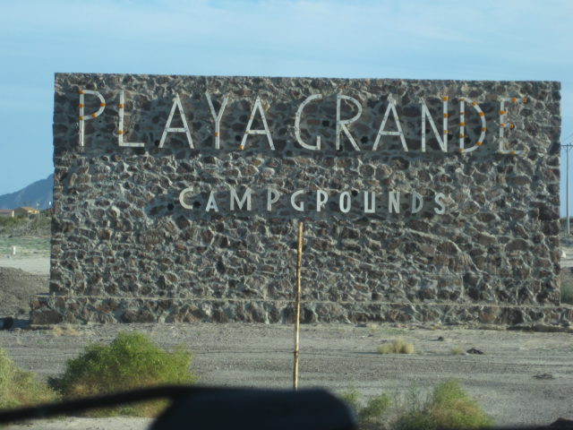
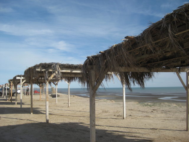
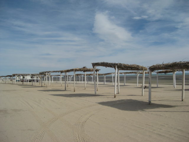
Km. 173.5 Playa Grande (1.9 mi.) Palapa camping.
I am running out of daylight, the wind is blowing too hard to have a nice camping night, so I get a room at the Hotel Diamante (Km. 185.5) for 480 pesos. Next time, I will try the Blue Sky… which is just a bit north.
I go into San Felipe, get some fish tacos and Pacificos, and all is good.
Tomorrow, I will cover the San Felipe to Pete’s Camp to Playa Grande campos.
Here are the DAY 1 Thursday photos:
Sulfur Mine (Km. 49 + 7 miles):

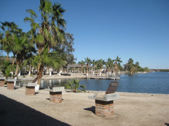
Playa Grande:


Friday March 3, 2017 Day 2 of 7
OK Friday Morning… I drive south from the Hotel Diamante to the entrance arch of San Felipe to record all the campos that are actual camping places and other points of interest to travelers:
So you understand my kilometer marker notes:
If the point is right at or within visual sight of a kilometer marker, that will be what is given: Km. 179 (for example).
If it is about 1/4 kilometer after then it will have a + sign added: Km. 180+ (for example).
If it is approx. halfway between two markers, then a .5 is added: Km. 177.5 (for example).
If 3/4 a kilometer after, then a + sign is added after the .5: Km. 181.5+ (for example).
ROAD LOG NOTES (going north):
Km. 189.5+ San Felipe Entrance Arches
Km. 184+ Campo El Pescador (entrance closed)
Km. 184 PEMEX (on west side)
Km. 183 Playas del Sol (1.1 mi.) Palapas
Km. 182 Campo Ocotillos (not camping, lots for lease)
Km. 181.5+ Pai Pai Campo (0.9 mi.) Beach only.
Km. 181 Colonia Morelia (Valle Chico/ Agua Caliente/ Matomí access) Road. San Felipe Storage.
Km. 180+ Campo Los Compadres (0.9 in) Many palapas overlooking beach or arroyo.
Km. 179 Playa del Oro entrance. Road-Runner Restaurant/ Deli. GOOD FOOD! Had a nice breakfast here, many cars in front.
Km. 178.5+ PEMEX STATION (on west side)
Km. 177.5 Pete’s Camp El Paraiso (1.0 mi. to restaurant, 1.1 to palapas)
Km. 173.5 Playa Grande (see Day 1 post for details).
From Highway 5, I take the Colonia Morelos Road (at Km. 181):
There are kilometer posts on this road, but don’t go the entire distance to Agua Caliente Canyon road.
First, the beach campo photos taken Friday…
Playas del Sol:


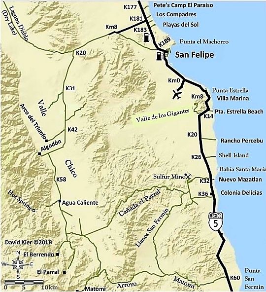
Colonia Morelia Road: Km. 181
This road leaves Mex. 1 about 5 miles north of the San Felipe arches and is the replacement road for what was the new Zoo Road that now passes through the El Dorado Ranch residential zone. That road is at Km. 178.5 and is signed for residential use only.
MILE:
0.0 Highway 1 (Km. 181) Signed: Colonia Morelia 60 km.
4.2 (Km. 7) Junction with Km. 178.5 private road.
5.1 Junction with original Ensenada-San Felipe road (left goes to Km. 189+) [the road has since been paved from Hwy. 5 for 6.2 miles/ 10 kms.]
12.5 Cattle Guard
12.8 Major Fork: Right to Diablo Dry Lake/ Left to continue into Valle Chico.
19.5 Unsigned road right (to Rancho El Cajon?).
24.6 Rockpile at road to left.
25.9 Cattle Guard
26.0 (Km. 42) Road right to Arco de Triunfo, rehab facility.
29.6 Cattle Guard
31.5 Junction: Ahead to Rancho Algodon and old Valle Chico road on north. Left to continue south:
36.4 Abandoned Farm Project, on left. (Linda Vista on some maps)
37.2 (km. 60) where Colonia Morelia is supposed to be!
38.2 Cattle Guard
39.4 Enter abandoned farm ejido village (Plan Nacional Agrario/ Agua Caliente).
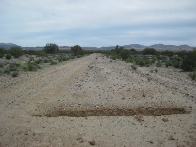
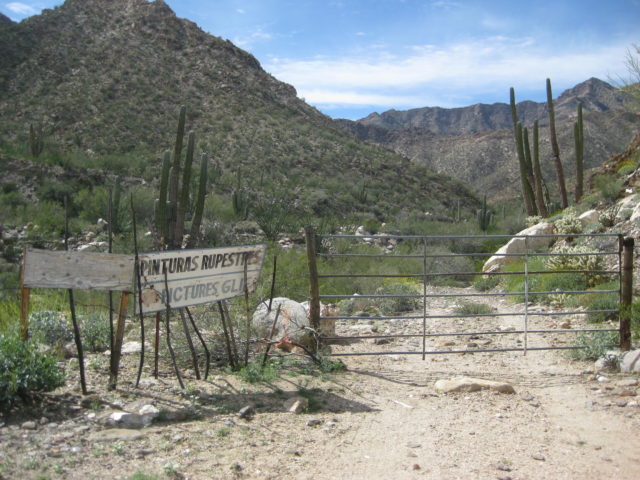
39.6 Ranch house surrounded by fence and trees. Major fork here. To right side (north side) of ranch, the road goes west to Agua Caliente Canyon. To left, and stay along the east side fence of the ranch on the southbound road to continue south.
A side trip to Agua Caliente Canyon, goes from the ranch, onto a former airstrip for the ejido, enters the canyon at Mile 2.0, passes a metal water tank at mile 2.2, Comes to a gate at Mile 2.4 (petroglyph viewing), and goes to Miles 2.6 mile where the road was washed out. A track has been blazed to the left that does continue but going solo I had to resist trying to get to the hot springs today!
PHOTOS:


Continue on next page…