El Rosario de Abajo, La Bocana Beach, Petrified Forest
Next, I am off to investigate is the old town of El Rosario de Abajo (Lower El Rosario). This is where the mission moved in 1802 and the post-mission town was primarily located. With the coming of automobiles, a second Rosario developed along the route that in 1973 would become a paved highway. The newer town was called El Rosario de Arriba (Upper El Rosario) to distinguish it from the older town, across the river and 2 miles west.
Set odometer to 0.0 at the sharp curve in Hwy. 1, across from Mama Espinoza’ Restaurant and drive west.
In a couple hundred feet the street to the left was the main road to Abajo, but traffic has mainly gone to a new crossing ahead.
0.4 End of paved (concrete) road surface.
0.8 Fork. Right to Las Palapas recreation area, 0.6 mi. The road beyond once went to Diamante Del Mar project. Road now badly damaged by rains. Go left.
1.2 Junction in the middle of the river valley. Left is route back to Hwy. 1. Ahead to continue on.
1.9 ADB Market, center of town of El Rosario de Abajo.
2.0 Mission Ruins, on the right. Park setting, signs. Mission moved to this spot in 1802.
2.9 Fork. Left goes south to Agua Blanca, San Antonio, San Carlos. Go right.
3.3 Junction. Left goes to Punta Baja (7 miles). Go straight ahead.
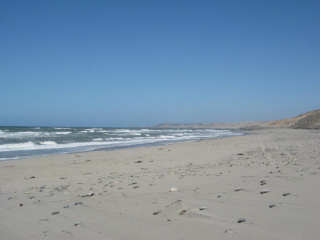
5.3 Parking for beach of La Bocana.
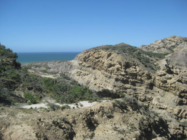
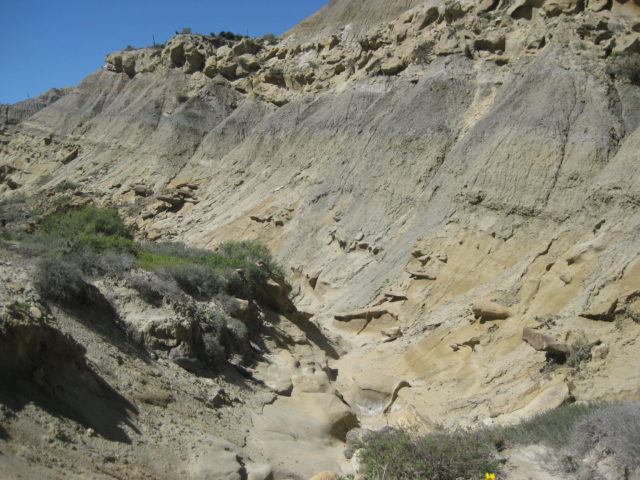
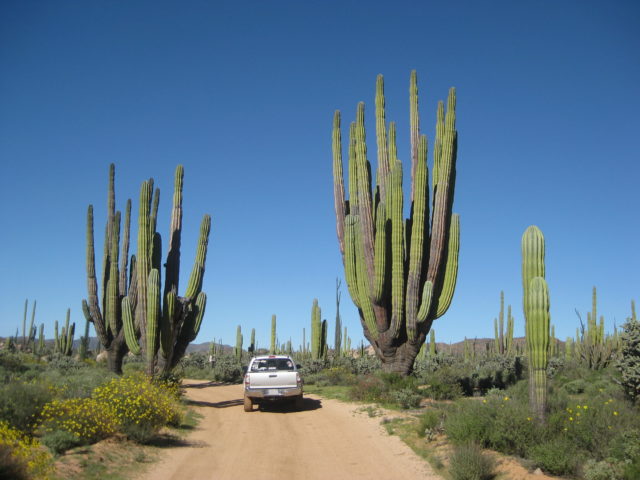
A drive north then turning into the hills goes 2.3 miles to the edge of a small canyon. A hike into the canyon will take you through a prehistoric forest (using your imagination). Petrified wood is scattered about. Look but do not remove.
I drive back into town on the former Diamante Del Mar high road, but it is not maintained and large gullies in the road make travel a challenge. 4WD and large tires only. La Palapas is passed returning to town.

Petrified Forest of El Rosario:


Returning back to Baja Cactus Motel, I find Antonio. He is a busy man having been part of an emergency rescue after midnight (an off-road motorcycle tour member hurt), as well as his two businesses in town.
We get together for dinner that evening at La Pasadita with Isela and daughter Itzel, who is doing fine and growing fast since her heart surgery of 2010: http://forums.bajanomad.com/viewthread.php?tid=48946
After dinner, we stopped at the Hot Dog stand (very busy place) between the La Pasadita and Sinahi restaurants. There Isela asked for several cups to go, of a hot Mexican dessert drink, that is similar in concept to hot chocolate, thick and hot. It is called Champurrado and was quite good. https://en.wikipedia.org/wiki/Champurrado
Monday is now in the bucket! Two more days in Baja…
DAY 6: Tuesday Mar. 7, 2017 RANCHO EL SAUCE
To have some interesting side trips for the new map-guide, I asked Antonio about a place I had heard Doug and family talk about and show photos of back in November 2006: http://forums.bajanomad.com/viewthread.php?tid=21098
I had wondered about this ‘recreation’ place, and with some rough directions and only the name of the owner to use as a name (Señor Alcides and daughter Clarissa), off I went…
Km. 82+ (15.5 miles southbound from El Rosario Pemex) turn right on unmarked road. Just a mile from the highway, I stopped to well, stretch my legs, and I saw dust and a truck racing towards me. I just waited until it arrived. It was a cammo painted army pickup with four machine gun toting soldiers in back. It pulled up along side and in front, partially to block me from making a run for it! Once they were satisfied I wasn’t waiting for a drug plane to land, they turned around and headed back to the highway.
1.7 mi from highway you merge with a parallel route and soon go downhill from the side of Mesa la Sepultura and into Arroyo El Sauce where you curve left, upstream. This is the route of El Camino Real between Mission San Fernando and El Rosario.
5.7 mi from Hwy. 1 arrive at the palapas and a pool is to the left (empty).
6.3 mi from Hwy. 1 arrive at Rancho El Sauce. Cabins rent for 300 pesos (bring bedding) and palapas are free off season. Perhaps 100-200 pesos during busy times?
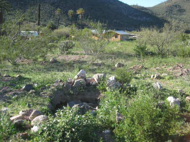
Two caretakers gladly show me the rooms, the other pools and were happy to have me tell my American amigos to come here to camp.
This is truly one of those Baja surprises.


Next: San Juan de Dios…
Km. 103 to San Juan de Dios, 22 miles.
Back out to Highway 1 at Km. 82+ I turn right (southbound) for my next excursion… to see what happened at San Juan de Dios.
Just 500 feet past the Km. 103 marker is the trucker restaurant El Sacrificio (at the signed road for Los Mártires), on the left. Turn in here and go uphill past the restaurant. To the right was an airport runway used during the construction of Hwy. 1 in 1973… named El Arenoso, after the old ranch a few more miles down the road.

Set odometer to 0.0 at Hwy. 1 and the El Sacrificio (Mártires turnoff) restaurant.
2.4 Fork, go left.
3.5 El Sauzalito Copper Mine. New Ranch built upon old town site.
4.8 Arroyo San Juan de Dios crossing (dry this time)
5.1 Fork: left to El Rosario via La Vibora, go right.
5.3 Fork: left to Los Mártires and beyond, go right.
8.6 Fork, go right.
10.5 Road left to ranch.
10.7 Road in from left to ranch.
13.2 Pila (water tank) ‘San Sebastian’
15.5 Fork, go left (gate on right fork).
16.9 Fork: left to El Sauce de Carter, go right.
20.1 Gate, close behind you.
21.5 Gate ‘Rancho Las Palmas’, close behind you.
21.7 Cross Arroyo San Juan de Dios. Rancho Las Palmas on left. Park on right across from water tank to visit ruins.


Goodnight from Planet Baja!
DAY 7 of 7: Wed. March 8, 2017
It was just a week ago, but so many memories and these trip reports and photos preserve and share them.
I had a nice dinner with Antonio and Isela. We went to Ed’s (Baja’s Best B & B) to have some of his clam chowder, which is more shrimp than clams, all the better. Back at Baja Cactus for a final night in El Rosario to sleep before the long drive home.
Wednesday morning, quickly loaded my truck, drove next door to top the tank and then, the other side of the gas station past the water purification place is El Popeye Car Wash. My truck had plenty of mud on it from the drive to San Juan de Dios. The arroyo crossings were dry but several deep water pools on the road could not be avoided. I asked for only an exterior wash and they soon put me into the stall and got to work on it. The charge was so low (80 pesos) I gave them a generous tip in appreciation for getting on the road quickly. Left El Rosario at 9:12 am.
Now, with the outside so clean, I just didn’t have it in me to get it covered with that dust on the road to La Lobera (Km. 47.5), so I passed by. I was there last September.
I will include some of my kilometer notes.
Km. 25.5 Playa El Socorro
Km. 16.5 Fidel’s El Pabellon (1.3 mi. in).


Km. 16 El Pabellon (1.2 mi. in) 150 pesos per night. A HUGE caravan of RVs is all lined up and just pulling out. They are northbound and no way do I want to be caught behind a half mile long caravan! Before I get a photo taken of the place, I U-turn and get out just ahead of the lead RV.

Km. 17 Pemex station (Nueva Odisea)
Km. 14.5 Highway Fork (northbound), ahead is older route via Santa María.
Km. 11 Paved side road to Hotels Misión Santa María and Cielito Lindo. Pemex station ‘Los Pinos’.


Km. 5 Fork (southbound), straight south for older route, new route curves.
Old English Cemetery is west of here.
Km. 4 Pemex
Km. 1.5 Los Olivos RV Park road west
Km. 1 Paved road west to Jardines road, Old Mill hotel, San Quintin bay shore.
Km. 0/ Km. 196 (from Ensenada). Point of newest section of Highway 1 (1973) south of here as highway narrows to 19 ft. to fit the construction budget.
Km. 169+ Mission Santo Domingo road (5 miles)
Km. 140.5 Paved road 62 miles to observatory (at 9,280′).
Km. 105 new Pemex.
Km. 102.5 Road to Valle de Trinidad
Km. 90 Pemex, San Vicente
Km. 88.5 Road west to Mission San Vicente
Km. 79 Paved road west to Ejido Erendira
A road widening construction detour is 1.3 miles long.
Km. 50 Santo Tomás, Pemex, El Palomar RV Park (steep driveway).

The RV park is huge and empty. The owner tells me the hew highway crews will be making an improved entrance as widening made the driveway so steep, motorhomes are fearful to enter.
The remains of the final California mission to stay in operation are just outside the park and accessed by driving right through (turn left at the bus). This was the third location of the Santa Tomás mission, moved here in 1799 and operated until 1849. I go into lot’s of detail in my book, ‘Baja California Land of Missions’ www.oldmissions.com


Now, back 12 years in time:

The old Spanish missions are vanishing. See them while you still can. Take photos to preserve their memory.
Km. 47 La Bocana and Puerto Santo Tomás road west.
Km. 41.5 Paved road east to Ejido Uruapan (hot springs).
Km. 40.5 Juan’s Acambaro Market https://www.facebook.com/juanmanuel.villarrealperez.9
Km. 37.5 Military Checkpoint
In Maneadero, I stop for lunch and have a bowl of Birria (60 pesos).


Takes me a half hour just to get across Ensenada…
The highway to Tecate is excellent.
Km. 75.5 Pemex and Paved road into Guadalupe (Francisco Zarco) and the ruins of the last California mission to be founded (1834-1840): Guadalupe.
I have lots of pesos still, and fill my gas tank in Tecate. It is 16.10 pesos per liter for Magna ($3.25/ gallon at 18.80:1). I get 17.7 mpg from El Rosario to here (223 miles).
I get to the border line at 3:40 pm and am inside the U.S. at 3:59.
With traffic, I am home by at 6 pm. 1,064 miles since I left.
I will be ready to go back in about a month. Can’t wait!!! VIVA BAJA!!!
WELCOME TO VIVA BAJA; a place to view, discover, or plan your Baja California adventures!