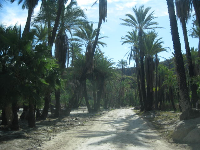
It is about 26 miles from the San Javier highway to San José Comondú and my drive time was about 2 hours. The slow, 4WD section, was the steep up and down grades between Palo Chino and El Horno.
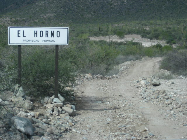
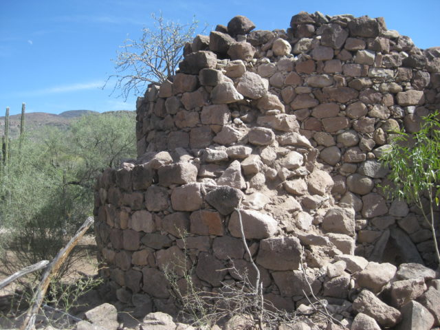
The road improves as you near El Horno. An active ranch is set up next to the giant kiln-oven built in the 1700s to make mortar from limestone to build the mission church at Comondú, the largest church in all California!


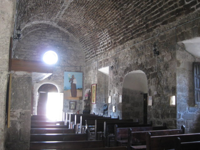
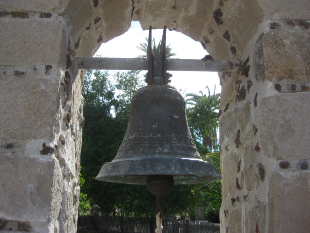
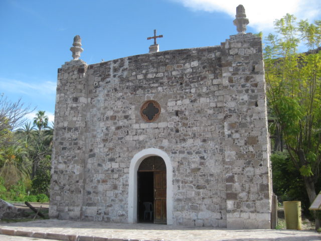
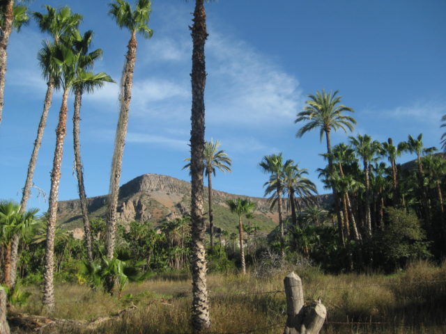
Mission San José de Comondú, founded in 1708 and relocated to this site in 1736 from Comondú Viejo, 22 miles to the north. Stone church buildings erected in the 1750s. All but this side chapel were demolished in 1936.


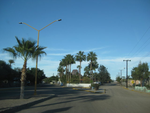
The cobblestone street beyond the mission returns to dirt, the road northwest to San Isidro and La Purísima is passed 0.4 mile from the mission, and the more populated and active town of San Miguel Comondú is reached 1.8 miles beyond the road junction (2.2 miles from the mission).

San Miguel Comondú began over 200 years ago as the visita of San Miguel, attached to Mission San Javier. It was so productive, often producing more food than other missions on the peninsula. Jesuits trained here before going on to work at missions, elsewhere. In 1736, when the Comondú mission moved so close, San Miguel was transferred to it from San Javier.
Today, San Miguel (with Comondú attached to its name) is the larger and more active of the two towns. A small hotel is located here…

Here’s my road log (miles) for the Comondú road (2-4-17):
0.0 San Javier Paved Road (at Km. 27.5)
3.8 Farm/Ranch, both side of road.
4.5 Ranch on left.
5.7 Rancho Monte Alto
6.8 Sideroad, to the left
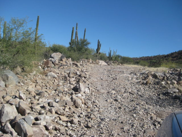
9.0 Palo Chino, abandoned ranch. 4WD recommended beyond here.
13.1 Top of steep grade going down.
14.3 Bottom of steep grade. Road greatly improves.
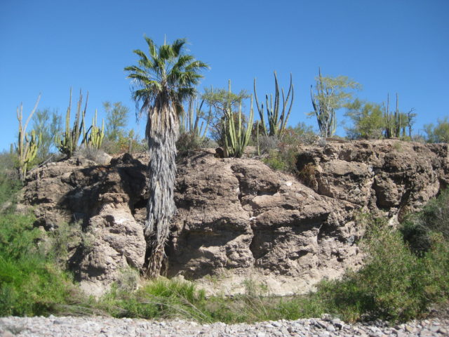
15.1 El Horno, ranch and historic lime kiln.
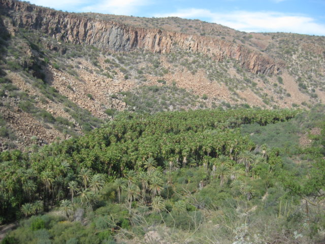
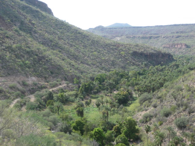
24.6 Top of grade down into Comondú canyon.
25.2 Bottom of grade. enter village of San José Comondú
25.7 Mission San José de Comondú (founded 1708, relocated here 1736)
26.1 Road right to San Isidro and La Purísima
27.9 San Miguel Comondú, Hacienda Don Mario hotel.
A paved road goes south from here to join Highway 1 at Ciudad Insurgentes. I turn around and go back towards San José Comondú, to catch the road to La Purísima. 1.8 miles from the hotel.

DAY 6, continued: (Comondú to La Purísima) Saturday Feb. 4, 2017
Beginning log at the road between the two Comondús: San José and San Miguel, 0.4 mile from the mission or 1.8 miles from the hotel.
The road begins as a narrow lane crossing from the south to the north side of the canyon floor, then begins the climb up and out of the canyon. It is steep, but not 4WD stuff. The road is rough for a couple miles as it leaves the Comondú region.
I didn’t note the mileage, but at the top of the first climb up, near the cemetery, the original road from Tijuana to La Paz (and now serves as a ranch road) joins in from the right. The north end of this section, near where it meets the road from Bahía Concepción, looks very unused… perhaps the floods of recent years have erased it somewhere?
The road north to San Isidro and La Purísima becomes quite good and the second half is even fast. It is just over 18 miles to where it enters the La Purísima valley and the road to Hwy. 1, just south of Bahía Concepción joins in from the right (no signs). It takes me less than an hour to drive from Comondú to here. It is 4.7 miles from the junction to La Purísima (market, restaurant, and motel).
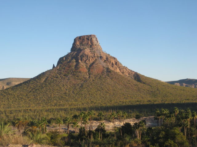
Now heading west, the road soon becomes paved (in 2.3 miles) as one enters the town of San Isidro. I see a sign advertising gasoline. Continuing west on the paved road the majesty of El Pilón, the towering butte in the middle of the valley, makes one want to take photos!
As I enter La Purísima, I see a market on the left (ice for sale) and on the right is the Restaurant Otho with a bunch of off road vehicles parked… and Willy Airstream’s race buggy. I park and go introduce myself to Richard (Willy Airstream). He was surprised, thinking I was older (or look older on my Baja Nomad pics, lol)! I was surprised too, that he was only this far in his run today (4:40pm) as he was going to Comondú… and still did!
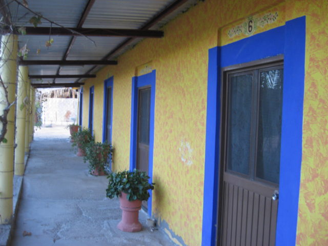
I saw that the little motel Posada del Angel was next door to the restaurant and both businesses were run by a couple of men. The motel I had heard was nice by Roy (‘The squarecircle’) and ‘TW’ (Tom). No wi-fi, but the market has it, if needed.
I first drove around the block to see the mission site, it is a block north of the restaurant and a block back east. There is a sign pointing to it from the paved entrance road to town, the cross street before the market and restaurant.
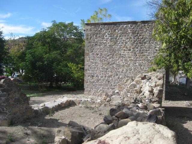
The mission, founded in 1720, fell into ruin after 106 years in operation but appears to have still had a roof and was used by locals, in a 1906 photograph by Arthur North (Camp and Camino in Lower California author). In the 1950s, Howard Gulick (Lower California Guidebook author) shows photos of just a small portion of wall remaining and the crypts next to the mission ruins. Today, just two crypts remain and are all that is left of the once prosperous mission. Next door (west of crypts) is a private home… built on top of where the mission church was and fenced/ walled closed.
I check out the little motel, very basic, but clean, has hot water, and satellite TV with some 500 channels (a few in English including Fox News and CNN)! It is the day before the Super bowl so that is all I am hearing about.
After cleaning up I go next door to have a delicious fish dinner. I also bought three bags of ice from the market to keep my OJ, milk, string cheese, and water bottles cold.
The room was 250 pesos (=$12.50) and the dinner (with a beer) was 125 pesos (=$6.25) + 75 peso tip (as he was closing but made my dinner anyway). I think Willy Airstream’s group an hour earlier had worn him out. He also went to the store to buy my beer and some supplies to make my meal! Otho rocks!
I slept well, and was glad to have the room, it was cold! A family arrived and they were given the room right next door… so I had some kid noise issues, but that didn’t last. The parking is inside the courtyard and the gate was closed when I left in the morning.
End of Day 6… 4 more to go! Now, the photos:


More of La Purísima town:

The motel Posada del Angel:

DAY 7 Sunday Feb. 5, 2017
I get an early start from La Purísima, on the road before 8. The gate for the motel courtyard parking was closed, so nice security measure there.
0.0 Comondú road junction, 4.6 miles east from La Purísima (Restaurant Otho)
1.1 Top of switchback grade out of the valley.
6.2 Sign: Los Narranjos
16.8 Ranch and a Km. 31 post
21.0 Road south (was the original road to La Paz before the 1970s) goes to Rancho San Juan and the hike to Comondú Viejo, the original mission location from 1708 to 1736. See below…
32.0 Highway One (at Km. 59+)


Side trip to San Juan & Comondú Viejo:
0.0 La Purísima Road (11 miles from Hwy. 1/ 26 miles from La Purísima)
0.9 Ranch on right.
1.3 Cattle Guard
2.5 Closed Gate, for cattle control, close behind you.
3.0 Rancho San Cristobal road to right.
4.1 Cattle Guard
4.3 Fork. Go left. Right shows on AAA map to San José Comondú.
Road crosses riverbed and is a bit tough to the ranch. 6.5 Rancho San Juan, an active goat ranch. You may get some stares as this really is the end of the road, being that it is totally obliterated where it once re-crossed the riverbed ahead. Continue ahead, passing baby goat pen.
7.1 Park on the right. Ahead the road ends and there is no easy turnaround. Begin Hike Here. The mission site is just 3/4 mile away. You must cross the riverbed twice. GPS almost mandatory to find the ruins, as they are so heavily overgrown upon.
Photos from the Comondú Viejo side trip:


It was very hard to get good photos as the brush was so thick. I even crawled on my hands and knees to get this close, getting a cholla spine in my knee and back!
This sort of thing has to be big to you to go through this. To me, to see something that dates back to 1708-1736, in the center of Baja, has got to be appreciated before it vanishes.

Popping out from the mission site, I came to the old road. These rock piles were there… A good marker. Go east from here and slightly north to see the ruins.
I walked north on the old road, it vanishes by the riverbed… go across to the west side and walk it north to the crossing near my truck parking spot.


Continue to Day 8 and Mission San Borja, on the next page…