Tijuana to San Quintín sites and the San Pedro Mártir mountain drive.
What was supposed to be a 7 day, final trip, to collect data on the remaining areas of Baja of interest for the road guide and map project… turned out to be a 6 day trip and missed doing Hwy. 3 from Ensenada to Valle de Trinidad plus Laguna Hanson to La Rumorosa.
Why? I will start from the beginning with all my data for those interested:
DAY 1 (WED Oct. 10, 2017)
Left my north San Diego County home at 9 am on Tuesday, October 10. I stopped at Costco, Chula Vista (I-5, exit Palomar street, east to Broadway, north to Costco). Got gasoline and then into the store to exchange dollars for pesos. The rate was 17.40 pesos per dollar. [It was 17.35 last August and 20.20 last January; 18.80 last March; 17.70 last April; 17.80 last June].
My FMM had expired so I stopped at the Tijuana border crossing INM counter to get a new one. 500 pesos and good for 180 days. It took longer than at Mexicali or Tecate as the INM agent does not collect the money as at the other places. One must take the form and walk inside the building to a bank counter to pay, then back to the INM desk.
Maybe 15-20 minutes overall as the banker was not at his desk for a few minutes.
To get the FMM, stay in the right lane, as you are nearing the border… drive over to the giant flagpole and see the covered parking area in front of a large, blue building and park. Walk into the building and through it to the other side and just outside the doors, on the left are the INM counters. Have your passport and reading glasses if you need them. The print is tiny to fill out the form. When you are done simply drive back to the lanes of traffic crossing south then seek out the signs for PLAYAS DE TIJUANA, SCENIC ROAD, ROSARITO once you pass the red light/ green light gate. Red light means you have been selected for a search.
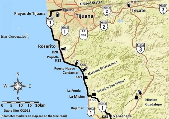
I took notes on the mileage and kilometer markers going south. I used the toll (Scenic) road (Hwy. 1-D) first (a 33 pesos toll) then exited on the south side of Rosarito onto the free road (Hwy. 1).
The road to the south first goes west, along the U.S. border before climbing a steep hill and joins the highway in 3.9 miles. The Playas de Tijuana exit is at 5.1 miles (from the border crossing) and a Km. 9 post is at 5.3 miles. The kilometers are measured along the street through town and not the border wall expressway, so a 1/10 mile difference. The first toll booth is at Km. 11 and I exit the toll road at Km. 34.5… not need to bore you further, as I will add this data to the Baja Nomad Kilometer list thread! The free road has different Kilometer markers, as it uses a shorter route to the border (Km. 0).
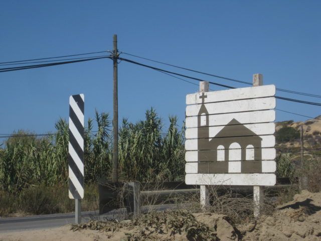
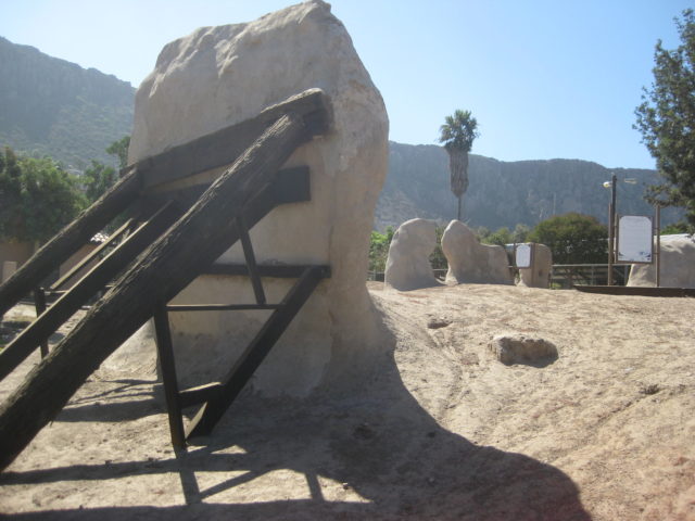
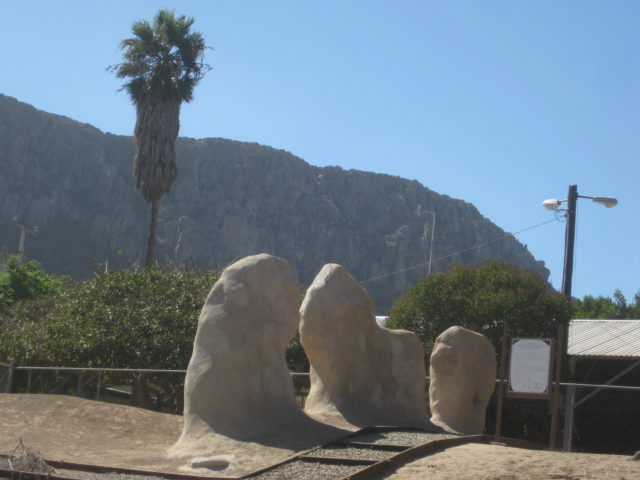
Just beyond the Cantamar sand dunes, see a church sign (at Km. 49) that points the way to the mission site of El Descanso. This was the first ‘Mexican Baja California mission’ as it was founded after Mexico’s independence from Spain. Originally, Descanso was a new location for Mission San Miguel in late 1809 or early 1810 when floods destroyed the fields there. In 1830, Padre Caballero established El Descanso as a new mission. It was short-lived. In 1834, he founded his next mission at Guadalupe and abandoned Descanso and San Miguel.
The mission is located next to a modern church, located just a half mile from Hwy.1 on a dusty road, beyond a school. Park at the church and walk behind it to see the archeological excavation, partially protected by a steel awning.

The original site date, once believed to be 1817, was corrected in 1960 by new research that has escaped many. The padre who moved Mission San Miguel to the hillside just south of here wrote a letter to his superiors that he did so shortly after he arrived at San Miguel (in 1809). An author of Dominican mission history (Peveril Meigs) did not have that letter when he was published in the 1930s, and simply guessed it was about 1817. We now know that by 1817, that padre had already transferred to southern Baja California.


After taking photos and continued south and noted the locations for Splash and the Halfway House, two popular restaurants… very close to each other (around Km. 52.5.)
The next California mission going south is not far away and right on Hwy. 1…
Staying on the free road, it goes from 4 lanes to 2 lanes just before the Descanso mission road and gives you an early taste for the highway south of Ensenada and Maneadero.
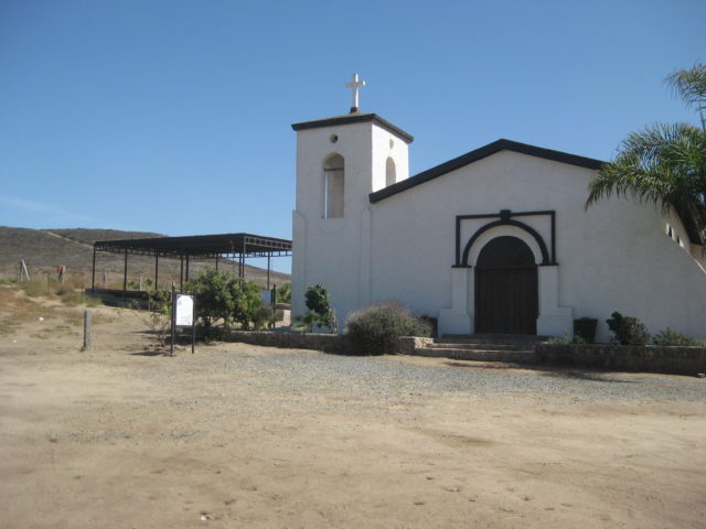
The town of La Misión is at Km. 65 and the mission, for which the town gets its name is at Km. 65.5, on the left, in a schoolyard. It is fenced off from the kids, but to get close to it, you need to enter the school grounds. When I was there, the kids were at recess and playing all around. So, I walked alongside the mission and took photos through or over the chain-link fence.


Mission San Miguel Arcángel was founded in 1787 by the Dominican missionary Luis Sales, 7 miles east of here, overlooking an oak tree canyon. At the invitation of an Indian chief who was bitten by a rattlesnake and treated by the padre, the mission moved to his village the following year. That location was known as San Juan Bautista by the Franciscans who passed through in 1769 on their way to establish San Diego. The native name was Ja-kwatl-jap (for the tribe’s hot springs there).
It is this fascinating history that inspired me to write Baja California Land of Missions, published last year. Baja continues to be a source of interest!
Passing on from La Misión, the paved cut across road to Guadalupe Valley and Hwy. 3 is at Km. 83.
The free road and toll roads merge just after Km. 95, and the next kilometer marker is on the 4 lane highway and is Km. 100, in reality just a half kilometer southbound from Km. 95 on the free road.
Km. 101.5 is the junction with Hwy. 3 to Tecate.
Km. 107 is the split in the highway with the Tourist Zone and San Quintín or San Felipe bound travelers recommended to take the right fork.
Km. 110 post is just as you near the Ensenada harbor and 1/2 mile ahead is the fork (and first signal light in this city), right to parallel the waterfront and continue south (a Pemex station is over on the left of this Y in the road.
The signed Hwy. 3 to San Felipe is 1.5 miles from the signal at the Y and 0.4 mile beyond is the left turn to get on Hwy. 1 south. It is signed here for La Bufadora and the street name is Estancia. This seems to be the newer, less congested way to get south. A right turn is made in another 0.4 mile (Pemex on the right and a Soriana store is across the intersection). Now you are back on Highway 1, southbound!
Crossing any city is not fun with traffic and so many stop lights… which all seem to turn red when you arrive!
I made more mileage notes heading south (Estero Beach access, Baja Country Club, and San Carlos Hot Springs road) as I did not see any kilometer markers until Maneadero. Very likely they were hidden by parked cars or simply not there, as is the case in other populated areas.
‘bajaguy’ invited me to stop by and show me the hot springs. Sadly, I was running about 2 hours behind schedule and had to get a rain check.
The highway from Maneadero to Punta Banda and La Bufadora is just over 13 miles, and the tourist shops at the end of the road were just a zoo. There were busloads of tourists there, so I just GPS’d the spot and made a U-Turn as soon as I could!

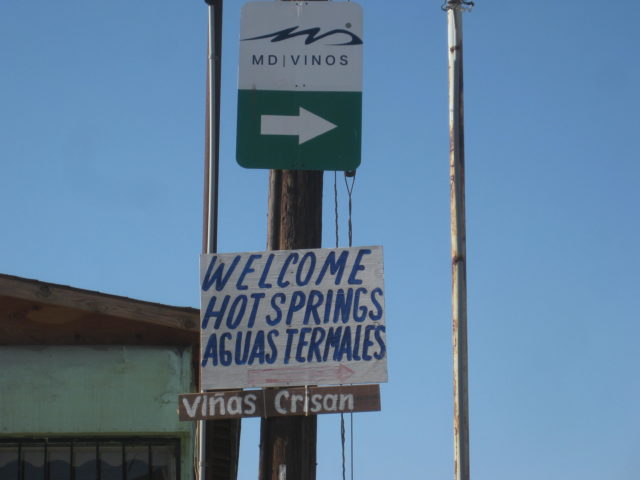
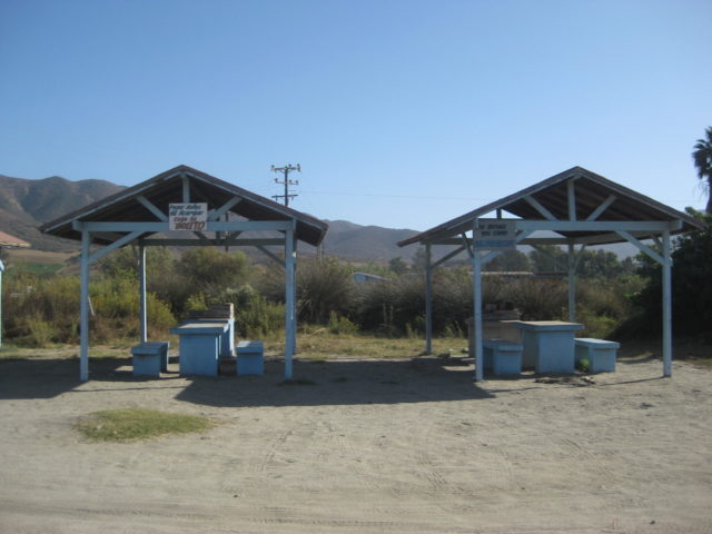
Next, I pulled off at Ejido Uruapan (Km. 41.5) to take a quick look at the hot springs advertised there. The pavement ends in 0.8 mile, turn left (well signed) and 1.9 miles from Hwy. 1 you arrive at the hot springs. There are bathhouses for men and for women, a few palapas for picnicking, and several washing machines and clotheslines! I guess hot water here is more prized for laundry use than for soaking!
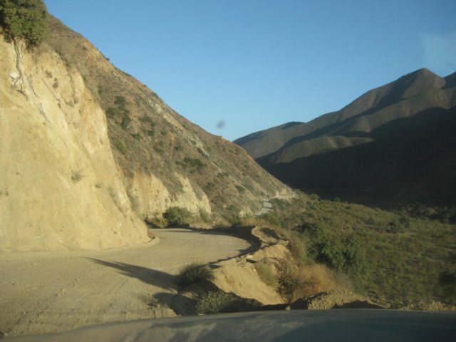
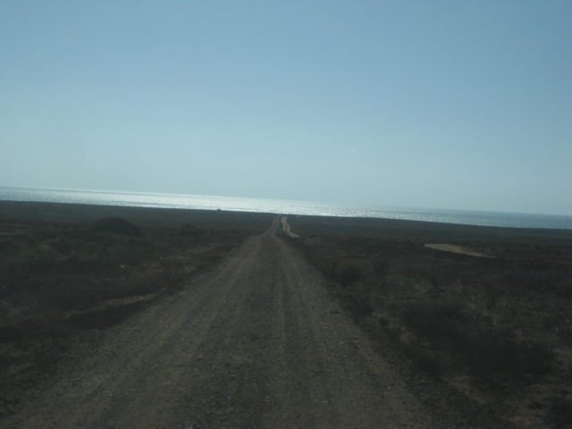
The sun was dropping and I had to see one other spot before arriving at my destination for the next two nights, La Bocana at the end of Arroyo Santo Tomás. The road is at Km. 47 and once beyond the ejido at the junction (El Ajusco) the graded dirt road was very smooth. There was a lot of traffic that afternoon and lots of blind curves, so no high speed. It is 28 kms. or about 17 miles from Hwy. 1 to the beach at La Bocana. The location was almost ghostly with empty homes, yet there is so much potential here.

On the way out, I was saddened to find that the oak tree picnic area (fork 3.6 miles from Hwy. 1) and location of the first Santo Tomás mission has been closed and fenced off. The creek that once ran by it was dry and sadly we come to realize that things don’t always last. One must enjoy places while they are available!
The second Santo Tomás mission site was in a plowed field on the north side of the road (2.8 miles from Hwy. 1)… It has been obliterated by farming. I took photos of the remains in 2009 and saw on 2012 satellite imagery that the pepper fields looked freshly plowed and no longer was the soil and rocks from the adobe mission visible as on previous satellite images.
The third and final mission location (near the El Palomar campground in the town of Santo Tomás) is also nearly vanished. I had lunch there a few months ago. All three mission locations for this, the last mission to be operational in the Californias (abandoned in 1849), will be only saved in photos… too bad INAH or private concerns did nothing to preserve the ruins of these sites.

My destination tonight was San Vicente, another Spanish mission colony, founded in 1780. A very nice motel called El Camino is on the left, on the far side of town.
DAY 2 (THU Oct. 11):
I met ‘bajatrailrider’ (Larry) on Ken Cooke’s 2015 Pole Line Road run. Larry lives full time in San Vicente and has been providing off-road motorcycle guide service for many years. Larry was kind enough to insist I be his (and Andrea’s) guest and he would show me a few sites in the area that may make interesting material for the Baja Bound Road Guide I have been producing this year.
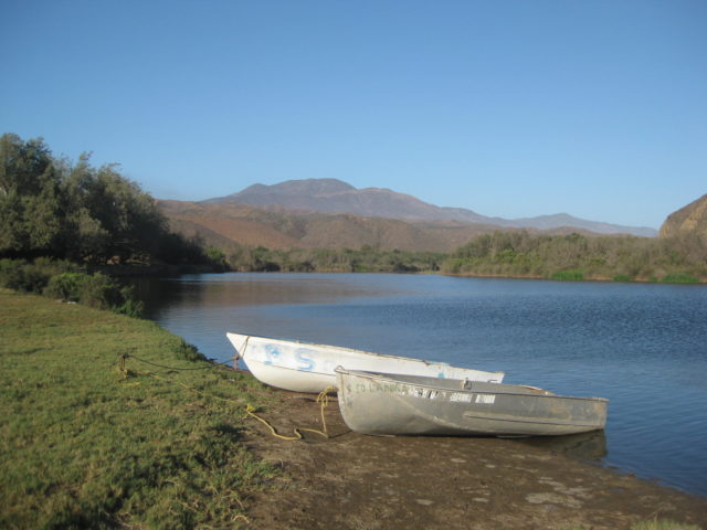
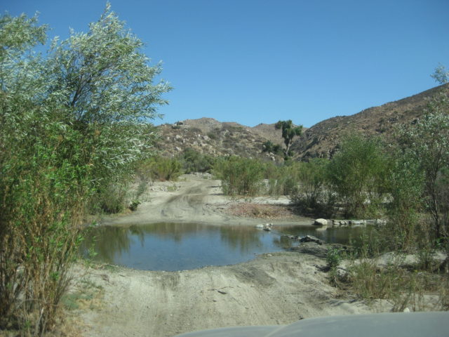
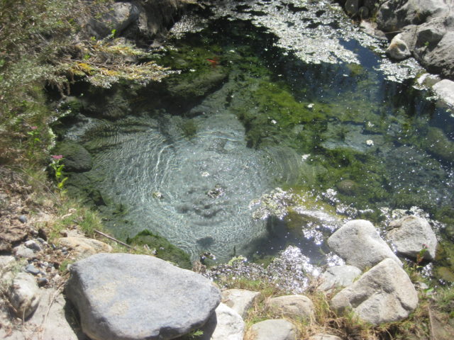
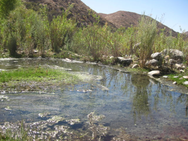
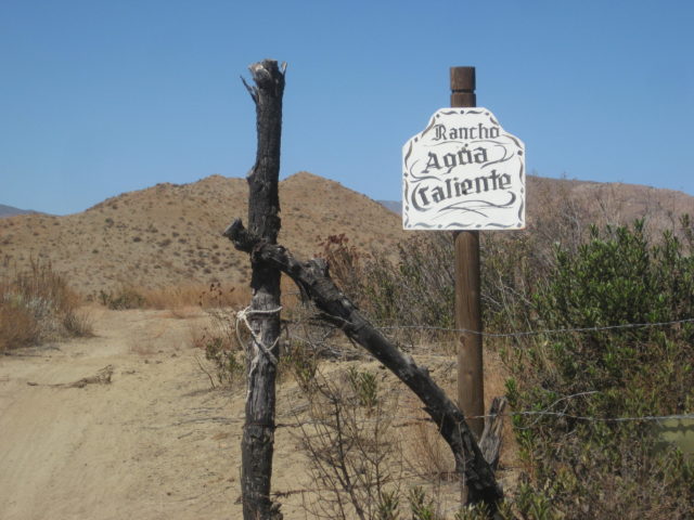
Rancho Agua Caliente and at least three source hot springs are 12 miles by 4WD road from San Vicente. The hot springs have been published as far back as the 1958 edition of the Lower California Guidebook. The ranch there is not occupied but is owned by a friend of Larry’s in San Vicente.
The hot springs are not developed at all. So, bring picks and shovels if you want to bathe here! They are along the south bank of Arroyo San Vicente and another, not as hot spring is by the ranch on the north side of the arroyo. The south springs felt to me to be about 90°-100° and the water rises in the pool with enough force to cause the sand to spin. There are some gas bubbles as well. No sulfur odor was detected, which is a nice surprise.

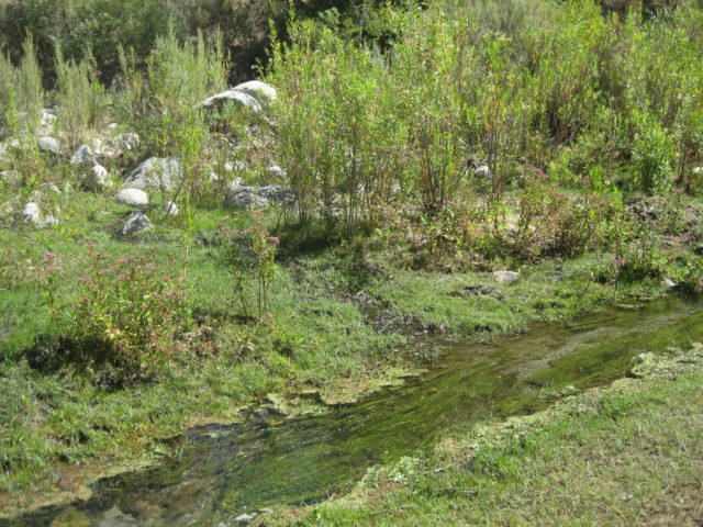
About 1000 feet downstream (west) one comes to…
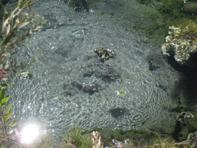

A hot stream drops down to a cool mountain stream… Natural hot and cold running water!:
We drive out on the road to the south and return to San Vicente for lunch at an excellent place, Mi Ranchita. It is located on the road to the mission (Km. 88.5), north of the highway bridge.
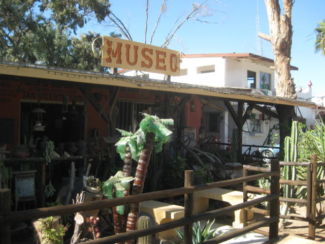
After lunch, we visit the town museum… Did you know San Vicente has a museum? Turn west at the north side of the town plaza and it is down on the right.


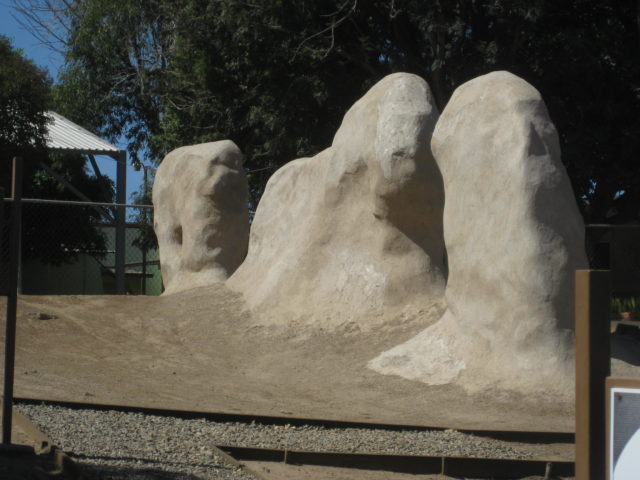
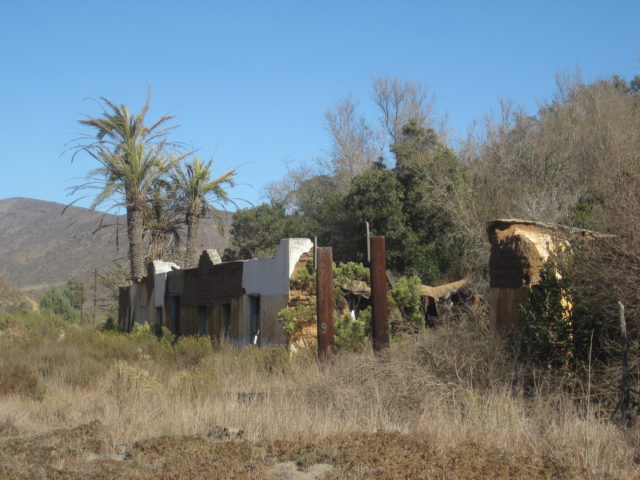
Larry guides me down the river valley towards Erendira to these ruins…
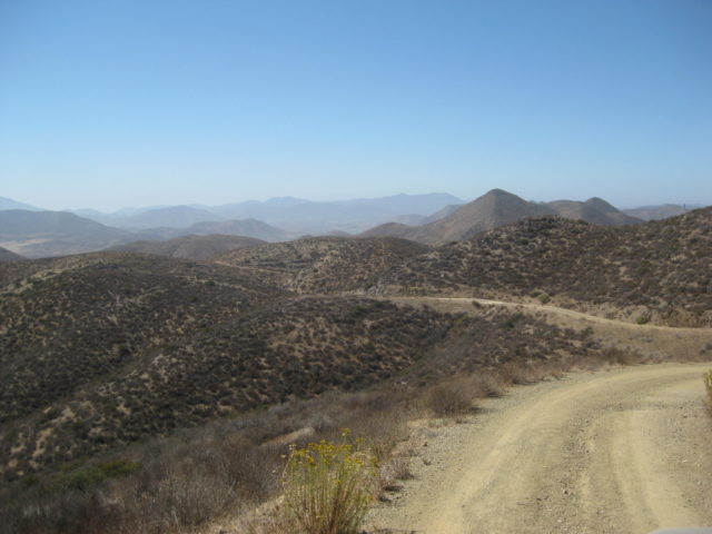
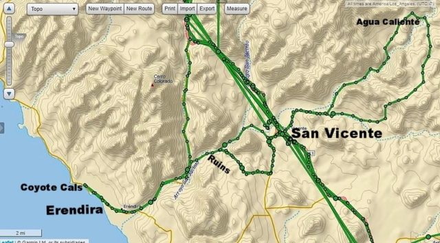
We return to town via another route. Here is my GPS track map of the area and routes to the hot springs:


DAY 3 (Thursday Oct. 12, 2017)
I say goodbye to Larry and Andrea’s hospitality and drive north 7 miles to Km. 79 and get on the paved Ejido Eréndira road.
At Km. 10 is the dirt road left that goes directly back to San Vicente, passing those ruins we looked at yesterday. If you go that way, turn right at 0.3 mi and cross the arroyo (the road straight ahead dead ends at a ranch). The ruins are 1.0 mile from the paved Eréndira road.
Km. 16.5+ is the road south to Malibu Beach Sur, once a popular RV park and now more of a vacation home area.
Km. 17 Enter Ejido Eréndira, a large farming town.
Km. 19 Motel Eréndira at the far side of town, pavement ends in 500 feet.
In 0.7 mile from the pavement is Castro’s sportfishing center (motel rooms, guided fishing trips).
1.0 mile from the pavement is ‘Camping Manriquez’.
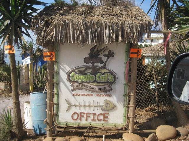
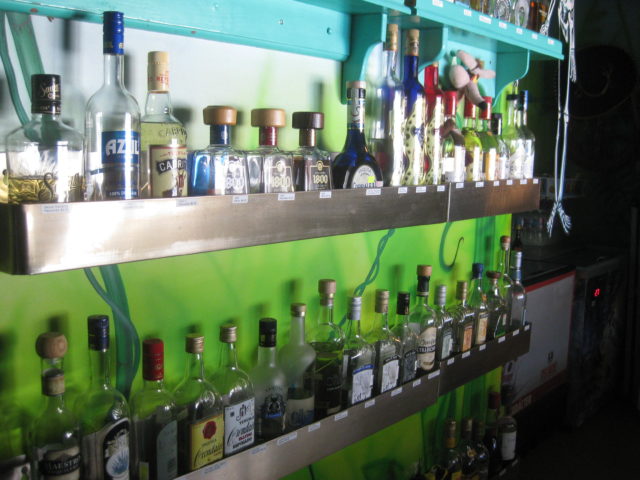
1.8 miles from the pavement is Coyote Cal’s Hostel and Camping and Massage. Operated by Rick and Ta with immaculate services for off-the-grid conditions. The bar here is fully stocked and the food service sounds amazing. I suggest you visit their website: www.coyotecals.com
This establishment is friendly to both hitchhikers and off-road racers, as well as all other world travelers.


After leaving Coyote Cal’s I return to Highway 1 via the dirt road past the ruins. I heard there were pictographs along the north side of the canyon but after some searching, I had to move on!
Traveling south, my next sideroad to check was to San Antonio del Mar, west of Colonet.
This was a popular place my family went fishing to, in the 1960s. I remember giant sand dunes sliding down when I wasn’t catching corbina in the surf with mom and dad! The pavement south of Ensenada ended a few miles north of Colonet back then. Bradley’s Service Station and the Flying Samaritans clinic was at the junction back then.
Today, the road is unmarked except for a poorly placed sign on the highway, well north of the actual road. The road is at Km. 126.5+ and just north of the bridge over the San Rafael Riverbed. The main part of the town of Colonet is south of the bridge. The road is an easy graded one and crosses a mesa before dropping down to a crossroad at Mile 4.5. To the right is the Johnson Ranch (The original San Antonio Del Mar) that dates back to the early 1900s when the Johnson and Meling families came to this part of Baja California.
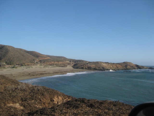
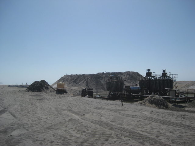
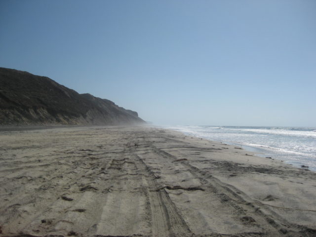
At Mile 5.1 is a Y. The right fork goes west to the beach at the abandoned fish camp San Antonio del Mar and just beyond, near the sea is a mining operation extracting titanium (?) from beach sand.
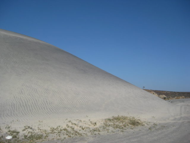
I go back to the fork in the road, and go 1.3 miles on the left (south) fork and pass the big sand dunes I remember as a kid and there is a burro eating some grass here.


I remember playing here, 50 years ago.
The last time camping here was in 1980.
The fish camp is gone and the nearby beach mining is new, otherwise it still looks about the same!
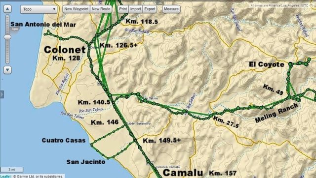
It is an easy 5.2-mile drive from Km. 146, Jaramillo, on Hwy. 1 to the coast. The road is the signed turnoff for CUATRO CASAS. However, at the end of the road is just a rocky beach and NO CASAS ![]() . I turn south and follow the coast.
. I turn south and follow the coast.


The road south from Cuatro Casas to San Jacinto. Many people are mining the coast for beach rocks used in decorative gardening and landscaping. See these stones at a Home Depot or Lowes near you!
2.2 miles south on the coast road is a camping place called Las Lagunitas.
3.0 miles south is the shipwreck at San Jacinto, several beach homes.
3.6 miles, a road heads east, back to Hwy. 1 (4.0 miles) at Km. 149.5+.
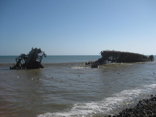
Here is the ship when it ran aground in 1982, The Isla del Carmen.


South on Highway 1 to Km. 169+ and the signed road east to Mission Santo Domingo (founded in 1775). It is 4.6 miles to the mission and the road is wide and graded, but pretty bumpy. This large red hill on the south side of the arroyo is where the Dominicans first had services, in a cave at the base. The mission was moved up the canyon by 1798 for better water and farming potential.

There is an HR painted up on the mountain, right side 2/3 way up, that stands for ‘Hamilton Ranch’. This was a popular fly-in guest ranch often frequented by Hollywood types to party as they wished without being photographed. The remains of the cabins near the runway and near that hill have all been removed, I was told. I drove across the riverbed to get a close look and saw nothing. They were in the group of trees still there. Erle Stanley Gardner often stayed at the Hamilton Ranch and wrote about the place in the 1960s.
MISSION SANTO DOMINGO in 2017:


Back out to Hwy. 1 as the sun gets low in the sky, I have to think about where I am going to spend the night, as part of my research I go to the nearby Posada Don Diego at Km. 173, and 0.6 mile in (west).
I have stayed here a couple times back in the 1980s with Tom Miller’s Mexico West Travelers Club. In fact, I met the future mother of my children there! She was also with the Mexico West group traveling with her parents… that was in 1984!
Well, much has changed since 1984, including the RV Park that was at Posada Don Diego. The place was empty with only the restaurant there looking filled with many cars in front. I know the owner is a Nomad “Irene”, but she hasn’t posted in a long time. I don’t want to be the only camper and all the trees were gone, I just wouldn’t rest easy in my tent, I thought. The other RV park that used to be near the highway in Colonia Vicente Guerrero, Meson Don Pepe (?), has vanished or I couldn’t find it.
I was going as far as San Quintín for this research trip. With only 30 more miles to El Rosario, I used my inReach device to ask Antonio if he had a vacancy that night at his Baja Cactus Motel (admittedly the finest run and most comfortable motel along the 1,000 miles of Highway 1). I was in luck, but sadly, Antonio was in Tijuana, so I wouldn’t be able to visit with him.
I was a dozen miles from El Rosario when I crested a hill on the long, straight road, only to see a Federal Highway Police holding a radar gun toward me and stopped me. So be careful, the ridiculously slow 80 kph (49.6 mph) is enforced here! I was going closer to 60 at the moment, and not in any hurry, just cruising and listening to my XM Radio.
The officer was super cool, I apologized, told him I must have been anxious to get to my comfortable room in El Rosario and didn’t pay attention to my speed. His English was good, he even showed me how his radar gun worked, pointed at other motorists. I was let go. I asked if he wanted a cold water bottle, and he accepted. Officer Juan and I are amigos now!
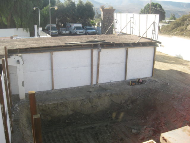
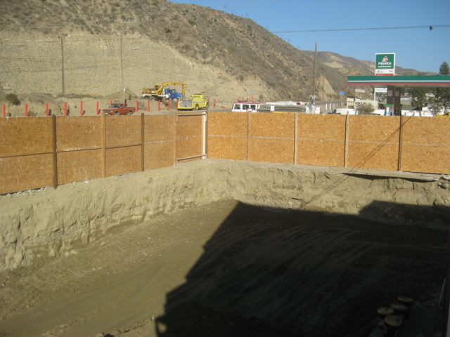
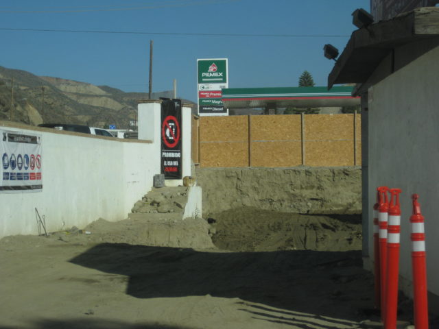
I arrive at Baja Cactus and see a big construction project going on in the front of the motel. The office is now accessed from the parking lot on the south. This construction is for Antonio’s new restaurant. The building will also block highway noise to the motel.
End of DAY 3 Report.
Coming up on the next page, Sierra San Pedro Mártir National Park, and camping at 8,200 feet.