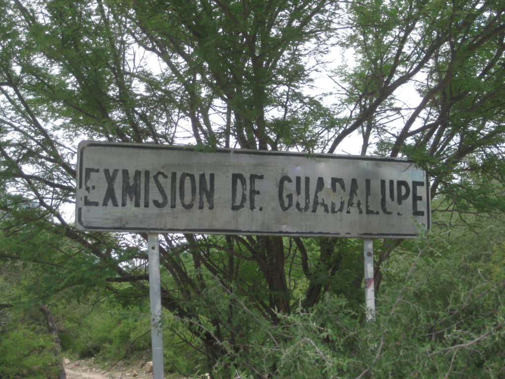
Full name: Nuestra Señora de Guadalupe de Huasinapí
Founding date: December 12, 1720 Mission #8
Catholic Order: Jesuit
Founded by: Padre Everarado Helen
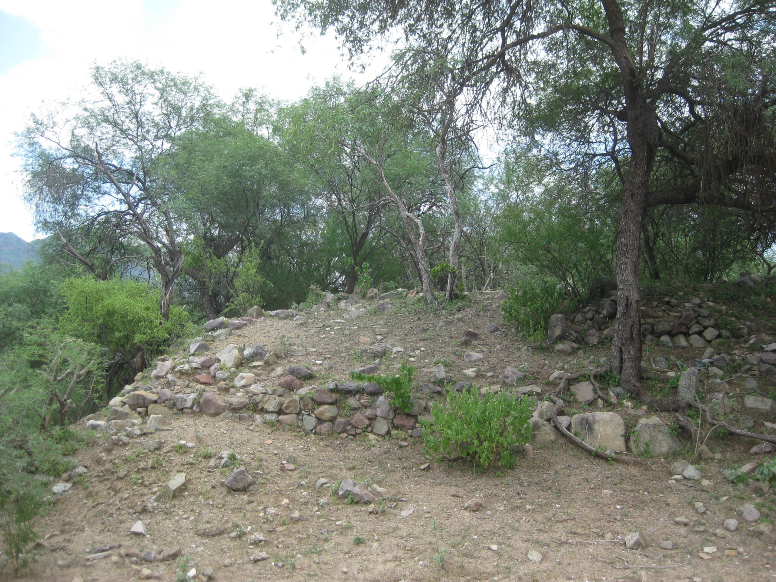
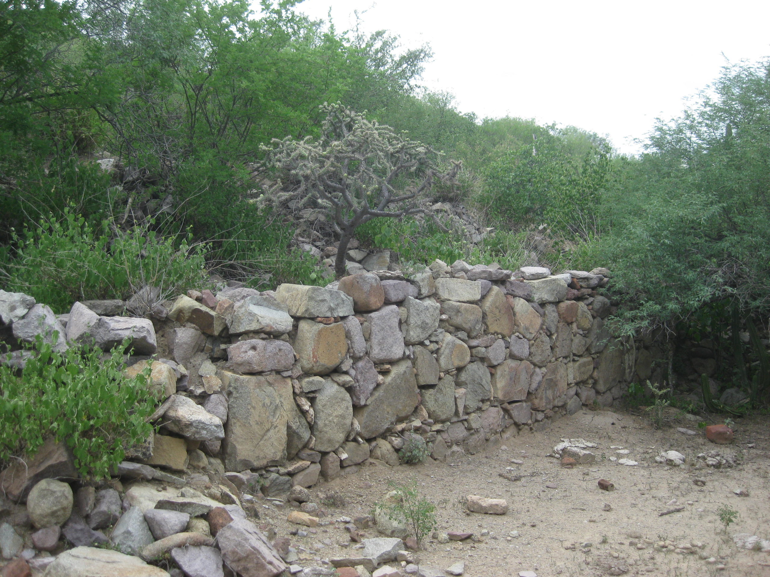
Condition: Ruins from the 1750s.
Closing date: Closed in 1795.
GPS: 26.918403, -112.405787
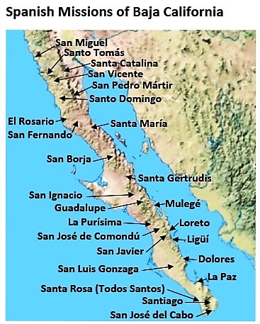
Access: Mex. #1 Km. 131.5 (Mulegé) east & north 41 miles.
Read more: HERE
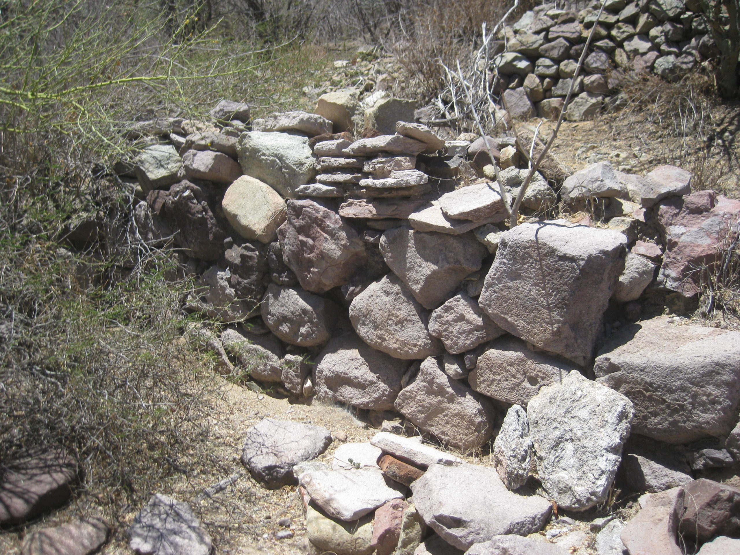
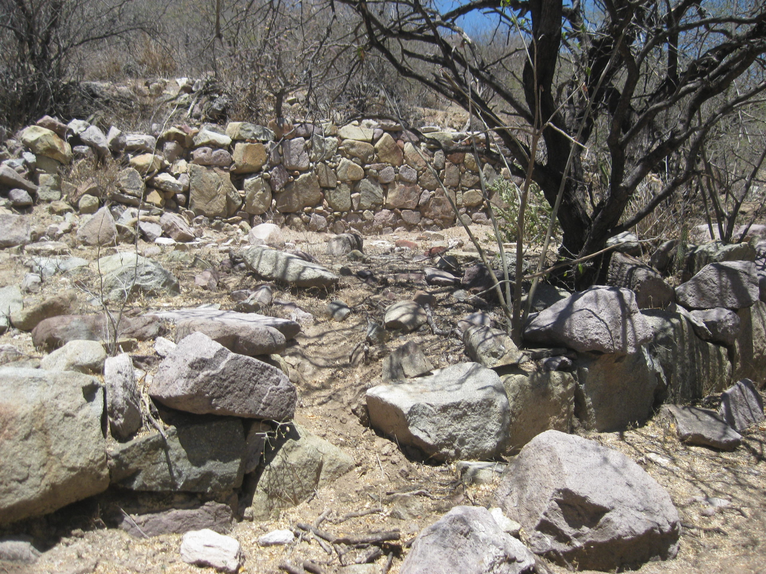
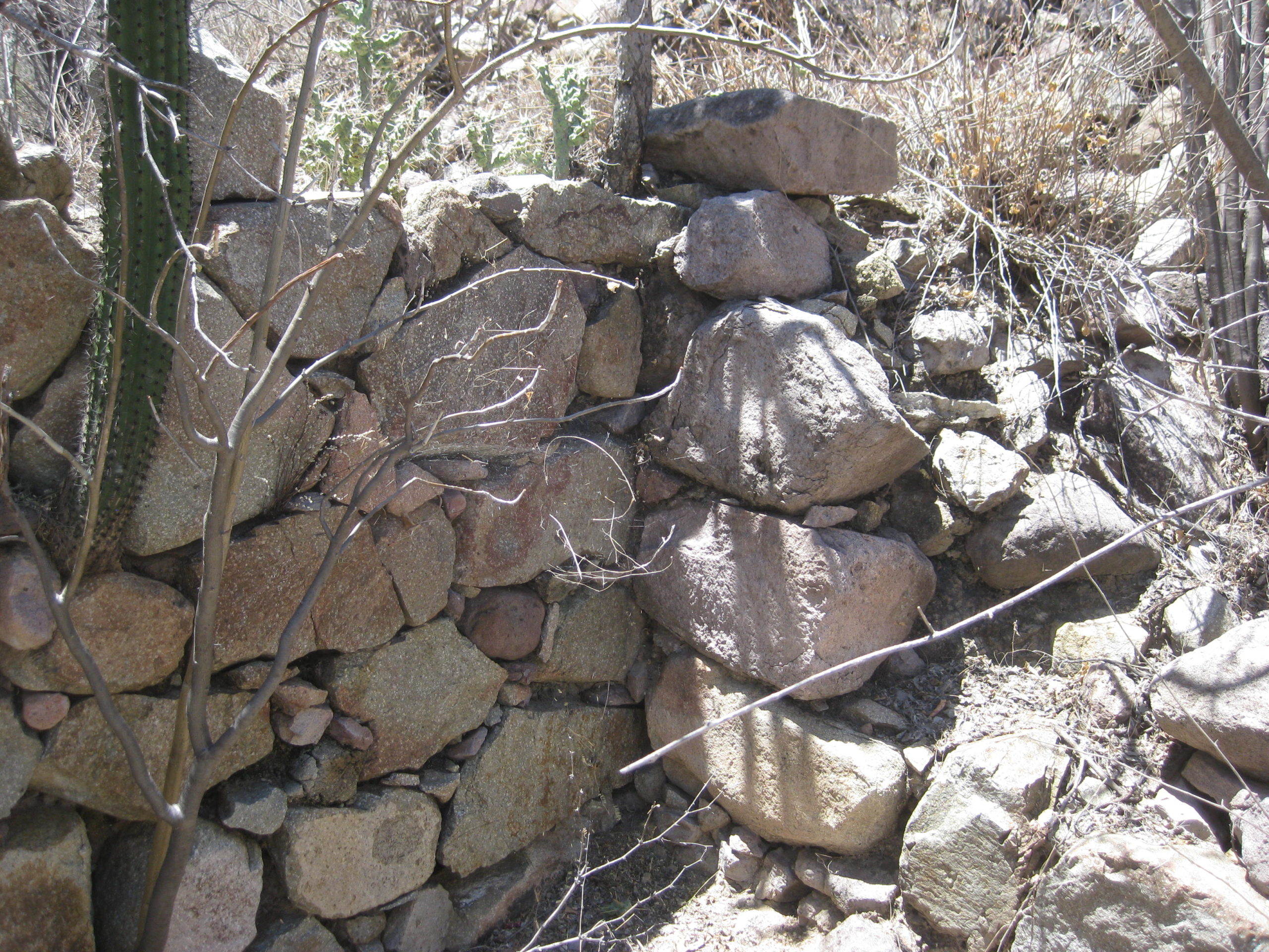
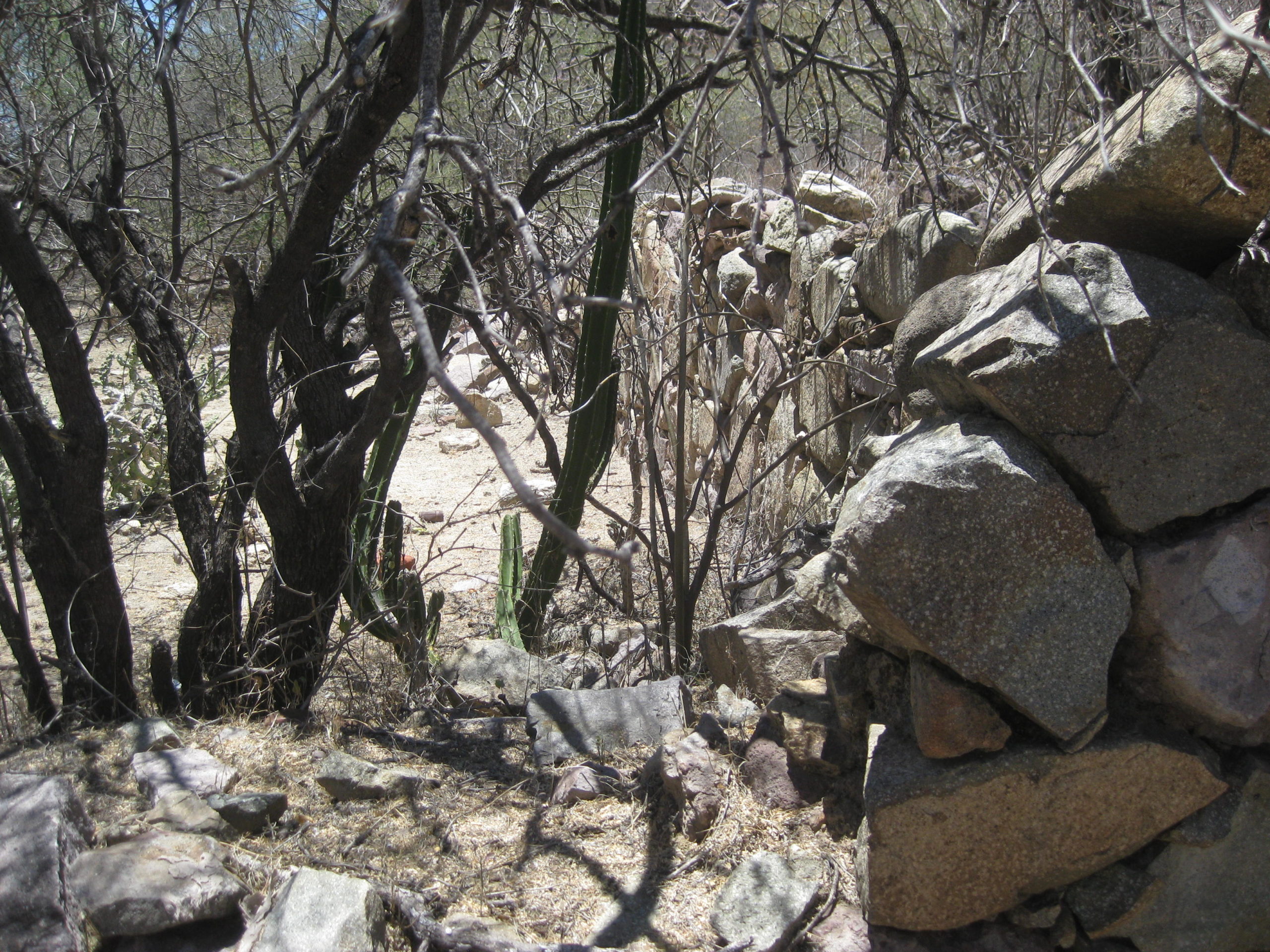
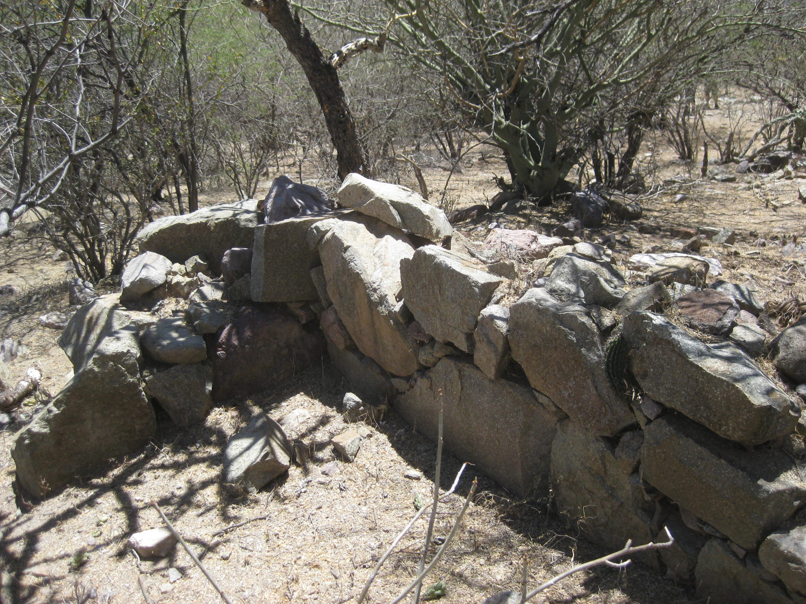
May 2019 drone photos of mission site by Jimmy Lee Cook


May 2019 photos by David Kier


View right: Compare with Max Kurillo’s photo from 1996:
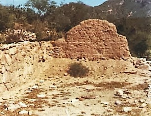
View left: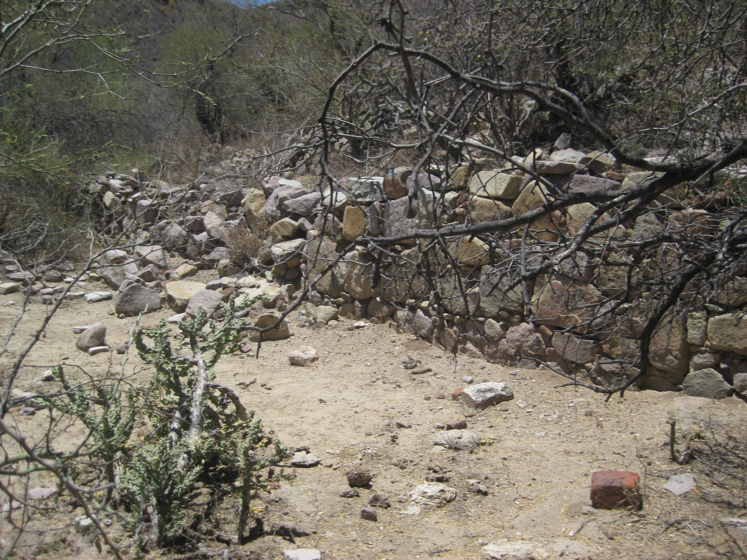 Compare with Ed Vernon’s photo from 20 years earlier:

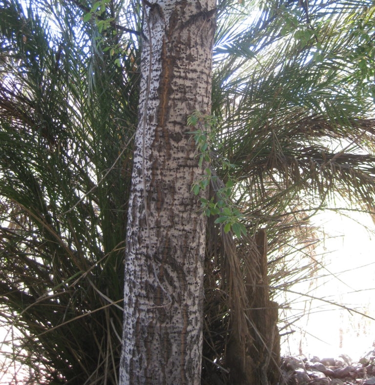
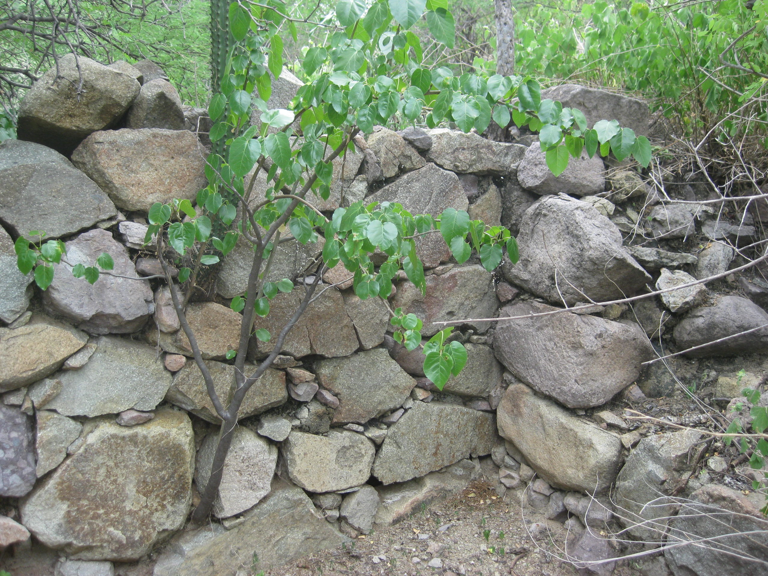
The Güéribo tree was the reason the Jesuits came to these mountains, 300 years ago (1719). They were used to build a ship, El Triunfo de la Cruz. The next two photos (taken in 2019) are of a güéribo tree growing next to the mission site. The ship timbers were harvested a few miles north of here: https://www.dstretch.com/CNPSGueribo/

August 2017 photos by David Kier


1999 photo by Edward Vernon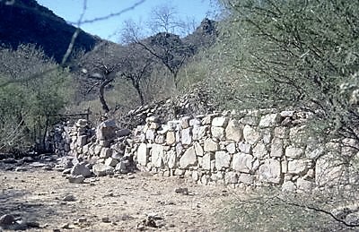
1996 photos by Max Kurillo
1953 photo by Howard Gulick

MULEGE TO MISSION GUADALUPE, 40.5 miles, 4 hours (2017 data)
Total / Partial Miles
0.0 / 0.0 Hwy. 1 Mulegé, Km. 135.5 Take concrete street going west, known locally as the “Ice Road” as it passes an ice plant.
1.1 / 1.1 End of pavement
2.4 / 1.3 Construction equipment yard, continue west.
2.7 / 0.3 Fork. Ahead is the original road, but rocky. Left (south) is an alternate.
5.1 / 2.4 Cattle Guard
6.0 / 0.9 The alternate road junctions in from left.
8.3 / 2.3 Rancho Trinidad junction, south (small sign). Take right fork.
11.1 / 2.8 Rancho Trinidad junction, south (big signs). Continue west.
The road enters a canyon and begins a steep climb with one concrete section of road.
24.6 / 13.5 Rancho El Aguajito
25.0 / 0.4 La Ballena Fork. Turn north for Guadalupe. Big signs. Ahead goes to San Miguel and on to the Pacific side of the peninsula.
25.8 / 0.8 Gate (always reclose behind you)
34.1 / 8.3 Fork. Go right. Left to ranch.
34.7 / 0.6 Gate.
36.9 / 2.2 Gate.
40.0 / 3.1 Road west. Once was passable to San Ignacio via Las Tunas and El Patrocinio. Inquire locally for conditions.
40.1 / 0.1 Gate.
40.5 / 0.4 EX-MISION de GUADALUPE sign, turn left, cross arroyo, park near gate on the right. A second access road is 300 yards ahead and in 2019 was easier to pass through, on foot.
The gate was wired shut, but no signs were posted. The road beyond the gate was going to have some concrete pillars along it leading to the possible museum structure at the end of the road. The project was abandoned. The mission ruins are just north and west, uphill of the cinder block building area. Take your time and make discoveries. As with all historical sites, take only photos and leave only footprints. If you are not comfortable going through the fence, seek a guide at one of the nearby ranches.
I hope this was interesting or informative for you! Please be welcome to join our Baja California Land of Missions Book Group, on Facebook: HERE
- All the missions, quick look and history, north to south: HERE
- Other mission photo pages plus more Baja California history: HERE
- VivaBaja.com home page
![]()
![]()
The following chapter is from my book, Baja California Land of Missions Order your own copy from Amazon Books: HERE
#8 Nuestra Señora de Guadalupe de Huasinapí (1720-1795)
The history of the eighth California mission began in 1719 when Padre Juan de Ugarte discovered a forest of güérivo trees (Populus brandegeei) from which he could construct California’s first ship, El Triunfo de la Cruz. According to the missionaries, the Cochimí Indians of the region (who helped cut and transport the lumber) requested a mission of their own.
On December 26, 1720, Jesuit Padre Everardo Hellen arrived at the Indian settlement of Huasinapí and began to establish the mountain mission. Padre Hellen served at Guadalupe for fifteen years, except when he was ill and removed to rest at Mulegé in 1724, and once again in 1726. Over 2,000 natives were baptized by the Jesuits here in those first fifteen years at Mission Guadalupe.
Just two years after its founding, the people of Guadalupe mission suffered the destruction of crops and native fruits (pitahayas, berries, etc.) by swarms of locusts. The food stores of wheat and corn at the mission helped save them from starvation. The Cochimí neophytes also gathered up dead grasshoppers, then dried and cooked them to supplement their diet. Sadly, dysentery broke out from that action and many lost their lives.
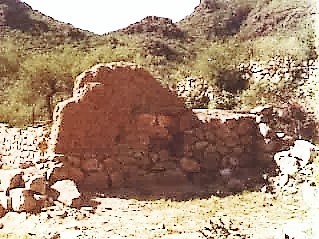
The mission church floor was tiled, and a 1744 report by Padre Juan Antonio Balthasar said that Guadalupe had “the finest church in California.” Tragedy followed heavy rains in November 1744 when a mission wall collapsed and killed 100 neophytes. A new stone and adobe mission church was built around 1750 and it is those foundation stones that can be seen today.
Unfortunately, the diseases introduced by the Europeans decimated the native California population and the Guadalupe mission was abandoned in 1795. The surviving seventy-four neophytes were transferred to La Purísima.
In 1834, another mission named Guadalupe was founded in the far north area of Baja California. To avoid confusion, that northern mission is typically called “Guadalupe del Norte.” The 1720 mission in the south became known as “Guadalupe del Sur” or known locally as “Ex-misión de Guadalupe.”
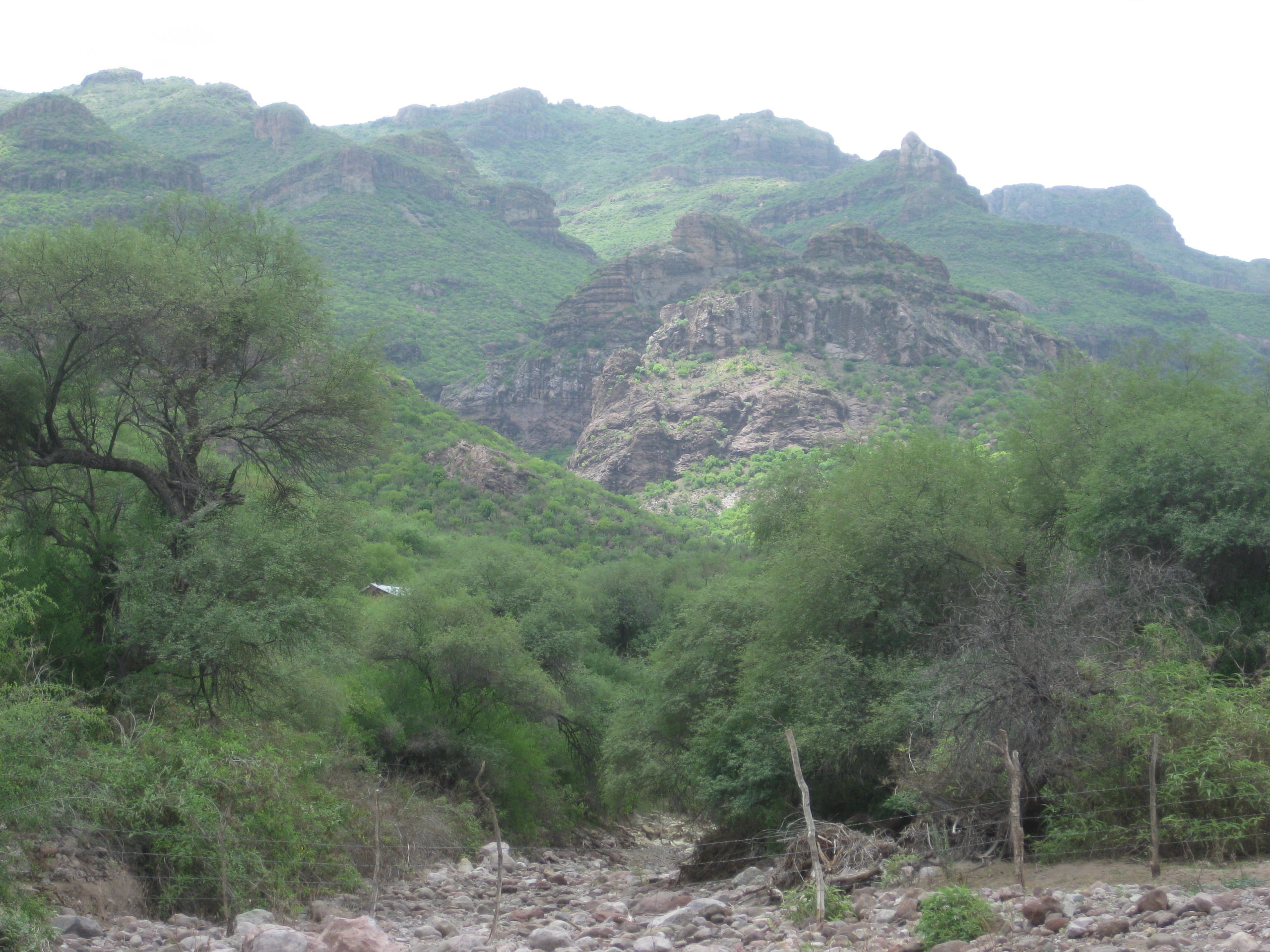
Guadalupe de Huasinapí is accessed by a dirt road from Mulegé. Take it twenty-five miles west and then fifteen more miles north. A 30-mile-long, steep dirt road to Guadalupe from San José de Magdalena, leaves Highway One at Km. 168. A local guide may be required to locate the ruins.
Missionaries recorded at Guadalupe:
Jesuit
Everarado Hellen 1720-1735
Ignacio Nápoli 1724
Francisco Osorio 1726
Joseph Gasteiger 1735-1754
Benno Ducrue 1755-1768
Franciscan
Juan Sancho de la Torre April 5, 1768
Andrés Villaumbrales 1770
Manuel Lago 1771-1772
Dominican
José Santolárria and Nicolás Muñóz May 15, 1773
Luis Sáles 1773-1778
Joaquín Valero 1783
Rafaél Arviña 1792-1795
See the other mission pages: https://vivabaja.com/baja-mission-albums/