Full name: Nuestra Señora de los Dolores
Founding date: August 2, 1721 (relocated 15 miles southwest in 1741 to La Pasión) Mission #9
Catholic Order: Jesuit
Founded by: Padre Clemente Guillén
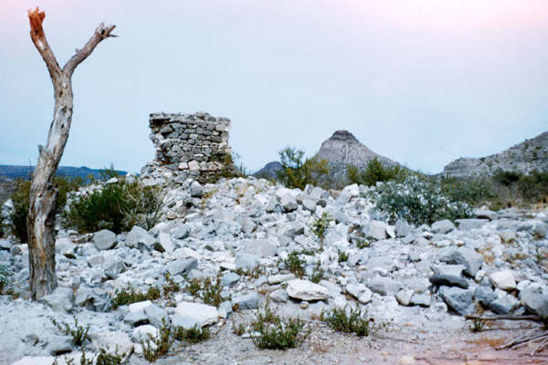
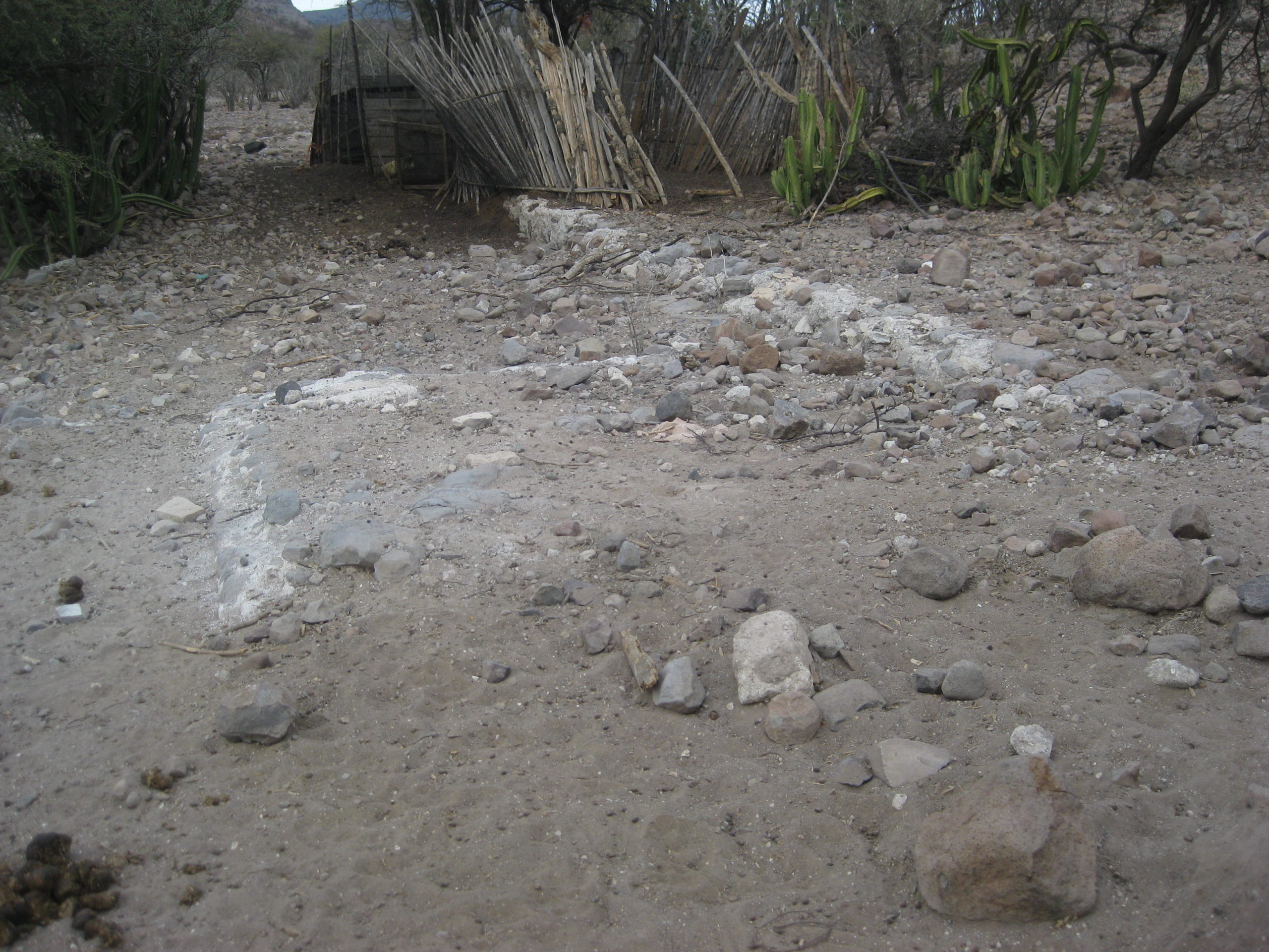
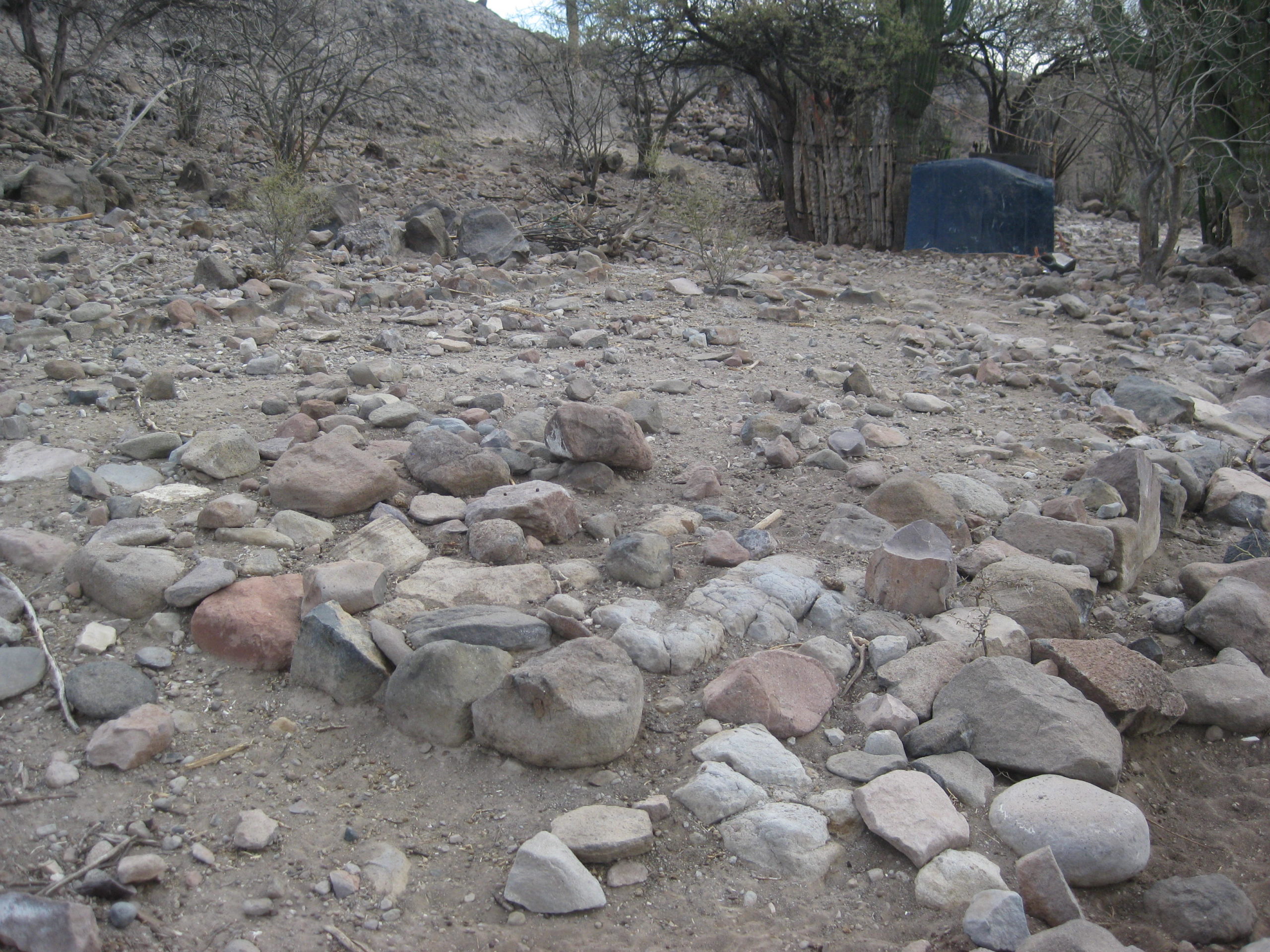
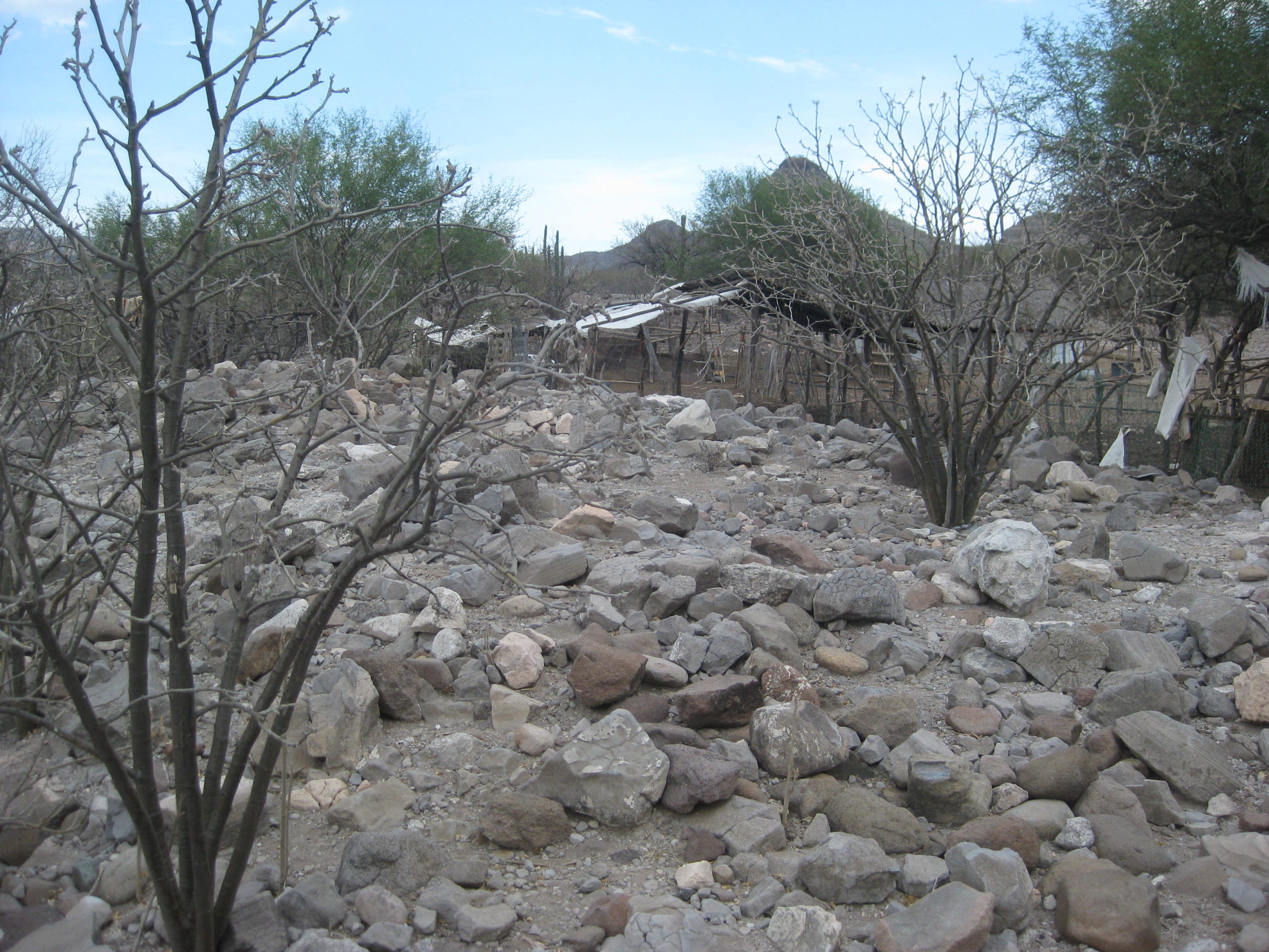
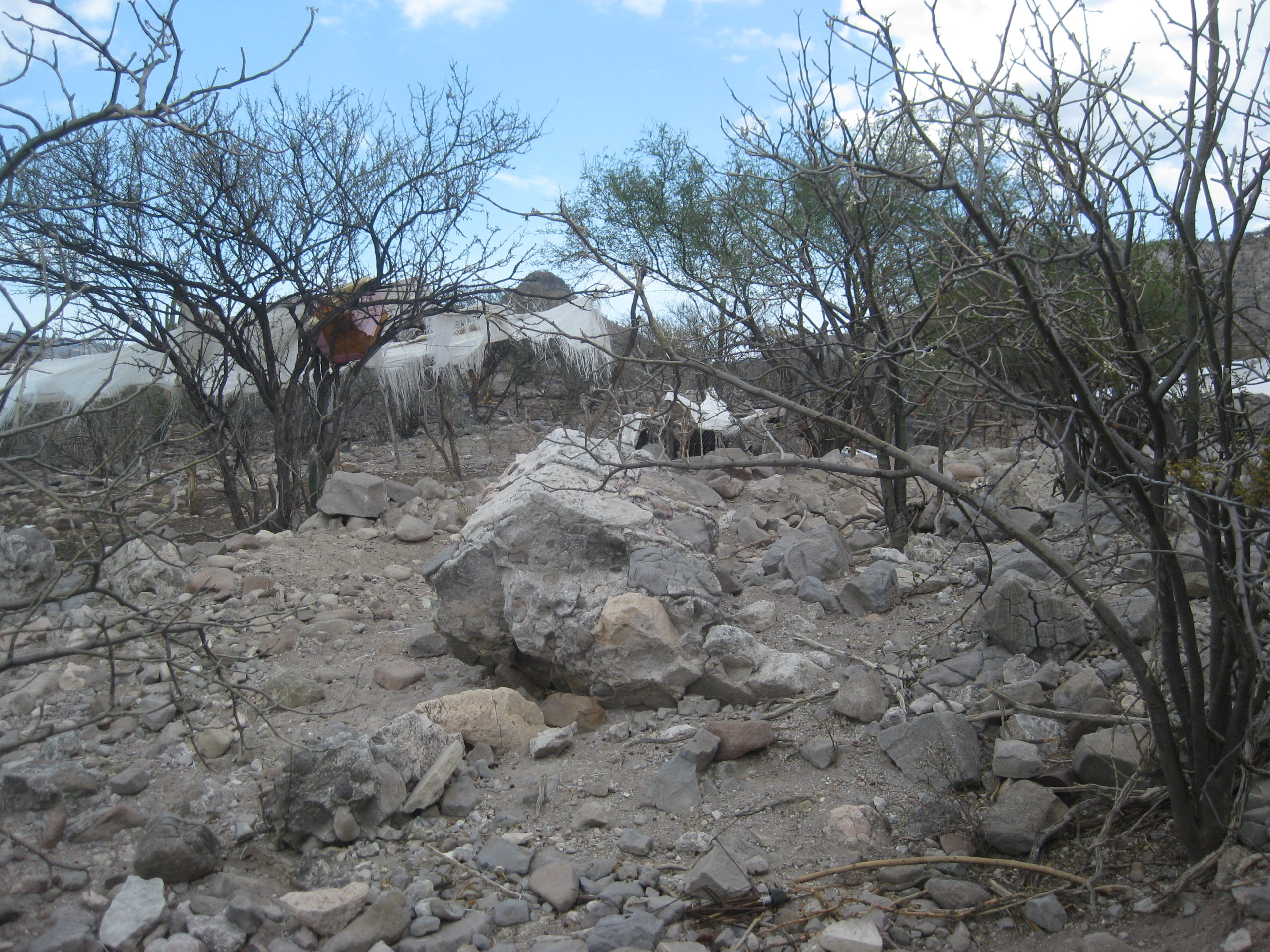
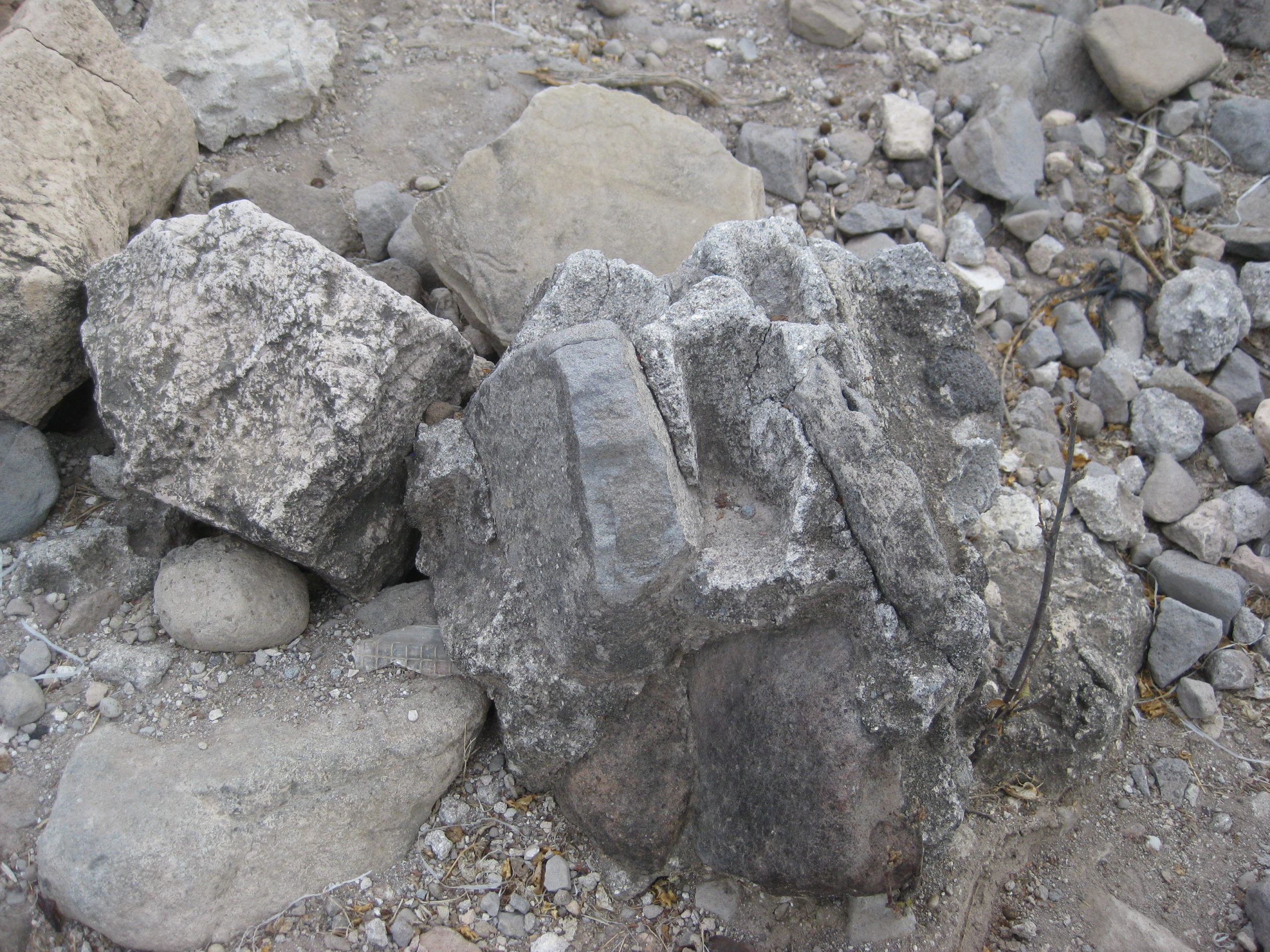
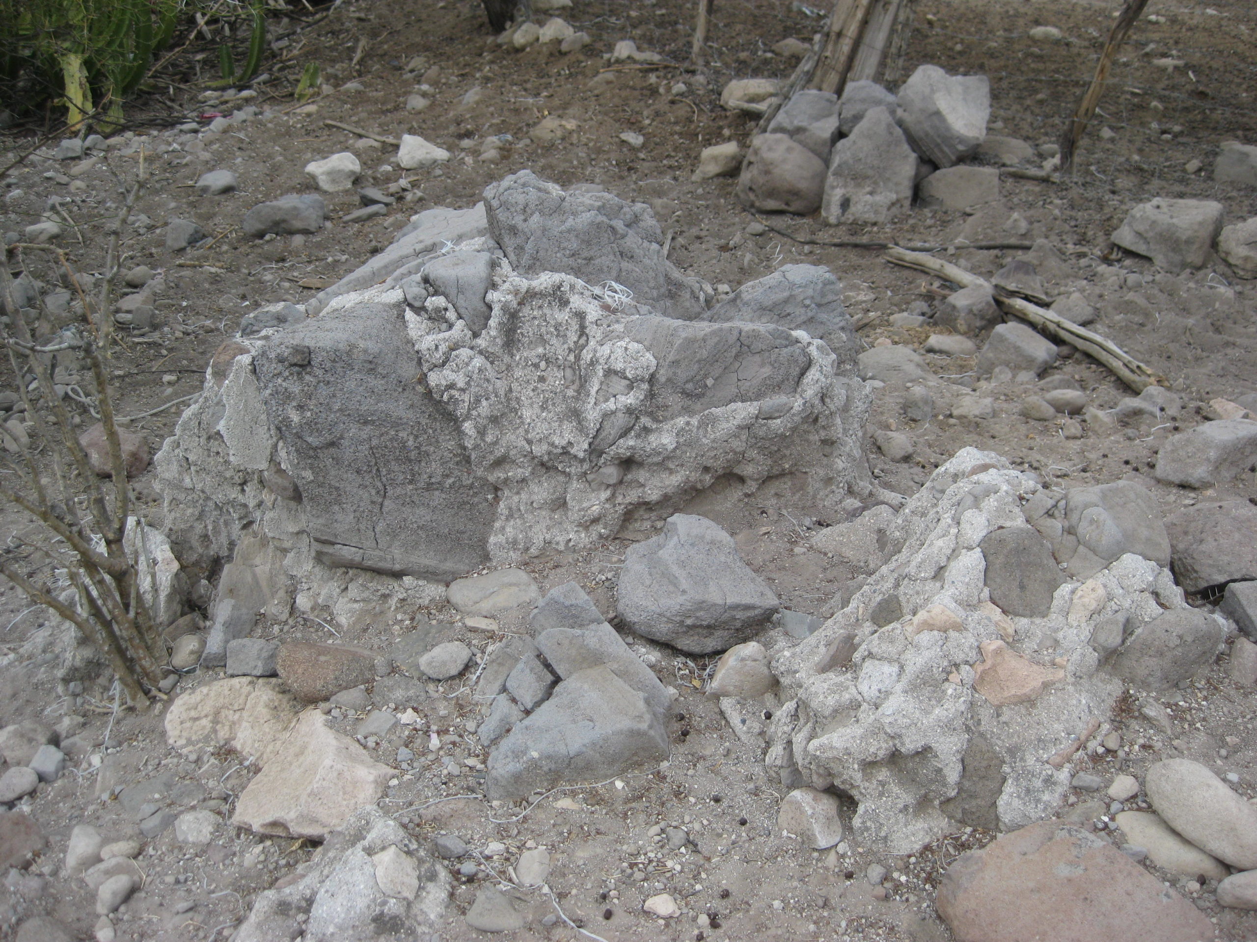
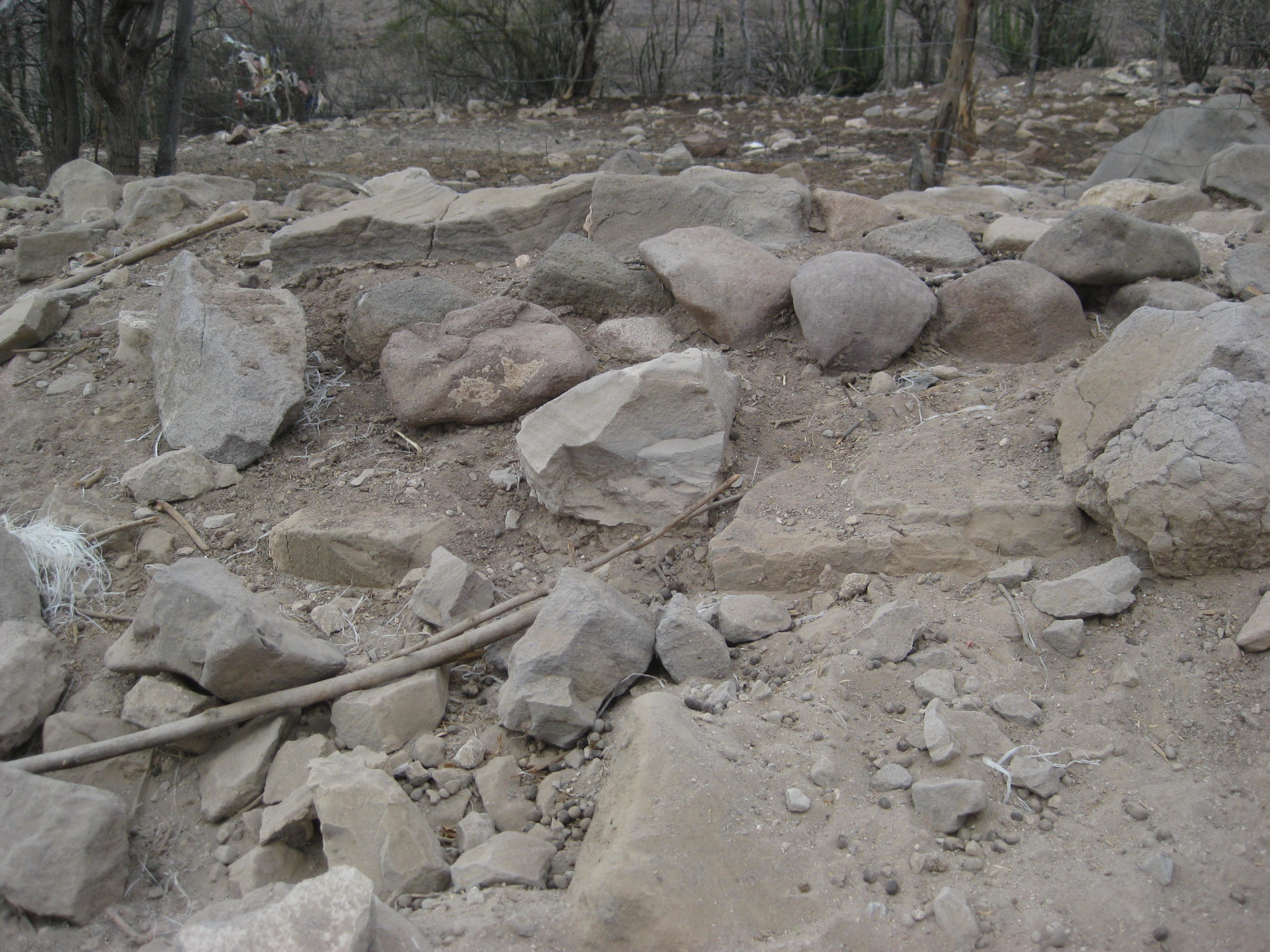
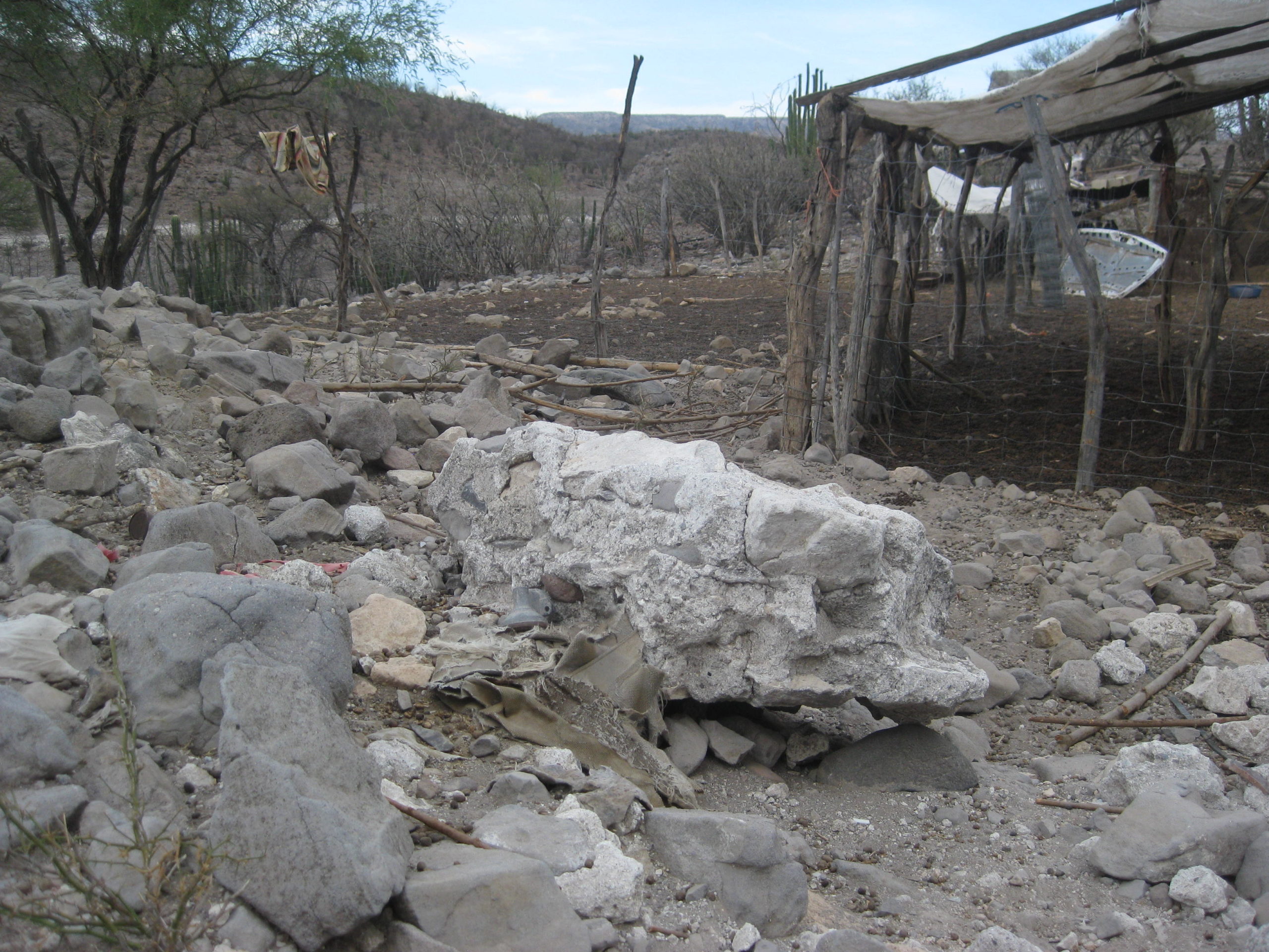
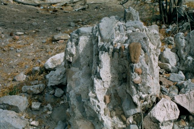
Condition: Ruins at two sites, with only rubble and foundation stones at final site.
Closing date: Closed in 1768 by the Spanish government.
GPS: 25.055543, -110.884425 (second site, Apaté) 17 miles east from Chillá; 24.887709, -111.031002 (final site, Chillá)
Access (final site): 30 miles from Mission San Luis Gonzaga at Rancho La Capilla/ Cabañas La Pasión.
Read more: HERE
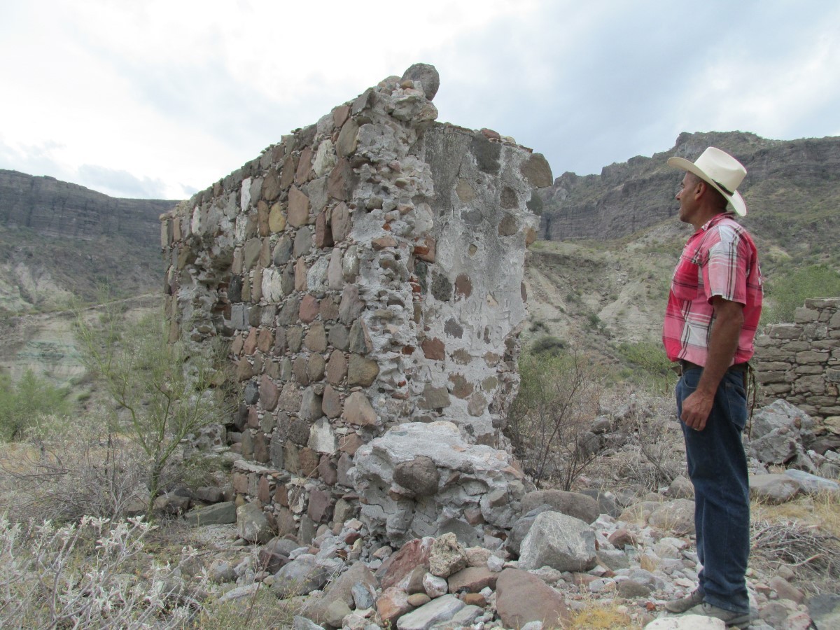
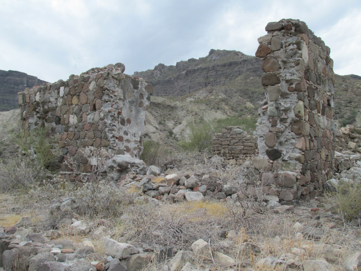
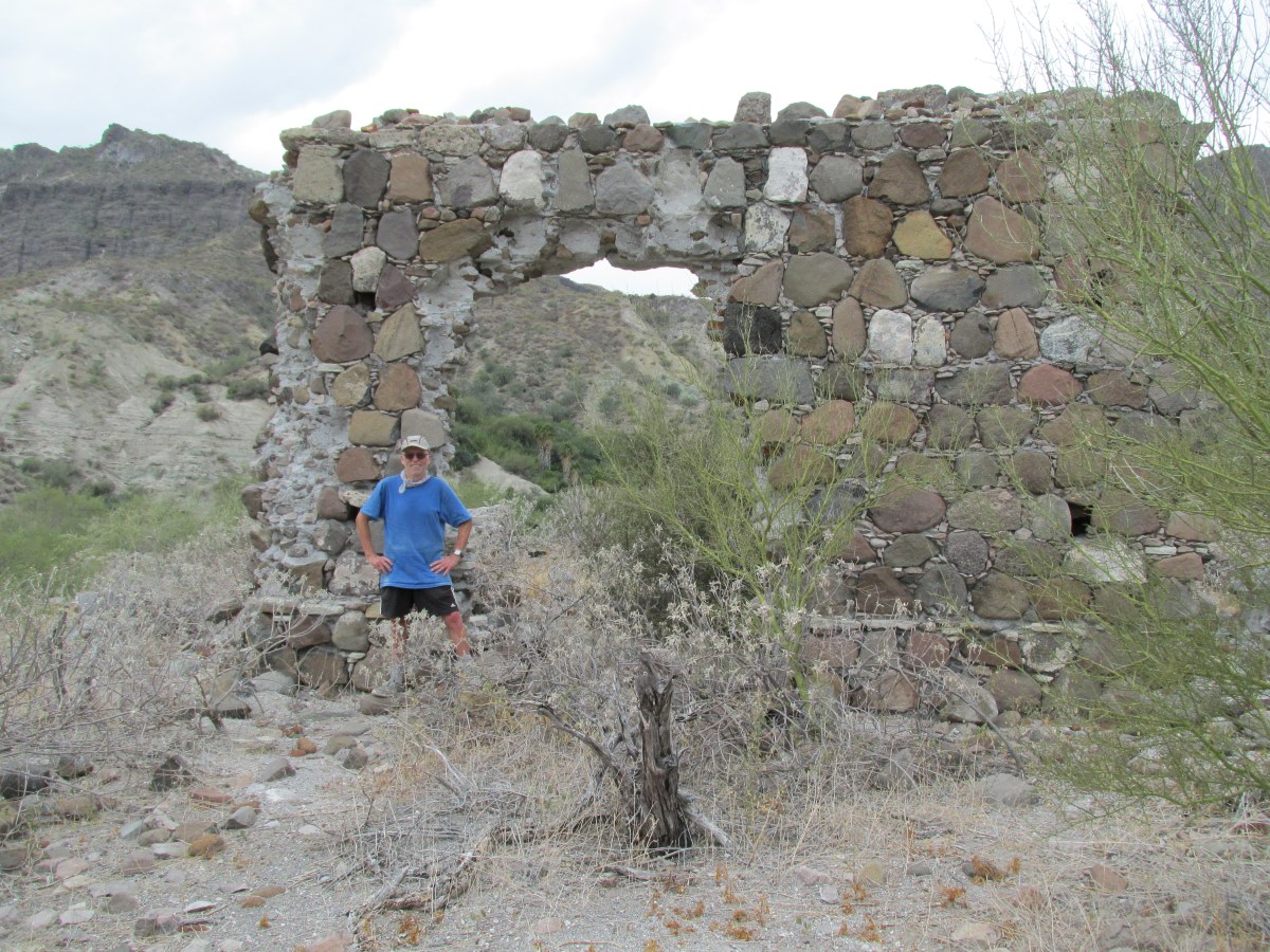
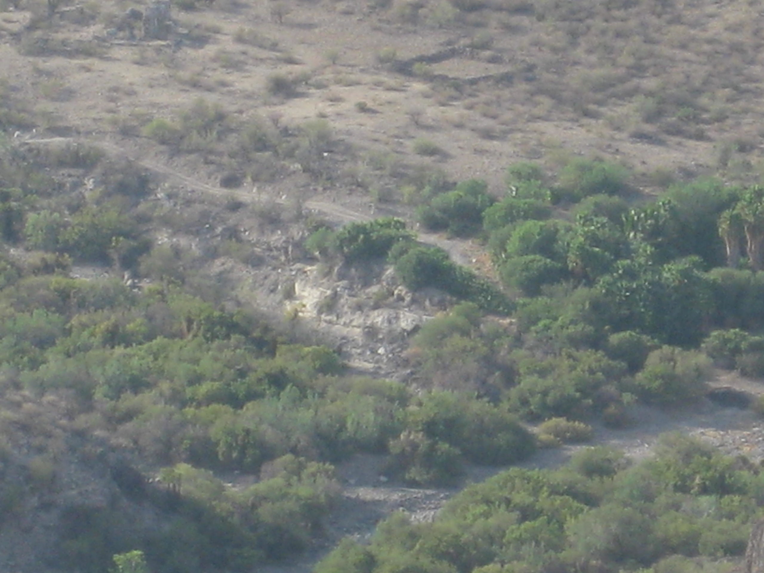
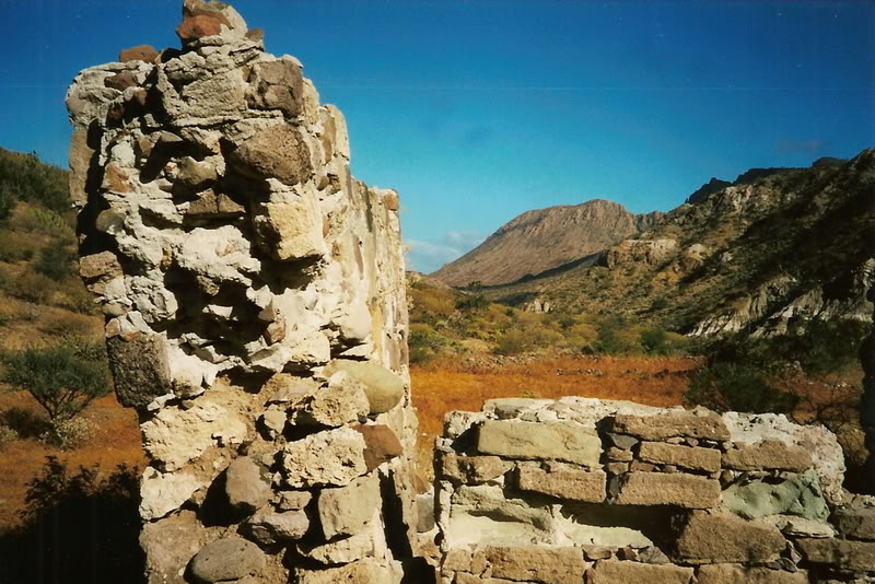
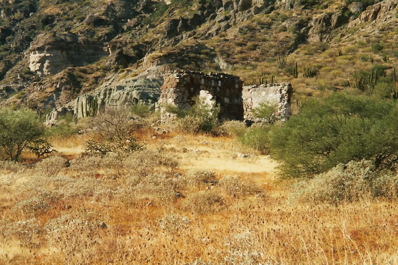
First Site, Apaté (1721-1741)
2018 photos by Graham Mackintosh
2017 photos by David Kier (from the south rim of the canyon)
2014 photos by Ashek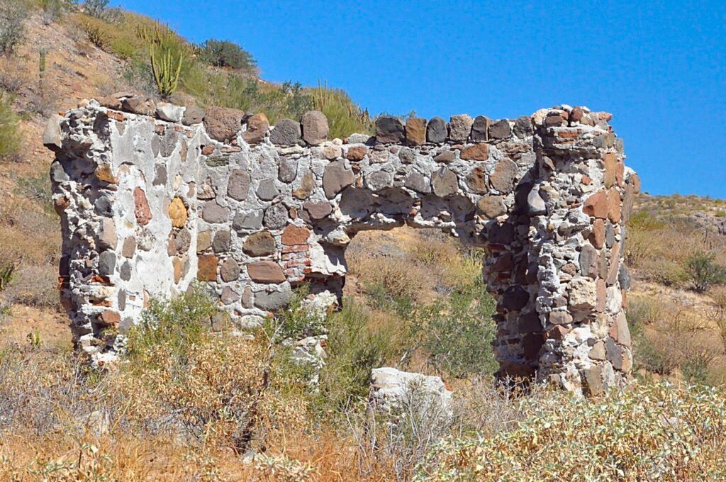

2002 photos by Jack Swords


1998 photos by Kevin Clough
1984 photo by Graham Mackintosh
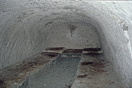
Storage Cave near the mission. 2001 photos by Edward Vernon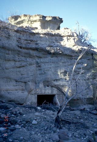
More Internet Dolores-Apaté photos: HERE
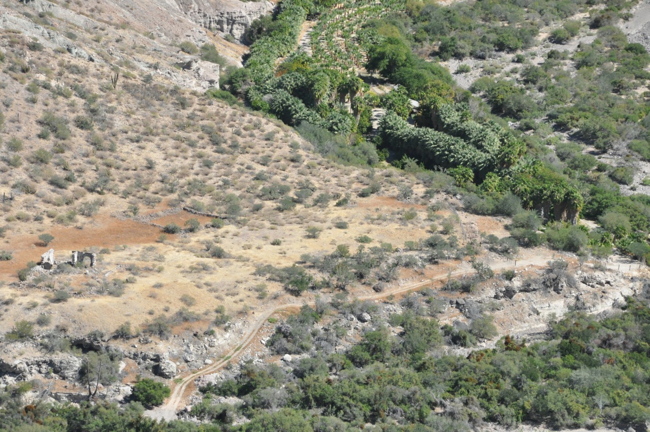
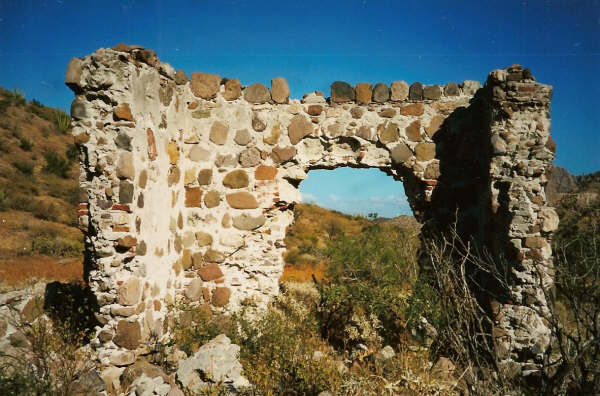
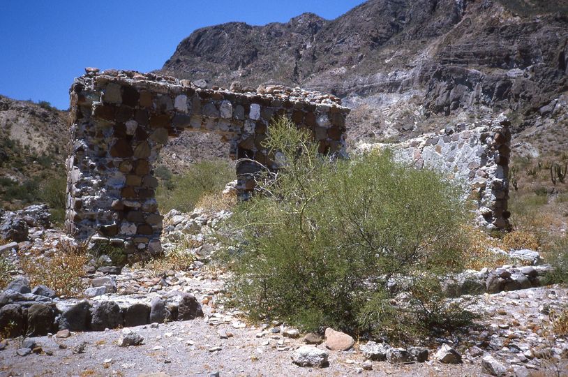
Final site, La Pasión de Chillá (1741-1768)
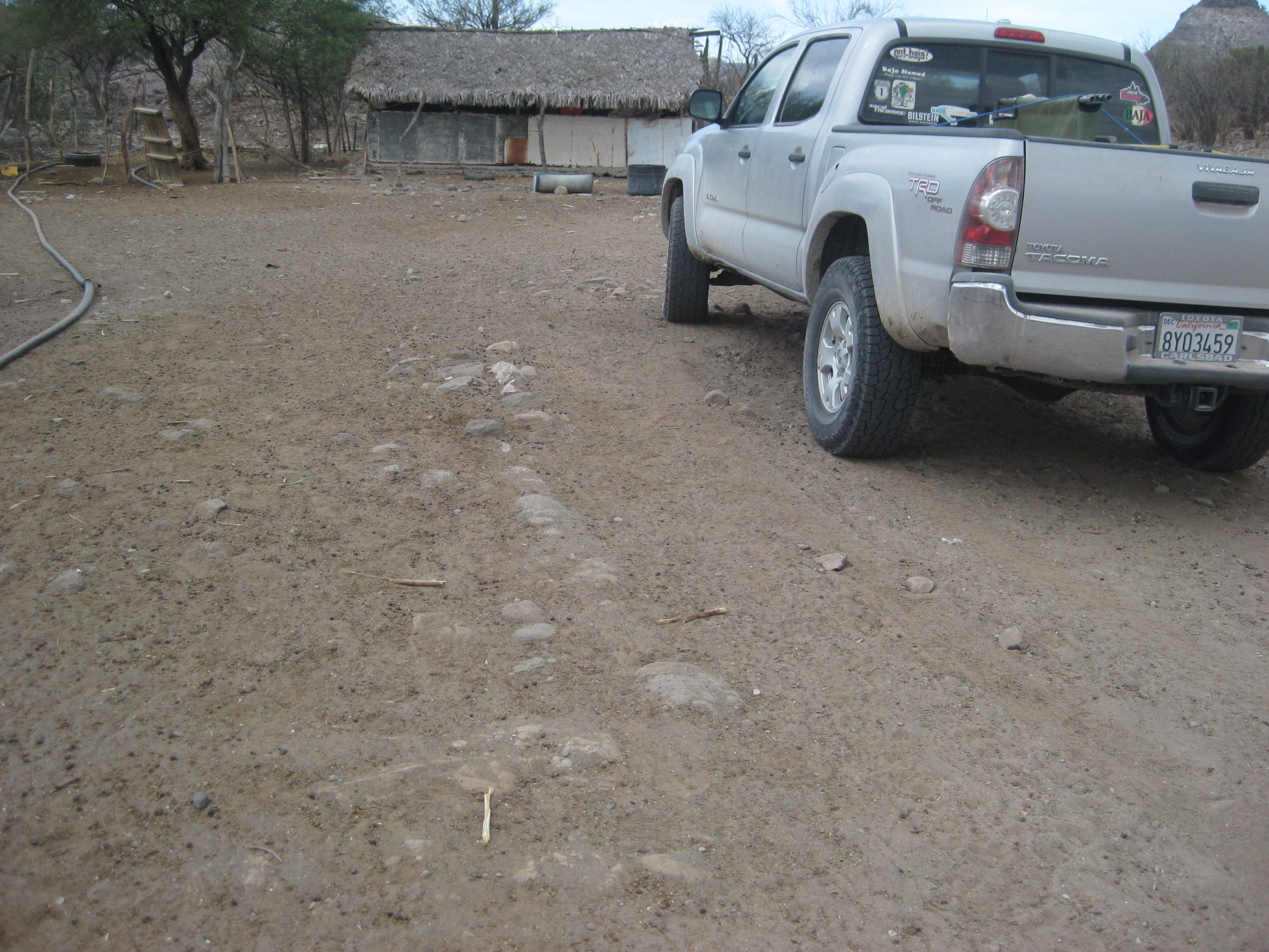
La Pasión was the name for the Dolores mission visita here. After the mission moved to there, for clarity on which site was discussed, the mission was typically referred to as La Pasión instead of Nuestra Señora de los Dolores Chillá, the official name. Today, the mission is on Rancho La Capilla (Family Amador) land and next to Cabañas La Pasión campground.
1950 photo by Marquis McDonald
2017 photos by David Kier (10 photos behind the Amador home at Rancho La Capilla)
Compare the hill with the 1950 photo by McDonald
2002 photos by Jack Swords


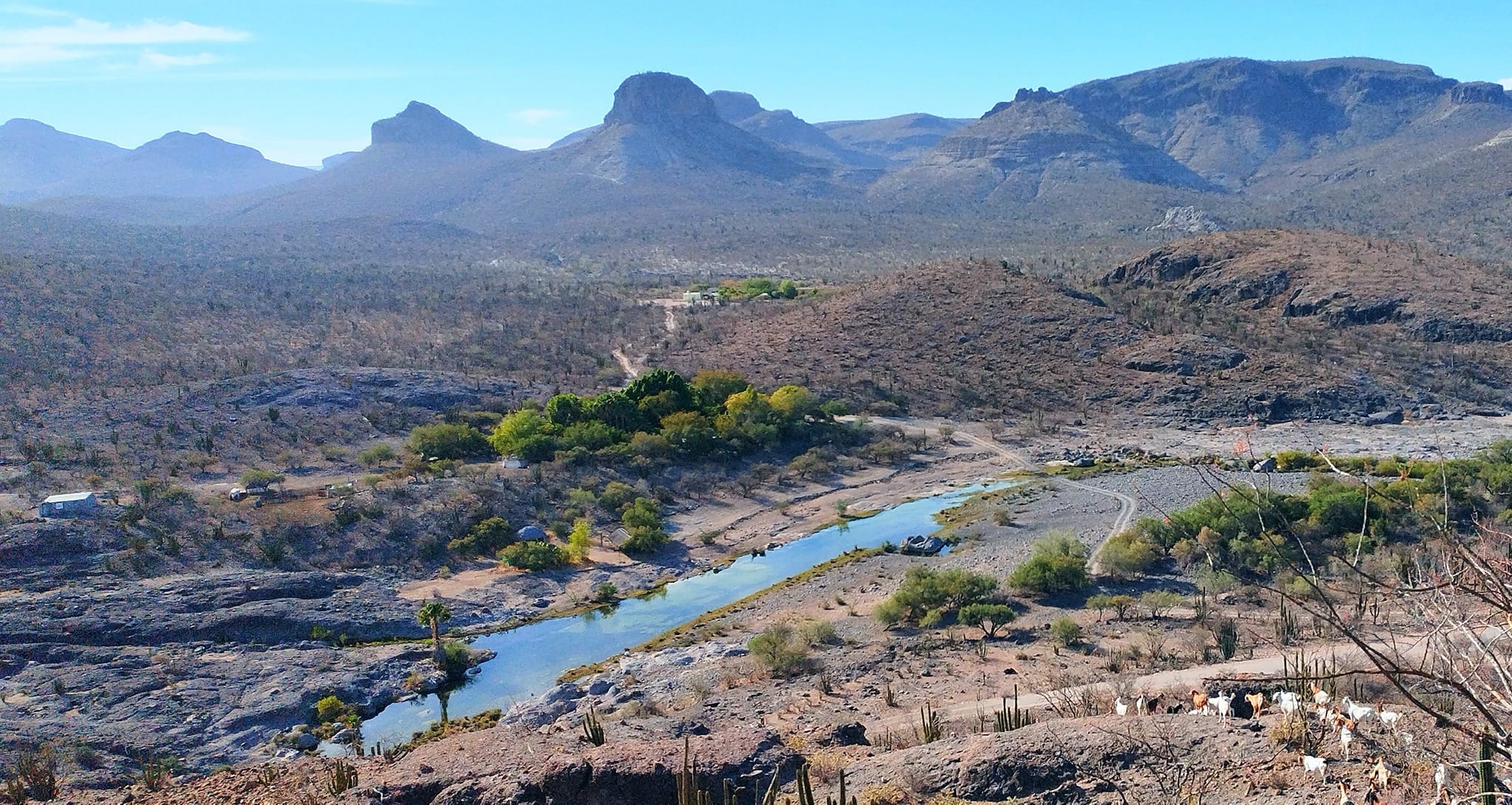
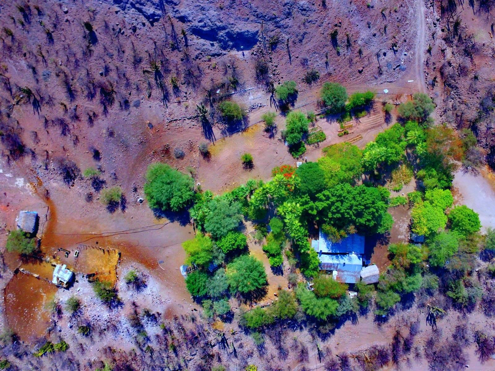

Next to Mission Dolores Chillá/ La Pasión is a campground, Cabañas La Pasión: Facebook page
I hope this was interesting or informative for you! Please be welcome to join our Baja California Land of Missions Book Group, on Facebook: HERE
- All the missions, quick look and history, north to south: HERE
- Other mission photo pages plus more Baja California history: HERE
- VivaBaja.com home page
The following chapter is from my book, Baja California Land of Missions Order your own copy from Amazon Books: HERE
#9 Nuestra Señora de los Dolores
(1721-1741 at Apaté and 1741-1768 at La Pasión de Chillá)
The mission of Los Dolores began because of the need for a mission between Loreto and La Paz following the failure of the mission at Ligüí/Malibat. The new mission was also known as “Dolores del Sur” to distinguish it from an important early visita of the Loreto mission that was named Dolores.
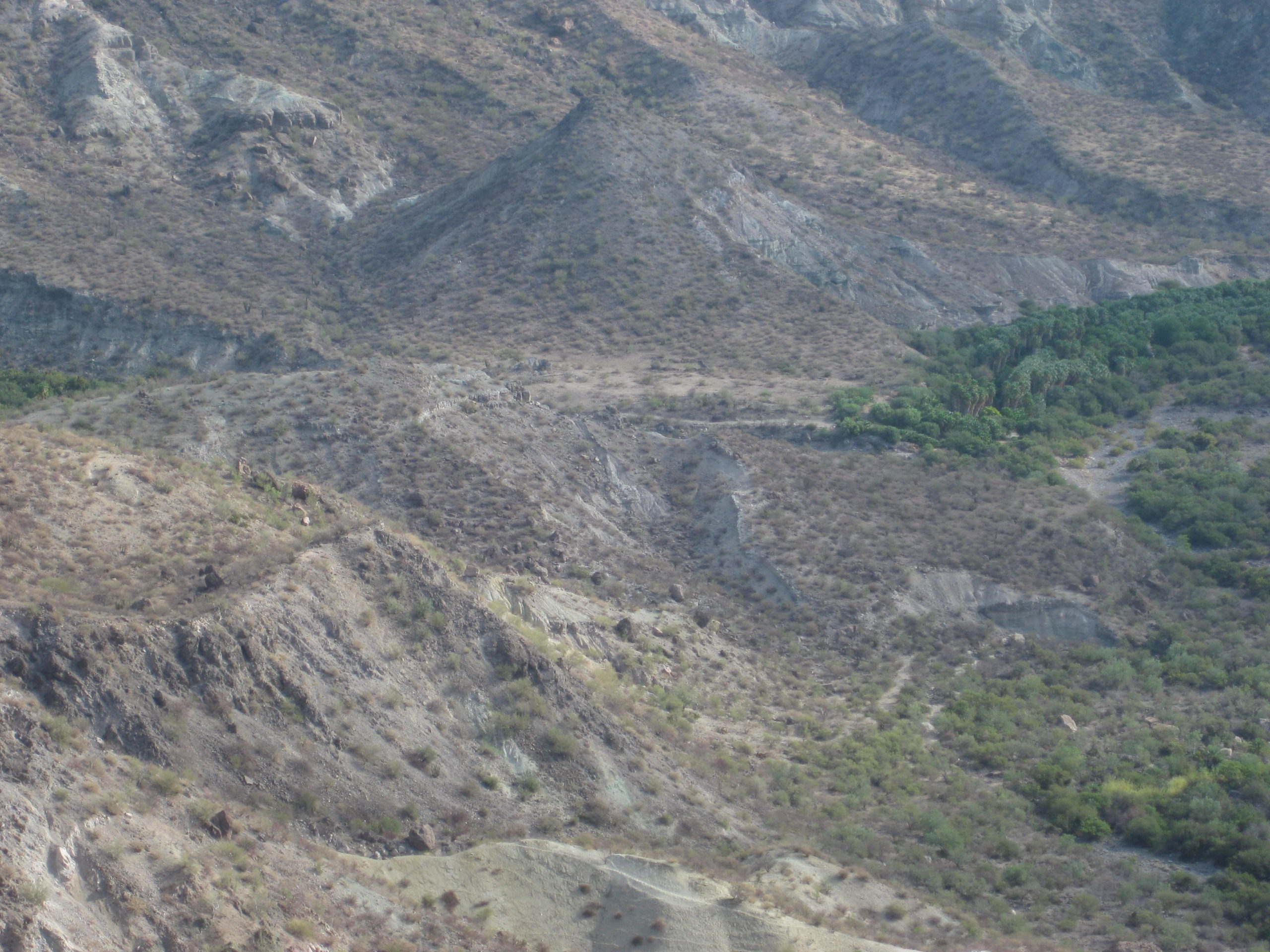
In 1720, Padre Clemente Guillén investigated the site of Apaté along the gulf coast during his overland trip from Malibat (Ligüí) to help start the La Paz mission. Guillén found fresh water near the beach at Apaté by digging a shallow well. Guillén also found running water in a canyon about two miles west of the beach.
On August 2, 1721, with new funds guaranteed by the Marqués de Villapuente, Guillén founded the mission of Nuestra Señora de los Dolores de Apaté. The mission may have been established quite close to the beach initially, but within two years was moved into the canyon. A stone-walled church, dam, aqueduct, reservoir, and other mission structures were built there, and ruins of them remain to this day.
In 1734, Padre Guillén wanted to move the mission out of the canyon about fifteen miles to the southwest for better farmland and easier access to the majority of Guaycura people. The Pericú Indian rebellion at the four southernmost missions (La Paz, Santiago, San José del Cabo, and Santa Rosa) interrupted the move until 1741. The new Los Dolores location had been a visita named La Pasión, known locally as Tañuetía (The Place of Ducks) or Chillá. After the move, the Dolores mission was more typically called La Pasión, which has caused some amount of confusion with writers. Guaycura neophytes were served by Padre Guillén until 1747 when age and illness forced him to retire to Loreto. Padre Lamberto Hostell replaced Guillén at Los Dolores.
The end of Mission Los Dolores came from a bureaucratic decision rather than a site or population failure. Following the 1767 order to remove the Jesuits from their missions, Spain’s Visitador General José de Gálvez ordered the mission closed in September 1768. The mission’s 450 neophytes were relocated to Todos Santos, which was far outside their ancestral homeland. This made for extremely poor relations with both the Guaycura and the Pericú, who had lived at Todos Santos.
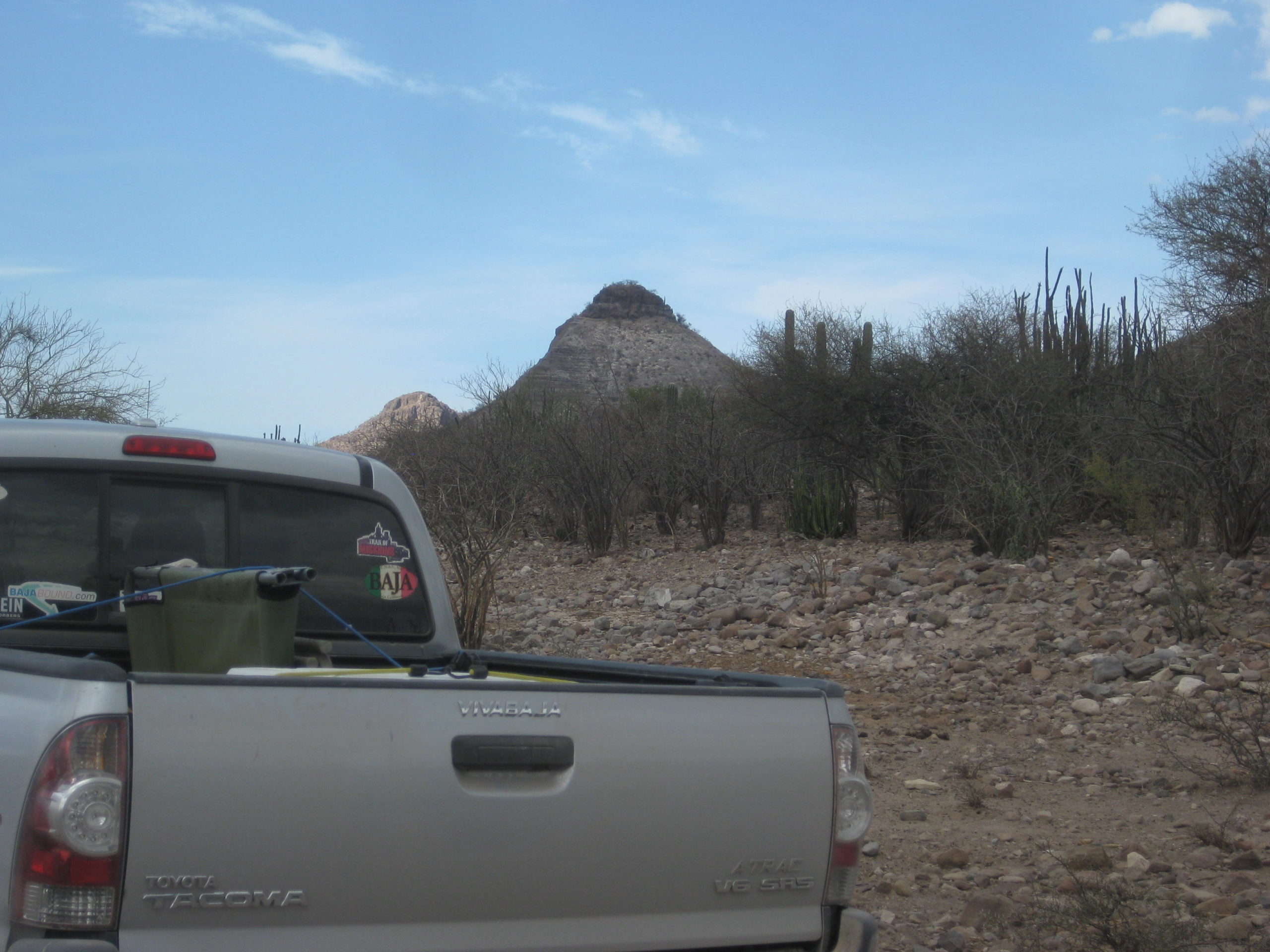
The Dolores Apaté site is one of Baja California’s most remote and no automobile road goes to it. Visitors can take boats to the beach followed by a hike to the mission, or they can take a longer, steep hike on the mission trail from the west.
The La Pasión (Los Dolores Chillá) site can be driven to in an SUV or truck on the road to Los Burros from Mexico Highway One, north of La Paz. La Pasión is located 2.5 miles east of Rancho La Presa. Only rubble from the mission walls and foundation stones remain; La Capilla is the name of the goat ranch on the mission site. Visitors are welcome.
Missionaries recorded at Los Dolores:
Jesuit
Clemente Guillén 1721-1747
(Mission moved to La Pasión in 1741)
Lamberto Hostell 1741-1743 and 1746-1768
Franciscan
Francisco Gómez April 5, 1768
See the other mission pages: https://vivabaja.com/baja-mission-albums/