Veteran’s Day Weekend (Nov. 11) to Agua Dulce and Other Sites
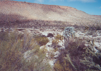
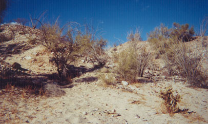
A lone blue palm grows from the gully containing the large spring. Located along the El Camino Real, Agua Dulce was a vital water source for early travels. GPS at the water’s edge is 29°52.98′, -114°49.42′ (WGS 84).
Agua Dulce (Sweet Water)
The spring now quenches the thirst of cattle, but gave life to Baja’s original natives and early travelers.
Adobe ruins near San Juan de Dios
Located along the arroyo one mile north-east of the mission visita, at 30°11.33′, -115°9.19′. The history of this site is unclear. Photos and GPS for the visita are at: http://vivabaja.com/davidlorenzo
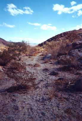
Pico Matomí to the north-east.

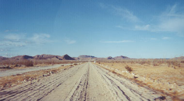
A new ranch road heads towards the mountain, which is about ten miles away. Photo taken from a gate at 30°16.13′, -115°11.87′. The Baja Almanac shows a site called La Huertita out this way.
The detailed trip report with the above and more photos: https://vivabaja.com/baja-weekend-2002/
Thanksgiving Week, 2002
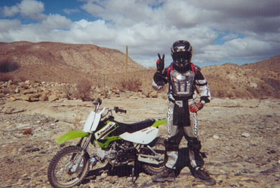
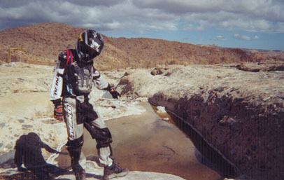
My (almost 14) son, Christopher shows off his dirt bike and riding gear. We are north of Coco’s Corner heading west for La Turquesa Canyon.
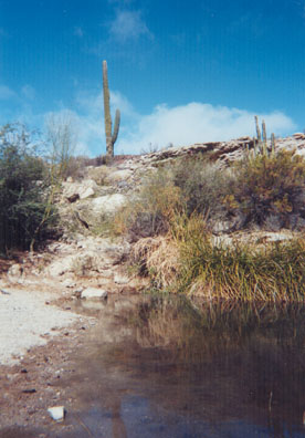
Green Pools 29°33.73′, -114°23.93′
Several pools of water are found near the end of the road in La Turquesa Canyon. A tough motorcycle trail continues west to Hwy. 1 at El Pedregoso boulder mountain.
Highway 5 near Gonzaga Bay
Rancho Grande is just ahead at the turnoff to Alfonsina’s Resort.
Molino de Lacy
Located between Hwy. 5 and Punta Final, this mill processed gold ore over 100 years ago. Operated by William Lacy, who is buried on the opposite side of this hill.
Lacy’s Grave 29°42.50′, -114°19.66′
Located on the east side of the hill, facing Punta Final.
William Lacy 1835 – 1897
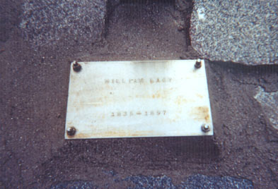
Well preserved plaque of the man who must have faced some fantastic struggles in this harsh land. Molino de Lacy History: william_lacy
Top of Molino de Lacy’s hill
Looking south, thunder and lightning with occasional showers this Thanksgiving day. The old road south to the mines and on to Coco’s begins on the right side of the photo. Mostly just dirt bikes use it now.
Franciscan Warehouse? GPS: 29°48.92′, -114°24.61′
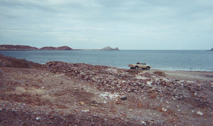
We found this ruin on the shore of Gonzaga Bay where the Lower California Guidebook said mission era ruins were located. In the background, is Punta Willard and Papa Fernandez’ camp.
Thanksgiving 2002, at Alfonsina’s

Chris and I were invited to sit with Doug Bowles and his other guests (Mike and Maureen) for a great feast, hosted by Alfonsina’s son Roman Cardenas. I flew in Doug’s plane from Alfonsina’s to Oceanside in 1999.
Sunrise over Punta Final
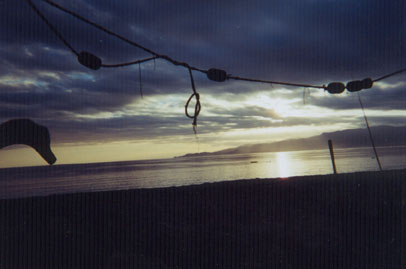
This Friday morning we hoped the rain would hold so we could have a full day of exploring!
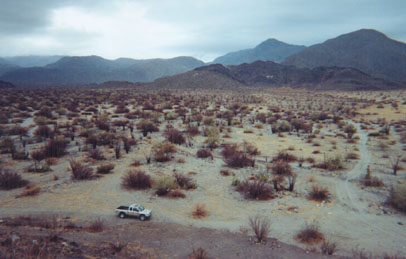
The road to the Onyx Springs
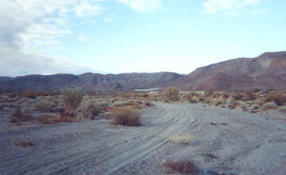
Off in the distance, a white slope or cliff can be seen. We spent two days looking for a way to get to it! GPS data not published by request of a Baja naturalist to limit visitors to a fragile site.
A Baja Glacier!
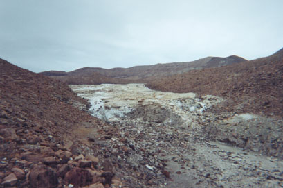
Not ice, but mineral salts! The short hike begins in an arroyo with small onyx boulders laying about.
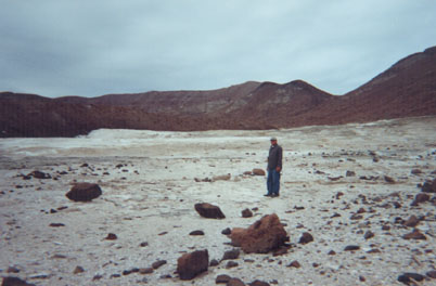
I’m in the center of this huge field where soda springs are depositing layer upon layer of ‘future onyx’.
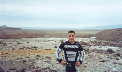
Here’s Chris at the top of the ‘onyx glacier’ where a grand view of the Sea of Cortez is another reward for our day’s discovery. If you come here, please avoid walking on the thin white crystal areas to preserve them for future visitors. Thanks!
Search for the El Camino Real to Mission Santa Maria

Ahead is the entrance to the Santa Maria canyon. The El Camino Real stays out of the canyon and goes into the hills to the north (right) to avoid it. A vehicle can drive to the canyon entrance from the Las Palmitas road. Then it’s by foot or hoof from there.
Here it is!!! 29°41.74′, -114°28.22′ (WGS 84)

Three cattle trails cross Arroyo Santa Maria and converge at the only place where a climb out of the arroyo is possible. This was on my second day searching, and the reward was worth it!
This second climb takes you out of the Santa Maria river valley and into a higher side side valley heading northwest. Ocotillos line the trail just ahead.
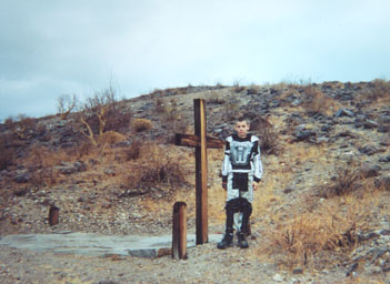
In case you had any doubts…

This sign says it all! It was laying along the El Camino Real about a half mile up from Arroyo Santa Maria. I continued hiking, with a big smile on my face!
The Royal Road 1767 to 1905+
Looking back to the southeast. This was the Baja Highway, before automobiles.
Ahead to Mission Santa Maria

This is where I turned back. The temptation to continue was high, but Chris was waiting for me back at the truck. In fact, the trail ahead gets much rougher and would require better preparation and at least one overnight, for the round trip. Thank you for traveling with me (via the Internet) and I hope you enjoy exploring Baja’s many fascinating places.
Please visit my web site http://vivabaja.com/ for more Baja adventures and links to many other great web sites and message boards for Baja travelers. If I can help you have a great Baja adventure, write to info vivabaja.com