Join these two Desert Explorers* as they find palm filled arroyos, the El Camino Real, odd rock formations, springs and water holes in the central Baja Norte desert. GPS directions at the end. Enjoy the magic and beauty of Baja California, Mexico! LATE ADDITION: At the end, after the GPS list, see what happens on their return trip to photograph desert flowers! * http://www.desertexplorers.org/
The day begins…

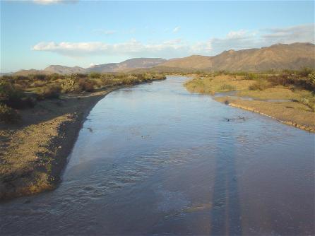
… with a beautiful sunrise at Agua Dulce.

Agua Dulce, from the north side of the historic spring. Photos from the parking spot on the south side, and at the water’s edge at http://vivabaja.com/1102 Located on the El Camino Real, between the missions of Santa María and San Fernando.
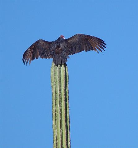
A vulture warming its wings atop a cardón cactus.
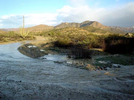
Lower Yubay tinaja, which is typically dry. The recent rainfall filled all the tinajas (water holes) in central Baja.

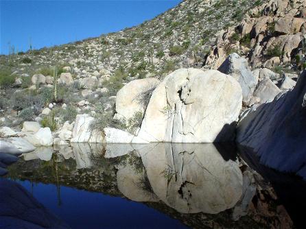
The main tinaja of Yubay, full Feb., 2003.

A bit closer… note the wild fig tree growing on the cliff side (left). This is the clue you have arrived at the true Tinaja de Yubay, less than a mile up a canyon where those traveling the El Camino Real would stop, between the mission of San Borja and Calamajué.

Grinding stone at Yubay… Neal’s 2 way radio, for size scale.
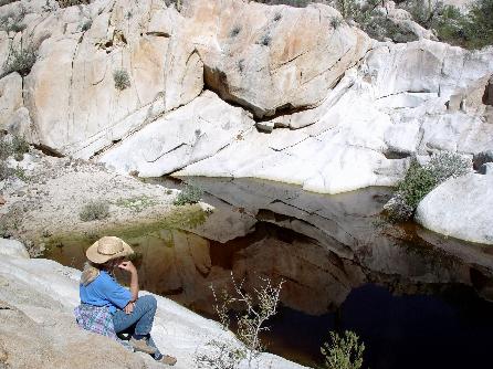
Above Yubay another tinaja is found… sitting is Marian. Neal scrambles over boulders like an old goat, ‘er I mean mountain goat!
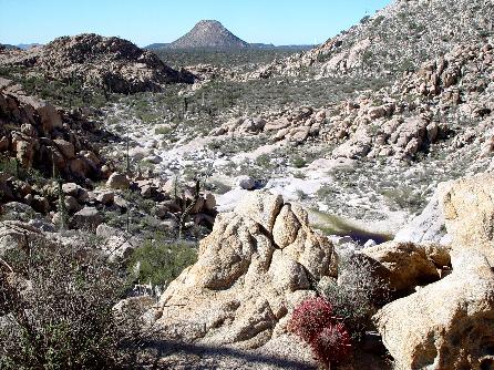
The canyon containing Yubay, looking south at Cerro la Palmita. That landmark helped travelers find life giving water.
Yubay in 2001 (a dry year!)

One of Neal’s many ‘Wives in Waiting’, Sue is standing by the average water line for this famous tinaja.

Desert and storm clouds near Mina Luz de Mexico, south of Yubay.
Amigos de Baja

Marian poses with ‘GILAORO’ (Max and Polly), from Yuma, Arizona.
The road to Mission San Borja looks more like a river, this day!
I think we can see how the Baja desert can sustain such thick vegetation. This has to be rare, however.
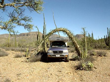
The boojum (cirio) tree is one of the strangest plants on earth. Here Neal and Marian enjoy a ‘Baja drive through’ on the way to finding a portion of the El Camino Real, near Cerro Colorado de San Borja.
Desert scene near La Virgen..
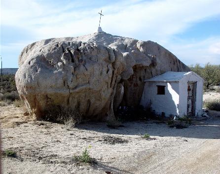
The original La Virgen shrine on the old trans-peninsular dirt road.

Naturally sculptured boulder near La Virgen.
Arroyo Aguaje Guillermo Palms
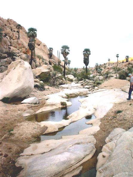
Over 100 blue and fan palms were found by Neal and Marian after a mile hike from the road end. The unmapped road is 0.4 mile north of La Virgen, and then a 4.4 mile drive east. Another great discovery by the Johns’, thanks for sharing with us!
Data Sheet for Neal’s Feb. ’03 Baja Trip
- GPS Waypoints are now at map datum WGS 84
- Agua Dulce access road: 29°51.68′, -114°50.40′
- Agua Dulce spring: 29°52.98′, -114°49.42′
- La Virgen access (Neal’s): 29°49.19′, -114°48.52′
- La Virgen access (DK’s): 29°49.42′, -114°48.67′
- Yubay/Desengaño access on L.A. Bay hwy.: 29°04.31′, -114°2.41′
- Fork: Yubay right./Desengaño left: 29°06.84′, -114°01.65′
- Jcn.: Yubay right/Rock Palm Hill straight: 29°09.17′, -114°01.40′
- Yubay Parking for 2WDs: 29°10.19′, -113°59.77′
- Yubay Parking for 4WD/Trail start: 29°10.29′, -113°59.66′
- El Camino Real (from south) bottom: 29°10.59′, -113°59.25′
- El Camino Real summit: 29°10.55′, -113°59.23′
- Tinaja de Yubay: 29°10.69′, -113°59.26′
- Upper tinaja (above Yubay): 29°10.94′, -113°59.03′
- Luz de Mexico mine road: 29°2.94′, -113°55.98′
- Side track to arch boojum & El Camino Real near San Borja: 28°51.56′, -113°47.69′
- El Camino Real (south end): 28°51.58′, -113°47.44′
- El Camino Real (north end): 28°51.99′, -113°47.69′
- El Mármol south access at old road: 29°51.35′, -114°48.56′
- El Mármol Onyx Quarry: 29°58.00′, -114°48.32′
- Above GPS data from Neal Johns & David K
- See Neal’s Sept.’02 Baja trip: http://vivabaja.com/neal
- David K’s Baja Home Page: http://vivabaja.com/
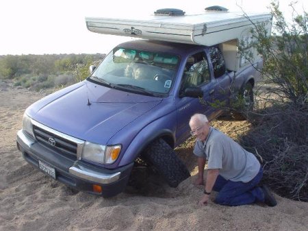
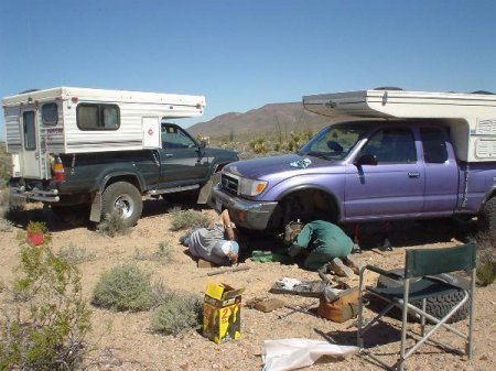
Neal Breaks His Toy!
The Johns’ returned in March for photos of wildflowers. Many miles from help, the satellite phone is put into service!
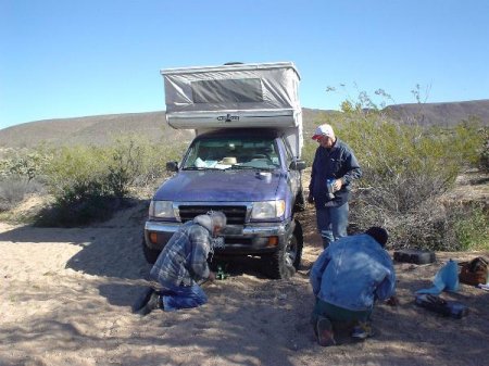
Help arrives! Big thanks go to Bob Martin and John Page.
“All the king’s horses, and all the king’s men, couldn’t put Neal’s TOY together again!”
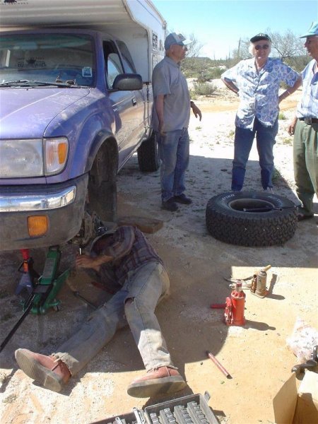
If anyone can… a Mexi-can! Hooray for Cataviña’s mechanic, Pancho! Pancho had a bigger tool than any of the gringos!
Neal Johns passed away Dec. 27, 2019. He is greatly missed by all of us Desert and Baja explorers who knew him: https://www.desertexplorers.org/neal-johns