In April 2025, this online version of this guide was completed. Page numbers now are added to help one find the desired road log or map. Viewing this guide on cell phone may be look different than on a desktop monitor. Updated January 2026:
The following are updates and notes that may not be in the road logs, researched from 2016 to 2019. We appreciate feedback to changes since the guide was researched. Business names and quoted prices may have changed from what appears in the guide.
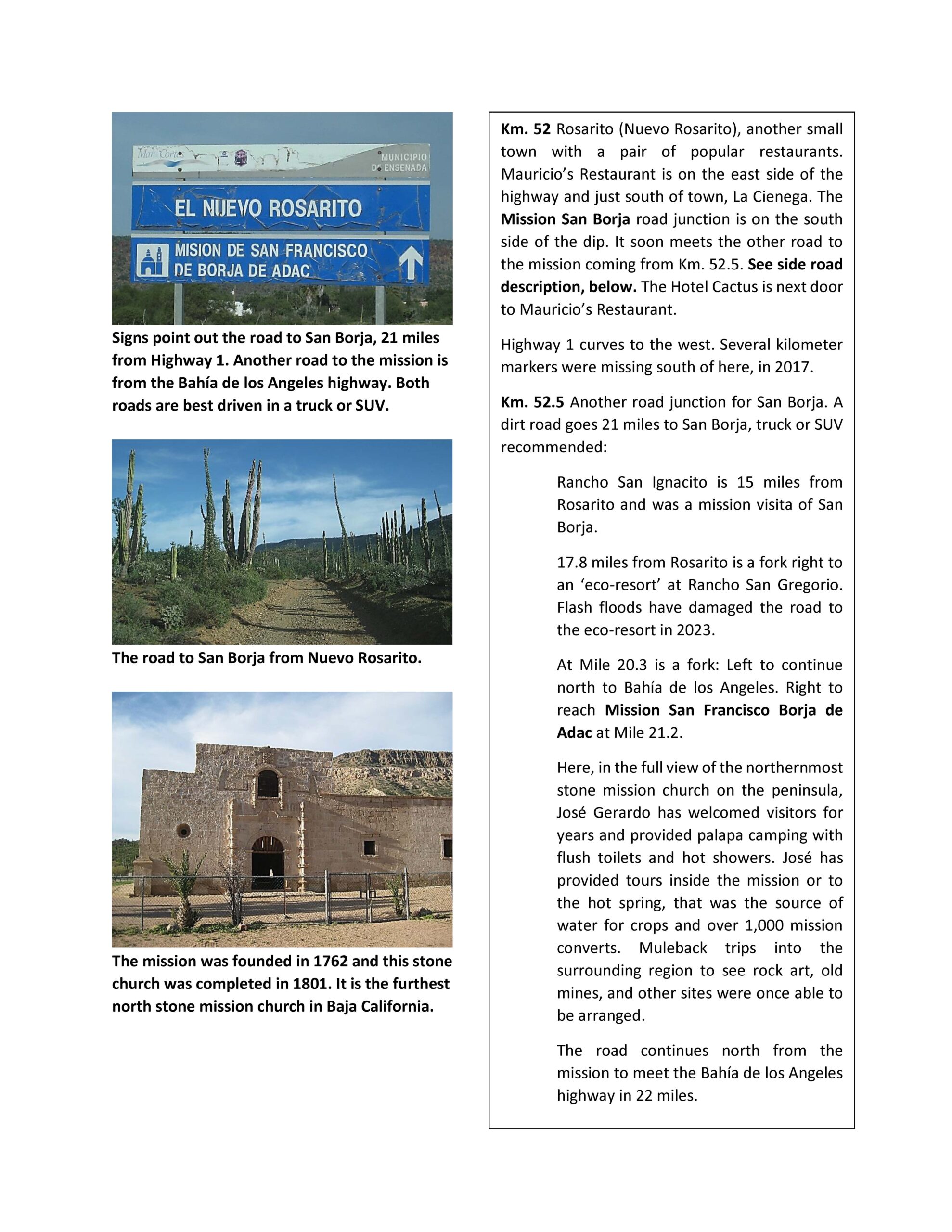
5/2026: Research trip on Hwy. #5, then to L.A. Bay, south to Mission San Borja then west to Nuevo Rosarito and back north via Mex #1 & Mex #5. See the photos and details: https://vivabaja.com/baja-526/. The north road to San Borja was very bad and very slow to drive. The west road was slightly better.
1/2026: The dollar is worth about 17.4 pesos. One peso is worth 5.8 cents. The FMM fee increased to 983 pesos, making the FMM cost about $57 (dollars). See also the new dog requirements at https://vivabaja.com/advice-on-driving
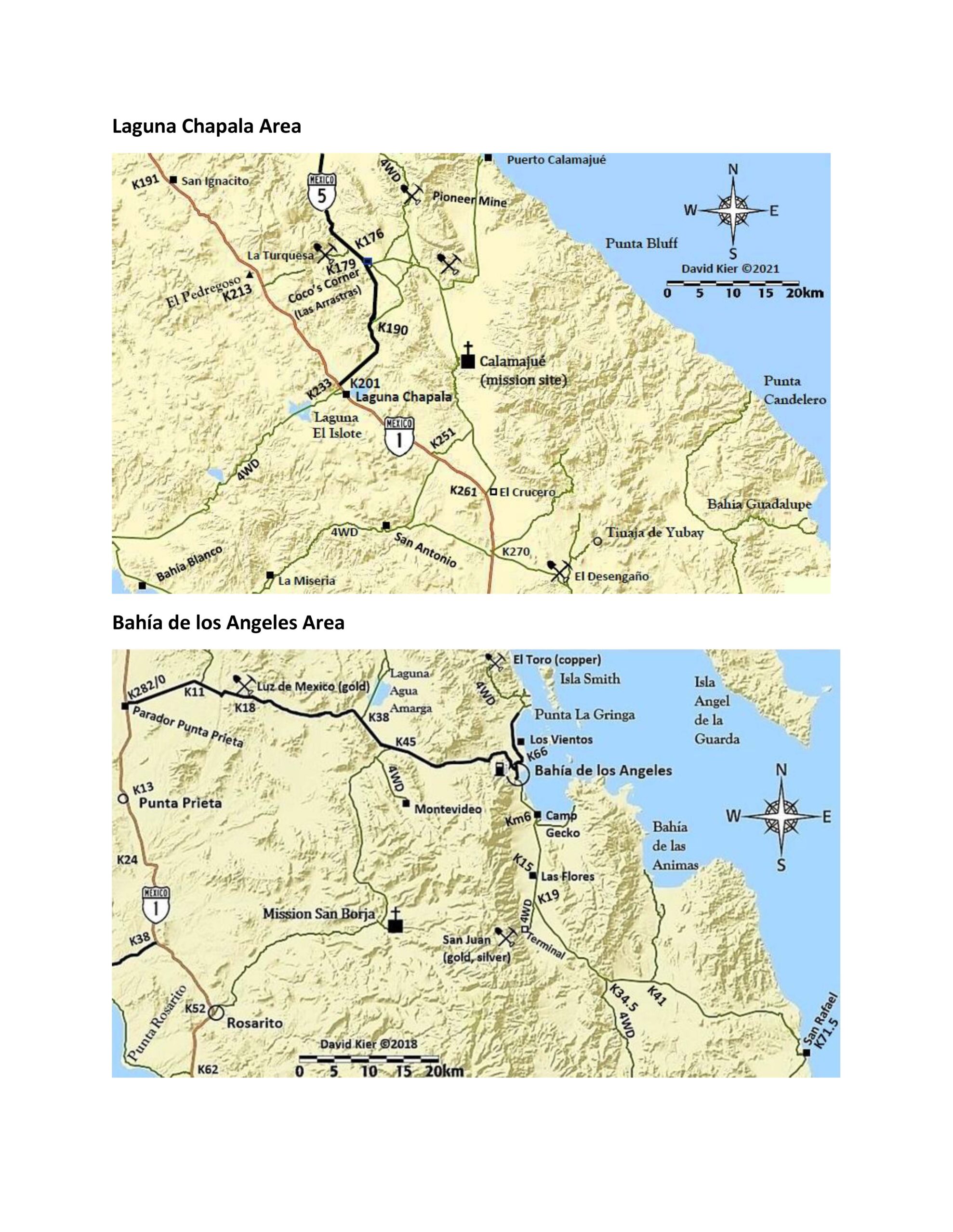
11/2025: The 16-mile road between Bahía Tortugas and Punta Eugenia is reported to be paved. The 2025 Baja 1000 race (Nov. 14-15) is again utilizing the narrow and steep track from Hwy. 1 (Km. 213, near El Pedregoso boulder hill) to Hwy. 5 (Km. 176, near Coco’s Corner). The road is partly shown on my maps but not mentioned in the guide. It is known by different names: La Turquesa Grade, Fred’s Tractor Trail, Kacey’s XR Ride, Coco’s Shortcut, etc. Use with caution in a 4×4 with companion vehicle.
5/2025: Research trip on Hwy. #1 & Hwy. #5 to historic sites and more: https://vivabaja.com/baja-525/ In Santo Tomás (Km. 50), the El Palomar campground and motel/restaurant were all closed.
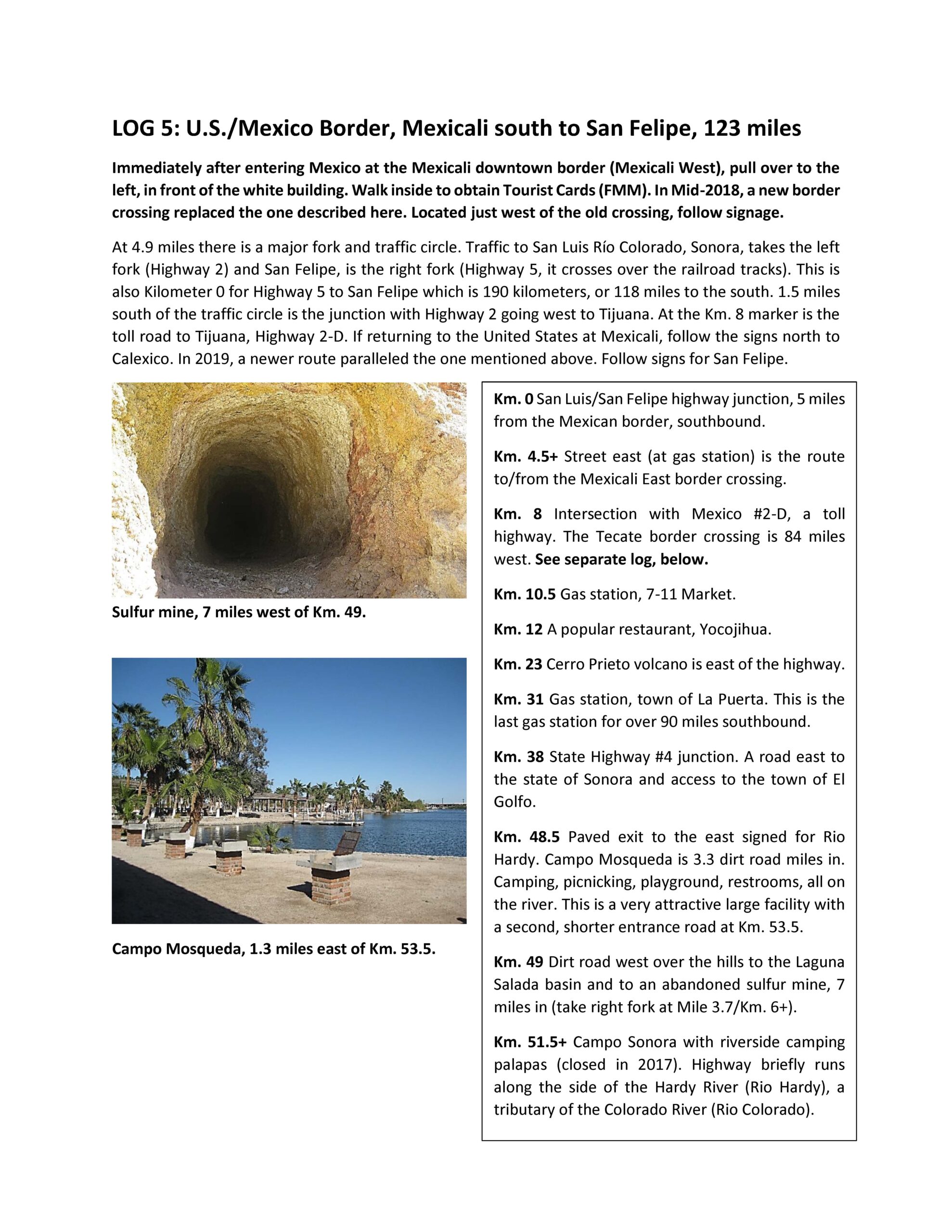
4/2025: The gas station in La Puerta (Hwy. #5, Km. 31) is closed.
9/2024: The book publication date is unknown… and I am doing my best to keep it updated (other than photos and prices). Paving is completed or underway from San Miguel Comondú to San José Comondú, and from Bahía Tortugas to Punta Eugenia. The ‘Cowpatty’ cantina, km. 73 south of San Felipe, had reopened and then burned down, tragically!
The contents of the book may look different in the final version, if and when published.
This is a guide of the roads beyond the cities to help you find the fun places to camp or explore in Baja California. It uses the kilometer markers on highways and odometer mileage on the dirt roads. All of the maps I made to accompany the road logs had previously been made public and are included.
Again, these are the pre-publication pages and might not include the latest updates. I hope you enjoy my way of describing roads and locations. Here is the link to my road guide maps (which also appear throughout the guide): https://vivabaja.com/davids-2018-maps/


NOTE: ALL PAGES are protected by copyright © David Kier 2026
SEE: Advice on Border Crossing and Driving in Baja California: https://vivabaja.com/advice-on-driving/
CONTENTS (-page numbers-)
Introduction -1-
Travel Information -2-
Starting the Baja California Road Trip -3-
Log 1: Tijuana to Ensenada -4-
Log 2: Tecate to Ensenada and Ensenada to San Felipe -8-
Log 3: Ensenada to San Quintín -15-
Log 4: To San Pedro Mártir Observatory -21-
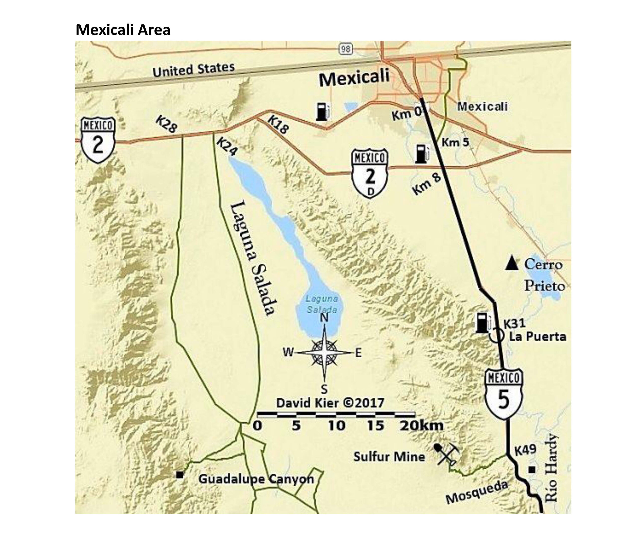
Log 5: Mexicali to San Felipe -24-
Log 6: Mexicali to Tecate -30-
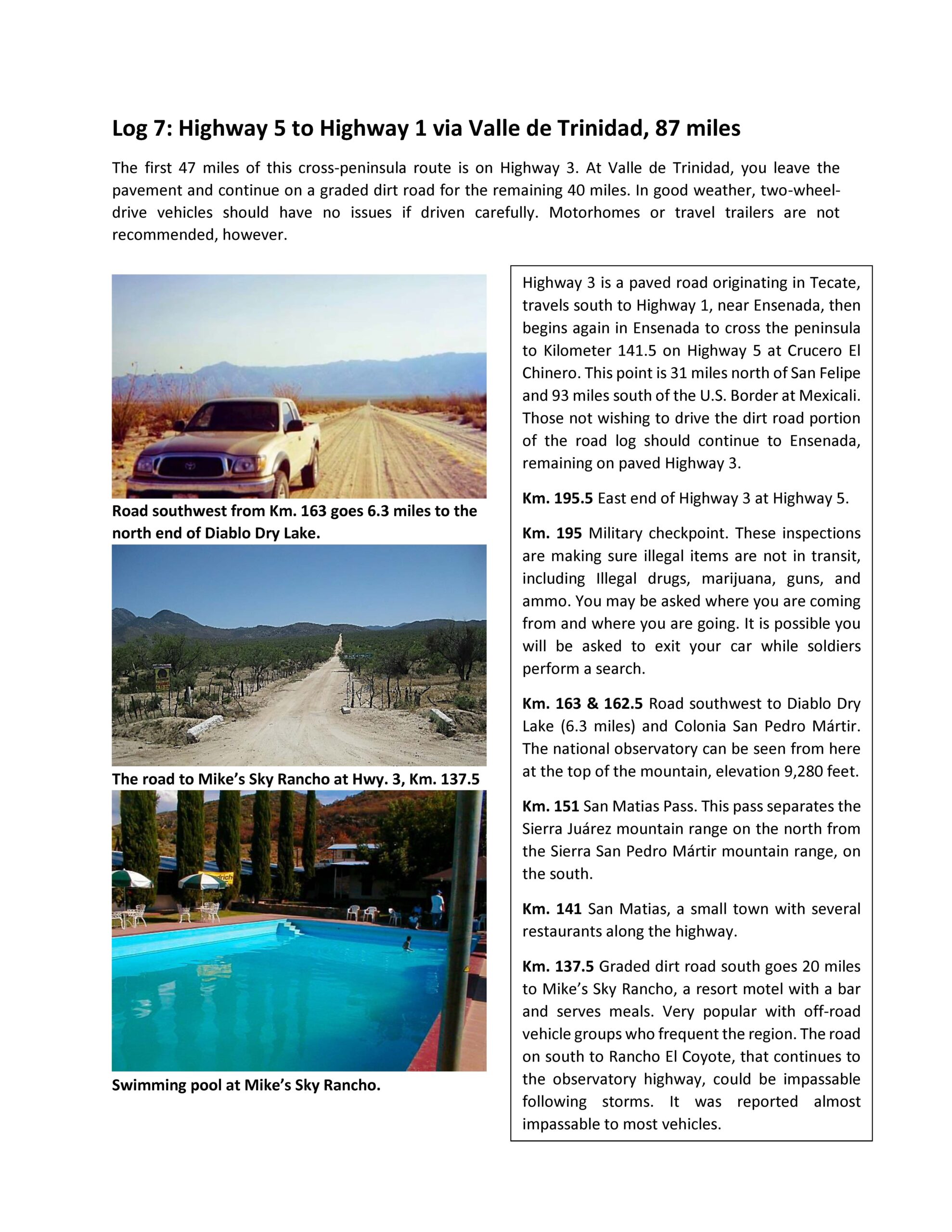
Log 7: Highway 5 to Highway 1 via Valle de Trinidad -31-
Log 8: San Felipe to Valle Chico and Rancho Matomí; Valle Chico to the Sulfur Mine -34-
Log 9: San Felipe to Laguna Chapala (Junction with Highway 1) -39-
Log 10: San Quintín to Guerrero Negro -51-
Log 11: The Remote Pacific (“Seven Sisters”) -68-
Log 12: Highway 1 to Bahía de los Angeles, La Gringa, and Punta San Francisquito -75-
Log 13: Guerrero Negro to San Ignacio -84-
Log 14: Highway1 to El Arco, El Barril, and Punta San Francisquito -88-
Log 15: El Vizcaíno to Bahía Asunción, Bahía Tortugas, Punta Eugenia, and Punta Falsa -92-
Log 16: Highway 1 to Punta Abreojos, La Bocana, and Bahía Asunción -97-
Log 17: San Ignacio to Laguna San Ignacio, San Juanico, and Ciudad Insurgentes -100-
Log 18: San Ignacio to Loreto -108-
Log 19: Mulegé to Mission Guadalupe -119-
Log 20: Loreto to San Javier, Comondú, La Purísima, and Comondú Viejo -120=
Log 21: Loreto to La Paz, Todos Santos, Los Cabos, Santiago, Los Barriles, and back to La Paz -126-
Log 22: La Paz to La Ventana, Punta Arena, Ensenada de los Muertos, Ferry Terminal, and El Tecolote -141-
Log 23: Highway 1 to Mission San Luis Gonzaga, San Evaristo, and La Paz -145-
MAPS (-page numbers-)
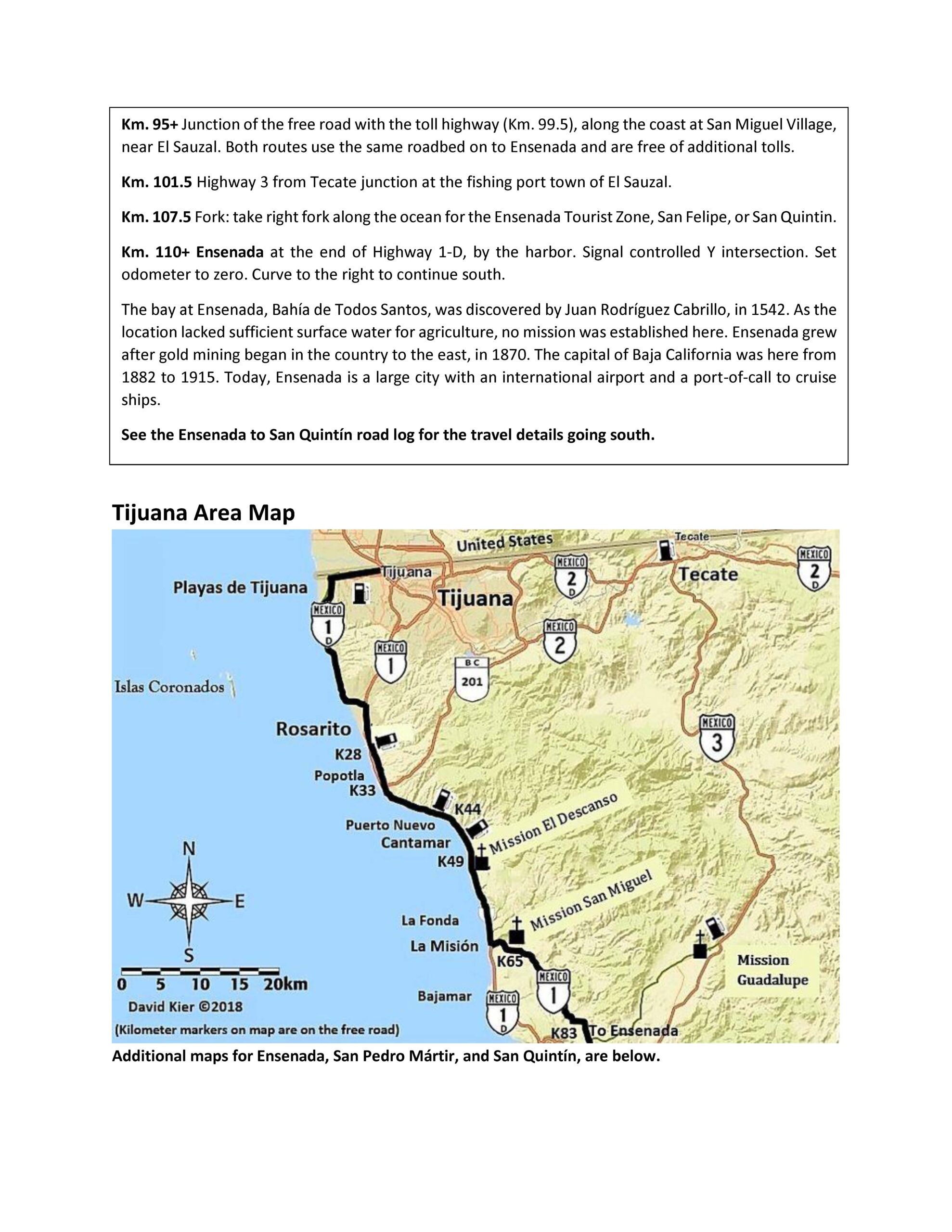
1) Tijuana area -7-
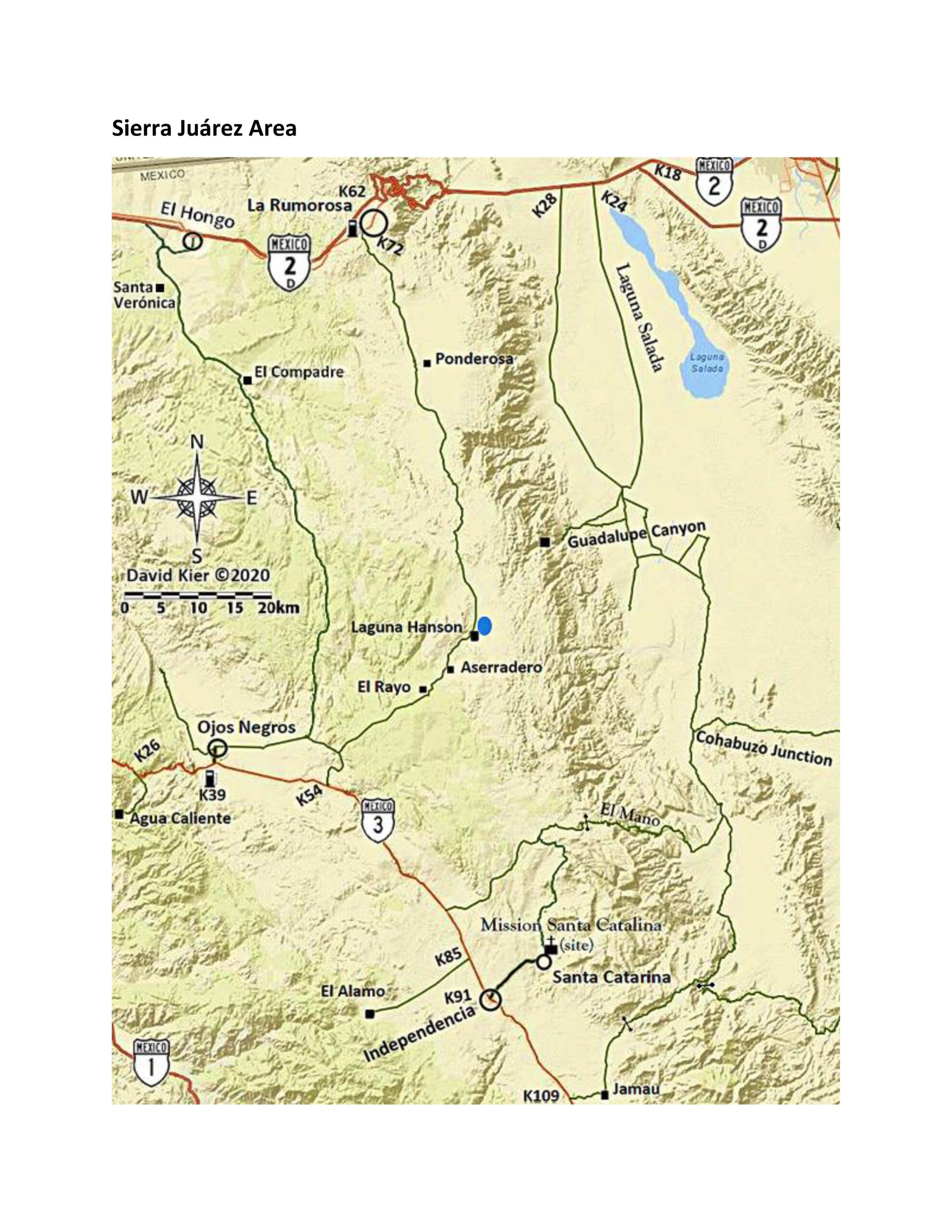
2) Sierra Juárez area -14-
3) Mexicali area -28-
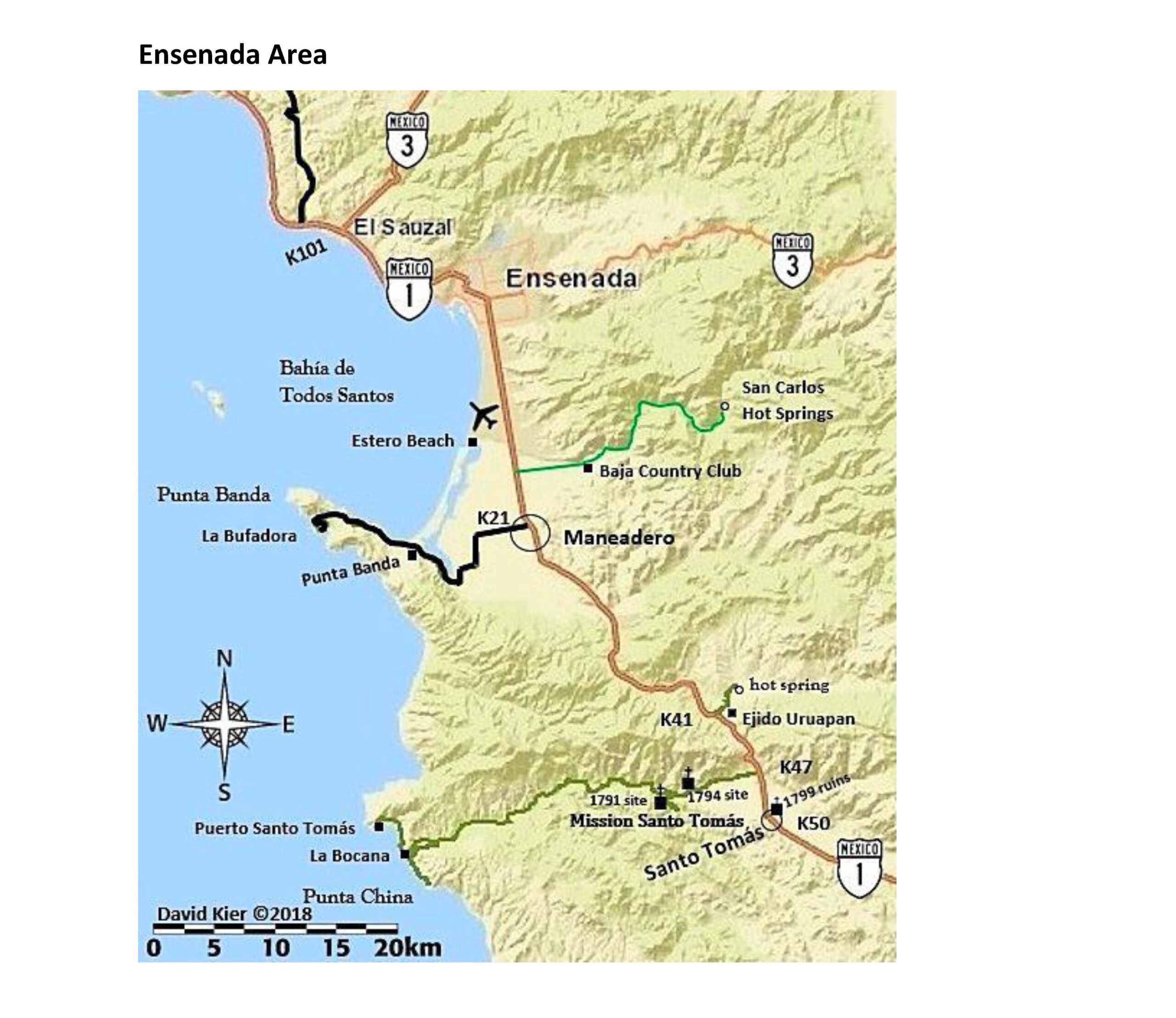
4) Ensenada area -19-
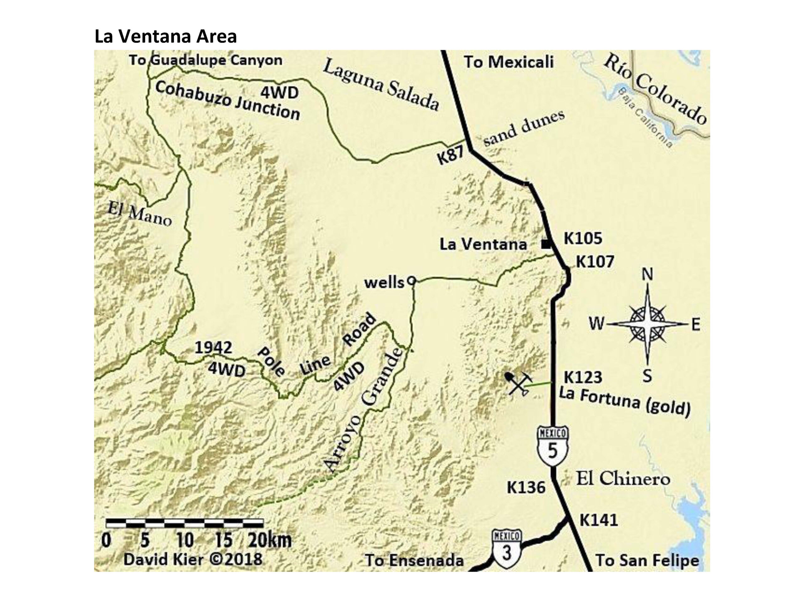
5) La Ventana Highway 5 area -29-
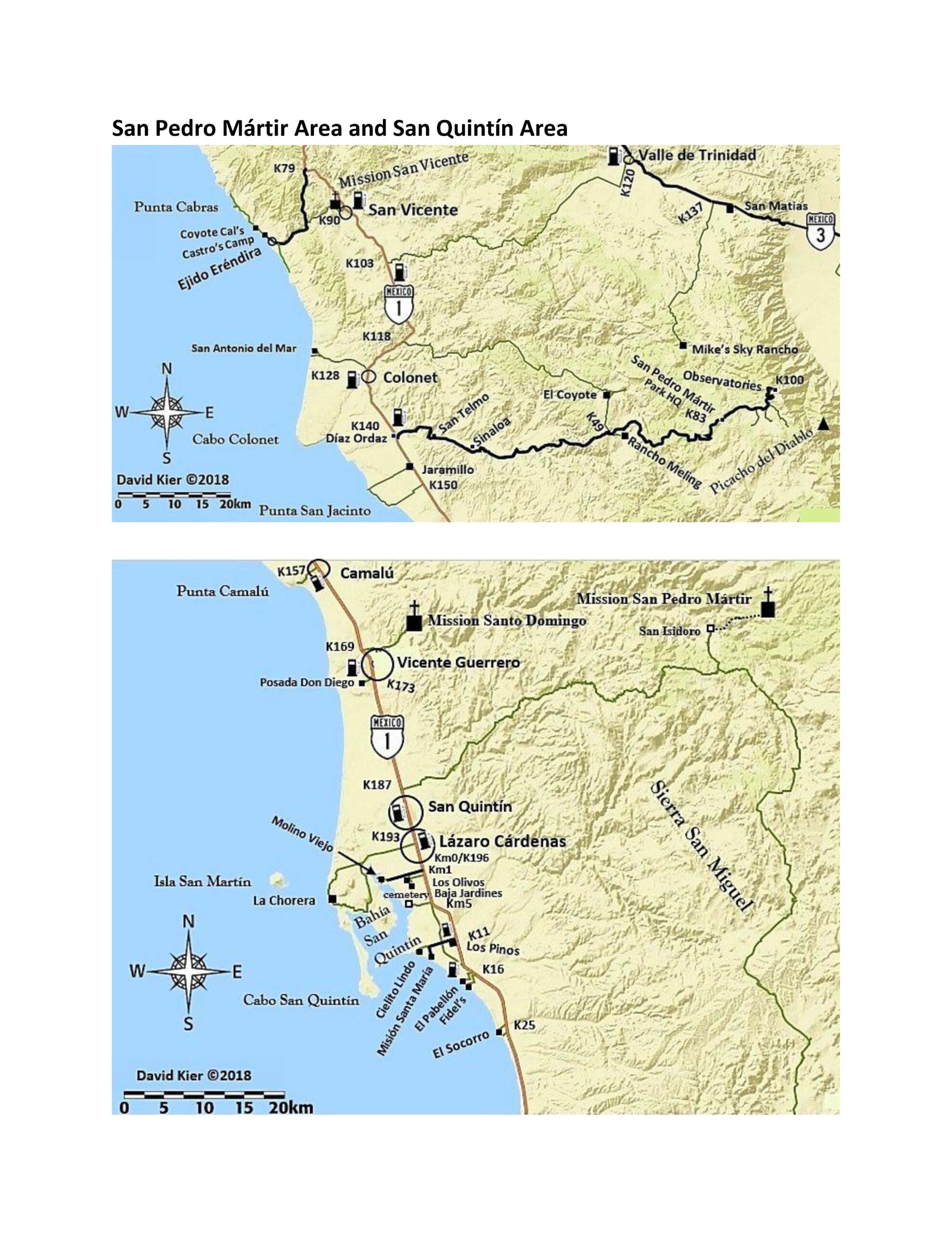
6) San Pedro Mártir, San Vicente, and Valle de Trinidad area -20-
7) San Quintín area -20-
8) San Felipe area -38-
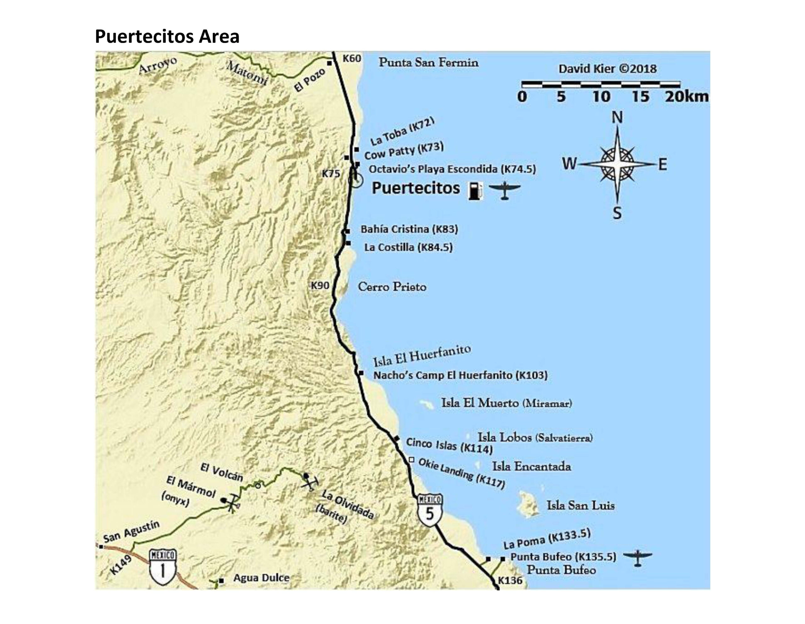
9) Puertecitos area -48-
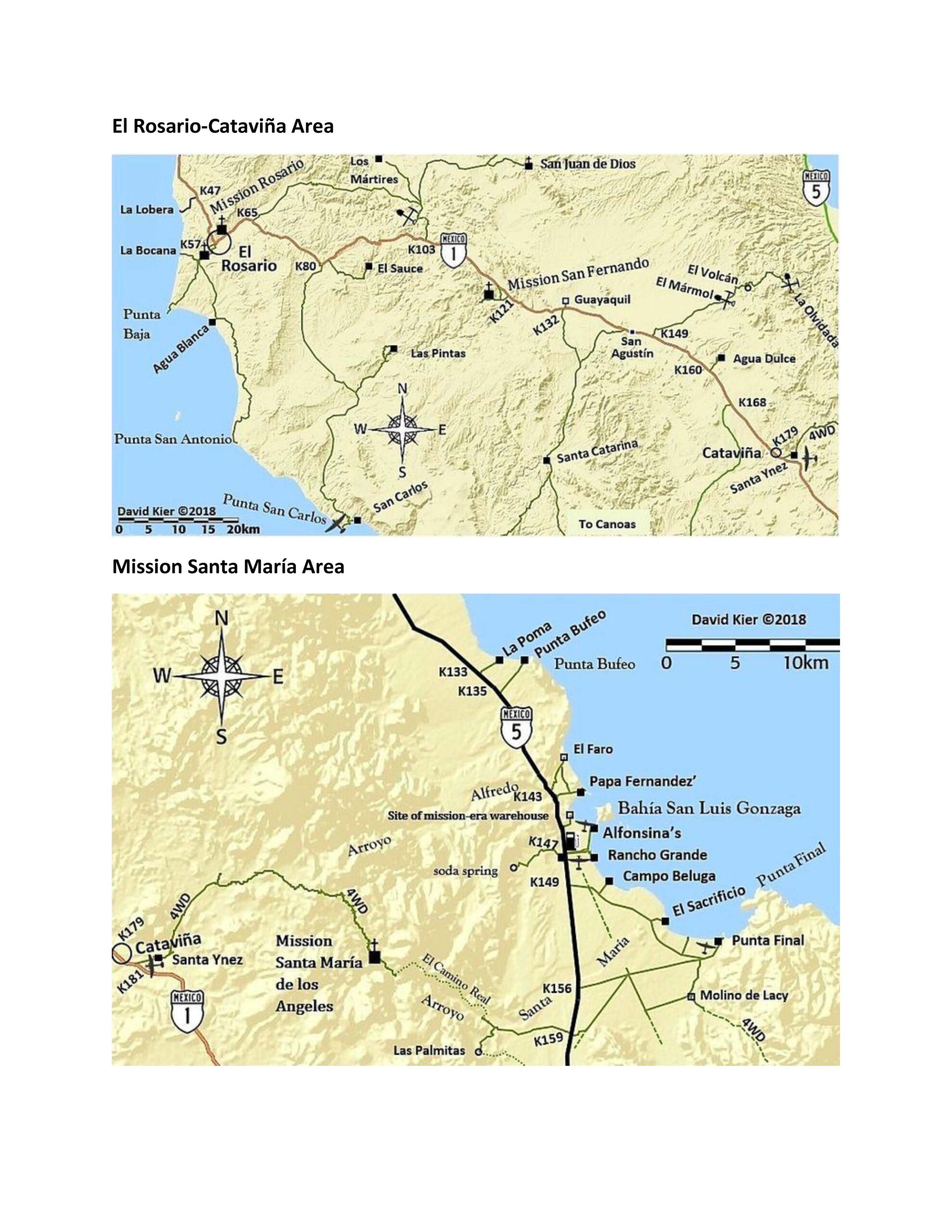
10) El Rosario to Cataviña area -65-
11) North Seven Sisters area -73-
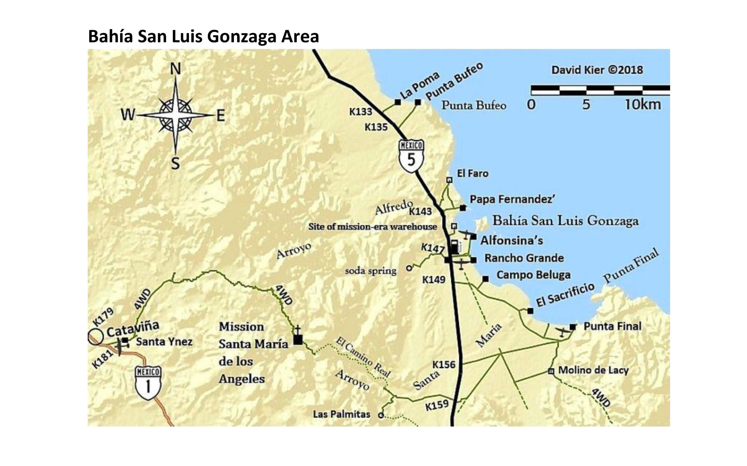
12) Bahía San Luis Gonzaga and Mission Santa María area -49-, -65-
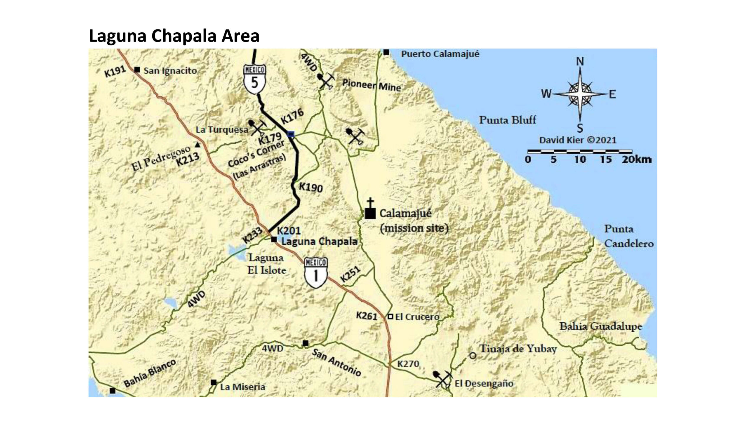
13) Laguna Chapala area -50-, -66-
14) South Seven Sisters area -74-
15) Bahía de los Angeles area -66-, -83-
16) Paralelo 28°-El Arco-Punta San Francisquito area -67-, -83-, -91-
17) Vizcaíno area -87-, -95-
18) Bahía Tortugas area -96-
19) Bahía Asunción area -95-
20) Punta Abreojos area -99-
21) San Ignacio to Laguna San Ignacio area -87-, -104-
22) San Ignacio to Santa Rosalia area -116-
23) San Juanico area -105-
24) Mulegé area -117-
25) Loreto-Comondú-La Purísima area -106-, -118-
26) Juncalito to Ciudad Insurgentes area -107-
27) Ciudad Constitución-Bahía Magdalena area -131-
28) Ciudad Constitución to San Evaristo area -132-, -151-
29) La Paz area -133-, 144-, -151-
30) Todos Santos and Los Barriles area -144-
31) Los Cabos area -144-
-11-
-12-
-13-
-14-
-15-
-16-
-17-
-18-
-19-
-20-
The Observatory Road:
-21-
-22-
-23-
-24-
-25-
-26-
-27-
-28-
-29-
-30-
-31-
-32-
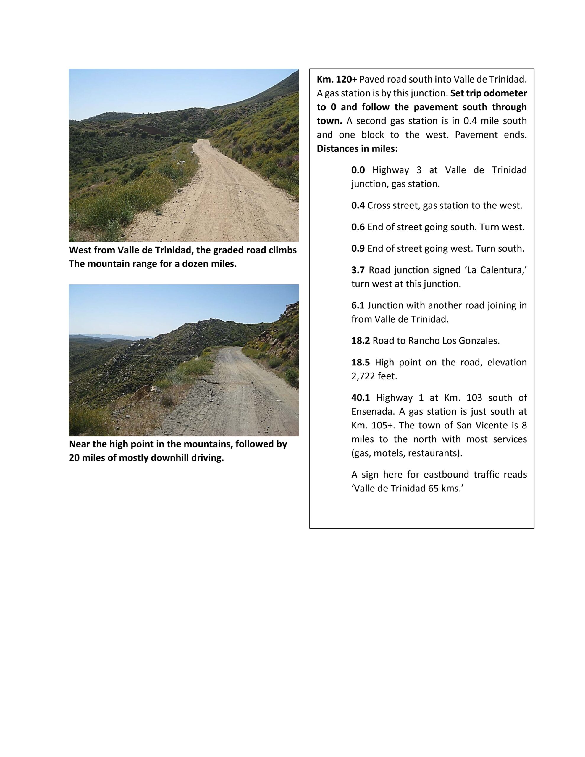
Valle de Trinidad to Highway 1 Map

-33-
-34-
-35-
-36-
-37-

-38-
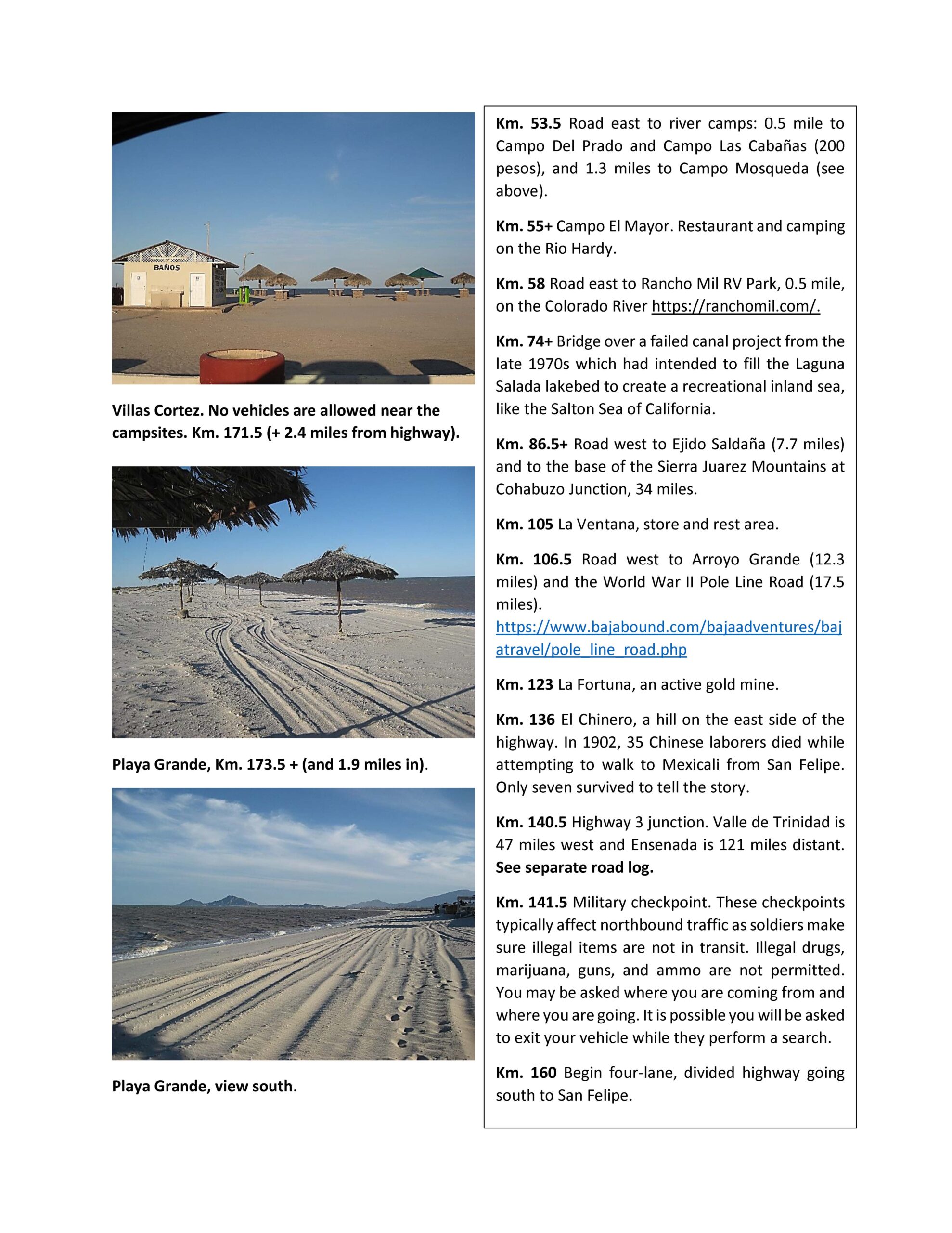
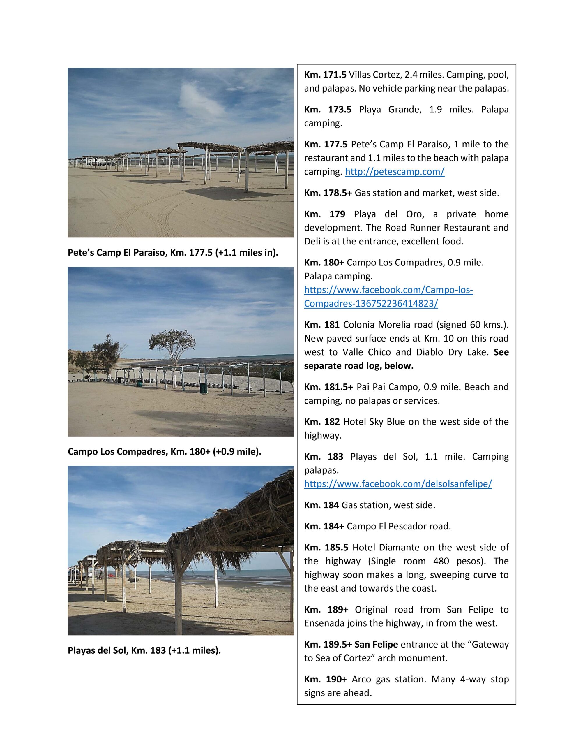
Highway #5, south of San Felipe:
-39-
-40-
 -41-
-41-
-42-
-43-
-44-
-45-
-46-
-47-
-48-
-49-
-50-
-51-
-52-
-53-
-54-
-55-
-56-
-57-
-58-
-59-
-60-
-61-
-62-
-63-
-64-
-65-
-66-
To Paralelo 28° (state border)

-67-
-68-
-69-
-70-
-71-
-72-
Remote Pacific (“Seven Sisters”) Area:

-73-
-74-

-75-
-76-
-77-
-78-
-79-
-80-
-81-
-82-
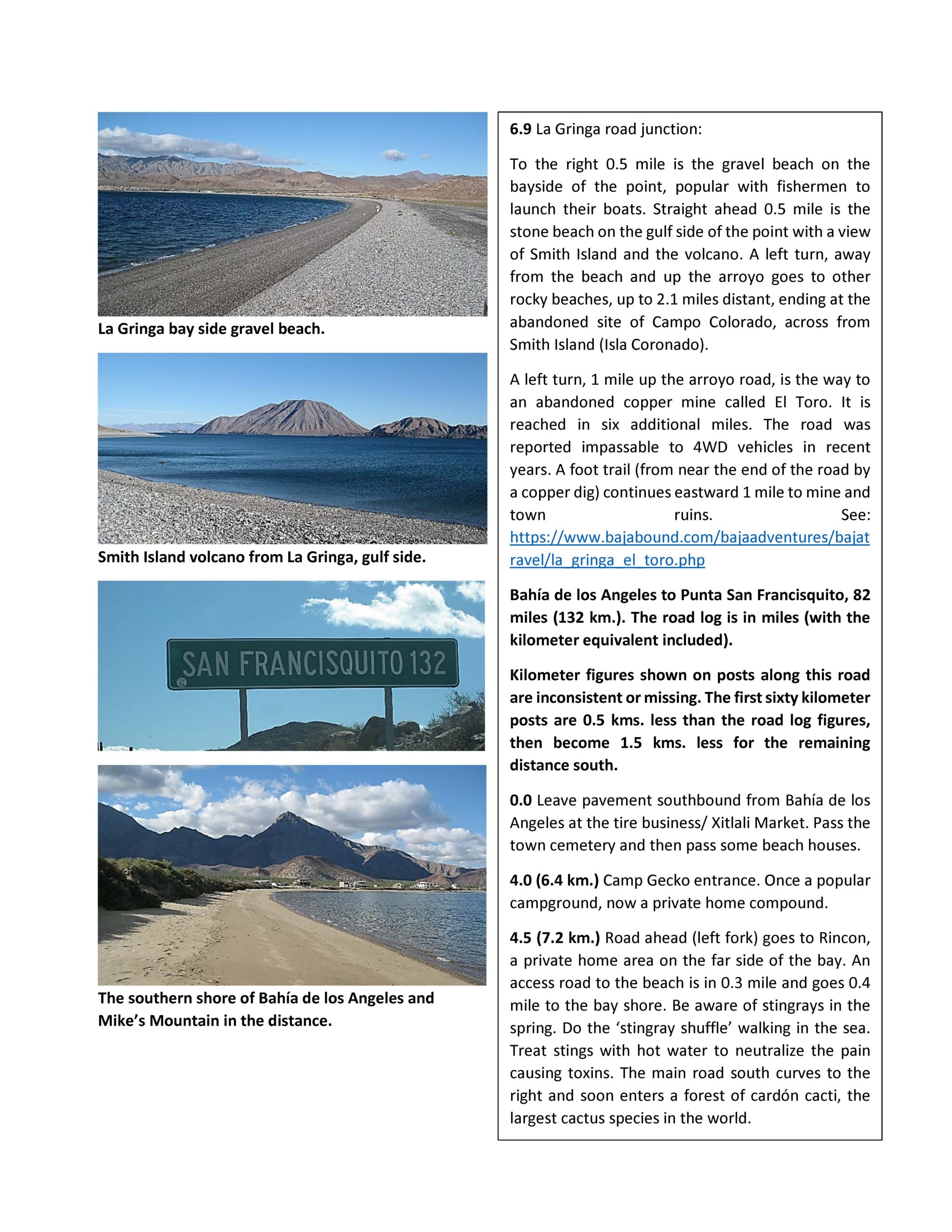
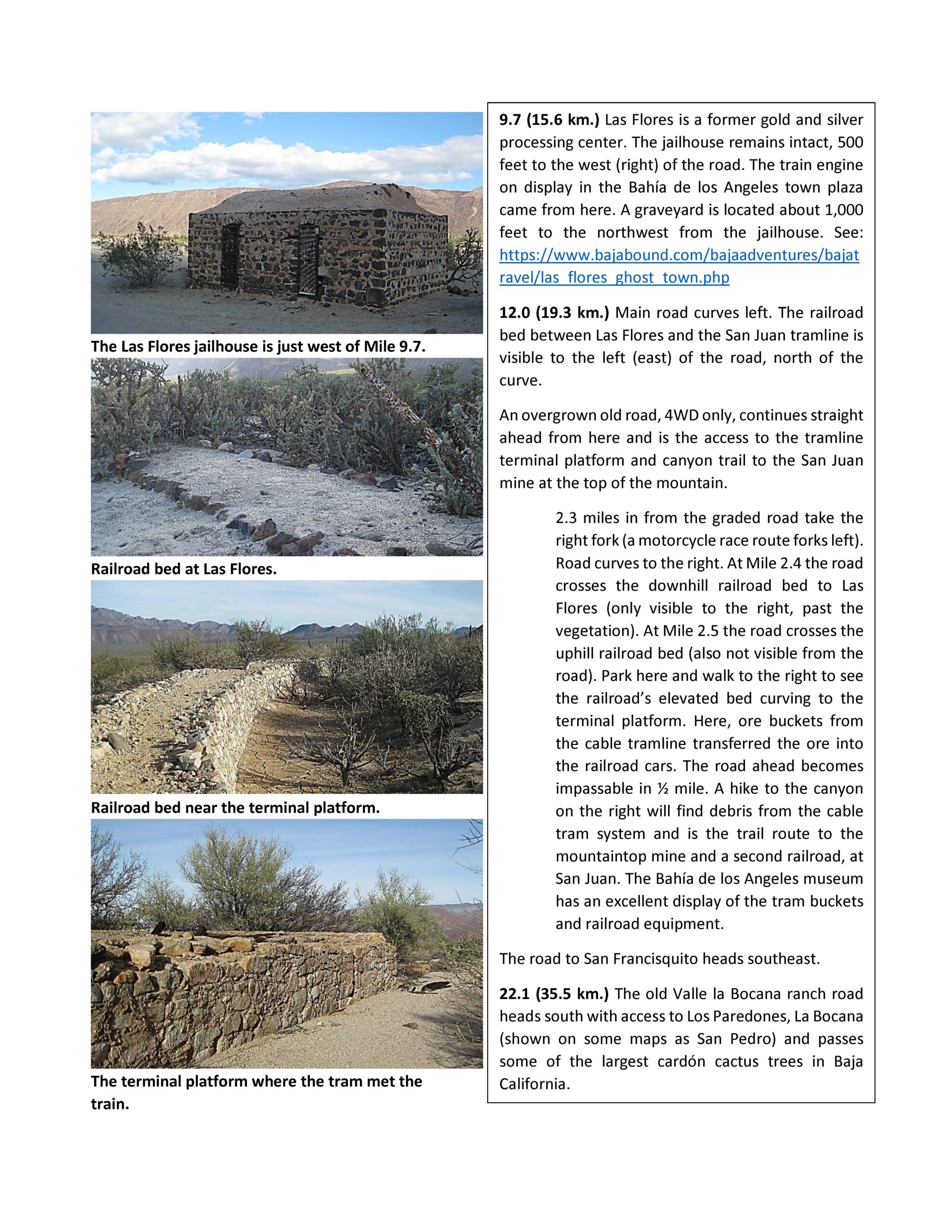
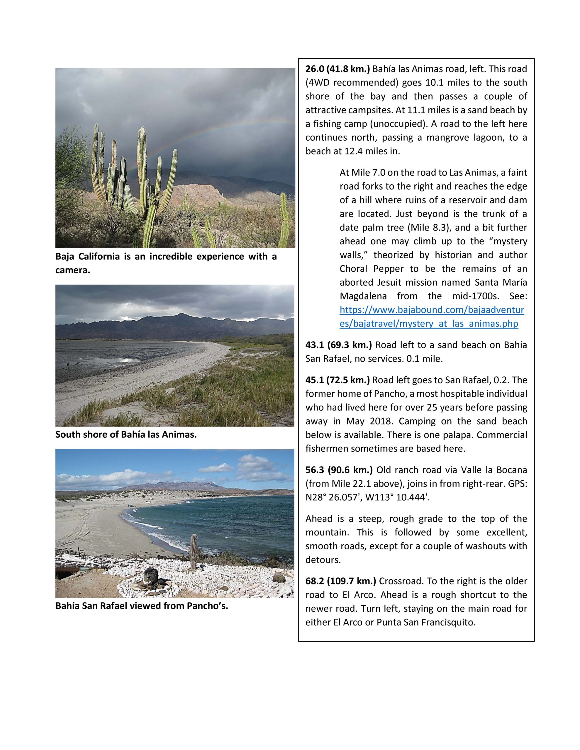
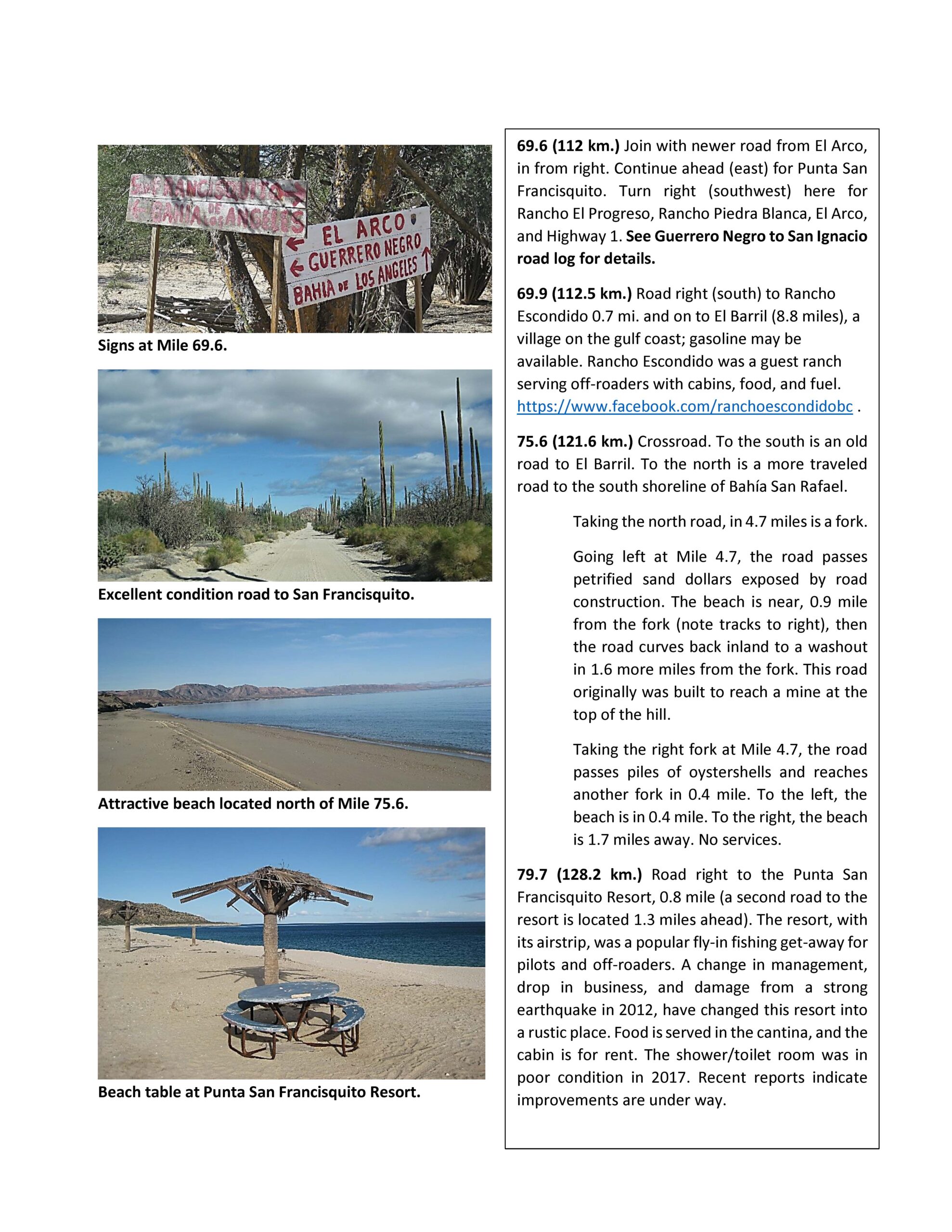
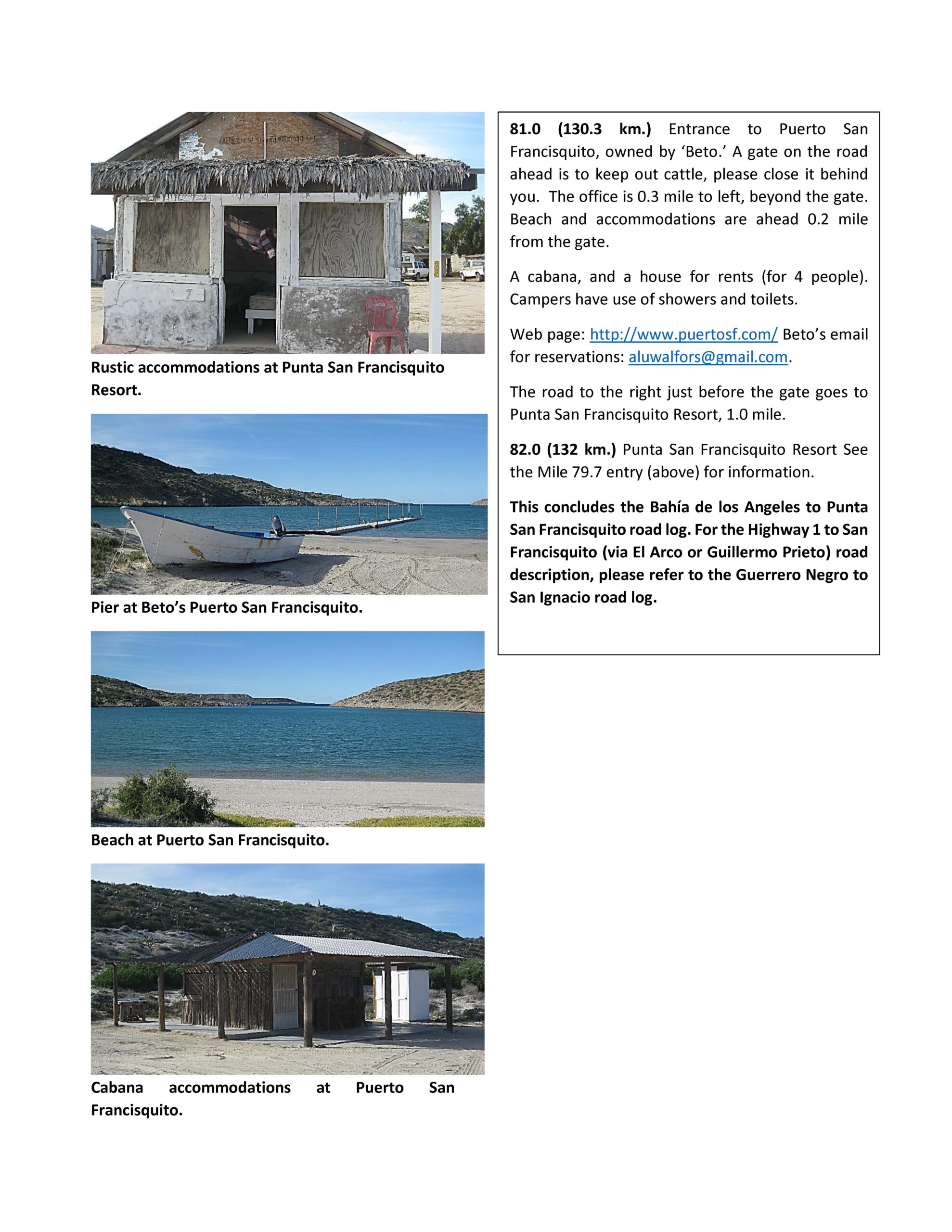
Bahía de los Angeles to Punta San Francisquito Area:

-83-
Go to Part 2 for Baja California Sur