Full name: San José de Comondú
Founding date: 1708 (relocated 22 miles south in 1736) Mission #5
Catholic Order: Jesuit
Founded by: Padre Julián de Mayorga
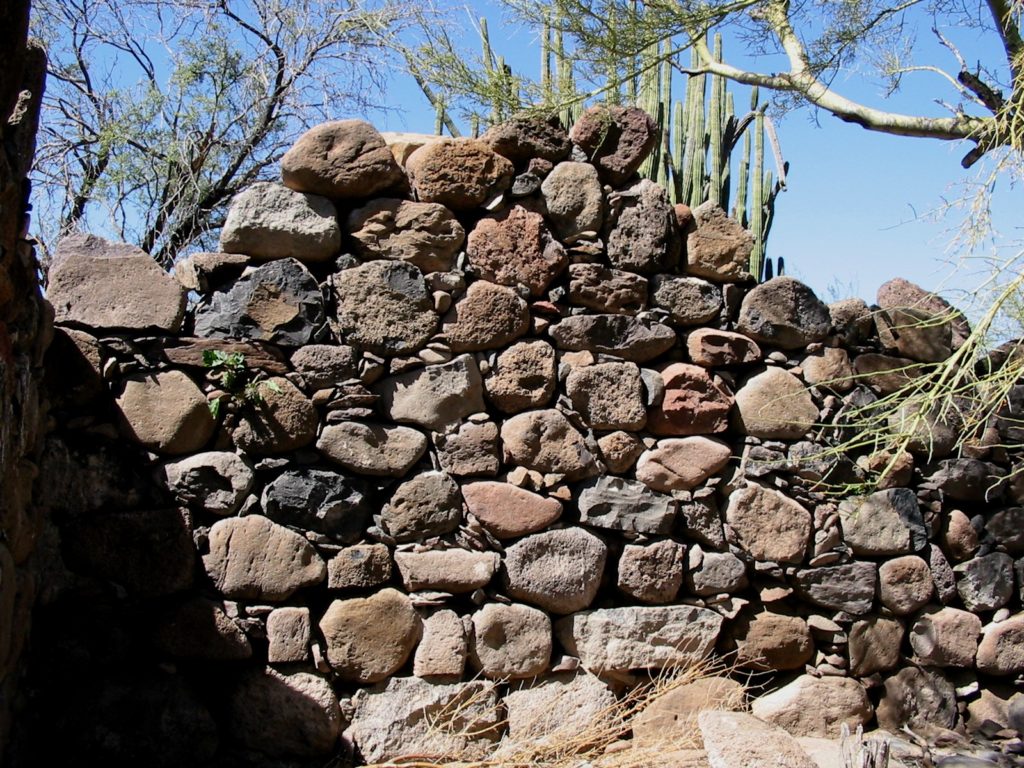
Condition: Stone foundation outline of an adobe church, completed in 1716, and stone ruins of missionary’s home, is at the first site. A cut stone church was constructed from 1751 to 1761 at the final site and demolished in 1936. A side chapel was preserved.
Closing date: Closed in 1827.
GPS: 26.274278, -111.719028 (first site), 26.059726, -111.822168 (final site)
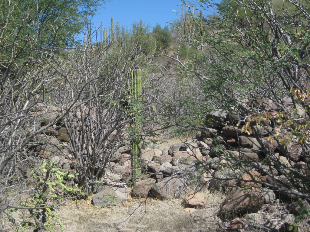
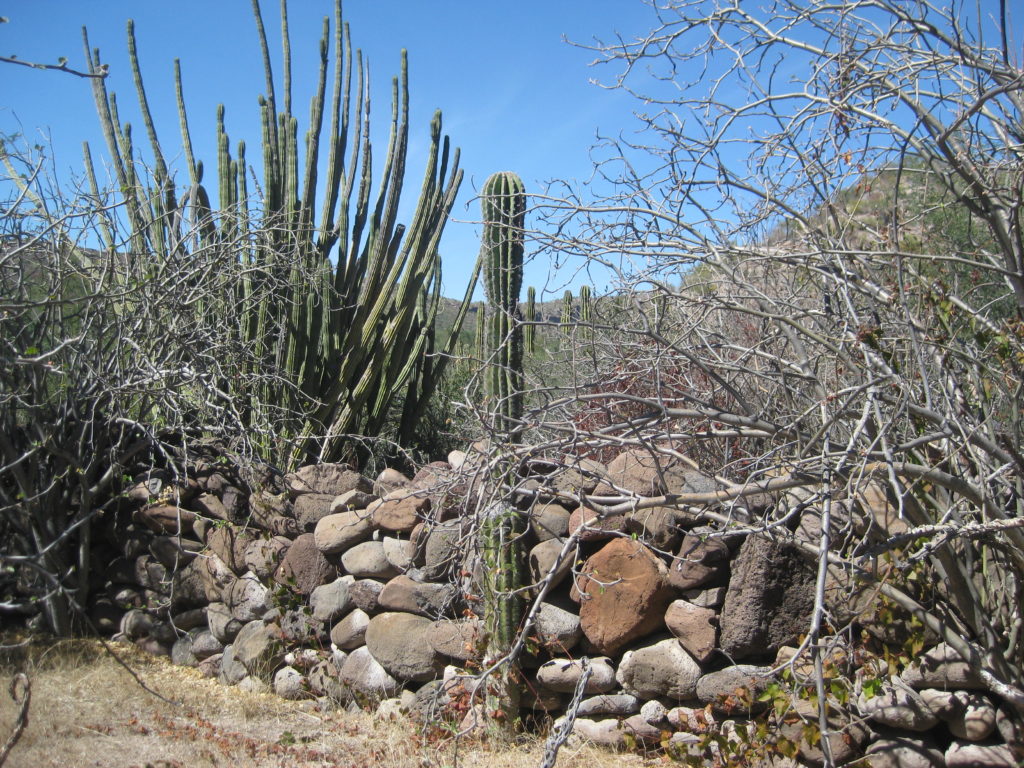
Access: (First site) Dirt road from the north via Rancho San Juan and 1 km. hike crossing arroyo twice. Ruins partially concealed by heavy brush and cactus growth. (Final site): Paved road from the south (BCS#53, km. 64.5) or unpaved roads, east from km. 27.5, near San Javier or southeast from San Isidro/ La Purísima.
First site, read more: HERE
Final site, read more: HERE
FIRST SITE, now called Comondú Viejo, 1708 to 1736
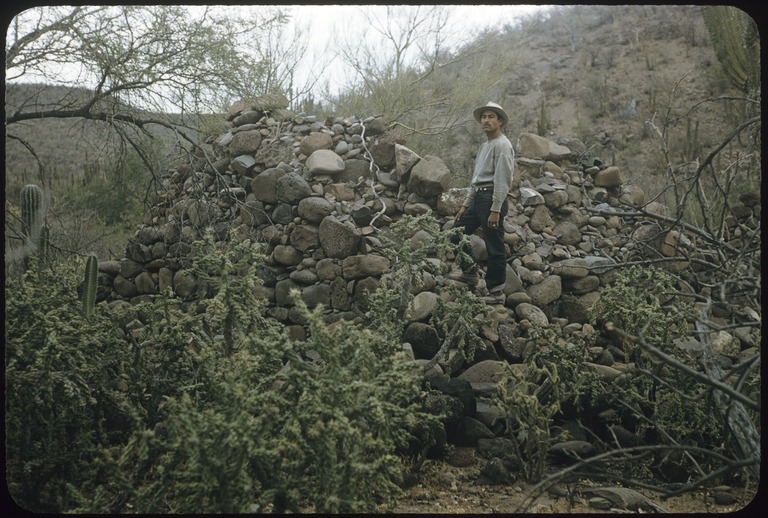
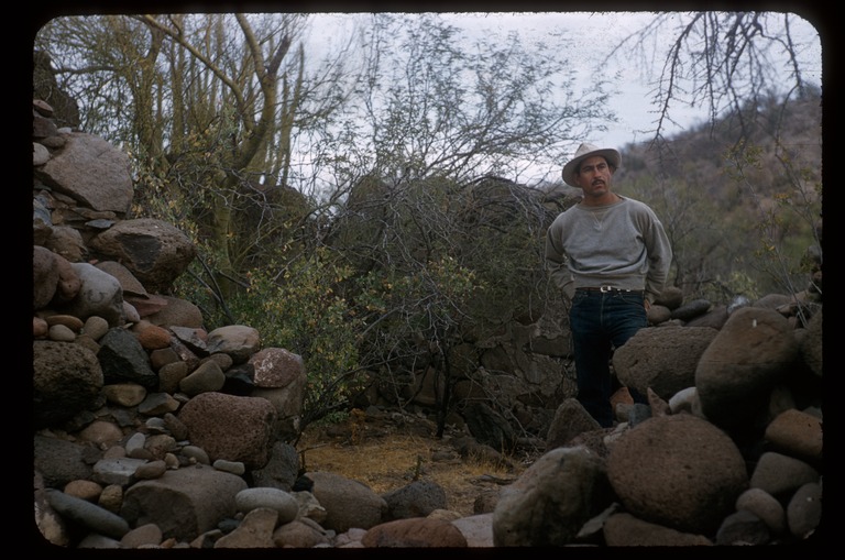
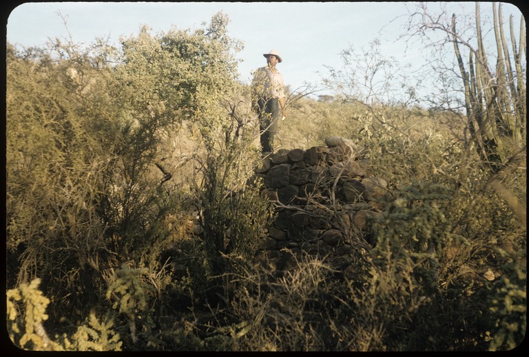
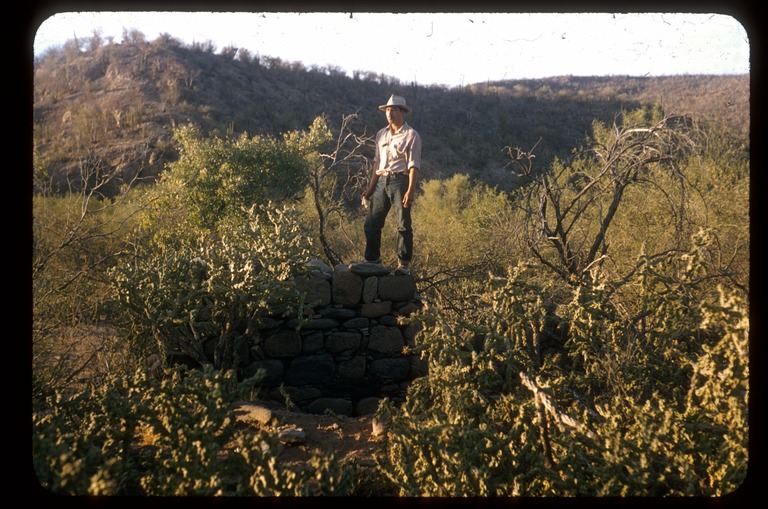
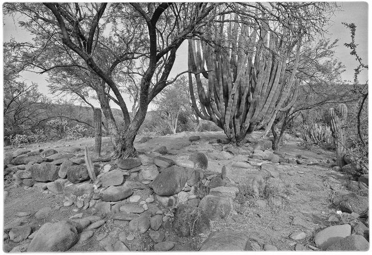
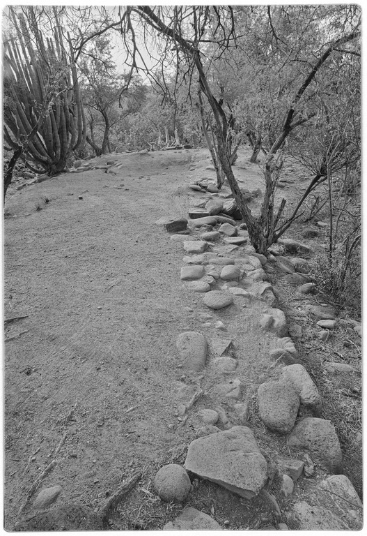
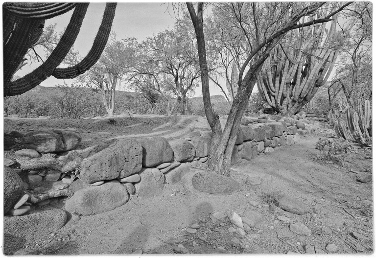
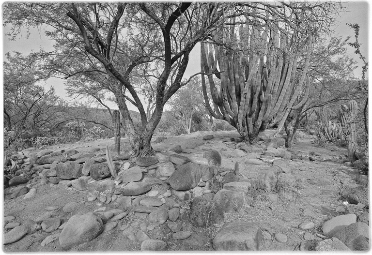
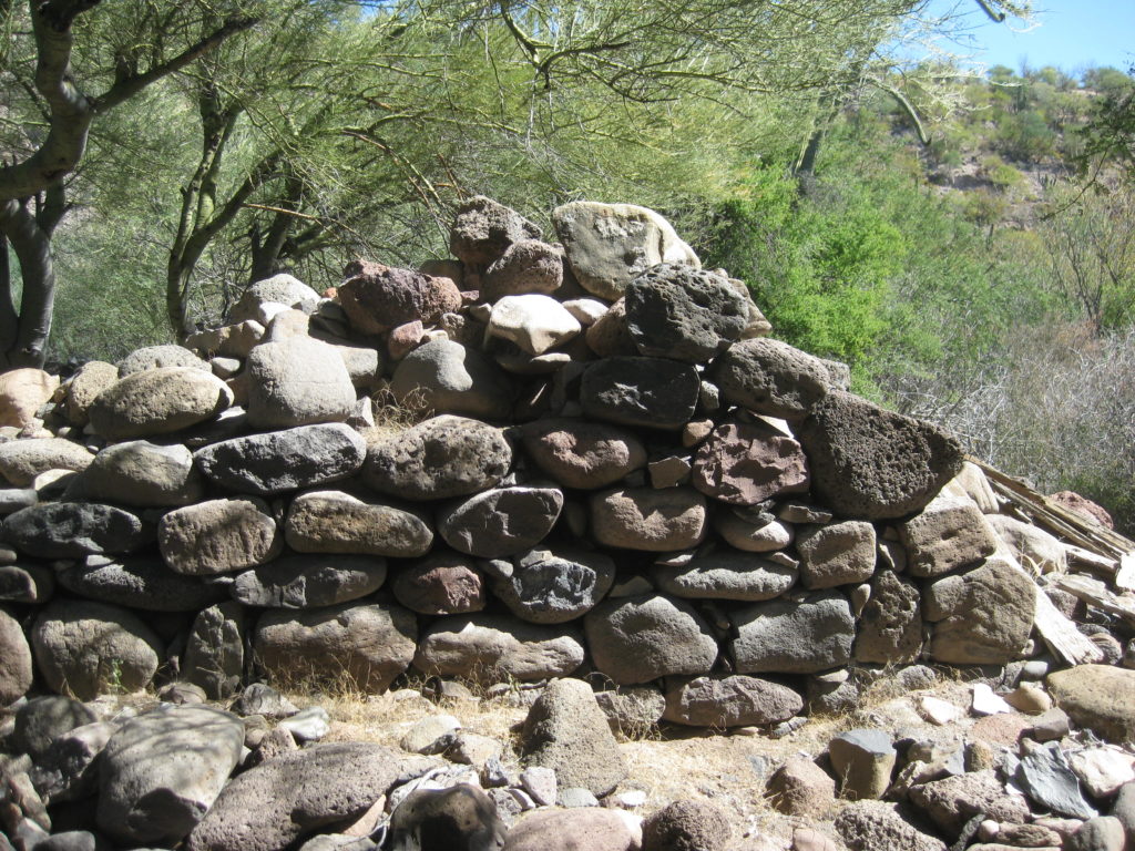
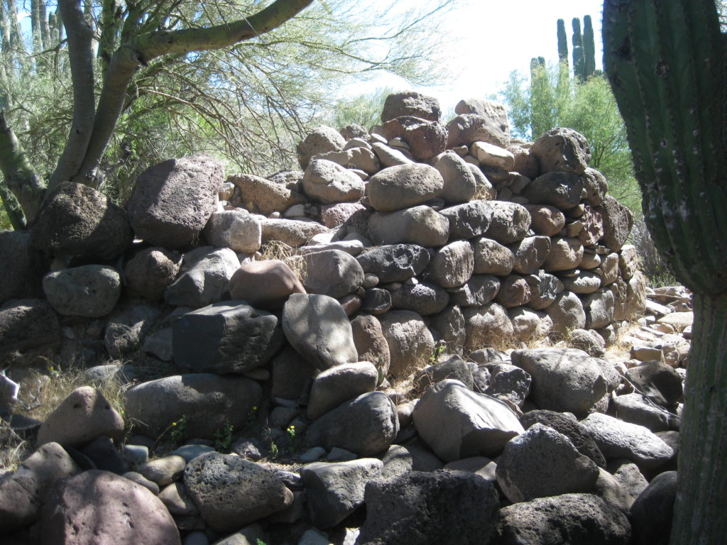
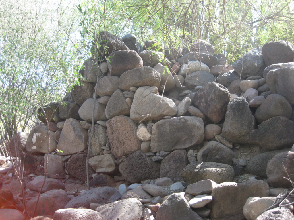
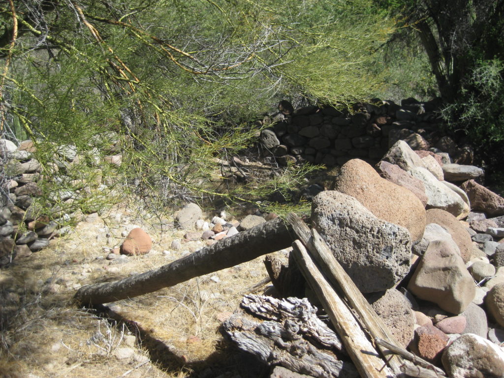
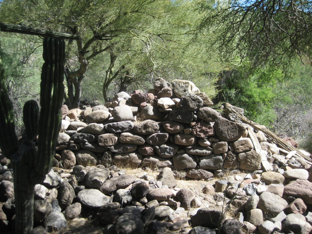
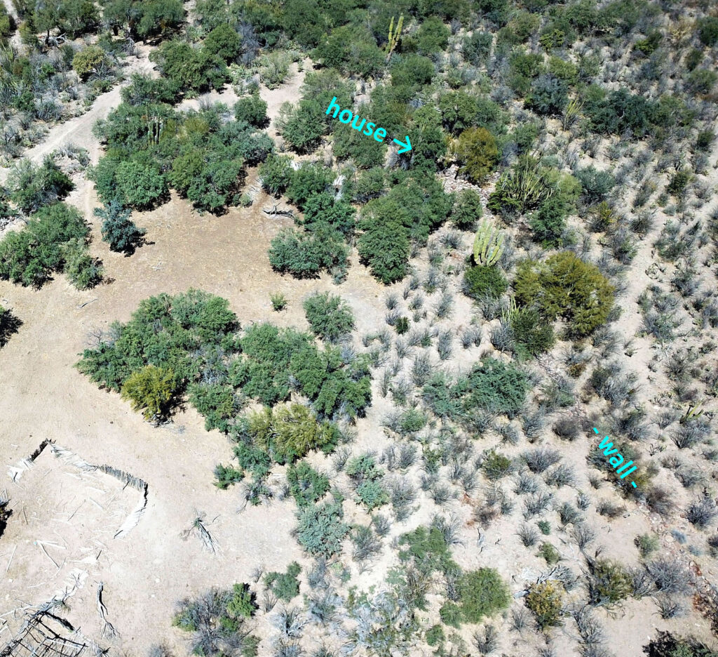
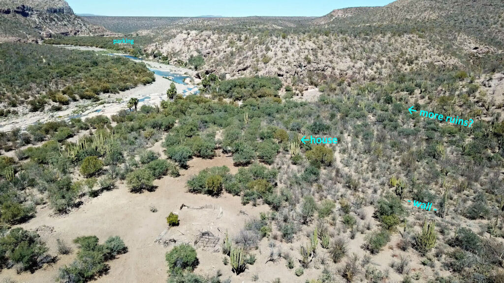
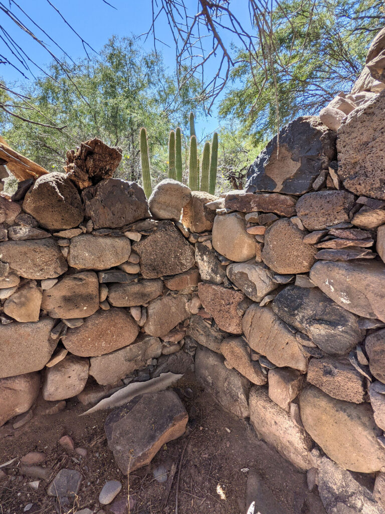
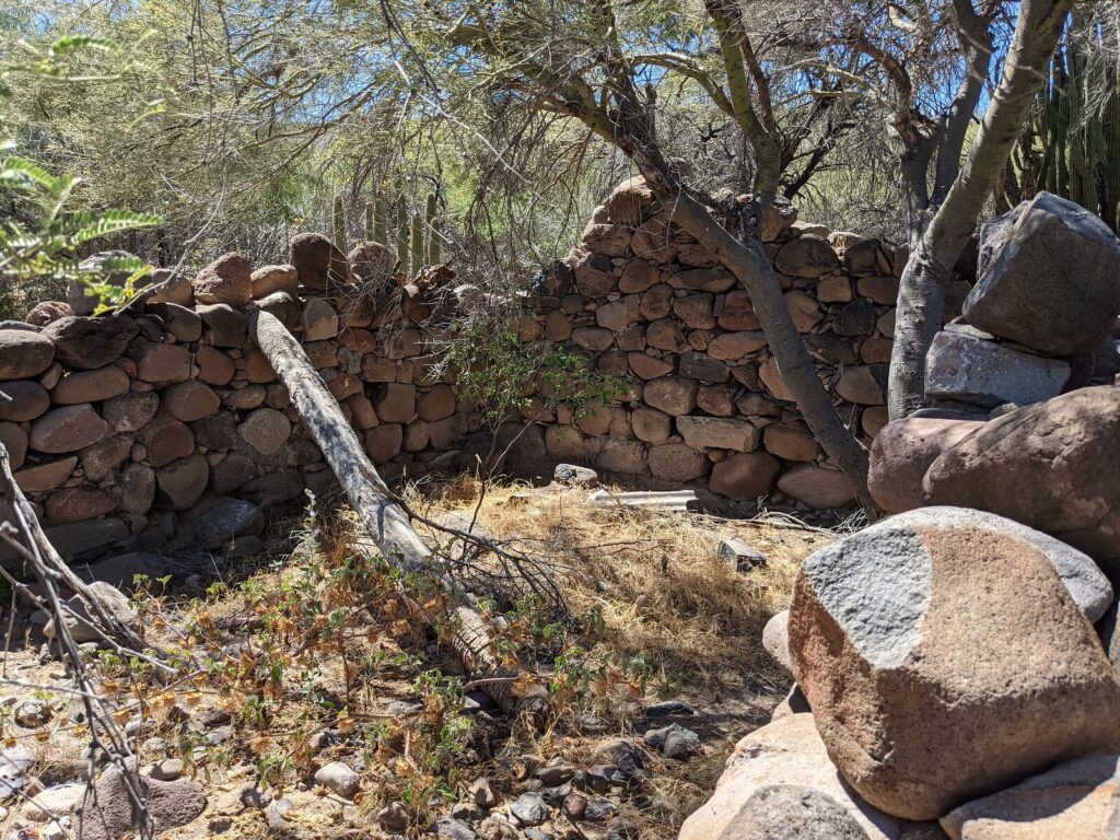
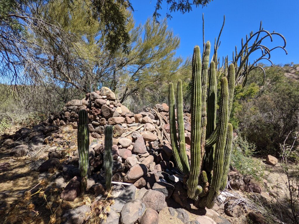
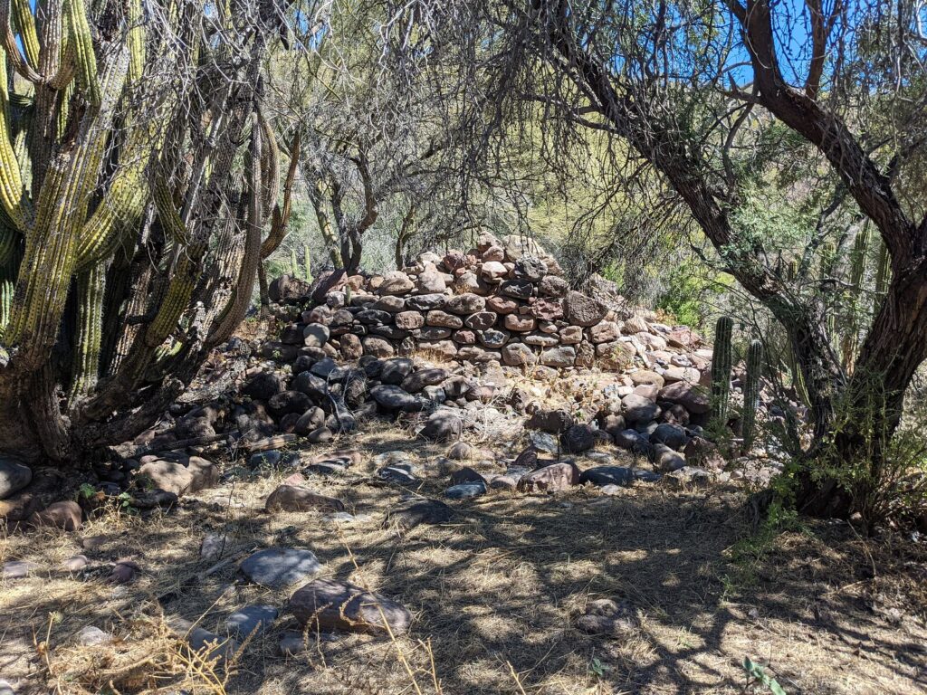
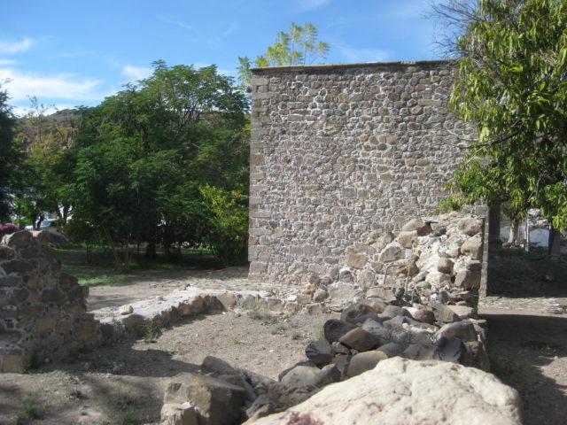
Photographs below are by Howard Gulick in 1956; Harry Crosby in 1990; Jack Swords in 2002; David Kier in 2017; and Octopup in 2023. Stone walls are the remains of Padre Mayorga’s mission residence.
1956
1990
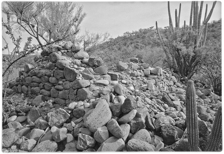
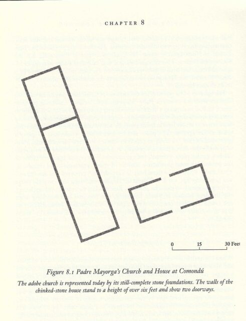
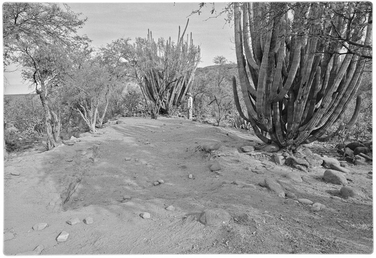
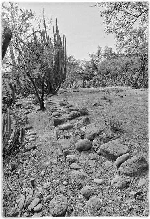
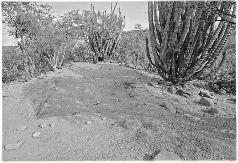
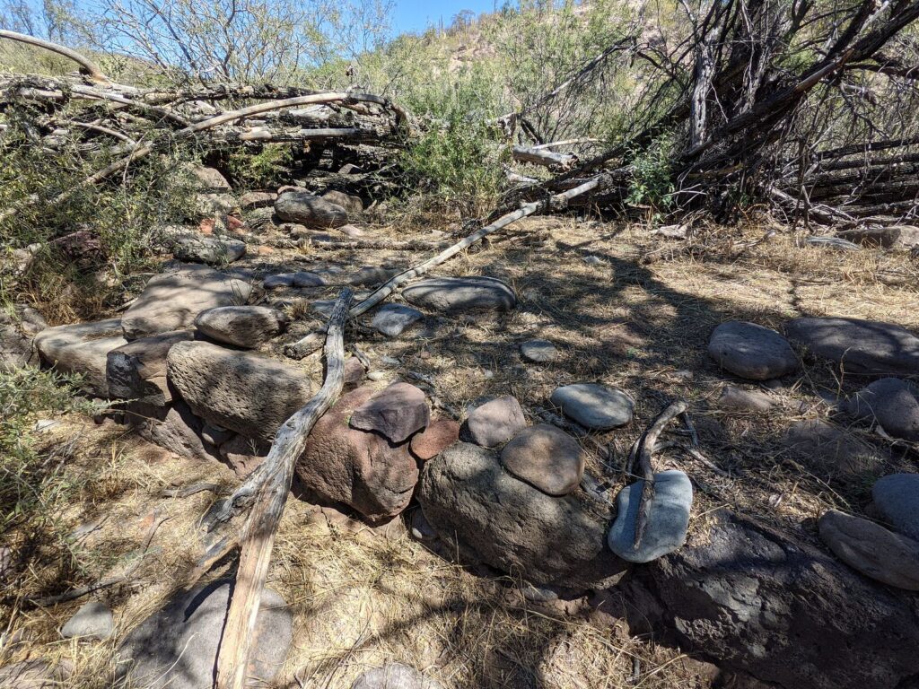
The priest’s house ruins are at N26°16.45’, W111°43.14’ and other walls are just northeast. The mission church was made of adobe and nothing remains of it. It was next to the padre’s house, forming the long line of a letter L (with the house being the small line). See the plan below from Harry Crosby’s book, Antigua California.
The mission church floor and foundation stones in 1990:
2002
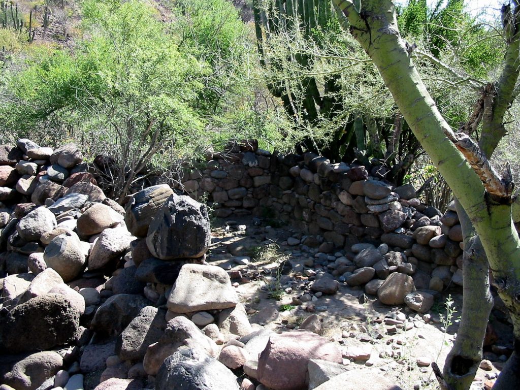
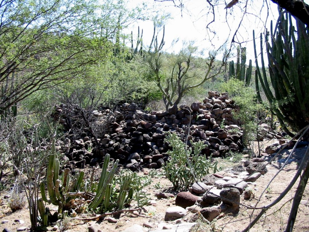
In February 2017, I traveled to the site. The road from the north, via Rancho San Juan was washed away 1 km. from the mission requiring a hike. In 2023, conditions were the same for ‘Octopup’ on his visit.
I wrote about my visit, with driving directions, HERE
2017
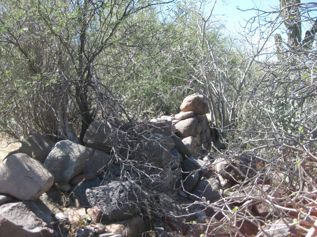
2023
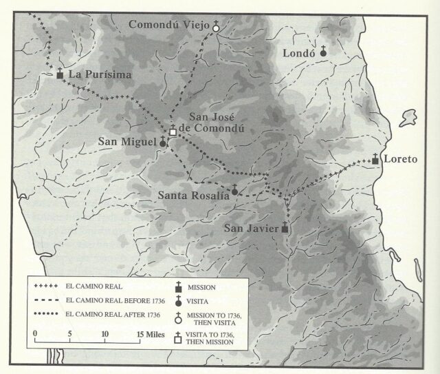
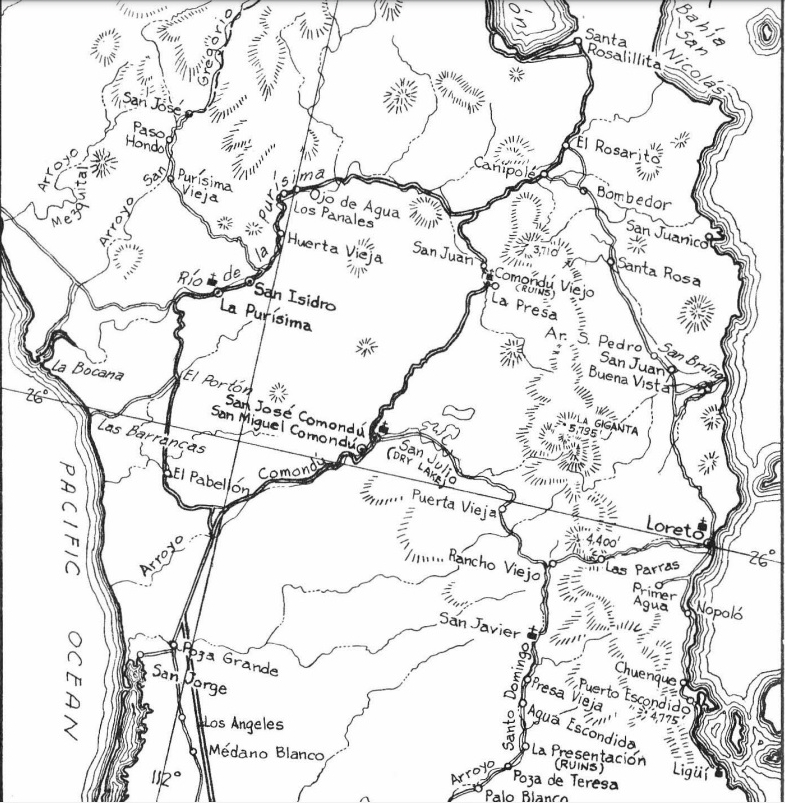
MAPS showing both Comondú mission sites:

FINAL COMONDÚ MISSION SITE, 1736 to 1827.
Prior to 1736, this location was a Comondú visita named San Ignacio. It was just 2.2 miles (4 kms.) from the San Javier mission visita of San Miguel. When the mission moved, it kept the original name and the visita of San Miguel was transferred to it, making that San Miguel de Comondú.
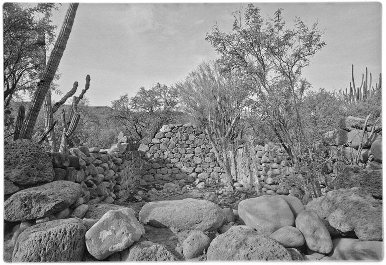
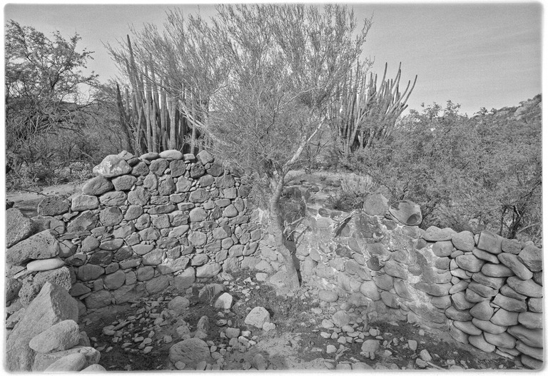
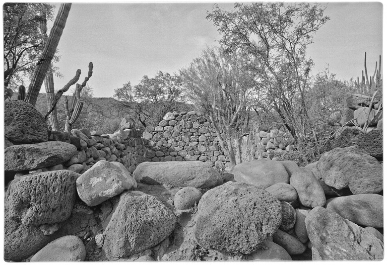
Photographs below are by Arthur North in 1906; Edward Davis in 1926; an unknown photographer after 1936; Marquis McDonald in 1950; Howard Gulick in 1955; Erle Stanley Gardner in the 1960s; Jack Swords in 2001; Octopup in 2012; and David Kier in 2017.
1906
1926
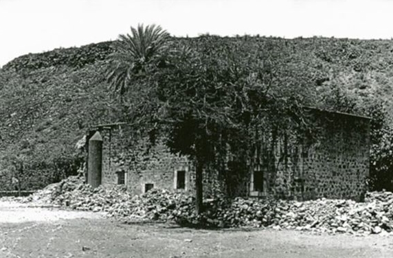
Post-1936
1950
1955
1960s
2001


2012
In May 2012, Octopup photographed Mission San José de Comondú: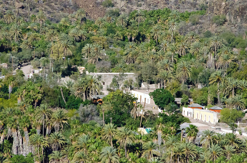
2017
February 2017 David Kier photographs:
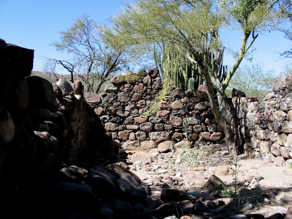
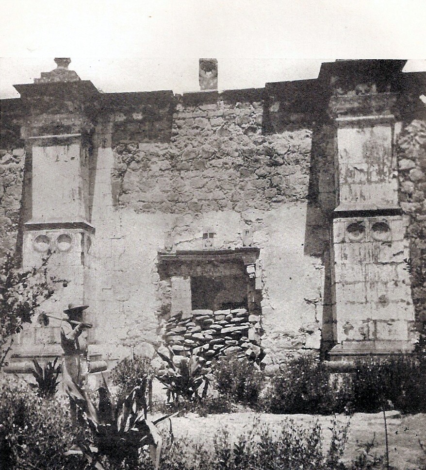
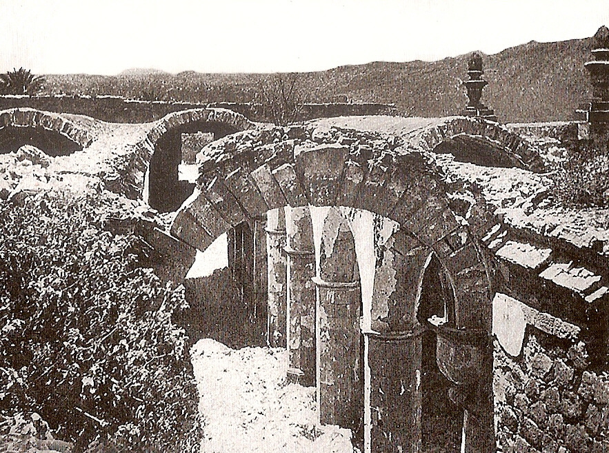
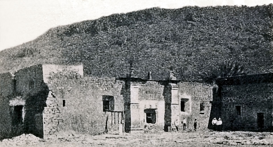
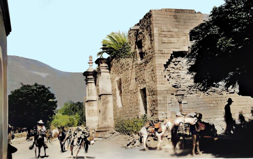
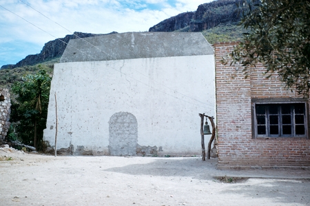
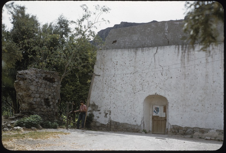
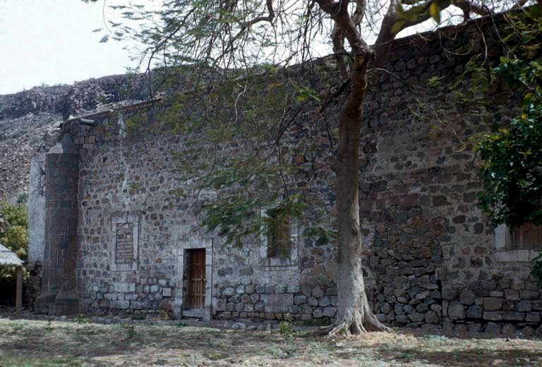
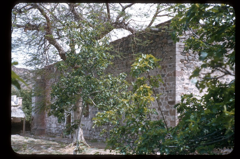
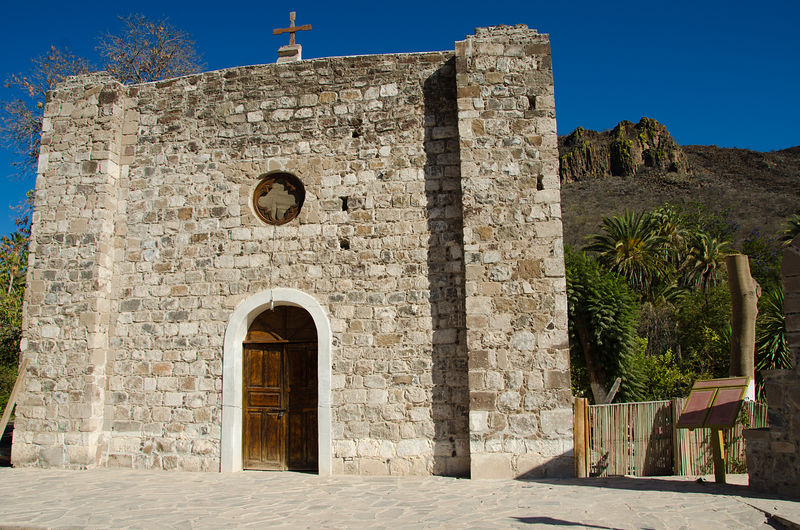
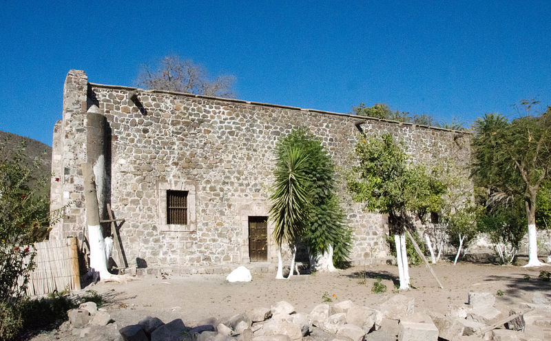
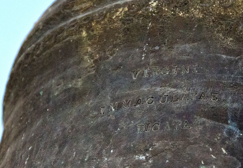
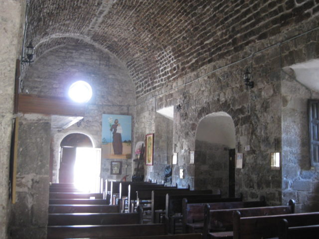
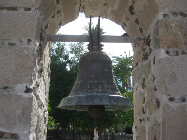
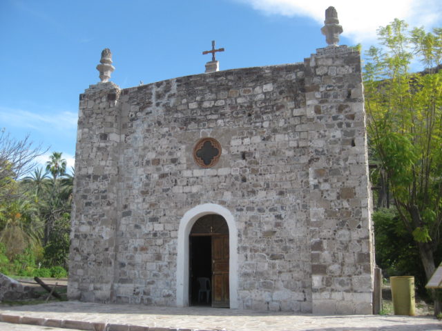
Mission San José de Comondú, founded in 1708 and relocated to this site in 1736 from Comondú Viejo, 22 miles to the north. Stone church buildings erected between 1751 and 1761. All but this side chapel were demolished in 1936.


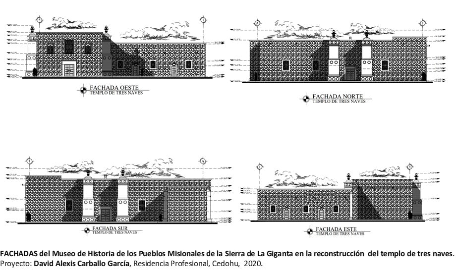
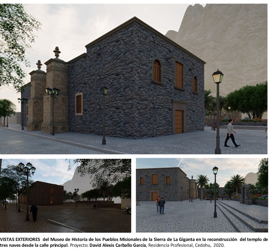
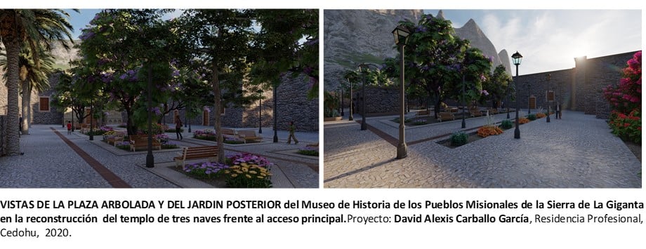
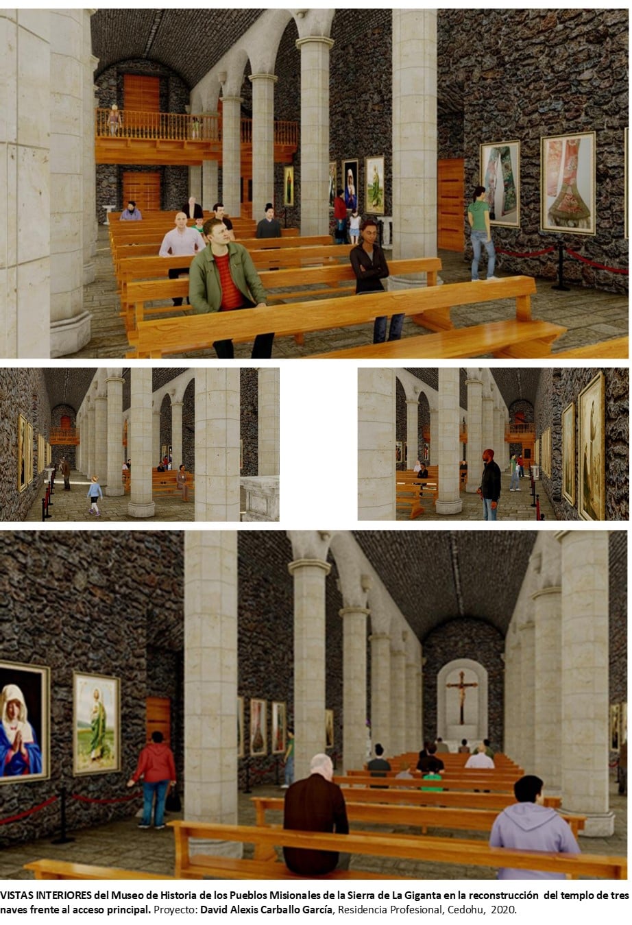
The 1761 mission church, demolished in 1936, was one of the largest churches in all of the Californias, but was in ruins and deemed to be dangerous. Here are some artist samples of what it would look like if rebuilt…
I hope this was interesting or informative for you! Please be welcome to join our Baja California Land of Missions Book Group, on Facebook: HERE
- All the missions, quick look and history, north to south: HERE
- Other mission photo pages plus more Baja California history: HERE
- VivaBaja.com home page
- Special thanks to Octopup.org
![]()
![]()
The following chapter is from my book, Baja California Land of Missions
Order your own copy from Amazon Books: HERE
#5 San José de Comondú (1708-1827)
The fifth California mission was founded by the Jesuit Padre Julián de Mayorga about thirty miles northwest of Loreto, on a stream that flowed west to the Pacific Ocean. The new mission name was a combination of the Indian name for the site (Comondú) and the Spanish name, “San José de la Giganta,” given to it by Padre Juan María de Salvatierra, Loreto’s founder. The Marqués de Villapuente, José de la Peña Castejón y Salcines was the mission’s benefactor.
The first enclosed church building here was small and made of adobe blocks. It replaced a simple thatch-roofed shade structure made from local trees. Padre Mayorga hoped to construct a larger church, but a smallpox epidemic delayed its construction. Stone masons were not available, so the larger church was also made of adobe. It was built on a stone foundation and completed in October 1716. The footing can still be seen today. The new church and attached storeroom walls were nearly seventy feet long by twenty-one feet wide and ten feet high. The walls were three feet thick, so the interior width was only fifteen feet.
In 1717, two mission visiting stations or visitas were transferred to the jurisdiction of Comondú from Loreto. They were San Juan Londó and San Ignacio (not the 1728 Mission San Ignacio site). The visita of San Ignacio was twenty-two difficult miles south of San José de Comondú. Because the visita of San Ignacio was such a productive source of food, Padre Mayorga took frequent trips there to help develop it further. Two more miles south was another visita but developed for Mission San Javier and named San Miguel. Together, the visitas of San Miguel and San Ignacio provided more food than many of the other peninsula missions could.
The Jesuits assigned Padre Guillermo Gordon from 1734 to 1737 to the San Miguel visita to relieve both Padre Mayorga of Comondú and Padre Agustín Luyando of San Javier. Some have called San Miguel a separate mission because of this, but Jesuit records show it was never a mission. The location is now known as San Miguel Comondú.
Padre Julián de Mayorga had been ill for some time and twenty-eight years after he founded San José de Comondú he passed from this life on November 10, 1736. The Jesuits must have been anticipating that day because they decided to move Mayorga’s mission to the visita of San Ignacio, just a couple of weeks later. Some say the mission first moved to nearby San Miguel for a year while San Ignacio was being prepared. The mission name remained unchanged with the move, and the name San Ignacio was eliminated once it became the new mission site. The loss of their padre and then the sudden move from their homeland caused great strife among the Comondú neophytes. The original mission location was renamed Comondú Viejo and is today located between the ranches of San Juan and La Presa.
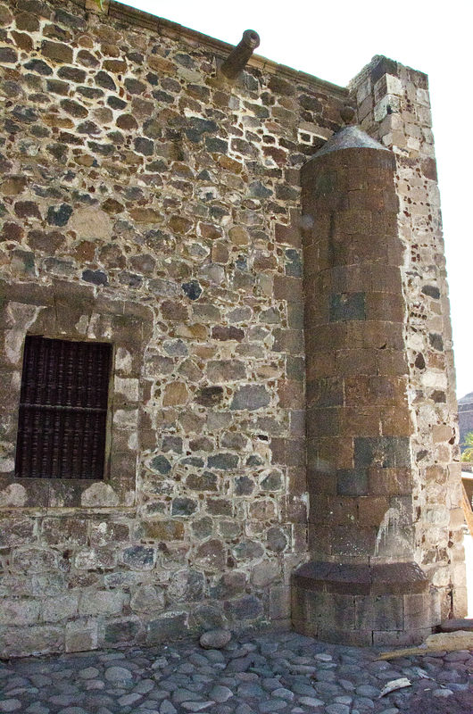
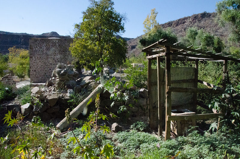
A massive cut-stone church complex was constructed at the new location during the years 1754 to 1760. Even as epidemics were killing off the population the church was built to attract and serve. What had been the largest mission church in California fell into ruin and was demolished in 1936. A side chapel to the main mission church was preserved and is what stands today in the town of San José Comondú. San José Comondú can be reached by paved road from the south or by rough roads from the east and north.
Missionaries recorded at San José de Comondú:
Jesuit
Julián Mayorga 1708-1736
(Mission moved in 1736)
Franz Wagner 1737-1744
José Rondero 1745-1751
Gaspar Trujillo 1748
Franz Inama 1751-1768
Franciscan
Antonio Martínez April 5, 1768
Vicente Imas 1771
Tomás de la Peña 1771-1772
Juan Prestamero 1771-1773
Dominican
Cristóbal de Vera and Andrés Souto May 15, 1773
José Estévez 1790-1791
Pedro de Acebedo 1790-1793
José Aivár 1792
Ricardo Texéyro 1794-1796
Jorge Coéllo 1797-1798
Plácido Sanz 1803-1810
José Antonio Sánchez 1812
Tomás Mansilla 1825-1826