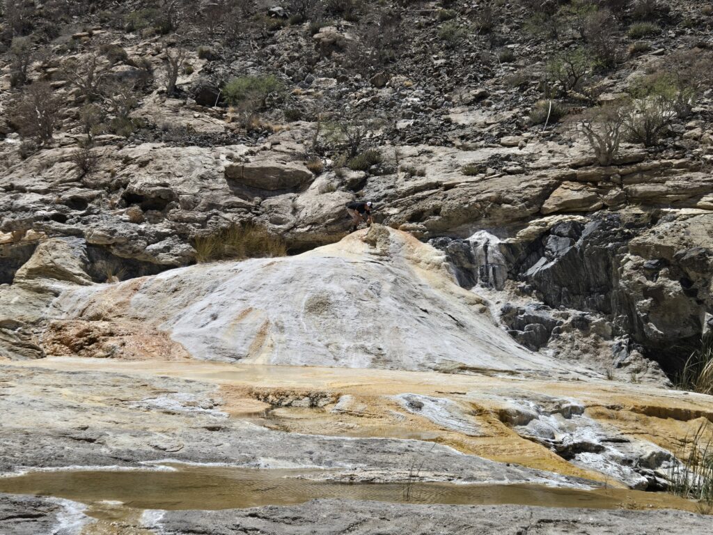
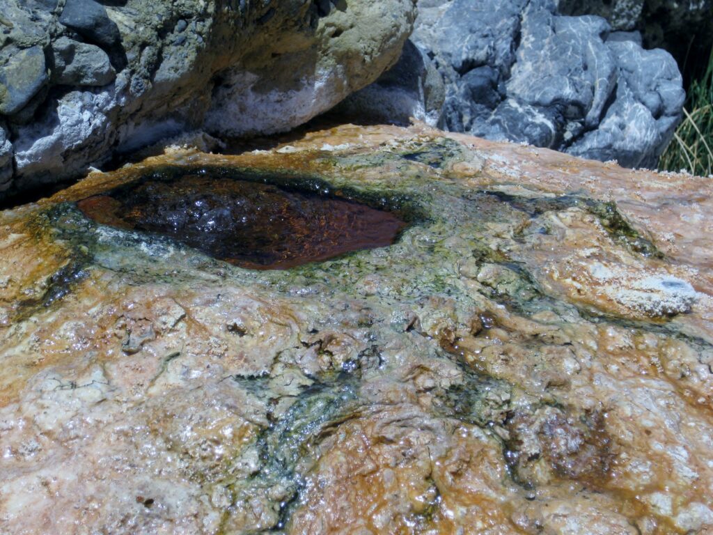
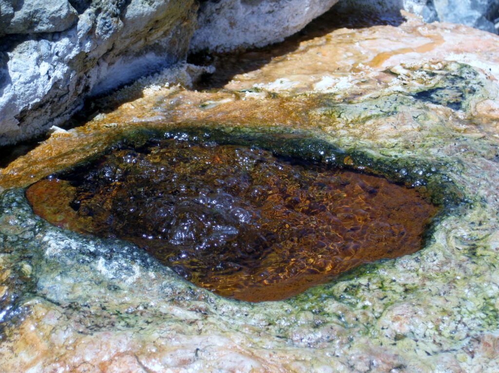
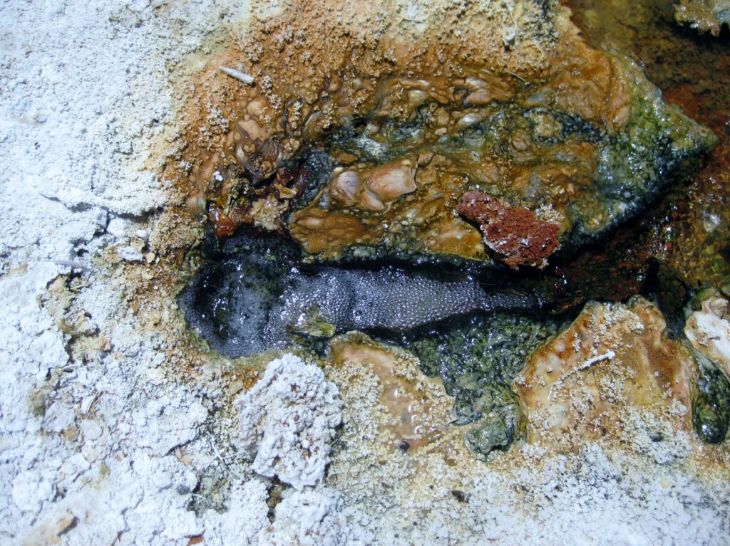
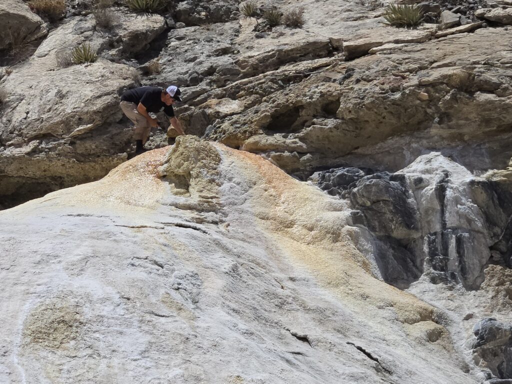
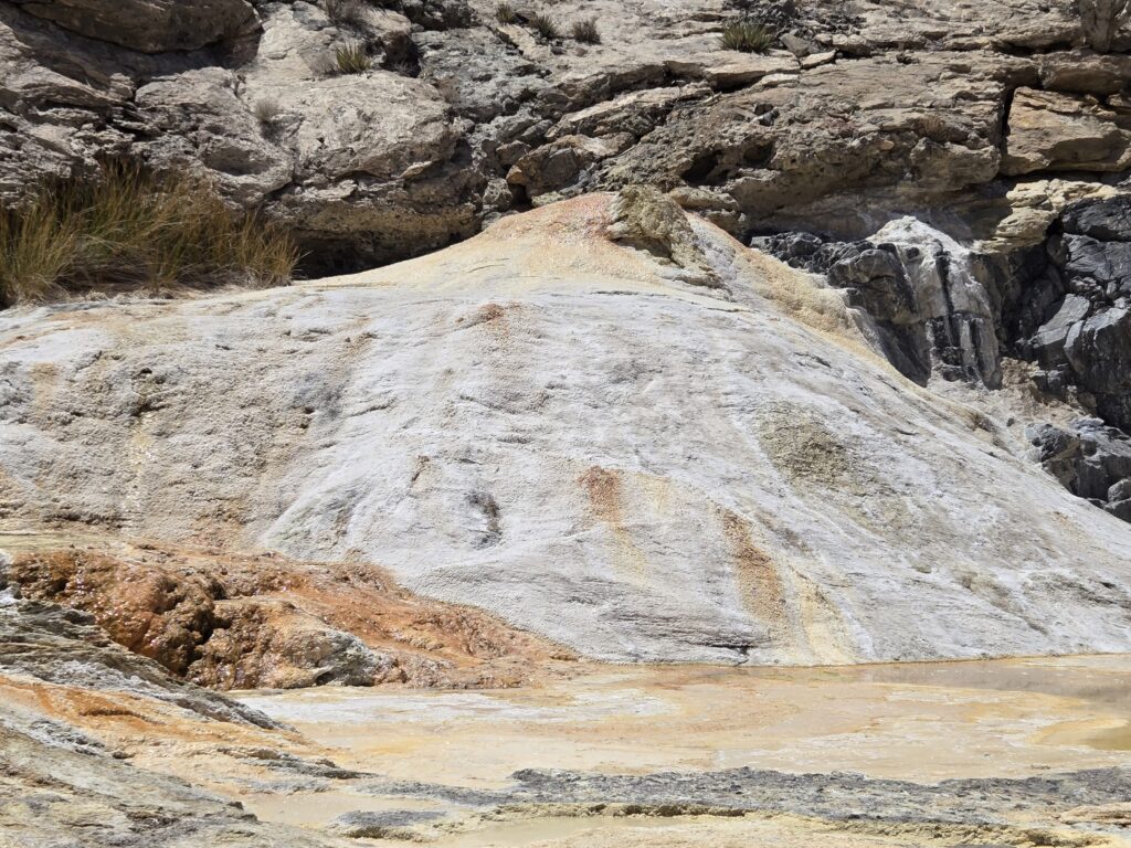
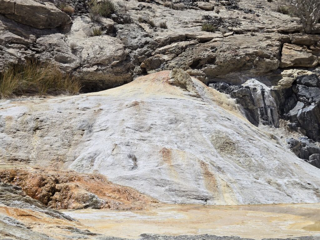
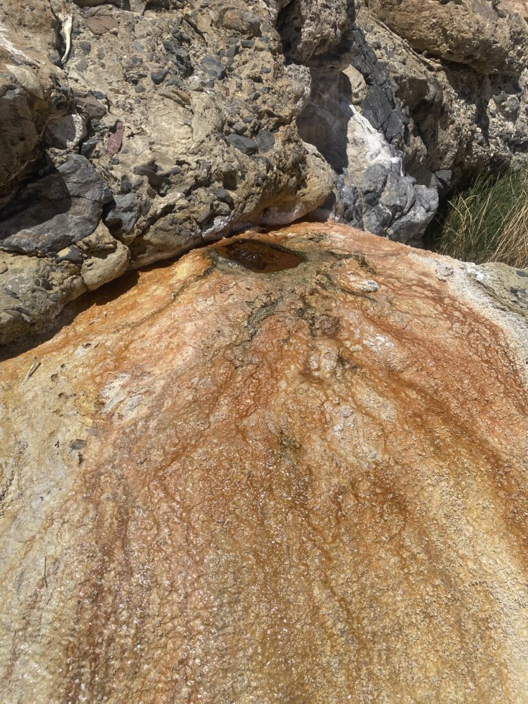
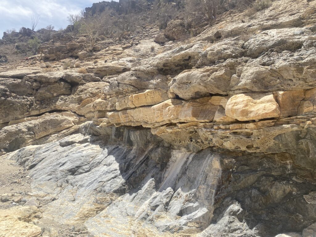
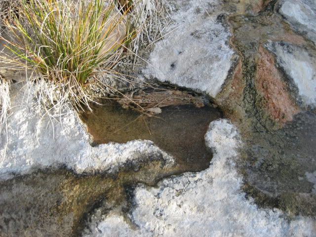
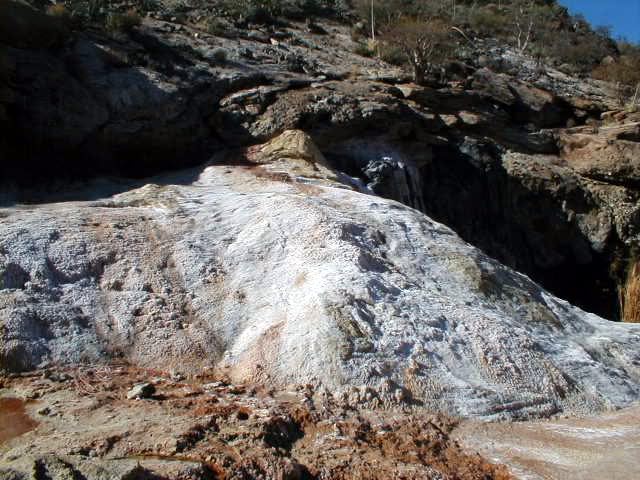
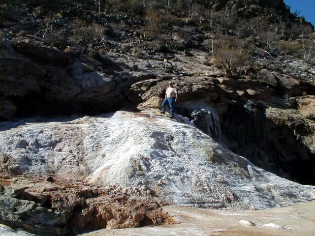
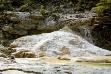
Four miles northeast of the El Mármol onyx schoolhouse, the process by which onyx is made can be seen, at El Volcán. Mineral springs, where onyx is created (about an inch every thousand years), are in the arroyo. The biggest spring is on top of a thirty foot dome, which erupts once a month. This cold water geyser is how El Volcán (The Volcano) got its name. For several minutes water and gas is sprayed 60 feet into the sky!
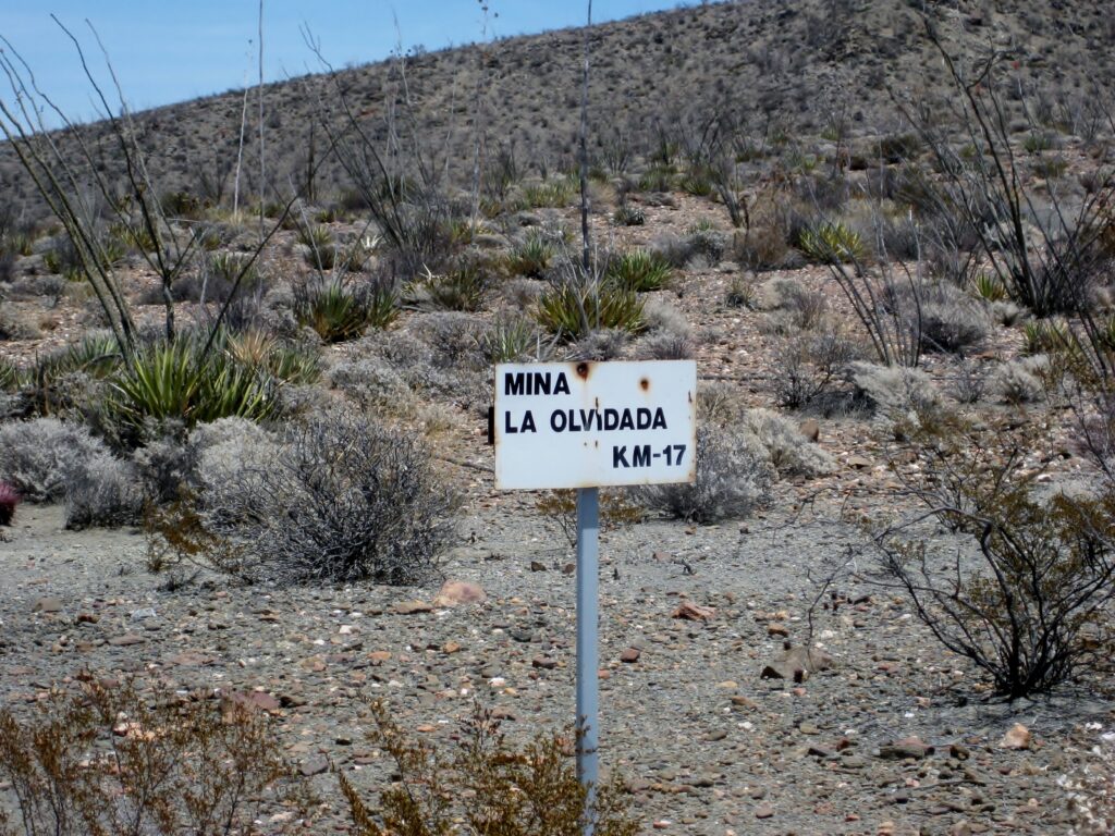
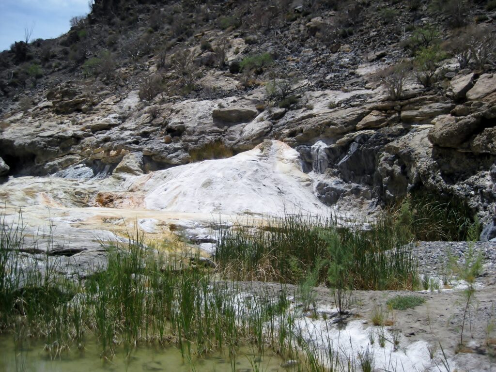
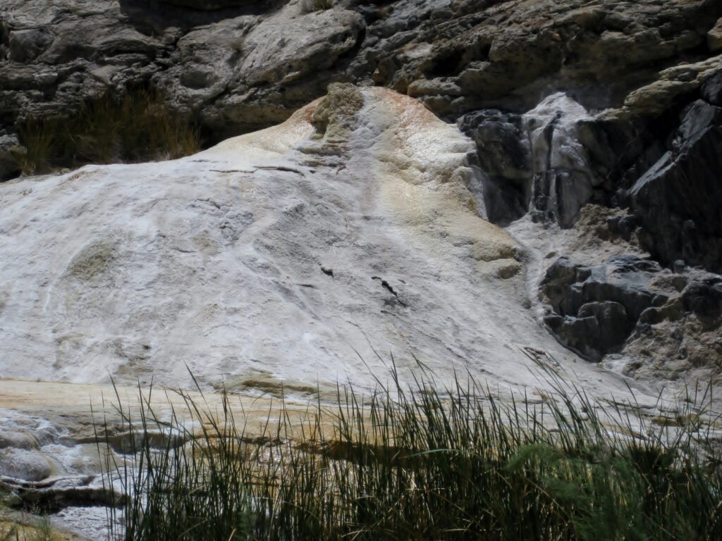
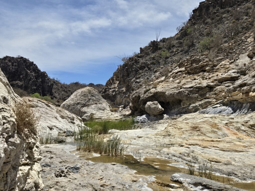
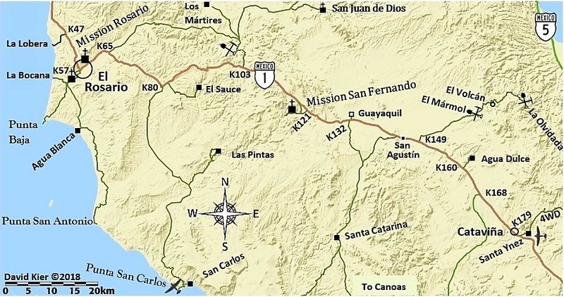
Directions: Take the signed dirt road off Highway 1 for 9.5 miles to El Mármol’s onyx schoolhouse. Note kilometer signs to the Mina La Olvidada (a barite mine). At 2.0 miles from the schoolhouse, turn right, 4WD recommended from here. At 4.0 miles, come to Arroyo El Volcán. Some maps have misnamed Arroyo el Volcán as ‘Zamora’ from an error on the INEGI topographic map, that switched the names (the true Arroyo Zamora was labeled as El Volcán). The El Volcán geyser dome is 0.4 mile to the right, up the arroyo. Ahead, at 4.3 miles, the La Olvidada road passes a white slope with several bubbling onyx springs. See 2011 & 2006 photos of that.
GPS at El Volcán: 29°59.55′, -114°46.26′, elev. 1,885 ft.
HISTORY: 1947 El Volcán visit, on page 13, December edition of Desert Magazine
Baja Bound Bulletin article on El Volcán (October 2024)
Photographs at El Volcán, 2003-2025:
2025 (‘David K’ and ‘Dave W.’):
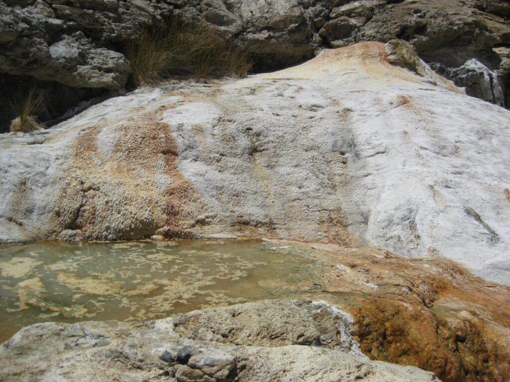
THE TOP OF EL VOLCÁN:
Video clip of it, with sound:

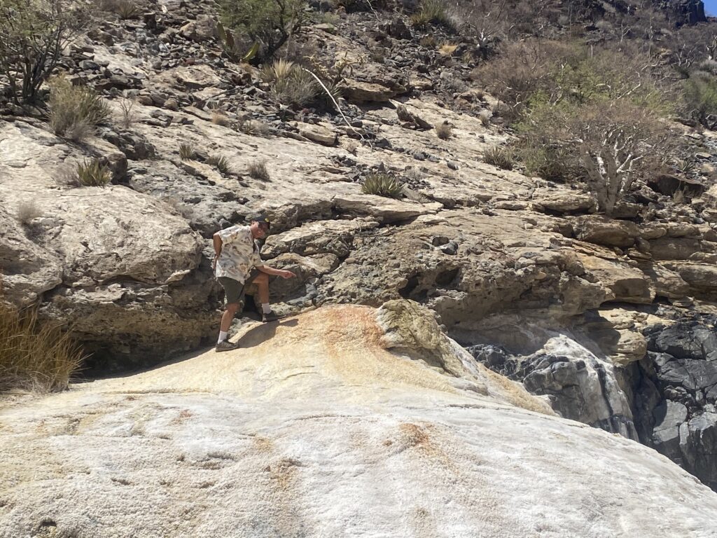
Time to head back to the truck. Here is a last look around…
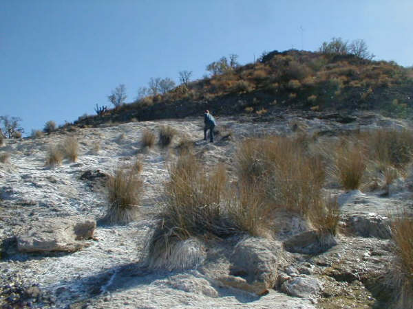
2011 (Vern ‘El Vergel’ & José ‘BajaCat’ join David to see El Volcán):
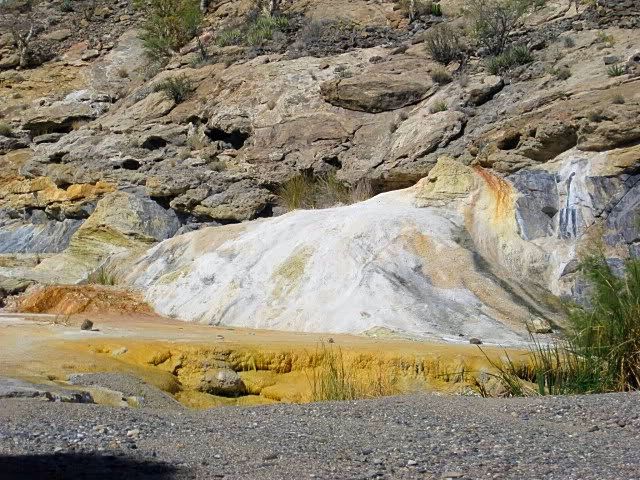


1/4 miles past the arroyo crossing, on the La Olvidada road, is the ‘white slope’ with several springs:

See all the 2011 photos, including La Olvidada: https://vivabaja.com/p411/
2006 (Elizabeth ‘Baja Angel’ and ‘David K’):


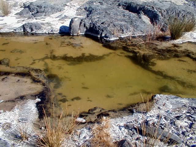
White slope, 1/4 miles past Arroyo el Volcán crossing:
See all the 2006 trip photos: https://vivabaja.com/marmol/
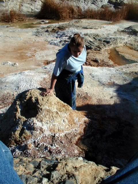
2003 (‘David K’ and his daughter, Sarah, age 12):


See all the 2003 trip photos: https://vivabaja.com/p403/
El Rosario to El Volcán Road Log (Miles) GPS @ WGS 84
- 0.0 El Rosario Pemex Station (Km. 57)
- 14.6 Punta San Carlos Jcn. (Km. 80)
- 28.5 Los Mártires, San Juan de Dios Jcn. (Km. 103)
- 31.5 El Descanso (Km. 108)
- 31.6 Monument to Hector (Km. 116.5)
- 37.8 Old Road to right, Mission San Fernando access
- 39.4 El Progreso (abandoned café), signed San Fernando road (Km. 121)
- 46.2 Santa Catarina Jcn. (original shipping point for El Mármol’s onyx, Km. 132)
- 46.4 Guayaquil Jcn. (abandoned village north of highway, Km. 132.5)
- 54.2 San Agustin abandoned trailer park
- 54.3 Abandoned gas station San Agustin (Km. 145)
- 54.4 San Agustin highway maintenance complex
- 56.1 Abandoned Tres Enriques café.
- 56.5 EL MÁRMOL JCN. (Km. 149)
- 9.3 from Hwy. 1 is EL MÁRMOL at 29°58.21′, -114°48.57′ , elev. 2,190′
- 4.0 from El Mármol is Arroyo El Volcán (take right fork at mi. 2.0)
- 0.4 to the right/south, up the arroyo is EL VOLCÁN at 29°59.56′, -114°46.26′, elev. 1,885′
Return to www.VivaBaja.com