Named originally ‘San Francisco’ this natural water source was an important stop for travelers on El Camino Real, the mission road. Junípero Serra gave its name in his diary of the expedition from Loreto to San Diego, on May 4, 1769:

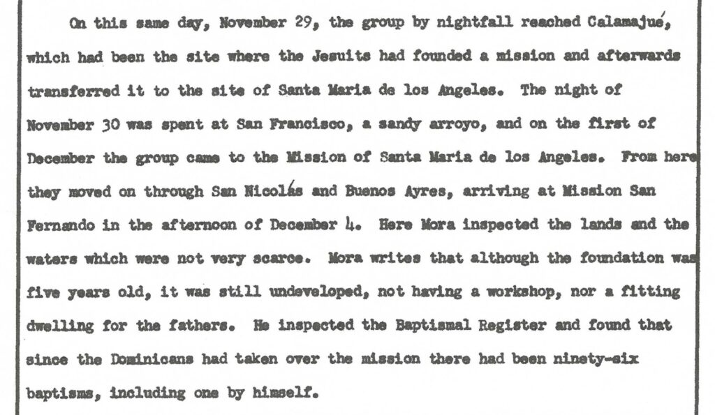
The 1773 diary of the trip north from Loreto by Dominican Padre Mora mentions spending the night at San Francisco:
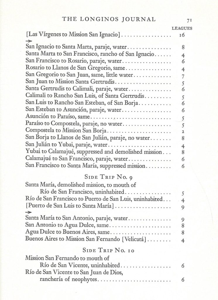
A 1792 road log of El Camino Real, includes San Francisco (a place with water) midway between Calamajué and Santa María. In Side Trip No. 9: Río de San Francisco = Arroyo San Francisquito/ Arroyo Las Arrastras:
An 1856 book, Itinerarios y derroteros de la Republica Mexicana, page 431, provides the following [translated] description of San Francisco and the Camino Real from Calamajué, 9 leagues distance:
San Francisco: the land goes up until it passes through a small mountain range of large loose stones that gives way to another plain and from this to the San Francisco stream that is nine leagues from the starting point. The water of San Francisco is bad, it does not quench thirst, it increases it and is harmful, like the one that is in San Andrés.
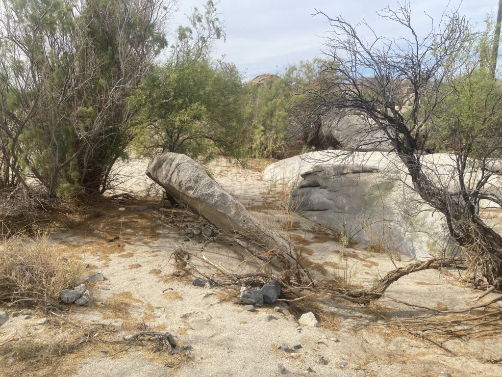
The waterhole of San Francisquito provided the name for the arroyo it is in, which flows to the gulf at the Ensenada de San Francisquito (usually called ‘Gonzaga Bay’ along with the true bay of that name, to its north). The topo maps today call the arroyo ‘Las Arrastras’. The gold mill near Punta Final called ‘Molino de Lacy’ (sometime after 1897 when William Lacy, its founder, died), was originally called Molino de San Francisquito. The gold was sent out from the bay at today’s Punta Final Resort, but was then known as Puerto de San Francisquito. The gold came from the Mina de San Francisquito, which later was known as the Pioneer Mine.
In 1906, Arthur North describes the site in his 1910 Camp and Camino in Lower California, page 96:
San Franciscito [sic], or “Little San Francisco,” lying on the southern edge of these plains (Llanos de Santa María), proved, though located on the map, to be nothing but a few old arastras [sic], a small mining shaft and a waterhole from which we were driven in disgust by the presence of a dead coyote.
In 1954, Howard Gulick created a document to describe the route of El Camino Real. Here are his comments about this location:

Another translation of Serra’s diary simply says “early” and not “good and early.” There is a valid question if Serra actually slept at San Francisco or closer to Santa María, because he arrives there at 8:30 am. The hike up the “Cajon” canyon to the mission is very difficult, taking 6 hours for modern travelers. From the mouth of the canyon, that is 7 miles. That, plus the 13 more miles (4 hours min.) from San Francisco/ Francisquito, makes it hard to imaging he began there, 20 miles (10 hours) from the mission.

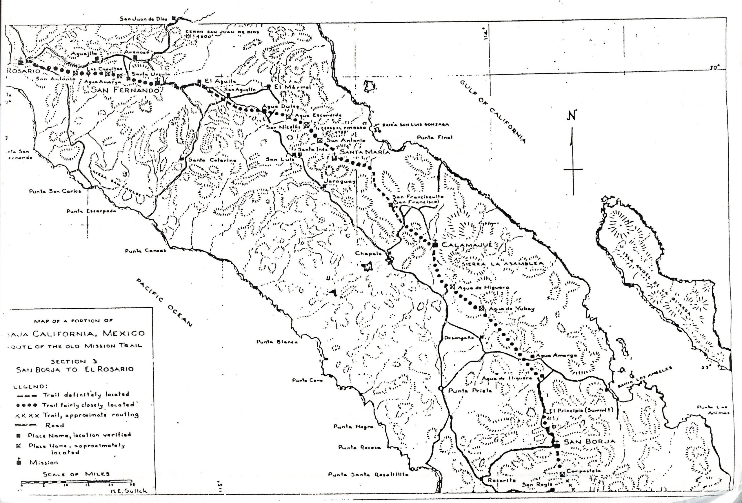
Howard Gulick’s map of 1958, from the Lower California Guidebook:

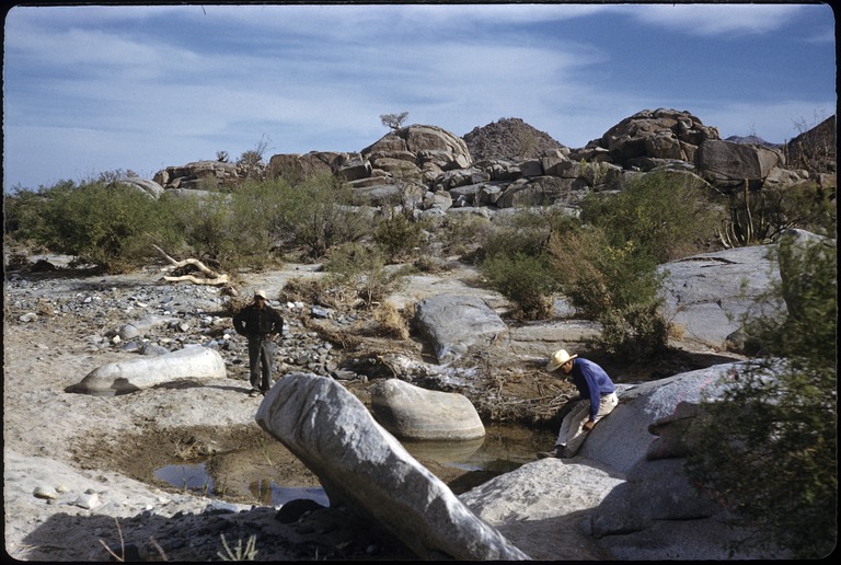
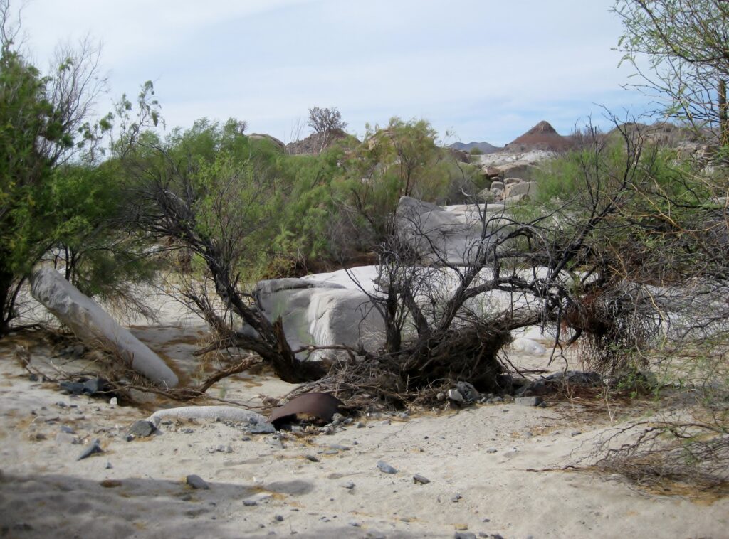
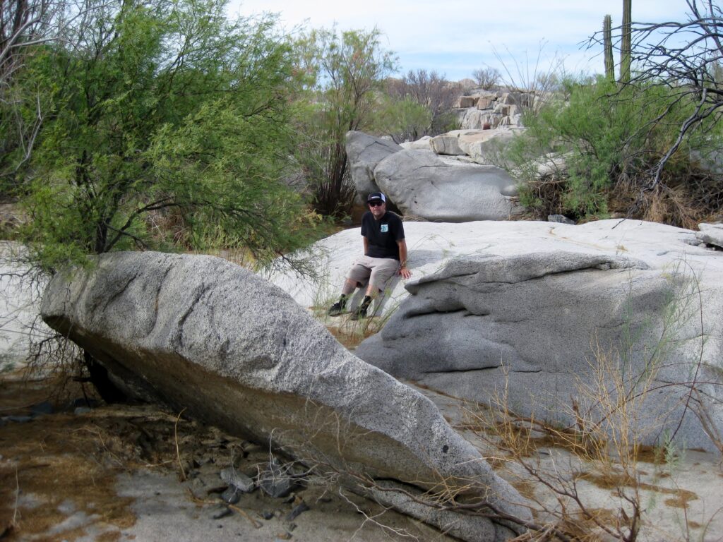
Two more 1959 Howard Gulick photographs at San Francisquito:


Maps showing the waterhole of San Francisco or San Francisquito
1888:

1899:

1919:
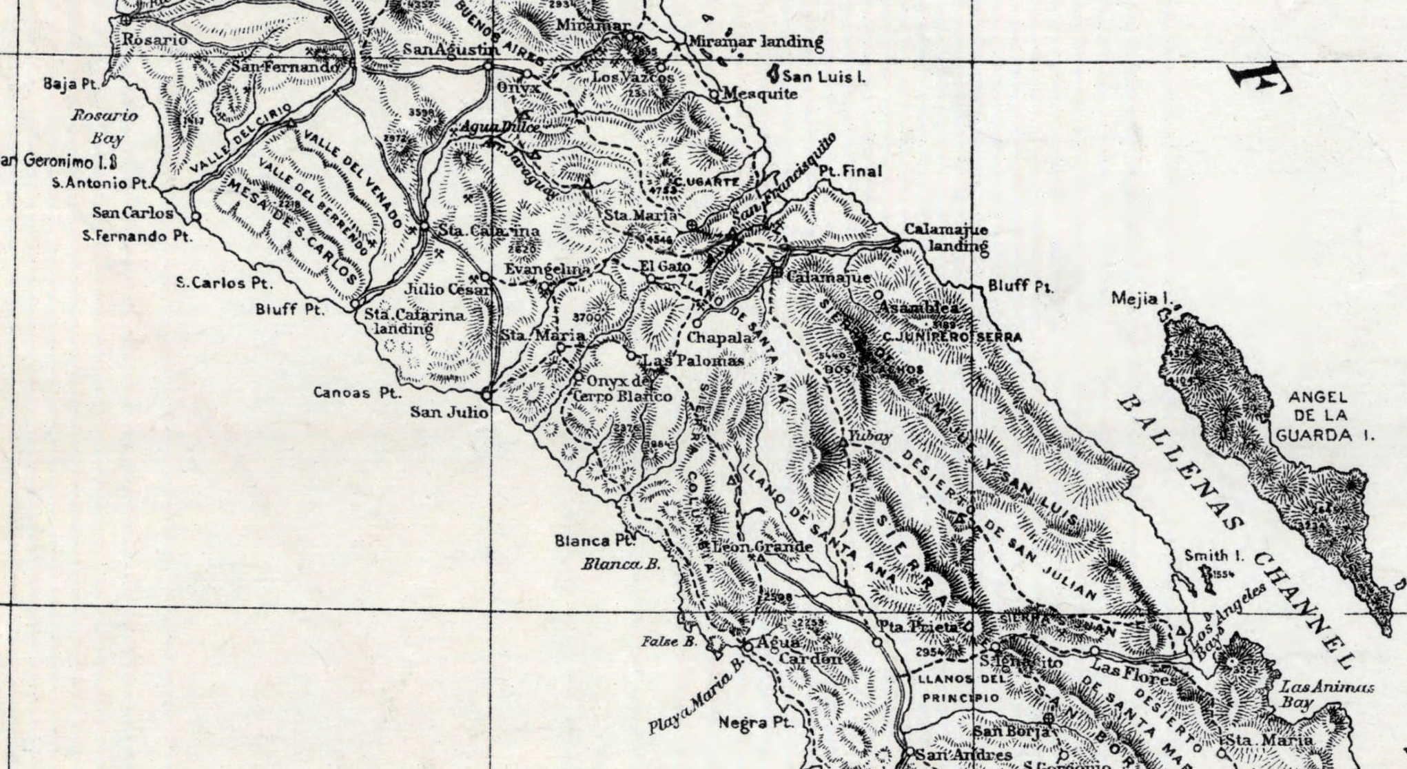
1954:
1958:

Return to this page to check for additional information that may be added.