We visit both sites of the Santo Tomás mission, then take an off road excursion into the high country north-east of El Rosario to see great boojum forests and discover petroglyphs! Finally we have another look at both sites for the mission of El Rosario.
1st site for Mission Santo Tomás de Aquino 1791-1794
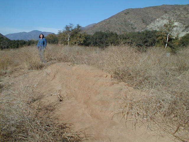
The first location of the Santo Tomás mission is 3.9 miles from Hwy. 1, just 1/4 mile off the Puerto Santo Tomás graded road at 31°34.19′, -116°28.85′ (WGS84).
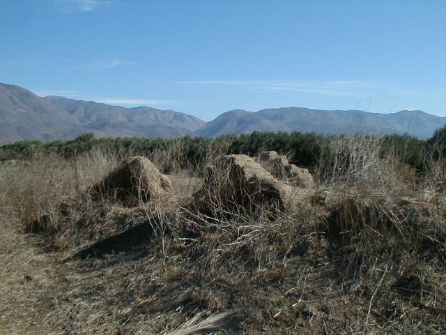
Very little remains of the adobe mission walls 206 years after the mission was moved to the final location along Hwy. 1, where the town of Santo Tomas is. In the background is a recreation facility building in a campground.
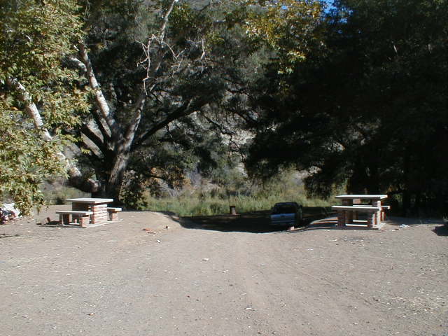
This nice oak tree campground along the Santo Tomás river looked inviting, just north of the mission ruins. Take the Puerto Santo Tomás road for 3.6 miles then turn left and cross the river, pass a ranch and reach the site at mile 3.9.
Final site for Mission Santo Tomas 1799-1849
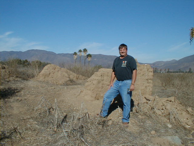
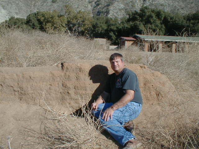
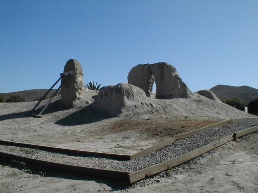
Once a large mission complex, only a few low adobe walls remain 156 years after it was abandoned. Located just east of the highway and north of the El Palomar campground in Santo Tomas at 31°33.51′, -116°24.82′ (WGS84).
More ruins of Mission Santo Tomás… Soon it will be all gone!
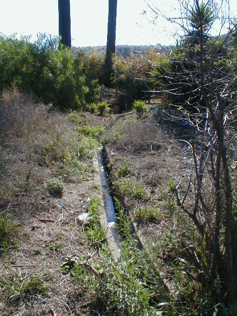
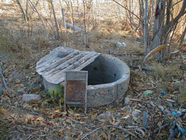
Part of the mission’s irrigation system is still in use. Very likely will long outlast the mission walls.
Off road into Baja high desert…
The 57 mile dirt road goes north from Km.103.5 (28.5 miles southbound from El Rosario’s Pemex) to about 2,600 feet in 28 miles then drops toward the Pacific returning to Km.24.5 on Hwy. 1 at El Socorro, 20 miles north of El Rosario.
The first 25 miles are easy 2WD road and permits most vehicles to enter the cactus gardens.
The remaining 32 miles will require 4WD and ground clearance to negotiate bad erosion in a road that appears abandoned.
This road has been used for the Baja 2000 off road race (Nov. 2000) and a couple of earlier Baja races.
Desert River
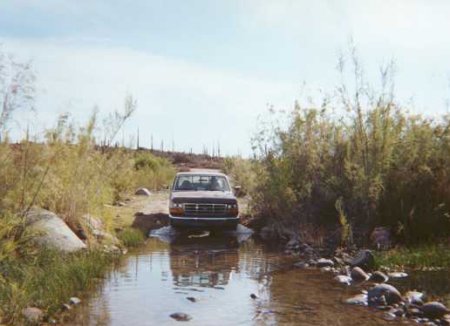
Arroyo San Juan de Dios is crossed 4.9 miles north from Hwy. 1… This photo from a trip in July, 2000… Other times there has been less water here.

A baby boojum tree with adults in the distance! We are traveling north of Rancho Los Mártires and San Antonio. We left Hwy. 1 at Km. 103+ next to the roadside café 28.5 miles from El Rosario’s Pemex station. The El Sauzalito copper mine ruins* are passed at mile 3.6, then the San Juan de Dios river is crossed 1.3 miles further. (*Photos at http://vivabaja.com/705/)
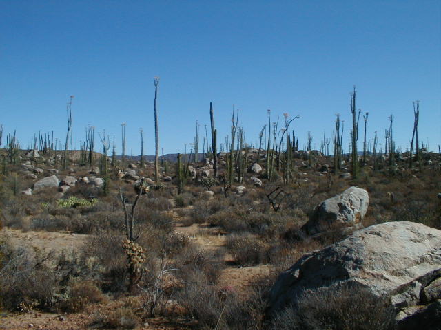
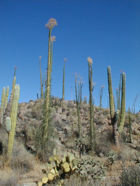
Boojum Trees (Cirios) as far as the eye can see!
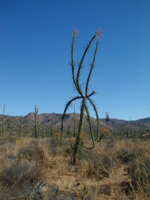
This one has arms like an octopus!
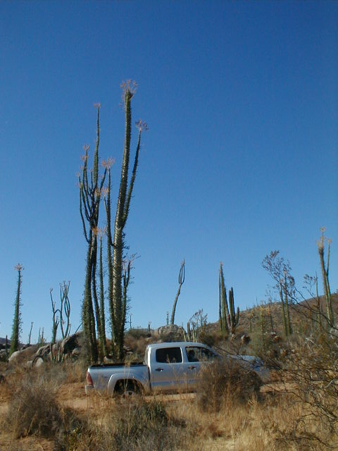
Looks almost like these two are growing from my truck!
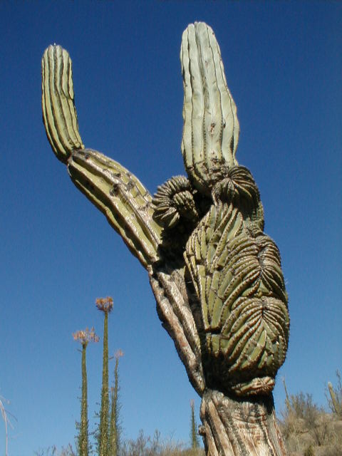
This CARDÓN cactus had some unusual growth.
More boojum trees to entertain us as the road climbed higher into the backcountry.
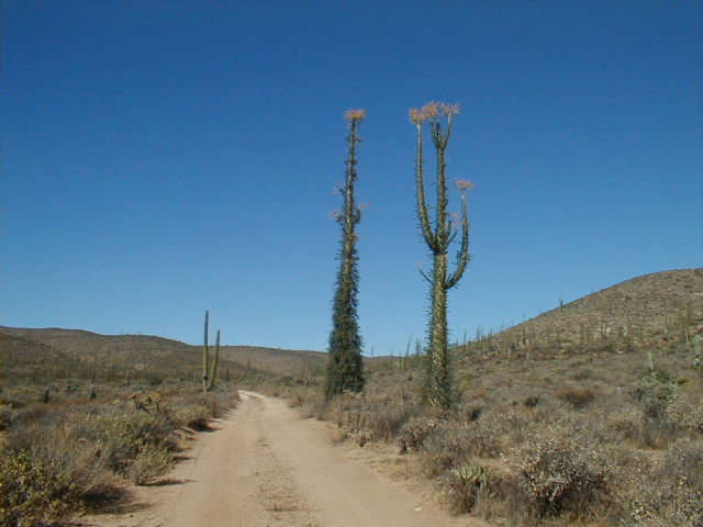
The last boojums next to the road, as we continue north were quite bold in stature. We are about 25 miles from Hwy. 1 and to here the road has been easy… 2WD stuff. Beyond, I recommend only 4WD for the 32 additional miles to El Socorro.
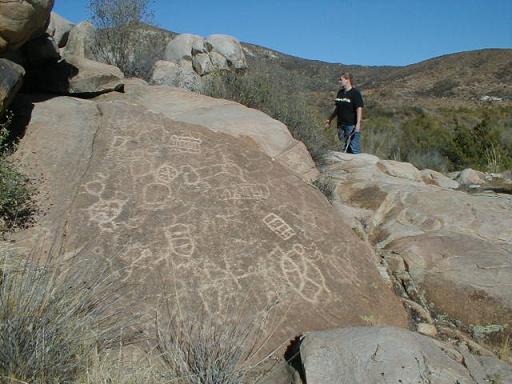
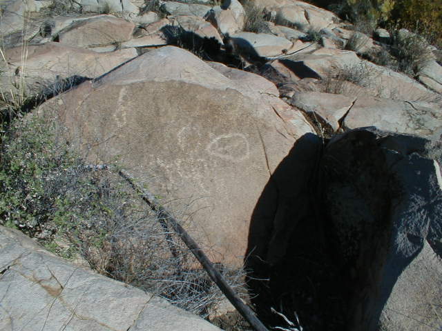
PETROGLYPH PARK 30°24.20′, -115°33.37′ (elev. 1,721′)

At Mile 37.0, we spot a nice place to pull over for lunch. We discover a natural spring that begins a small stream here… I wandered around, so excited to see these petroglyphs.
Elizabeth suggests I check out some boulders across the creek… She was right!!! This site has not been mentioned in any of my collection of books. This was quite an exciting discovery!
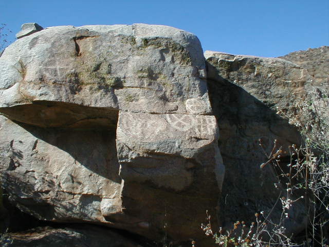
Many rocks were decorated…
We spent a long time here walking about and admiring the ancient graffiti.

The site is next to the road, so it is certain the ranchers were aware of it. None the less, I have always desired to find a petro site… it sure made my day!
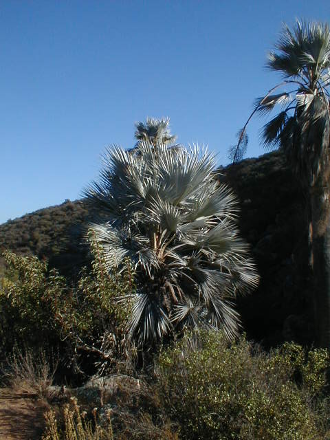
Blue Palms 30°23.97′, -115°35.63′
At Mile 39.2 there is a fork… By mistake we took the right branch (northwest) and in 0.9 mi. we came to some blue palms. Checking the GPS and Baja Almanac topo map, we realized our error and returned to the correct road. (this detour is not included in the trip mileages)
Rancho El Ciprés 30°22.11′, -115°38.03′

Mile 43.4 brings us to the abandoned rancho of El Ciprés in the shade of eucalyptus trees.
El Ciprés laundromat!
Some more tough road is encountered as we continue west from El Ciprés. A major fork is at Mile 49.4, the right branch goes to Nuevo Odisea. We take the lesser used left branch to El Socorro.
Mile 54.8
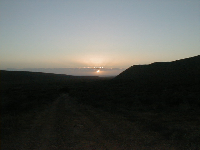
Just as we reach the El Socorro river valley, the sun sets… Mile 57.1 of today’s trip finds us between Km.24 and 25 on Hwy. 1. It is an easy 20 miles south to our room at the Baja Cactus Motel in El Rosario. We enjoyed a lobster dinner at Baja’s Best Restaurant (that’s the name) on the far end of town (Km. 60.5)
TRIP MAP
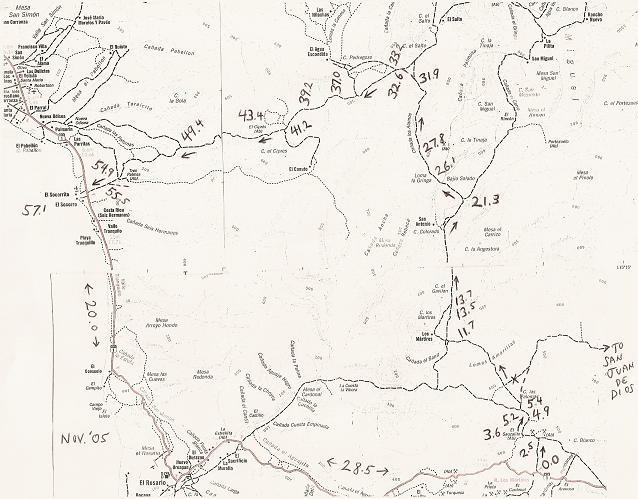
Satellite Map from ‘BajaLou’
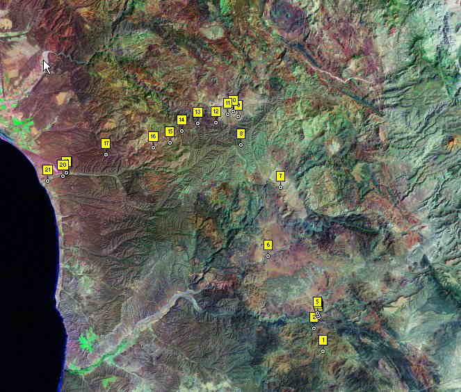
The numbers represent GPS waypoints from the road log. #1 is Hwy. 1 at the start of the dirt road trip and #21 is Hwy. 1 at the end (El Socorro).
Trip Road Log (in miles) and 21 GPS waypoints (Map Datum WGS84)
- 0.0 Leave Hwy. 1 (28.5 mi. from El Rosario Pemex) at café just past Km. 103, head north. 30°3.82′, -115°20.92′
- 2.5 Fork, go left
- 3.6 El Sauzalito ruins on left at 30°5.90′, -115°21.81′
- 4.9 Cross San Juan de Dios river 30°6.84′, -115°21.33′
- 5.2 Fork, go right (left goes back to El Rosario via La Vibora grade) 30°7.05′, -115°21.38′
- 5.4 Fork, go left (right goes to San Juan de Dios) 30°7.23′, -115°21.47′
- 11.7 Fork, go right (left goes to Rancho Los Mártires)
- 13.5 Cross Arroyo Los Mártires/ Arroyo Grande 30°12.38′, -115°26.38′
- 13.7 Road in from left to Rancho Los Mártires. Rancho San Antonio is passed about five miles ahead
- 21.3 Fork just north of Arroyo El Portezuelo crossing, go left (right goes to San Miguel and La Suerte) 30°18.43′, -115°42.33′
- 26.1 Fork, go left (right goes to ranch). Only 4WD beyond here.
- 27.8 Bulldozed switchback grade to ridge top 30°22.27′, -115°29.26′
- 31.9 Fork, go left (right for La Suerte) 30°24.80′, -115°29.26′
- 32.6 Jcn. with old El Socorro to La Suerte road, turn left 30°25.19′, -115°29.77′
- 33.2 Jcn. with road north to El Agua Escondida 30°24.98′, -115°30.32′. A second road north is at 30°24.29′, -115°31.56′
- 37.0 ‘Petroglyph Park’ 30°24.20′, -115°33.37′
- 39.2 Fork, go left (right goes 0.9 mi. to blue palms and beyond) 30°23.59′, -115°35.06′
- 41.2 Jcn. road south to El Canuto 30°22.52′, -115°36.29′
- 43.4 El Ciprés (abandoned ranch) 30°22.11′, -115°38.03′
- 49.4 Fork, go left (right to Nuevo Odisea) 30°21.57′, -115°42.85′
- 54.8 Jcn., road in from left to Tres Palmas 30°19.97′, -115°46.87′
- 54.9 Old road to north (to Nuevo Odisea) 30°19.95′, -115°46.90′
- 55.5 Join road along south side of river valley, turn right 30°19.67′, -115°47.30′
- 57.1 Hwy. 1 near El Socorro (Km. 24-25). El Rosario is 20.0 mi. south. 30°19.26′, -115°48.82′
El Rosario Map
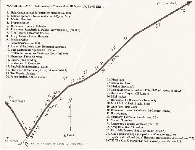
To help find services along Hwy. 1 as it passes through El Rosario, Elizabeth and I made this map.
Mission Nuestra Señora del Rosario (1st site)

The first Dominican mission in California was founded in 1774 and remained here until 1802 when the spring dried up… A move to the side of the river was made…
2nd site of the Rosario mission 1802-1832
Located 1.6 miles west of the sharp curve of Hwy. 1, in El Rosario de Abajo, along the road to Punta Baja. Baja California is a place of adventure and history… If exploration and discovery is in your blood, then Baja is the place to go!
El Rosario with it’s fine motel (Baja Cactus), nearby beach (La Bocana), and many restaurants makes an excellent base for excursions.
See more photos, maps, and links on my main web site: http://vivabaja.com/