In Arroyo el Volcán, we search for Mission Santa Isabel
The Lost Mission of Santa Isabel is an old legend, born out of the idea that the Jesuits had accumulated treasures from their seventy years on the peninsula. A totally false theory. When the missionaries got advance warning that the Spanish Court was about to arrest them all, this legend says that the padres quickly built one final mission in a hidden canyon, beyond Mission Santa María.
A member of the Baja Nomad Internet community, with the handle ‘elbeau,’ using Google Earth, thought he saw some ruins that deserved to be investigated. It turned into a big deal for us. In just a few weeks, several of us traveled hundreds of miles to see what ‘elbeau’ was talking about. Here is that thread from 2011: http://forums.bajanomad.com/viewthread.php?tid=51399
Does everyone know where Arroyo El Volcán is or at least where where El Mármol onyx quarry is? El Mármol is 9 miles from Hwy. 1 at Km. 149, between El Rosario and Cataviña.

The arroyo is 4 miles from El Mármol and flows to the Gulf of California just south of El Huerfanito. Some popular topographic maps have mislabeled the arroyo as ‘Zamora’ and called the next arroyo to the south, ‘El Volcán’!
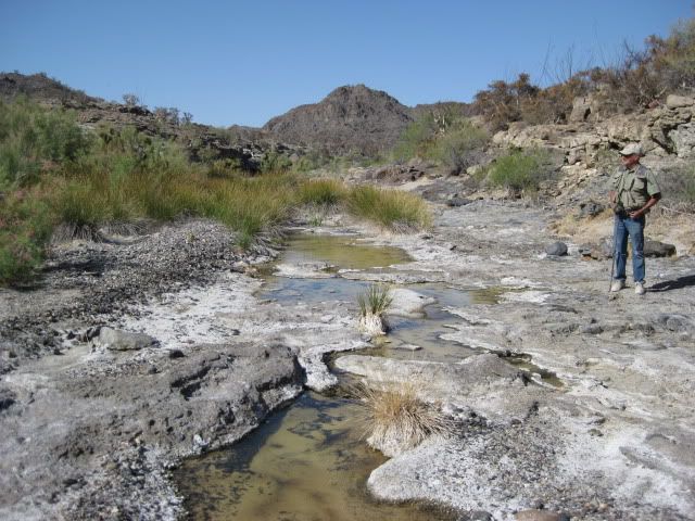
El Volcán is a cold-water geyser and an area of soda springs where onyx is slowly being formed. Much onyx is seen in the area, as well. The geyser is less than a half mile south of the road, in the arroyo. The ‘lost mission’ site discovered by ‘elbeau’ is 4 miles to the north.
My fellow adventure seeker was Baja Nomad member ‘El Vergel’ (Vern) from the Los Angeles area and the beach campo south of San Felipe. ‘Baja Cat’ (José) who waited for us just across the border at Otay Mesa joined and traveled along with us on Friday.

San Vicente, Km. 90 (from Ensenada)
We stopped for lunch in San Vicente at a taco cart operated by Gloria, who served us ‘tacos de borrego’ (lamb tacos) along with a cup of consommé de borrego to which we added onions and salsa… YUM


El Rosario, Km. 57 (from San Quintín)

El Rosario Pemex (Baja Cactus Tourist Services), Km. 57
We arrived in El Rosario about 2:30 to fill our gas tanks and buy a few cases of Tecate and Dos Equis cerveza. I also wanted to show Vern the rooms at Baja Cactus Motel as they are so outstanding given the location and typical highway accommodations usually found in Baja.
Fuel prices in Baja (below the border region) were 8.77 pesos per liter for Magna and 9.87 for Premium. The exchange rate at Baja Cactus was 11.20 pesos per dollar and in Ensenada on Sunday was 11.00 pesos per dollar… both close to $3.00 per gallon.
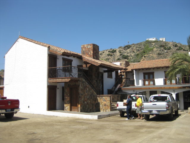
Baja Cactus Motel, Km. 57+ El Rosario

Baja Cactus Motel office

Hugo Lopez art, on display at Baja Cactus Motel

Baja Cactus has amazing accommodations and makes a great place to stop, 250 miles south of San Diego.
The 56 mile drive down Highway One to the El Mármol road was a breeze and the signed road was at the kilometer 149 marker (measured from San Quintín). The next 9 miles to El Mármol are dirt, but some of the easiest dirt miles in Baja and would be a breeze for most vehicles.

We stopped to take new photographs of the schoolhouse ruins and cemetery before the final leg of today’s drive down to Arroyo el Volcán.


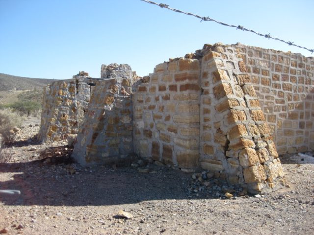
El Mármol, an abandoned onyx quarry and has the famous school house ruin. The world’s only school made from Onyx!


I heard the sound of a speeding Toyota Tacoma and it was ‘TW’ (Tom) and his brother Bill arriving from an ice run to Cataviña (20 miles distant). José, Vern and I followed them down to the campsite in Arroyo El Volcán, 4 miles from El Mármol.


‘bajalou’ and ‘BAJACAT’

‘XRPhlang’ (Phil) and ‘dtbushpilot’ (David)

‘El Vergel’ (Vern), Bill W and ‘TW’ (Tom)

Our camp in Arroyo el Volcán is just off the north side of the road from El Mármol, at the left edge of the satellite image, below:

Our destination is the white tag at the top of the next image, 4 miles down the arroyo from our camp.

TW made a batch of grits to supplement our morning diet and we secured camp for the day’s hike. It looked on the map to be about 3-4 miles down the arroyo to the primary site of elbeau’s Santa Isabel (arches, stairways, fountains). I called the location ‘site B’ on my Google Earth map. Our camp was just a few hundred feet down the wash from the El Mármol-La Olvidada mine road (which was totally graded very recently).
bajalou had all the sites GPSed on his hand-held and I had the primary Santa Isabel site on mine… That was my goal: to get right to the spot that elbeau saw ‘man-made’ structures like arches, stairways, fountains, etc. If that was there, then we would look for the others places later.
On the Google Earth image, the site is just off the main arroyo, along a side gully…
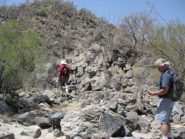
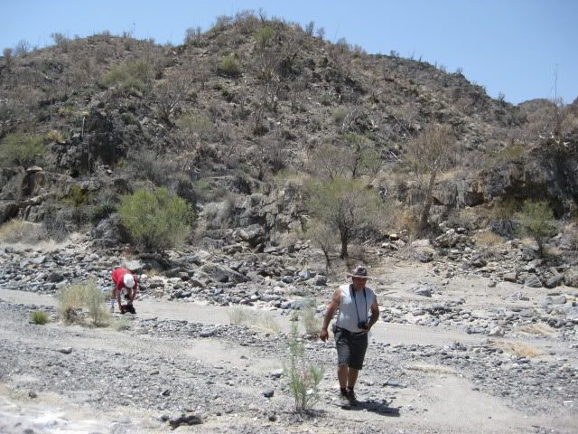
We begin the hike:

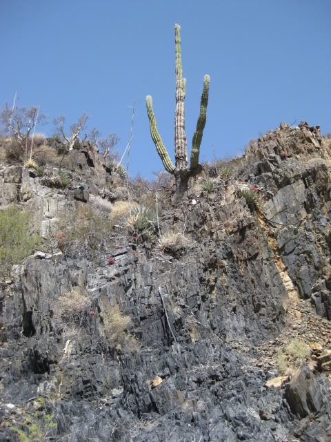
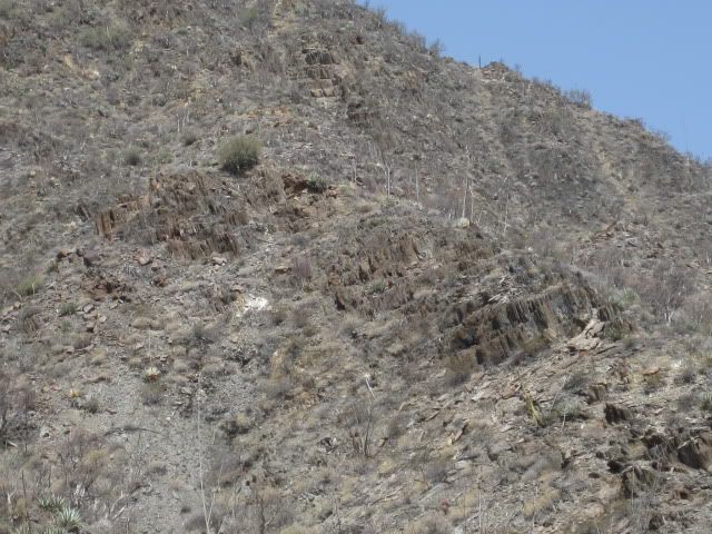
The arroyo of El Volcán was extremely interesting and is well worth the visit (even without a lost mission)! I will let my photos do most of the story telling…


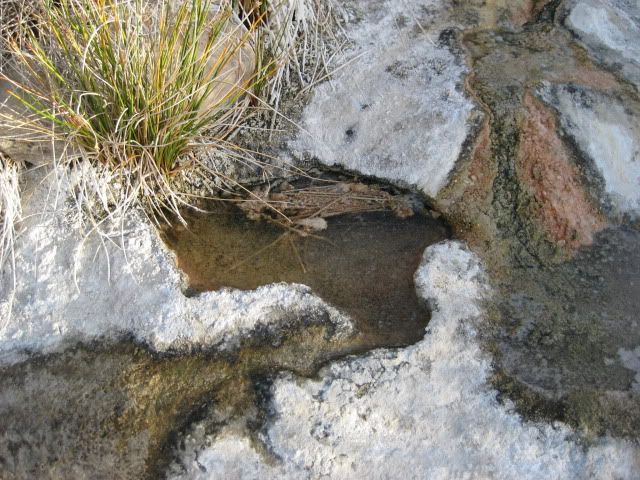
Water in small amounts was near our camp and oozing out of a cliff at the first big bend.

This was the the last Baja adventure for our friend “Baja” Lou Wells. It was great to see him having fun in the land he also loved, like the rest of us!


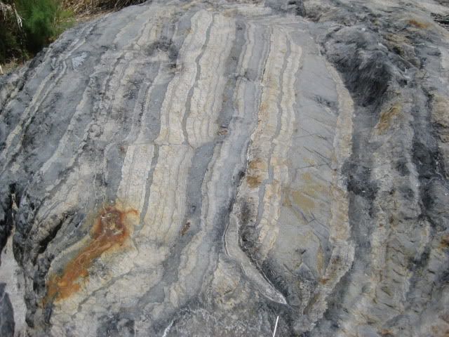
A piece of onyx trapped in newer rock, along the arroyo.


BAJACAT
Both images below, are looking southwest, up the side gully…
GPS of the site marked by the white tag: GPS is 30°01.42′, -114°46.29′ (WGS84). Elevation is 1,701′. Was this the Lost Mission of Santa Isabel?


Interesting trench erosion up and over the ridge… ‘Santa Isabel’ is on the other side!


Near the end of the 4 mile hike down Arroyo El Volcán. As we looked high up the cliffs to the location of the ‘corral’ (in elbeau’s satellite images) we could not see directly the level or semi-level area. It was out-of-sight, and some of us wished to find a way up there for a closer look… Now, if we only had a helicopter, like Erle Stanley Gardner did 40 some years ago!

That is the ‘corral’ area up above the cliff.

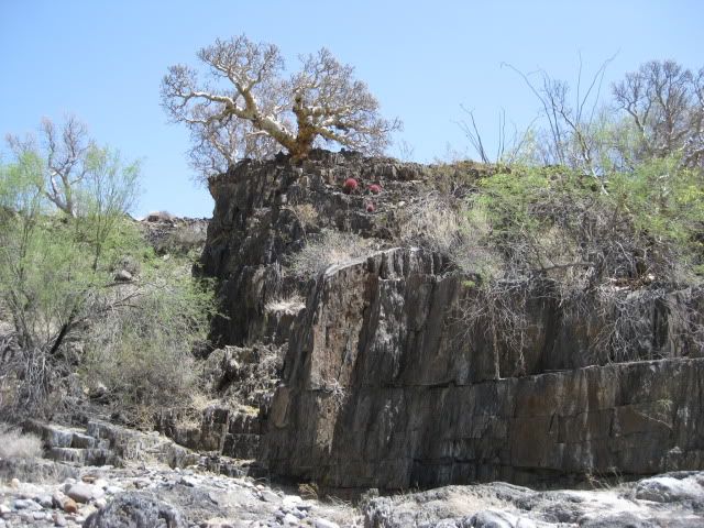
Ahead, on the left… are the formations marking the entrance to Santa Isabel arroyo!
Close up view of the rock face on the north side of the Santa Isabel arroyo, where it meets Arroyo El Volcán.
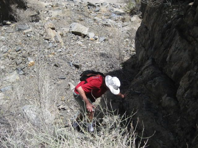
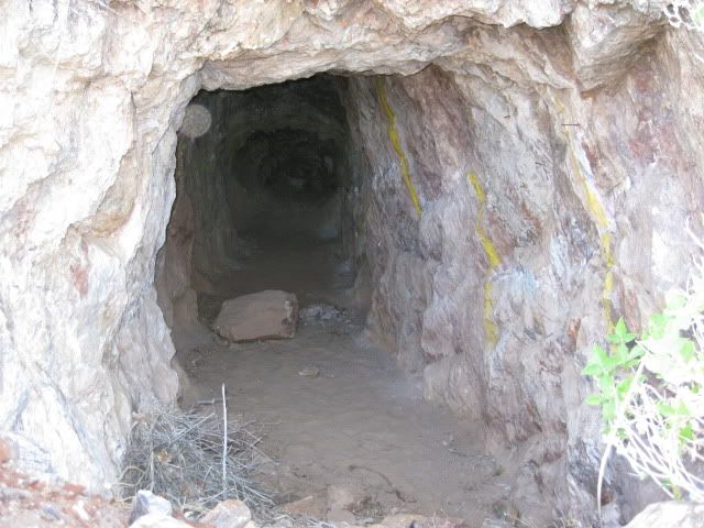
Climbing into Arroyo Santa Isabel and arriving!


Climbing up this dry waterfall is the only way into ‘Arroyo Santa Isabel’.


Vern photographs me closing in on the site.

My GPS on ‘ground zero’ at the site!
On Google Earth, ‘site b’:


This is what elbeau sees in the Google Earth image:

HERE is what we saw:

Close up
Now, from across the small arroyo and up the other slope:

Arroyo El Volcán is in the background


THAT’S IT! (well, that’s all we have agreed to show you… you should have joined us!)
El Vergel and BAJACAT continued up Arroyo Santa Isabel some distance, as did dtbushpilot and XRPhlang (while I was climbing the north slope for the above photos)… BAJACAT gave something to the mountain (I will let him share that with you). We all got bloodied on the brush or rocks.
BAJACAT and El Vergel continued further down Arroyo El Volcán and found bigger pools of water (photos coming).
The hike back to our camp seemed much longer, as the temperatures were higher and water was running out…
That afternoon, after a good rest, we drove up to La Olvidada mine and also the small onyx mine at El Volcán.
The next day (Sunday) we explored the El Volcán geyser and surroundings… so STAY TUNED, plenty more high adventure and photos coming!!!

It was 4 miles from Santa Isabel back to our camp, I walked with David and Phil for about a half mile after we left the three Corral explorers (TW, Bill, Lou)… and decided to wait and see if any of the 5 were going to get a move on…
Tired of waiting, I decided to march on solo… About a kilometer from camp, I took a break in the shade of a cliff and after maybe 15 minutes, here comes El Vergel… We finish the trip back together.
Here are some photos of Arroyo El Volcán on the return:


This was mile 2 from camp marker (I did one at the other mile points, but this was the highest).


After resting up from the big hike, later Saturday afternoon we took a drive to see the La Olvidada (The Forgotten) Barite Mine. Along the way and on the return we take a look at the White Slope of springs just east of Arroyo El Volcán.

Looking down at our camp area, as we drive east.

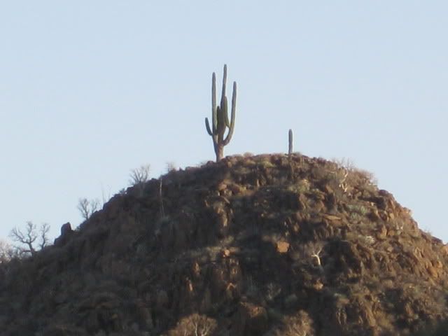
We see some boojum trees as we get close to the mine area.

The road to the mine from El Mármol has been recently graded and is 2WD friendly.

Our first view of the Sea of Cortez (Gulf of California) from the road.

That is Isla El Huerfanito (The Little Orphan).

Other islands come into view from the end of the road, 6 miles from Arroyo El Volcan.


Phil (XRPhlang) and David (dtbushpilot) also ride up to the mine with us.


More boojum trees as we head back.

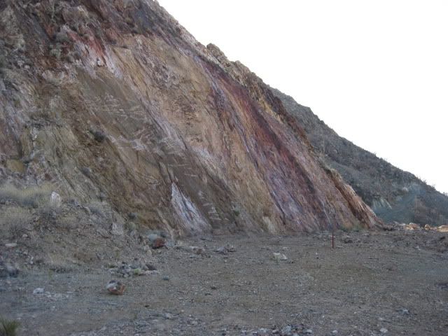
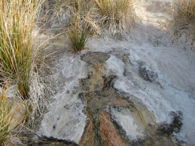
The white slope of tiny springs.


On Saturday afternoon, after visiting the Olvidada barite mine and white slope of springs, we drove south on the road along the east edge of the El Volcán arroyo gorge… It goes about 3/4 a mile past some onyx mine activity and then drops steeply down to the arroyo.
Coming back up the steep grade gave me an opportunity to demonstrate the Tacoma’s A-TRAC traction system to Vern (a Jeep owner)!
[A-TRAC or Active Traction Control is Toyota’s answer to front and rear lockers to achieve maximum traction. A-TRAC is available on the Off Road TRD 4WD Tacoma since the 2009 model. Using the ABS brakes and spin sensors, any tire that starts to spin from a loss of traction gets braked to match the rotation on the opposite tire on that axle… an automatic locker effect for all 4 tires… however, steering ability is unaffected]
Once back up to the mine area, we hike around… and eventually go to the edge of the gorge where we look down on the giant dome that is EL VOLCÁN… Baja’s ‘Cold-Water’ geyser!
On Sunday, we return in the arroyo with BAJACAT and have a very close look at the geyser. Vern even took some videos of the activity… so stay tuned for Sunday’s photos!

View up Arroyo El Volcán from the onyx mine area


Looking into the gorge and to the right…

El Volcán


Another look down upon El Volcán from the cliff to then east:


TW demonstrates how to use gasoline to start a fire!
Sunday Morning, May 1
TW gets underway…


We wait for David (dtbushpilot) to get underway, then BAJACAT, El Vergel and I go visit El Volcán:
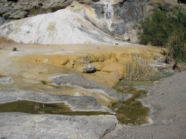
El Volcán, Baja’s cold-water geyser

We can drive about half of the 2,000 feet from the road to El Volcán. Last time I was here (2006) the arroyo was sandy… now it is mostly rock.

Walking south, towards El Volcán


A look back (north) towards our trucks
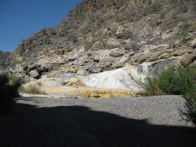
El Volcán
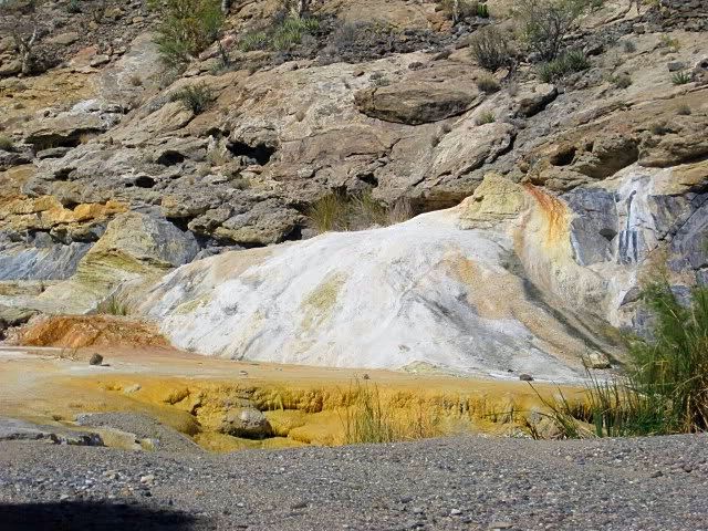


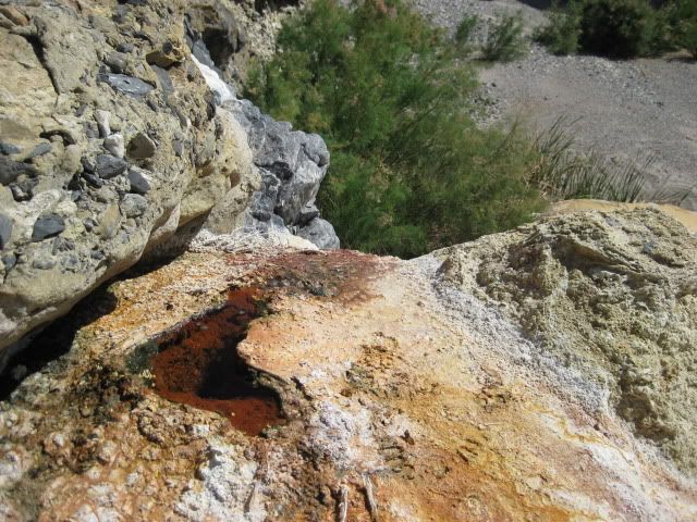
A large vein of onyx in the cliff past El Volcán

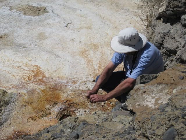
BAJACAT gets a closer look


We hike past El Volcán to see the onyx dome, an older geyser, all dry now.

José, on top of the ‘onyx dome’ boulder

Plenty of tracks in here!


The top of El Volcán, Baja’s cold-water, soda geyser

El Vergel records a video clip of the bubbling cold water springs


A baby elephant tree

Onyx is all over the place!


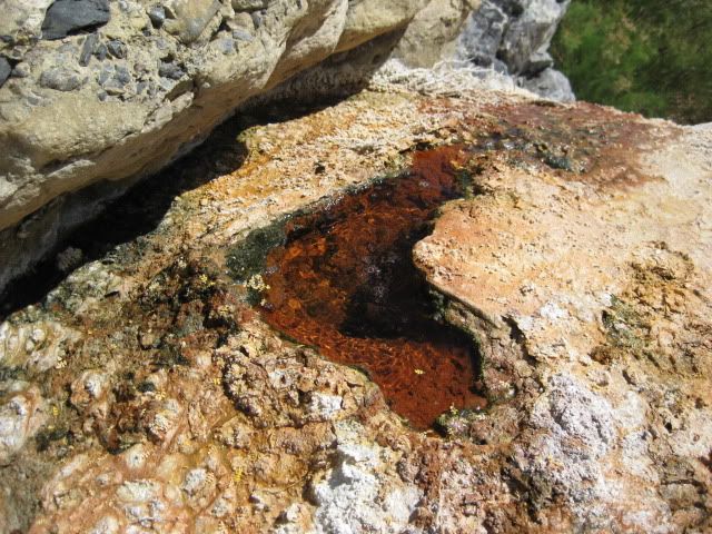
Lots of bubbles on El Volcán!

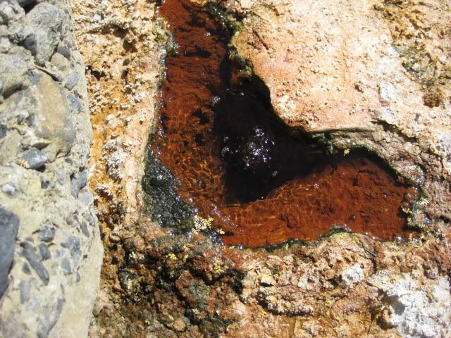
This is how onyx is created over thousands of years. Other sites in Baja California have the same process. One such site is just west of the Gonzaga Bay gas station. There are at least four onyx mines on the peninsula, as well.

Our trucks, as seen from El Volcán


Next, we return to El Mármol for some more photos… then to the windmill at the site of Rancho San Simon (where we met the owner of Rancho Sonora, son of founder ‘Santiago’). Then to Rancho Sonora to see the onyx made curios.

Here is the fork, 2 miles from El Mármol (and 2 miles from Arroyo El Volcán)… facing northeast.

On the road to El Mármol

Nearing the Onyx quarry, you can see the old road climbing the hill… This was the road south, 10.3 miles back to the old main road (between Agua Dulce and La Virgen). I travelled it twice (in 1974 and ’75). Neal Johns took it about 10 years ago… I wouldn’t go solo as there may be some deep washouts.

The schoolhouse

Some of the home foundations from 1958 and earlier.

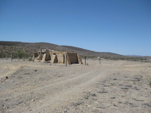


Graveyard

In 1952:


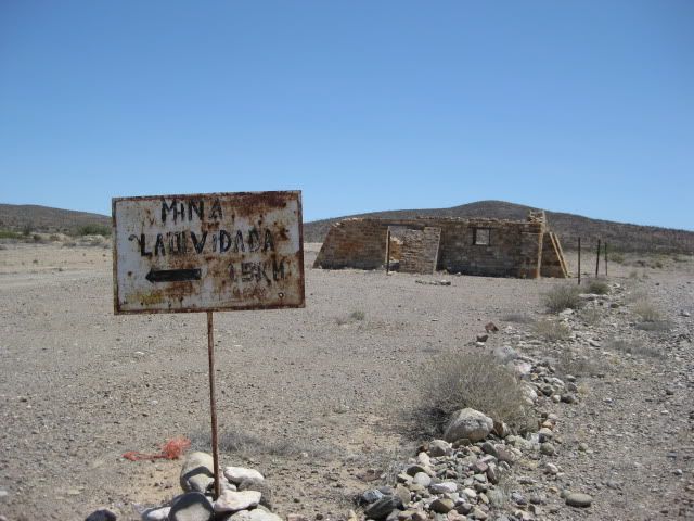
Sign pointing the way to El Volcán (4 miles) and La Olvidada (10 miles). It is 9 miles from this point back to Hwy. 1 (Km. 149). Rancho Sonora is just south of the El Mármol jcn. with Hwy. 1.


In 2017, this business of Rancho Sonora, was abandoned.
I was asked about the El Volcán geyser eruption times:
All I know of its erupting ‘monthly’ is from Walt Peterson’s 1987-1998 editions his very popular, The Baja Adventure Book, describing the event as a 60-foot plume of water and gas, lasting several minutes. A photo of this would be a wonderful thing!
A visit to the El Volcán Cold-Water Geyser is one of Baja’s must-see attraction, in my book. To catch the monthly eruption (in the daytime) would be perhaps the most amazing thing to experience in Baja. When we were in the area back in 2000, my travel amigo ‘Lorenzo de Baja’ considered setting up a camp for up to a month to witness the event!
I have no knowledge of any photos or other documentation of the eruption other than in Walt Peterson’s ‘The Baja Adventure Book’. The feature is also called ‘soda springs’ and have been erroneously described as being ‘hot springs’, in at least one book.
Enjoy more of Baja California’s amazing sites: www.vivabaja.com
Thanks for going us!