July 24, 2000:
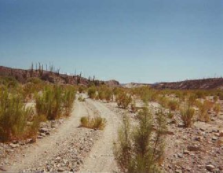
The Road to Las Pintas
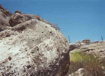
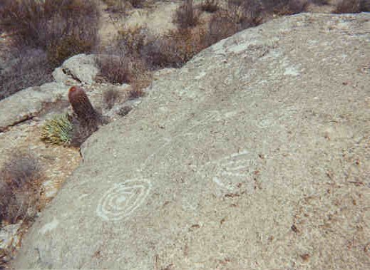
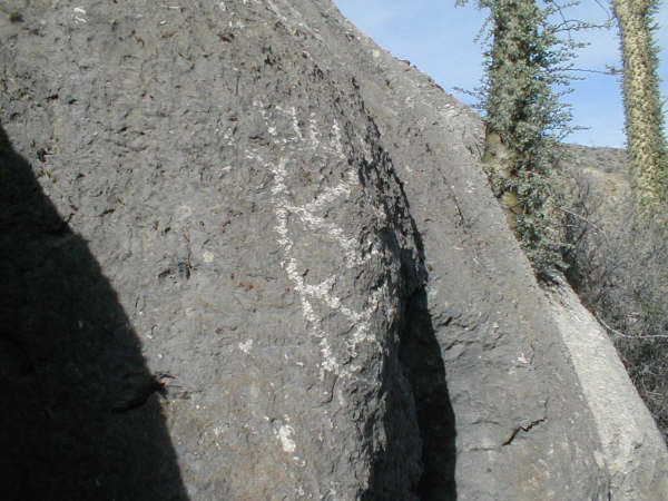
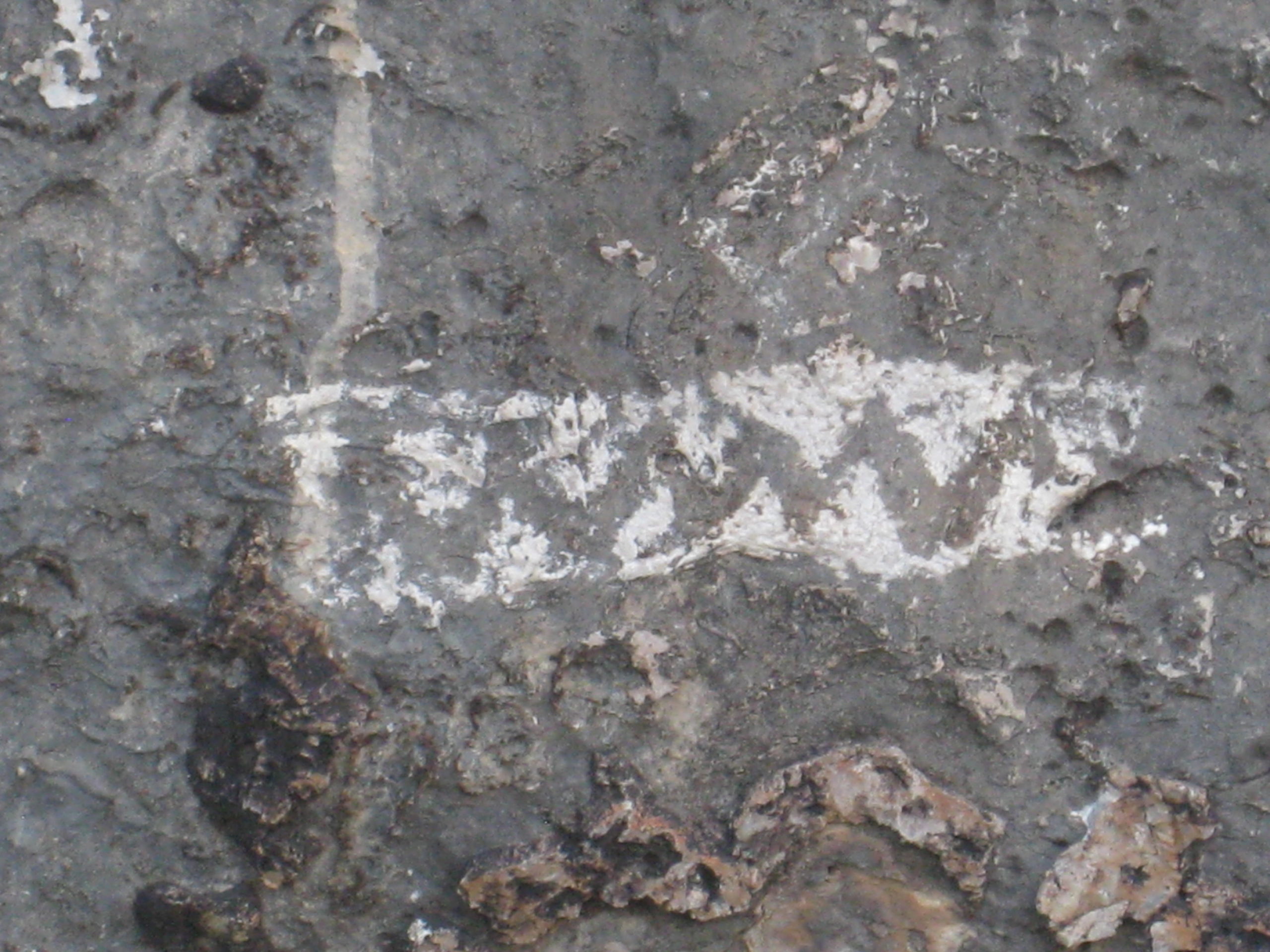
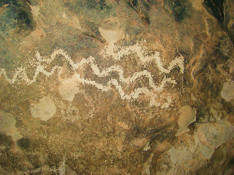
Las Pintas


July 1, 2001


Sept. 17, 2005
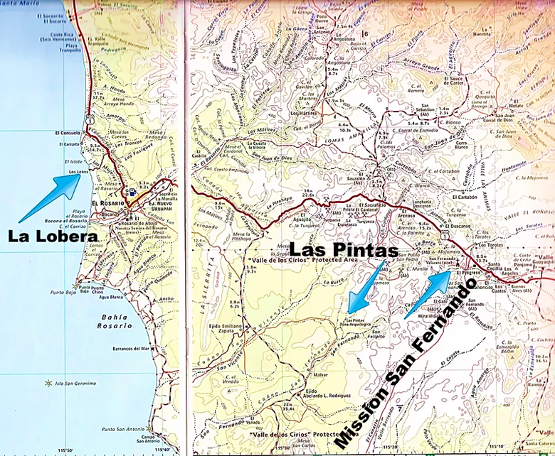
On Sept. 17, 2005, Elizabeth (my girlfriend of nine months) and I traveled from El Rosario’s Baja Cactus Motel to the Las Pintas petroglyph and fossil grotto. Travel directions follow the photos.


DIRECTIONS (in 2005)
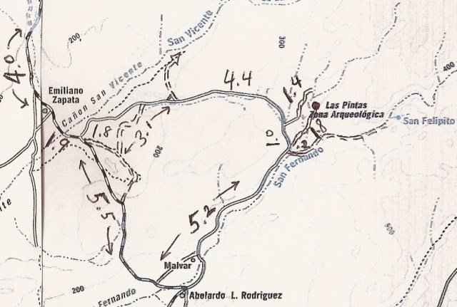
Highway 1, southward from El Rosario 14.6 miles (between Km. 80-81), turn right at the left curve. GPS: 30°01.60′, -115°32.10′ (Map datum set to WGS84)
Go 17.4 miles on the good graded dirt road to a single track road going left. If passed, just ahead is a ranch house on the right and there is a second left road that joins the first. Set odometer to ‘0.0’. GPS: 29°49.65′, -115°28.47′ .
Pass ranch houses (‘Malvar’ on some maps) and make an ‘S’ turn right, into Arroyo San Fernando. You soon will be reach a (possibly) closed gate at Mile 3.5. Always re-close any gate after you pass through.
Mile 5.2, (GPS: 29°52.54′, -115°25.27′) turn LEFT off of Arroyo San Fernando road, and follow a small side arroyo. Brush may scratch your vehicle in here.
Mile 5.4, (GPS: 29°52.70′, -115°25.31′) turn RIGHT, out of small arroyo and cross low divide to small valley.
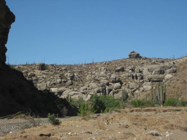
Mile 7.2 LAS PINTAS parking area. GPS: 29°53.91′, -115°24.53′, elev. 755′. You are 24.6 miles from Highway 1 and 39.2 miles from El Rosario’s Baja Cactus Motel and Pemex gas station, per my odometer.
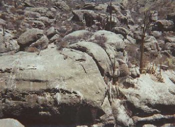
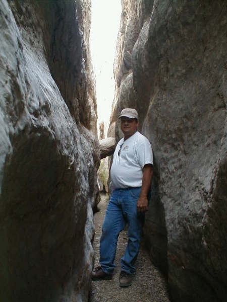
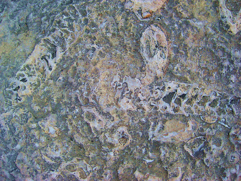
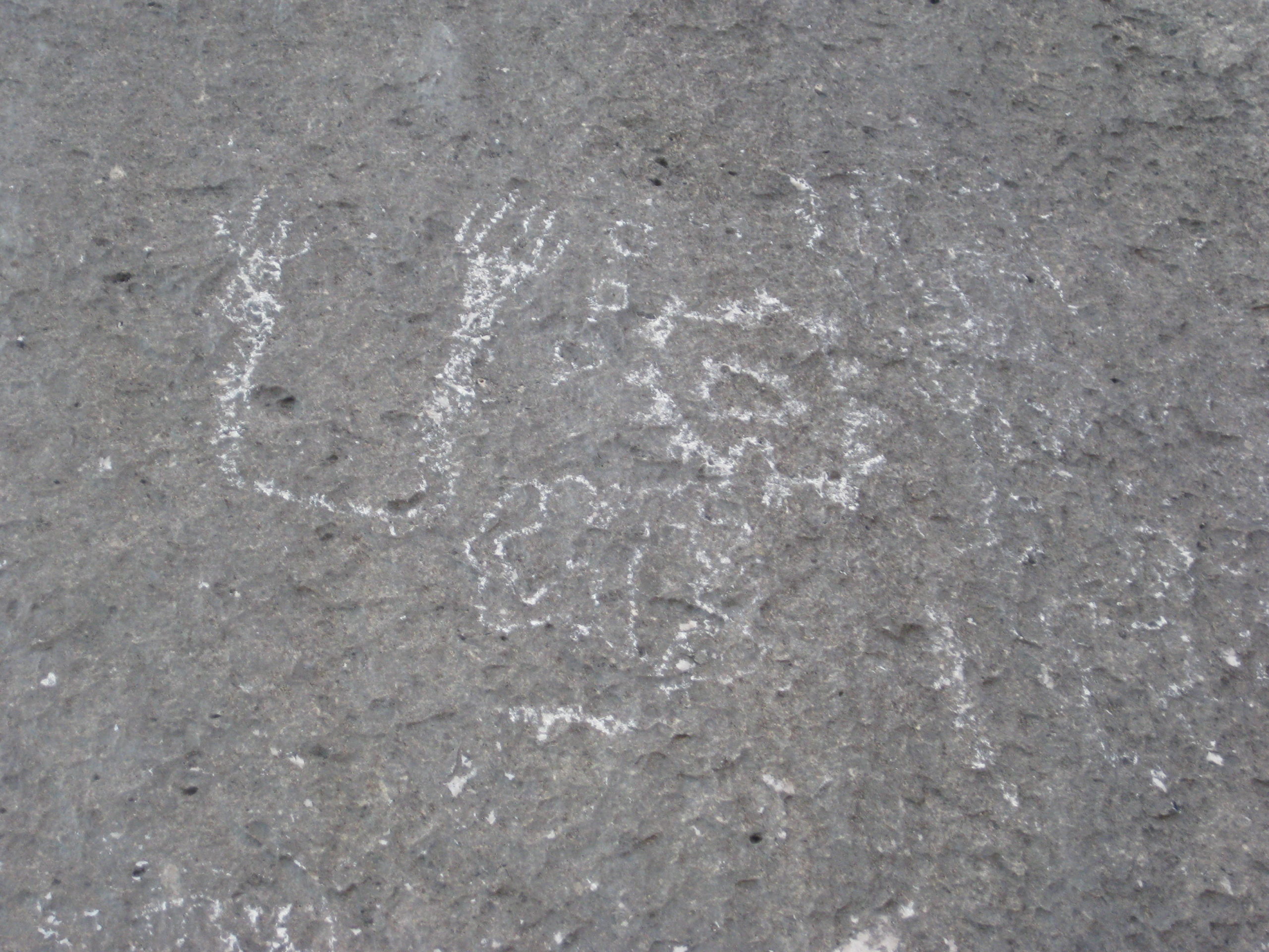
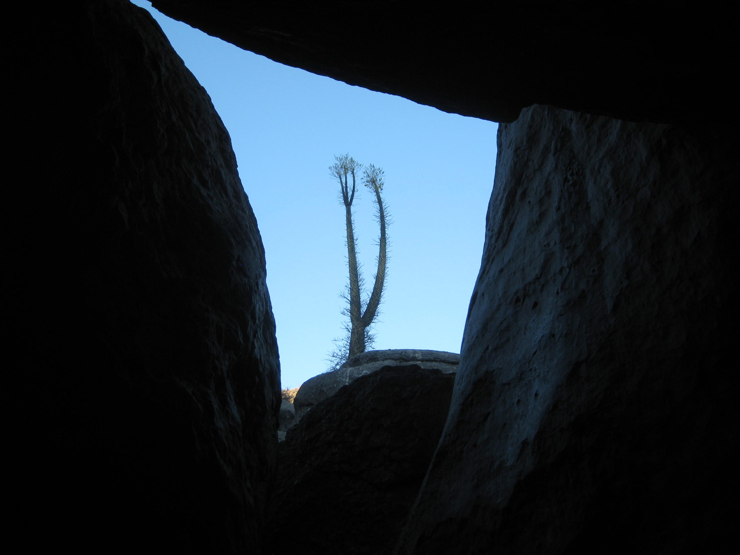
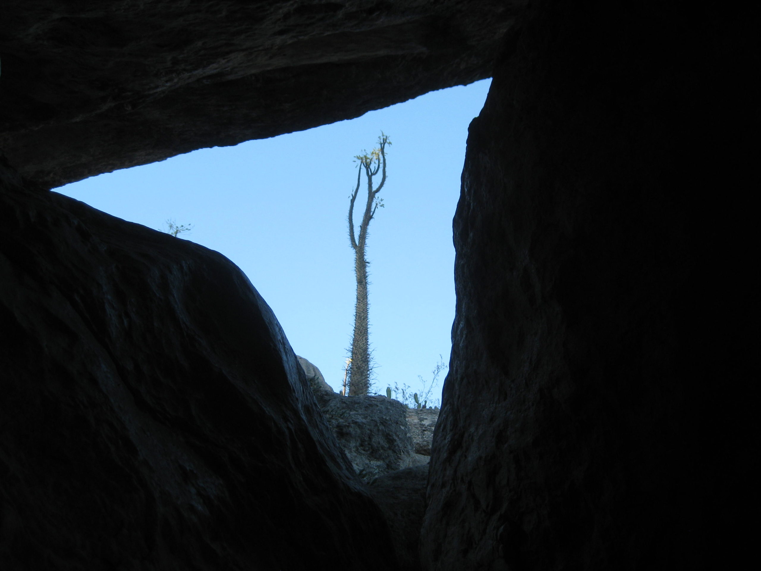
Trail to the right of the boulders is the best way to the top, then cross over to other side and try the more difficult trail to get back down. Straight into the boulders from the parking area are tunnels, passages, and boulder shelters. ENJOY!
April 8, 2006
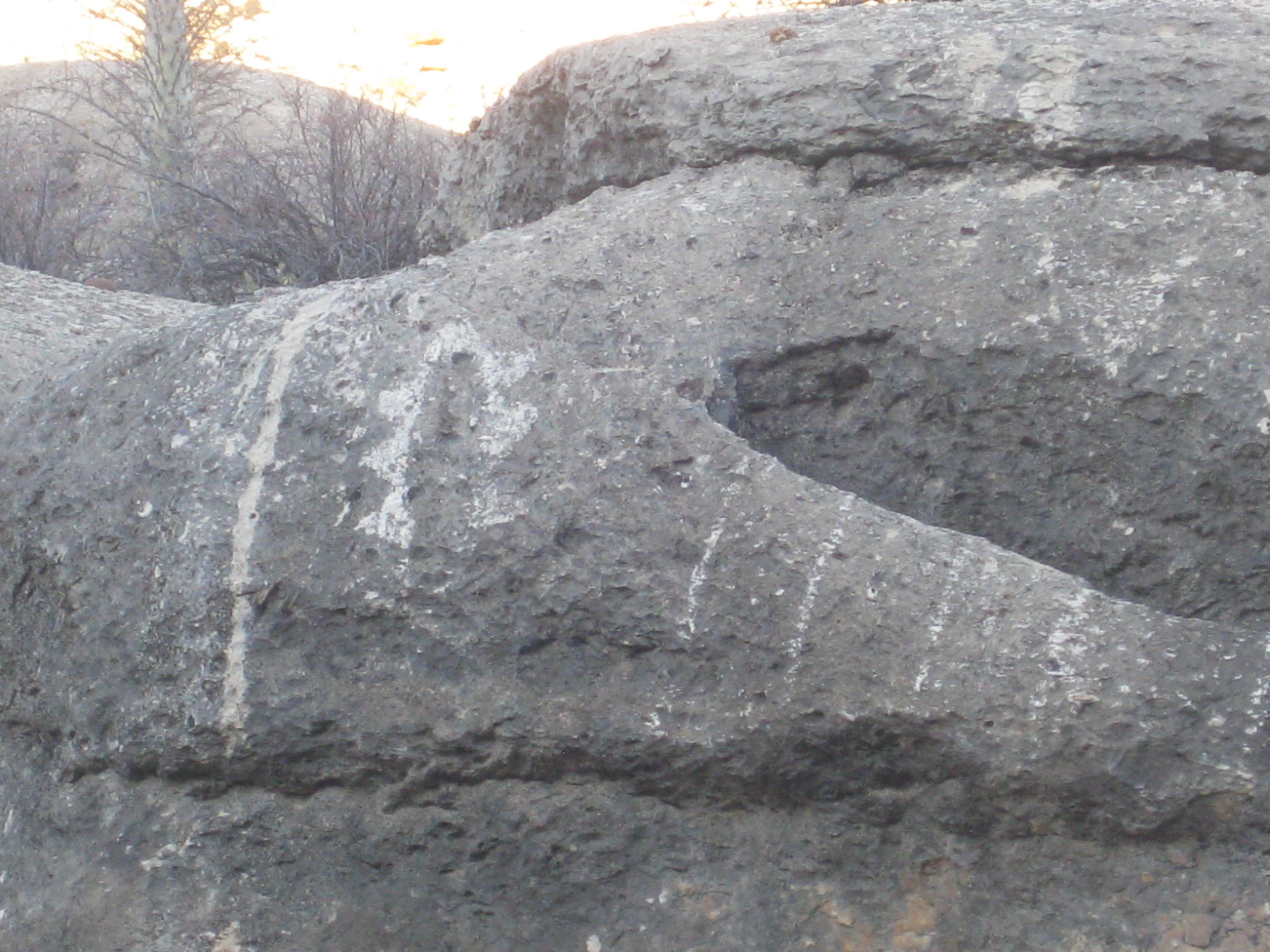
LAS PINTAS

The Baja Adventure Book:
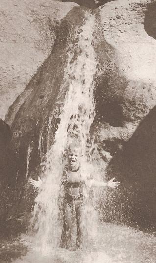


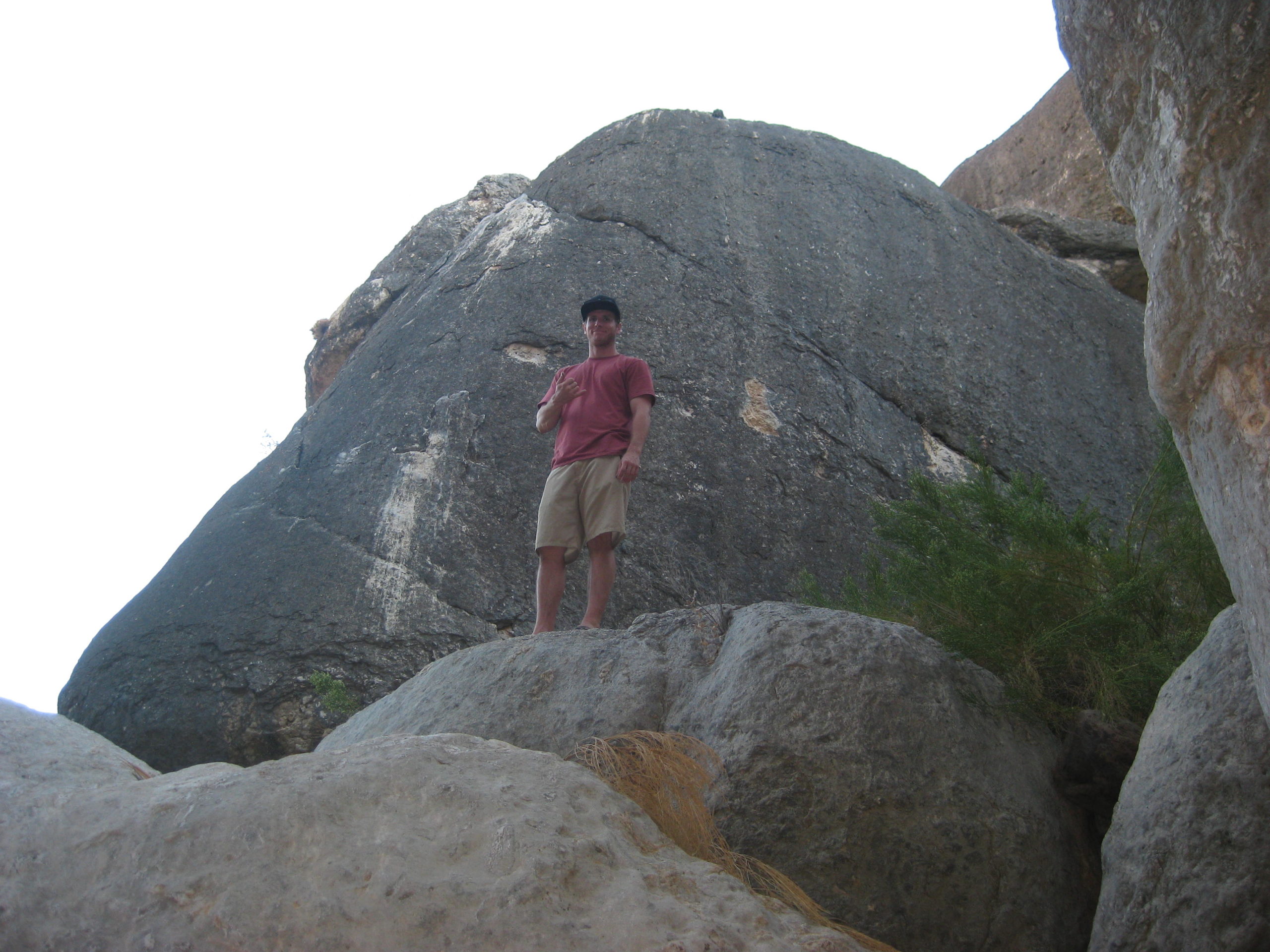
Chris climbs up the boulders…


Saturday, 9-18-2010, My Birthday in Baja: Exploring las Pintas Fossil Grotto
A trip to Baja for my birthday weekend was possible, so we packed up and headed south! We slept well at the Baja Cactus Motel in El Rosario and were in no rush, so we casually got motivated and went 2 miles down the highway to Baja’s Best (Bed and Breakfast) Restaurant… across the highway from the Turista Motel, on the far east edge of El Rosario. Elizabeth had hot cakes and eggs and I had their chorizo and eggs breakfast burritos… delicious!
With so many interesting sites around El Rosario, we had not decided exactly which ones to visit until then. We decided on Las Pintas, but this time to try the northern road in and see more of the top of the boulder field. We have been to Las Pintas several times before, and it never ceases to amaze us.
The access to Las Pintas is off the road to Punta San Carlos, a tiny fishing village and nearby wind-surfing resort called Solo Sports, about 36 miles from Highway 1. The turnoff is between Km. 80 & 81 (just over 14 miles from El Rosario’s Pemex station). There are two turn offs, the first one was signed for ‘Puerto San Carlos’ and the second one is just ahead at the second left curve in the highway. Set your trip odometer to zero when you leave the pavement.


We noted the mileage at Rancho Emiliano Zapata as 10.0 from Hwy. 1, and knew the northern road to Las Pintas was not far past the ranch, and so we took the first road we saw, 1.9 miles ahead. At 1.8 miles (on this side road) is another road to the left (which was the correct one we sought), but it seemed to me to be going too far to the north, so I elected to continue ahead. The road ahead just returned to the San Carlos road. No matter, we will just continue south to the normal Las Pintas access road, and return via the less used northern road!
The Las Pintas road is 17.4 miles from Highway 1, and if you miss the first one, another is just ahead. Go too far, and a ranch is passed, further: you will cross the big Arroyo San Fernando (a usually dry riverbed) indicating a U-Turn is required.
Once on the Las Pintas road, reset your odometer to 0.0 for the (7.2 mile) drive in…

Approaching Las Pintas:
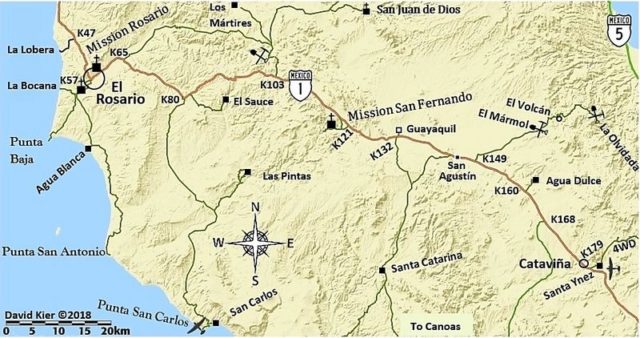
EL ROASRIO TO LAS PINTAS MAP

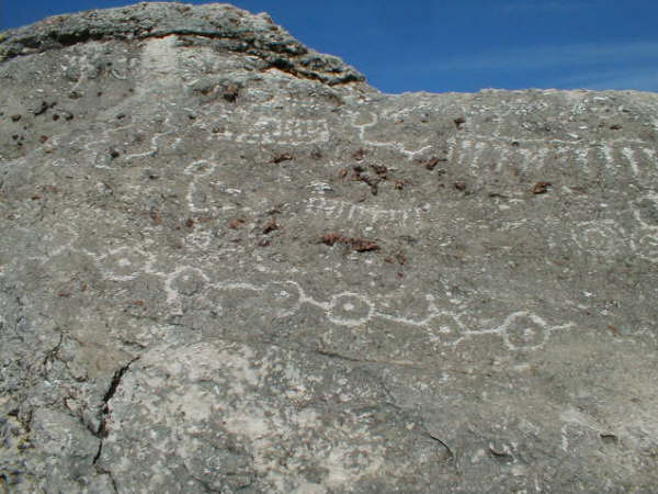
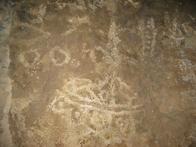
Okay, we have arrived at Las Pintas and we make a lunch, have some cold beer, and explore around the lower end of the rock art and fossil site. Plenty to see and photograph at the lower Las Pintas site and then we travel around to the top end of Las Pintas and see fantastic rock art that we have not seen before!


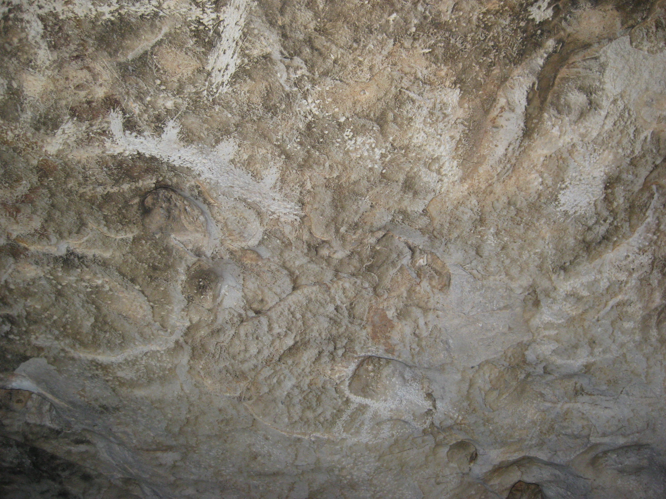
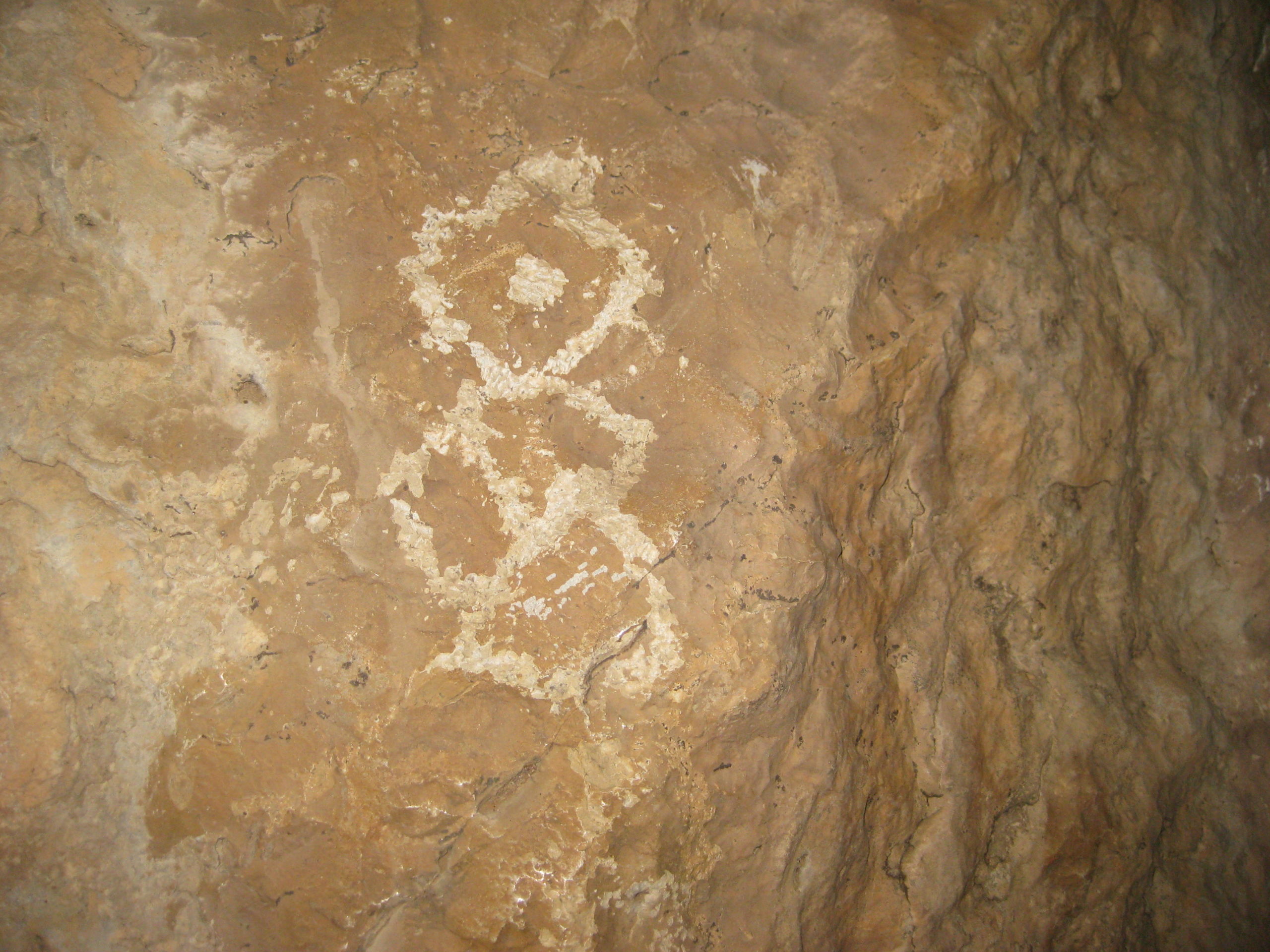
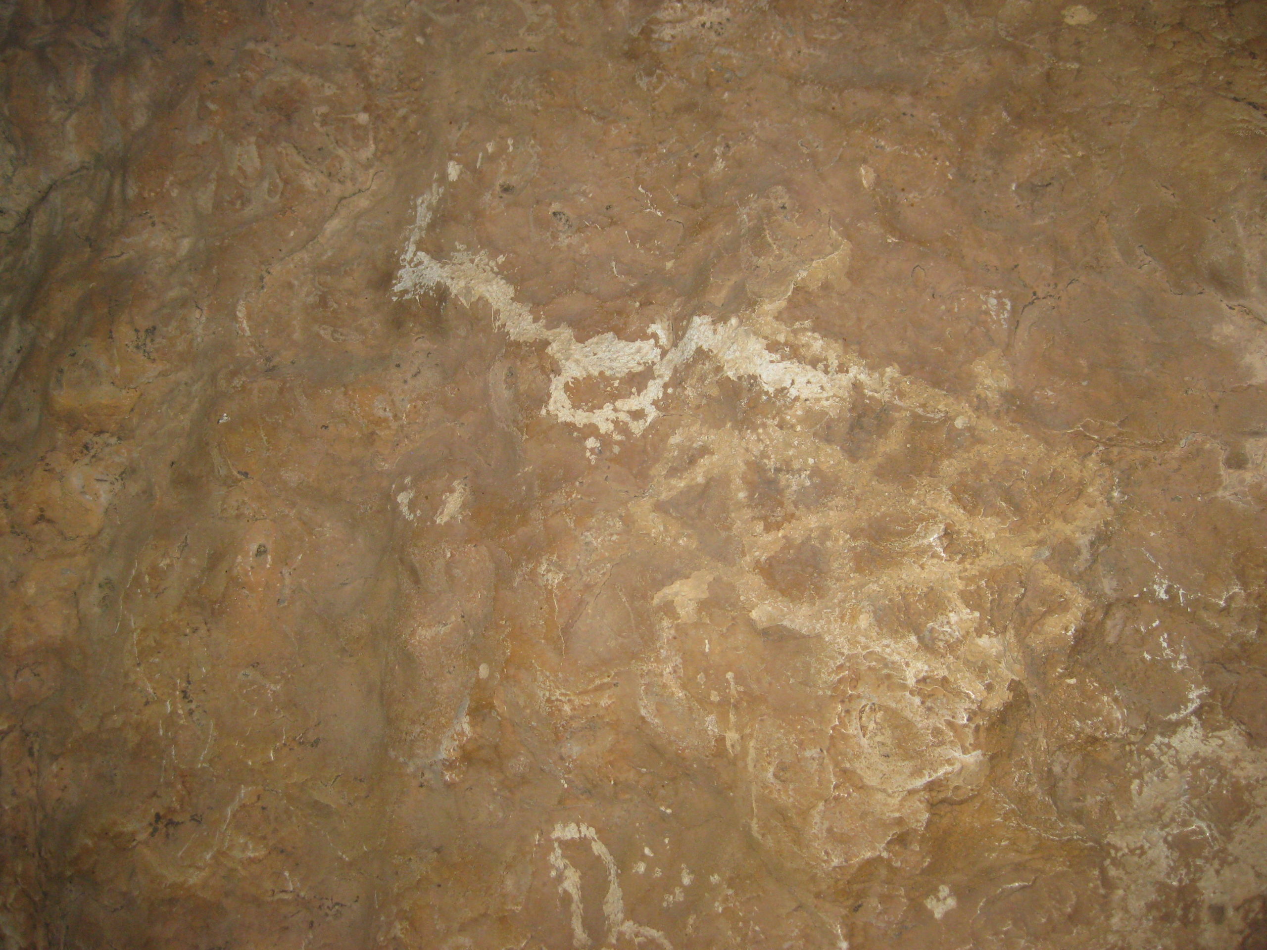
After a quick look, and another beer, I find a way to the big room… a cave created by a giant boulder resting on others. Inside are petroglyphs, as well.

Okay, time to go on new (to us) roads! Back out the 1.8 miles to the side arroyo, then 1.0 mile north to the upper Las Pintas road, and 1.4 miles to the end of the road…
LAS PINTAS REGION MAP
Lower Las Pintas at end of 1.8 mile road. Upper Las Pintas at end of 1.4 mile road. (2015 note: a vehicle track can be seen offering a shorter and more direct connection between the two sites)
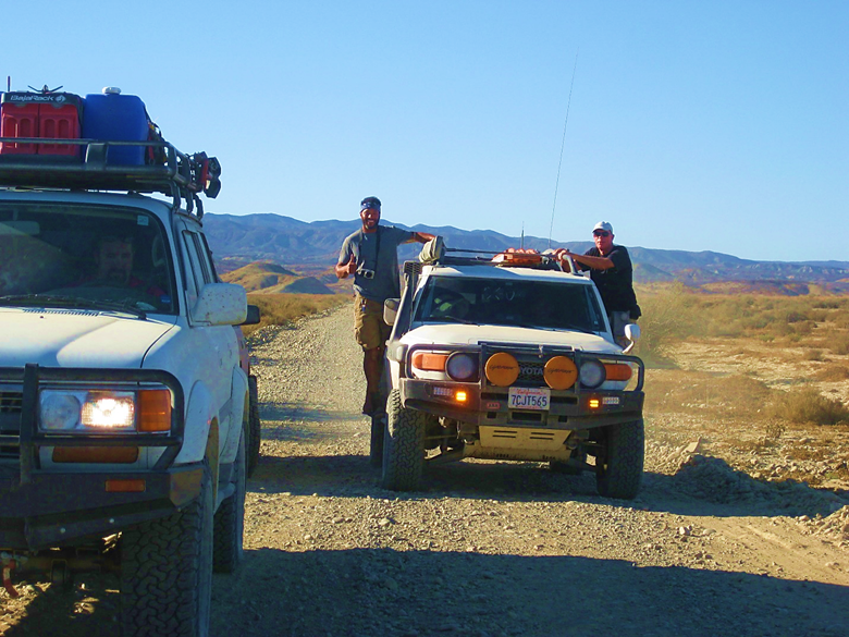
Now a 2WD might get to the lower Las Pintas site, but a good 4WD is a must for the top. There is a short section driving up a dry-mud hill, ridge-top, where traction assistance will make it easy.
The following photos were taken at the top of Las Pintas, a short walk along the boulders from the end of the 1.4 mile road:


On my 2018 map:
Thanks for coming along!
Sept. 17 & 18 2016 of the ‘Baja Extreme 2016’ Tour
Four Toyota 4x4s: My Tacoma (with Pat), Jesse’s Land Cruiser (with Marland), Nick’s 4Runner (with Christine), and Ham’s FJ Cruiser (with Jerry). Photo by Shari at the La Bufadora Inn, Bahía Asunción.

Ham (FJ Cruiser) condensed the eleven day tour into this wonderful 7-minute video, with great music. Las Pintas was our camp location where Chef Jesse made us Dutch Oven meals: pizzas for dinner and blueberry muffins for breakfast: https://youtu.be/kAWGzW4bR9Q Las Pintas is from minute 4:37 to 5:39.
Pat Malone (my passenger) filmed our trip and on this video, Las Pintas is the first 3:15 minutes. The video shows the drive in from the highway, the Las Pintas boulder passages, the petroglyphs and fossils: https://youtu.be/pu8OZyy5S9U
Thank you for your visit!
My VivaBaja.com web home and more location photos: https://vivabaja.com/locations/