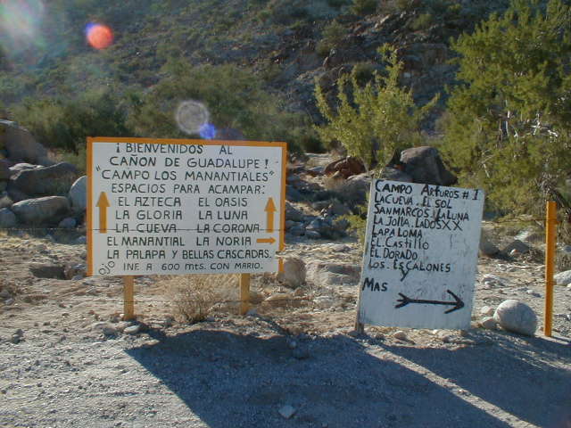
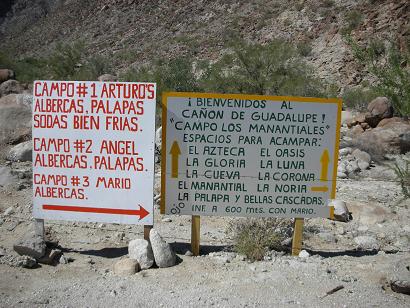
Map of campsites at Arturo’s Campo #1. Don José Loya was Arturo’s father, the founder of Guadalupe Canyon Camping. Refer to the map for campsite names given.
Steve ‘Hot Schott’ and his wife Val at their La Paloma palapa. Steve invited me (in September) to check out the campground and hot-spring-fed tubs for a large group campout, hosted by ‘M’ (Michelle), for her second BBBB (Boojum Buddies Baja Bash). The first Baja Bash was at San Quintín’s Cielito Lindo. See this webpage’s first photos for BBBB-1: https://vivabaja.com/van1/
Funny Steve!
November 2001: BBBB #2
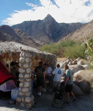
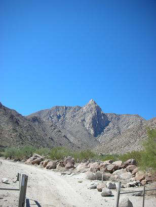
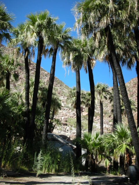
Mike & Mary Ann Humfreville’s campsite ‘El Sol’ in Guadalupe Canyon. Mary Ann is waving to Marla. Photograph by Marla Jo Fisher. Look for her feature story in the Orange County Register.Socializing at campsite El Sol (Humfreville’s).Kathleen and Don, in ‘La Cueva’. Photograph by Marla Jo FisherDesert Bull (Tim) experiencing the ‘Baja Feeling’ at campsite ‘El Castillo’ in Guadalupe Canyon.Here is Kyle who thinks hot tubs are COOL!Steve ‘4Baja’, in on left, as he chats with some of the gang at El Castillo. ‘Desert Bull’ & ‘Princess’Here’s Mike Humfreville, writer of many Baja travel stories and the book, ‘In the Shadow of the Volcano’ (in 2006).Sarah Kier, in El Mirador’s hot tub, perched on the edge of the palm canyon.Doing dishes (with the 125° spring water) is Jeans!Kim making coffee in campsite ‘El Mirador’. She was Marla’s guest from Georgia.The peak that dominates the canyon and to the left, the pinnacle that resembles Mexico’s Virgen of Guadalupe. The ‘highway’ into Guadalupe Canyon. This is looking east towards Laguna Salada.
April 2005
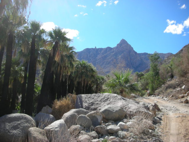
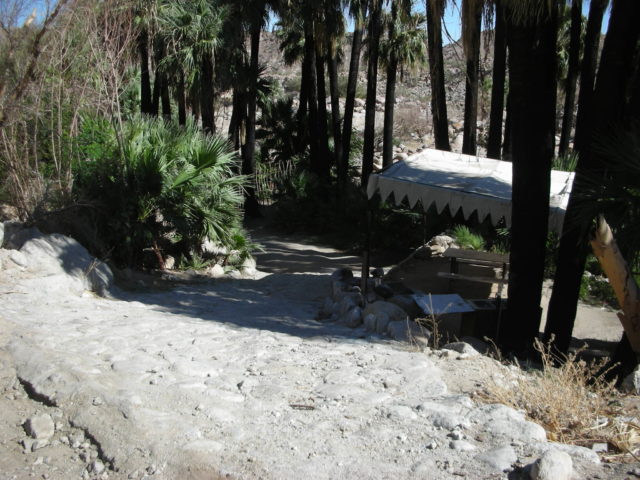
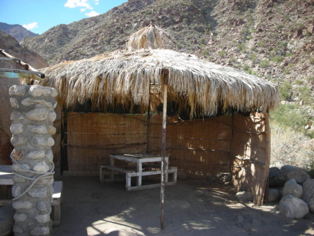
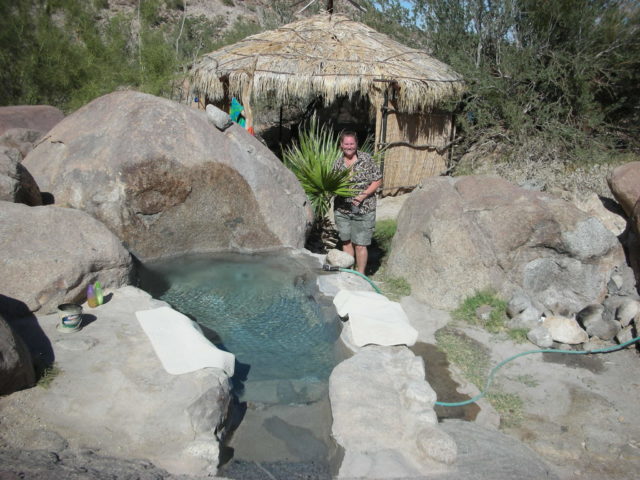
We actually drove in during the night, the photo below was taken when we drove out Sunday. The next morning we took several photos of our private campsite… called ‘La Jolla B’ at Arturo’s Campo #1.
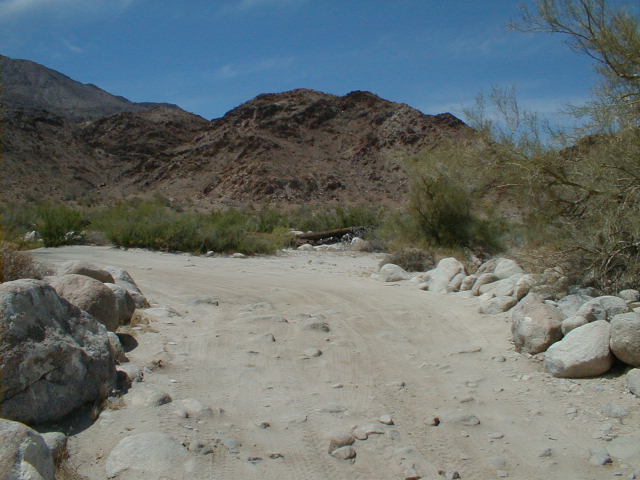
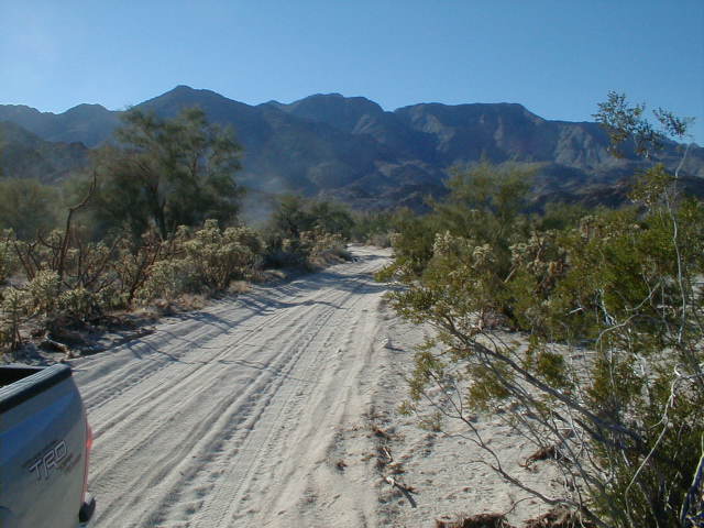
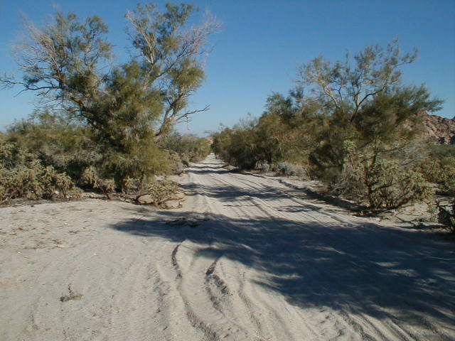
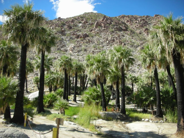
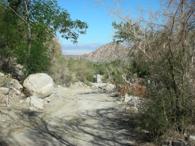
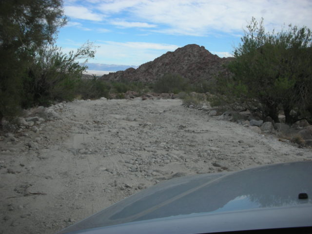
The road is rocky and slow going the final 2 miles to the camping area.
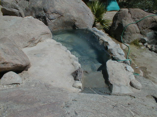
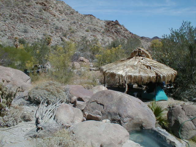
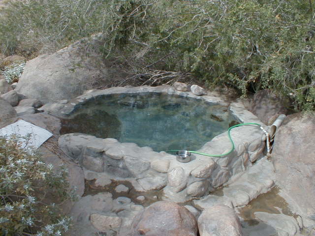
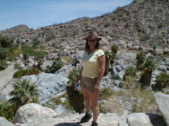
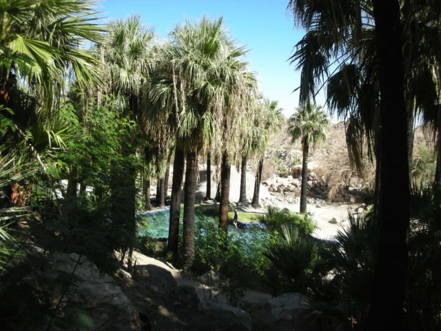
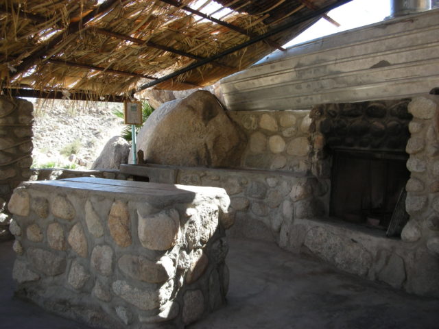
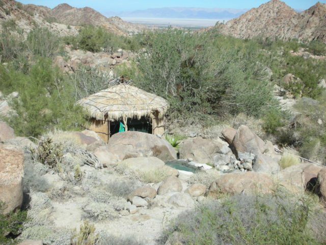
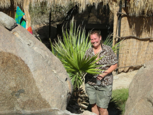
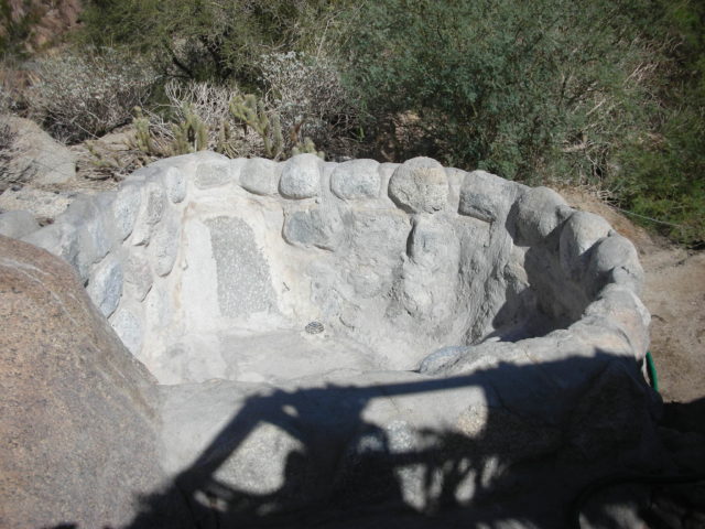
Naturally hot spring water is piped through the canyon’s camp sites. The tubs are made using natural rock and the water temperature is controlled with the valve on the garden hose.The fire pit was well placed and one can enjoy the campfire while soaking!Palapas (palm shade structures) are provided for each camp site. This is ‘La Jolla B’The palm lined canyon is just a short distance from our camp.We take a walk up the road to see the other camp sites.Here is the source spring for Guadalupe Canyon. Water at this point is 125°F. Insulated pipes carry the thermal water to dozens of camp sites, swimming pools, and even flush toilets!The view down the canyon and way off to Laguna Salada dry lake.A palm grove across the canyon from Arturo’s is used for camping.Campsite ‘La Jolla A’ which is between ‘La Paloma’ and ‘La Jolla B’. These three are the lowest sites in the canyon, share a common driveway, but are otherwise private. See the camp map. This photo required climbing a boulder. Here is the hot tub at camp site ‘La Paloma’. It is very nice for summer as it is in the tree’s shade. When you direct the hot spring water to spray up into the tree, it rains back down quite cool!Elizabeth looks like she is adapting well to desert camping!Elizabeth and David on the waterfall trail, April 30, 2005. To the left of the main peak is a pinnacle that resembles Mexico’s ‘Virgen of Guadalupe’, thus the canyon’s name.As the sun crosses the sky, the canyon’s beauty increases with the continuous change.Sunday was a little cloudy, but otherwise it was very nice… we hated to leave!
Guadalupe Canyon Entrance
In November, 2005, we followed Steve and Val to Guadalupe Canyon Hot Springs. After doing some soaking, we explored the area outside of the canyon entrance…
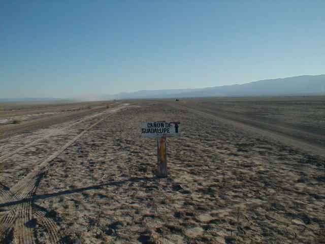
The Dry Lake Road south from Highway 2 has choices. Where it matters, there is a sign!
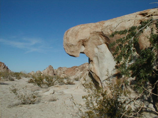
Plenty of signage! Lots of dynamic rock shapes and caves.
My new 2005 Toyota Tacoma 4×4Signs at the canyon entrance point out campsites on the south and north sides where the road splits.
Looking down, don’t be surprised to see pottery or arrowheads.
Elizabeth and Val are ‘hunting’.
Elizabeth & DavidVal & Steve
Guadalupe Canyon Weekend 9-16-06
A dual event weekend shared with our friends Steve (‘Hotschott’) and Val at wonderful Guadalupe Canyon Hot Springs! Elizabeth and I both celebrate birthdays in September and we became engaged on the 5th of September.
Elizabeth and David, turning 49-years-old!
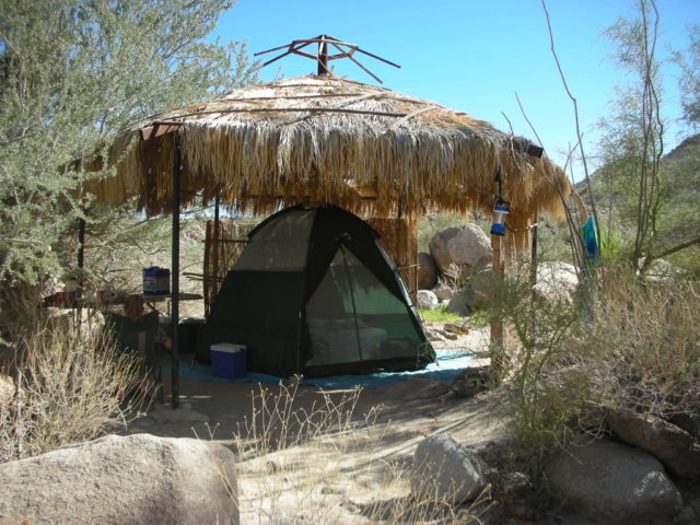
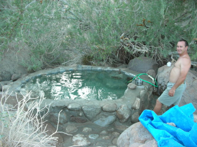
Our campsite, ‘La Jolla B’ with hot tub.
In the palapa.Hot tub under the sky and stars.Peak and Guadalupe Rock above the canyon.Mud on the Laguna Salada road was sticky!Canyon viewed from ‘La Paloma’.Desert scene near La Paloma, in the canyon.Signs at canyon entrance.
One last look back!
Guadalupe & La Vibora Canyons New Years 2008
Hot spring campground and petroglyph covered boulders in Northern Baja California
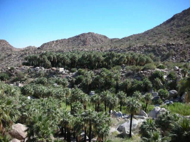
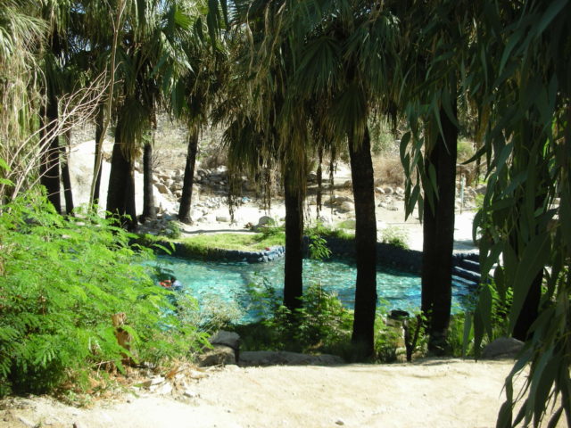
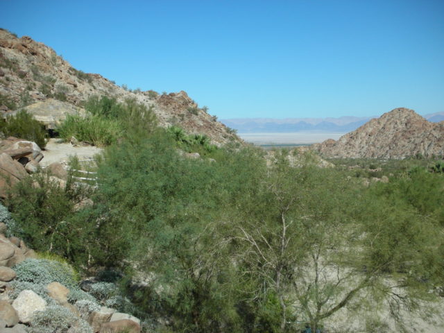
25 miles on the dry lakebed of Laguna Salada is the first part of the drive between Hwy. 2 and Guadalupe Canyon.Arturo’s Campo #1 has several choices of private camp sites with hot tubs and palapas.A fire had recently burned the palms in the canyon and Arturo’s cantina.The palm grove across the canyon, burned as well.The view up Guadalupe Canyon.Close up of the ‘Virgin of Guadalupe’ rock, on top of the canyon ridge.The view towards Laguna Salada from camp site ‘El Mirador’.The large pool is popular with kids when the campground is busy.The campground west of (above) Arturo’s was burned by the fire.
To La Vibora Canyon Petroglyphs
Guadalupe Canyon to La Vibora Canyon (8 miles)
0.0 Arturo’s Camp, La Paloma & La Jolla road
2.2 Take right fork. Left is main road back to highway
2.8 Turn sharp right onto track heading south
7.5 Take road to right that drops steeply into arroyo
8.0 End of road, park for petroglyph and metate hike
GPS at end of road: 32°6.74′, -115°44.66′ (map datum WGS 84)
Allow 3 hours for the drive and hike.
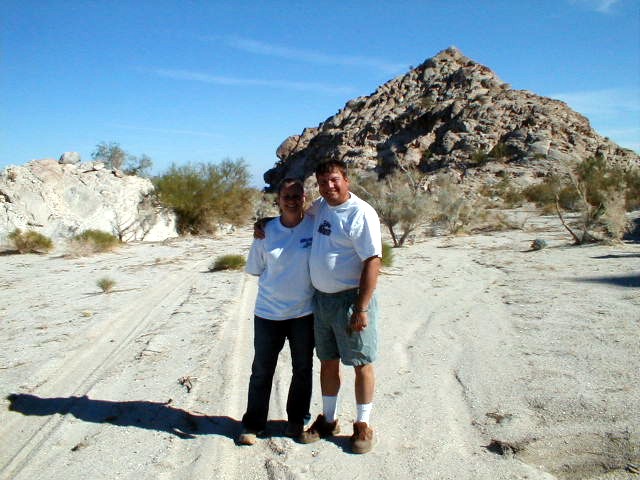
The Guadalupe Canyon road is pretty rough the last 2 miles into the canyon.Rocks turn into sand as we continue east towards Laguna Salada. Soon we will leave the main road and head south on a less used desert track.This is Cañon La Vibora (‘Rattlesnake Canyon’), as seen from the desert road that continues south at the foot of the mountain range.Right away one sees evidence of ancient Indian activity.Our trucks, as seen from the decorated rock.This highly decorated rock is visible from the end of the road.After examining the first rock, we continue up the canyon over a difficult trail.Steve shows us the next decorated boulder.
This was on the back side.We continued climbing over the boulders looking for more petros…
As we come back down the canyon, a deep metate is found. Metate is the Spanish word for a grinding pit or mortar.Steve and Elizabeth chatting about al the Indian activity that happened here some hundred and more years ago.A high boulder above the parking area is covered in petroglyphs.Here’s another we saw before driving back to Guadalupe Canyon.Our friend and guide, Steve… known on the Internet’s Baja Nomad forums as ‘Hotschott’.Our hot tub and palapa at campsite ‘La Jolla B’Another great weekend for Elizabeth and I in Baja California, at Guadalupe Canyon. This trip was extra special with our friends Steve and Val.
Happy Halloween 2008 from Guadalupe Canyon Hot Springs
My trip report on Baja Nomad forums:
Baja Angel (Elizabeth) and I just got back home from a very, very nice weekend in Guadalupe Canyon with Nomad Hotschott and his esposa, Val. Hotschott even brought pumpkins and carved them!
Being that Halloween was Friday and that was when we drove down, arriving just after dark… our party was Saturday night…
We got out of North County about 2:30pm Friday and that put us ahead of traffic… lucky for us! Crossed into Mexico at Tecate about 4:30…
TWO new (since our last time this way) Pemex stations are now on the road leading east from Tecate to the toll highway entrance.
We were on the Laguna Salada to see the sun set about 5:30 and the lakebed was dry and fast driving (50-60 mph). When it got dark, I ignited my HIDs. I spent some time playing with the adjustment angle… testing a couple different ways to use them, etc. By the time we were climbing up the road from the lakebed to the canyon, it was dark. The HIDs gave out plenty of bright blue-white super light.
We arrived at our reserved camp (La Jolla B) at 6:30. Hotschott and Val had arrived a couple hours earlier and were settled in at their nearby campo, La Paloma.
As soon as our camp was set up, we were soaking in the wonderful hot spring water under a sky solid with stars!
That was Friday.
Saturday was a day of rest and relaxation… enjoying perfect weather… it was actually warmer than we expected… warm all night, too. Baja Angel and I took a short walk up to the office and beyond into the next camp.
The palms all burned now had plenty of green leaves with only their trunks blackened… All of Arturo’s camp sites are open, but the next campo up (formerly Angel’s Campo #3) still has not rebuilt their palapas or sites… from what we could see. Across the canyon were some new wood sided palapas… but no privacy, like at Arturo’s!
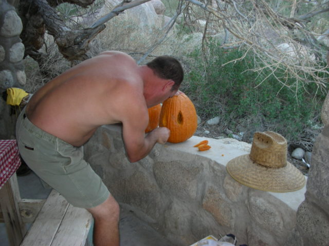
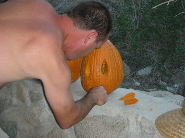
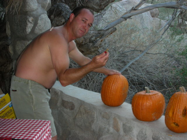
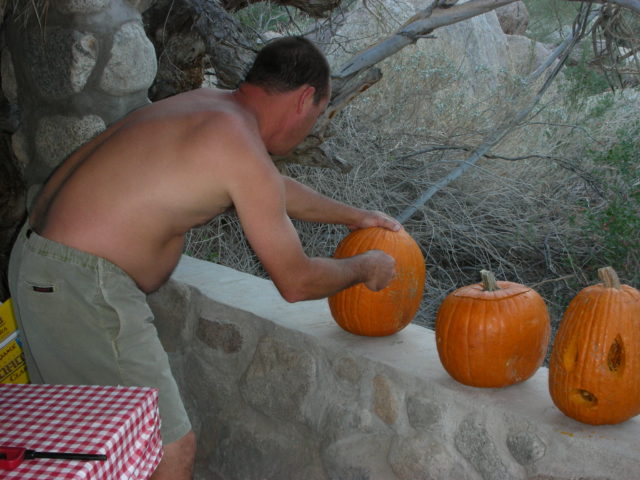
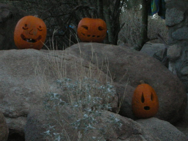
Saturday evening we had dinner at the Hotschott’s camp and Steve (Hotschott) made three Jack O’ Lanterns…
More soaking then sleep… A wind came up and tried to blow things around for a few hours…
Sunday (today) morning was overcast and made packing up a cooler, nicer experience than if we had to in the full sun!
We left the canyon about 10:30 (new standard time) this morning and reached the border line at Tecate about 1 pm… The wait was 65 minutes.
There were some Baja 1000 pre-runners about and the race course is the main street in La Rumorosa! I bought $20 (240 pesos) of gas at La Rumorosa (12 pesos per dollar) for 33 liters (8.7 gallons) or $2.30/ gallon.
Great trip, very nice weather, good friends, hot springs… hard to beat!
Photos next!
The road up through Arturo’s camp.Looking down at the swimming pool from the road.Looking across the canyon at the grove where the other campground is located, popular with big groups from Mexicali.Looking up at the former campo of Arturo’s brother (Angel) just past Arturo’s office… the palapas were burned down in the fire of 11 months ago.
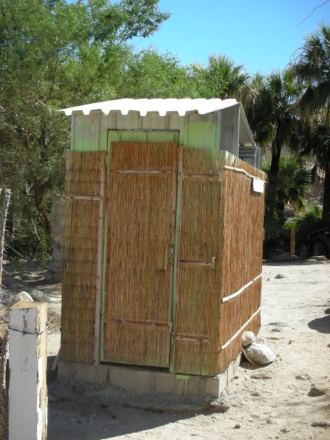
Elizabeth and David in one of our Baja Happy Places!The source hot spring for the canyon is against the cliff, past these palms (just above and to the right from Arturo’s office).Another look down at the warm, spring fed swimming pool.Steep cobblestone path can be dangerous! In 2001, a friend, Mary Ann Humfreville, slipped and fell. Fortunately, a paramedic was also camping there (‘Westy’) and provided first aid.Walking back down to our camp, Laguna Salada in the distance.What might be Baja’s only hot-water-flushing outhouse toilet.That’s Laguna Salada in the distance.
Here are some photos of camp site ‘San Marcos’ 11-1-08:
Here is our campsite, ‘La Jolla B’
She’s my Baja Angel!La Jolla B has two palapas, a second one serves as a kitchen/ dining area for us.Here is La Jolla A and it’s tub.
Campsite La Paloma:
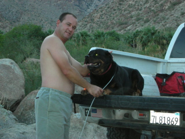
‘Hotschott’ (Steve) and Boomer:La Paloma’s palapaLa Paloma’s hot tub
It’s Halloween! Steve is in the festive mood and brought pumpkins:
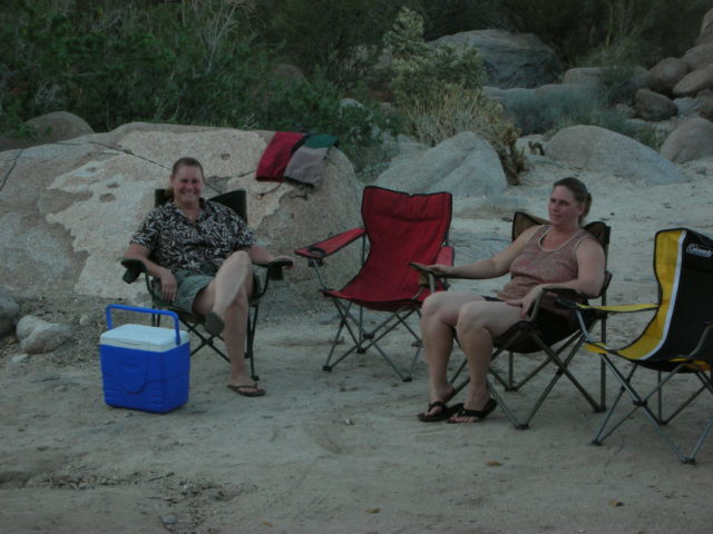
Baja Angel (Elizabeth) and ValBoooo!Going home.
Sadly, this was our final time camping at Arturo’s and Guadalupe Canyon. Arturo was replaced by his younger relatives and that side of the canyon was closed. Since then, some of the luxury campsites have been reopened. See my 2021 article: HERE
Hope you enjoyed this look at our years camping in the canyon. Enjoy more location photos: 1,600 photos map
 Where is Guadalupe Canyon? Fifteen miles west of Mexicali, or fifty-seven miles east of Tecate, and then 35 miles south: