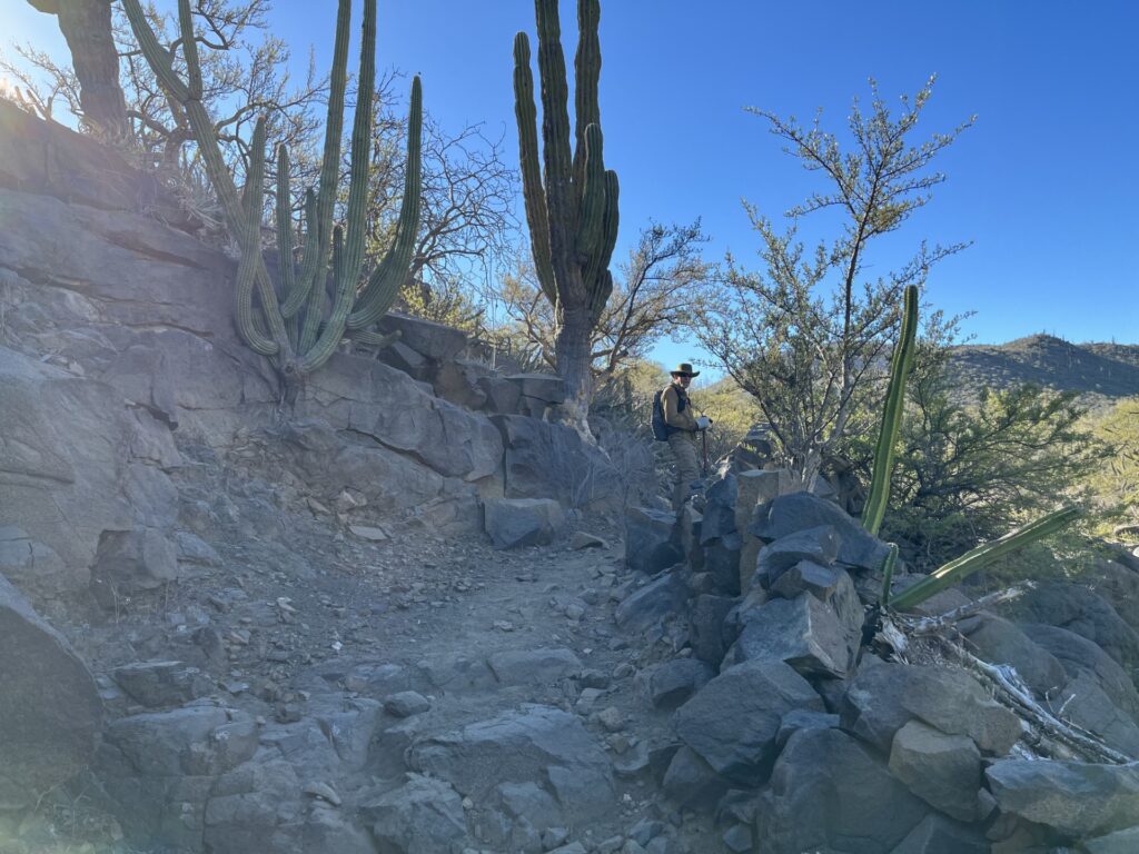
The El Camino Real between Loreto and El Rosario has been accurately located by the team of Kevin Branscum and Genevieve Mattar following twenty years of intense backpacking on the mission road. They have followed the research made by Harry Crosby published in the 1970s and Howard Gulick in the 1950s in hopes to create an exact placement of the old trail with GPS and Google Earth. Their website details the work: http://caminorealbaja.com/
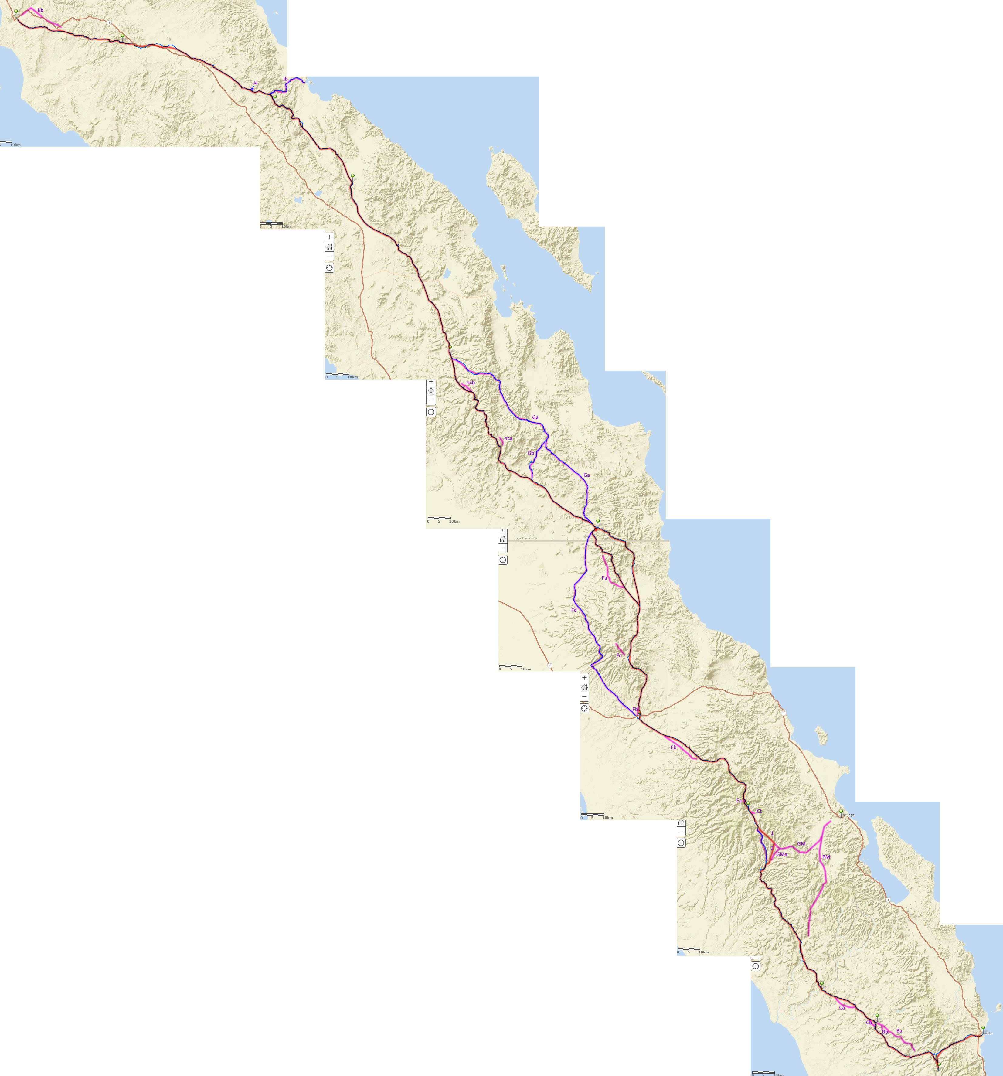
In 2021, Benchmark Maps published the Baja California Road & Recreation Atlas. The Camino Real route, from Kevin and Genevieve’s research, is shown in the new Atlas. The Atlas also shows the kilometer marker points on all of Baja California’s highways.
Here is a list of where the old mission road crosses or joins with modern roads, from north to south:
- Km. 58.5 (Hwy. 1, El Rosario)
- Km. 129.5 (Hwy. 1)
- Km. 166 (Hwy. 5)
- Km. 178-179 (Hwy. 5, by Coco’s Corner)
- Km. 29 (L.A. Bay Hwy.)
- Km. 75 & 77 (Hwy. 1, San Ignacio, two trails)
- Km. 0 (Laguna San Ignacio road)
- Km. 114.5 (Hwy. 53, La Purísima)
- Km. 6-25 (San Javier Hwy. in, over, or parallel with El Camino Real).
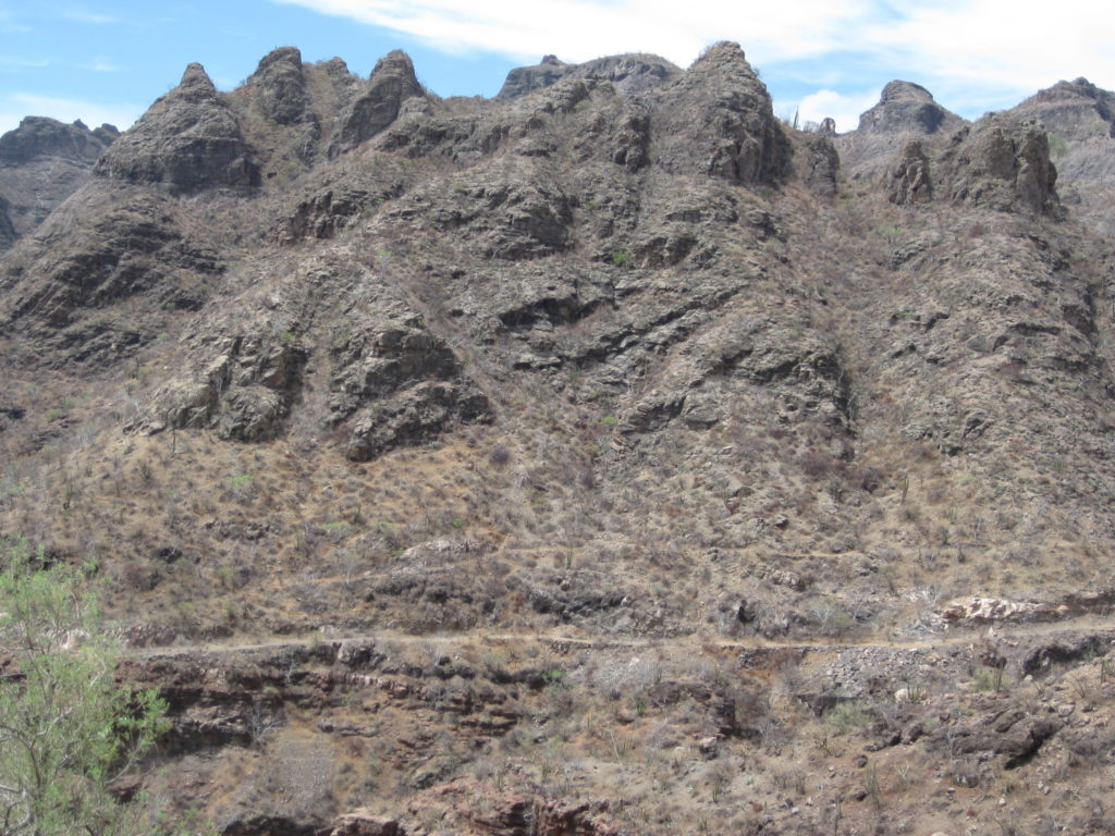
In the photo below, the El Camino Real and old auto road can be seen across the canyon from the new San Javier highway.
GPS waypoints on dirt roads at approximate El Camino Crossings or Junctions (WGS 84):
- 30° 0′ 59.6″ N 115° 32′ 9.3″ W (Punta San Carlos Road)
- 29° 55′ 12.3″ N 114° 56′ 19.9″ W (El Mármol Road)
- 29° 46′ 29.3″ N 114° 38′ 18.6″ W (Mission Santa María Road)
- 29° 32′ 34.2″ N 114° 16′ 26.6″ W (Puerto Calamajué Road)
- 29° 25′ 28.6″ N 114° 11′ 59.2″ W (Arroyo Calamajué Road)
- 29° 15′ 43.9″ N 114° 8′ 22.6″ W (El Crucero Road)
- 29° 12′ 56.6″ N 114° 3′ 4.2″ W (Rancho San Luis Road)
- 28° 55′ 7.9″ N 113° 48′ 40.7″ W (San Borja Road)
- 28° 51′ 37.7″ N 113° 47′ 39.9″ W (San Borja Road)
- 28° 47′ 28.9″ N 113° 45′ 46.2″ W (San Borja Road)
- 28° 8′ 51.9″ N 113° 16′ 14.9″ W (El Arco-Pta. S. Francisquito Road)
- 28° 7′ 21.1″ N 113° 13′ 45.9″ W (Guillermo Prieto Road)
- 28° 3′ 44.6″ N 113° 6′ 27.6″ W (Santa Gertrudis Road)
LINKS:
Camino Real Baja site, with Google Earth ECR link
Feb. 2022 Camino Real Baja Update
Camino Real Baja 2018 tracks on topo map
Camino Real Baja 2018 tracks on terrain map
1769 Diary of Junípero Serra on El Camino Real (pgs. 39-123)
1792 Camino Real Road Log (leagues)
1856 Camino details in ITINERARIOS Y DERROTEROS (pgs. 424-437)
Harry Crosby’s El Camino Real Details (1977-web archive)
Harry Crosby’s El Camino Real Details (1977- new webpage)
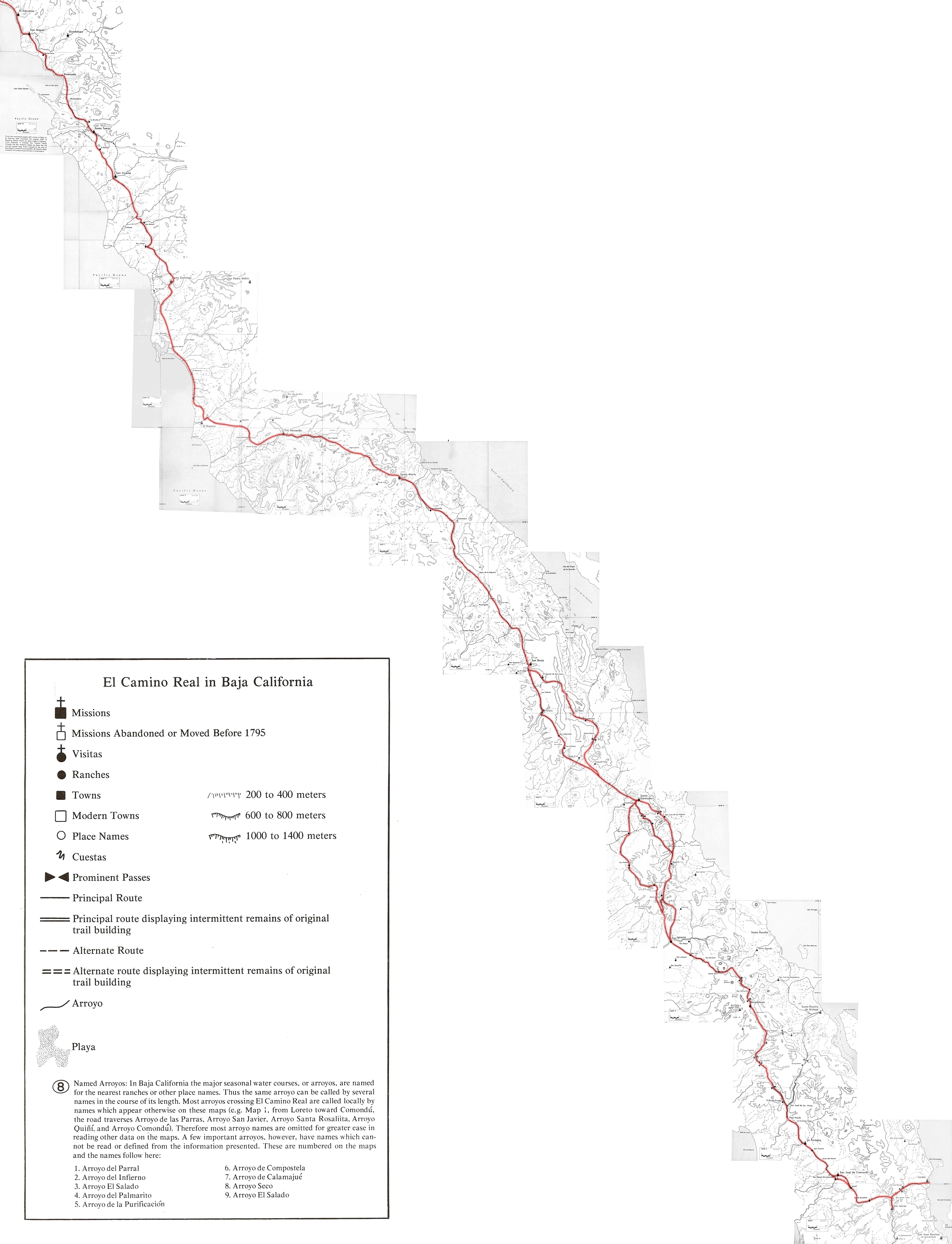
Harry Crosby’s 1977 El Camino Real Maps
Harry Crosby’s 1977 El Camino Real Maps (stitched together)
Harry Crosby’s 1974 El Camino Real Maps (stitched together)
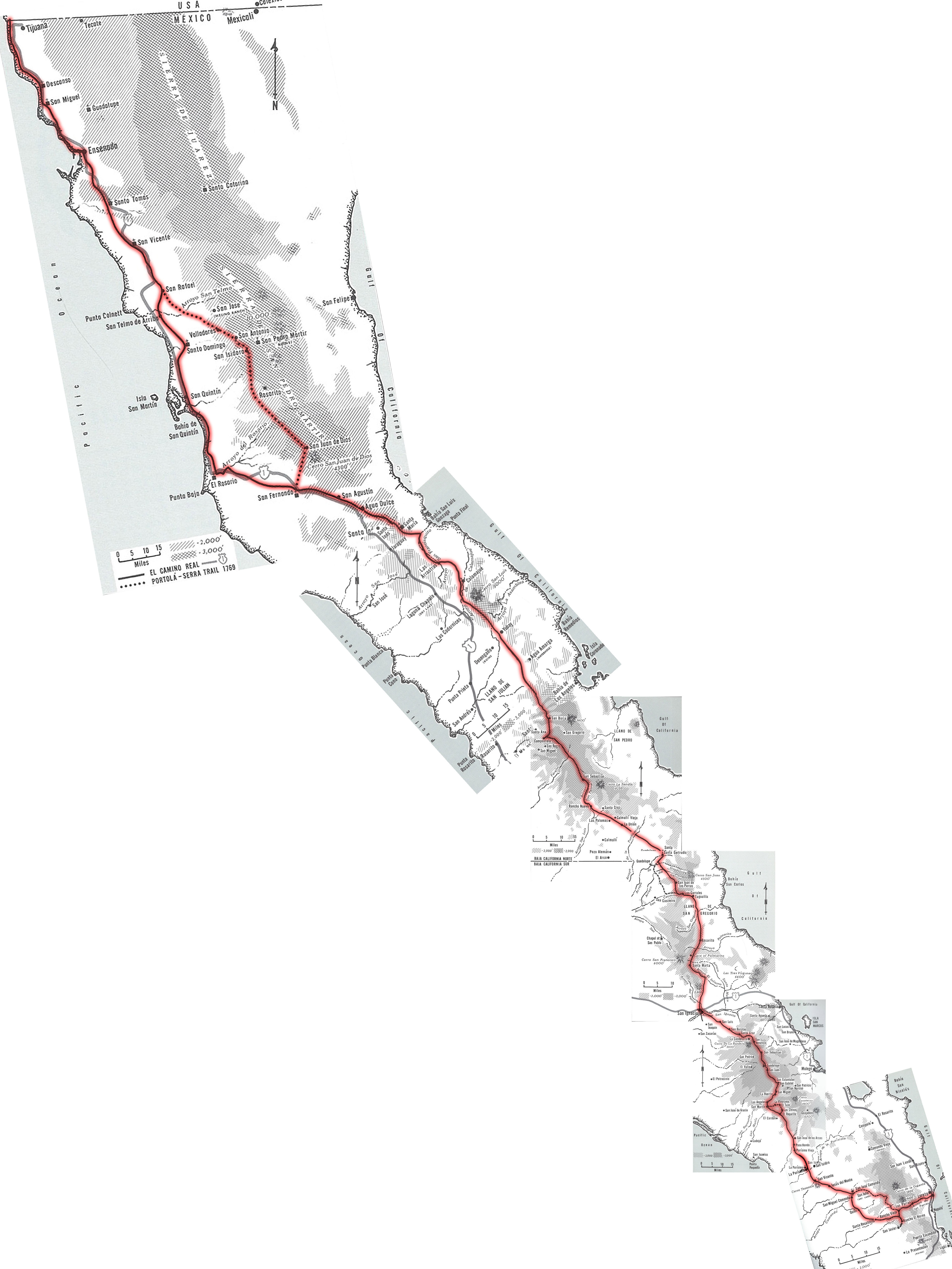
Howard Gulick’s 1954 El Camino Real Maps (stitched together)
Finding El Camino Real in words, referencing the 2003 Baja Almanac and 2021 Baja Atlas, plus the 1954 individual maps from Howard Gulick: https://vivabaja.com/ecr/
Benchmark Baja Atlas Book (special price)