Plotting the Atondo-Kino 1684 Expedition (San Bruno to the Pacific) on Satellite imagery, using Admiral Atondo’s diary published by Dawson Book Shop in 1969 as First from the Gulf to the Pacific (#16 of the Baja California Travels Series of 51 volumes), translated by W. Michael Mathes.
The 1960 Ronald L. Ives drawn route map:
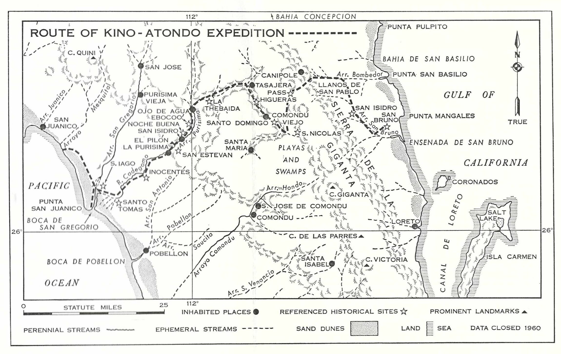
Admiral Don Isidoro de Atondo y Antillon, Admiral of this Kingdom of California, on behalf of the King, provides us with his diary of this great expedition which was the first time Europeans crossed the peninsula to the Pacific Ocean, with Father Rector Eusebio Francisco Kino of the Society of Jesus (the Jesuits), twenty-nine soldiers, a surgeon, a muleteer, a slave, and nine Christian Indians from the Mainland. The animals used included thirty-seven horses and forty-four mules. An unspecified number of heathens (how the Spaniards labeled unbaptized-Native Californians) were also along to act as guides. In this report, location names that are no longer used will be in italics. Distances that are corrected, are based on evidence and estimation. The Ives map above does have some possible errors and omissions from the diary.
The Daily Notes from Admiral Atondo and our modern views
Distances in miles or corrected leagues, as well as GPS coordinates, are all estimates of these historic locations.
Day 1: 6 miles, satellite view:
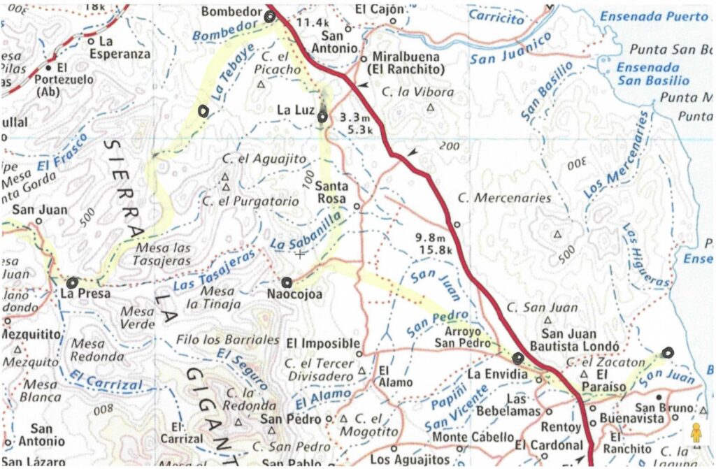
Dec. 14 PDF Topo Map (1″=1 km.) Below, see a JPEG image of this PDF map. The track estimate (red line) was provided by Harald P., if differs only slightly from my track estimate on the satellite image, above:
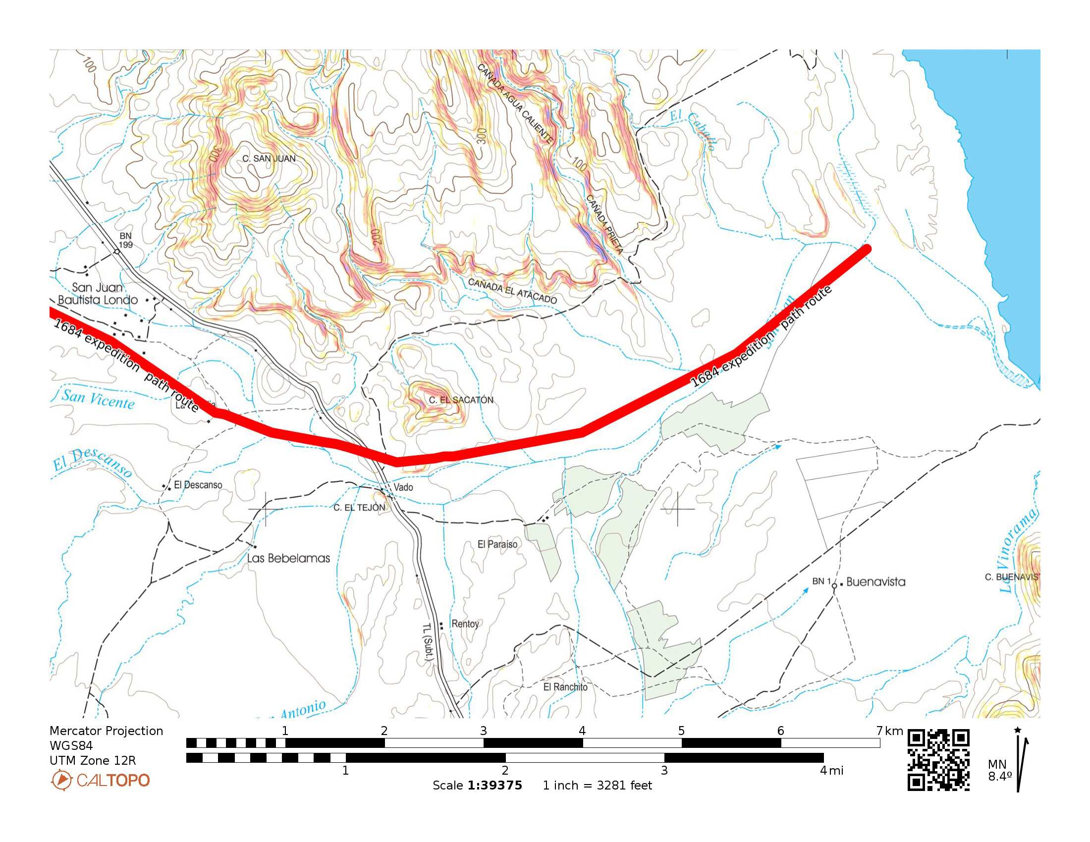
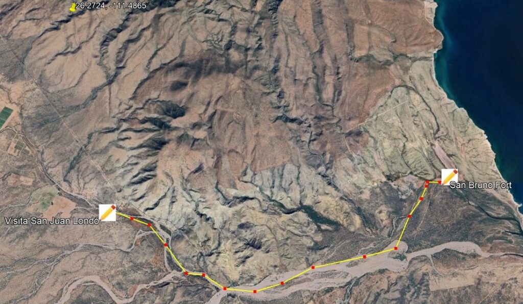
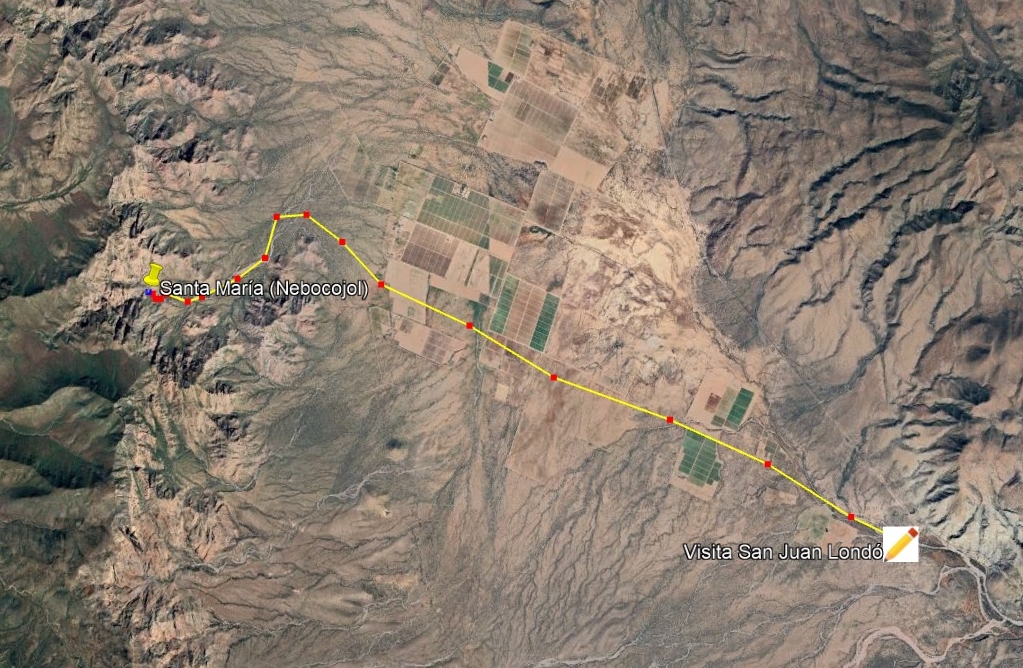
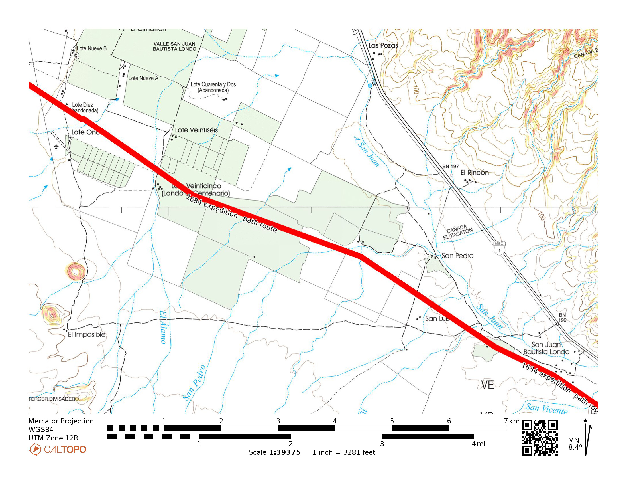
Dec. 14, 1684: Begin from the Real de San Bruno [26.2328, -111.3983] and travel three leagues (6 miles) to San Isidro (San Juan Londó) [26.2262, -111.4729]. Londó was the Native Cochimí name, and the Spaniards called the place San Isidro. A visita of the Loreto mission was established here in 1699 and named San Juan Bautista Londó. A stone block church was built here and is still partially standing just ½ mile west of Highway 1, at Km. 30.
*a league is the distance traveled in one hour on horseback or (typically) 2-3 miles. The Atondo diary book translator says a league is 3 miles and Harry Crosby in his Antigua California says it is 2.5 miles. In fact, Atondo likely over-estimated his leagues which usually are closer to 2 miles, or less!
Day 2: 9.5 miles, satellite view. Trip total: 2 days/ 15.5 miles.
Dec. 15 PDF Topo Map: A (1″=1 km.) & Topo Map B

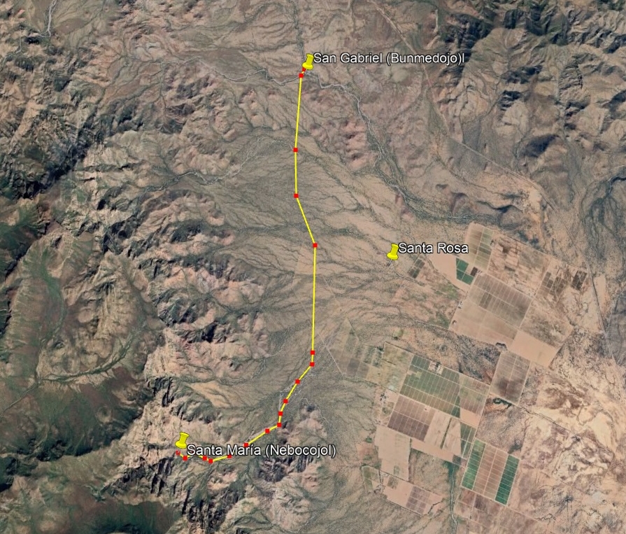
Dec. 15: A little over five leagues (but actually 9.5 miles) to the spring Nebocojol, in a gorge surrounded by very high hills. The Spaniards name it Santa María. The diary book author (Michael Mathes) says Atondo over-estimated his distances, and this spring gorge is probably in Arroyo de San Pedro. Modern maps show that arroyo is too far to the southwest. Santa María (Nebocojol), is most likely at or near today’s Rancho Naocojoa [26.2641, -111.6011], whose name is quite similar to the Native name.
Trip total: 3 days/ 22 miles
Dec.16 PDF Topo Map (1″=1 km.) [same as Day 2 Topo Map B]
Dec. 16: About five leagues from Santa María to arrive at a stream the Natives call Bunmedojol and renamed (by the Spanish) as San Gabriel. Mathes says this is Rancho Santa Rosa: 26.2997, -111.5572. We believe San Gabriel was further north, 6.5 miles (not 5 leagues) from Santa María, a location called La Luz on modern topo maps [26.3399, -111.5766].
Trip total: 4 days/ 30 miles

Dec. 17 PDF Topo Map (1″=1 km.)

Dec. 17: Traveled four leagues, first to a large stream the Natives called Cupemeyni, and the Spaniards called Santo Tomás. Mathes says this is Arroyo Bombedor, where the expedition turned westward. Rancho Bombedor today is by Highway 1, here: 26.3866, -111.6020 (4 miles from San Gabriel/ Bunmedojol/ La Luz). If Bombedor was their Santo Tomás, indeed the route turns west, and soon southwest, following Arroyo El Tebaye (Teballe) to the base of the mountain. If they camped at the base of the mountain [26.3456, -111.6329], that is four leagues (8 miles) total.
Dec. 18: This next day was used to prepare to cross the mountain by building a trail so that the cargo laden animals could pass. Pry bars, spades, and axes were used by the Admiral, eleven soldiers, and four Christian Indians to build the road.
Trip total: 5 days/ 30 miles
Trip total: 6 days (no travel on Day 5)/ 40 miles
Dec. 19 PDF Topo Map: A (1″= 1 km.) & Topo Map B (1″=1 km.)

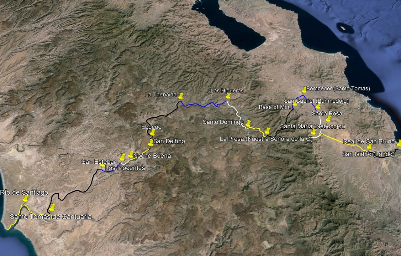
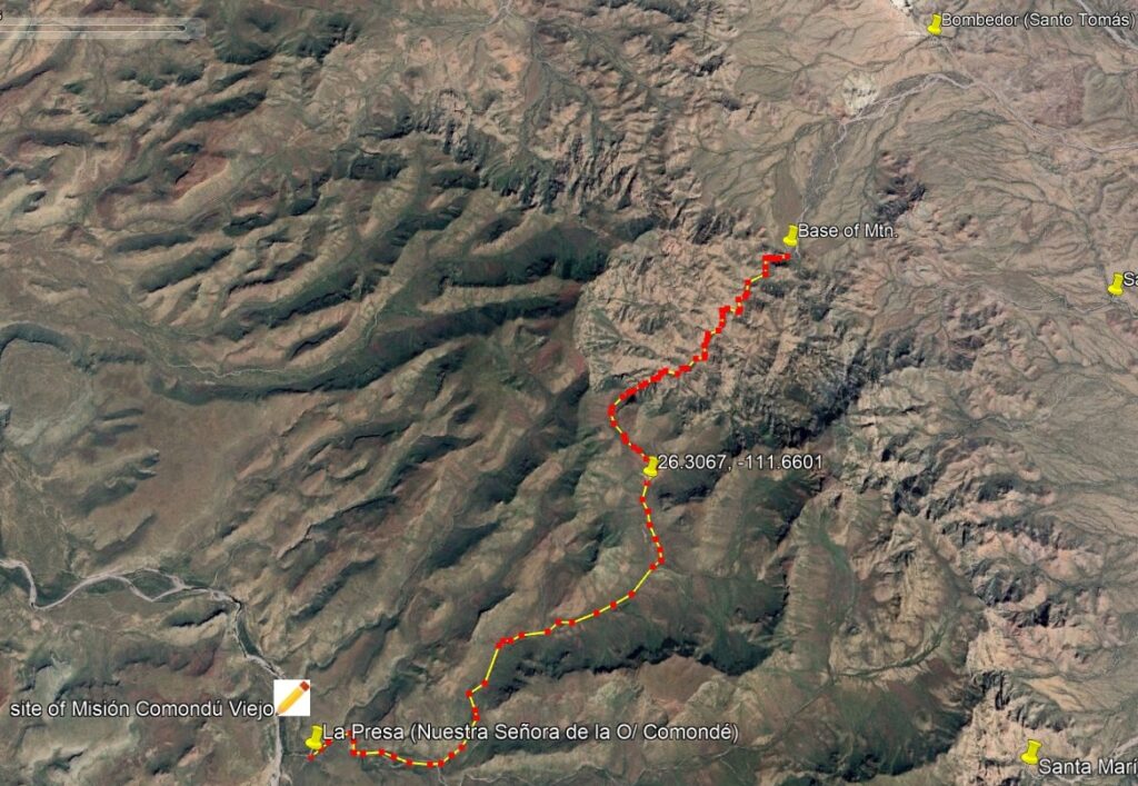
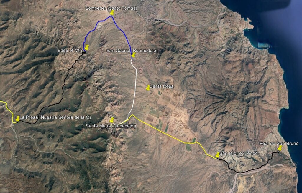
Dec. 19: Traveled six leagues. There was great difficulty in crossing the mountain, using a pass named Cuesta Trabajosa. Afterward, they turned south. There is a canyon with running water exactly where the diary said they went [26.3318, -111.6478]. After they crossed over the mountain, they went down this drainage [26.3067, -111.6601]. This comes out of the hills by Rancho La Presa, just south of the first Comondú mission (Comondú Viejo). When I measure the distance on satellite imagery, the result is 3 miles to the top of the mountain ridge and 7 more going down to La Presa, 10 miles total. The Natives called this place Comondé, and the Spaniards named it Nuestra Señora de la O [26.2665, -111.7161]. Today’s maps show it as Rancho La Presa, just over ½ mile south of the 1708-1736 San José de Comondú mission ruins (by La Capilla, on the topo map).
On the following map, the route is highlighted and important points or camps are circled and named here. Expedition name (Native name) = Modern name:
*Real de San Bruno (near gulf coast)
*San Isidro (Londó) = San Juan Bautista Londó
*Santa María (Nebocojol) = Najocojoa
*San Gabriel (Bunmedojol) = La Luz (on INEGI topo & Baja Almanac)
*Santo Tomás (Cupemeyni) = Bombedor
*Base of Mountain
*Nuestra Señora de la O (Comondé) = La Presa
From Comondé (Rancho La Presa) the expedition follows this arroyo (today called Arroyo Comondú Viejo and then Arroyo La Purísima), all the way to the ocean.
Dec. 20: The party traveled just two leagues (4 miles) down the wide arroyo to Santo Domingo de Silos. I estimate this was where the arroyo turns north [26.2879, -111.7628]. The short distance was due to difficulties with deep water, trees, and boulders, plus some of the animals needing shoes replaced.
Dec. 20 on PDF Topo Map (1″ = 1 km.) (from La Presa to El Horno)
Trip total: 7 days/ 44 miles (included on next satellite map)
Trip total: 8 days/ 52 miles 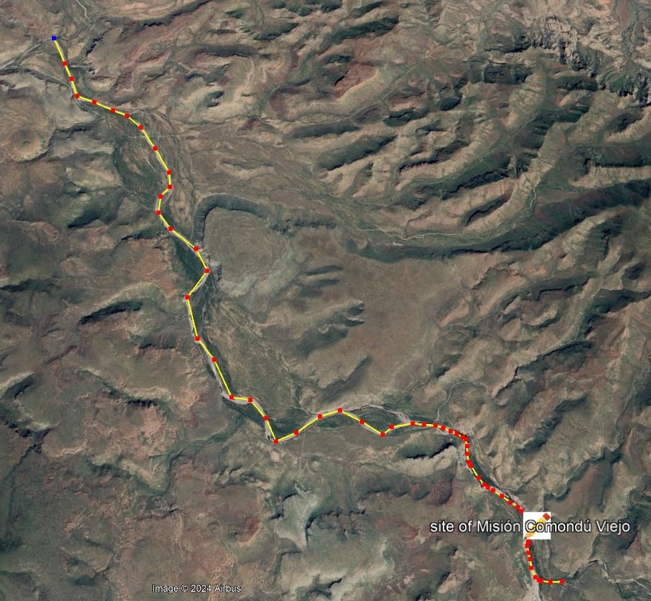
Dec. 21 on PDF Topo Map A (1″ = 1 km.),Map B (El Horno to Las Higueras)
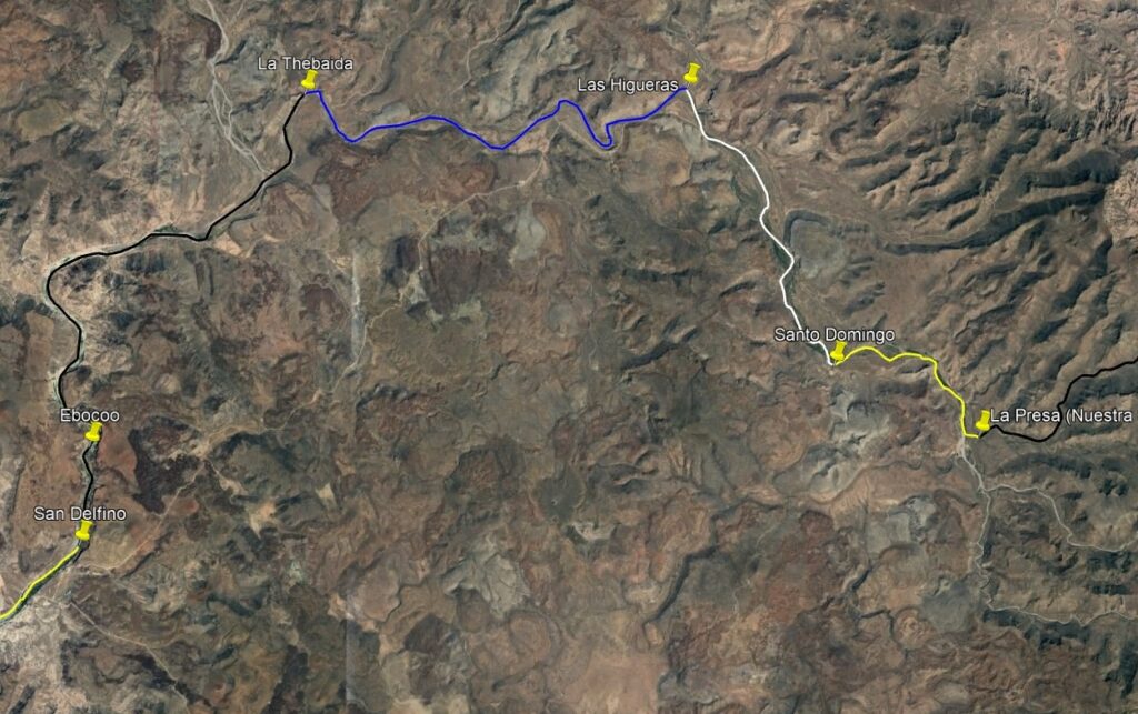
Dec. 21: The party traveled north some four leagues (closer to 8 miles) to Las Higueras, where the arroyo turns west [26.3700, -111.8086].
Trip total: 9 days/ 62.5 miles 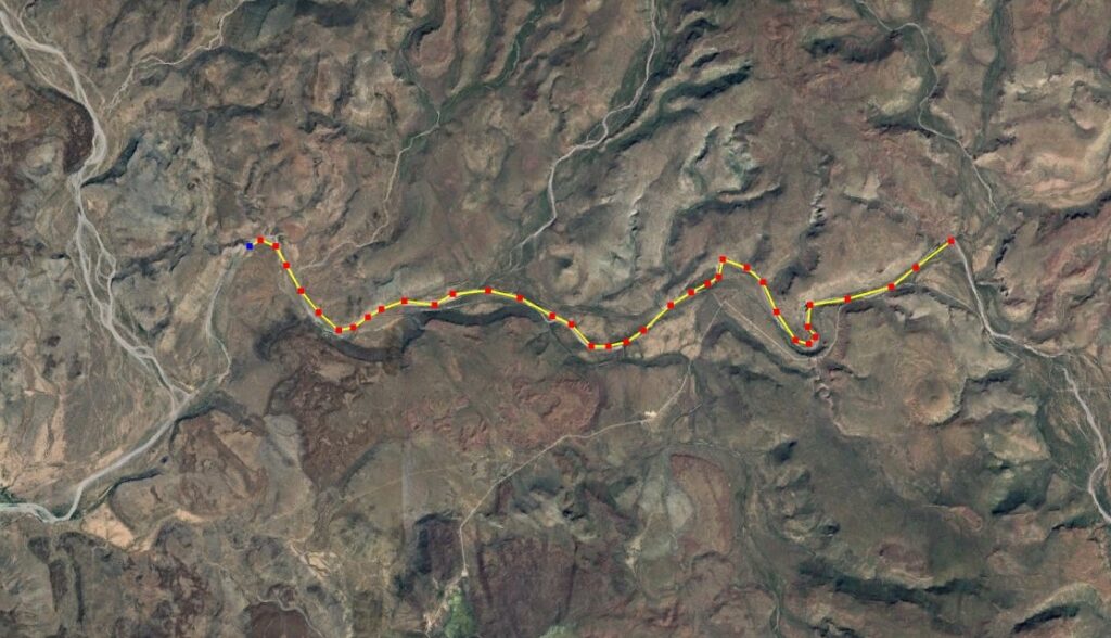
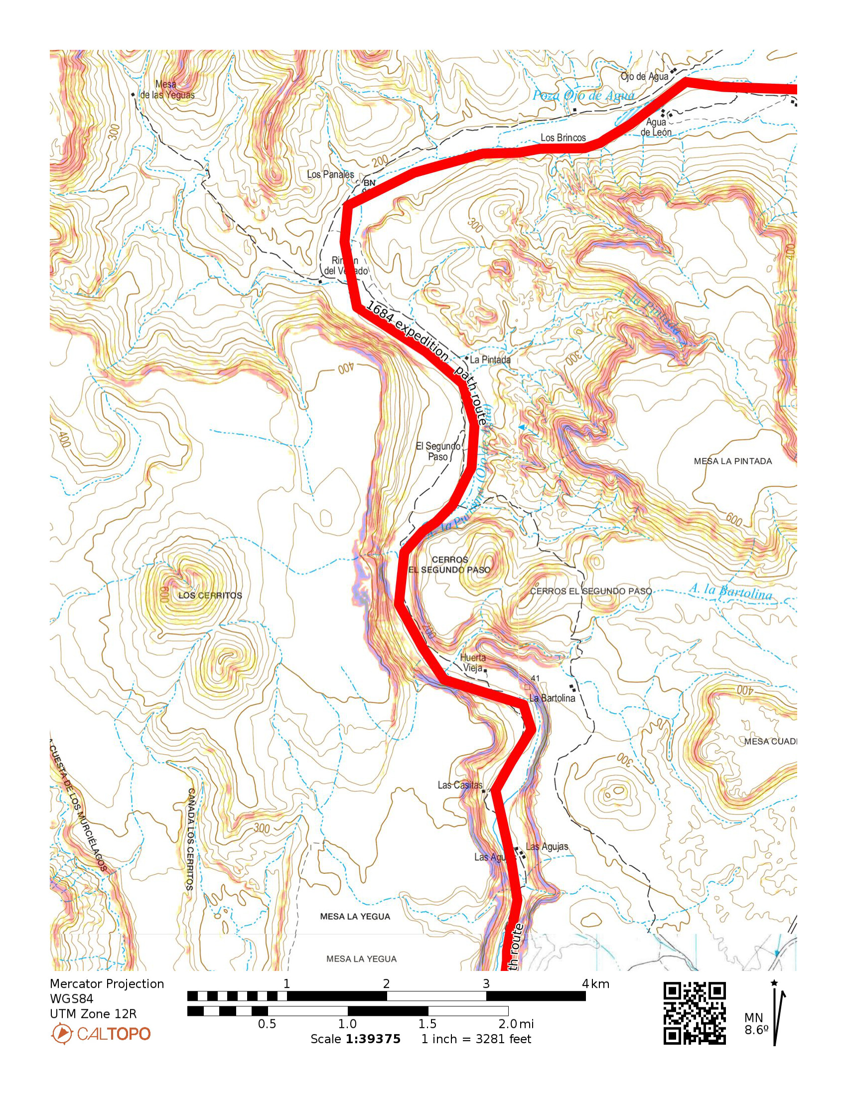
Dec. 22 PDF Topo Map A (1″ = 1 km.) & Topo Map B (Las Higueras to Agua Verde)

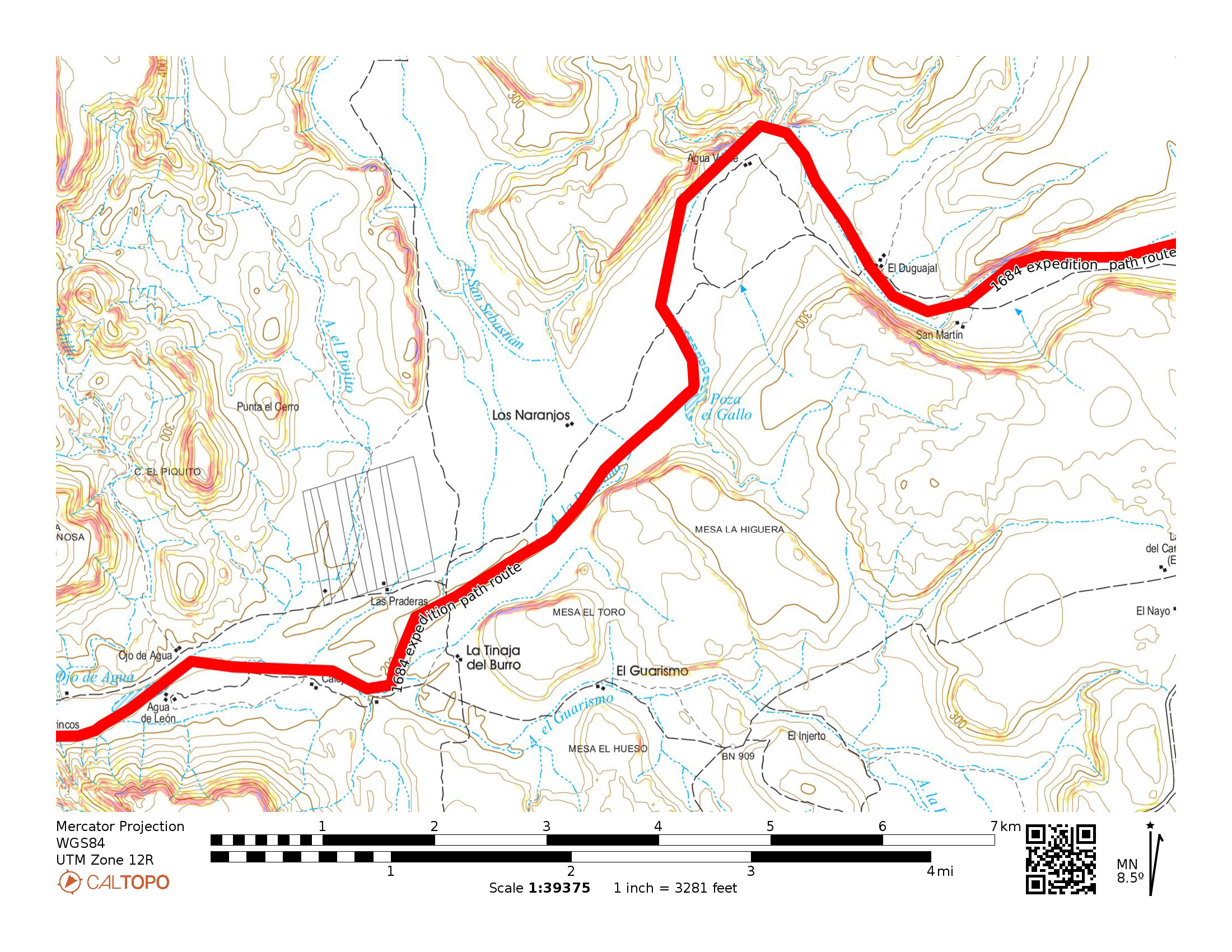
Dec. 22: The party traveled some six leagues (about 10.5 miles) in rocky, difficult, thorny paths that caused many horseshoes to come off. They made camp at a place with a large waterhole (but no pasture) the Natives called Gaelvxu, and the Spaniards named La Thebaida [26.3684, -111.9342]. Map artist Ronald Ives notes this place is 2 miles upstream from Rancho Los Narranjos, at or near Agua Verde on the topo map.
Trip total: 10 days/ 76 miles 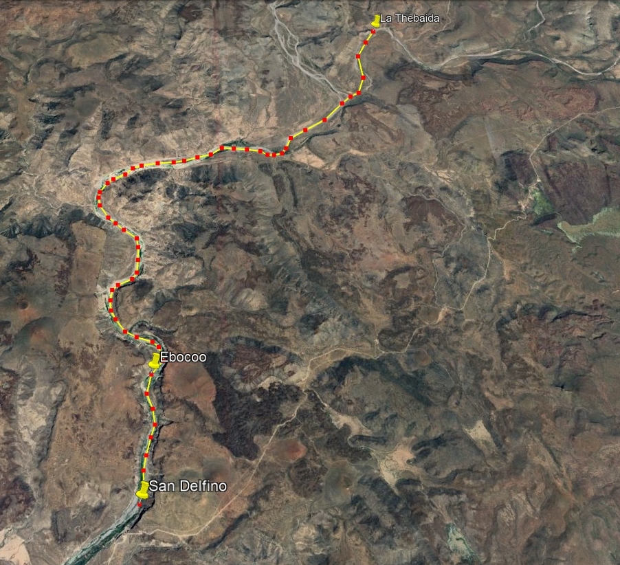
Dec. 23 Topo Map A (Agua Verde to Ojo de Agua), Topo Map B (to Las Casitas “Ebocoo”), & Topo Map C (to westward bend in river “San Delfino”)

Dec. 23: The expedition followed the riverbed for two leagues and found some springs that formed a river. The day’s traveling ended after going seven leagues at a place the Natives called Ebocoo and the Spanish called Santo Tomás [this is the second place they named Santo Tomás]. Ives says Ebocoo was between Rancho Segundo Paso and Huerta Vieja, or 10 miles of travel. Tracking on satellite maps puts it just south of Huerta Vieja, perhaps Las Casitas on the topo map, 11.5 miles of travel [26.2641, -112.0016]. A scouting party explored down river one more league or 13.5 miles total that day to a place they named San Delfino de Pamplona, where the river turned west [26.2358, -112.0031].
Trip total 11: days/ 79.5 mile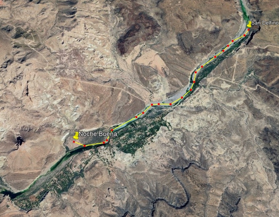
Dec. 24 PDF Topo Map (1″ = 1 km.) (same map as Dec. 23 Map C, San Delfino to across the river from San Isidro)
Dec. 24: Atondo writes that they left San Delfino de Pamplona and only traveled two leagues (3.5 miles) due to difficulties with boulders and deep pools, causing five horses and their riders to fall and nearly drown. That night they named their camp, Noche Buena (it was Christmas Eve). This camp was set upon a small flatland [26.2068, -112.0477]. Easily seen on a satellite map, it is just east of El Pilón, the dynamic butte in the La Purísima River valley and across from today’s San Isidro.
A drone flyover of this section by Victor Du, shows the river route and how it was not an easy one: Click HERE
Dec. 25: Night 2 at Noche Buena (across the river from San Isidro)
Trip total: 12 days/ 79.5 miles
Trip total: 13 days/ 81 miles (see next map, below)
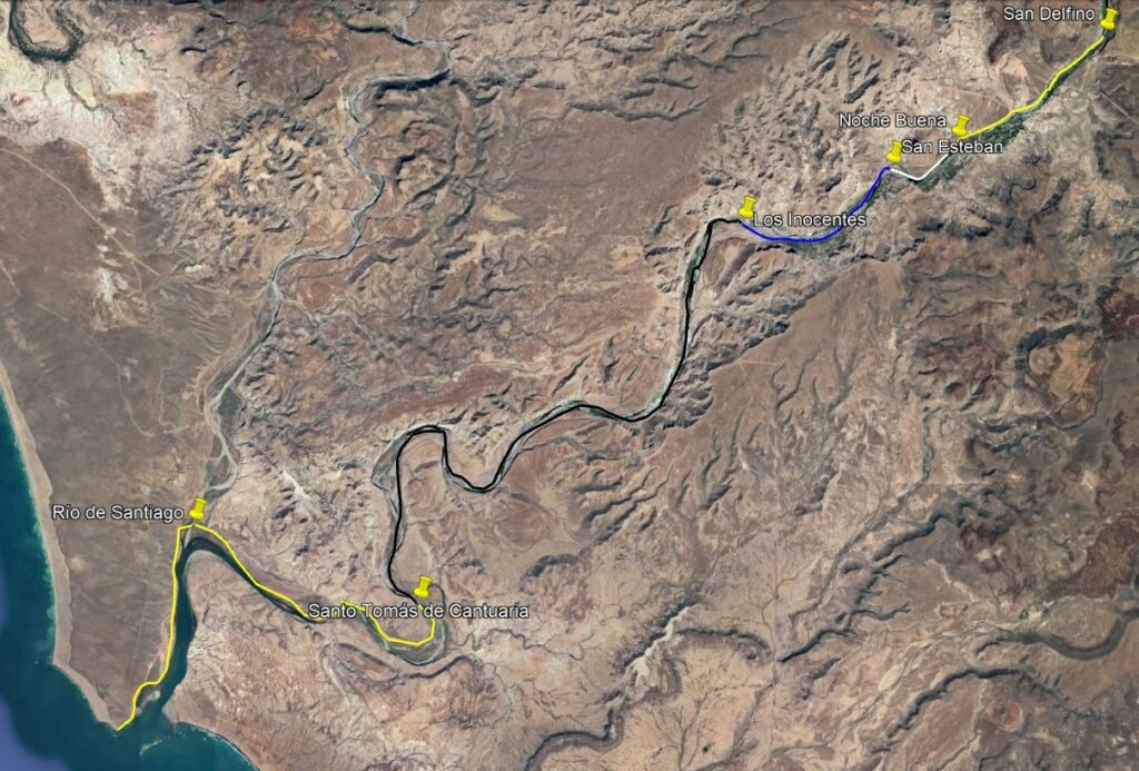
Dec. 26: Noche Buena to San Esteban, five leagues [Atondo says the river here turns southwest]. Ives says this is by El Pilón because of the name they gave it, (looking like a hat). However, that puts it only one league (1.5 miles) from Noche Buena, not five. This is very near La Purísima, today.
Dec. 27: A day of rest and Night 2 at San Esteban [26.2006, -112.0673]
Trip total: 14 days/ 81 miles
Trip total: 15 days/ 84.5 miles 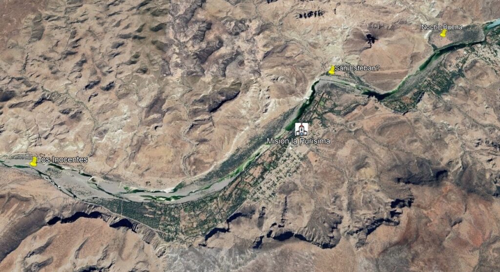
Dec. 28 PDF Topo Map (1″ = 1 km.) (El Pilón/La Purísima to El Alhuate)
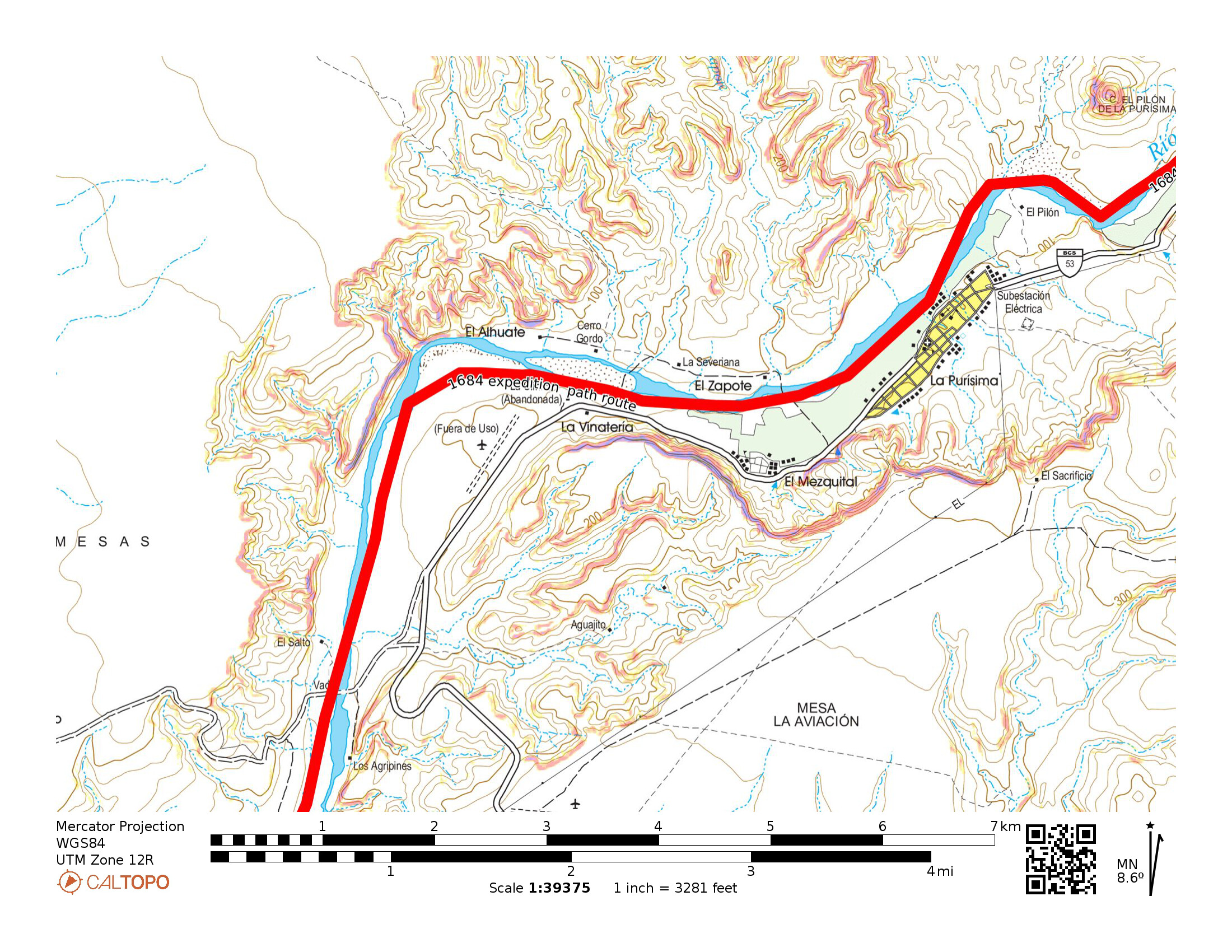
Dec. 28: San Esteban to Los Inocentes, five leagues [but actually works out closer to two leagues (3.5 miles), 26.1856, -112.1115]. San Esteban is placed west of El Pilón and across the river from La Purísima. Los Inocentes is placed near El Alhuate, on the topo map.
Trip total: 16 days/ 98 miles (see next satellite map, below)
Dec. 29: Los Inocentes to Santo Tomás de Cantuaria, seven leagues (13.5 miles). This is the third time that Santo Tomás was used as a place name on this trip. [26.0867, -112.2054] On the topo map: El Alhuate to near El Saucito.
Dec. 29 PDF Topo Map (1″ = 1 km.) & Map B


Trip total: 17 days/ 108 miles 
Dec. 30 PDF Topo Map (1″ = 1 km.) (Same as Map B, above)
Dec. 30: Santo Tomás to Río Santiago (Arroyo San Gregorio) [26.1064, -112.2698], three leagues (6 miles) plus two more (4 miles) to the sea (10 miles total) along the north side of the river. The location today is called Boca de San Gregorio. The expedition named it Año Nuevo for the coming new year.
Dec. 31 PDF Topo Map (1″ = 1 km.)

Dec. 31: the Admiral and Padre Kino wished to explore as far north along the beach as possible. They then returned to Río Santiago, traveling sixteen leagues this day (see the Ronald Ives map).
17 days/ 108 miles (2 days of no travel) to reach the Pacific. Average distance on traveling days was 7.2 miles, about 3 to 4 (of Atondo’s) leagues. Not so bad when you consider there were around 50 people, 37 horses, and 44 mules!
January 1, 1685: they examined the river here as a potential sea harbor and named it Año Nuevo (New Year) before making camp back at Santo Tomás de Cantuaria. The following day begins the return trip to San Bruno. The diary was brief as they used the same route:
Jan. 2: Santo Tomás to Los Inocentes.
Jan. 3: Los Inocentes to a unnamed place 4 leagues up-river.
Jan. 4: Up the riverbed for an unspecified distance.
Jan. 5: About 3 leagues of travel.
Jan. 6: A day of rest.
Jan. 7: Today they traveled to the place they previously had named Las Higueras.
Jan. 8: Las Higueras to Santo Domingo de Silos.
Jan. 9: Santo Domingo to Nuestra Señora de la O (Comondé or Rancho La Presa).
Jan. 10: A day of rest for most, but Padre Kino and seven soldiers explored the region.
Jan. 11: Nuestra Señora de la O to Santo Tomás (Arroyo Bombedor).
Jan. 12: Santo Tomás south to San Isidro (Londó).
Jan. 13: San Isidro to San Bruno.
13 days for the journey back to San Bruno including two days of rest.
Others named in the Atondo diary, besides Padre Eusebio Francisco Kino:
- *Surgeon Josef de Castro y Mendoza
- *Francisco Santiago
- *Diego de la Cruz
- *Adjutant Don Francisco López Chillerón
- *Ensign Nicolás de Contreras Ladrón de Guevara
- *Sergeant Nicolás de Bohórquez
- *Corporal Don Josef de Oya Sotomayor
- *Corporal Juan del Canto
- *Corporal Gerónimo Valdés
- *Clemente García Bonal
- *Don Juan Francisco Ruiz de Bribiesca
- *Don Juan Castellano
- *Simón de Sandoval
- *Antonio de Mendoza
- *Manuel Valdés
- *Mateo Ruiz Limón
- *Domingo Julián de Sosa
- *Juan de Aro y Cueba
- *Don Juan de Escalante
- *Antonio López
- *Ignacio de Anero
- *Juan Félix
- *Domingo Verdugo
- *Diego de Espinosa
- *Nicolás de Uría
- *Miguel de Acosta
- *Alonso de la Serna
- *Don Juan de Lara Villaseñor
- *Melchor de Aragón
- *Don Diego de Aguayo
- *Antonio Rodríguez
- *Pedro de Uría
Plus:
- an unnamed mulatto muleteer
- a slave
- nine Christian Indians from New Spain
An edited version of this work was published by Baja Bound Insurance: https://www.bajabound.com/bajaadventures/bajatravel/atondo_kino_expedition
