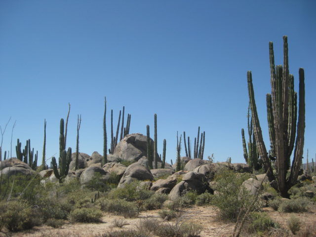
TRIP #4 goal is to explore the remote Pacific Coast of Baja California between El Rosario and Guerrero Negro. On the way south, I will also be checking Highway 3 from Highway 5 to Valle de la Trinidad and continue from there on the dirt road to Highway 1, near San Vicente.
DAY 1 Wed. Apr. 19, 2017:
On the road at 8:25 am, arrive at Calexico at 11:25 am.
Buy pesos at 17.70: Dollar
Note to supplement the previous trip: Hwy. 5, Km. 51.5+, Campo Sonora is closed.
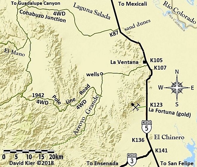
Take Hwy. 3 (Ensenada highway) west.
Km. 195 Military Checkpoint (just west of Hwy. 5).
Km. 179.5 Borrego pit area, race road crosses highway.
Km. 163 & 162.5 Road to SW to the top end of Diablo Dry Lake, signed ‘Colonia San Pedro Mártir’.
Km. 152.5 Road north to Rancho Arroyo Grande (may be closed by locked gate)
Km. 151 San Matias Pass. Original road to San Felipe to left.
Km. 141 San Matias village. At least three eating places along the highway.
Km. 137.5 Road south to Mike’s Sky Rancho (31 kms./20 miles).
Km. 120+ Valle de la Trinidad, paved entrance, Pemex station.
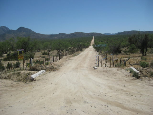
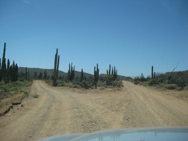
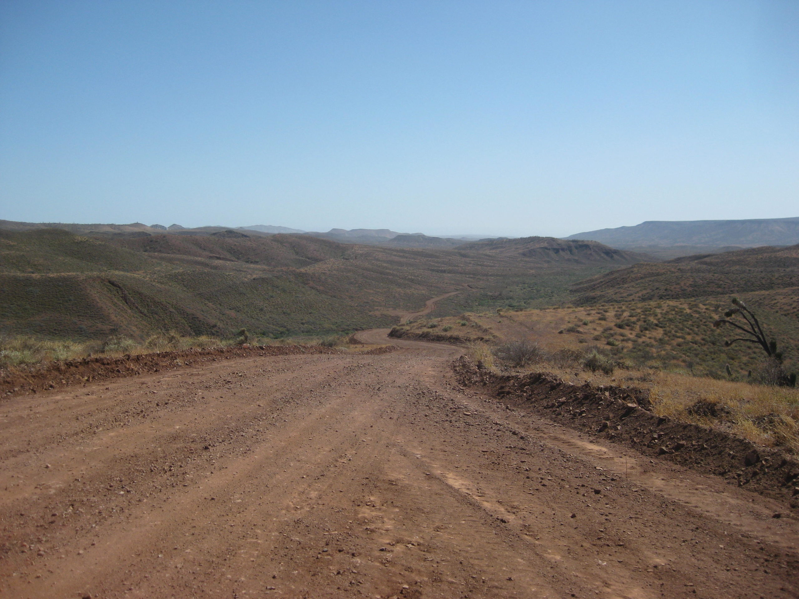
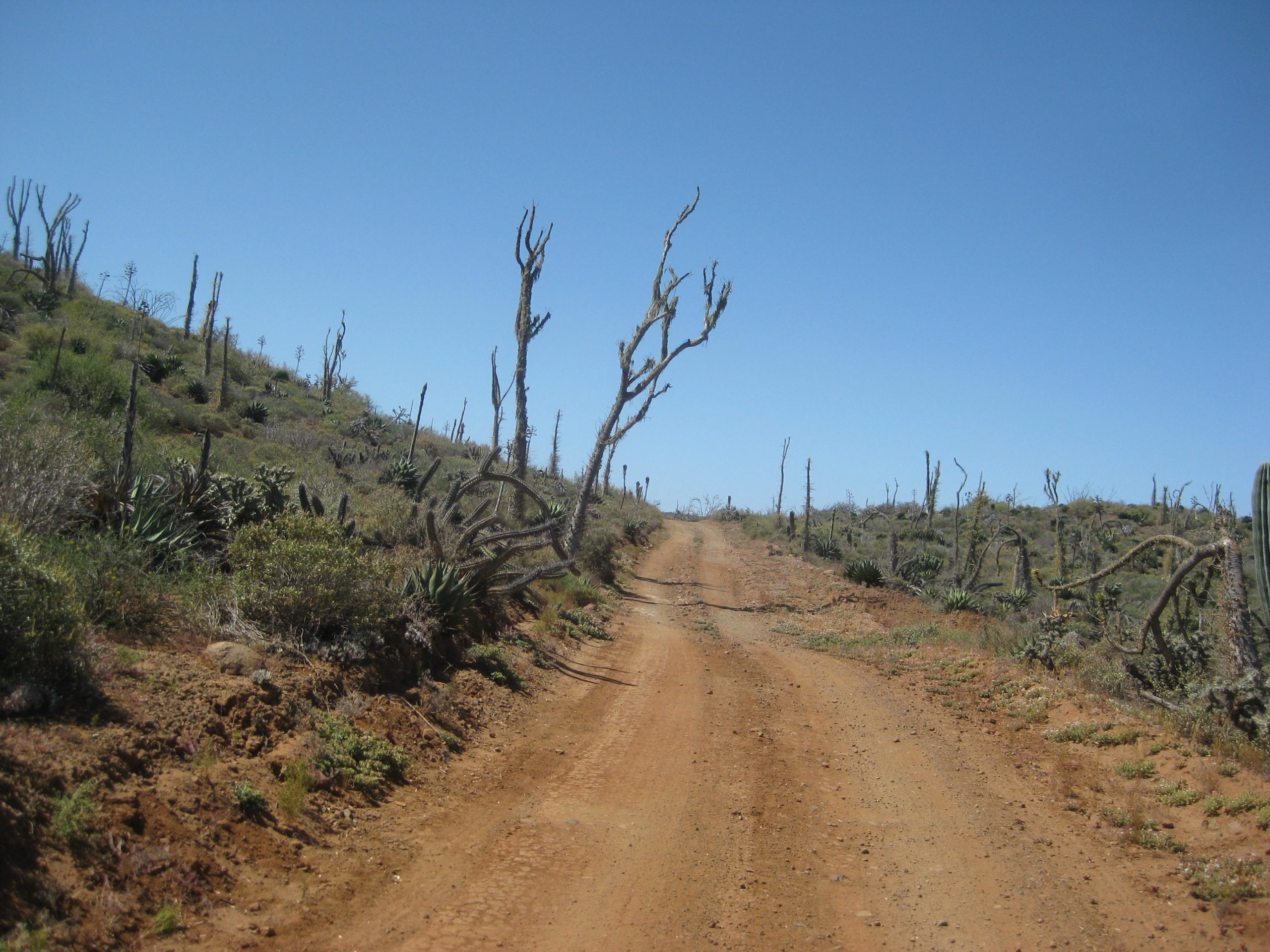
From here, I take the dirt road that crosses the hills to Highway 1, just south of San Vicente. There are a few turns to get started on the correct road (I won’t detail them unless requested) and then it is up and down for a total of 40 miles from Hwy. 3 to Hwy. 1. Took me about 2 hours to drive. 2WD road, but not for motorhomes or Porsches!
Highway 1 is reached at 4:30 pm (Hwy. 1, Km. 103).
I book south to San Quintin, take the ‘new’ paved road west at Km. 1 for the OLD MILL, and the road is already potholed!
The Old Mill hotel and restaurant is 3.2 miles from Hwy. 1.
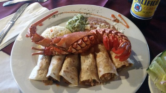
I have a delicious LOBSTER burrito plate, with soup and salad and a Pacifico for 230 pesos (U.S. $13)!
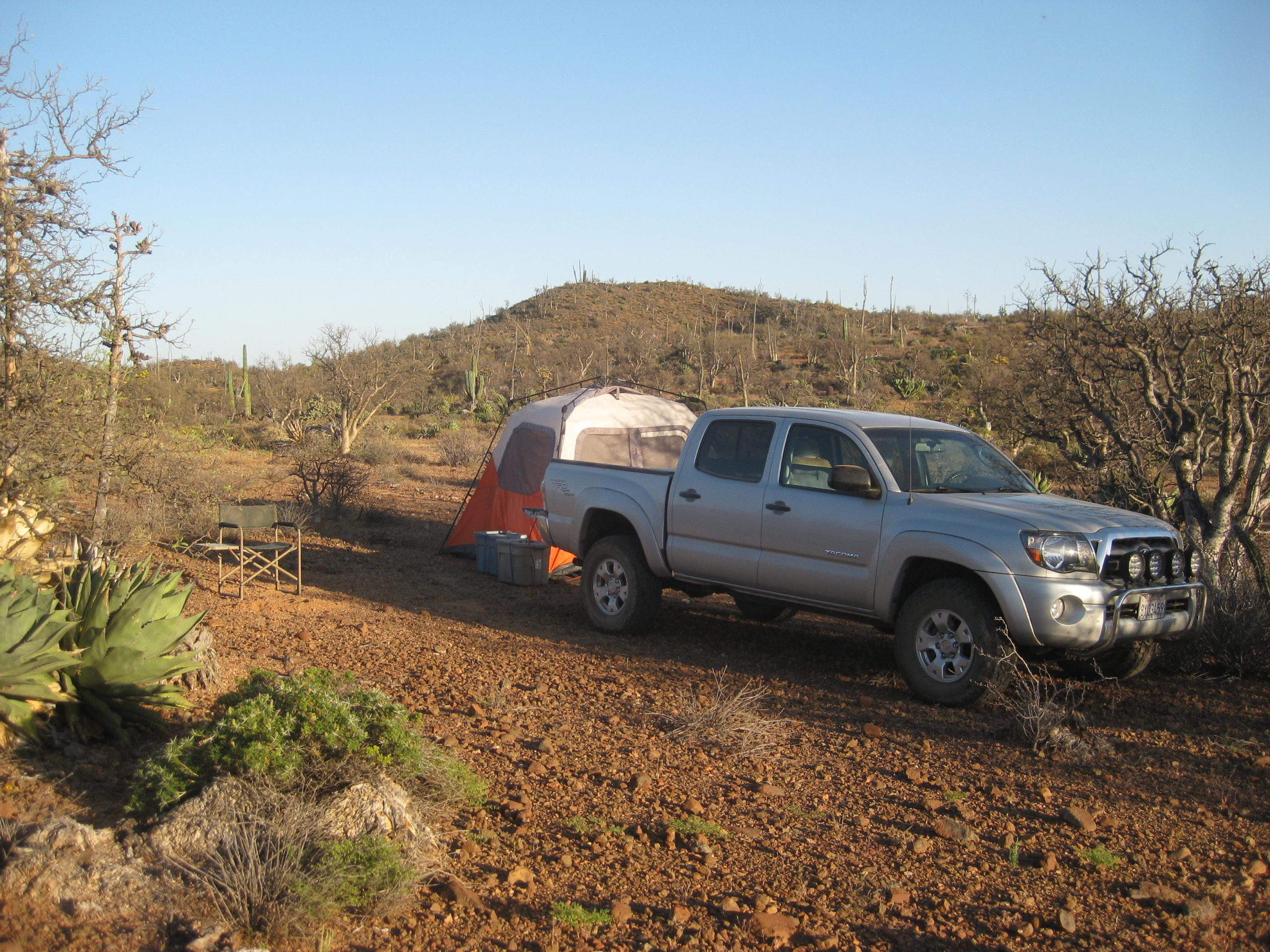
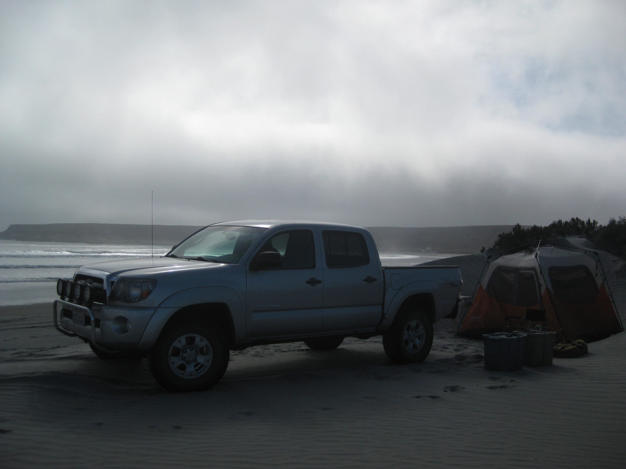
I arrive at El Rosario, where the nicest bed and pillows await at Baja Cactus Motel.

Today’s drive on my maps:


DAY 2 Thu. Apr. 20, 2017
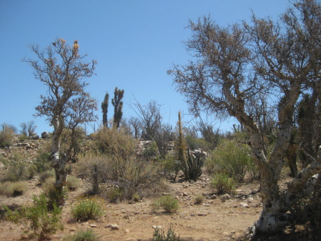
My lobster burritos from last night were still providing energy and I was ready to get down into the ‘Never-Never’ of Baja! (Never-Never means no paved roads, no cell phone service, and not much civilization)
On the road at 8:30 after topping my tank and my extra 5-gallon can. 87 octane gas here was $3.459/ gallon. I averaged 17.7 mpg for the 287 miles traveled yesterday. Starting today, my truck now has mostly ethanol-free gas in the tank. That usually bumps up my mileage 1-2 mpg. However, off-roading and four wheeling will knock that gain down.
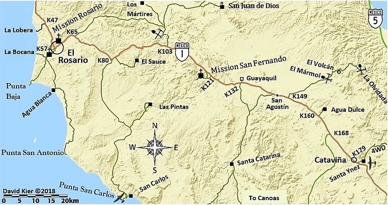
Last month I made notes on the points of interest and road junctions between El Rosario and Laguna Chapala (~100 miles south, where Hwy. 5 from San Felipe meet Hwy. 1). I knew there were more points I wanted to add… Here they are:
Km. 108+ Loncheria El Descanso (popular with truckers, for meals and tire repair)
Km. 116.5 Monument to Hector the young truck driver killed on this curve.
Km. 129 Café La Pasadita (a newer place)
Km. 131 Rancho Los Cuates tire repair.
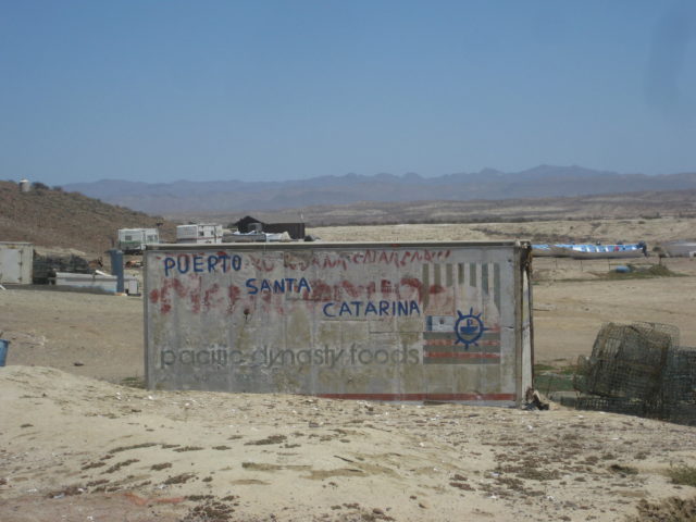
Km. 132+ Road south to Puerto Santa Catarina, Puerto Canoas, and south.
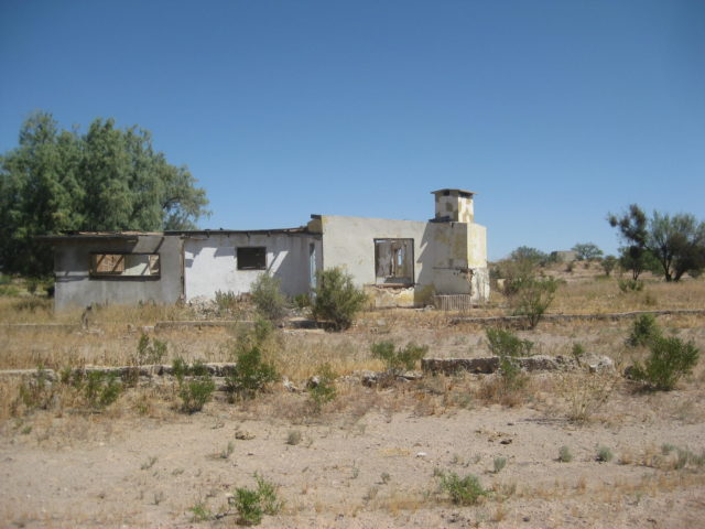
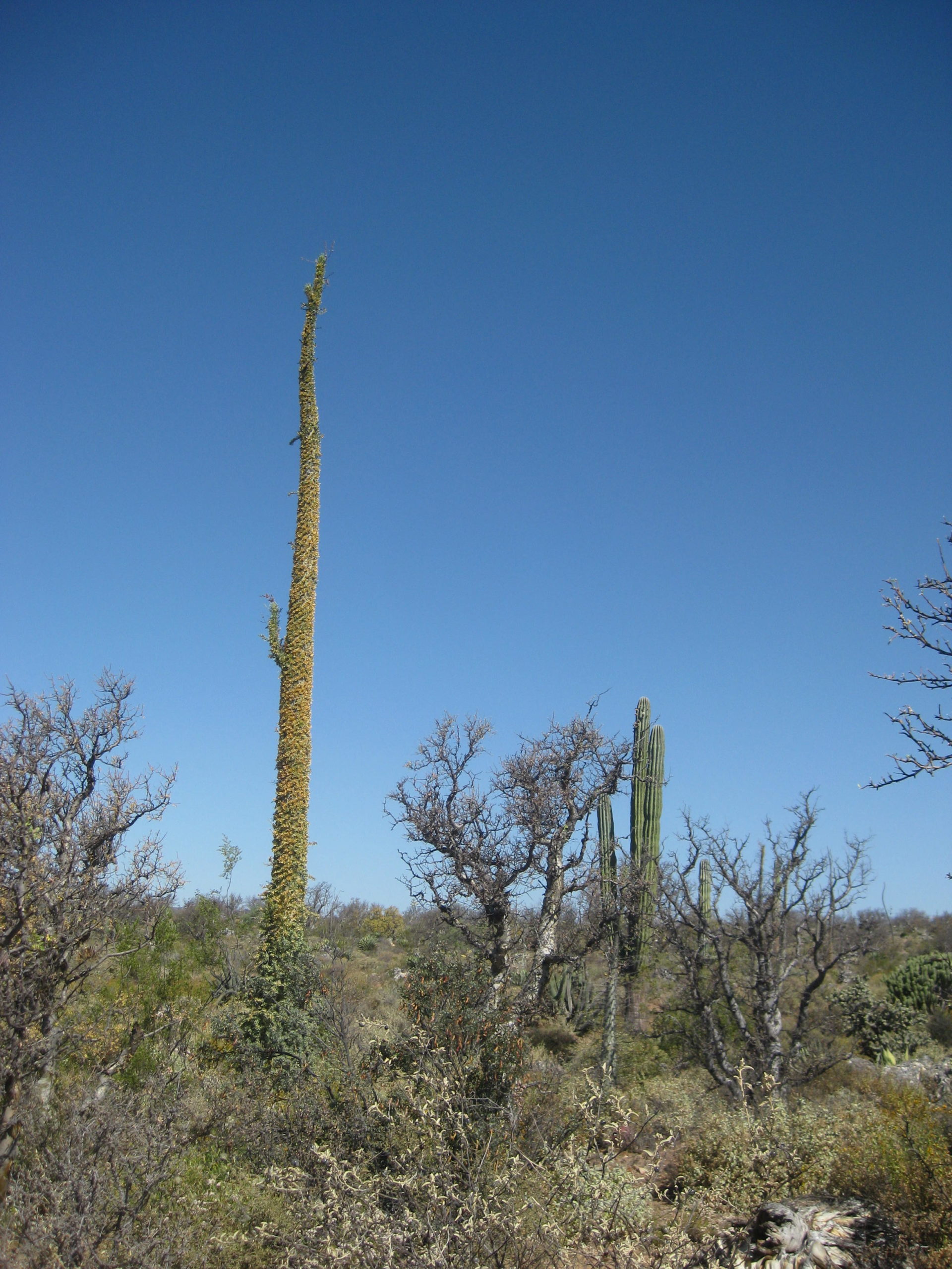
Km. 132.5 Road north to Guayaquil, 0.5 mi. A ghost town where a delegation office, schools and weekday housing for area ranch children, and an airstrip once existed. The town was created around 1970 and the town’s 50-80 people expected the new paved highway to pass right through their little place to provide prosperity. In mid-1973, the highway engineers put the highway up on the ridge, a half mile away and that placed Guayaquil out of sight of travelers.
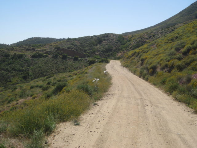
Since I am bound for the remote Pacific region, I return to Km. 132+ and drop my tire pressure once again (I dropped it for the 40 dirt miles between Valle de Trinidad and Hwy. 1, yesterday).
Dropping tire pressure has three major effects, one is that the ride is softer as some of the bouncing is absorbed in the tires. The other, more important reasons are flats due to sharp rocks are greatly reduced as the tires can wrap around, rather than force a sharp rock into its tread. Traction is enhanced as softer tires can climb/ grab without slipping and float on sand much better. I don’t lower them as much as others, but dropping the normal 34 psi to 24 psi seems to work very well. Of the hundreds of dirt, rocky miles, not one flat (that came later, on the highway, at full pressure)!
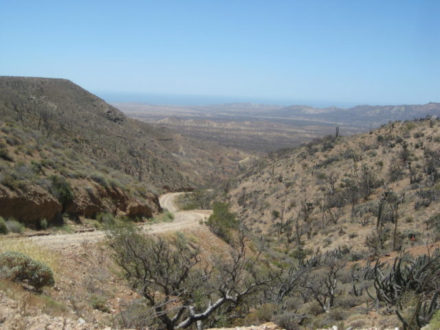
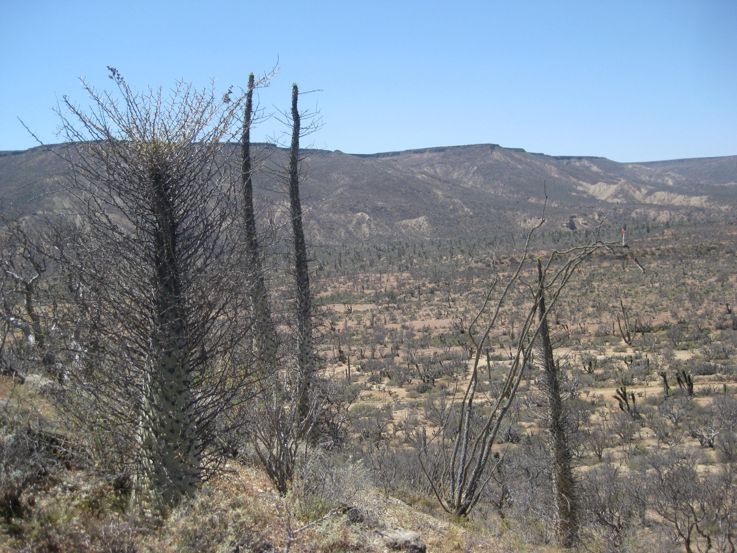
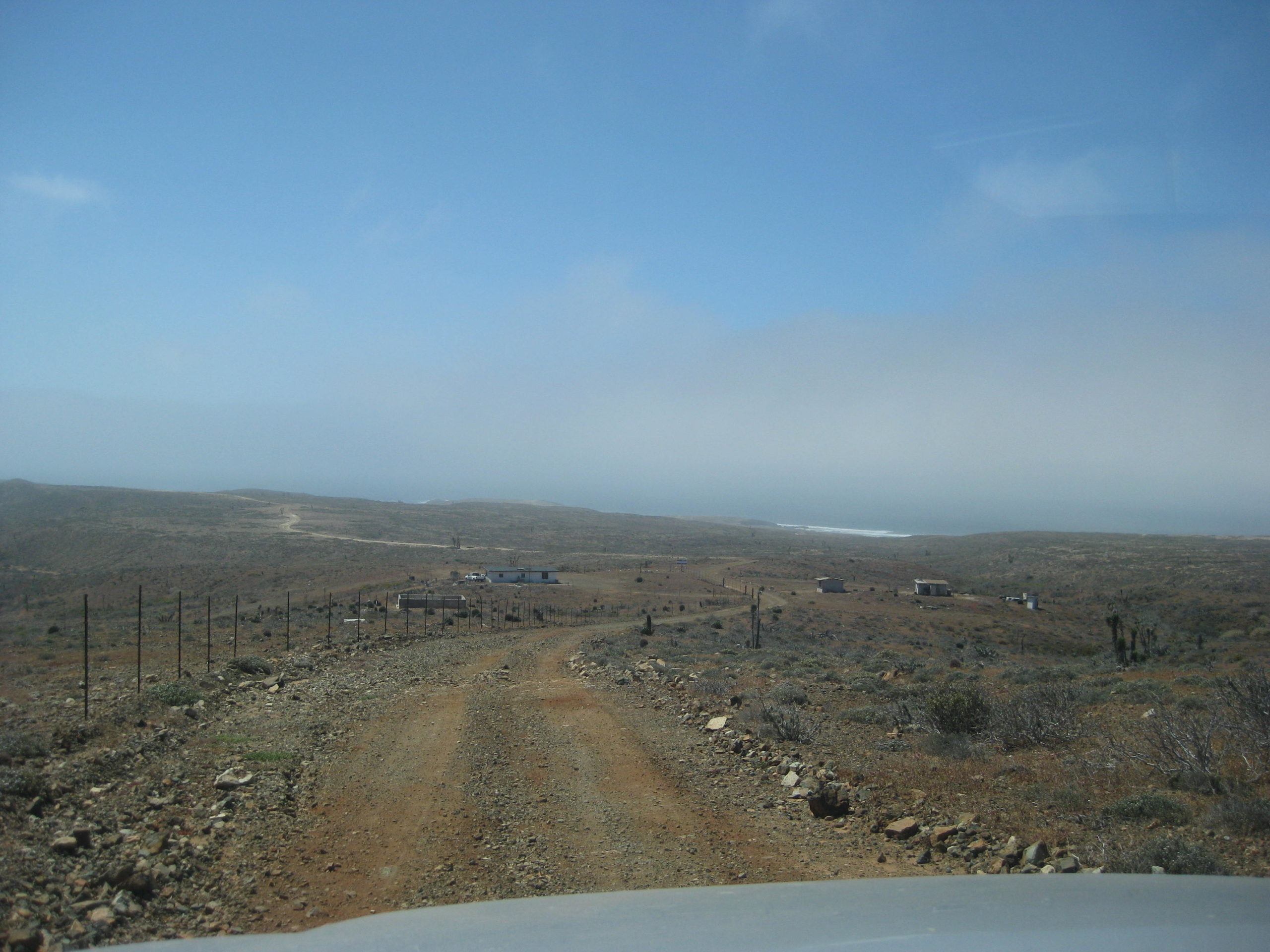
The roads into Puerto Santa Catarina and most of the way to Puerto Canoas were excellent, and that’s considering the extremely wet winter and spring we just had that has damaged so many other roads in Baja.
It was 10:38 am when I was on my way in the dirt.
On the highways, I use the kilometer markers to help everyone locate a point. But, on the dirt roads (most don’t have markers, or they aren’t consistent) I have no choice but to use my trip odometer. While my odometer is a bit slow on the highway (I am running 1″ taller than stock tires), when I drop the pressure they seem to be pretty close to correct (on the dirt roads with kilometer markers, my odometer matched them).
However, many of you may have vehicles with less-than-accurate odometers, so the mileages are just an approximate location spot to help you find points.
0.0 Hwy. 1 Km. 132+ (Signed for Santa Catarina) 10:38 am.
7.0 Road in from the left was the original route to Puerto Santa Catarina from El Mármol, whose blocks of onyx were transported to the coast and placed on ships using a very difficult looking system! The system was used from the early 1900s to maybe the 1940s when an automobile road allowed trucks to ship the onyx to San Diego.
18.4 Santa Catarina, a ranching settlement. It was once much bigger!
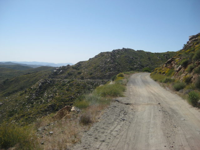
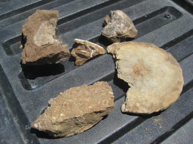
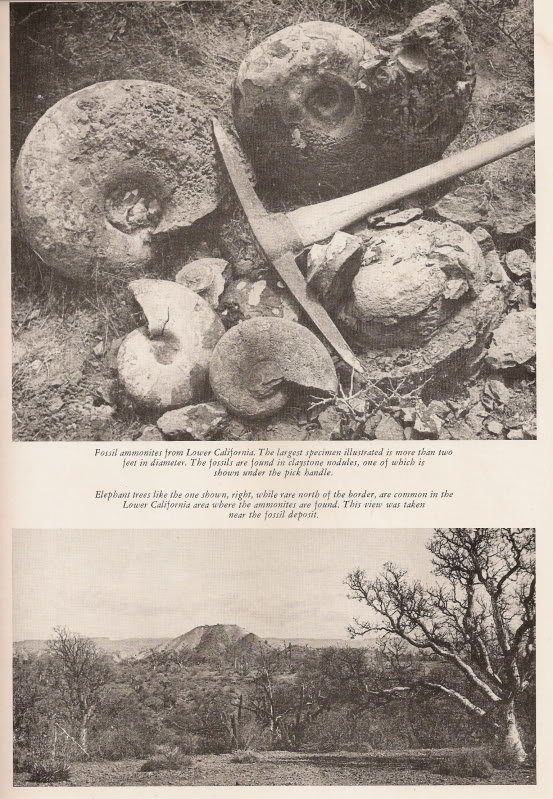
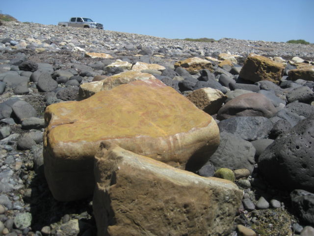
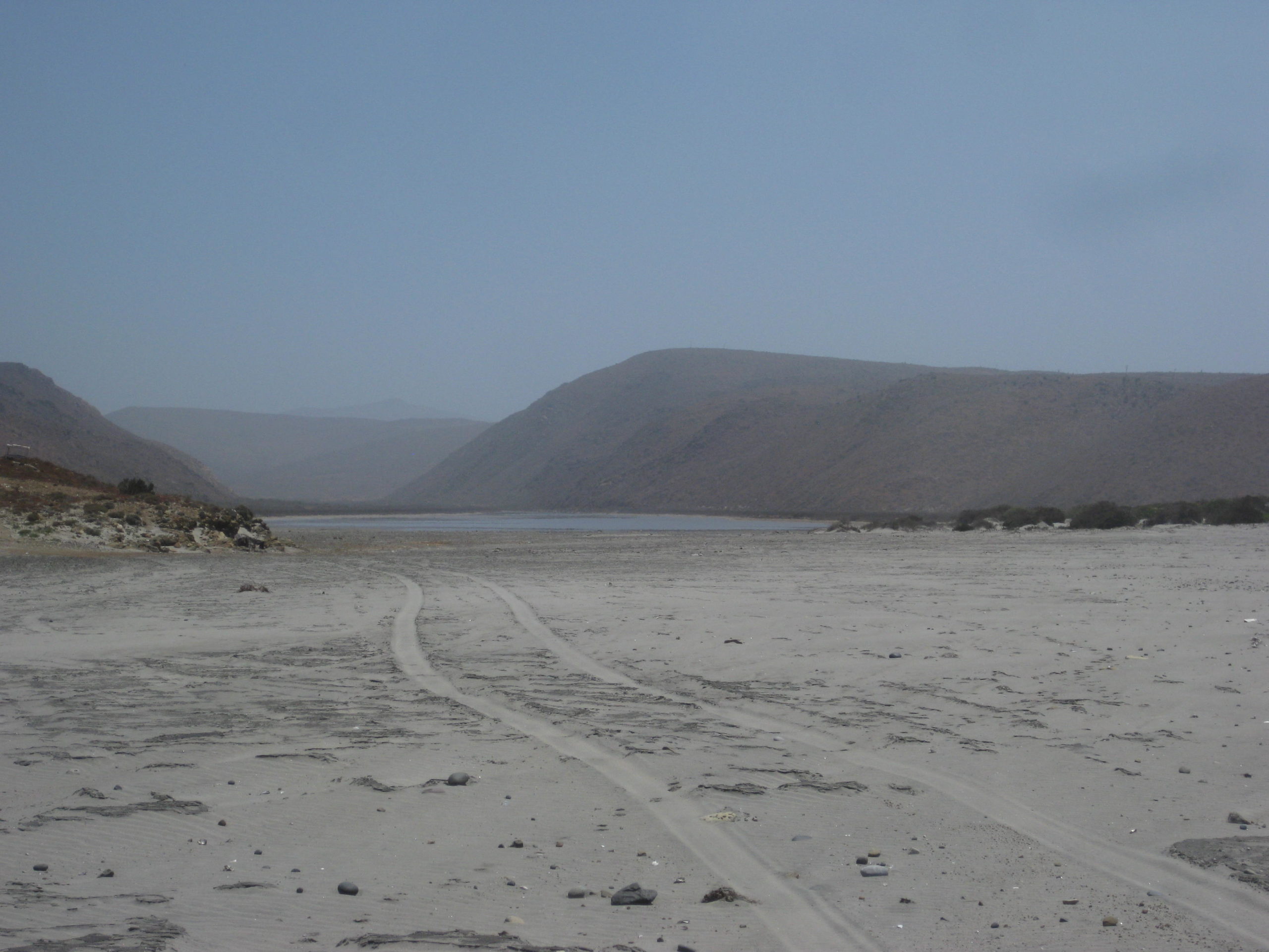
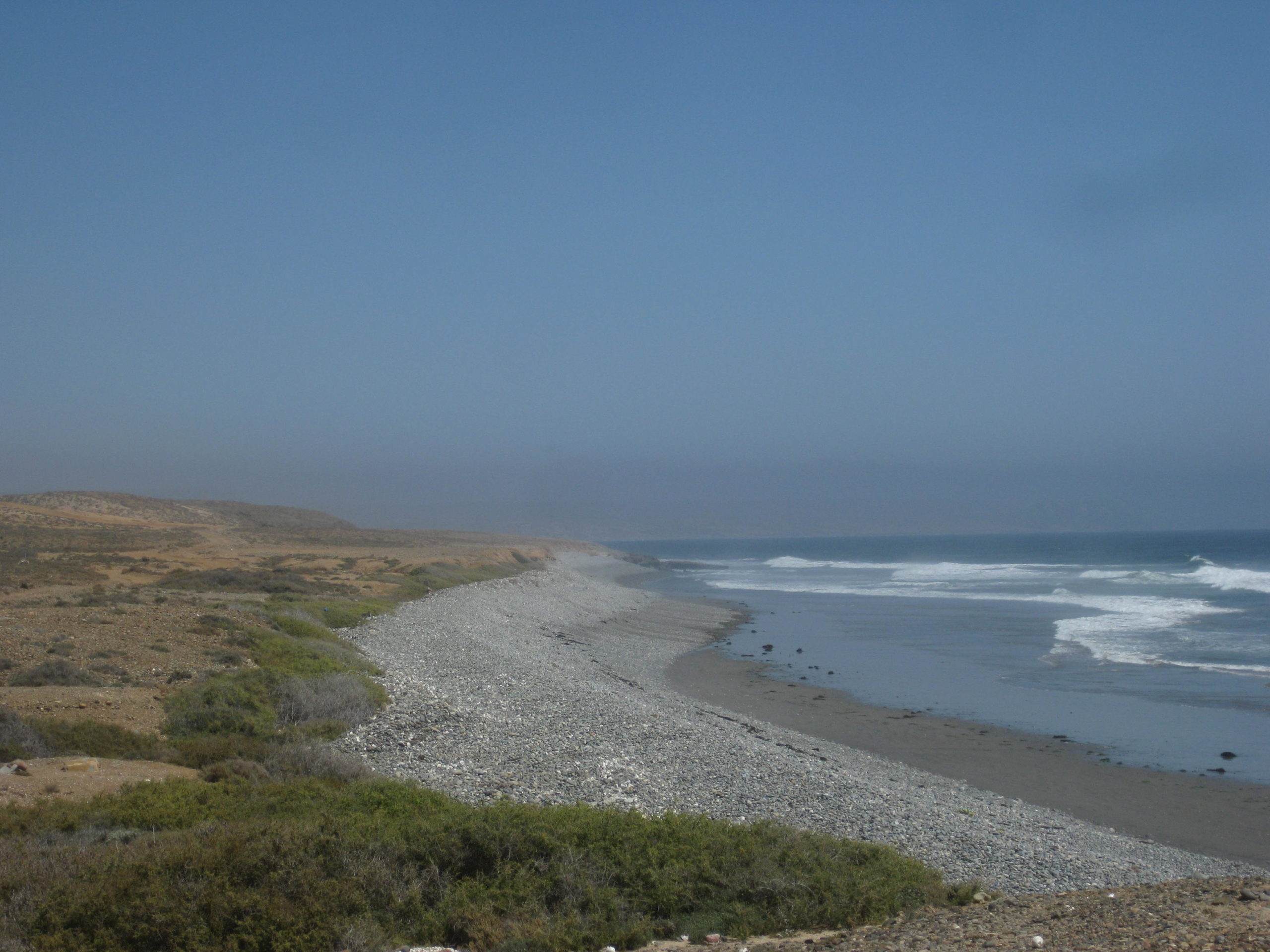
20.3 FORK: Puerto Canoas left, Puerto Santa Catarina right. 11:25 am. The right branch travels high on a ridge offering great vistas of the surrounding country and the Pacific coast (hidden by clouds or fog) before dropping down to the large arroyo valley. A farm’s gated entrance is 11.2 miles from the fork and the famous ammonite hill was nearby. Ammonites are fossil snails found in great quantity at one time, near here. One is on display in Mama Espinoza’s Restaurant, El Rosario.
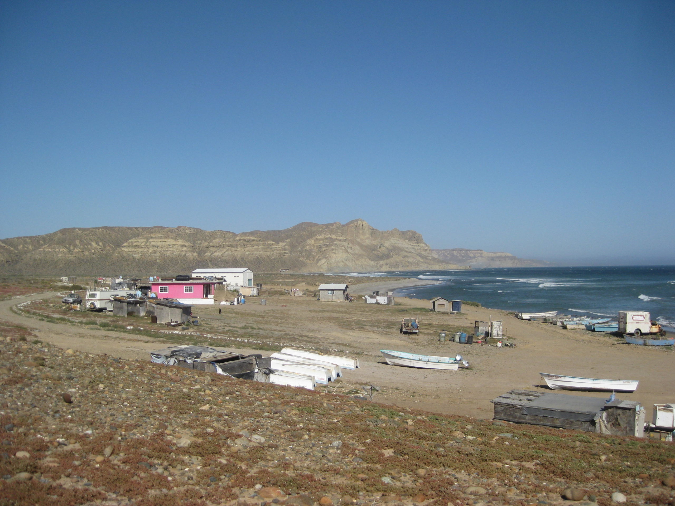
37.0 (16.7 miles from the fork) is the fish camp and landing of Puerto Santa Catarina. Many blocks of onyx are littered about on the tidal rocks. It is 12:45 pm and the time includes photo stops and a short walk to try and find fossils to photograph (removing fossils is illegal for foreigners).
Photos:


As you can see from the map, there is a short cut road between Catarina and Canoas. We drove it in 2007, the last time I traveled this area. Well, I couldn’t find where it met the road I was on (it 2007, the junction was 1.0 mile from the fish camp. Looking at Google earth, it now goes right into the fish camp, and there was no connector outside of the camp, that I briefly searched for.
No problema, I wanted to look more for the Ammonite hill, which is supposed to be a few miles from the beach. Walt Peterson (1980s Baja Adventure Book) puts it 6.7 miles from the beach. Howard Gulick (1960s Lower California Guidebook) puts it at 4.8 miles. Now, the road alignment is likely different and maybe there is more than one ammonite hill, but close is good enough, usually! That fancy gate entrance for the farm is 5.5 miles from the beach, today. The few fossils I did find where near Gulick’s point. On the way out, I hiked to and climbed a hill closer to Peterson’s point and found nothing.
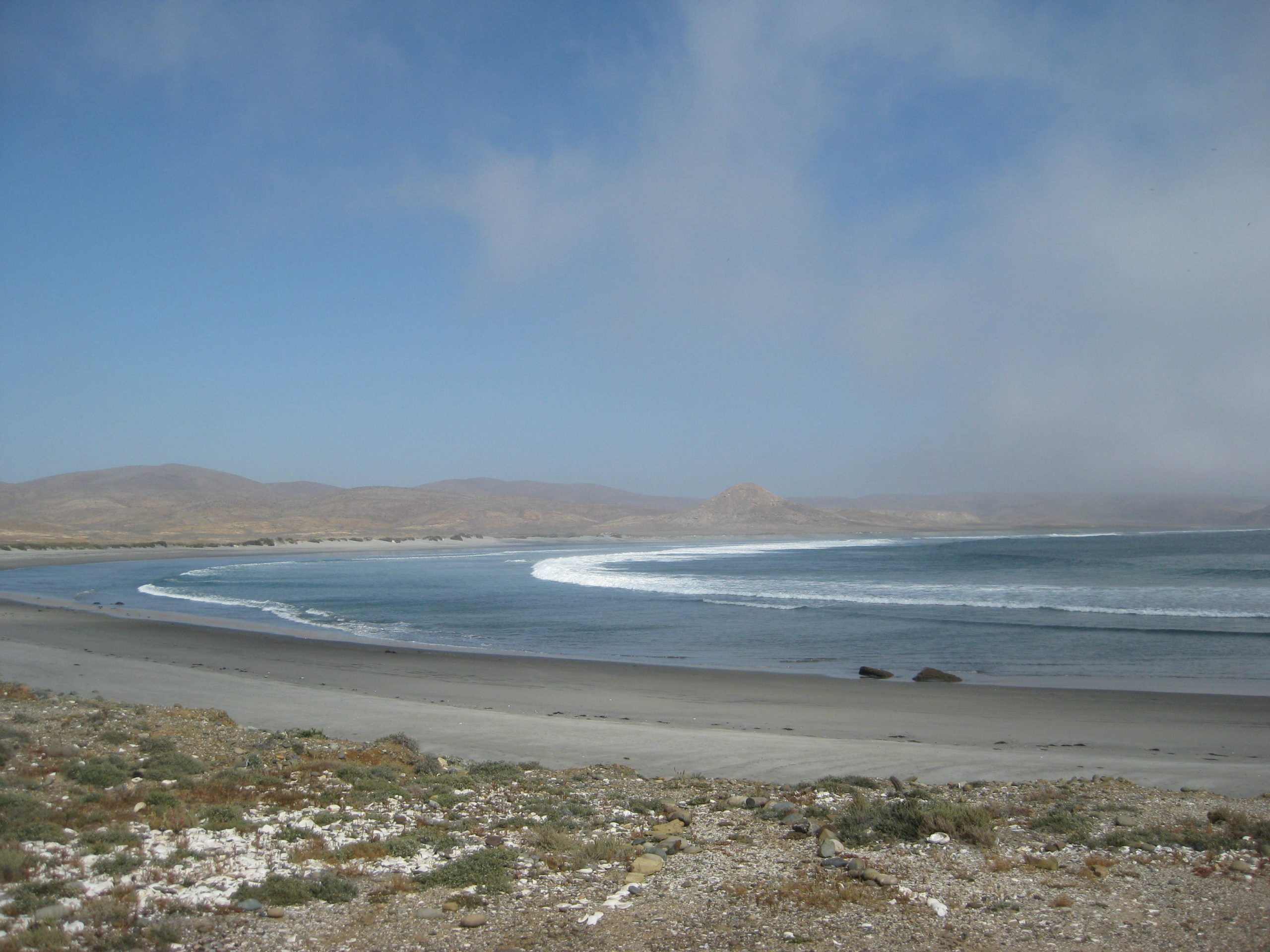
Back at the fork (20.3 miles from Hwy. 1) I head on the left branch towards Puerto Canoas, a small fish camp a few miles south (actually more east) of Punta Canoas.
0.0 Fork
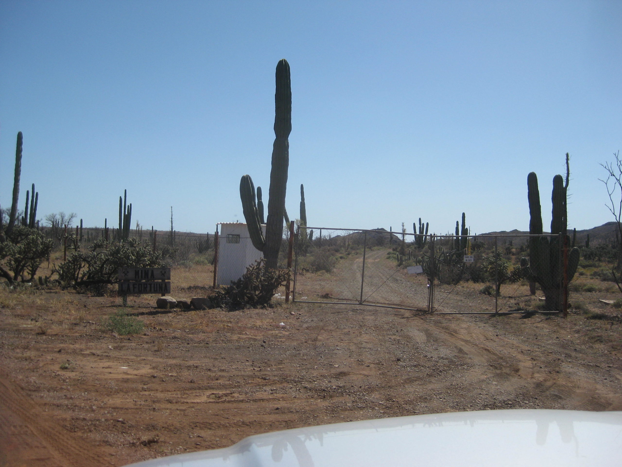
4.4 Mina La Fortuna gated entrance.
8.9 Fork, lesser used graded road to the left. Go right. (Left fork goes to Evangelina Copper Mine, per Baja Almanac map)
13.6 Junction with the shortcut road to Puerto Santa Catarina (10 mi).
18.4 Fork. Go left, south. Ahead (right) goes to the coast and the mesa of Punta Canoas.
23.6 A graded road coming from inland joins this road. Puerto Canoas fish camp is 1/2 mile ahead.
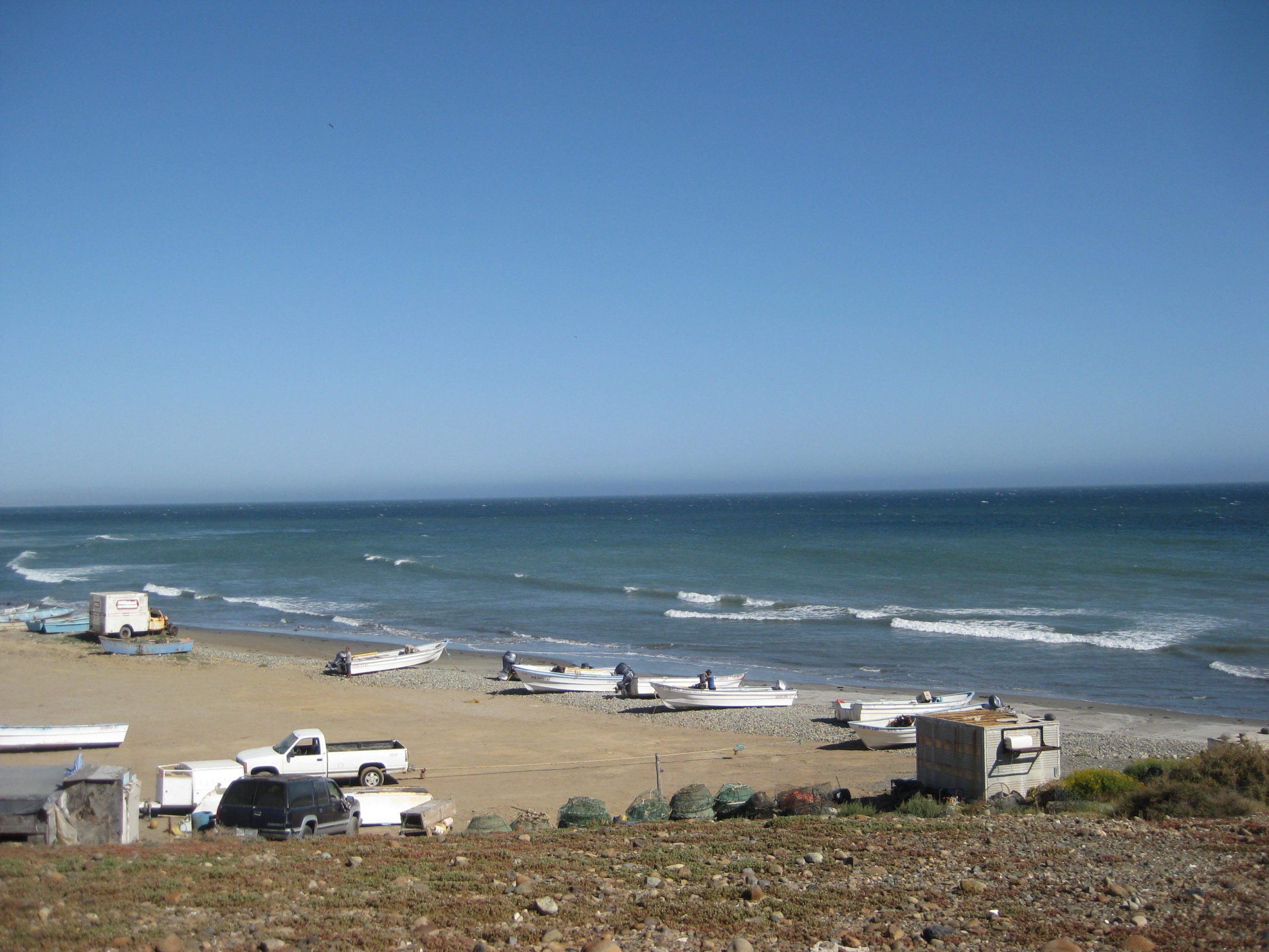
24.1 (44.4 mi from Hwy. 1) Puerto Canoas
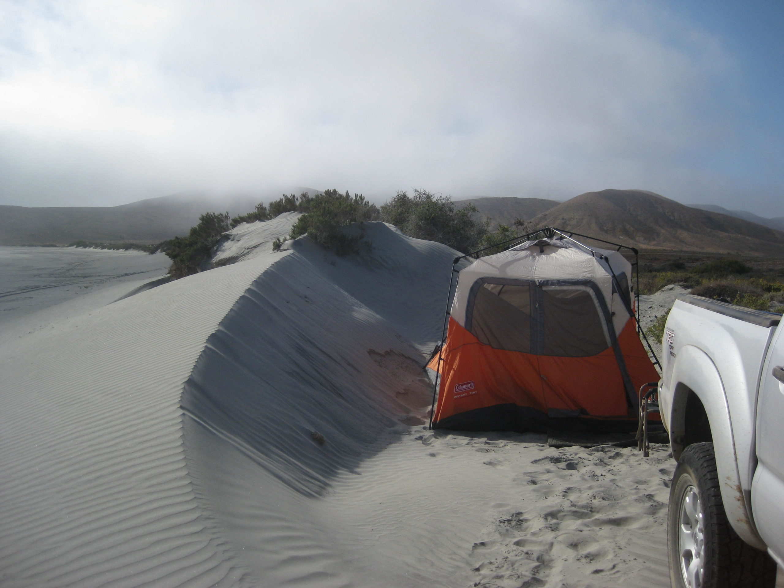
It is 4:10 pm and very windy! Camping near here in a tent is out of the question. I continue on…
0.0 Puerto Canoas
0.5 Take the graded road (straight ahead or right fork).
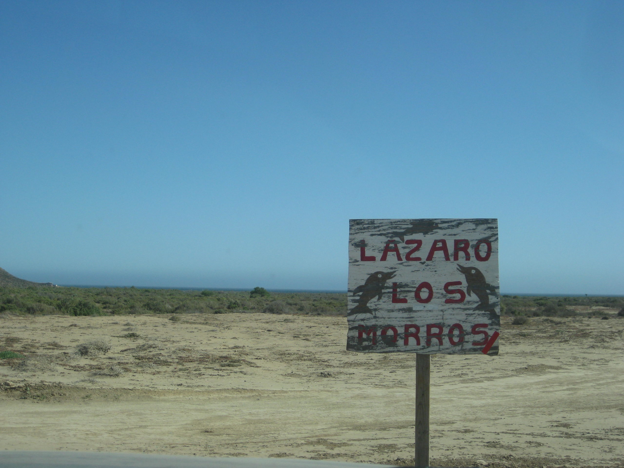
1.3 Come to a cross road. Ahead are a windmill and water trough. Turn sharp right (south). A sign is here for Lazaro and Los Morros, to the south.[see photo]
2.0 Important Fork. The grader has scraped the right branch, and this is the route south closest to the coast. However, in 2007, the left (inland road) was the primary road and we didn’t even notice the coast road (which we actually wanted to drive in 2007).
Now, it is windy, and I know the inland road would have better shelter possibilities, in addition to the history that we camped in there with our amigo Roy ‘The squarecircle’, in 2007. I go left… and end up going past where we had camped, as it was still windy at that point.
This once-graded, main-road was now abandoned, slow, and needed 4WD a couple times on the steep up-grade. I camped in a nice clear spot on the top of the hills. No more wind. It seemed great! It wasn’t until my tent was up that hoards of gnats took a liking to me. I have DEET, but the smell is less than enjoyable to have around your face. They did not bite but were just annoying.
I lit one of my fire logs but took refuge in my tent as the flying tiny devils did not rest at sundown.
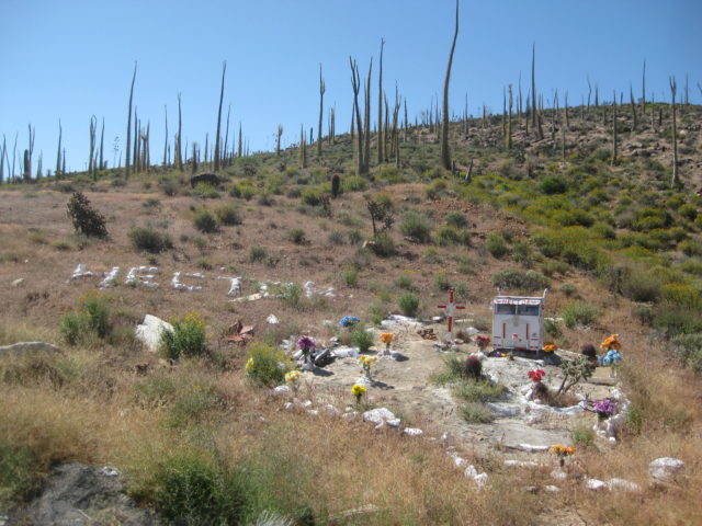
CREEPY… I realize that this spot is only about 2 miles from where Gary Patton vanished from his 4Runner… The next day, I passed the ranch road, down which Gary’s Toyota was found. Gary vanished in September 2013. Here is the thread on Gary Patton: http://forums.bajanomad.com/viewthread.php?tid=69117


DAY 3 Fri Apr 21, 2017:
Well, I slept okay.. the air mattress helps. It was very quiet and only heard an owl once. No chupacabras and no ghosts.
I got the camp taken down and was on the road at 9 am.
This road log continues from yesterday’s, which I will repeat the first four lines here to keep it flowing:
0.0 Puerto Canoas
0.5 Take the graded road (straight ahead or right fork).
1.3 Come to a cross road. Ahead are a windmill and water trough. Turn sharp right (south). A sign is here for Lazaro and Los Morros, to the south.
2.0 Important Fork. The grader has scraped the right branch, and this is the route south closest to the coast.
11.1 Road south, faded sign, no recent tracks (down this road is where Gary’s 4Runner was discovered).
13.6 Abandoned ranch site. Cider block room.
16.0 Junction with the main graded road between Hwy. 1 (Km. 168) and Faro San José. Highway 1 is approx. 25 miles away. I turn right, towards Faro San José.
Reset trip odometer. 9:52 am.
0.0 Abandoned road to Canoas and San José fish camp road junction.
3.2 Road to right. Trash can. Environmental sign.
4.3 Major Fork. An ejido meeting room is to the left, with picnic tables. I thought this looked like a school house back in 2007. The road to the coast forks to the right. Ahead (left branch) is unsigned but would appear to be a new road east to Rancho Todos Santos, looking at the map and Google Earth.
There is an onyx mine (Cerro Blanco or Cerrito Blanco) on the old road, north of Todos Santos. I had planned to go there this trip, but you will read soon about the rescue mission that altered that plan.
5.1 A ranch to the right.
14.3 Road to the right. Trash cans. 10:50 am. It is amazing that some environmental group thought that it was better for people to empty their trash here (in nowhere land) instead of waiting until they got to a town or their home. The trash cans are full and the excess trash is littering the desert.
16.6 & 16.7 Road to the left (south).
18.4 Road to the right (north).
19.3 Pass home on the left.
19.4 Major Junction. The road to the right is the coastal road north to Canoas.
20.3 Road left is the road to continue south to Bahía Córbin and beyond.
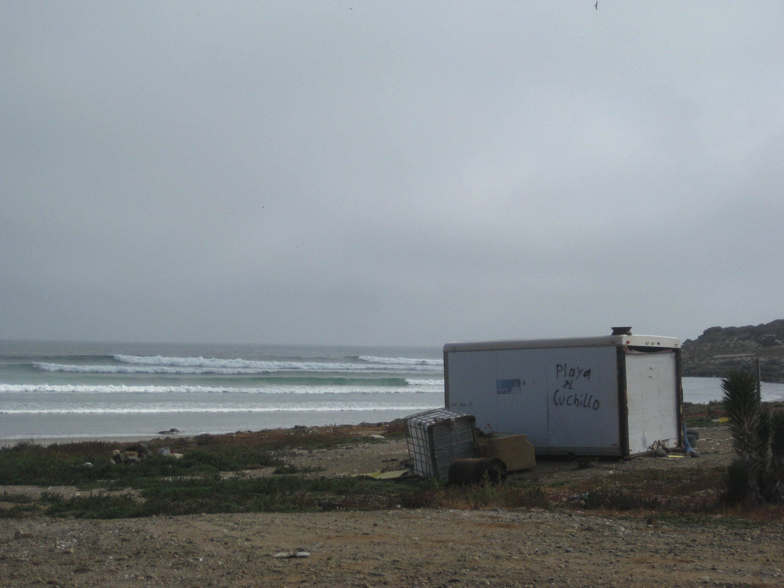
20.4 road left over the hill into the fish camp of San José. Faro San José or San José de la Piedra are what signs and maps call it. A road to the right goes 0.3 mi to a rocky beach.
20.5 San José fish camp
20.6 Beach by camp. A small island is just offshore.
In the next section, I will do the drive north from San José, past Los Morros to where I took the abandoned inland road the day before.
Photos:


Because I went on the inland road south from Canoas, but the coastal road is the primary route, I needed to check it… and because of my direction was southbound, I would also have to drive the coastal road again, southbound.
So, after taking photos around San José, I drove back up the hill to Mile 19.4 for the coastal road north. Zero my trip odometer… I put ‘4WD’ on my map for this coast road north from Faro San José.
0.0 Junction Coastal Road and Faro San José road from Hwy 1, Km. 168 (near Cataviña).
4.3 Steep, eroded grade up (4WD).
5.0 Second grade up.
13.1 Los Morros. White picket fence around house. Rocky beach.
16.8 Enter Arroyo Lazaro from the south.
17.2 Rancho Lazaro
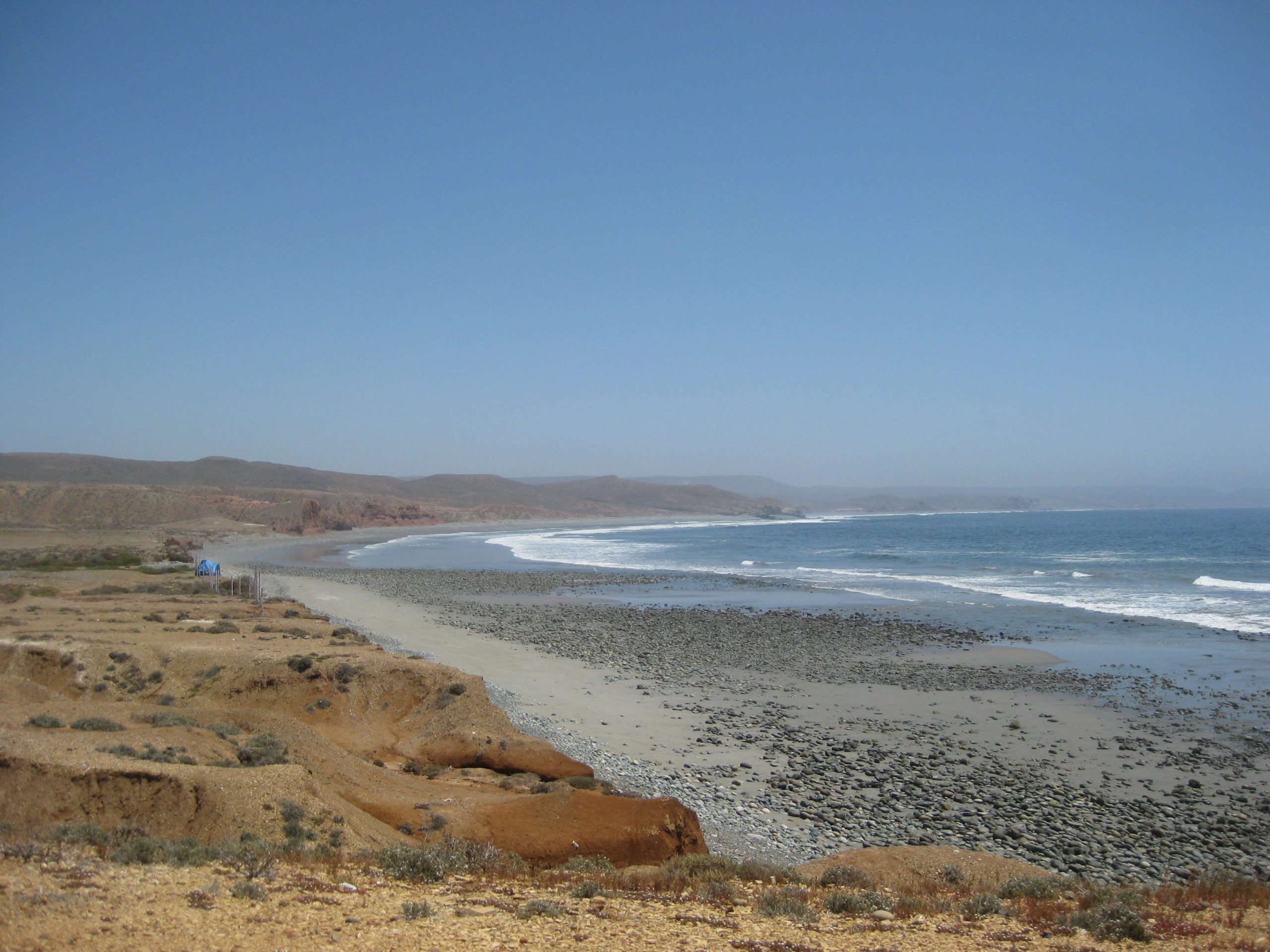
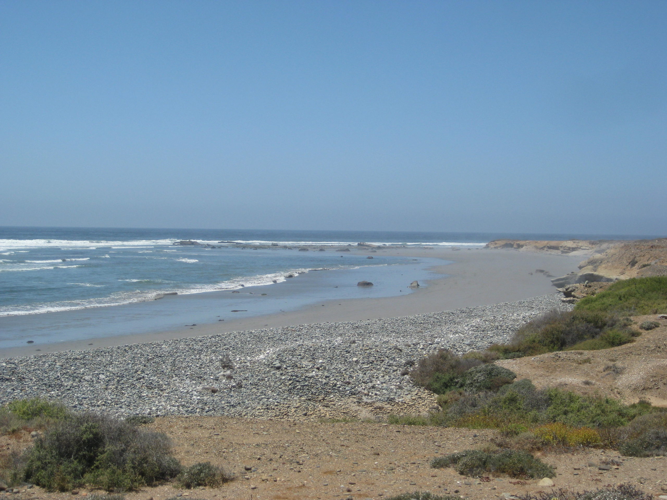
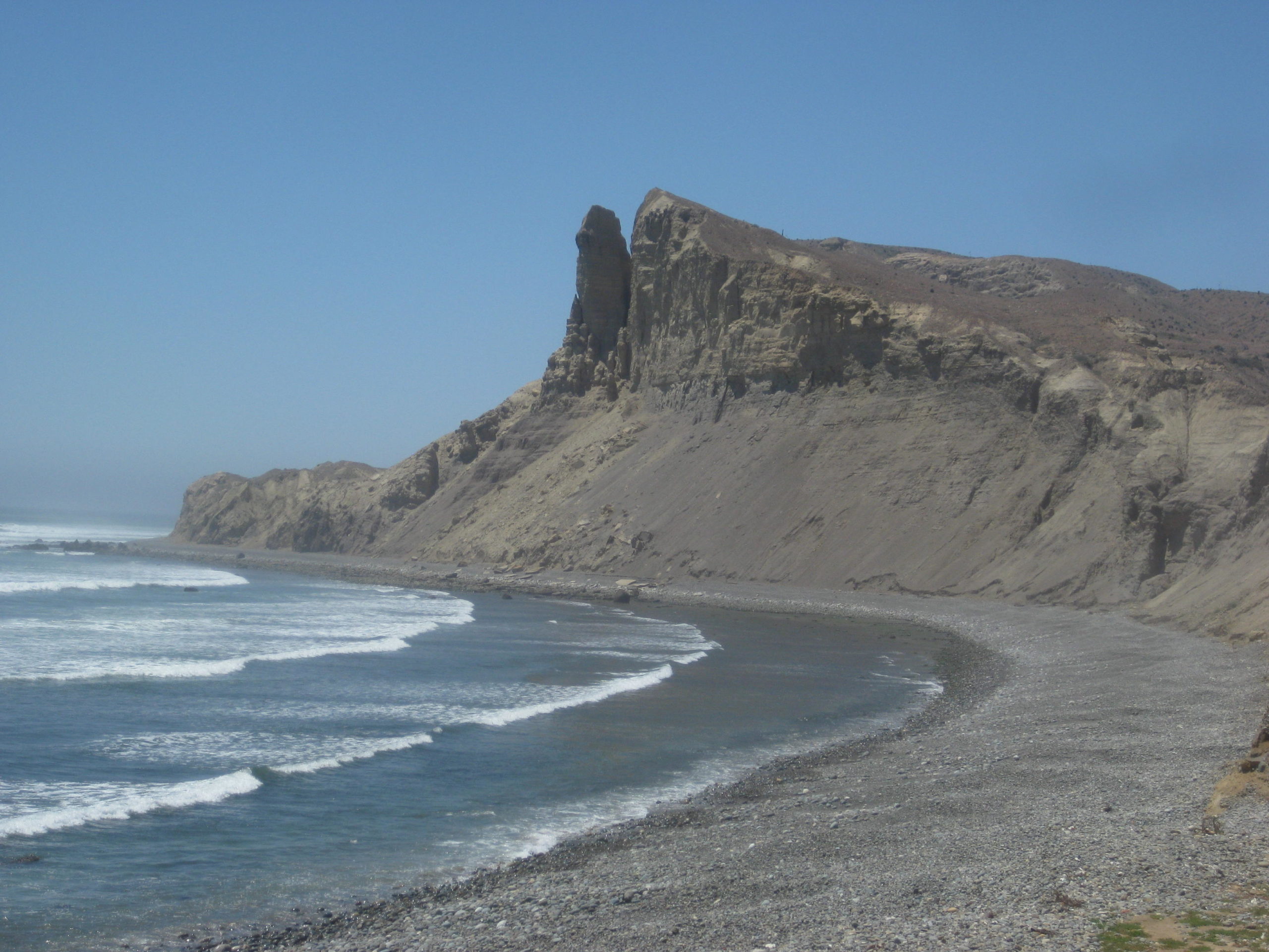
20.9 Road to beach, 0.3 mi, rocky. See photo of Acantilado los Candeleros.
22.6 Junction with inland road (2 miles from Puerto Canoas)
This coastal route (22.6 mi took 1.5 hours to drive). Now, I will turn around and drive it south…
0.0 Junction coastal and inland roads, go right, fresh grading. The grading doesn’t last or was washed out by this season’s rains. 1:36pm
1.7 Road right to a rocky beach with an impressive cliff, see photo.
5.2 & 5.4 driveway to Ranch in Arroyo Lazaro.
9.5 Los Morros, white fence. 2:16pm
10.5 Steep grade up.
16.2 Steep grade up.
17.5 Big grade down.
18.2 Big grade down.
22.6 Junction Faro San José/ Cataviña graded road. 3:05pm


I get to the junction with the abandoned inland road, 3 miles away, turn around, and head back south and back to San José. There just was no other option to continue to do a road log south from San José fish camp.
About 6 miles south from San José is Bahía Córbin, and some nearby dunes.
Continue to Day 4 on the next page…