July 18, 2009 (OUR FIRST ANNIVERSARY)

Lobster dinner at Baja Jardines Restaurant, San Quintin.


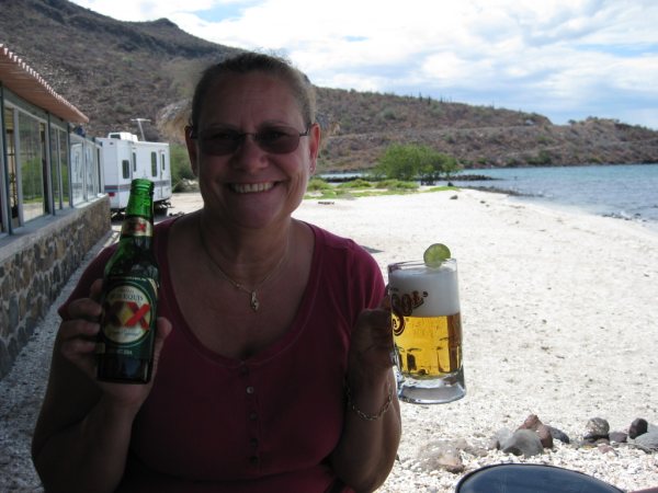
Beer break in the Vizcaino Desert along Highway 1 on Day 2 of our vacation.
IGNACIO SPRINGS Bed & Breakfast entrance…

Located in the oasis of San Ignacio.

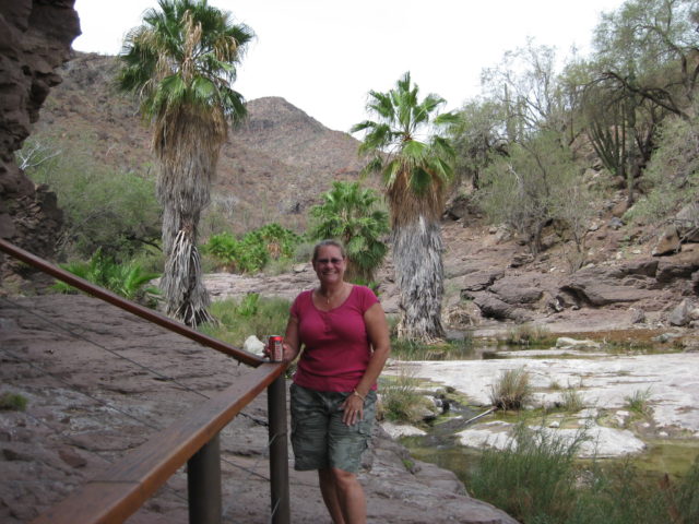
The San Ignacio River at Ignacio Springs.
Our yurt
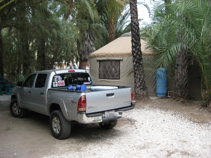

Mongolian style canvas homes are called yurts, They are quite roomy on the inside .


DAY 3

One more look at the view before leaving for Mulegé and Playa Frambes on Bahía Concepción.
San Ignacio, Baja California Sur


The entrance road to San Ignacio is a 2 mile must-see detour off Hwy. 1.

Highway One reaches the Sea of Cortez near Santa Rosalia.

Our home the next two nights. ..

Very impressive! Bob and Susan Frambes are great hosts!

All bamboo furniture from Bali.


Pool deck at the Lighthouse Resort.

The lighthouse.

View from the lighthouse. See Bob & Susan’s web site: http://www.mulege.org/

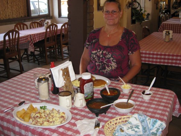
Great food always in Baja! Dinner was at El Patrón (in Mulegé, on the beach).
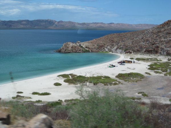
Bahía Concepción

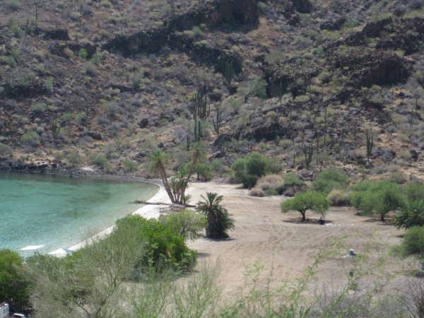

El Requesón is where we camped in 2007. http://vivabaja.com/707
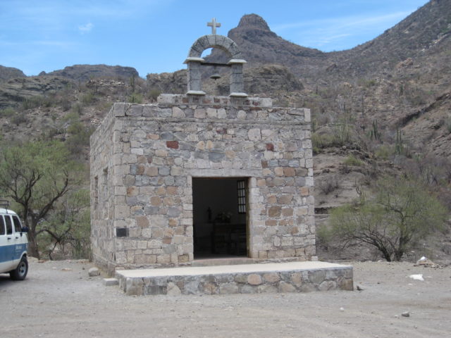
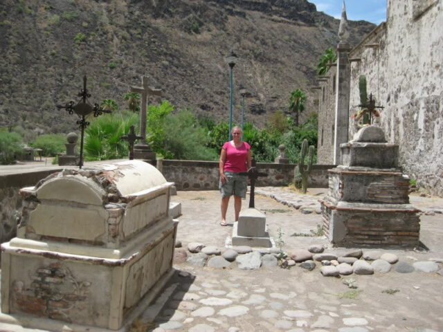
San Juan Bautista Londó

These mission visita ruins are just off the highway.

Happy to connect with Baja California history!

South of Loreto is a viewpoint worth stopping for.
Ligüí mission was here…

The third California mission ruin was totally washed away in 2001. It was between that tree and my truck before a flash flood undermined the site.

San Juan Bautista de Ligüí y Malibat has a new memorial site just east of the original location. Update: three years later (2012) part of this outlined area was washed away. Five more year (2017) it was completely gone. For mission details, see vivabaja.com/missions1
Playa Ligüí

The beach at Ligüí, just east of the mission site.

Ensenada Blanca is just south of Ligüí. A small village of fishermen and families is near the bay.
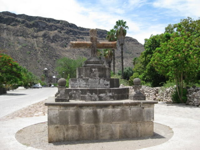
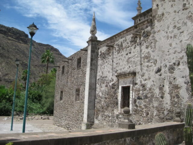
Loreto

Our motel for one night in Loreto was the Coco Cabañas, located on the north of the main street into town and one block behind the malecon drive.

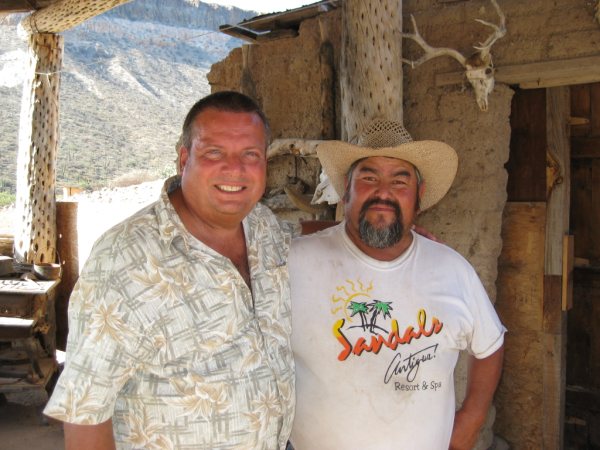
Phil C at an El Camino Real bell, showed us around Loreto.

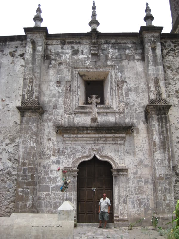
California’s First Mission, founded in 1697


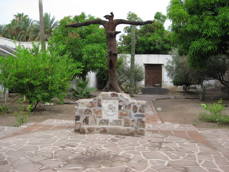


Loreto, founded in 1697. This church was built from 1740 to 1750, and repaired in the early 1950s. To see all of California’s earliest missions: http://vivabaja.com/missions1
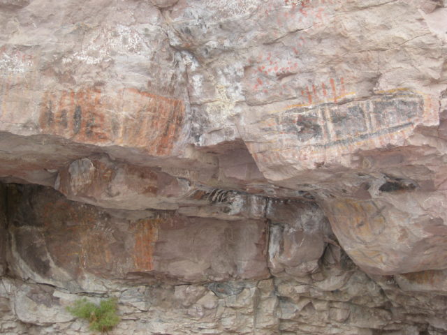
Pictographs along the road to San Javier, at Mile 8.2


California’s Second Mission

San Javier, founded in 1699 is located 22 miles southwest of Loreto, high in the mountains.

San Javier remains as the best preserved of the Jesuit missions.


The drive back down to Loreto was as easy as the drive up over the new road. In 2009, paved for 10 of the 22 miles between Loreto and San Javier.
Lunch at Mc Lulu’s in Loreto

Beats McDonald’s every time!


We say goodbye to Loreto and drive north to Bahia Concepcion.
Bahia Concepcion
Playa Buenaventura

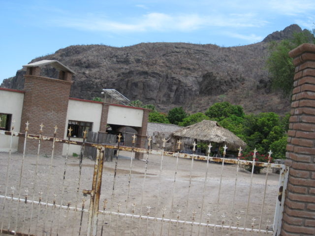
We stop at Mark & Olivia’s restaurant for a beer and a burger.

‘David K’ with Mark (‘Oliguacomole’ on the Baja Nomad forums) at Playa Buenaventura Restaurant.
Playa La Perla

Our campsite for the night.

Sunrise at Playa La Perla

Normally we don’t get up this early on vacation, but an arriving fisherman with his car speakers cranked up was better than any rooster.
Quest to find the Magdalena ruins!

12.9 miles north of Mulege, north side of Palo Verde village, we take the road signed for San Borjitas cave art site. The road has kilometer markers and some are attached to the local vegetation.
Arroyo El Perdido

Just past the Km. 7 marker is Rancho El Perdido on the left (4.3 miles from Hwy. 1). A short distance past the ranch, at Mile 4.5, we take the faint track west across the rocky arroyo and that soon turns north and finally leaves the arroyo on the other side.

Beyond the rocky arroyo we continue northward over what was once the El Camino Real between San Ignacio and Mulege. A grave is passed at Mile 6.1 (belonging to a Jose Villalobos Diaz 1914-1980).
Magdalena Ruins 27°03’30” -112°10’07” (WGS84)

6.7 miles from Hwy. 1 at Palo Verde we came to the mysterious stone ruins of several buildings on both sides of the road.

It is unclear if they are of Jesuit, Franciscan or Dominican origin and why out in the desert instead of the nearby oasis valley of San Jose de Magdalena. An aquaduct was built many miles to bring water to here from the valley .

The Jesuits proposed a mission of ‘Santa Maria Magdalena’ in the 1740’s, but they placed it far north of here on their 1757 map. Several books and maps have labled these ruins as that mission. See http://vivabaja.com/109 for the possible northern Magdalena site photos.

I believe it is more likely that these ruins were an agricutural colony of the Mulege mission or were the visita of San Jose de Magdalena. A church ruin closer to the village of San Jose de Magdalena is identified as the Dominican visita by Michael Mathes in his books.
Magdalena Aquaduct (0.6 mile from the ruins)

This aquaduct is sevral miles long, coming from the oasis valley and out into the desert to a pila (reservoir) near the ruins.
Aquaduct caved into cliff.

We return to Hwy. 1 over a shorter and better road. At 0.6 mile from the ruins we take the aquaduct photos by some ranches and drive a road north across the wide Magdalena arroyo. At 0.9 mile from the ruins we meet a well traveled road at a sign for ‘Rancho La Poza’, and head east. At Mile 4.6 (from the ruins) we arrive at Hwy. 1 (between Kms. 162 & 163). This is 3.8 miles south of the signed San Jose de Magdalena road junction, and just north of the series of bridges on Hwy. 1 over the Magdalena arroyo zone.
Santa Rosalia

Elizabeth collects some of Santa Rosalia’s black sand beach.
Rice and Beans, San Ignacio

Very popular with the Baja off road race crowd. One of my Viva Baja stickers from 2001 is still there!

We were the only guests for lunch, but the food was very good.
The Old Road

We spot the original Baja trans-peninsular main road east of Hwy. 1, just south of Vizcaino. This was the ‘highway’ before 1973. I traveled on it when I was a kid, with my parents, in 1966.
Eagle Monument 28° Parallel

The state border between Baja California and Baja California Sur, approached from the south.
To Mision San Borja

The 22 mile dirt road leaves Hwy. 1 at the village of Rosarito and passes this ruin, next to Rancho San Ignacito. This was the location of a visita of San Borja, then called San Ignacio.
Doorway of San Borja

Is it an alien in a space helmet.. or just a padre wearing a hood? This face is carved into the stone doorway, on the left side.

The stone church at San Borja was finished in 1801 by the Dominicans… except for the bell tower, which was never added onto the church.

San Borja is the northern-most stone mission church in Baja. The ones that followed were made of adobe, and weather along with treasure hunters have destroyed most of the following 11 missions built after San Borja was founded, in 1762.


The west side of the church, as seen from the top of the stairs.

View south from the top of the stairs towards the camping palapas. Beyond the palapas is the fruit orchard and hot spring.

A sink carved into stone in side room, next to the church.

New window covers have been added since my last visit, several years ago.

The original adobe mission ruins from the Franciscan and Jesuit period, 1762-1772. A protective awning was built over some of them in 2000, and other walls have been coated to preserve them.
Jose Gerardo and his family live next to the mission and provide guide service to the area’s fascinating sites.

Jose has made a museum that includes machinery such as this piece from the San Juan Mine. A sidetrip to San Borja is well worth the drive.

Fascinating cactus forests that include boojum trees entertain your 22 mile drive north from San Borja to the Bahia de los Angeles highway.

The north road is the better of the two to San Borja, but still has some slow sections.

Agua de Higuera is a sulfur-water spring, next to the road.

We drive to El Rosario for the wonderful rooms of Baja Cactus Motel, perhaps Baja’s finest roadside accomodations.
Mama Espinoza’s Restaurant
A Baja landmark and traditional stop for many, many years in El Rosario… long before the highway was built and the Baja off road races from before. The restaurant has been remodeled and food and service were great.
101 years old and still going strong!

Mama (Anita) Espinoza autographs her book for me. Born on Oct. 16, 1910 per her 2002 published biography. However, her 1994 autobiography says the year was really1908. We talk about the old days and of my first trip through El Rosario in 1966. Her memory is so strong that she recalls visitors that long ago.
Elizabeth and Doña Anita Espinoza
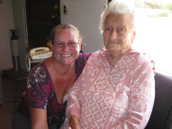
It was a great honor to meet this famous lady after so many visits to El Rosario. There is even a museum about Mama Espinoza, see the photos: http://vivabaja.com/406(taken in 2006).
MEXICO HIGHWAY #1

While a few miles have recently been widened near El Rosario, most of the Baja Highway, south of San Quintin, is only 19 feet wide with no shoulders or places to pull off.
Mision Santo Tomas (SECOND LOCATION)

While some authors have claimed the second site for the Santo Tomas mission was destroyed by road construction, I was able to find the adobe remains photograhed about 1926 in Meig’s book and in 1949 by McDonald. Today, the remains are in the center of a pepper field, 2.8 miles west of Hwy. 1, north of the La Bocana road.
View East…

At the adobe mission remains, a farmer tried to plant over it, but the peppers refuse to grow well and hide the once Holy site. He probably had no clue this was a major historic site from 1794-1799! This and most other Baja mission sites can be seen from space today. Images, location and GPS at http://vivabaja.com/missions4

Marquis McDonald photo from 1949.

Kevin Clough photo frm 1998. To read and see more of the Spanish missions, visit http://vivabaja.com/missions1
What a great trip…

Day 1 to El Rosario
Day 2 to San Ignacio
Day 3 to Bahia Concepcion (Playa Frambes)
Day 4 Relax at Playa Frambes
Day 5 to Ligui & Loreto
Day 6 to San Javier & Bahia Concepcion (La Perla)
Day 7 to Magdalena, San Borja & El Rosario
Day 8 to Santo Tomas & Home
Home Page: http://vivabaja.com/