On June 28, my daughter Sarah and I drove south to enjoy a week vacation with friends at Camp Gecko. A one day excursion to Mision San Borja and two visiting stations of that mission (Santa Ana and San Ignacito) was made. On the way home (July 5), Sarah took several photos of the colorful rock art near Catavina. A pic of me by Baja Nomad at Fred Hall’s is at the end. Please ignore it if you know what I look like, LOL!
Gypsy’s Wet Buzzard Bar, Rancho Cielito Lindo

Here is Laura with Sarah. We stop here Saturday morning for some of Laura’s breakfast burritios… the ‘best’ in Baja!
The El Camino Real (looking south)

Along the highway into Bahia de los Angeles, the original trail connecting the California missions can be seen just south of the Km.30 post. 29°1.82′, -113°52.13′ (WGS84).
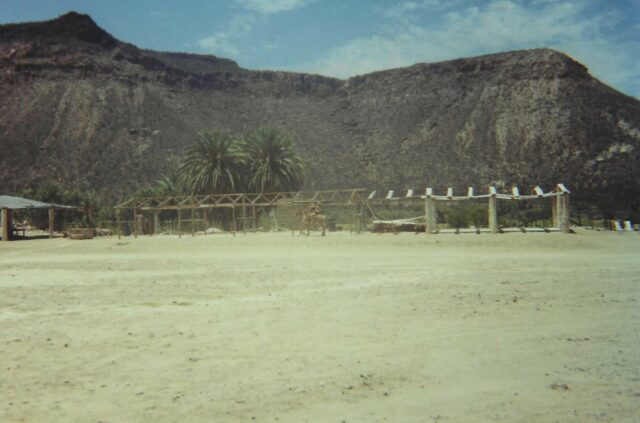
Camp Gecko, Bahia de los Angeles

Just a great week for relaxing, fishing, and exploring… Sitting under the tree with a book is El Camote.

The island filled bay seen from Camp Gecko’s cabins.

Visiting Doc Abraham Vasquez’ Camp Gecko was fun.
Mike Humfreville

The yellow tail were sure biting this week! Mike is ready for a siesta after hauling these two ashore.

El Camote shows off his yellowtail.

Nice squid!
Hector and Sunshine

Between town and Camp Gecko is a memorial to these two ‘lovers’ (?).
José and Family at San Borja

Available to provide guide service or mule caravans to area historic sites, vistors are made welcome by these nice folks.

The kids of San Borja bring a mule for Sarah and Andee to ride.

Sarah and Andee take a mule ride!
Theodoro and his dog.

Providing tours inside the mission is Theodoro. His dog was bit by a rattlesnake a couple months ago! Be very aware of where you place feet and hands.
Old and New in Baja

The stone mission at San Borja was completed in 1801. The Toyota Tacoma, 200 years later. What took the padres weeks to travel can be done in one day, now!

Jose’s oldest daughter, Brisa, gives Sarah a goodbye hug. On our last visit, Sarah arrived on Sonora Wind’s ATC and made a hit with the kids!
Santa Ana (southwest of San Borja)

The site of a mission visiting station, today Santa Ana is abandoned. A large oasis is in the background. This small graveyard is next to the seldom traveled road. Two large graves next to this one can be seen at: bajataco.com/Baja/Padres-at-Rest.html copied below…

A long rock wall is seen driving north from Santa Ana towards San Ignacito.

At the base of the wall, I found this flowering barrel cactus.

Andee and Sarah under a boojum.

Adobe ruins at Rancho San Ignacito. The oasis here was also the site of a San Borja visita (then called San Ignacio). GPS: 28°44.35′, -113°50.66′ (WGS84).
Cataviña Desert

View west from the rock painting site.

The colorful native paintings have not yet been damaged. Unfortunately, the boulders outside are covered with grafitti.

Sarah took many closeups of the astronomical observations depicted.

The location is signed and visible from the highway near the north arroyo crossing. Park at the palapa or down in the arroyo.

The ‘cave’ is at the top of the boulder hill, some steep scrambling required.

GPS is 29°45.12′, -114°44.57′ under a giant boulder. I hope you find Baja as wonderful a place for adventure as we do! http://vivabaja.com/
Photo by Doug Means, the Baja Nomad

With no cure for his ‘Baja fever’, David K returns again and again to the magic peninsula! Take photos, leave smiles, share the wonders online to preserve what cannot be replaced. Baja is for anyone with an ounce or more of adventure, and a pioneer’s spirit in their soul. ¡Adios y hasta la vista!