The weekend of April 7-9, 2006 my son Chris and I stayed at the Baja Cactus Motel in El Rosario to revisit friends and do some exploring.
Visiting historic places in Baja is one of my passions. Santa Ursula was a water hole along the mission road through Baja. Las Pintas is a fascinating site of Indian rock glyphs and fossils. La Lobera is a beautiful example of the rugged Pacific coast.
The Anita (Mama) Espinoza Museum
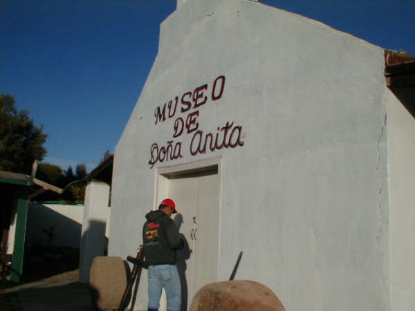
Located down a short path, just beyond the sharp left curve in the town of El Rosario. Request a viewing in Mama Espinoza’s restaurant if the museum is locked.


Doña Anita (Mama) Espinoza


Hugo Lopez Art

Visit Hugo’s Tacos Misión café in El Rosario for fast food and Baja art! Located on the left, on the far side of town, heading southbound.

Loading Yuccas

Yucca trees are being chopped out of the desert for the cosmetic/ personal care industry.
Ditched runway ‘El Arenoso’

Many of Baja’s dirt airstrips have been ditched by the military to prevent drug runners from using them. This airstrip is behind the Hwy. 1 café near Km. 103, along the road north to the Sauzalito mines, San Juan de Dios and Los Mártires.
South of Rancho El Arenoso (abnd.) searching for Santa Ursula

My 17 year old son Chris, on a fallen boojum tree…
Santa Ursula was a water hole on the padre’s El Camino Real. Howard Gulick visited the site by Jeep in 1953 and found an old adobe house, old dam, irrigation ditch and a shallow well.

The cardón and cirio (boojum tree) are the tallest of Baja’s cacti. This is the road leading south from El Arenoso (Km. 106).

The road ended at this arroyo…

Looking back at my truck at the end of the road. This is point ‘E’ on the map.

A yucca tree that hasn’t been cut down (yet)!

A cardón flower…

We see Arroyo San Fernando as we drive down this road (between points ‘D’ and ‘E’ on the map).

The road ends at this rock mine, just above Arroyo San Fernando (point ‘F’ on the map), 13.8 miles from El Arenoso.

One last look at the big San Fernando river bed.
The Map

To return to this area, I suggest one use the road through the gate at Km. 103 (Point ‘I’) because we encountered the Mexican army at El Arenoso (Point ‘A’) and they don’t like cameras! We didn’t find Santa Ursula, but if I return I believe I will turn west at Point ‘C’ and look around Arroyo La Burra!
In 1953, Howard Gulick reported he drove west of El Arenoso 2.0 miles (on the old transpeninsular road) then went southerly for 6.9 miles to Santa Ursula.
Since Hwy. 1 is located very near the old main road here, the road going south at Km. 103 (1.8 miles west of El Arenoso) must be the road Gulick drove.
LAS PINTAS
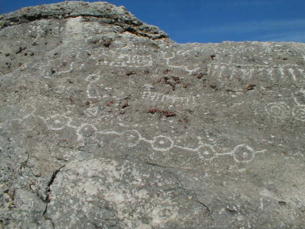
The ‘painted’ rocks of Las Pintas tell this was a popular site with the Native Indians of long ago!
Access from the Punta San Carlos road, off Hwy. 1 at Km. 80/81. Exact directions at http://vivabaja.com/pintas

Lots of neat places to explore here…
The Baja Adventure Book
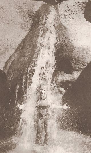
This photo of Las Pintas… a site in the desert, inspired me to see it for myself!

Here’s Chris at the same ‘waterfall’… he didn’t get the same shower as Walt Peterson’s boy did!

Chris looks above the waterfall.
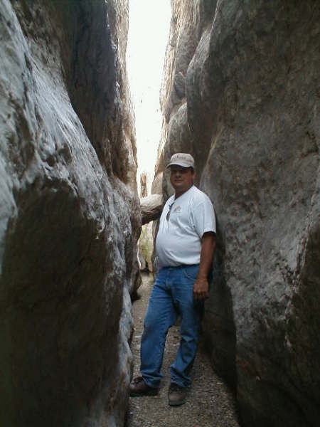
A tight squeeze for me, at Las Pintas!
Chris climbs up the boulders…

Looking down to the Las Pintas parking area from above.
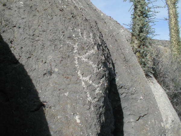
Chris climbed way up and photographed this petroglyph he called ‘the pineapple’.

Las Pintas is well worth a visit as one of Baja’s special sites… Exact driving (with GPS) details and more photos at http://vivabaja.com/pintas
Chris at La Lobera

Just 3 miles west of Hwy. 1 (between Km. 47 and 48) is the dramatic coast and future sea food restaurant!

Lobsters, abalone and other sea food will be grown in this man made pool at La Lobera.
I hope you enjoyed the photos! Email me any questions or comments: info@vivabaja.com