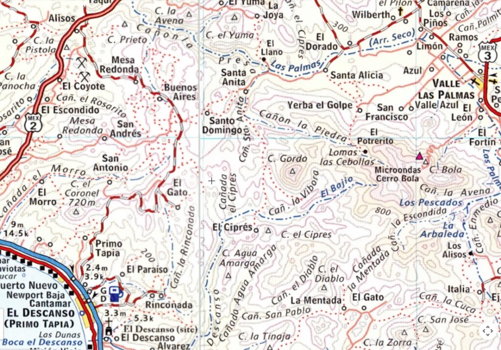
We used the 2003 Baja Almanac, Map 1 for place names capitalized below: Map closeup at bottom.
The point where we turned west, off Highway 3 was 15 miles south of Tecate at VALLE LAS PALMAS . GPS Map Datum WGS 84: 32°21.99′, -116°36.92′, elev. 944′ .
Down the wide graded road we go until a left turn is made at 32°24.85′, -116°40.12′, elev. 835′
We pass RANCHO SANTA MONICA, but the road through RANCHO SANTA ALICIA is locked, so we search for a way around and try crossing ARROYO LAS PALMAS river, but the road doesn’t continue on the far side.

Roy ‘The squarecircle’ and Elizabeth ‘Baja Angel’ check out a rattlesnake in a gully across the road!

We find a way around by using a small canyon of CAÑADA EL CIPRES to the north and west of EL DORADO. A small rancho is passed at 32°21.85′, -116°48.02′, elev. 837′, possibly SANTO DOMINGO on the map.

Lot’s of signs it is Spring!

Lot’s of green along the road as we continue west.
GILBERT RANCH CEMETERY

Located on a hill just north of the road at 32°20.96′, -116°49.53′, elev. 1,330′.

The Gilbert Ranch dates back to the gold mining days of the late 1800’s.

Looking west from the cemetery at the road we will be driving on. This valley contains RANCHO BUENOS AIRES, to the right of the photo.

Elizabeth and David, on April 10, 2005


The road was often on top of ridges providing views down to ranches and side valleys.

More Spring colors in these Baja California hills… just a few miles south of Tijuana!

A left turn is made at 32°20.76′, -116°50.97′, elev. 1,771′ on the ridge top, and we then come to this signed junction: right turn for RANCHO EL GATO and CANTAMAR… our destination on the coast.
32°19.38′, -116°50.84′, elev. 1,825′

This sign points the way we came, only we didn’t come from Tijuana that day!
CERRO EL CORONEL

This dramatic peak is the direction we head until we veer to the left, at its base, where the road drops steeply to the coast.
Pavement is reached at 32°15.39′, -116°54.74′, elev. 337′. Under the toll road, then over the free road until Highway 1 is reached at 32°14.07′, -116°55.53′, elev. 45′
Baja Angel on a breezy sea cliff…

We stop to visit Keri at the Pyramid Resort, then have dinner at the new Del Rio’s La Fonda.
Another great day in Baja!