Presidents Day Weekend FEB. 14 – 16, 2004 Campo Nuevo Mazatlan Km. 32 south of San Felipe, Baja California.
Saturday we visit Shell Island. Sunday we tour Parral and Matomí canyons. Monday we check out the sulfur mine, then head home.
All Photos c2004 from Bob H, David K, ‘Mexray’, ‘Tunaeater’, and Edie H (the source of each photo is noted in the caption).

Nuevo Mazatlan was a perfect location for our group camp. Baja Rob (from Bahía Santa María), came over to meet us on this morning. (David K)

‘Pancho’ with the cool Matomí 2004 hat (from Mexray), and Sarah. (David K)

When you have Baja Fever, stickers go on your Baja rig! (Bob H)

After horseback riding, Sarah takes the Toyota for a spin. At 13, she already knows how to go four wheeling! (Bob H)

Surfer Jim is ready to go exploring! I credit Jim for inspiring me to have a Matomí Gang reunion. Alumni from the 2001 Presidents’ Day trip were Mexray, Mike Humfreville, Sarah and David K. (David K)

Surfer Jim on the (mostly gone) causeway road to Shell Island. Built to provide high tide access in 1984 for a development that never was started. The concrete culvert/ bridge remains while most of the elevated road bed has eroded away. (Bob H)

Beautiful ‘Shell Island’* which at extreme high tides is totally separated from the mainland, a true barrier island. (* some call it the not so romantic name: ‘Shell Beach’) (Bob H)

The GeoRock Hummer likes to be in front and the smaller 4X4s keep their distance! (Bob H)

Audrey and Bob H in the Tacoma 4WD taxi! (David K)

The tide is low and a stop is made to look at shells. (David K)

Edie H finding goodies… (David K)
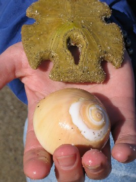
Sand dollar and moon snail shell… (Bob H)

This 4WD was feeling right at home! (Mexray)

Sarah, Alicia, Brittany on the ‘Hummer-a-go-go’ ! (David K)

Under a large clam shell was this fellow! (Bob H)

Bob H’s photo of his wife Audrey and their pet ‘Shelby’.
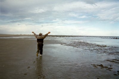
“I’m a bird.. I’m a bird!” Steve H should get out more often!!! I was doing the same thing! (David K)
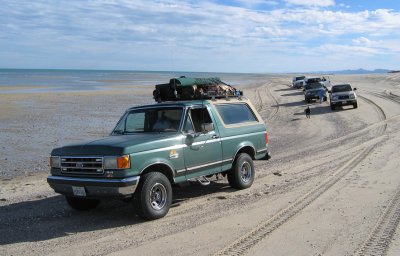
Mexray’s Bronco is Baja Proven! (Mexray)

Mike Humfreville chats with Chris (‘Via Baja’) who was by his Jeep (in background) and came over to meet us. (David K)

Big sandy beach… We reach the north point across from Percebu and head back to the low tide access point. (David K)

Heading back to Nuevo Mazatlan from Shell Island we pass some big birds nesting on Cardón cacti. (Bob H)

Under the shade trees of Nuevo Mazatlan we discuss our outing by Mexray’s rig. (David K)

Tunaeater (Paul) rides into camp Saturday night. Mary from Playa Mexico did as well, and everyone enjoyed watching the Matomi 2001 movie on Bob H’s TV & VCR pugged into Mexray’s inverter. (David K)
Surfer Jim…
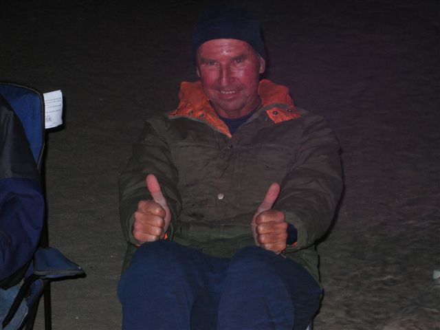
… looks ready to explore Baja, day or night! (Mexray)
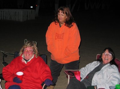
Edie H, Mary, & Pat (Mexray)

Mexray cooks some JiffyPop popcorn over the campfire. The nights were very cold, but the days were nice and with no wind. (Bob H)

David chatting with Pat (who was enjoying a fine Caribbean cigar). (Bob H)

Suzanne (GeoRock) and her cigar… (Bob H)
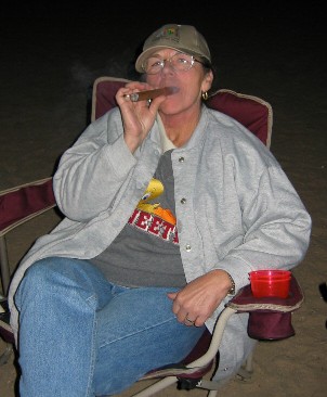
Pat has the right attitude… She and Mexray are continuing on to Mulegé after this weekend. (Bob H)
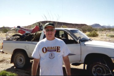
We meet TW (Tom) on Sunday morning. He and his brother Bill will drive the Toyota up to Matomí and TW will then ride the motorcycle out to Hwy. 5. (David K)
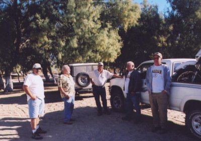
Rudy, Mike Humfreville, David K, TW, and Bill W are ready to head for Matomí. (Tunaeater)

A short jog north on Hwy. 5 between today’s Nuevo Mazatlan entrance and the road to the sulfur mine, which was the original road into Nuevo Mazatlan. (Bob H)

Nine vehicles made up the caravan to Matomí. Here we stop near the sulfur mine before entering the El Parral Canyon to Valle Chico. (Bob H)

Along the way stops were made to discuss the history and terrain of this land we love, Baja California! (Edie H)
David K Points the Way…
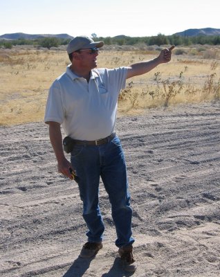
I do that… a lot!!! The sulfur mine is just north of our first stop. We will visit it, the next day.
Playing Football?
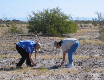
No, but GeoRock and Pat are finding obsidian pebbles, known as ‘Apache Tears’ laying all over the desert, at our second stop. (Mexray)

Having a geologist along is great for an educated tour… Thanks Suzanne (‘GeoRock’)! (Bob H)

Fifteen other Baja Nomads listens to GeoRock’s explanation of the folding process at work in El Parral canyon. (David K)

Mike Humfreville in Parral’s cardón forest. (Bob H)

Rudy (Tunaeater’s dad) and Mike Humfreville. (Tunaeater)
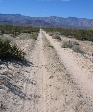
We reach Valle Chico, and cross it on this fence line road. It goes just over 4 miles from the east to west side of the valley. On the west side, is the north-south, Valle Chico road (between Agua Caliente and Matomí canyons). (Bob H)

Rugged land with chollas and cardóns at the edge of Matomí canyon. (Tunaeater)
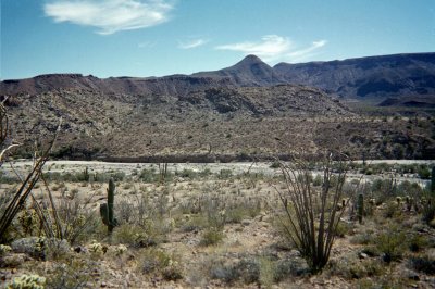
The south edge of Valle Chico is the Matomí canyon. An old road grade is seen on the opposite bank. Here the Valle Chico road drops steeply down to the big arroyo. (David K)

Three vehicle from Mexico’s Fish & Game/EPA department were in Matomí to check on big horn sheep and other rare animals. The Chevy is stuck because a vacuum hose was bad and the 4 wheel drive didn’t work. (David K)

I pause at the exact place where 26 years ago I was stuck in a rising Matomí river! See next photo… (David K)

My worst stuck, January 1978.. Returning from a failed attempt to reach Rancho El Matomí because of deep water, my 4WD Subaru is almost swept downstream. Airing down the tires saved me.
Rancho El Matomí
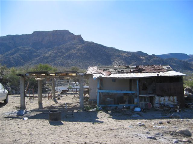
Nobody was home today, but someone was there recently. The path down to the waterfall fed pool is to the right. Photo looking west. (Mexray)

Behind the Matomí ranch house the ‘oasis’ pool is visible, way below. (Tunaeater)
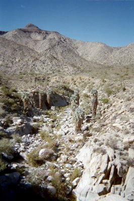
Upstream from the pool (1/3 mile), running water exits from a narrow gorge. (David K)

The El Matomí Canyon Oasis, Shangri-La in Baja? (Tunaeater)

Matomí’s waterfall filled pool offers year-round refreshment and tranquility. (David K)
Many Years Ago…
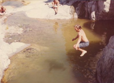
A young David K jumps into the Matomí oasis, from the cliff above. This was in August, 1979 and it was easily over 100°F. Many friends were camping with me on Shell Island when we took this excursion.
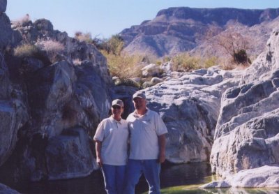
Pat and Ray (Mexray). Ray was with us in 2001 piloting a Subaru Brat all the way with no problems. (Tunaeater)

David K at Matomí Falls. My first visit was 26 years ago and it is still exciting for me to be here. (David K)

Tunaeater (Paul) and his dad, Rudy. (Tunaeater)
GeoRock Jumps In

Suzanne likes to make a big splash when in Baja! (Mexray)
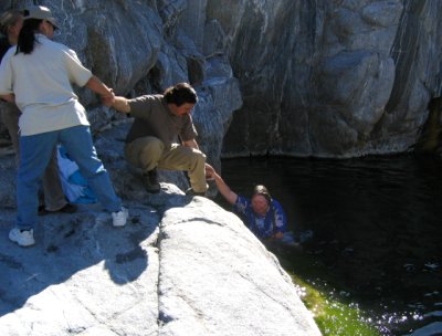
What goes down, must come up? Pat secures Pete so only the female Hummer passengers get soaked. Yes, the three girls jumped in after Suzanne did! (Mexray)
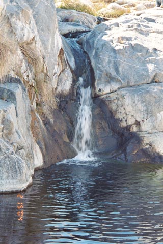
A final look at Matomí Falls, Feb. 15, 2004. (Edie H)
THE MATOMÍ GANG FEB. 2004
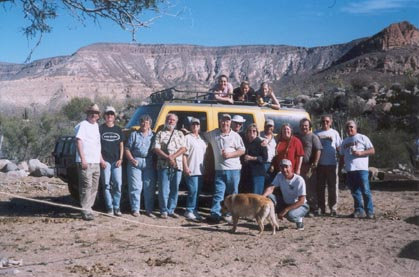
Photo from GeoRock’s automatic camera at Rancho Matomí. From the left: Bob H & Audrey, MaryAnn & Mike Humfreville, Pat & MexRay, Steve & Edie H, David K, GeoRock & Pete, Bill W & TW. On the Hummer: Alicia, Sarah, Brittany. In front: Surfer Jim (+Shelby the wonder dog). Tunaeater & Rudy left before photo taken
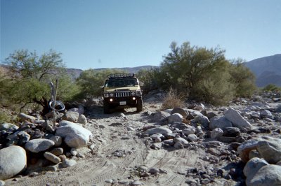
That Hummer really could maneuver over this tough road as we head back to camp from Rancho El Matomí and the oasis just behind it. (This and all photos after from David K)
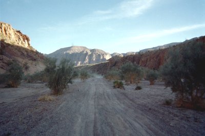
Heading down Arroyo Matomí towards Hwy. 5 is some beautiful scenery.
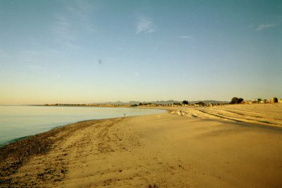
Sunrise Monday at Nuevo Mazatlan. Before heading home some of us tour the abandoned sulfur mine just 5 miles west.
Last worked about 50 years ago, sulfur was mined throughout this valley. Below is the old road south of San Felipe.

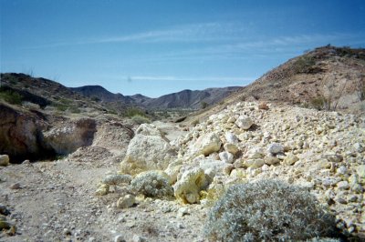
Many pits and caves were dug. Perhaps more to escape the sun than for the yellow mineral.

Sulfur is used to make many products including gunpowder, matches, and fertilizer. When lit with a match, this mineral burns and gives off a poisonous gas (sulfur dioxide).
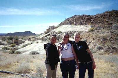
The girls became good Baja amigas.
Alicia, Suzanne (GeoRock), and Pete… The Hummer gang!
David K and daughter Sarah, part of the next generation of Baja aficionados!
GPS DATA (with elevation) @ map datum WGS84
- Nuevo Mazatlan: 30°43.32′, -114°42.37′ (22 ft.)
- Tour route west at Hwy. 5: 30°43.45′, -114°42.87′ (44 ft.)
- Old main road south, near sulfur mine: 30°42.77′, -114°46.78′ (347 ft.)
- El Parral Canyon road: 30°41.52′, -114°46.47′ (397 ft.)
- Fork: left to lower Matomí (17.7 mi.), go right (for Parral): 30°41.31′, -114°47.27′ (482 ft.) Pass through mountain to Valle Chico.
- Valle Chico and Parral road junction: 30°35.22′, -115°04.04′ (1,780 ft.)
- Arroyo Matomí, end of Valle Chico road: 30°29.64′, -115°01.57′ (1,937 ft.)
- Rancho El Matomí: 30°27.41′, -115°04.87′ (2,466 ft.)
- Jcn. road north 17.7 mi. to Parral road: 30°29.79′, -114°50.17′ (736 ft.)
- Hwy. 5 (10 mi. north of Puertecitos): 30°29.43′, -114°40.03′ (112 ft.)

My 1988 area map with some update notes .
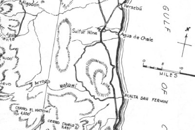
The area of our day trips as it appeared in this 1962 map by Howard Gulick. Note: ‘Persebu’, ‘Agua de Chale’, Sulfur Mine, and Arroyo Matomí.