Alfonsina’s Beach

Now, this is ‘Beach Front’ property!

The small mountain is San Luis Gonzaga Island or sometimes called Willard Island, which sits in the bay and connects to the beach at low tide.

Saturday and Sunday, after Thanksgiving, had perfect weather. The previous two days were windy.

A light house is near the south point of the island.
On the Royal Road in Baja, El Camino Real.

My son Chris holds the sign found next to the trail… How far to the mission?
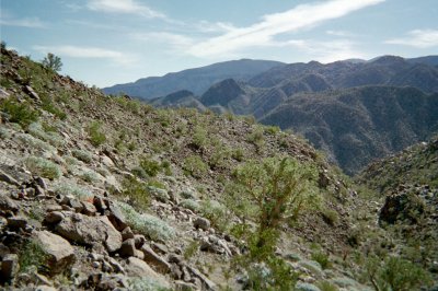
David K having a great day!

Much of this 234 year old foot and mule trail is pure rocks. In the distance is the Santa María arroyo near the canyon entrance.

We could see the south end of the bay near Punta Final from this point.

Elephant trees grow over much of central Baja.

Looking west towards the steep walled Santa Maria canyon. Just beyond is the valley containing the mission.

A s we continued west and up into the mountain, we encountered my favorite Baja trees, the boojum!
Here, the Camino Real dropped into a small side canyon, just north of the main Santa Maria canyon. Look closely just left of center for the trail.

Chris was motivated to get to the mission, but the trail disappeared on us here. We had just enough daylight to get back to my truck, so it was time to turn back. We really didn’t want to.

Baja has some great sunsets and sunrises. We had a great time, even though we came up short on reaching Mission Santa María. We hiked uphill four hours and it took three to get back, thanks to the GPS, to stay on the trail.
Puppies!

My daughter Sarah found these puppies under a tractor, across from Rancho Grande. Sarah stayed with Brandi’s family on the beach while we hiked on Friday. The part of El Camino Real we hiked, was built by the Franciscans after Junipero Serra’s walk from Loreto to Alta California. Serra and the Jesuits who preceded him, reached Mission Santa María by walking up the canyon then made a steep climb to get out of the canyon on what we today call the ‘Indian Trail’. In fact, this Indian trail was the early Camino Real route. It was so dangerous for pack animals, the new route was built which stays out of the canyon, just north of the rim. Both the old and newer trails join on the bulldozed road that ends about 2 miles east, from the mission. The Indian Trail or first Camino Real continues from the very end of the bulldozed road and drops to the canyon bottom. This can be seen in an aerial photo at http://vivabaja.com/missionsm/

The newer Camino Real comes down the mountain and joins the bulldozed road below (west of) the end of it. It is very difficult to spot where it connects with the bulldozed road, halfway between the arroyo and the end on the ridge. Per my GPS, Chris and I were less than a mile and a half east from the end of the bulldozed road when we turned back! With a GPS to help stay on the trail (which isn’t always obvious) I am estimating it would take 6 hours max. to hike from the end of the road (coming from Gonzaga) to the mission. Bring a minimum of a gallon of water (in cool weather) per person. A return hike down the canyon would make that less, if you drink from the year-round stream that runs to about a mile west from the Gonzaga side road end. Visit my Baja Missions web site for photos of Santa Maria and other Baja mission sites: http://vivabaja.com/missions1
In April 2003, I drove to the mission from the west, with my daughter and some of my Baja Internet friends: http://vivabaja.com/403
In May 2007, I returned to Mission Santa María and hiked some of the Camino Real where it meets the road from the mission: http://vivabaja.com/msm
In May 2010, I returned to the mission with 5 other vehicles: http://vivabaja.com/msm2010
Read more about this trip and other Baja adventures on the Baja Nomad discussion boards: http://forums.bajanomad.com
See all my past Baja travel web pages, links to other Baja web sites, old and new maps of Baja, and more at: http://vivabaja.com
GPS Directions (map datum WGS 84)
- Take Hwy. 5 south 7.4 miles from Rancho Grande, turn west: 29°41.10′, -114°24.61′
- 3.2 miles west of Hwy. 5, go straight where most traffic curves left for Las Palmitas: 29°41.29′, -114°27.68′
- 0.8 miles from above, park at huge boulder: 29°41.69′, -114°28.24′
- Hike to north bank of Arroyo Santa María to: 29°41.74′, -114°28.22′ elev. 609′ (ECR-1)
- Go northwest and climb out of valley, note ocotillos.
- Along left side of side valley: 29°42.38′, -114°28.61′ elev. 741′ (ECR-2)
- On first padre built switchback up: 29°42.68′, -114°28.98′ elev. 906′ (ECR-3)
- On a ridge, trail continues northwest: 29°42.68′, -114°29.47′ elev. 1308′ (ECR-4)
- On the Camino Real: 29°42.76′, -114°29.53′ elev. 1391′ (ECR-5)
- Crossing ridges and little mesas: 29°43.02′, -114°30.01′ elev. 1477′ (ECR-6)
- Drop along side of ridge, trail narrow: 29°43.08′, -114°30.17′ elev.1610′ (ECR-7)
- End of today’s hike just beyond this last clear sign of the old trail: 29°43.15′, -114°30.23′ elev. 1702′ (ECR-8)
- Junction of ECR & bulldozed road: 29°43.133′, -114°31.796′ elev.1413′ (End of bulldozed road, on canyon ridge: 29°43.04′, -114°31.60′ elev. 1,615′ )
- Mission Santa María: 29°43.90′, -114°32.84′ elev.1628′